In this post, we write in detail about our experience of visiting Askja for the first time. We combined this trip with seeing Studlagil Canyon.
Be sure to also read our detailed guide to Askja, for all the best places to see around Askja and useful driving tips.
Contents
Covid testing in Egilsstadir
7:45-7:55
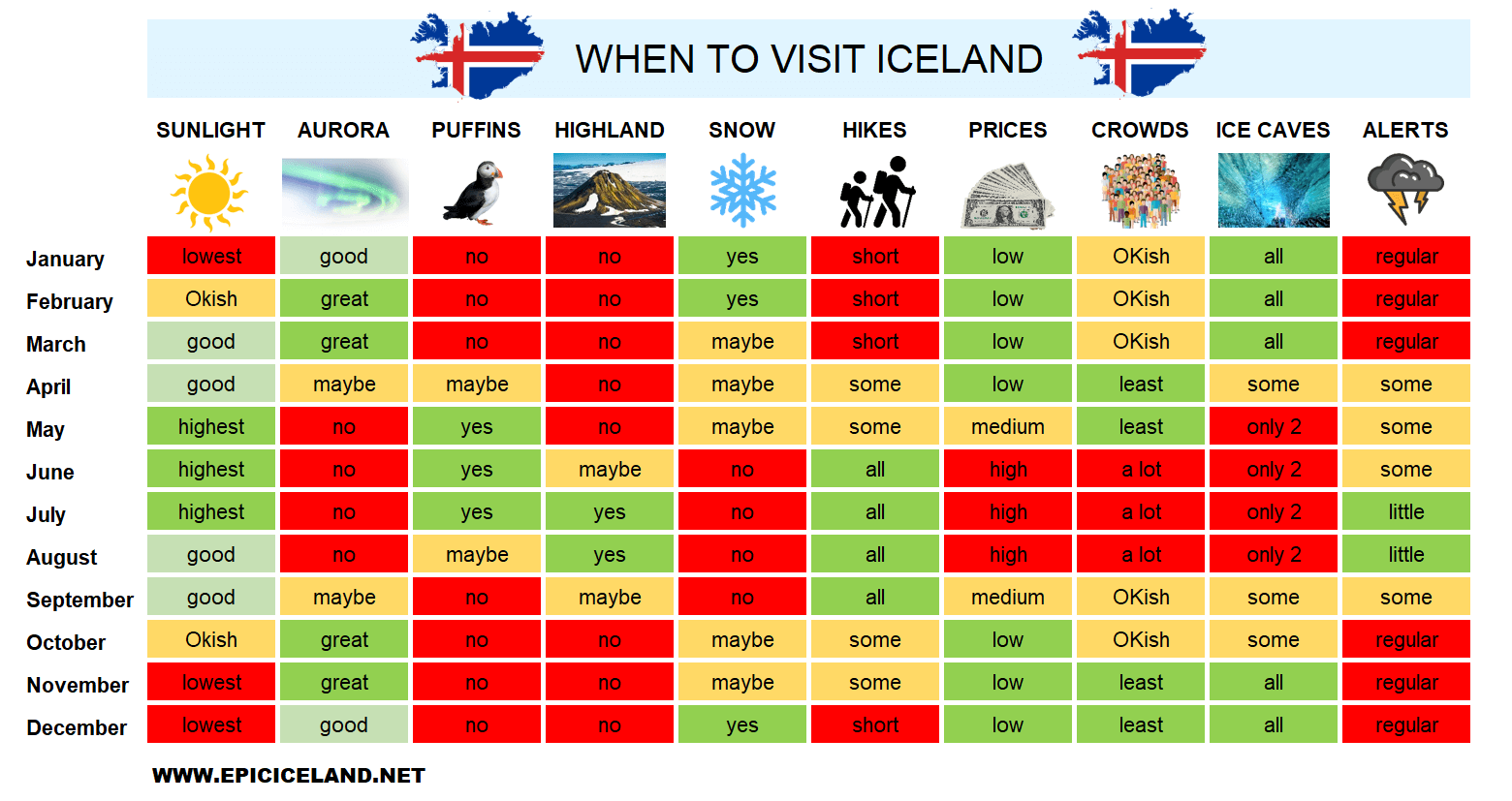
We woke up to a beautiful sunny morning, our first with a completely clear sky and the sun shining at the full throttle. I set our alarm clock to an unpleasantly early 6:30, but for a reason. We wanted to go to Askja and I wanted us to have enough time for the drive, since I read (and also heard as advice during our car rental pick-up) that you should definitely take your time, because of the rough road leading there. The weather forecast seemed to be incredibly on our side, that’s why we‘d left our campsite particularly encouraged a few minutes after 7:30 and headed towards our 2nd Covid testing in the health centre in Egilsstadir.
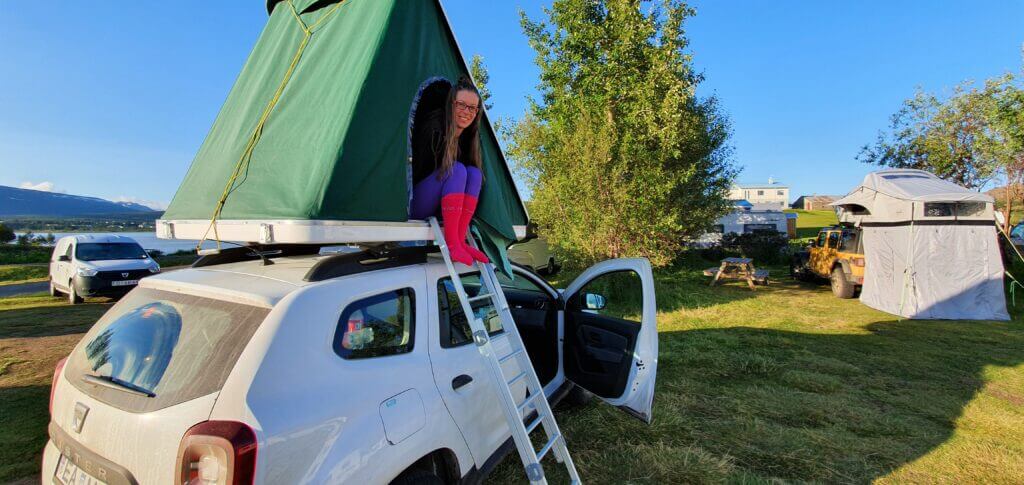
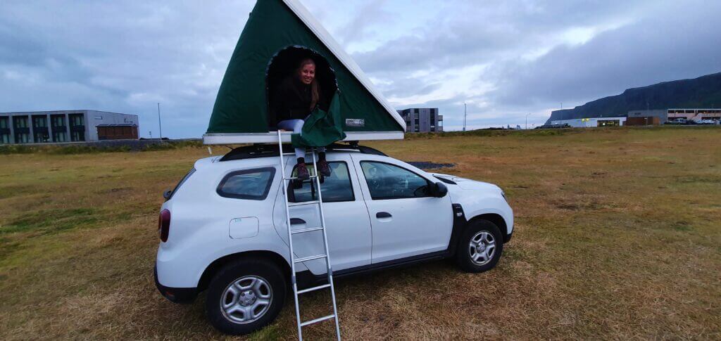
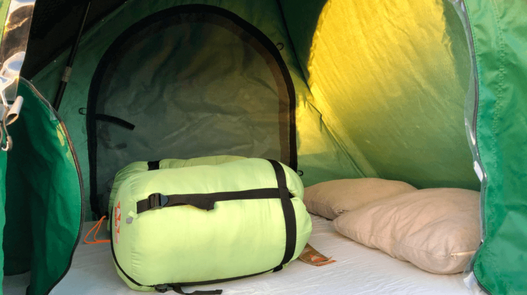
Waking up on a beautiful sunny morning in a rooftop tent in Fellabær camp, before our trip to Askja
We were afraid of how long will the testing take. Testing was supposed to start at 8 AM and the receptionist told me the day before, that we should arrive soon because lots of people are about to come on that day. We’d arrived at the testing spot at 7:45 and there was already medical staff performing tests, with 2 people in the queue in front of us. Waiting time was 2-3 minutes and the test was performed in another 2 minutes, so we were basically done in 5 minutes – really kudos to Icelandic medical staff! Despite being a hassle for travellers to have themselves tested twice, at least the testing process was very smooth and quick so that it didn’t interfere with our plans almost at all.
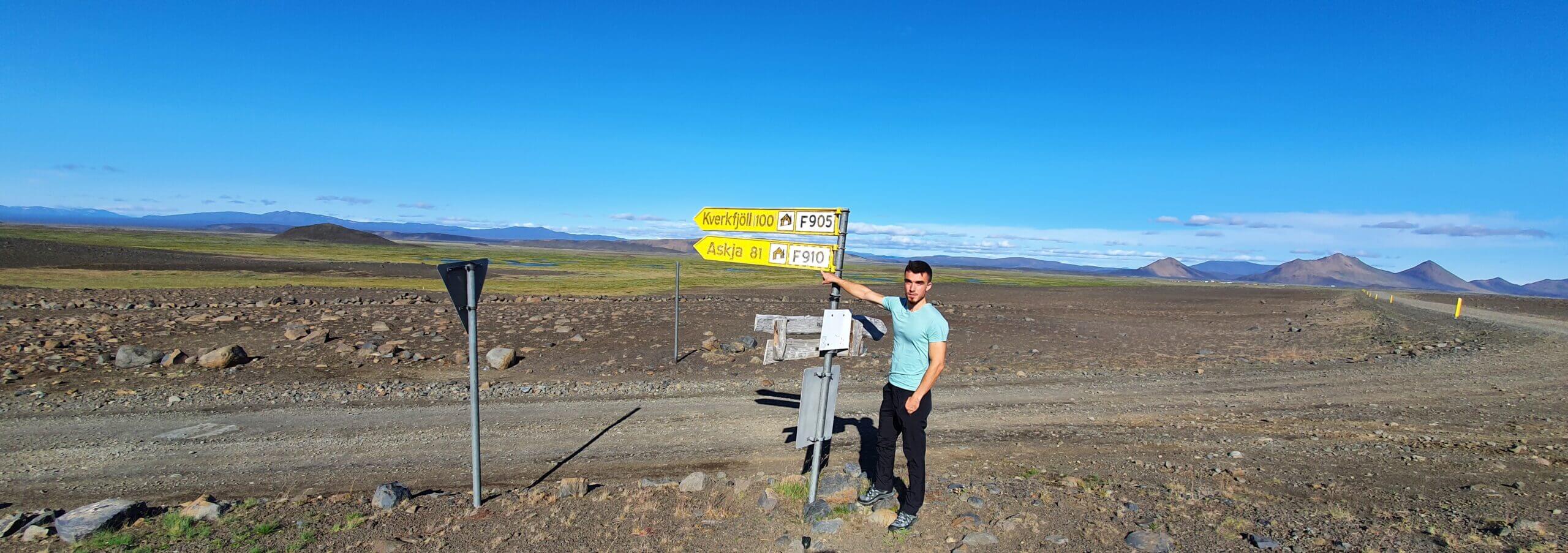
F905, F910 and more to Askja
8:30-12:00
Worth visiting even with bad weather: yes (not pleasant but worth the experience)
Interesting index: 1 – amazing  (1-amazing, 2-great, 3-nice)
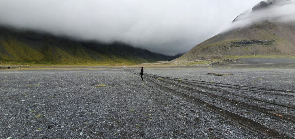
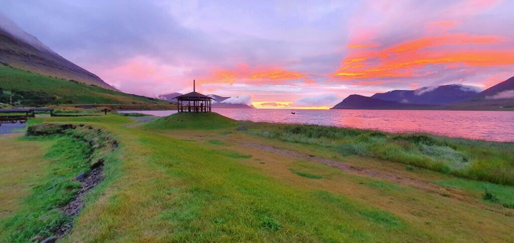
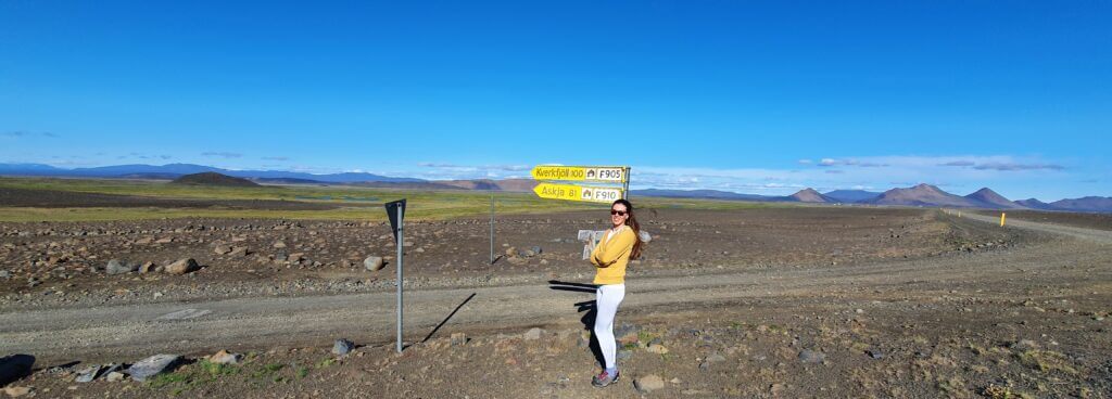
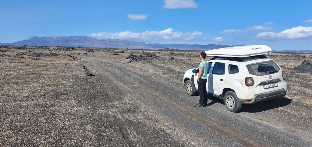
There are actually several different roads leading to and from Askja. We drove all the main ones. All the “bloggers” out there will tell you that the most treacherous one is supposed to be F88 from the north. The easiest route according to guides is then supposed to be the combination of F905 and F910 which we took during our first trip on our way to Askja. However, during our second trip, we took road F88 and realized that in dry conditions it’s actually shorter, quicker, and with much easier terrain.
Long story short – F905 and F910 are nicer in our opinion but longer. River crossings are usually similar (F88 vs F910). F905 and F910 have sand and big boulders and you have to drive really slowly. There’s nothing like that on F88. There’s, however, one river crossing on F88 – Lindaá river. Lindaá river crossing on F88 is usually the same size (medium) as those on F910, but when it rains, it can get bigger. So either check the rain in past days carefully or choose a bigger car.
If you are visiting Askja for the first time, better take the roads F905 and F910. Despite being bumpier and more difficult, you don’t need to deal with the unpredictability of the Lindaá river on F88.
Möðrudalsleið road, the first gravel road you’re gonna encounter when coming from Egilsstaðir direction
On our way back, my plan had two versions. First one, in case we didn’t have enough time, was coming back using the same roads and finding the first campsite nearby. However, my major version of the plan was seeing the Studlagil canyon on our way back, i.e. using the roads F910, F905, detour to the right without number called Austurleid (by the lake Thrihyrningsvatn), a short piece of F907 and then to the left via Jokuldalsvegur. I wasn’t able to find any info anywhere over the internet about this road that’s why I wrote a few lines about it here.
Modrudalsleid
8:40-9:10
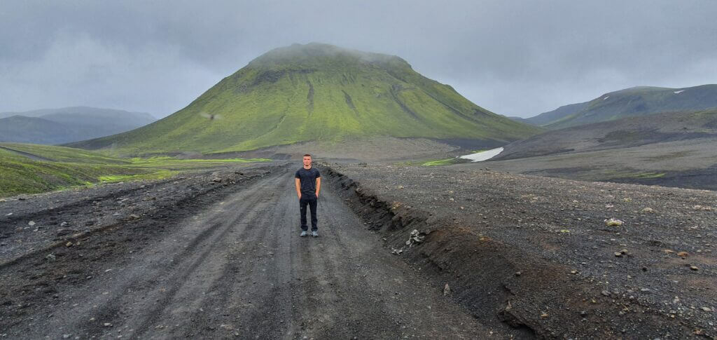
Crossroads between Möðrudalsleið road and F905
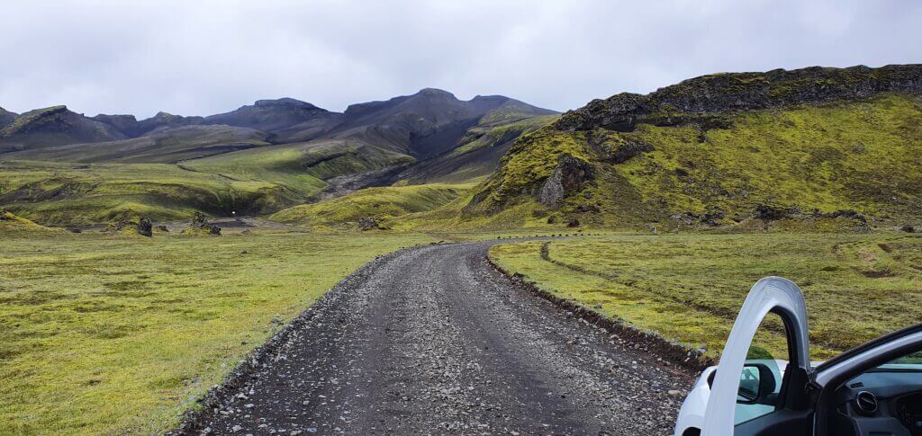
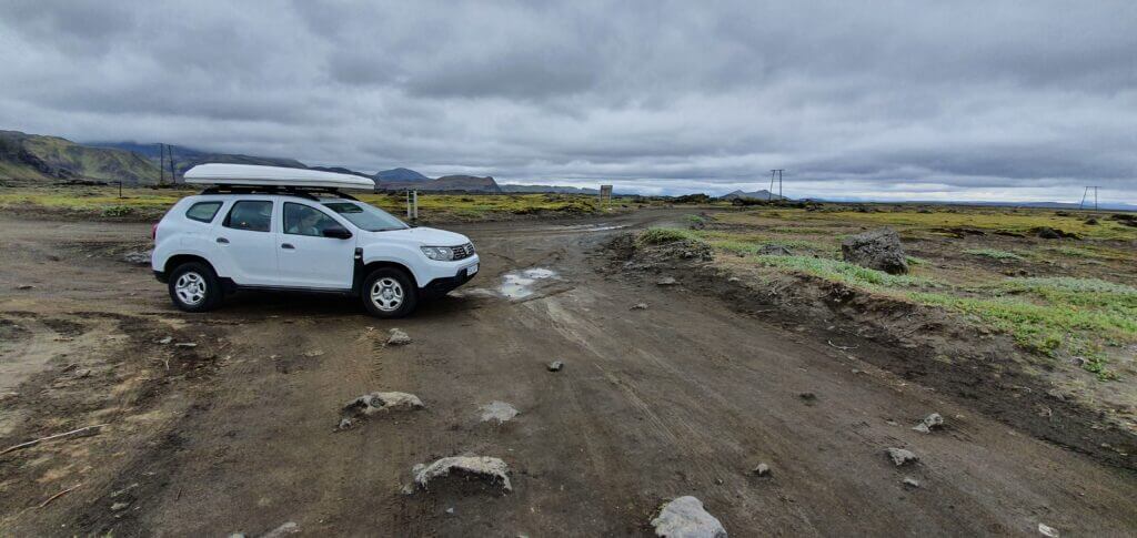
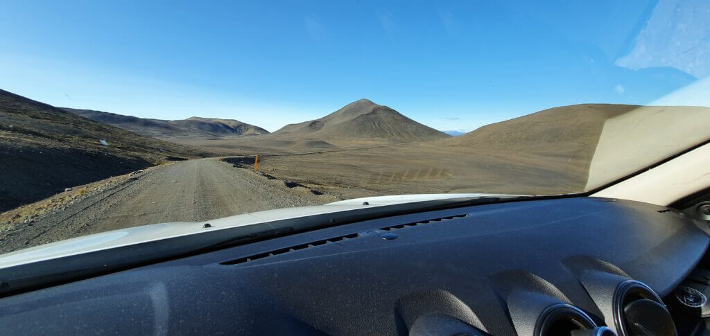
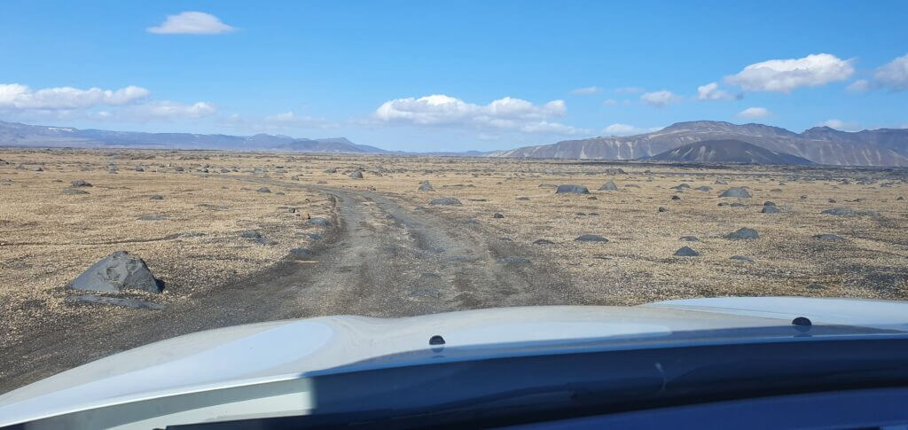
Weather was unbelievably nice, the sun was shining, the sky was completely clear and there was not even the slightest blow of wind. If this is not the weather to go for Askja then it never is. We’d firstly driven a while on the ring road, then turned left shortly for the road without any number on Google maps with a fancy name Möðrudalsleið. I guess the more the name of the road resembles some killing machine the rougher the actual road is, but that’s just what we’d observed. Möðrudalsleið is a quite good gravel road (compared to many other F-roads) so I was able to drive really fast.
F905
9:10-10:50
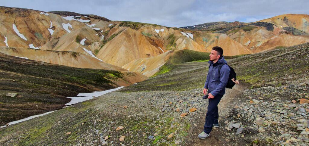
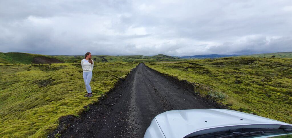
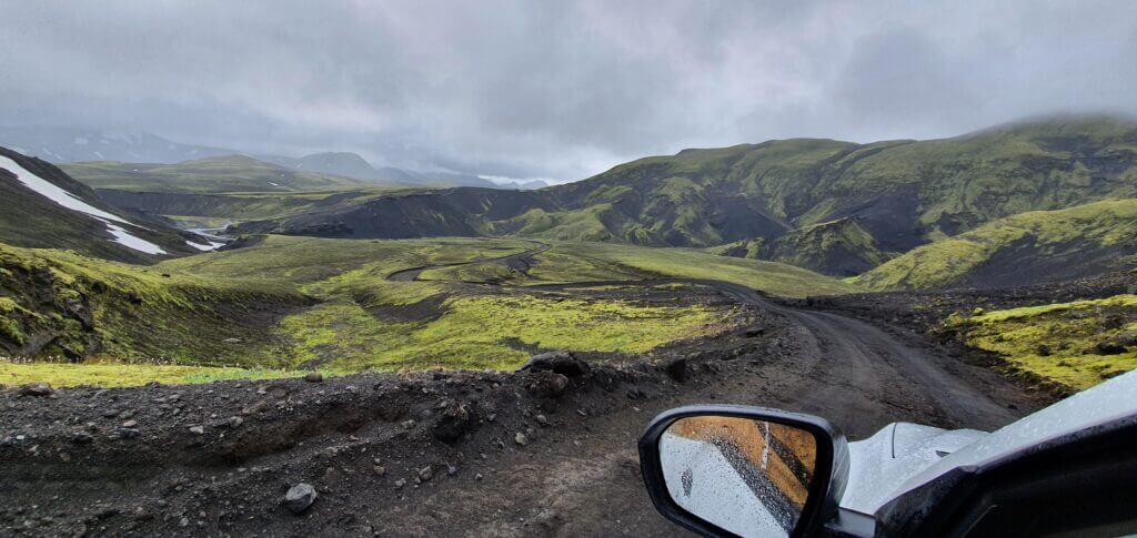
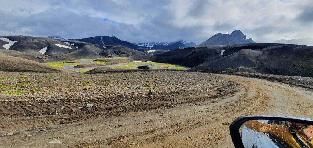
F905 to Askja on an exceptionally beautiful sunny summer day
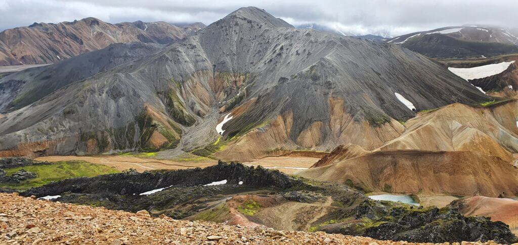
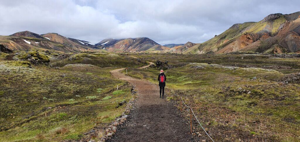
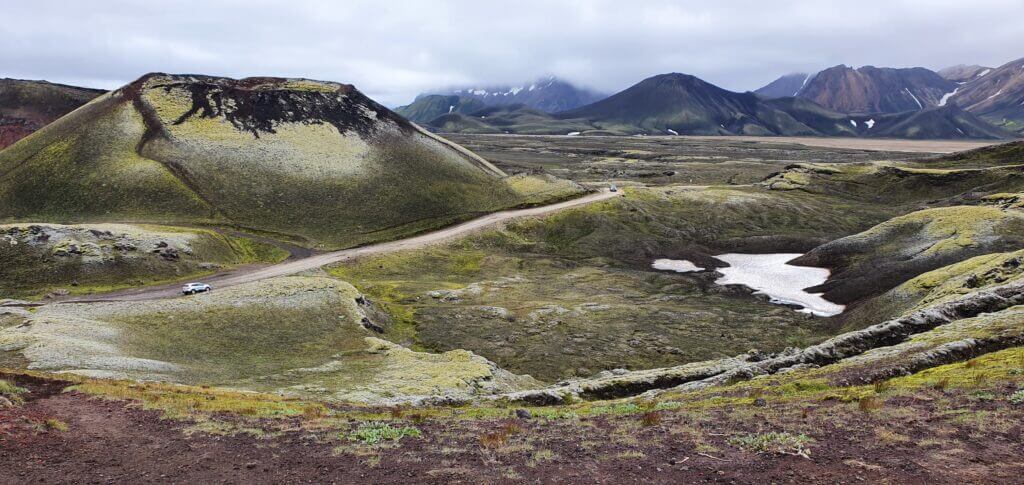
After driving some two-thirds of the road, we turned left to F905, where a real adventure began. By “a real adventure” I don’t mean anything dangerous (at least with our dream weather it definitely wasn’t), just endless out of this world landscapes as if you were on another planet. F905 and the ones following (together with reaching Landmannalaugar from the south) were the most beautiful roads we drove and are definitely highlights of our entire Icelandic trip.
Different types of surface alternate between each other, each one the more beautiful than the one before. Gravel, clay, rocks, sand, sulphur – anything you can imagine, all of this surrounded by unforgettable views of the volcanic hills around. I don’t remember any river on F905 (maybe only some small ponds, which shouldn’t cause you any trouble at all).
F910
10:50-12:00
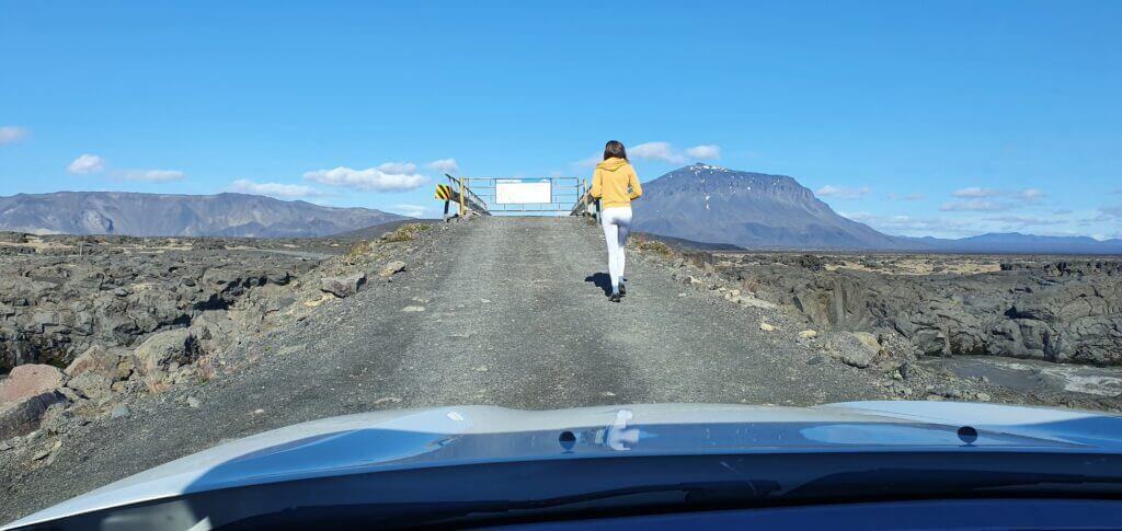
Gated bridge at F905 road towards Askja. Just open the gate when crossing the bridge and close it afterwards.
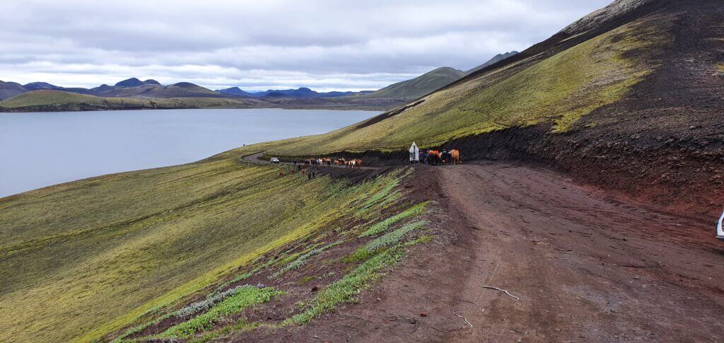
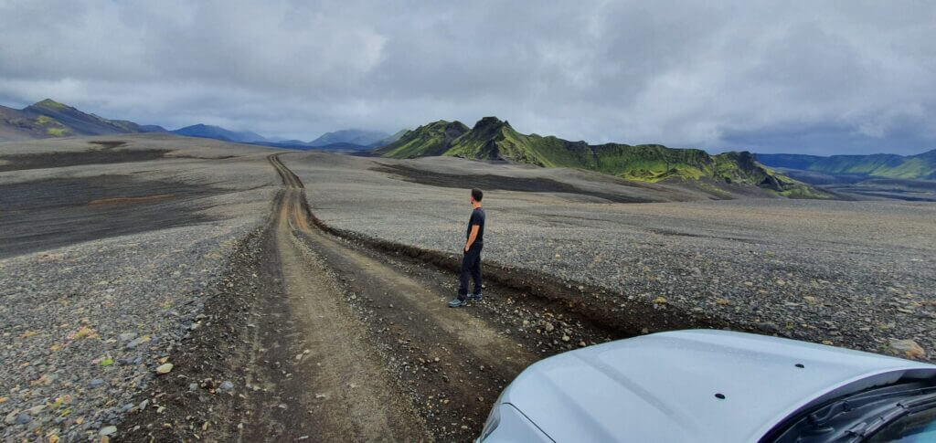
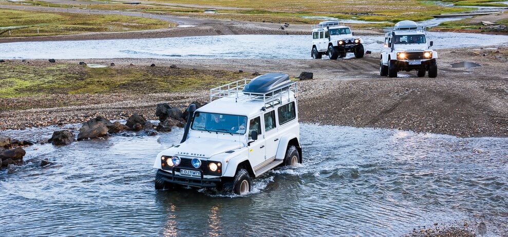
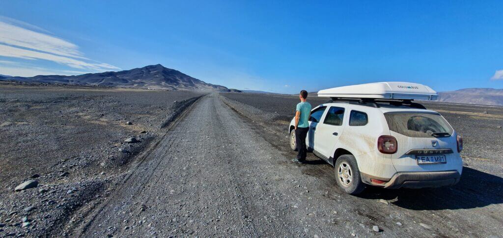
After spending some time on F905, the road turns into F910, which is very similar in its character to F905, just, once again a bit different. There are a few parts of the road where you’re going to drive literally on huge volcanic rocks and you have to drive really carefully not to damage your car – this is where a good 4×4 with high ground clearance happens to be useful. The most important part of an Icelandic F-road which you should pay attention to (as I wrote here) is the regular rivers and their existence on your road.
There are two medium-sized rivers on F910. When we’d reached the first river, there was already a 4×4 car waiting in front of the river, I think Toyota Landcruiser. It seemed like a driver wanted to see someone else to cross first. I stepped out of the car and inspected the river. This one was not very wide and I was able to observe where the best part to cross it is, even by visual inspection. Depth of the river was fair, some 40-60cm at the deepest point so should you have an appropriate 4×4 car for medium-sized rivers and take precautionary steps not to sink your car.
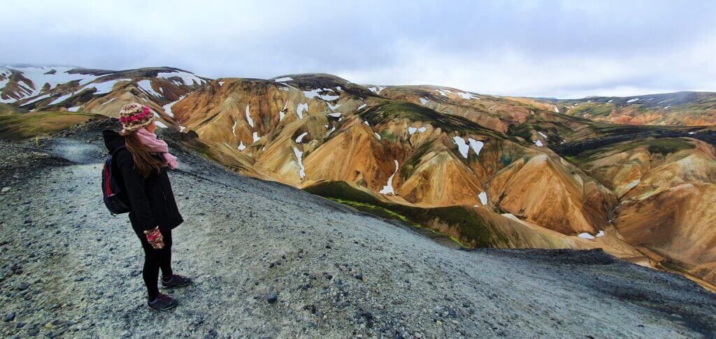
F910, or Austurleið, continuation of road F905 towards Askja
Since we’d already gained some experience with river crossings on our way to Landmannalaugar, we were more confident here in Askja. After my river inspection, the Toyota driver approached me and asked: “Is this your first time as well?” I just smiled and thought “man I know how you feel, we’ve been there some 2 days ago” and said that we have some experience already from Landmannalaugar. She asked us whether we may cross first so that she can see us, and so we did. I just adhered to all river crossing rules and the crossing went smoothly. After the ford, I waited to see whether Toyota was able to ford the river as well and yes, they were.
F910 towards Askja
The second river emerges very shortly thereafter. The depth looked to be about the same, i.e. 40-60cm at the deepest point. Just this time the river was considerably wider and the road on the other bank of the river was not in front of us but skewed to the left. So, we guessed, we had to steer to the left when crossing. The shallowest part seemed to be on the right side, so we forded there, realizing the river is a bit deeper than we’d thought, i.e. on the upper side of our estimated range (some 60cm the deepest point). Nevertheless, we were already in the river so we didn’t stop and our Duster was able to make it to the other bank without any trouble.
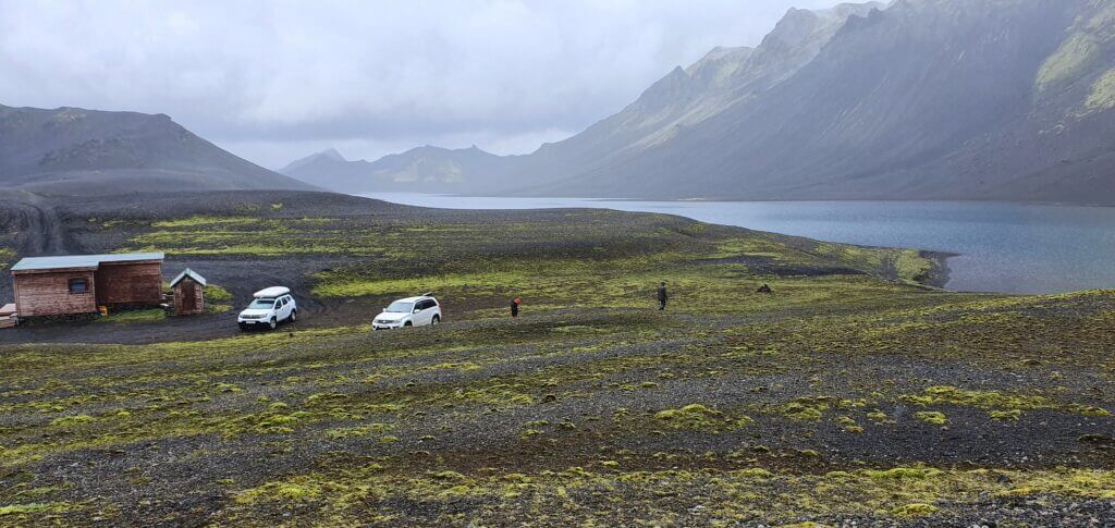
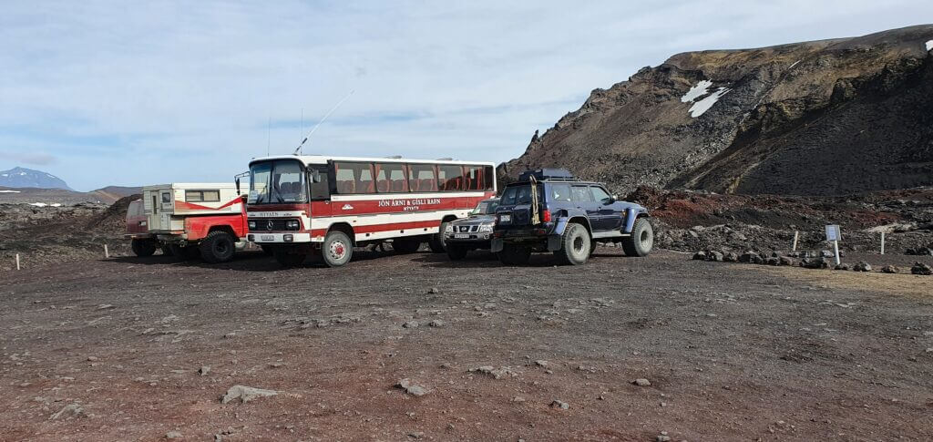
Dreki mountain huts
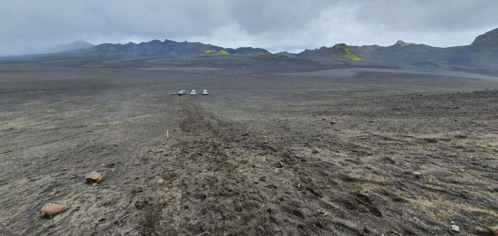
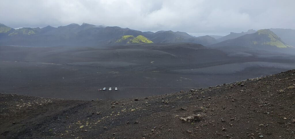
Next, we arrived at the junction of F88 and F910, where, by turning left, we continued via F910 and soon reached Dreki mountain huts – the only place where you may actually stay overnight in Askja area. There’s a free public toilet as well. Finally, we reached the Askja area – but where to go now?
Askja, Viti, Oskjuvatn
12:10-15:15
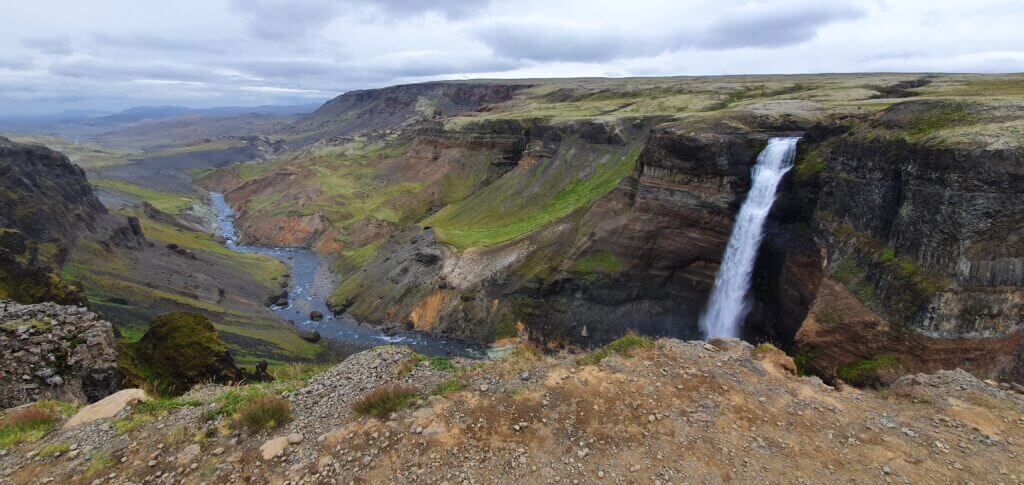
Distance from car park: 20-30 minutes one way (from Vikarborgir)
Time spent at: >1 hour
Worth visiting even with bad weather: yes, probably
Physical condition needed: medium to advanced (depends if you want to climb Viti)
Interesting index: 1 – amazing  (1-amazing, 2-great, 3-nice)
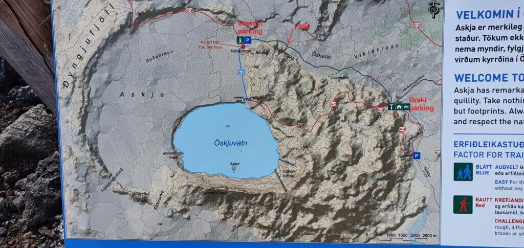
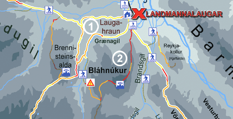
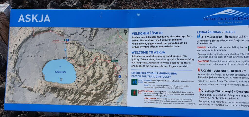
Useful map of Askja and Öskjuvatn area
A detailed map of the area to be found here.
A short glossary may be useful at this place. You may hike all of these and more:
- Askja = name of the entire area.
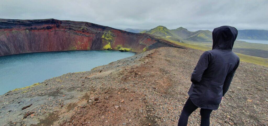
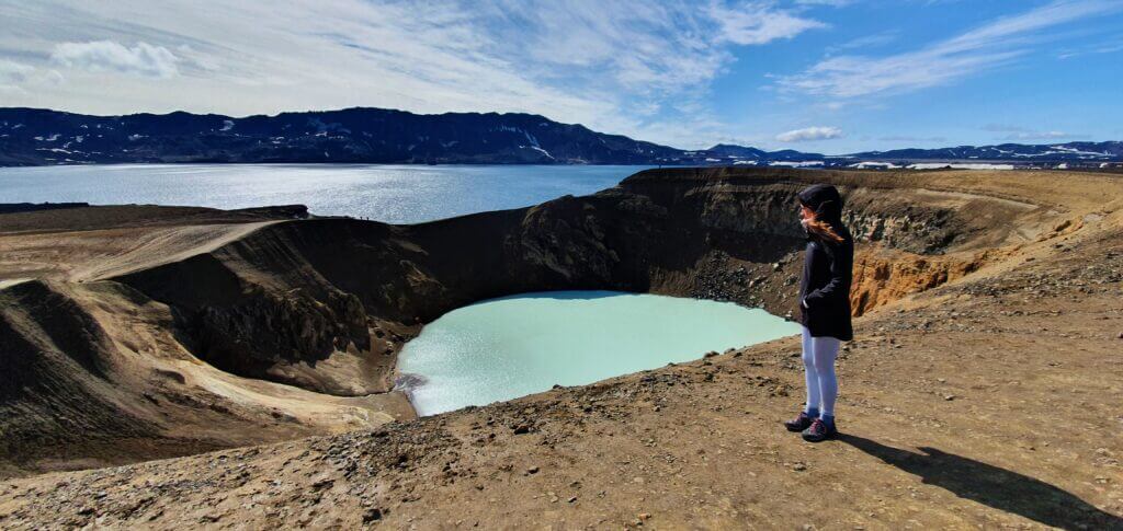
- Viti = volcanic crater you are probably aiming for as we were, with blue picturesque geothermal water.
- Oskjuvatn = big lake just next to Viti, with no geothermal water (Google calls Oskjuvatn “Lake Askja”).
F894 – Öskjuvatnsvegur
12:10-12:30
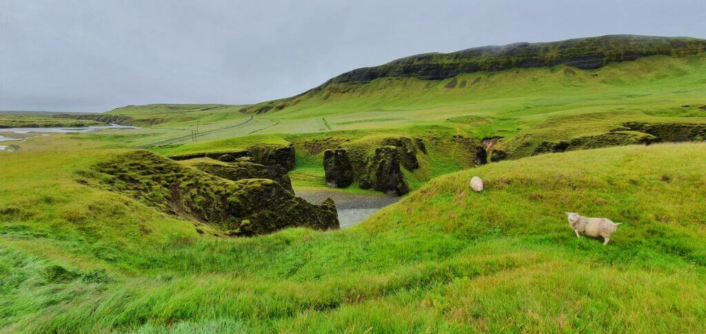
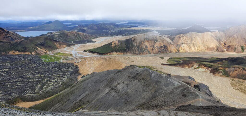
Vikraborgir car park, the closest point available on your route towards Askja/Víti crater
Once you arrive at Dreki huts, you may already leave your car here and go for 8km hike towards Viti and Öskjuvatn and you will definitely enjoy the beautiful mountain area even more. What we did, was to drive as close to the actual geothermal Víti lake as possible and spend most of our time there.
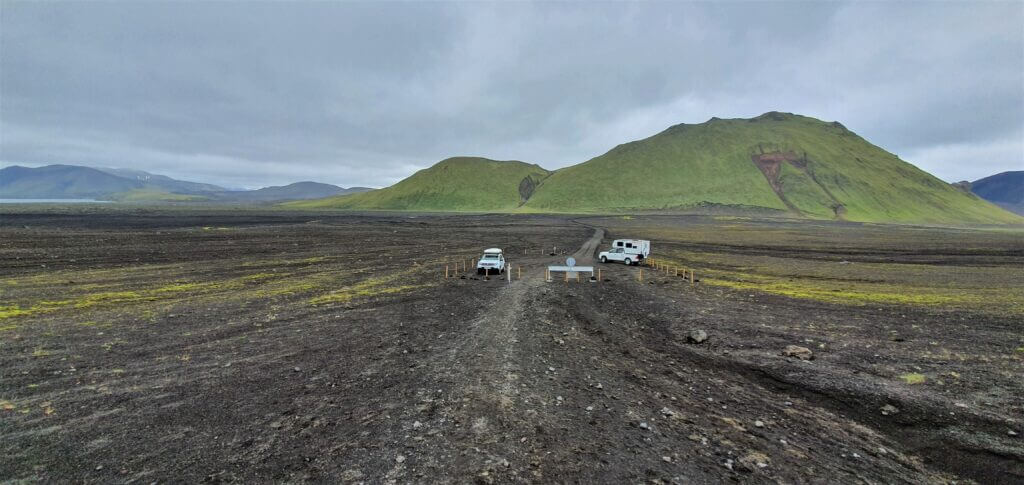
To do that, you have to take the F894 road, i.e. slight turn right coming from F910 direction, standing in Dreki huts spot. The road is really rough and rocky, with volcanic stones and rocks about everywhere. At the end of the road, you will reach the car park with another toilet booth, called the Vikraborgir car park. This is where you have to leave your car.
Askja
12:30-15:15
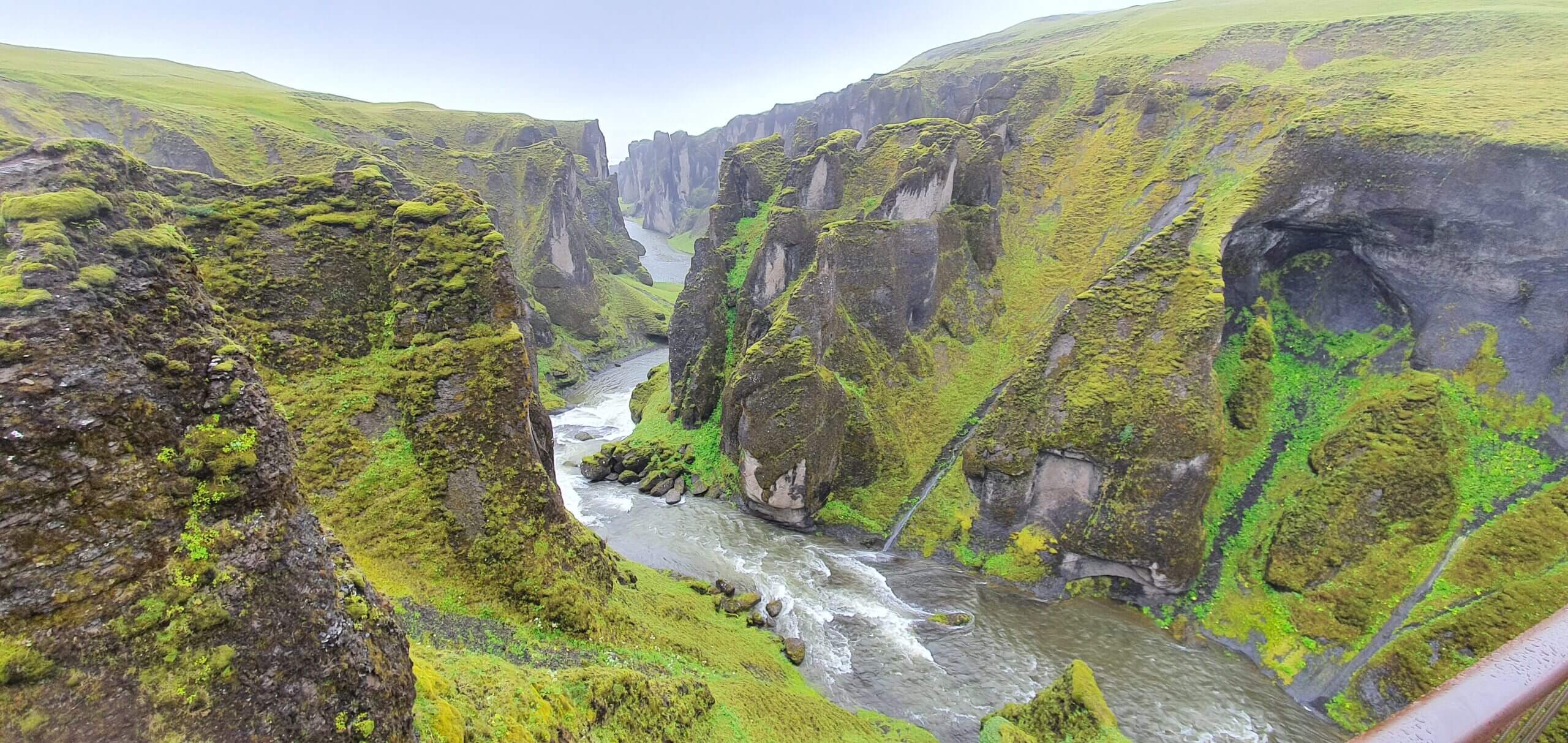
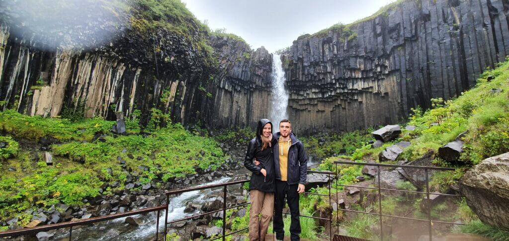
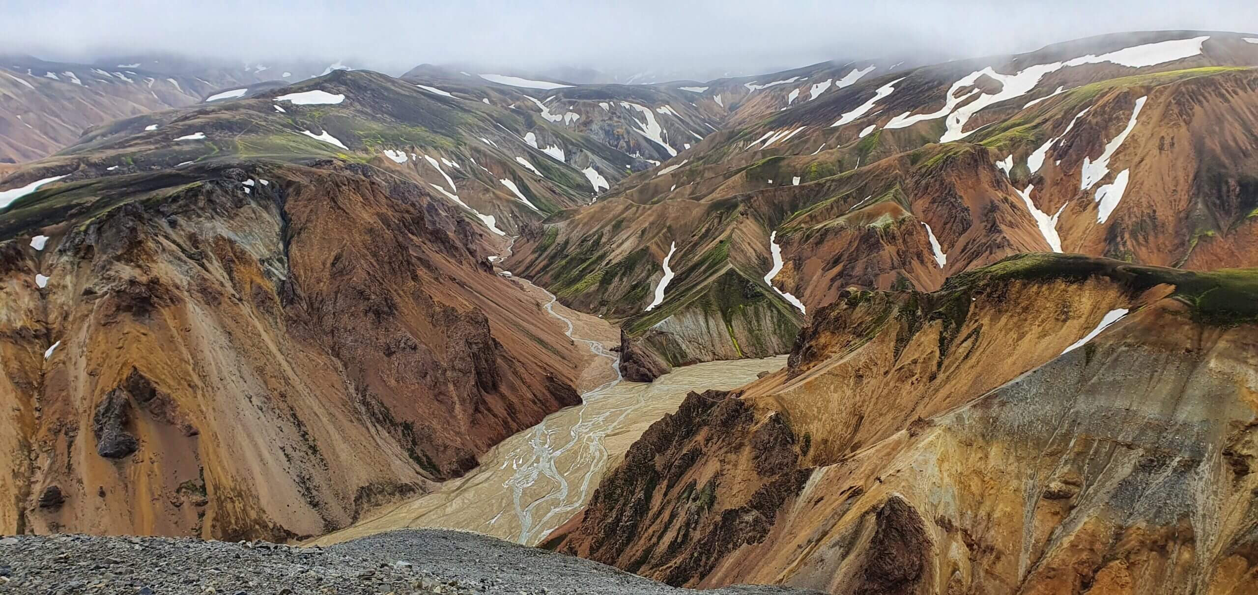
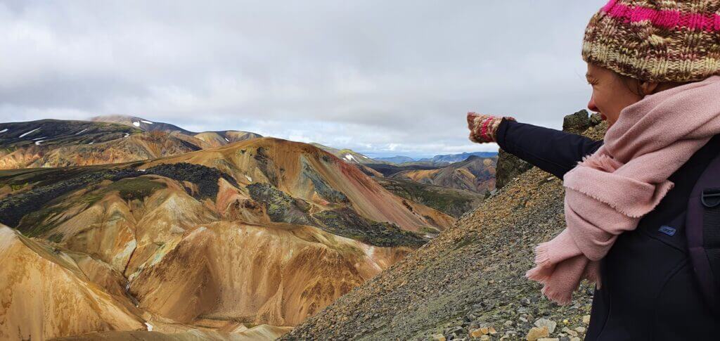
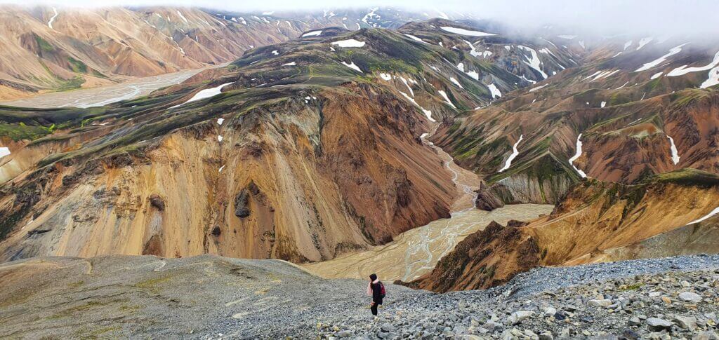
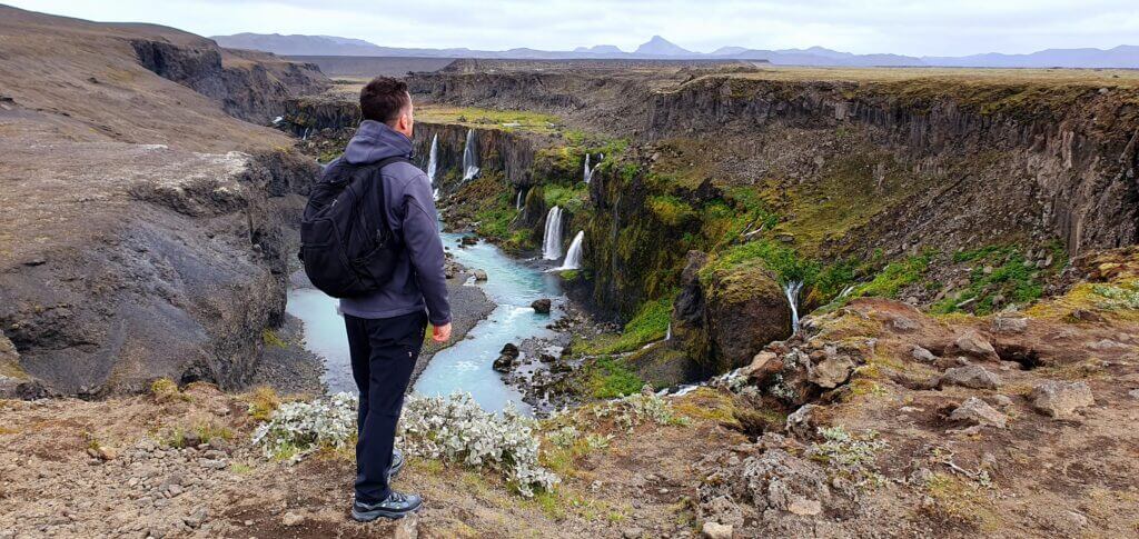
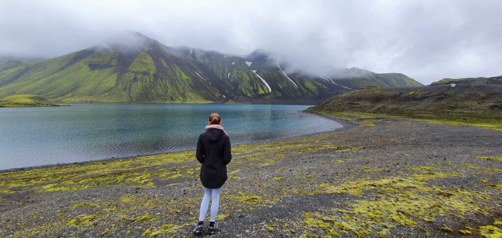
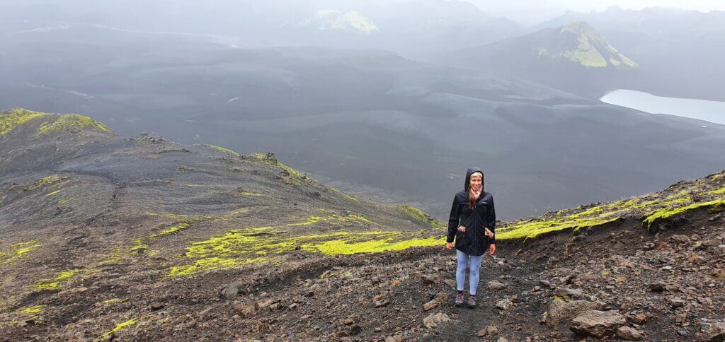
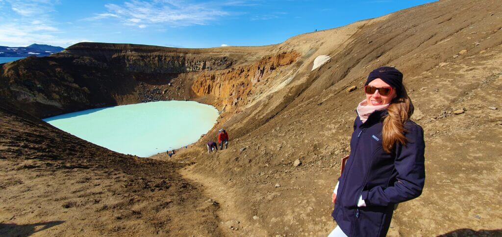
Amazingly beautiful Askja (the whole area), Víti (the crater lake) and Öskjuvatn (the bigger lake nearby) all in one picture
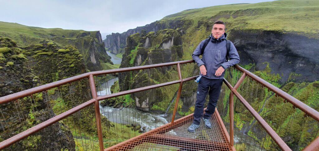
From the car park, it takes some 20-30 minutes of walking the well-marked path with yellow sticks to reach the place everybody admires in the pictures – i.e. Víti crater. The sun still shined, the sky was still clear and the wind was still mild – what a wonderful day! And Viti crater looked even better than in the photos! Fairy-tale-like blue water with moon-like surrounding landscapes. This was the highlight of our trip. From this spot you may either:
- Just admire the beauty of Viti crater and monumental Oskjuvatn lake next to it, or
- Hike around the area, or
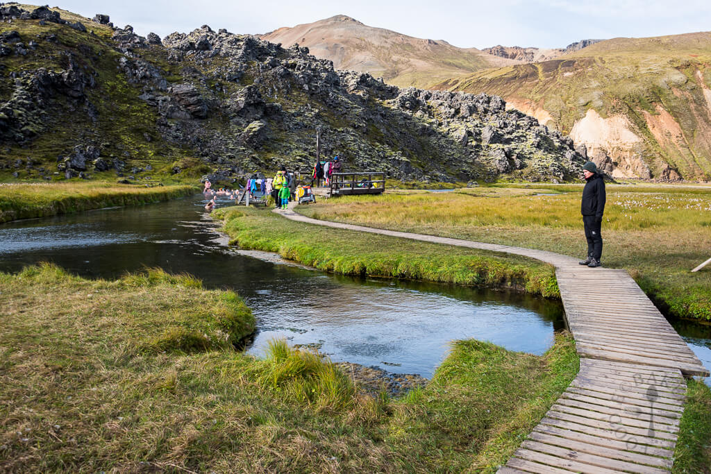
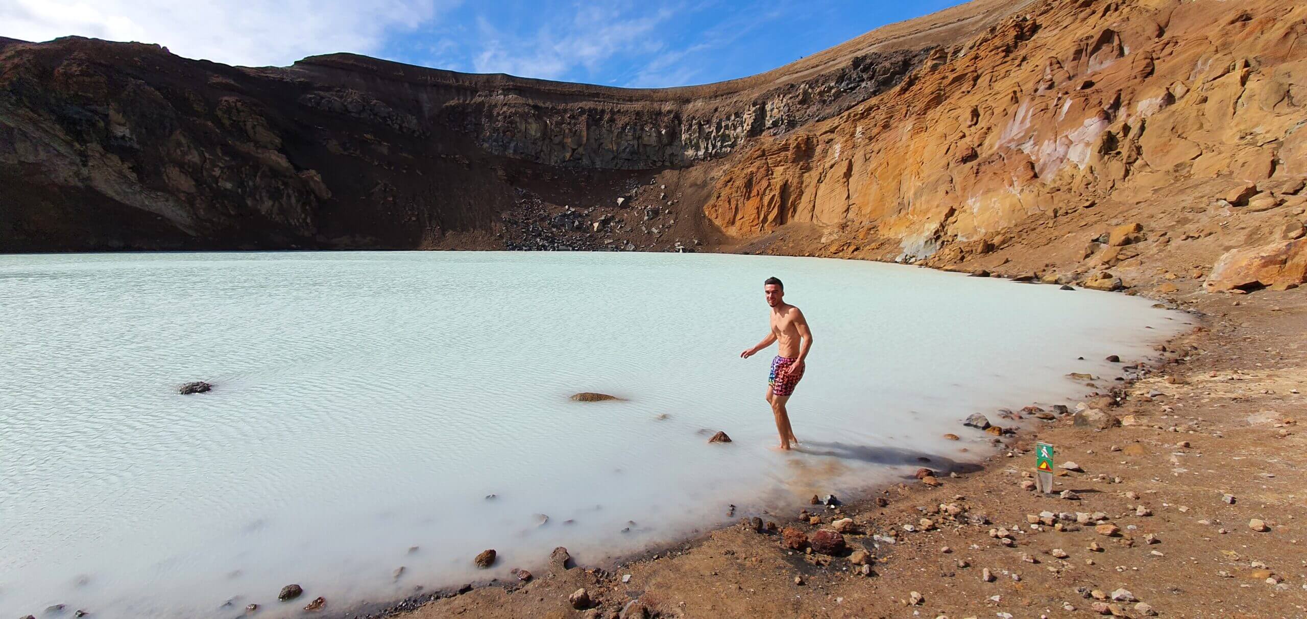
- As we chose (or as my girlfriend persuaded me), hike down the Viti crater and swim in the green/blue geothermal water.
Hiking trail down to Askja crater (Víti)
This was one of the two moments during our journey when I was a bit scared (first one when hiking up the Blahnjukur peak in Landmannalugar, climbing the steep clay slippery path). Here again, the descent was steep and the ground was covered with slippery clay, which means you’re unable to control any fall of yours, in case it happens.
Nevertheless, it’s a short descent and not too dangerous, so in good weather, you should be able to make it. Once down in the caldera, you may enjoy swimming in the water with a temperature around 25°C, which is definitely not a hot spring but it’s definitely warmer than air (at the time of our visit around 10-15°C). Once in a lifetime experience.
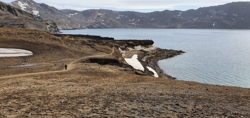
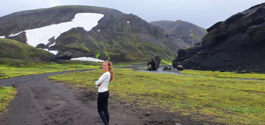
Öskjuvatn lake in Askja area, next to famous Víti crater
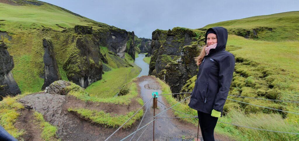
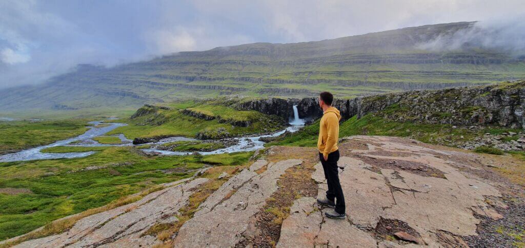
The way back is the same – i.e. 20-30minutes walk to the car park, taking F894 to Dreki huts, from there F910 and from there you may decide between 3 main options – F88 or F905 or detour to Stuðlagil Canyon, as we did.
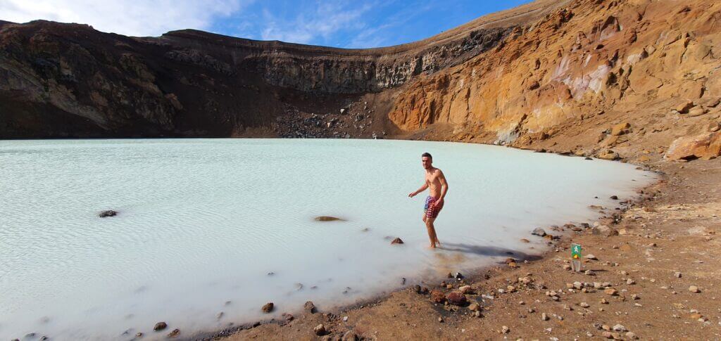
Me swimming in 25°C sulphuric water of Víti crater in Askja
F905, Austurleið, F907 and Jokuldalsvegur towards Stuðlagil canyon
15:15-18:45

We left Askja at 15:00, so we still had enough time for at least a short stop at Studlagil canyon, which was my primary best-case plan. We headed back from Askja, firstly via the same roads of F894, F910, two river crossings and then driving about two-thirds of F905 when we had to turn right according to Google maps to a road without any number called Austurleid (by the lake Thrihyrningsvatn).
Austurleið
This road and the roads which followed – I had literally no information about whether they contain any river crossings and if so, how serious they are. Hence, there was the only option – to try our best and in the worst case turn back. Well, at least if we had enough fuel. I tried hard to tank as much fuel as possible as close to the Askja area as possible. However, our trip was still a bit long even for Dacia Duster’s fuel tank. If we had to turn back in the middle of Austurleid or F907 or not to say, even later, we would have gone out of fuel probably. Luckily this hasn’t happened.
F907 and Jokuldalsvegur

Austurleið by the lake Þríhyrningsvatn didn’t contain any serious river crossings, just small rivers and small ponds of depth 20-30cm at max. The following short piece of F907, as well as a detour to the left for Jökuldalsvegur road, didn’t contain any river crossings and the quality of the roads was better compared to F905 and F910 in Askja area. Jokuldalsvegur is actually a semi-paved road and it’s definitely not dangerous to drive on.
Stuðlagil canyon – western side / eastern side
18:45-19:10
Distance from car park: 5 minutes / 30-40 minutes
Time spent at: 20-40 minutes / 1-2 hours
Worth visiting even with bad weather: yes, probably
Physical condition needed: little / medium
Interesting index: 1 – amazing  (1-amazing, 2-great, 3-nice)
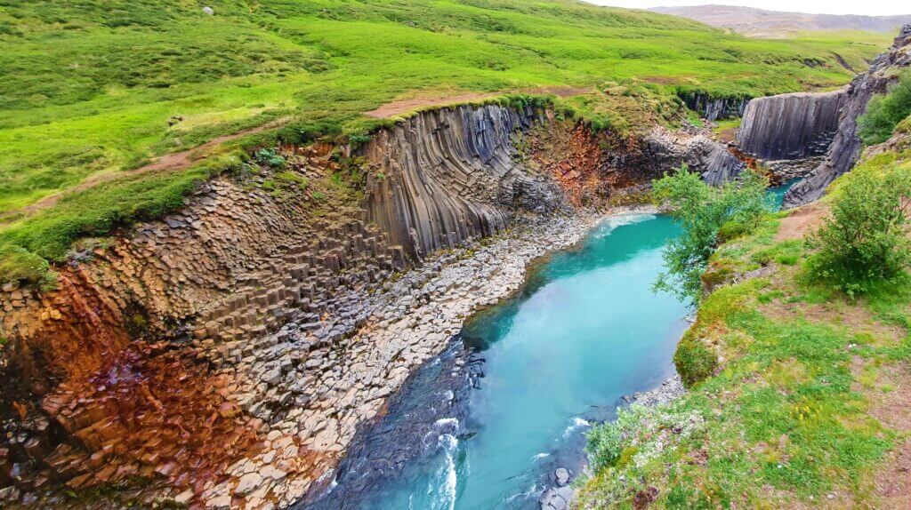
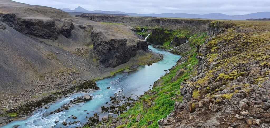
Stuðlagil Canyon, view from the western side
After a long day, coming from the southern side of Jokuldalsvegur, we finally reached the western bank of Studlagil canyon (i.e. left coming from the south, or right coming from Egilsstaðir direction). Two main viewpoints of the canyon do exist, i.e. there are two possible ways how to explore the canyon – from two different sides.
If you are lucky enough, water in the canyon will be crystal clear (as in our pictures). In case you are not, the glacier water of the Kárahnjúkar dam will change the colour of the water to a less picturesque one. Nevertheless, the canyon columns will remain the same at any time 🙂
Western side
Stuðlagil Canyon, another view from the western side
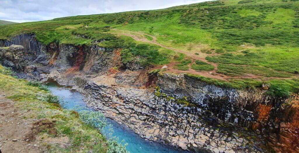
The western side we explored was the one suitable for those who don’t have enough time or energy to discover the canyon by walking along. On the western side (left from the south, right from Egilsstaðir) there’s a car park and stairs taking you down to the man-made viewpoint. It takes some 5 minutes to climb down the stairs. From there you may admire most of the beautiful views of the canyon. It’s not possible to descent down to the canyon itself though, compared to the other side.
Eastern side
The eastern side is the one where it’s possible to hike down right to the canyon itself. The car park you will aim for is this one. You have to first cross the small bridge to the eastern side of the canyon, where you have to leave your car (or eventually you may leave your car somewhere before the bridge). Then you have to walk along the bank of the canyon towards the south to see its most beautiful part. From there you are able to descent down to the river and make some amazing photos from the close distance.

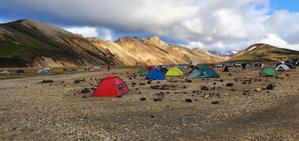
Möðrudalur camping
21:00-
The closest campsite to Studlagil canyon, in the direction towards Reykjahlid, which had good reviews, turned out to be Möðrudalur campsite. That’s where we successfully ended Day 6 of our journey. Luckily, we managed not to run out of fuel, so after leaving Jokuldalsvegur I quickly headed for the nearest gas station. Continuing on the ring road and turning back left to drive a short part of Möðrudalsleið again, we arrived at Möðrudalur campsite.
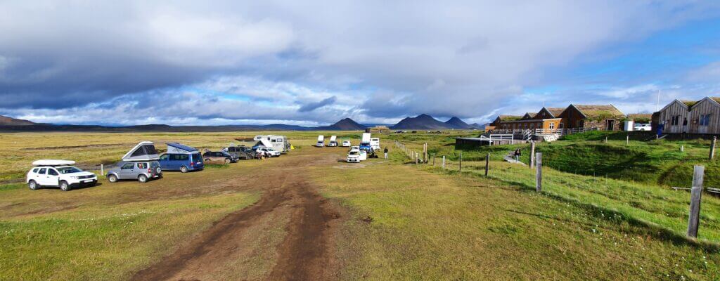
Möðrudalur campsite
The campsite was nice with a very cosy restaurant serving homemade dishes. We were lucky to see a very nice sunset as well. Definitely one of the better campsites.
More Videos


![]() ask questions or get inspired in our community
ask questions or get inspired in our community