Eldgjá is a gigantic canyon created by the largest volcanic eruption on earth in the last millennium. From a historical point of view, Eldgjá is definitely a fascinating place to visit.
Except for the Eldgjá canyon, there’s also a very picturesque waterfall called Ófærufoss right in the heart of Eldgjá.
But does Eldgjá belong to one of the most beautiful places in the Icelandic Highlands, as many people describe it? Well, we are not so sure about that, and we will explain why below.
Contents
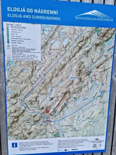
Map of Eldgjá
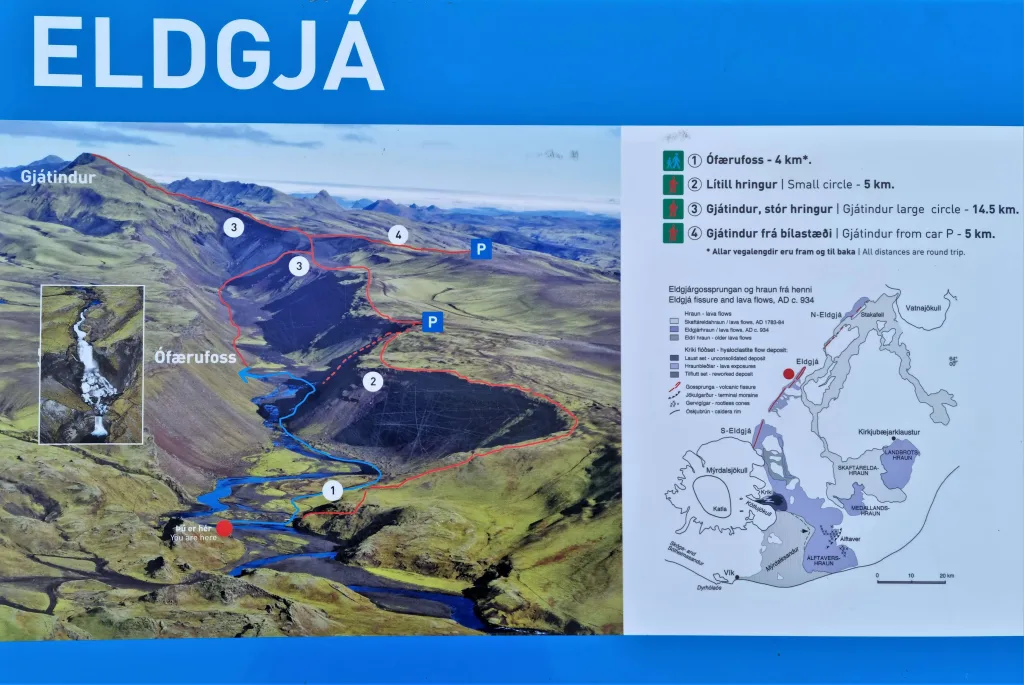
Eldgjá hiking trails
There are three main hiking trails in Eldgjá:
- Ófærufoss waterfall; easy 1.5 hours long out and back hike
- Small circle; moderate 2 hours long loop trail
- Gjátindur large circle; moderate 5 hours long loop trek
The two most popular hiking spots in Eldgjá are Ófærufoss waterfall and the peak of Gjátindur. The majority of visitors go only to the famous Ofaerufoss because it’s the most efficient option.
We wrote a list of 25 Off-The-Beaten Track Places in Iceland that nobody else writes about.
Besides the main trails, there are also several traverse routes leading to the Highlands.
Ófærufoss waterfall
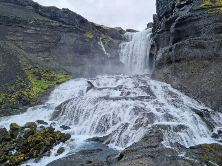
Beautiful Ófærufoss waterfall in Eldgjá
Hiking time: 1.5 hours round-trip
Difficulty: very easy
Trail Map: Ófærufoss hiking trail
Ofaerufoss is the legendary picturesque waterfall and the main attraction of Eldgjá. The waterfall is a must-see spot in the area we highly recommend visiting. It’s spectacular in any weather.
It’s an easy, well-marked walk that anyone can do. It took us less than 30 minutes to reach the Ófærufoss waterfall from the Eldgjá car park.
The shortest trail to Ófærufoss leads along the right/eastern bottom of the canyon and turns left/west right before the waterfall.
Small circle
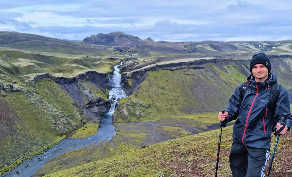
Ófærufoss viewpoint from the “Small Circle” hiking trail in Eldgjá
Hiking time: 2 hours round-trip
Difficulty: easy to moderate
Trail Map: Small Circle hiking trail
If you want to enjoy Ófærufoss from more angles and the bird’s eye perspective, you can take a longer Small Circle hike.
This trek is a loop path extension of the easy bottom-of-the-canyon walk. After passing Ófærufoss, you will need to climb shortly to the eastern edge of the canyon. From there, you turn back south.
Once you finish the climb, you will also get nice views over the Eldgjá Canyon. You can take this loop trail in any direction. It’s a nice compromise between a short Ófærufoss walk and a long Gjátindur trek.
Gjátindur circle
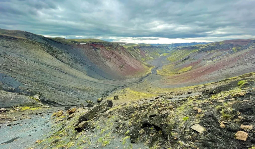
Bird’s eye view over the Eldgjá Canyon when hiking to Gjátindur
Hiking time: 5 to 6 hours round-trip
Difficulty: moderate with one steeper climb
Trail Map: Gjátindur hiking trail
Gjátindur is the tallest peak in the Eldgjá area. By climbing Gjátindur on a nice day, you will be guaranteed to have the best views over the entire Eldgjá. But are these views worth the climb? Well…
It took us almost 6 hours to complete the loop trail to Gjátindur and back, including a stop at Ófærufoss and then a struggle to find the correct path. The hike to Gjátindur is moderately difficult, with one pretty steep ash climb. Otherwise, the trek isn’t anyhow dangerous. It’s just long (around 16 kilometers, or 10 miles).
Several different trails lead to Gjátindur. One of the trails leads inside the bottom of the canyon, while the other trail leads along the upper edge of the canyon, see the Eldgjá hiking map above.
Langisjór traverse trail
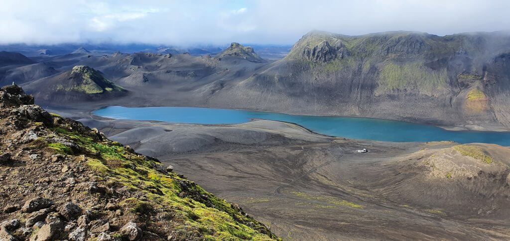
View over the Langisjór lake from Sveinstindur trail
Hiking time: 1 to 2 days
Difficulty: moderate to difficult
Trail Map: Eldgjá Skaelingar hiking trail
Eldgjá Canyon is actually a part of the vast hiking area that stretches all the way in between the road F208 (Fjallabaksleið Nyrðri) in the southwest and Lake Langisjór in the northeast.
Numerous marked and unmarked remote trails connect Eldgjá to Langisjór and Uxatindar mountains in between. See the huge Eldgjá map.
How to Visit the Icelandic Highlands and prepare for the Highlands road trip?
How to get to Eldgjá
To get to Eldgjá, you must take the F-roads F208 and F223, respectively. There are no buses or guided tours, so your only option is to drive or take a private tour.
Road F208
If you take the road F208 from the south, you have to cross one medium-sized river. You need to drive at least a medium-sized 4wd car to pass safely.
When you arrive by F208 from the north, you will encounter several small to medium-sized rivers to ford. This route is one of the most beautiful Icelandic highland roads.
We again recommend driving, at minimum, a medium-sized 4×4 car like Dacia Duster. That being said, if the conditions are ideal and the weather is dry enough, you may also pass with smaller 4wd cars like Toyota RAV4 or whatever is being called a 4×4 these days.
Road F223
F223 to Eldgjá is an easy F-road without any river crossings or other obstacles.
It’s a very short drive from the southern part of F208 (Fjallabaksleið Nyrðri). The only reason Eldgjárvegur is marked as an F-road is probably that it’s impossible to get there without using other F-roads.
Once you reach Eldgjá, there’s a huge car park with a ranger’s hut and modern toilets.
Is Eldgjá worth a visit?
Eldgjá is worth a visit if you have more time to explore the southern Icelandic Highlands. If you are short on time, we recommend other fantastic spots in the Highlands.
Interestingly enough, if you ask locals in Iceland to name a few most beautiful places in Iceland, many replies will include “Ásbyrgi” and/or “Eldgjá”. We have visited both, and both were actually slightly underwhelming in our opinion (and other foreign visitors’ opinions).
How to choose the Best Car for Iceland based on your trip plans?
Don’t get me wrong, both Eldgjá and Ásbyrgi are beautiful places to visit. But Iceland has so many unique gems to offer that Eldgjá or Ásbyrgi simply don’t measure up to many of them.
What is the Best Hike in Eldgjá?
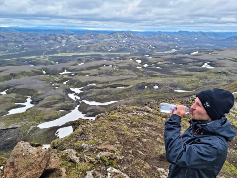
At the peak of Gjátindur in Eldgjá
If you have just a few hours dedicated to visiting Eldgjá, we suggest primarily seeing Ófærufoss. Ófærufoss waterfall was probably the highlight of our full-day visit to Eldgjá. Moreover, a hike to Ófærufoss is just an effortless walk, not even a hike.
If you have more time, you can do a longer hike to Gjátindur, the highest summit of Eldgjá. We suggest doing this hike only if you are really into hiking and have enough time. Once you climb the edge of the Eldgjá Canyon, there’s a nice viewpoint over the entire Eldgjá area from a bird’s eye viewpoint.
List of 130 most beautiful Icelandic Waterfalls with detailed info.
However, to reach Gjátindur, you need to continue even further, and the view from the peak isn’t that special in our opinion. Definitely not if you compare it, for example, to nearby Sveinstindur, Bláhnúkur, or Thakgil.
Once again, don’t get me wrong, the Gjátindur hike is pretty. If you have time and energy, then go for it. It’s just not among our favorite ones in Iceland, not even close to it.
Our Eldgjá Experience
We visited Eldgjá at the end of July and did all the main treks. We hiked to Ófærufoss and then to Gjátindur for the best views over Eldgjá.
Ófærufoss hike
As expected, we met many fellow tourists along the way to Ófærufoss. Apart from tourists, we also met many infamous Icelandic midges 🙂 Eldgjá is actually the only place where we’ve ever used head-nets in Iceland.
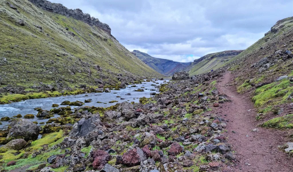
Easy hiking trail to Ófærufoss
Midges don’t bite, and they are not dangerous. They are just very pesky and persistent about getting into your nose and eyes, being attracted to wet spots. So either you will be waving your hand in front of you, or you’re gonna use head-nets.
Ófærufoss is totally worth a short walk. If I were to come here next time, Ófærufoss would be the only place I would visit again in Eldgjá. The waterfall is magnificent, and it will definitely make it to our list of favorite Icelandic waterfalls.
There’s even a huge viewpoint platform with seating. Rangers built ropes around the waterfall to protect the moss and tourists from falling into the waterfall. Despite the ropes, several arrogant visitors didn’t respect them and stepped on the moss to take better pictures anyway. This is how NOT to be a responsible tourist.
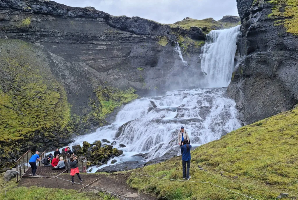
Crowds at Ófærufoss and tourists breaking the rules by standing behind the rope.
Gjátindur hike
After seeing Ófærufoss, we still had enough time and energy to hike more, and the weather was ugly everywhere else anyway. Thus, climbing Gjátindur made great sense.
We were equipped with hiking poles, head nets, and an old map, which showed we were supposed to be able to reach Gjátindur from the western trail. The map was terribly wrong. The only real trail leading to Gjátindur is the eastern trail, but more on that below.
Be sure to always check the safety warnings, road conditions, and weather forecast before embarking on any hike in Iceland!
The Bottom of the Canyon
Our hike to Gjátindur started by walking to Ófærufoss from the eastern bottom of the canyon which, right before the waterfall, turned to the west to reach the waterfall itself. After stopping at the waterfall, we continued further along the western bottom of the canyon in the north direction towards Gjátindur.
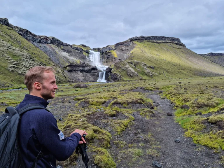
Hiking the bottom of the Eldgjá Canyon
This part of the hike is a fairly easy walk on flat ground. I remember very sparse red marks, but we mostly just followed the well-trodden steps along the bottom of the canyon.
Ascent to the Edge of the Canyon
According to our map, we were supposed to turn left a few hundred meters before the canyon ended and begin ascending steeply. There were no marks, only steps of someone else walking before us.
List of All Hot Springs in Iceland with detailed info.
Thus, we followed the steps, which soon turned into a very slippery and steep ascent via the ash slope. Steps soon disappeared, and we reached the point where it was impossible to continue safely. We tried to find the correct western trail but without success.
After climbing down the ash slope, we instead turned right to the marked trail (yellow sticks if I remember correctly). This eastern trail to Gjátindur led via a pretty steep slope entirely consisting of ash. Thus, with every step we slipped back a bit, because ash rolled back together with us. This was the spot where hiking poles came in extremely handy.
Crossroads and the Ridge
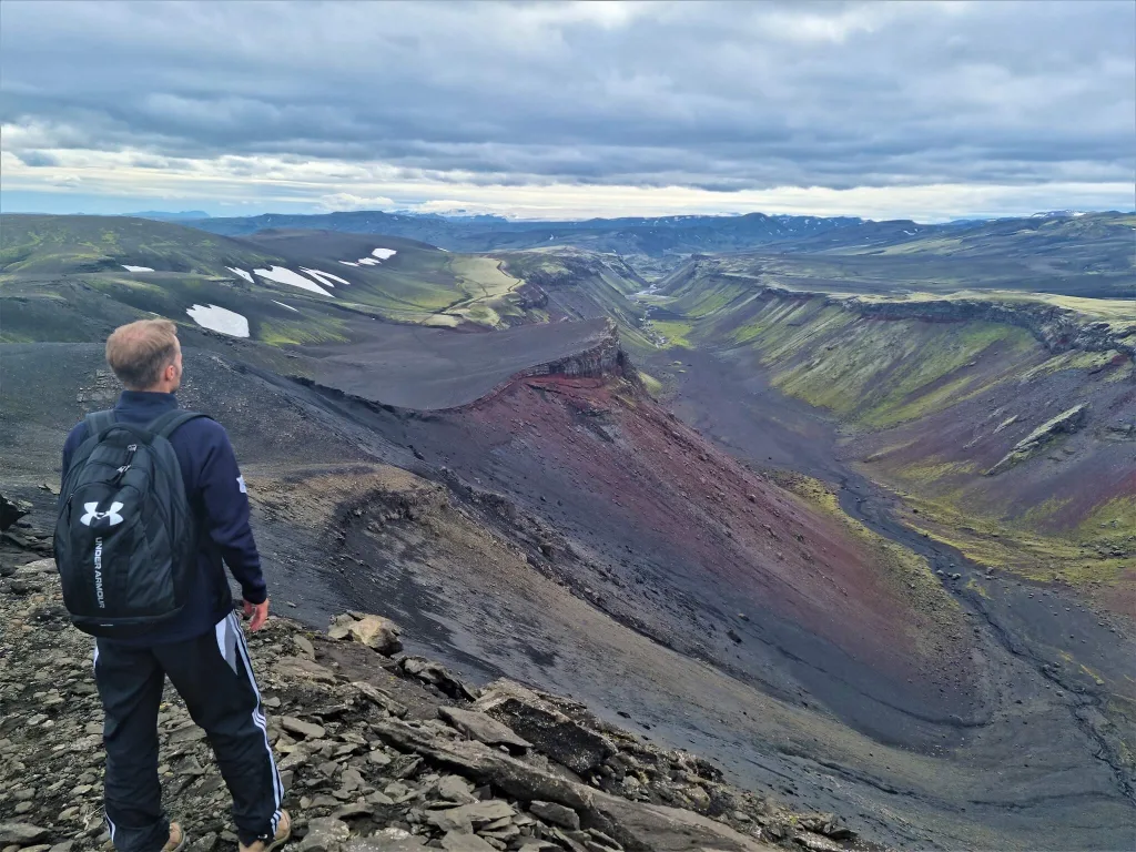
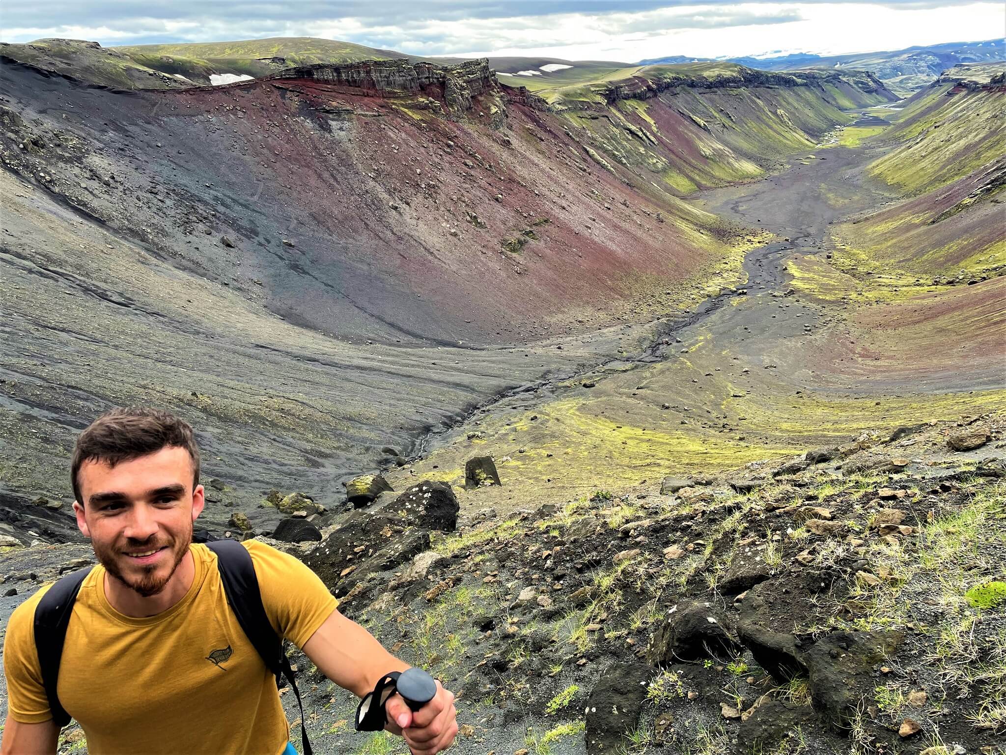
Great view over Eldgjá on a halfway towards Gjátindur
After finishing the climb to the eastern ridge of the Eldgjá canyon, we soon reached the crossroad of several different trails. Some lead further toward the Langisjór area, while one leads to Gjátindur (yellow sticks). Another trail leads back to Eldgjá car park, but not via the bottom of the canyon, but rather via the upper eastern edge of it.
Once you finish this climb and get to the edge of the canyon in the Gjátindur direction, this is where the most beautiful views over Eldgjá will pop up in front of you. You can see the entire Eldgjá Canyon from the bird’s eye viewpoint and this sight is really magnificent.
We then continued towards the peak of Gjátindur via a marked trail, which was basically a pretty dull and rocky ascent. It took us roughly an hour to reach Gjátindur from the above-mentioned crossroad of routes.
The summit of Gjátindur
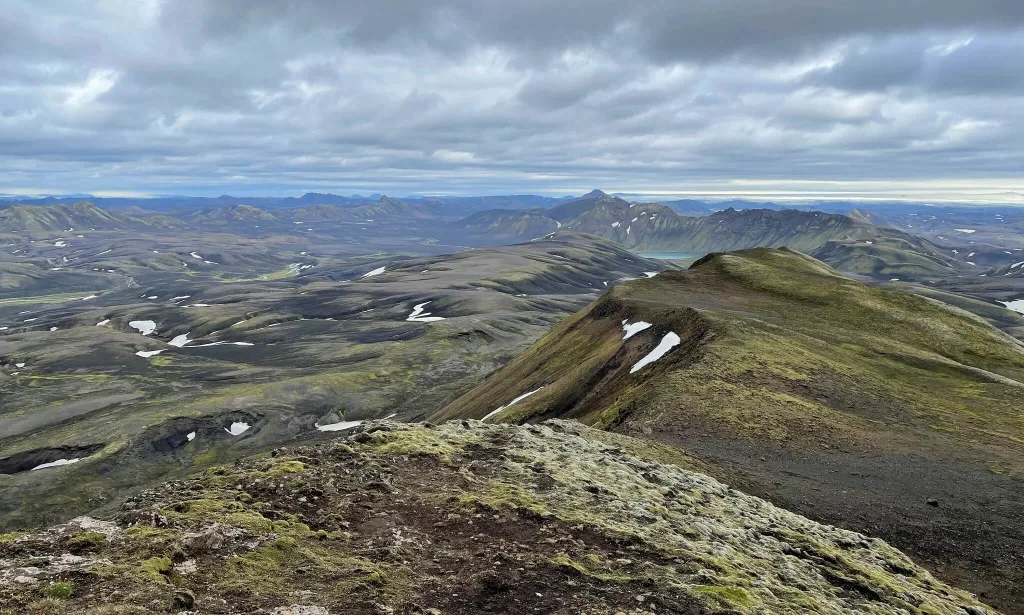
Views from the summit of Gjátindur
Gjátindur is the tallest possible viewpoint over the entire Eldgjá, so yes, you will be guaranteed 360° views if you hike on a day with good visibility. Despite the moody weather, we were lucky to have this good visibility.
Nevertheless, we were not overwhelmed by the views from Gjátindur. They were a bit monotonous and not that spectacular compared to many other amazing views we’d seen already at that time. Nice hike, nice views, but nothing out-of-this-world.
The weather felt a bit cold at the time of our visit, with some 5°C and light winds. Not ideal picnic weather, though. We started to feel cold even in all our layers after standing on Gjátindur for 5 minutes. Thus, we made a short protein bar break and started our descent back.
The Way Back
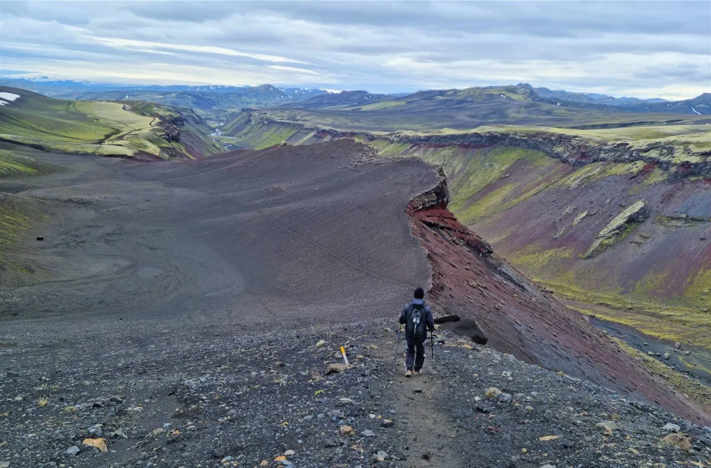
Hiking trail to and from Gjátindur
We decided to take a loop trail because we didn’t want to hike the same route twice. It was a good decision. Not only we avoided the unpleasant and steep ash slope descent, but we also saw Ófærufoss from a beautiful eastern ridge viewpoint.
The loop trail back from Gjátindur is a marked trail that leads along the upper edge of the eastern part of the Eldgjá Canyon. After more than halfway through the trail, you will reach an Ófærufoss viewpoint from the bird’s eye perspective, which is undoubtedly worth seeing. This is already a part of the “Small Circle” hike in Eldgjá. The trail then continues and descends back towards the car park.
YOU MAY ALSO LIKE:

