If you ask a typical tourist if they have visited Fjallabak reserve in the Icelandic Highlands, they would probably give you a weird look asking something like “What is Fjallabak reserve?”. And that’s exactly one of the reasons why we definitely wanted to visit Fjallabak roads 🙂 Not many people tend to go there.
The reason is, it’s not that easy to find information about beautiful places over the Fjallabak, and last but not least it’s not so easy to get there. You definitely need a good car for that. And still, almost every tourist surely has visited Fjallabak once, because that’s where also famous Landmannalaugar is located.
Contents
- Highlands of Southern Iceland
- How to get to Fjallabak – F210 and F261
- 1. F210 west to Alftavatn
- 2. Alftavatn
- 3. F210 east towards Maelifell
- 4. Maelifell
- 5. F210 east towards Raudibotn
- 6. Rauðibotn highlands
- 7. F210 south to Markarfljotsgljufur canyon
- 9. Highlands around Hungurfit track
- 10. F261
- Fjallabak highlands Videos
The weather slowly started to get cloudier and rainier in the south so we had to pick our next destinations really carefully. Our accommodation was near Hella, so there were still plenty of options to go at. One of the areas where the weather was supposed to be nice (i.e. not rainy and hopefully not foggy) was the Fjallabak nature highlands reserve. Fjallabak, i.e. the area around roads F210 and F261 was on the top of our list anyway, so it was an easy choice for Day 2 of our Highlands trip.
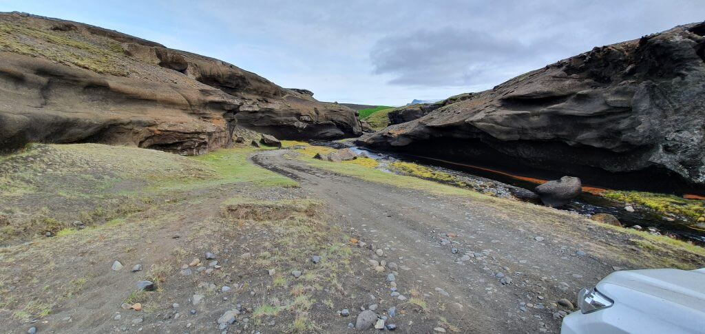
F261 near Markarfljotsgljufur canyon
Highlands of Southern Iceland
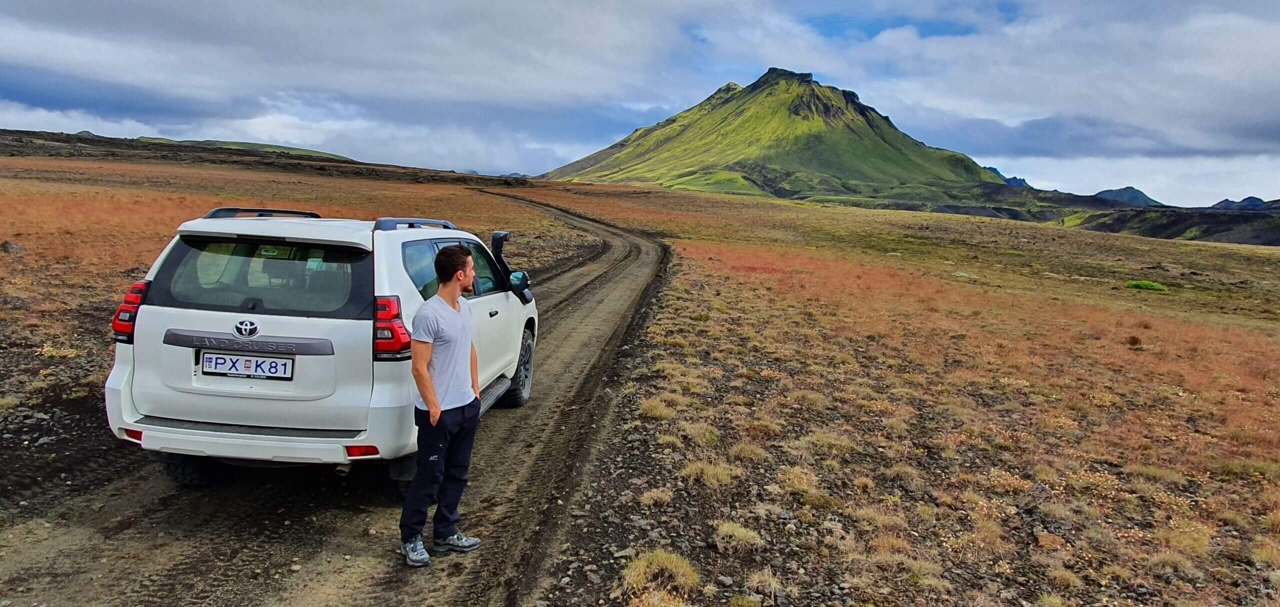
Our plan for the day was to drive the road F210 starting from the west (Hella side), stop at Alftavatn campsite/lake, and admire the surroundings of the magnificent F210. Next, if the weather and road conditions allowed, we planned to drive to legendary Maelifell and if we had enough time and courage, also to Rauðibotn.
Raudibotn is a remote place away from all of the tourists, hard to access, yet stunningly beautiful. At least that’s what I managed to find out from scarce sources beforehand. To get there, however, you need to cross the Holmsá river, which can get really dangerous at times, so we left it as an optional activity if the crossing looked safe only.

Then we planned to come back via F210 around Maelifell to go see Markarfljotsgljufur canyon, which was said to be one of the most beautiful, yet still pretty hidden. Then, if we still had some time a friend of mine suggested an adventurous 4×4 track leading north in between F261 and F210 to Hungurfit hut. He said our (slightly) modified Land Cruiser should be just enough to drive the route.
How to prepare for the Icelandic Highlands Road Trip
Our friend also mentioned to us a really remote hot spring – Strutslaug – but we saved that one for another day. Yes, a very packed day, but still pretty flexible, because we could basically cancel any activity if it seemed undoable. And that’s what everyone should plan for I think – anything should be cancellable, just in case.
How to get to Fjallabak – F210 and F261
No, there’s no bus here, such as the one in Thorsmork. The only way to get to F210 is by taking a guided tour (10% discount code: EPICICELAND10) or driving there by yourself (a time-consuming option demanding planning, experience, and driving skills). We naturally opted for the second option.
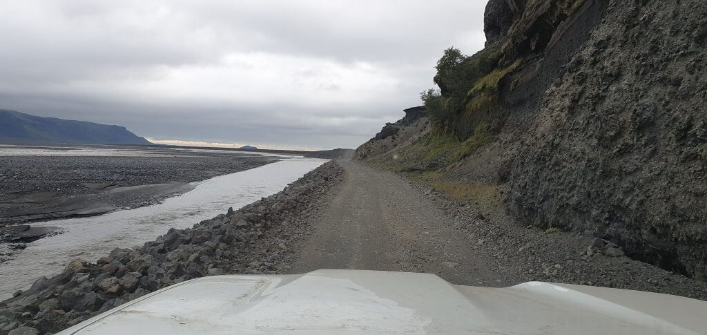
F210 (Fjallabaksleid sydri) between Keldur and Alftavatn
Most of the F210 is without bigger river crossings, so in case of good weather, even if you don’t feel like doing bigger river crossings, you may try to drive it in a proper 4×4 (ideally Land Cruiser or bigger, see our guide on how to choose a proper car for Iceland) – up to Alftavatn mountain hut.
We can also take you here on our Epic Private Tour, just email us.
Up to Alftavatn hut, the road is just bumpy, with potholes and some steep sections, but really picturesque and one of my favorite Icelandic roads. You will get amazing views in each direction – seeing Landmannalaugar from the distance and a big part of Fjallabak Park.
1. F210 west to Alftavatn
F210 west near Keldur
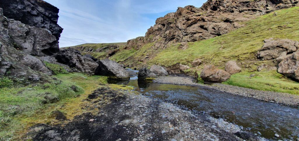
Even until Alftavatn, you will still have to cross several smaller streams, and even drive in the riverbed for around 100 meters! This is really one of the “once in a lifetime” experiences, for anyone not used to it (yes, maybe not for Icelanders ;).
As I mentioned, the road leads through multiple mountainous areas, so if you are unsure about driving in such an environment, please don’t go. Once you pass Alftavatn, the first real obstacle gets into your path – crossing the Kaldaklofskvisl river.

Kaldaklofskvisl crossing on F210 can get tricky at times because there are some large boulders in the river that you are unable to see beforehand. Secondly, the water level in the river may get too high to allow for safe crossing in vehicles not big enough.
It’s always necessary to strictly adhere to all the river crossing rules, watch someone cross before you, wade the river yourself if feeling unsure, and if still feeling unsure better turn back.
Kaldaklofskvísl river crossing
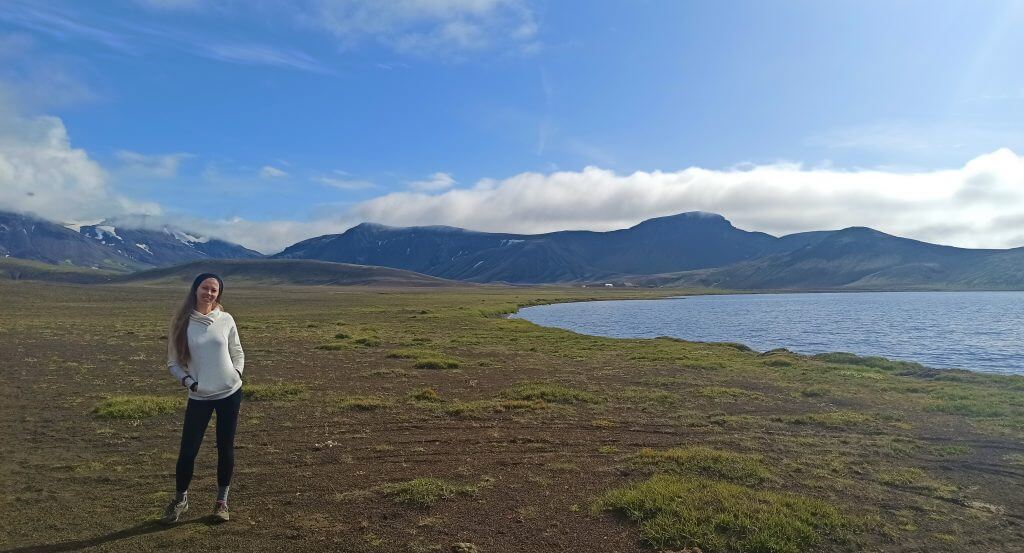
2. Alftavatn
We had nice partially cloudy/partially sunny weather, luckily with no fog and no rain. We already knew from our friends and from the day before, that the water level in rivers is favorably low and rivers are shallower than usual. These are practically one of the best conditions possible.
Hence, we drove F210 all the way to Alftavatn lake. The road was admiringly beautiful. The part I liked the most was the highest spot just before Alftavatn, where you could see all the surrounding land, including Landmannalaugar in the distance, almost from the “bird’s eye” point of view.
Álftavatn lake
We took a short break at Alftavatn lake, which is a very nice, calm, and quiet spot to stop at and have a picnic or short stay during nice weather. We were lucky enough that exactly after our arrival at Alftavatn the sun started to fight its way between the clouds and we could even walk in the T-shirt outside.
3. F210 east towards Maelifell
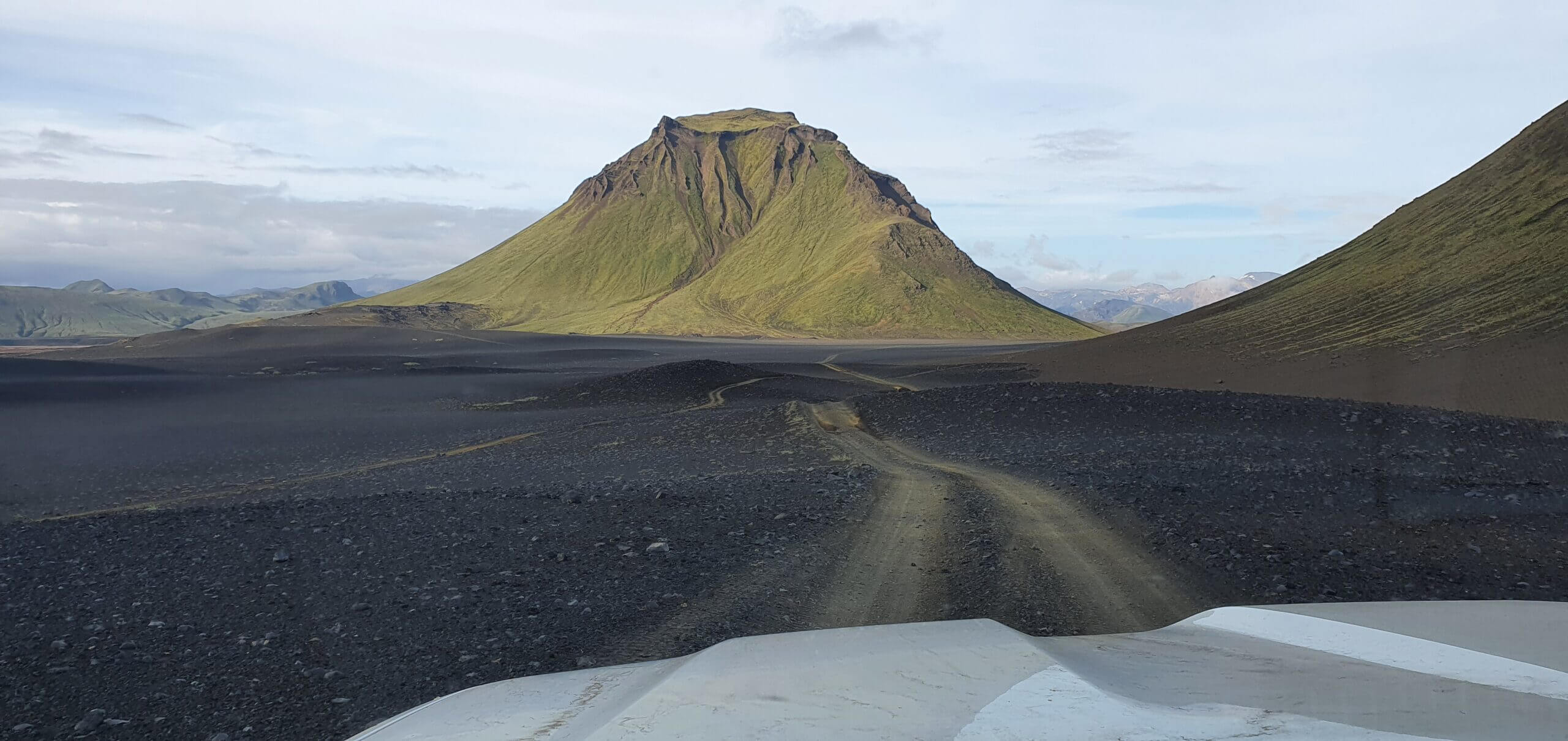
F210 after Alftavatn then continues in two directions – south towards F261 and east towards Maelifell and Holmsa river. Since our journey went smoothly up to this point, we definitely wanted to take a detour toward Maelifell and so we did. We turned left on the eastern part of F210. Here’s where the truly lunar landscapes have begun to emerge.
F210 Fjallabaksleid Sydri east to Maelifell
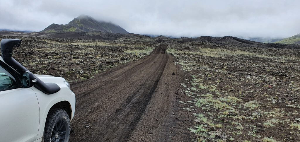
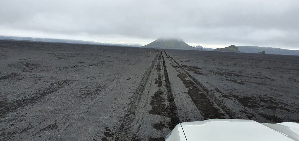
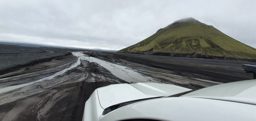
F210 towards Maelifell is definitely one of the most unique Icelandic roads. Firstly, the weather almost always changes when driving on this road. F210 towards Maelifellsandur literally feels like a gateway towards another world, thanks to this. Secondly, the road itself is very specific – it starts with huge boulders and continues as a black sand road.
And it’s almost always covered with some kind of mist – either light or heavy. Huge boulders are the most difficult part of F210 towards Maelifell. The road doesn’t have a clearly visible track, and if you don’t take enough care, you may damage the underside of your car.
Read our guide on how to choose the best car rental insurance for Iceland.
After basically driving on huge stone plates rather than an ordinary road, the route turns into tracks in the black sand. Oftentimes expect it to be wet and muddy because this is the area where it may rain occasionally. This part of the road doesn’t have any huge obstacles, or rivers, so it looks like a giant moon highway.
There are no more river crossings going from Kaldaklofskvisl to Maelifell. If you are the only car on the road (which is frequently the case, as with us) then your only guides are the tracks in the sand and yellow sticks marking the side of the road.
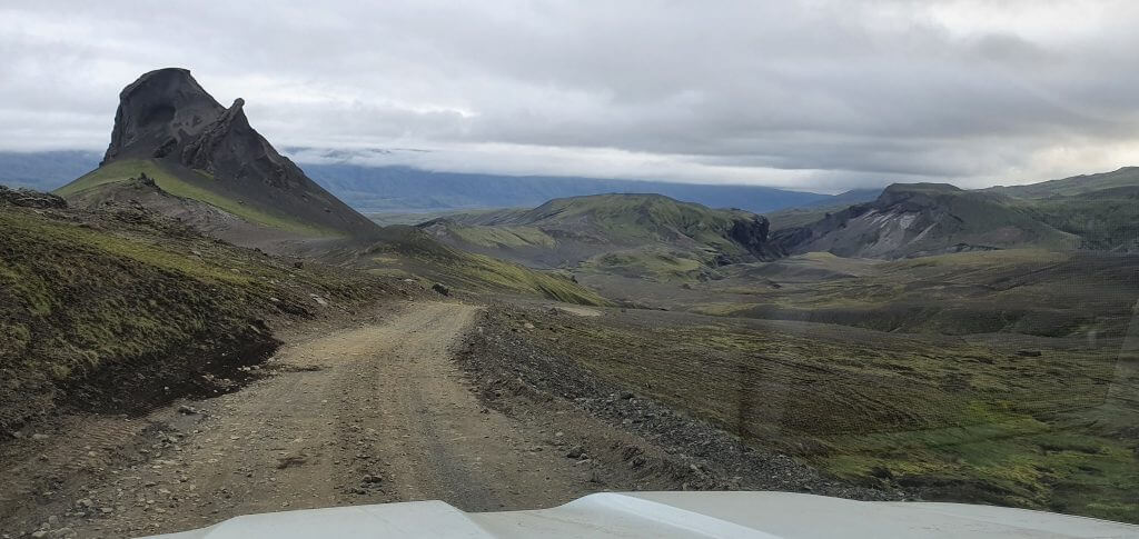
4. Maelifell
After a drive in the middle of “black sand nowhere”, you will be able to spot majestic Maelifellsandur in the distance. If you are lucky enough, and Mr. Maelifell is not covered in fog – which he likes to do – your view will be truly amazing. As I already mentioned, the weather usually changes to worse after turning towards Maelifell. This was exactly our case (multiple times). This time it, however, only changed to cloudy with occasional little rain – which is still considered good weather.
Maelifell in Fjallabak nature reserve
Finally, after an adventurous drive – there it stood – Maelifell volcano. It’s a view as if you were on a deserted planet. A huge green volcano in front of you, surrounded by black sand fields, with occasional little lakes created by past rain and absolute silence in the air.
It’s even possible to climb the Maelifell, but we don’t recommend doing that unless you are really experienced in performing steep, unmarked hikes unless there’s ideal weather and ideally only with a guide. We didn’t go for the hike as it may be really dangerous (and the view from above wouldn’t be great in partially foggy weather).
5. F210 east towards Raudibotn
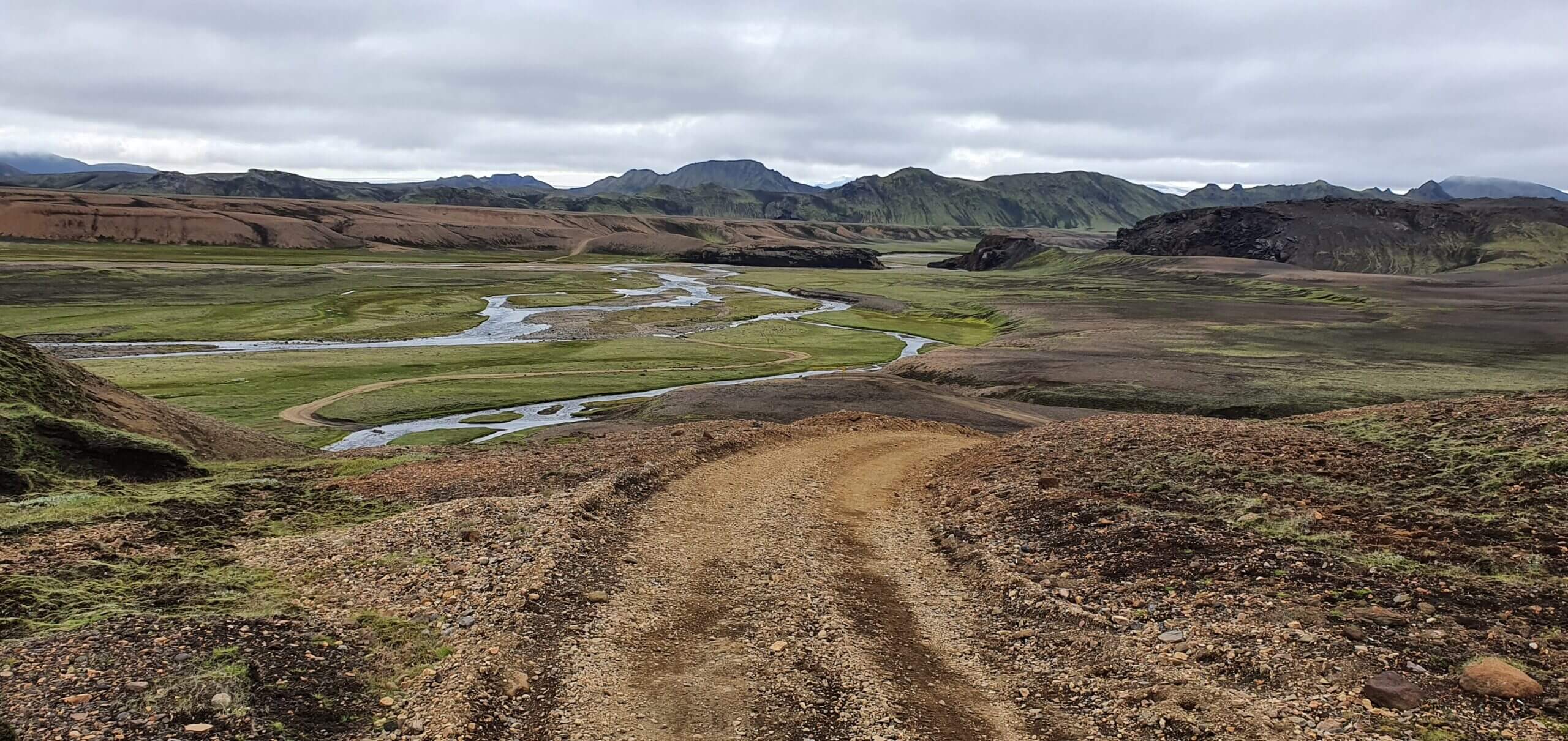
We still had enough time at that point of the day, because everything went pretty smoothly. Thus, we decided to take a look at the Holmsa river crossing with an aim of seeing Raudibotn – the beautiful hidden (from a typical tourist) area with a crater, river, and amazing landscapes all around.
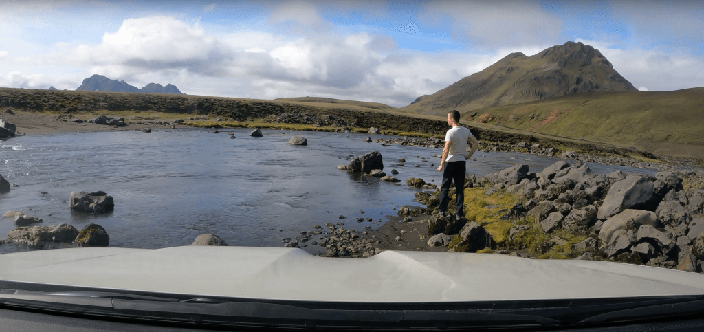
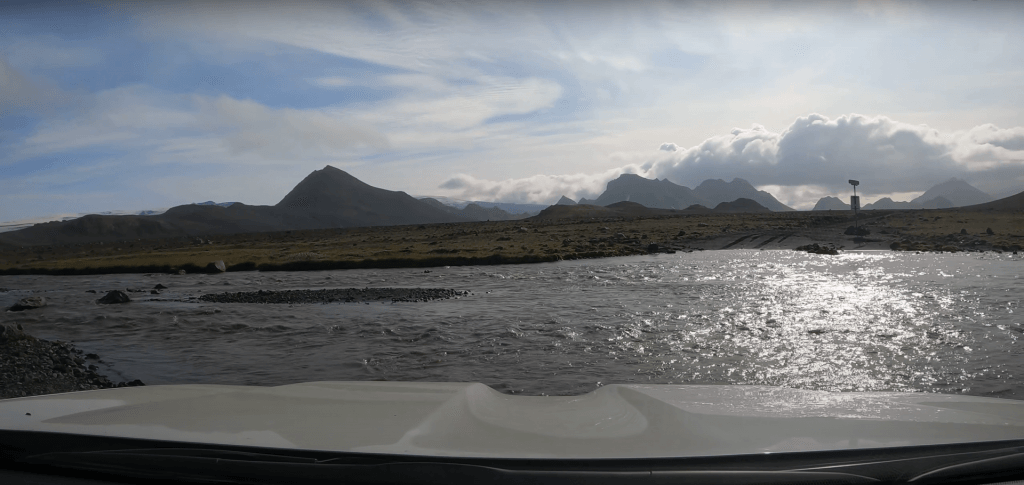
After reaching Maelifell, we continued east and we soon arrived at the Holmsá river crossing. According to a friend of mine, the crossing was supposed to be doable, without problems, at this time of the year (especially due to low water levels). Beware, this is the river crossing which may get pretty nasty. Always check both beforehand and on-site.
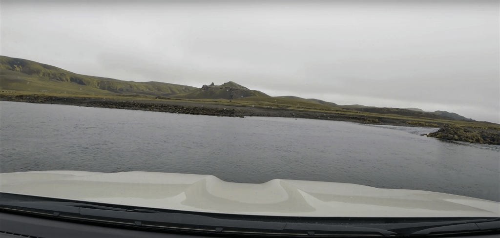
Holmsá river crossing at F210
The crossing looked exactly like my friend Haraldur described it – this time harmless. I examined the river anyway and it looked calm and shallow. Because of this, we decided to go for a ford even without wading the river on foot. And the crossing went smoothly. There’s a small hill with the road, usually easy to spot on your left after the Holmsa crossing.
The road ends soon at the improvised clay car park for a few cars. There was only one car other than us already parking at the spot. We just saw a crew of this car in the distance when arriving at the place and they were apparently heading back, so we decided to wait on them and ask about the route.
6. Rauðibotn highlands
In spite of having read already about the place, it wasn’t very clear from that article where to proceed. It was also unclear if it was possible to make a round trip (via different trails) or just to use the same way there and back. Thirdly, it wasn’t clear how much time should we devote to the entire trip. Once the group, which turned out to be the French family, came back, I asked them if it is worth making the hike, to which they immediately replied “Yes, it’s stunning”.
The second thing I asked was how long it takes to do the hike. They replied “3 hours”, although I’m not completely sure they understood me because, in reality, the little hike took us much less – around 1,5 hours. My last question was if they had done the roundtrip via 2 different routes. The answer I got was “No, I don’t think so unless you want to climb up to the volcano”. OK, thanks, some useful info 🙂
Rauðibotn parking
Raudibotn trail
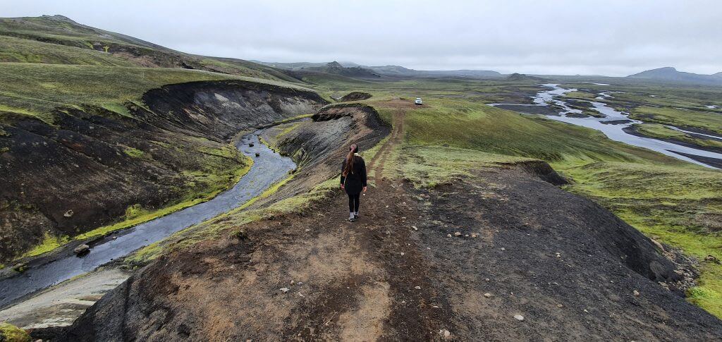
The trail towards Rauðibotn starts as a steep quad-bike track (I wonder who had driven up this steep hill, I wouldn’t…). It then turns right down the hill towards the picturesque green valley surrounded by a river, a volcano hill, and a lot of moss. Speaking of moss – please really do your best to NOT step on it – it takes ages for it to grow again and sometimes it will even not grow anymore. As we found it a bit difficult to orientate in the area, we put together a simple map of Raudibotn for you:
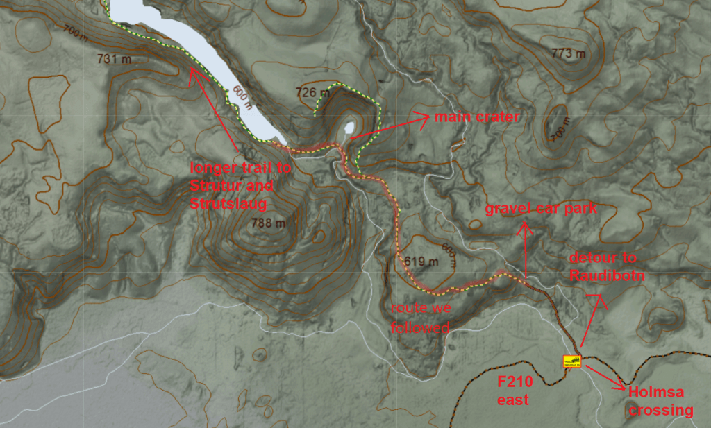
Map of Rauðibotn
The trail is not marked. The only way how to follow the trail is to look for the tracks, which are, however, most of the time easy to find. An entire area has an amazing lunar charm, where you once again really feel like on another planet. This time one which is greener and filled with a lot of water.
After roughly 30 minutes of following the trail, we arrived at the beautiful crater where the mist literally traveled up and down in the air. In the background, there was an amazingly red crater and the entire place was really pretty and definitely worth visiting. Even in cloudy and partially foggy weather which we experienced.
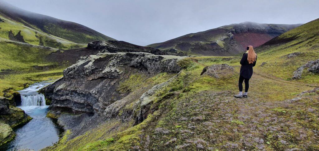
Raudibotn waterfalls
At that point, we tried to discover whether it was possible to come back via a different route or not. The article I had read mentioned that in order to do that you need to ford the river – but the river didn’t look fordable at all – the current looked too strong. Even when looking at the map, there didn’t seem to be an option to ford the river. Thus, we concluded – no ford – only the same way back.
The road, however, continues further next to the river all the way toward Strutslaug’s hot spring area. So, if you are into remote hiking and if you have enough time (and can somehow plan it all) feel free to proceed even further.
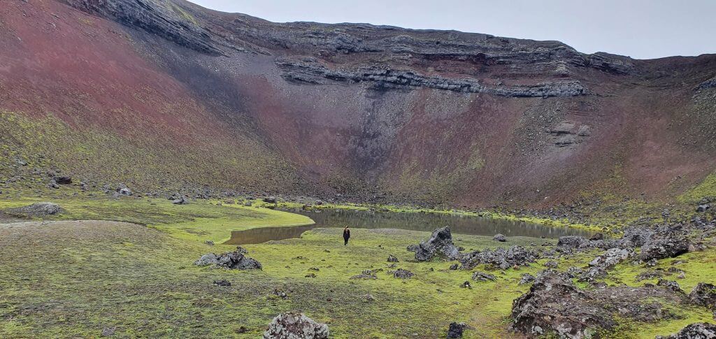
Rauðibotn volcano crater
After shortly examining the road further in the direction of Strutslaug (i.e. the one leading next to the big lake), we turned back and arrived at our car park via the same trail. And yet, the day still had not ended for us. One of the last stops I planned for the day was located on the way back, near the southern part of F210.
Hence, next, we drove back through Holmsa crossing, next to Maelifellsandur, and back to the F210 crossroads. At the crossroads, we turned left and headed towards our next stop – Markarfljotsgljufur canyon.
7. F210 south to Markarfljotsgljufur canyon
There are two major river crossings on the F210-F261 roundtrip. The first one is the Kaldaklofskvisl River, after Alftavatn and the second one is the Blafjallakvisl River further down F210 to the south (after not turning towards Maelifell at the crossroads). Our friend Haraldur told us that if we succeed in crossing Kaldaklofskvisl, then Blafjallakvisl will be easy because it’s a smaller crossing.
Bláfjallakvísl river crossing at f261
You can watch how we crossed the Blafjallakvisl river at F261 here. And we crossed it the wrong way. You may see in the video how our car struggled in the middle of the crossing, splashing a huge amount of water. This is exactly what you shouldn’t do. Luckily, our Land Cruiser has survived without any damage thanks to a snorkel and high ground clearance.
What happened here was that we, firstly, went too fast (overconfidence maybe?) and, secondly, probably took the wrong path. The river bed was very uneven and we fell into the deeper part with our car. All of this could have been avoided, had we waded the river by foot beforehand.
10% discount code for the best Fjallabak super jeep tour in Iceland: EPICICELAND10
After crossing Blafjallakvisl, we headed towards the Emstrur hut to see the Markarfljotsgljufur canyon from the eastern side.
How to get to Markarfljotsgljufur Canyon
There are two ways to get to the Markarfljotsgljufur – from the west and from the east. A little warning in the beginning – neither of the roads leading there is easy. On Day 2 of our trip, we decided to take the eastern route, from the Emstrur side. On Day 5, on the other hand, we decided to see Markarfljotsgljufur canyon from the west.
This is the map of Markarfljotsgljufur canyon access roads and the way we took:
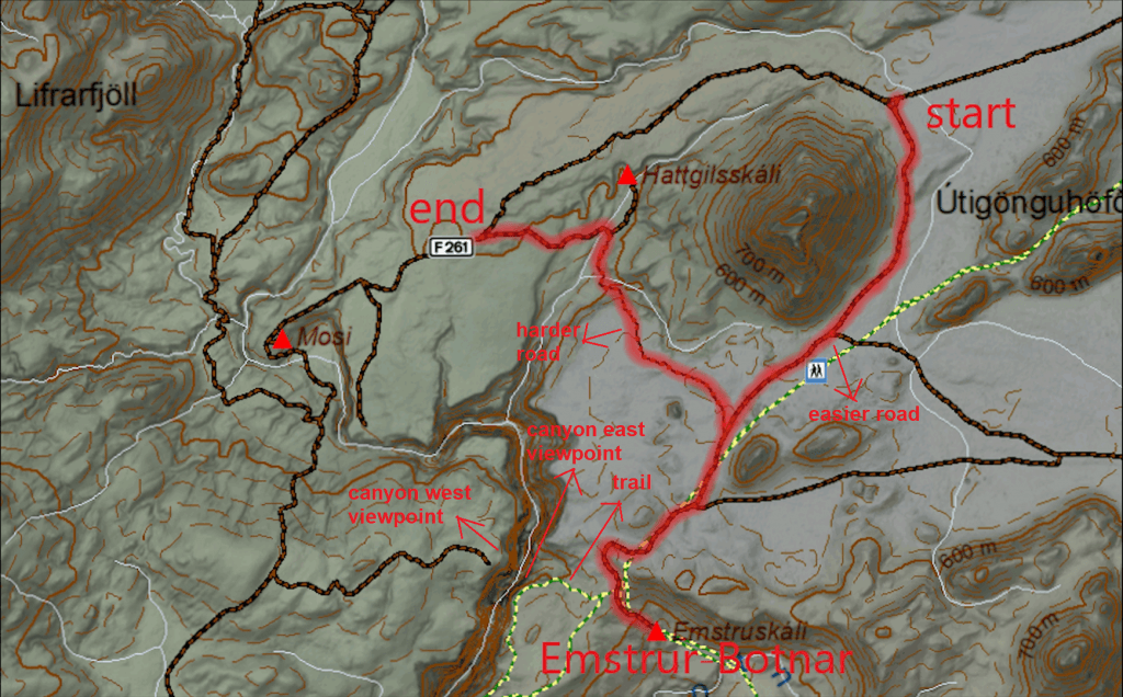
Markarfljótsgljúfur canyon map and roads
Beware, the Emstrur tracks we drove are just dirt tracks. Not even F-roads. This means they are even harder to drive than F-roads. Always check with your rental company if it allows for such roads, choose your car wisely, and study the roads in advance. Mostly only super jeeps are allowed to drive the dirt tracks.
When taking the eastern route, you have to make a detour from F210 towards Emstrur hut. There are actually two different paths – the northern one and the southern one. We took the northern one on our way there and the southern one on our way back. Both were pretty scary even in our (slightly) modified Land Cruiser.
The northern route leads primarily to the Emstrur hut. It’s a steep gravel road where you have to drive very slowly, in low gear, with 4×4 turned on, and beware of any mistakes like hitting the big stones.
Emstrur track (northern part) to Markarfljotsgljufur
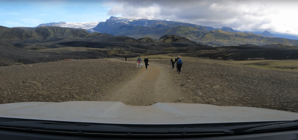
When looking at the map, the Markarfljotsgljufur canyon was supposed to be located right to us, but we weren’t able to see any detour leading there. So we ended up parking our car at the Emstrur campsite. We were the only car with tires smaller than 40” there, and the locals gave us some curious looks (apparently not many travelers come here by car, and most of the time locals only).
We asked at the hut where to proceed to see the canyon. They advised us we should come back a little by car, leave the car there and then follow the hiking trail on foot. We did exactly as we were advised.
There’s a little wooden sign saying “canyon”, not very well visible, which we apparently missed. Next to the sign, there’s a place to park a few cars, so we left ours there (as the only car). We continued by walking. It takes around 10 minutes to reach the edge of the canyon. And hell, the walk is completely worth it 🙂
Markarfljotsgljufur Canyon from the east
I’m not sure if this is the biggest canyon in Iceland but it definitely looked like it. Seeing Markarfljotsgljufur was a once-in-a-lifetime experience, which cannot even compare to seeing the over-touristy Fjadrargljufur canyon or other similar places. At least for us.
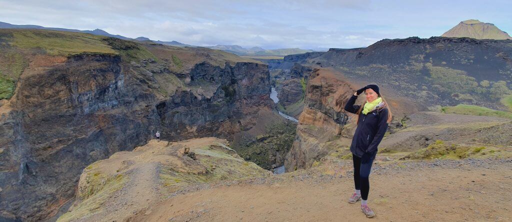
The east viewpoint of Markarfljótsgljúfur Canyon
Surprisingly we were not alone here, with maybe 2 or 3 other couples admiring the place. The reason is simple – Emstrur hut serves as a shelter along the famous Laugavegur trail. At the time we reached the canyon, it was already time when most of the hikers had already arrived at the hut and were spending their late afternoons doing this little hike towards Markarfljotsgljufur.
The views from the edge of the canyon are more than just stunning. It’s also possible to hike along the edge of the canyon. Take great care though, this place doesn’t have any ropes or barriers to keep you safe from falling off the giant cliffs. The biggest plus of Markarfljotsgljufur is definitely its remoteness, which means you definitely won’t meet many fellow tourists here.
How to get from Markarfljotsgljufur
As I already mentioned above, to get to or from Markarfljotsgljufur from the eastern side, you may use two roads – both detours from F210. One northern and one southern. We used the northern detour to get there and the southern detour to get back. However, if you don’t have a huge car and you don’t like damaged roads, I don’t recommend you take the southern one.
The southern detour is an old broken track leading towards Hattgilsskáli hut. I don’t remember any major river crossing, but I definitely do remember a track in some bad condition. This southern detour from Emstrur-Botnár is a short, yet pretty intense, steep, and difficult-to-drive track. Broken stones and boulders are all around the track and huge holes meet you at every corner. At one point my wife was so scared she simply got off the car and continued walking (and shooting my drive ^^).

Once you reach the highest point of the track, the steep descent follows, once again with some huge holes which cannot be avoided, because the track is narrow and there’s a hill on your left side and a steep fall on the right side. Yes, this track from Emstrur is definitely doable in a proper car and with proper skills, but it’s not a very pleasant experience, I wouldn’t take it again. At one point our 33” Land Cruiser had two wheels in the air and I felt like this is the edge of what this car can make and I shouldn’t push further.
Anyway, with some slow driving and checking the track frequently, we eventually made it back to F210 and still had some spare hours, even though the dark was getting close. I persuaded my wife to try at least for a while the track our friend Haraldur recommended to us, the track towards Hungurfit hut.
9. Highlands around Hungurfit track
Some tour guides say they will take you to impassable places and this is exactly one of these places 🙂 Please don’t even try without enough experience in 4×4 driving, steep hills, narrow roads, and river crossings. And preferably a super jeep, or at least a Land Cruiser-like vehicle. Our friend was right, though, and the track toward Hungurfit hut is definitely one of the most exciting (and difficult) tracks I’ve driven in Iceland. Due to the shortage of time, we decided to drive only less than half of it – the circular round trip. However, in the following days, I decided to come back and do the whole track.
Beware, the Skaelingar and Blautulon tracks we drove are just dirt tracks. Not even F-roads. This means they are even harder to drive than F-roads. Always check with your rental company if it allows for such roads, choose your car wisely, and study the roads in advance. Mostly only super jeeps are allowed to drive the dirt tracks.
Hungurfit track between F210 and F261
There’s no proper road service on this road, so expect it to be difficult to drive. Big gravel and narrow steep hills are a certainty. Other than that, there’s one (not just one, to be precise) specialty at the track towards Hungurfit hut why all these guides and even locals go have some fun in here.
Once you reach the first fork/crossroads you may choose – the track towards the left leads through a gorgeous area full of little river crossings and one surprise. On the other hand, the track towards the right leads through a mountainous area with beautiful views. We’ve done the whole roundtrip.
Left and right turns from the track towards Hungurfit hut
We started with a track towards the left and descended towards an area full of small river crossings, which, for me, was a once-in-a-lifetime experience. Of course, we were completely alone there. On the one hand, this was amazingly beautiful, on the other hand, it was a bit scary as well. I definitely wouldn’t want to get a flat tire in here or get stuck in the river. Forget about any cell phone signal or internet connection. Just you and the rough Icelandic highlands.

Taking the left detour at the beginning of the track towards Hungurfit hut you will soon arrive at the famous spot, which is the reason behind so many locals going in here. There are two giant stones on both sides of the road, making the road so narrow that you may pass only with a few centimeters of free space on both sides of your car.
At the same time, the track obviously isn’t flat underneath your car. There’s another huge stone on the ground, followed by a big hole and another sharp stone. So you would need to maximize your patience (and driving skills) to pass through without any damage to your car.
Hungurfit track
I took enough time to study the passage and to check whether everything is fine for me to pass and we passed well. The river crossing area then continues for a while and then you’re gonna connect to the right detour. From there, you may either come back (as we did this time) or continue around 50 kilometers all the way toward the northern part of F210 (as we did next time).
We came back via the right track, which was similarly exciting, just in a different way – some more steep and narrow passages with potholes. You can watch the entire video of our Hungurfit round-trip here.
10. F261
F261 Emstruleið
It was already evening, so we had to head back. We completed our round trip via F261 back towards Hella. F261 doesn’t contain any major river crossings, only Blafjallakvisl at the beginning (next to F210). And, as I mentioned above, Blafjallakvisl was easy this time and generally should be easier than Kaldaklofskvisl (if crossed correctly).
F261 near F210 is composed of big gravel and some steep sections so you have to drive slowly and the drive is not that comfortable. It’s definitely possible to drive F261 also in an SUV like Dacia Duster, although I cannot imagine how uncomfortable it has to be.
F261 near Fljótshlíð
You can watch the entire video of our F261 drive here. The western part of F261 basically leads to the other bank of the Krossá river and you are able to see the Thorsmork area and F249 well from it. Even this part contains a lot of big gravel and the drive has to be slow and not very comfortable. The scenery is beautiful as always, although for me F210 was even more picturesque. This may, however, be due to the effect that we had seen F210 first 🙂
Fjallabak highlands Videos


![]() ask questions or get inspired in our community
ask questions or get inspired in our community


Thank you for this amazing website. the most helpful i seen online.
Question – Is it extremely not advisable to do F210 in hte opposite direction, from east to west? (With Hilux)
We really want to drive this road, but we want to practice on F208 first, so we will be in Hólaskjól and thinking about get into F210 from there, or maybe drive only part of it, maybe to Maelifell and back to Hólaskjól. you think it’s a good plan?
Thank you very much again! amazing site!
Hi Yogev, thank you for your words!
F210 from east to west is more difficult, because you have to cross Hólmsá river before arriving to Maelifell. Holmsa can get really big. It really depends on water levels in the rivers, if it’s dry, you should be fine, if it rains more before, you may have problems. F261, F208 south or F210 west are definitely easier than F210 east. Hilux is a good car for most of the situations. In the end, you can definitely at least drive a part and if feeling unsure, turn back. The road is beautiful 🙂 And it’s always best to wade in the river by feet if feeling unsure. This is Holmsa in medium conditions: https://www.youtube.com/watch?v=7DHEyv23nnY
Thank you for the answer, you are much more helpful then the car companies 😀
I’m really debating with myself about 2 options and as far as I read on your amazing website, it all comes down to this one river crossing of Hólmsá.
Our route contains Landmannahellir, Landmannalaugar, F208, Langisjór, Eldgjá, Laki and Askja. We don’t have time to drive the entire F210 road, but we are thinking about going just to Maelifell (from Hólaskjól).
We plan to rent a Hilux or Land Cruiser. As far as I understand, all of these roads are double even with less than that – except for F210, so in order to get to Maelifell it is better to have a jeep with modifications.
MyCar has a Toyota Land cruiser with a 33 inch tire and snorkel, but NO insurance.
Lotus Has only normal Land Cruiser, but the DO have insurance.
If it is ok to ask.. .What option do you think is better? Did you cross Hólmsá with a normal Land Cruiser or did you have some modification on it?
Thank you, we truly try to be a helpful source 🙂
Yes, Hólmsá is the biggest and yes, a big car can get really useful there. We drove through Hólmsá with 33″ Land Cruiser from MyCar, it is a great car, I can highly recommend it. Probably the best performance-to-price you can rent in Iceland. We wrote more about our experience here: https://epiciceland.net/how-to-rent-super-jeep-iceland/ and we also have a 5% discount code for MyCar: EPICICELAND
Yes, Lotus is the only company in Iceland with river crossing insurance, but on the other hand their Land Cruiser is a bit smaller and without snorkel, so it’s a hard choice. We’ve rather chosen raised Land Cruiser from MyCar for highlands, because it’s clearly a better car. If weather/rivers are dry, also the “normal” Land Cruiser should be fine, but you never know..
Thanks for your work as always. Do you have the track for Raudibotn trail. I don’t see it clearly on the map. Thanks again
Hi Pasku, do you mean the hiking trail or the road/track to Raudibotn? The little map is in the article. The map is from here: http://vefsja.iskort.is/, part of the trail is also here: https://www.alltrails.com/
Hi Igor,
I am planning an excursion to Maelifell via the F210 from Grafarkirkja. I have read that it is possible to avoid the Hólmsá River crossing, by turning right and following the east bank of the river until you find a smaller tributary to cross. The road then climbs up a hill to a roundabout where you can park. What do you think?
Thank you,
Daniela
Hi Daniela,
the route you describe sounds like a route to Raudibotn from F210. But you need to cross Holmsa between Raudibotn and Maelifell to get to Maelifell.
The only way to avoid crossing Holmsa is by using the road F232 where you on the other hand have to cross a pretty bumpy medium-sized river (though less deep than Holmsa).
I created this little Holmsa map for you to help you understand.
Hello,
First of all, thanks for the excellent write up.
We are first time visitors to Iceland visiting in the month of September and really want to enjoy the view of Maelifell and want to drive on the black sand.
I saw a route from the south through F210 which has only 1 river crossing which is the Holmsa river. I don’t have any experience with river crossings or off roading. What do you think about this route?
I can get a bigger car if needed, but I am afraid a bigger car alone would suffice as I don’t have any experience.
Your advice will be really helpful.
Thanks.
Hi Dinesh and thank you.
I don’t recommend driving to Maelifell (from either direction) to someone who hasn’t tried any river crossings before. Especially the Holmsa river can get pretty big and dangerous if it rains a lot, it’s one of the biggest river crossings in that area.
An alternative would be to take the road F232 to Maelifell and back. There’s one medium-sized river crossing at F232 that is easier than Holmsa. But I would still suggest to practice first on some easier road with smaller river crossings like F225, or F208 South. The bigger the car, the better of course.
We also wrote a List of 10 Easiest F-roads that may be good for practice.
Hello,
Thank you for the detailed articles. They have been really helpful.
Would a Toyota RAV4 or a Jeep Renegade be fine for F208 South from Landmannalaugar to F235 to Langisjor for a beginner without river crossing experience?
Thank you.
Hi Jason and thank you.
Not sure when are you going, I will assume between July and September.
Jeep Renegade has higher ground clearance and better 4×4 capabilities than RAV4. Renegade should be alright for the routes you mention, if you stick to the river crossing rules and if the road is marked green on http://www.umferdin.is and if you dont go after heavy rain. In other words – in normal summer conditions it should be fine if you drive through the rivers properly.
We are going in late August, and would a 2021 Toyota RAV4 Hybrid also suffice? It has 8.1 inches of ground clearance.
Also, do you have any medium river crossings if going to Rauðibotn from F210 East?
Thank you
RAV4 has a bit low ground clearance. It may suffice if the conditions are good (dry days, not too much glacial river melting etc). And it may not if they are not good. If unsure, always better wade the river yourself before crossing in a car.
There are only small river crossings on F210 East from Grafarkirkja up to Raudibotn. Just dont go further west, there’s a big Holmsa river crossing.
Hello, I will stay in Vik for 3 nights in July and I like to drive for a day trip to Maelifell Vulcano.
Would be possible start in VIK route 1 via 208 and the last part of 210 to arrive in Maelifell?
I will rent for 14 days a normal 4×4 like Subaru Forester or Jeep Renegade because I do a round Iceland trip and it would complicate to rent a Large 4×4 just for 1 or 2 days and in VIK there is no rental options.
Many thanks
Daniel
Hi Daniel,
I’m not sure what route do you mean? F232 from the south? Or F210 from the west? We describe all of these in detail in our Maelifell Guide.
That being said, I would NOT drive to Maelifell in Forester/Renegade. These cars are simply too small and it’s too risky to do it. Yes, you may be able to pass with some luck when conditions are perfect, but it’s risky. The hardest roads are F233 and F210. The easiest one is F232 – this one may be passable with your car, but again – it’s a bit of a risk and you have to cross correctly the bumpy medium-sized river on this road.
Generally we advise to use at least a Hilux/Land Cruiser to pass safely even under conditions that are not ideal. Even better is a super jeep to minimize any potential problems.
hello daniel, i rent the car with your discount:)
thanks for your information, I have rented the dacia Duster and my idea is to visit maelifell, raudibotn, strutur thermal water and the Markarfljotsgljufur canyon, I do not want to cross the holmsa river besides being closed the pass, my idea would be to go up the f32 and then go to see the markar canyon towards f210 and then do the raudibotn trail and the natural pool and return by the f232 maybe it is a lot but we could extend half a day more and sleep in the shelter … What do you advise us?
Hi Jorge, I’m Igor not Daniel but never mind 😉
Dacia Duster is NOT the car for roads to Maelifell/Rauibotn/Strutur! It’s too small and the chances you will damage it are high! Please refer to our video on How to Visit Maelifell – we recommend at least a Land Cruiser, ideally a super jeep. The same goes for F210. You may pass if you are lucky, but I wouldn’t rely on luck myself…
Hello,
Thank you so much for all this !
To access the Markarfljotsgljufur canyon, I will not go on the East side (standard Land Cruiser, not upgraded).
First question : How to proceed from the West side ? Just stop somewhere on the F261 and then walk to the East direction ??
Seconde question : Is the view less scenic from the West side ? (on your videos, the East side looks more scenic, doesn’t it ?)
Thanks !
Hi Igor,
Thank you for building this website. There are so many information which are super useful!
We are planing to travel to Iceland in late August and check out the Highland. We know there aren’t much gas stations in Highland. I wonder if you could help me understanding the gas situation.
We will get full tank of gas at Hrauneyjar, then visit Sigöldugljúfur -> Landmannalaugar (few spots on the road F208) -> Rauðibotn(F233) -> Maelifell(F210), after visited Maelifell, we have two options to get back on road 1 which will depends on the weather. Option 1 is take F210 and F261 or F210. Option 2 is take F232.
If we rent a Toyota Land Cruiser 4×4 35” Modified Super Jeep from Lotus, do you think the full gas tank will be enough for us to travel from Hrauneyjar to road 1 with the options provided?
Thank you so much for your time and help!
Best,
Olivia
Hi Olivia, even the longest route you describe is just about 200km so your gas should definitely be OK 🙂 Modified Land Cruiser should have a tank of about 80-90L and you can expect the fuel consumption in the highlands to be at around 15L/100km, so you should be able to make at least 500km with it.
If we go for longer routes we use to bring 20L jerry can with us, however we’ve never used it in Iceland, just had it with us just in case.
P.S. If you like what we do please write us a short review on Google: https://g.page/r/CaJt1bHCTbF1EBM/review it would help us a lot!
Hi Igor, many thanks for your amazing blog, which helped me a lot during my trip to the highlands.
I went in late June when F210 east just opened, allowing me to see and get loads of drone footage of Maelifell. However, I was not able to drive up to it as the braided rivers right in front of Maelifell made the ground so soggy that it felt like driving in quicksand.
I was wondering if this is normally the case when the road just opens, and if the roads will harden up in July/August?
Maybe a super jeep would have helped…
Also, I saw a beautiful picture online filmed from a drone called the ‘tree of life’ but I’m struggling to pinpoint it’s location. All I know is that it is near a road. Any ideas where it is? 😀
https://www.behance.net/gallery/194986287/Tree-of-Life
Thank you!
Hi Victor and thank you!
Yes, that’s actually pretty common early in the season and it gets drier later in the season with less glacial melting. September is typically the driest UNLESS it starts raining a lot and/or winter with snow arrives early.
I’m sorry, I’ve seen this picutre many times but am not sure of the exact location.
P.S. If you like what we do please write us a short review on Google: https://g.page/r/CaJt1bHCTbF1EBM/review it would help us a lot!
Hi Igor.
What a wonderful website you’ve created. I have a question. My car is a Dacia Bigster. My destinations are Bláfjallafoss and then Maelifell. Due to your warning about crossing the Holmsa River, I’m looking for an alternative route. I’m thinking of first going to Landmannalaugar from Sigoldufoss using the F 208. Then, I plan to continue onto Road 1 and from there use the F 209 and F 232 to reach Bláfjallafoss and then Maelifell. Do you have any warnings or suggestions for this route? After Maelifell, can I cross to the Hella side using the F 210 western section or the F 261? Or should I return the way I came?
Hi Fatih and thank you very much!
Well, Dacia Bigster is really a minimum necessary vehicle for F232. It can pass the road only in good (dry conditions). In recent years a quite steep river bank has formed over the Blafjallafoss river crossing and cars such as Bigster have struggled there, so it really depends on how will it look this year.
F210 to the west is even harder with bigger river crossings, so I don’t recommend driving a Bigster there. You might be able to pass under ideal conditions, but you might also get stuck and/or damage your car. I personally wouldn’t go there in a Bigster.
P.S.: If you like what we do at Epic Iceland and/or if you appreciate my response, please a short review on Google: https://g.page/r/CaJt1bHCTbF1EBM/review would really help us 🙂 Thanks in advance.
Hi Igor,
Awesome website!! Unbelievable amount of info and all the work is much appreciated.
Have question about F210 and F208, around Raudibotn and Landmannalaugar.
I don’t want to move up from Duster to Land Cruiser, as the cost is too much, for 15 days (July 26-Aug 10). So, I want to stick to roads, which you have determined are okay for Duster. I have lots of off road, 4×4 experience, but not a lot of river crossing experience.
I just wanted to double check, that the following seems okay to you (assuming that the rivers are at usual summer levels):
Drive F210 from the south, to Raudibotn parking lot (which appears to be on east side of large Holmsa river crossing)
Avoid F233 (Duster not big enough, I suspect??) and backtrack to 210/208. Then take F208/F224 up to Landmannalaugar?
Thanks, for any advice.
Cheers,
Jamie
Hi Jamie everything is OK except F210 south (at least currently).
as you can see on https://umferdin.is/en/ the last strech of F210 east of raudibotn is currently impassable which means if something happens to you there, your insurance will not be valid; this can change any time though; no significant river crossings there but a lot of water and loose sand so cars keep getting stuck there this year so far, that’s why the impassable sign
this can change later on in the season, making it passable for a Duster but it’s still some risk due to water and loose sands