Highlands around Hekla are a unique area of remote and rough Icelandic nature almost untouched by tourists.
Contents

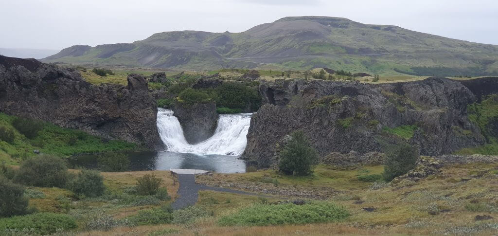
Map of our day around Hekla highlands
The weather forecast was not very favorable once again. So, we had to chase the weather yet another day. We were based in Hella and I had prepared several backup plans and alternative options for each day to stay flexible, as mentioned in our article – how to plan an Icelandic highlands road trip. On day 5 of our trip, however, the forecast showed rain at ALL of the places I had planned 🙂 Welcome to Iceland.
Nevertheless, there were no weather warnings, nor road closures, so we (I) definitely wanted to head out for some new adventures. I finally decided where to go based on the forecast showing probably the least rain in the area near Hekla, south of Landmannaleid (F225). Moreover, this day plan contained a lot of driving and you don’t care that much about rain when driving (unless it’s torrential, which it wasn’t).
Enjoy car rental discounts and tour discounts in Iceland for our readers.
F225 – Landmannaleið
From our accommodation located at the beginning of road 26, it took us only a couple of minutes to reach the junction with F225 road, Landmannaleid. Landmannaleid is an old highlands road that serves as a shortcut from Hella/Hvolsvollur to the Landmannalaugar area.
F225 Landmannaleið in rain
All the blogs and articles recommend taking the northern part of road 208 (previously F208) to reach Landmannalaugar. They claim this route is easier, faster, and safer. None of these is true in my opinion. F225 did undergo many road improvements, and it’s possible it will even be reclassified to 225 (without an “F”). Driving F225 was liking driving on a highway for me 🙂 It’s much more comfortable, more straight, less bumpy, with fewer potholes, and considerably fewer cars compared to 208 (F208) north.

Moreover, landscapes around F225 are 100x more beautiful than those around F208 north, which are pretty boring and there’s pretty much nothing to see. F225 is also much shorter and thus quicker than 208 north. Even Icelandic highland buses use F225 to reach Landmannalaugar – and they know why. The only disadvantage of road F225 is that it contains 2-3 little water streams that need to be crossed, but they were of minor size at the time of our visit (late August) and they never turn to big river crossings. Of course, it’s always best to adhere to all river crossing rules, but these fords shouldn’t be any problem even in a smaller 4×4 SUV like Suzuki Jimney.
F-roads and dirt tracks near Hekla
While F225 is a “highway F-road” in my opinion, this definitely cannot be said about other roads in the Hekla area. All the roads and tracks connecting to F225 are rough highlands roads and you will need a big 4×4 car to pass them safely. We wrote an article about which cars are suitable for F-roads and tracks around Hekla and similar. Hint – aim at least for a Land Cruiser – or better a raised super-jeep-like vehicle. I rented exactly a super-jeep-like vehicle (raised Land Cruiser with snorkel) to be able to pass all these roads safely.
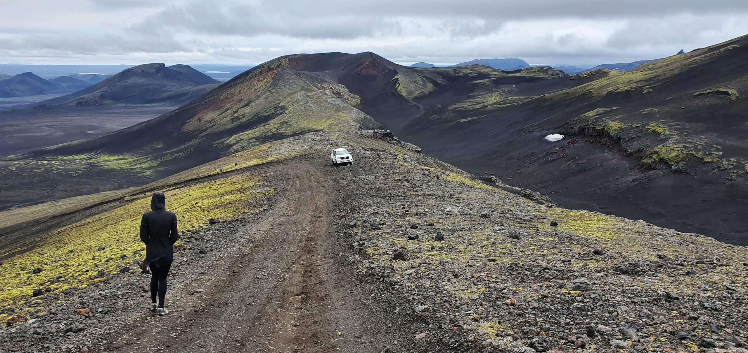
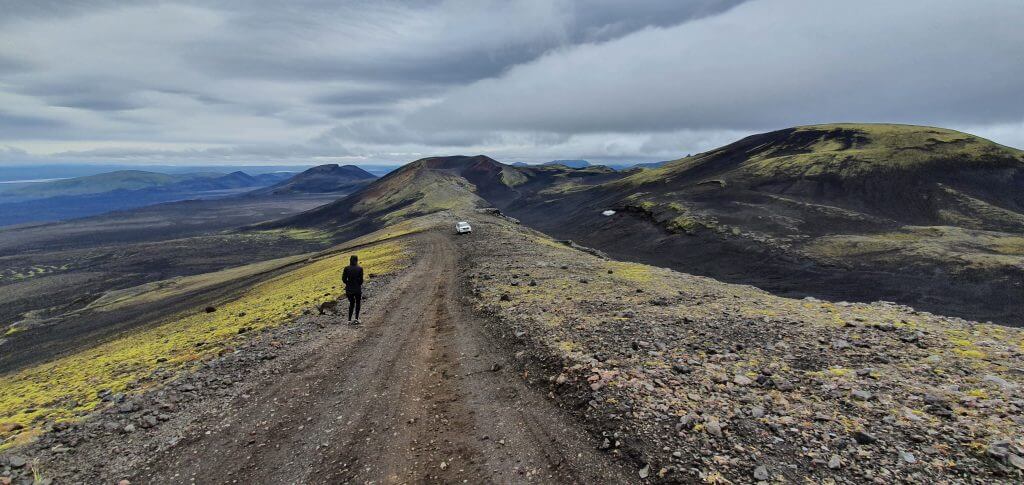
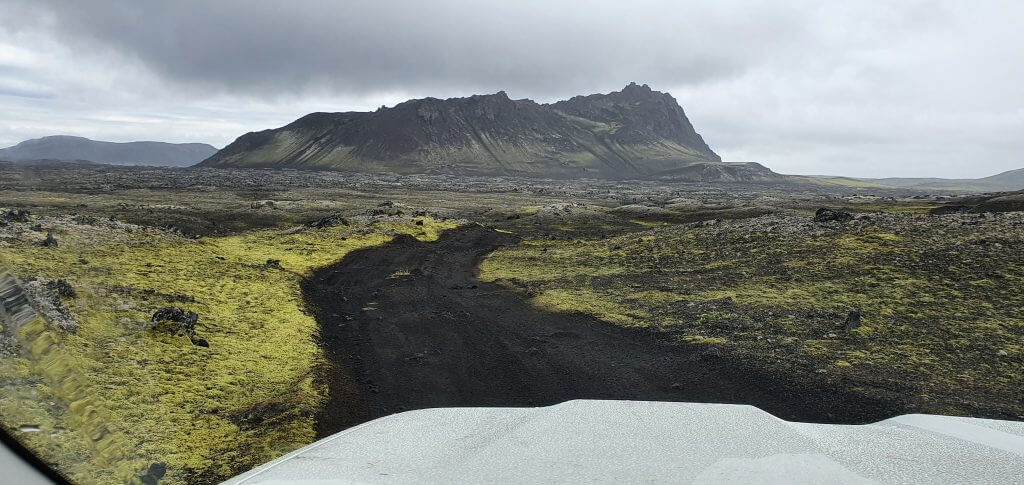
Hekla track (F-road)
Our first stop after turning right to F225 was another turn right towards Hekla. There’s a track that leads around halfway to the top of Hekla. This means some gorgeous views when it’s not foggy. Definitely, a place we wanted to visit 🙂 Some (and Google as well) mark this road incorrectly as “Hekla F-road”. However, this is not an F-road! It’s just a dirt track, which means, the quality is even worse than for an F-road. Always check with your rental company if it allows for such roads, choose your car wisely and study the roads in advance. Mostly only super jeeps are allowed to drive the dirt tracks.
Beginning of the F-road to Hekla
This road is even marked on Google maps (unlike other dirt tracks in the area), so getting in the right direction shouldn’t be a problem. There are no river crossings on the Hekla road. The road consists mostly of ash and mould, is really bumpy, and gets pretty steep soon. The main difficulty with the road is undoubtedly its steepness – and big potholes on steep slopes. You need a 4×4 with big tires and a great grip on these tires to be able to make it all the way to the top through the potholes.
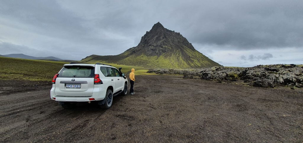
Hekla F-road near the top
That being said, with every additional meter climbed, the views get better and better. We eventually reached the point (the last kilometer or so of the road) where the slope was so steep that it looked really scary. We stopped at that point, parked our car next to the road on the only flat ground, and wanted to climb the rest of the road by walking. However, we could hardly get out of the car, because the wind blew so strongly, it wasn’t even possible to open the doors. After getting out of the car, we felt like we would be blown if we jumped a little, so we decided to get back to the car.
The final ascent of the Hekla F-road track.
I tried to persuade my wife to go to the top in our Land Cruiser – which would definitely make it – but she was too scared. The slope up to Hekla wasn’t only probably the steepest we’d seen at that time, but also very uneven, narrow, and full of potholes and other similar obstacles. Thus, I didn’t push it further and rather turned the vehicle and went back. Bye-bye Hekla, maybe next time.
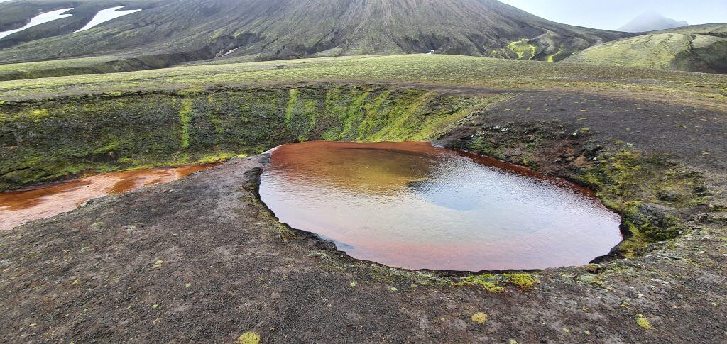
Raudaskal crater
One of the “secret” and “impassable” places where guided tours in the highlands would take you is a Rauðaskál crater. You will not find Raudaskal in many guides or lists of to-visit-places because it’s still not much visited and thus also not touristy at all. Surprisingly, Raudaskal is not hard to access at all. Of course, you need a 4×4 and have a proper map to find it. But there are no river crossings on the way and you can make it to Raudaskal in basically any 4×4.
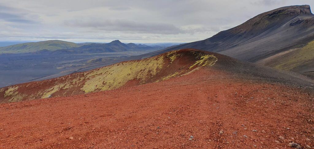
Rauðaskál crater, often marked as a “hidden” spot.
Here is a map of Raudaskal. After a few kilometers of driving the F225 from the west, you simply turn right towards “Hekla F-road” and then, instead of continuing straight/right towards Hekla, you turn left. A few hundred meters from this left turn there’s another left turn and you will quickly find yourself at improvised gravel parking in front of Rauðaskál. There have been issues of illegal offroad driving in the past – drivers drove right on the edge of the Raudaskal crater – which is STRICTLY FORBIDDEN. You need to leave your car at the gravel parking spot and continue by walking. There’s no road at the edge of the crater.
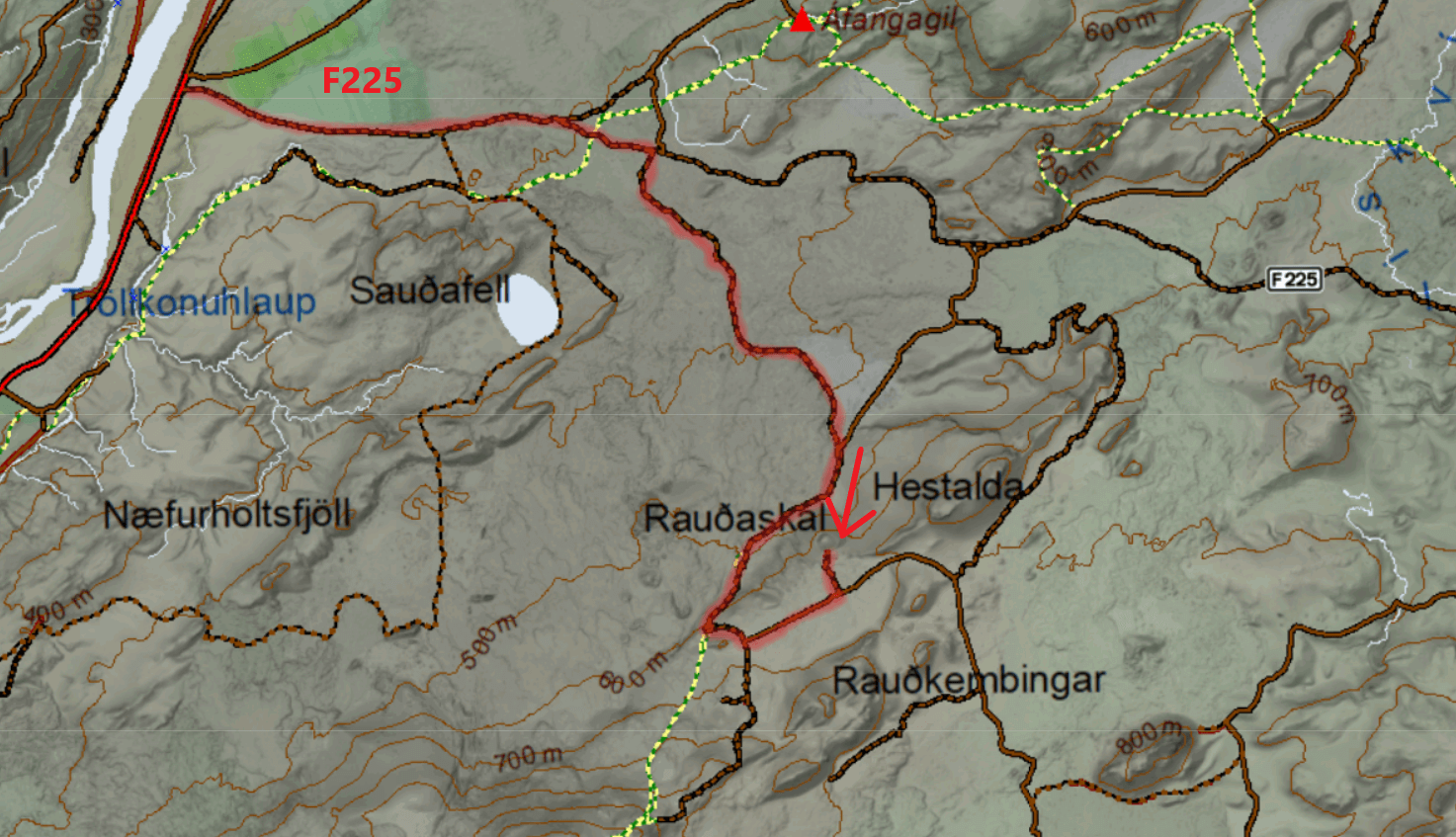
Raudaskal crater map
Raudaskal crater is one of these lunar, out of this world and completely remote places, not yet discovered by hoards of tourists. Its green and red colors and surreal surroundings are both unique and stunning at once. It’s possible to walk a while around Rauðaskál, however, we had a really strong wind during our visit so it didn’t feel safe at all to approach the edge of the crater. Thus, we rather observed the crater from a safe distance – which I recommend everyone to do as well. There are no ropes, nor any safety barriers. This is still a pretty wild place.
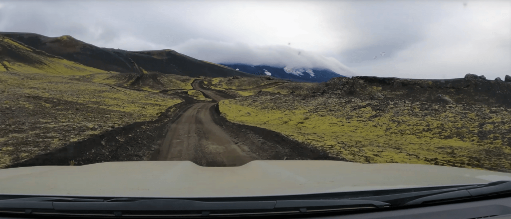
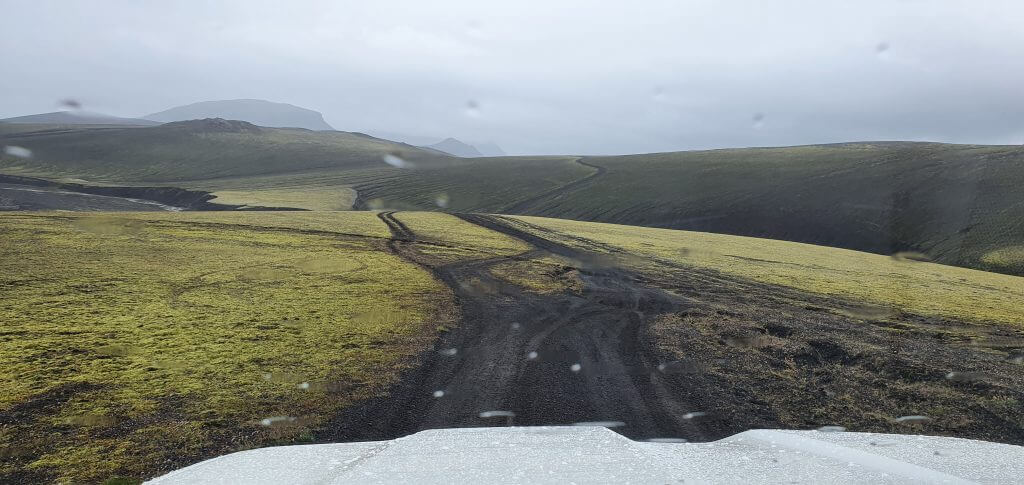
Krakatindur track – Krakatindsleið
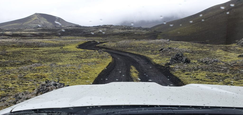
Rainy Krakatindur track
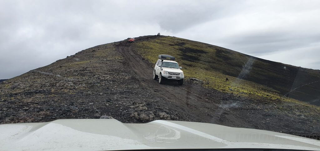
Next on my list of unexplored Icelandic dirt tracks was a track named Krakatindur. Krakatindur is an older volcano/mountain in the middle of the highlands south of F225 and north of Landmannalaugar. There are several dirt tracks in this area and the Krakatindur track is one of the best known out of them. As the name suggests it leads to and around legendary Krakatindur mountain. Once again – this is not an F-road! It’s just a track, which means, the quality is even worse than for an F-road. Please carefully check with your car rental company if you can drive it.
Krakatindur track near Hekla. Watch out for your car’s ground clearance!
Krakatindur track starts right next to road F225 and next to the detour to Raudaskal. It is a narrow track in the huge moss area surrounded by hills, moss and absolute silence. It’s impossible to drive the road fast because it has many holes, little and bigger slopes, twists, turns and all of those even combined together to give you a hard time in some passages. Here is a map of Krakatindur road – Krakatindsleið.
Legendary Krakatindur mountain
Nonetheless, the Krakatindsleid road is picturesque, and more so are its surroundings. For highlands track lovers, this one is a must. We’ve done the track in a raised Land Cruiser (33” Cooper discoverer tires) and the car felt just right for the road. We had seen also one Dacia Duster on this road, but in my opinion, Duster is simply too small for the Krakatindur track and I consider it irresponsible driving in the Duster in here. Come only with a large 4×4!
Crazy Krakatindur F-road track – where to now?
There are no river crossings on the Krakatindur track, but remember, the road is not easy to drive on. Our aim was to finish at the north-east part of the road which is located next to Raudfossar. We firstly passed Krakatindur mountain (roughly in the middle) and then headed to Raudfossar area. At times, there were some pretty big holes at the track, testing the ground clearance of our Land Cruiser pretty well. Eventually, we arrived at Raudfossar gravel car park.
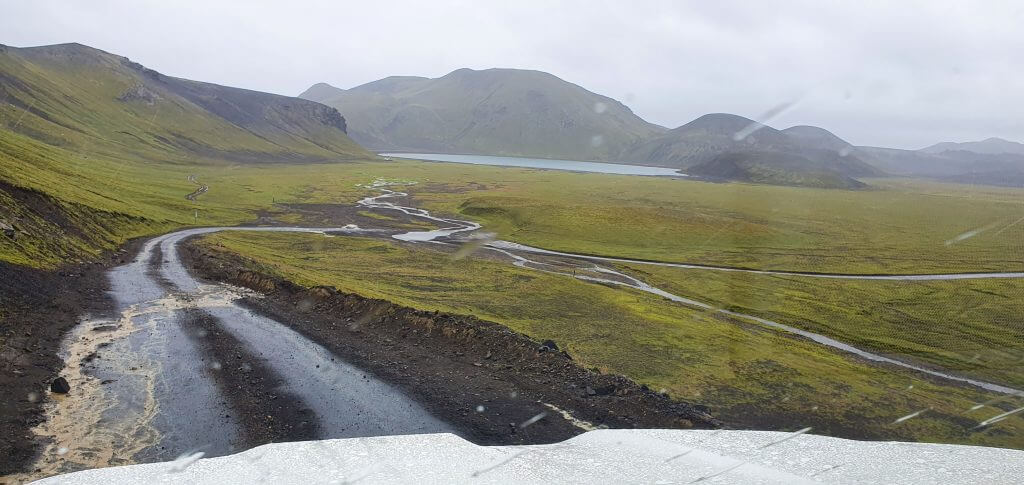
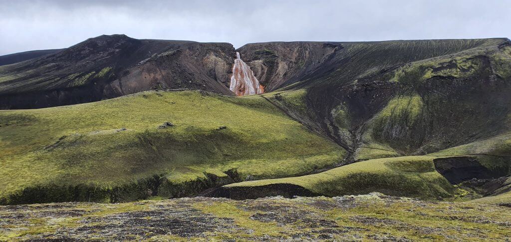
Raudfossar
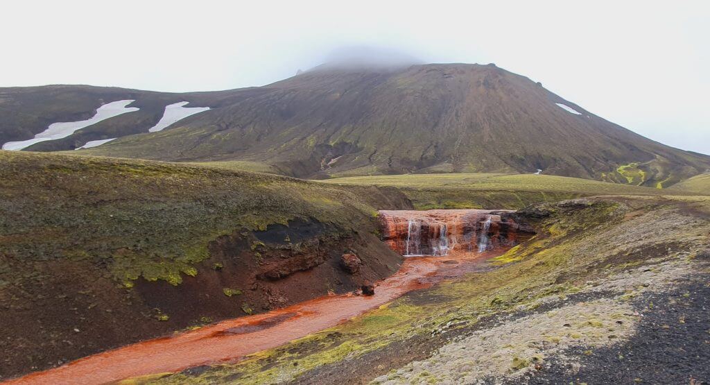
Another of the “hidden gems” we wanted to explore in this part of the Icelandic highlands was the not that much known Raudfossar waterfall. We were surprised to arrive at the little gravel car park to find there 5-6 cars already, which seemed a lot, given the place is still pretty unknown and hard to access. We then realized why this was the case – Krakatindur is not the only way leading to the Raudfossar trail. The turn to Raudfossar is located closely to the main F225 Landmannaleid road, so it’s actually pretty easy to access from F 225. And that’s how all these cars got here.
Raudafoss, a.k.a. Raudfossar, hiking trail
The rain didn’t get any better at this point, rather the opposite – not only wind, but now also more rain. All that in 5°C in the middle of August. Welcome to Iceland once again 🙂 My wife really didn’t feel like going for a hike in this kind of weather, so she stayed in the car. I put on all my wind and waterproof layers and went for the hike towards Raudfossar. This was supposed to take me some 20 minutes one way (still unpleasant with the wind blowing the cold rain into my face). But I didn’t feel cold, nor I was wet, thanks to the layers, so the hike was doable.
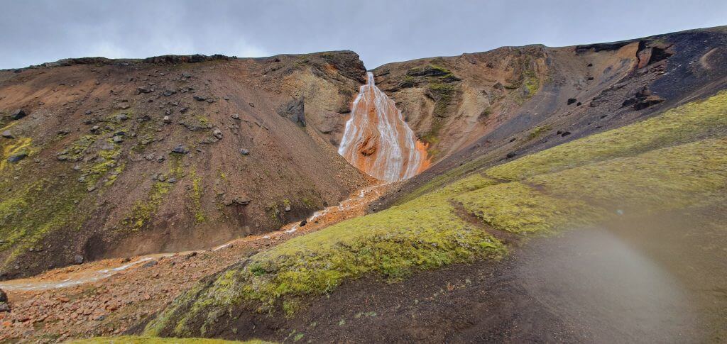
Rauðufossar, Raudfossar or Raudafoss – all the different names for the same picturesque waterfall.
Rauðufossar trail
After 10 minutes of walking on the well-trodden path through the giant moss field, I was already able to spot Raudafoss in the distance. Beautiful sight in beautiful surroundings. It’s roughly 2-3km from the car park and it took me roughly 20-30 minutes to reach Raudfossar. The last part of the trail is slightly steep (a couple in front of me even used hiking poles), but for me it was manageable also without the poles. It was definitely much much easier compared to e.g. parts of the Fimmvorduhals hike.
Amazing views from the hiking trail next to Raudfossar (Raudafoss)
Raudfossar waterfall is very unique with all its orange colors and I definitely do recommend doing this short hike. Even in unpleasant weather the short hike to Raudfossar was doable without problems, when dressed properly. Raudfossar definitely belongs to one of my favorite Icelandic waterfalls.
Raudufossafjoll
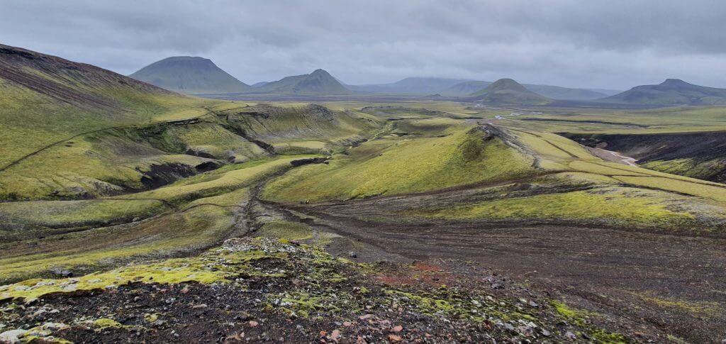
The trail towards Raudfossar doesn’t end at Raudfossar, though. You may continue to pursue the source of all these orange colors and orange-colored water in Raudfossar. That’s what I did. In the beginning, I was just curious what will be the view like if I climb the nearby hill right next to Raudfossar. I climbed the hill right of Raudfossar and the view over the entire moss area was amazing (see picture above). There’s also a big crater hidden in that way, which you will be able to spot only after climbing the hill.
Hiking trail between Rauðufossar and Rauðufossafjöll
The trail then continues along the water streams further ahead. I didn’t have any idea if it was worth going forward or not. I met a British couple and asked them if the trail is worth continuing and they replied “absolutely, it’s amazing”. I was too curious not to continue after these words 🙂 However, I wasn’t sure how long will it take me to reach the end of the trail. I went anyway, with my wife still waiting in the car.
The end of the Raudfossar hiking trail, a stream called Rauðufossafjöll
The trail continued into the new and new valleys, new and new moss fields, over new and new water streams. I don’t know why I had thought it will end in a few minutes, but it didn’t :)) The further I got, the less I wanted to turn back before reaching the end. Eventually I finally reached the end of the trail in around 1 hour, which was much longer than I expected. And I hiked at my full speed, which I don’t consider to be slow.
That being said – it takes around 3 hours from the car park to do the entire Raudfossar – Raudafossafjoll round trip. Or around 1 hour if you want to go for the waterfall only.
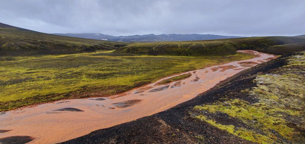
Raudufoss stream source – Raudufossafjoll
There’s an oval orange source of all these orange water streams at the end of the trail. There’s also another cute little orange waterfall. The entire area fits well into the moon-like landscapes of this part of highlands. Was it one of the most beautiful places I’ve seen in Iceland? Probably not. Was it worth hiking the extra 1 hour one-way? Probably yes, the area is very nice.
Blahylur (Hnausapollur) lake
During our last visit, we had found out that probably the most beautiful crater lake near Landmannalaugar was supposed to be Ljotipollur and we were happy to see it and admire it, being entirely alone there. This just confirmed our thoughts that Ljotipollur was a very good option when searching for beautiful, non-touristy places. We had not gone for any other lakes at that time, though. This time I wanted to explore also another, supposedly more touristy, crater lake – Bláhylur also known as Hnausapollur.
If you have time, nice weather and a good camera, you may take a picture like this one from Blahylur. We had none of those 3 so we took a picture below 😀
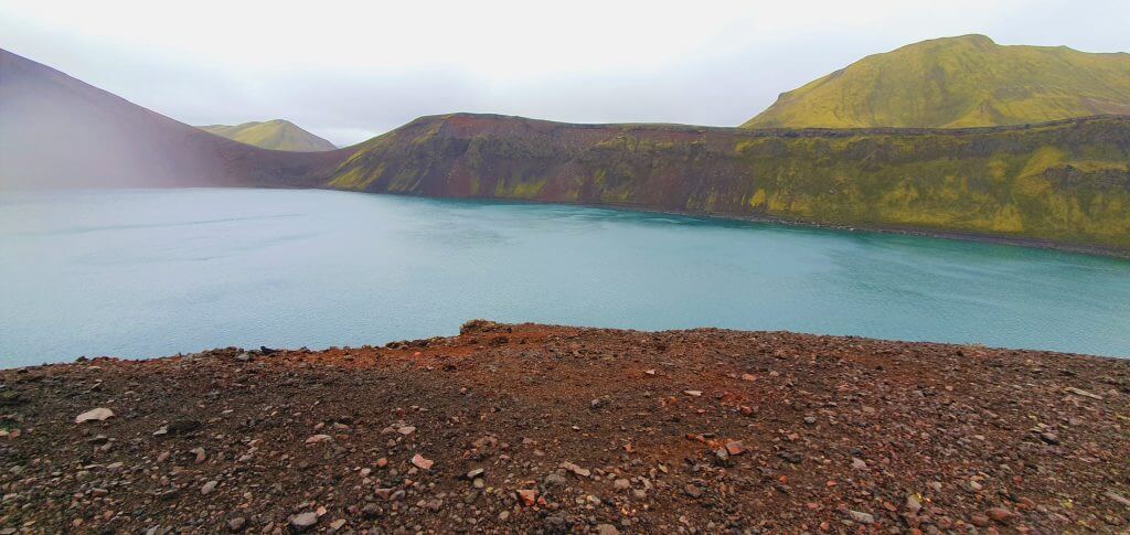
Hnausapollur, a.k.a. Bláhylur int not that good weather
Blahylur (Hnausapollur) is located already on 208 (F208) north. It’s also possible to get very close to Hnausapollur by driving. You don’t need any special 4×4 to visit them, basically, any SUV should be enough, even Suzuki Jimny or Dacia Duster. Blahylur lake is beautiful and pretty much comparable to Ljotipollur, yet a bit different. We didn’t even meet many fellow tourists there (maybe due to rainy weather?). Blahylur lake is also definitely one of the places which are fine to visit in the rain because it is easy to access and does not require extensive walking.
Gjain
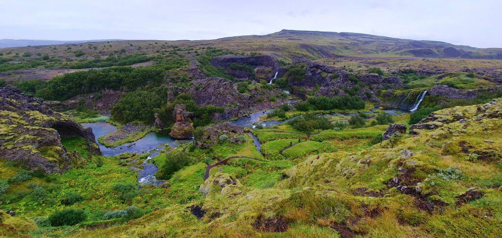
View over the entire Gjain area – hobbit land 🙂
After driving and exploring F-roads and dirt tracks around the Hekla area, the weather still didn’t get any better with rain and fog still in place. Hence, we decided to go and see one of the more touristy spots that was situated nearby (and we hadn’t been there yet) – Gjain. From my own Icelandic research, I had never found Gjain particularly interesting, but several visitors praised it for being beautiful, so we decided to go and to form our own opinion.
Everything is smaller in Gjáin. Especially waterfalls.
There’s an easy gravel road leading towards Gjain, without any river crossings. It’s bumpy, so cars with really low ground clearance may struggle a bit, but definitely doable for everyone. I had thought before, that Gjain is a larger natural area, but it’s actually pretty small. To us, it seemed like a hobbit land. Everything was smaller in Gjain than at other similar Icelandic places. Smaller waterfalls, smaller lakes, smaller rivers, smaller islands, shorter trails. Like a huge miniature of the Icelandic countryside.
One of the waterfalls in Gjáin
Nevertheless, Gjáin is a nice, short, stop when going to/from the Landmannalaugar area and/or Haifoss. If you don’t like it, you may simply leave earlier and it will not cost you a lot of time. Gjain doesn’t belong to one of our favorite places in Iceland, but we still do find it interesting and some other visitors even amazing. It’s also one of the spots which are easy to visit even if it rains.
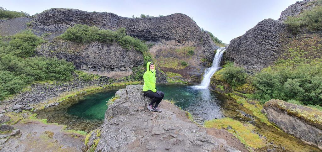
Stong Viking House
The rain still poured persistently, so we went for our last stop, which lied very close to Gjain, and was actually a part of it probably – old Viking house. It’s actually a reconstruction of the real old Viking house with some parts of the base of the building still being original. Interesting, though not my cup of tea 🙂 But, my wife seemed to be thrilled.


Thank you for the great article. We will be staying in Laugarvatn this coming June 12th and 13th. We’d like to visit Landmannalaugar and from what I’ve read, the F roads may or may not be open by those days. Our rental car will be a Toyota Land Crusier GX. Of the two routes you list in this article, (Road 32 to F26 to F208 to Landmannalaugar) or (Road 26 to F225 road, Landmannaleid to Landmannalaugar) do you have an idea as to which one may be more likely to be open that time of the month in June? (I realize it’s very difficult to predict due to weather between now and then) One other idea I had was to drive the south part of F208 up from Ring Road when we are staying in Vik on June 10th and 11th. Any input you can provide is appreciated!
Hi, Toyota Land Cruiser is a good car that should be able to reach Landmannalaugar from any direction (given the roads are open).
The easiest, and usually open the soonest is the northern road 208 (former F208, the one you describe as 32+F26+F208), there are no river crossings. This route is also the least beautiful one.
Then comes F225 in the second place, it has only small river crossings and it’s a beautiful road. Chances are, it will be already open in June, you can definitely make it with your Land Cruiser.
Thirdly, southern route of F208 is probably the most beautiful and also the most difficult – but still doable, with Land Cruiser definitely (3-4 medium river crossings). However, chances are it will still be closed in June.
We wrote more about these roads here:
https://epiciceland.net/list-f-roads-iceland/
and here:
https://epiciceland.net/day-3-journey-to-langisjor-and-landmannalaugar/
https://epiciceland.net/day-4-journey-landmannalaugar-and-back-north/
Thanks! Do you think a 2022 Four wheel drive Toyota Highlander would be able to handle the F-Roads?
The first 2 alternatives (208/F208 from north or F225) yes, if the roads are open on http://www.road.is. For the third one I would not go with Highlander, due to low ground clearance.
This is by far the best I have read on Iceland. Believe me. I have been there 4 times and read a lot! Thank you!!!
Thanks so much Veronica <3
Is there an online map you can recommend that actually shows the tracks as well?
I was not able to find one that includes the Track to Hrafntinnusker for example.
As far as I know only Vefsja and then Our Map contains the most popular dirt tracks in Google Maps format.
Maybe I should mention: I tried https://vefsja.iskort.is you mentioned but it seems to be broken.
I tried it now and it works for me – you just need to tick off that you accept an unsecure connection (it doesn’t have HTTPS just HTTP)
Hi! Hope you are well! Do you think a 4W Toyota Rav4 is doable to drive to the Raudaskal crater gravel parking? And if you know roughly how long will it take to walk from the gravel parking? Thanks in advance.
Hi Sophia, there are two car parks:
-the one above the crater (pictures in this article), is hard to get to and requires at least a Land Cruiser/Hilux, ideally a super jeep
-the one below the crater, where you can hike up the crater, is slightly less hard to get to, but still hard
This is the Map of Raudaskal parking.
If you go later in summer (August, September), you may be able to get to the car park below the crater with Toyota Rav4. But I don’t recommend it, you can get stuck when you don’t drive well. Toyota Rav4 is too small for these dirt tracks and no insurance will cover you in these dirt tracks.
Hello Igor,
Love all your content and have been studying everything! Thank you so much for doing these.
Question: approximately how long would it take to drive from Landmannalaugar via F 255, swing off F 255 on the dirt track leading to Raudfossar hiking area, around Krakatindur track, see Raudaskal Crater, get back on F 255 to get to 26 towards Ring Road? I am planning to do that as a return trip to KEF and am wondering how long this section would take to complete (drive and hikes). Thanks so much.
Hi Bryan, thank you!
You can measure the distance for example here: https://graphhopper.com/maps/, just press a “bicycle” or “hiking” icon, because the maps perceive these dirt tracks just as trails, not roads for cars. Once you measure the distance, I would count something like 15km/h for Krakatindur and something like 40km/h for F225.
Please be sure to take a proper car. Krakatindur is only for super jeeps. Hilux/Land Cruiser is an absolute minimum and even with them, you have to be a very good driver to not damage your car. That’s why we recommend bigger jeeps like Defender or raised Cruiser.
I booked a 4×4 VW campervan from easy campers using your link. Thanks. Will this 4×4 campervan be able to go through to raudaskal crater bottom parking in September. Plan is to go to Kerlingarfjoll from West then from there to Landmannalaugar stopping at all the attractions then next Landmannalaugar to selfoss via raudaskal.
Hi, it depends when are you going. Early in the season like June/early July there may be snow fields and I wouldn’t go there if this is the case. Later in the season you may give it a try.
You can check it out and if you think you may get stuck, you can turn around.
Today we did the Hrafntinnusker track (start 5 mins after you pass the Raudufossar waterfall entry). It’s marked black on the google maps pack but in my opinion more easy to drive than some of the F-roads. Yes you need a big car but we never felt scared or something and the river crossings (2) were small. Half-way the track was closed but we took the right turn to Laufafell. After the river crossing we took the same way back. The trip was beautiful, nice views everywhere and we passed several geothermal spots, I can really recomend it!