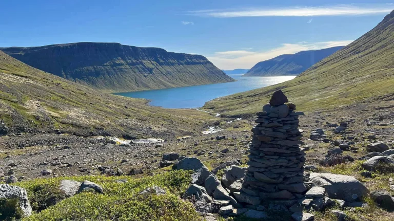
Hornstrandir is one of the last places on earth where you can still safely hike in untouched nature and enjoy full remoteness without the internet, cell phone, and any other fellow tourists.
We decided to write this guide on how to visit the Hornstrandir Nature Reserve because hiking in Hornstrandir is neither easy nor well accessible. To explore this northernmost corner of Iceland, you need to plan everything well in advance and pray for good weather.
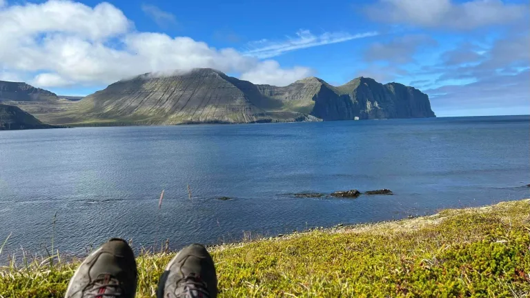
For those willing to put up all the effort to conquer Hornstrandir, the reward is huge, though! This secluded peninsula offers endless hiking opportunities, many picturesque fjords, arctic foxes playing with your tent, and lots of moments to clear your mind and contemplate your life.
In this guide, we compile all the information we have about Hornstrandir from locals, our friends, and visitors who have hiked here recently, as well as numerous hard-to-find Icelandic online sources.
Contents
- Hornstrandir Map
- How to visit Hornstrandir
- When to visit Hornstrandir
- Most Beautiful Spots in Hornstrandir
- Hornstrandir Accommodation
- Campsites in Hornstrandir
- Meals in Hornstrandir
- What to Pack for Hornstrandir
- Hiking Tips from a Local
- Hornstrandir Hiking Trails
- Veiðileysufjörður – Hornvík
- Hornvík – Horn – Hornvík loop
- Hornvík – Hlöðuvík
- Hlöðuvík – Fljótsvatn
- Fljótsvatn – Látrar
- Fljótavík – Látrar
- Látrar – Hesteyri
- Hesteyri – Sæból
- Hesteyri – Hlöðuvík
- Horn – Hornbjargsvíti
- Hornvík – Hornbjargsvíti
- Hornsá – Hornbjargsvíti – Bjarnanes – Smiðjuvík
- Smidjuvík – Furufjörður
- Furufjörður – Hrafnfjörður south
- Secondary Hiking Trails
- FAQ
- Hornstrandir hiking rules
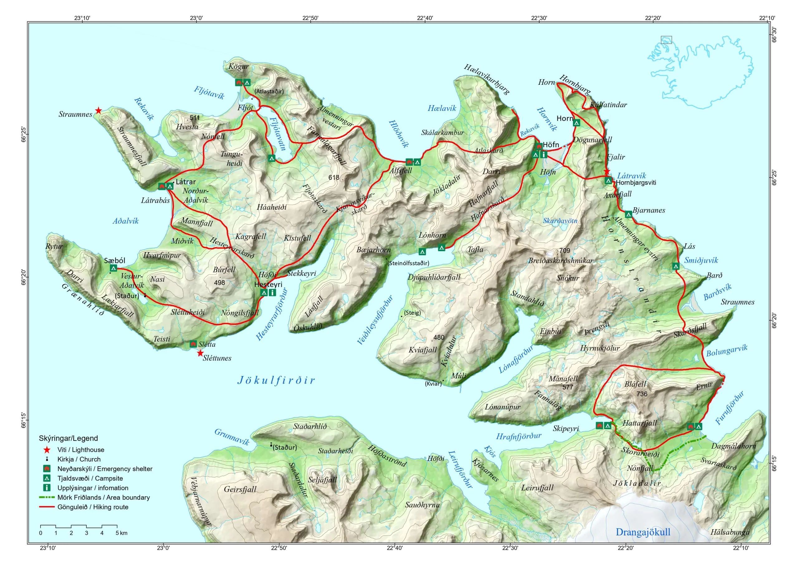
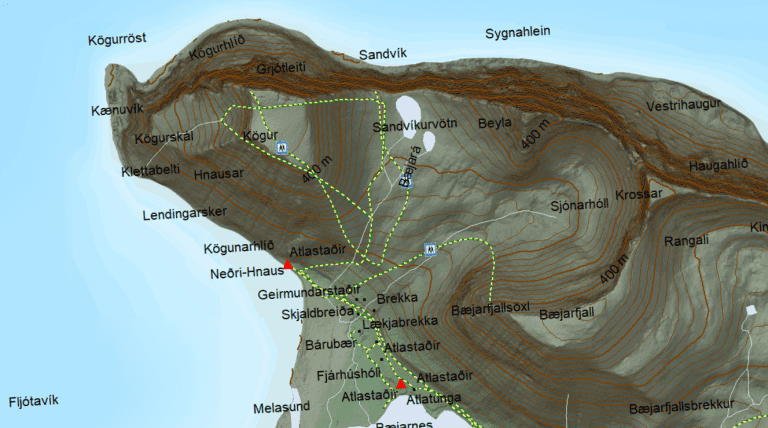
Hornstrandir Map
Our interactive Hornstrandir map displays all the campsites in Hornstrandir, ferry stops, 26 hiking trails, accommodations, all emergency shelters, and many interesting places to see:
Beware!!! Use only main hiking trails if you don’t have enough previous experience with Hornstrandir! The secondary trails may be very dangerous. Several visitors have almost died there. They should be taken only with a local guide or if you are highly experienced in the area!
How to visit Hornstrandir
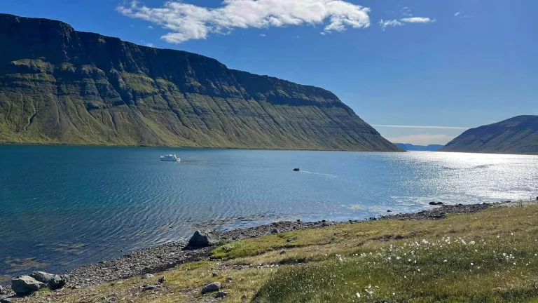
The only way to reach Hornstrandir is by using a ferry from Ísafjörður or Bolungarvik or by hiking for multiple days from the mainland in Westfjords. There are no roads in Hornstrandir. Once there, your only way of transportation is hiking.
It’s important to say that visiting Hornstrandir is not easy. If you are looking for a laid-back trip without much effort, stay away from this part of Iceland. Just getting to Hornstrandir requires careful planning, and if you want to hike it, you have to prepare even more thoroughly.

Hornstrandir is also no place for those with a fear of heights or mobility issues. This is a hiking-only region and the hiking is not the easiest, although not the most hardcore one as well.
Ferry
There are currently three ferry companies running boat transfers to Hornstrandir from Westfjords:
- Sjóferðir – departs from Ísafjörður
- Borea Adventures – departs from Ísafjörður
- Hornstrandir Tours – departs from Bolungarvík
They typically operate the boats from early June until early September. See all the current Hornstrandir ferry schedules here:
- Sjoferdir 2026 Hornstrandir ferry schedule
- Borea Adventures 2026 Hornstrandir ferry schedule, 10% discount code: in our newsletter
- Hornstrandir Tours 2026 Hornstrandir ferry schedule
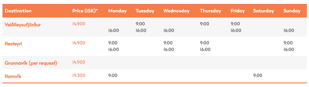
Hornstrandir ferry schedule for 2026 – a boat run by Borea Adventures, 10% coupon code: in our newsletter
Borea Adventures ferry stops at six different stops – Aðalvík, Grunnavík, Hesteyri, Hornvik, and Veidileysufjörður.
The ferry by Sjóferðir also stops at Fljótavík and Hrafnfjörður upon request.
The Hornstrandir Tours ferry leaving from Bolungarvík stops at all stops above and also at Slétta, Hlöðuvík, Lónafjörður, and Flæðareyri.
You have to book the ferry in advance. The boat may be either full or may not depart at all if there are not enough passengers.
Guided tours
Multi-day Hornstrandir guided tour by Borea Adventures
The easiest and safest way to visit Hornstrandir is to attend a guided tour. All the planning is handled by a guide. The main downside of a guided tour is that you will not see as much as you possibly can when hiking alone. Additionally, you won’t be alone, which means a part of Hornstrandir’s magic will be gone.
There are two main tour companies operating guided trips to Hornstradir – Borea Adventures and West Tours. Both companies are running their tours from Ísafjörður in Westfjords. Apart from tours, Borea also runs a ferry, as mentioned above.
10% discount code on all Hornstrandir Tours and Ferries by Borea Adventures: in our newsletter
Both tour providers offer day hikes as well as multi-day treks across Hornstrandir, all with experienced local guides.
All tours have to be booked in advance and can be canceled due to unfavorable weather with a refund or a new proposed date.
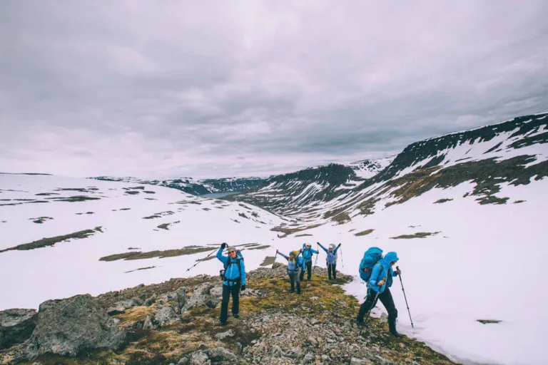
When to visit Hornstrandir
When to visit Hornstrandir? Only in summer. Even then, snowfields can be present. Photo by Rob Oo, CC BY 2.0
In short, you can visit Hornstrandir only in summer and only when the weather is favorable. This means no strong wind, no heavy rain, and definitely no weather alerts.
Planning is crucial when it comes to visiting Hornstrandir. The same applies to weather. I know it’s hard, but it’s essential to plan your trip to happen over a nice weather period. Otherwise, it may just turn into suffering rather than joy.
Discount codes on Icelandic Guided tours and Car rentals.
Season
You can visit Hornstrandir from early June until early September when the ferries are running. The main season also coincides with the time when Hornstrandir is partially or mostly snow-free. This is also when the weather is the mildest, with the lowest number of storms and weather alerts.
Hiking trails in Hornstrandir are typically best accessible between mid-July and the end of August when there’s only a little snow and temperatures reach their peaks.
Weather
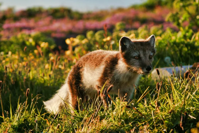
Hornstrandir has by far the highest chances of spotting arctic foxes in Iceland!
Weather in Hornstrandir can be your biggest friend and also the biggest enemy. Simply said, it’s extreme. On a bad day, wind can reach hurricane-force strength and on a nice day, you can even sunbathe easily. That’s Hornstrandir, be ready for it!
In an ideal case, you should wait for a week or two of a stable and mild weather forecast. This is a good time to visit Hornstrandir. In reality, however, this is easier said than done. How are you supposed to know what the weather will be like at the time of your visit? Well, you can’t know. This basically leaves you with two options:
- Plan for fixed dates. In this case, be ready to cancel everything when the weather gets really bad. Or be ready to experience fog, rain, and wind throughout your entire trip. This can easily happen.
- Be flexible. Very flexible. Be ready to reschedule, postpone, shorten your trip, or whatever is needed to avoid harsh weather and maximize the time spent under favorable weather.
Always check the weather only on the official Icelandic meteorological office website. This is the most precise forecast. The longer it forecasts, the less precise it is, but it’s still the best one available.
25 hidden gems in Iceland nobody writes about.
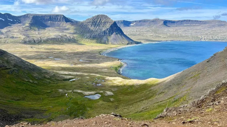
Most Beautiful Spots in Hornstrandir
Below is the list of seven spots many consider to be the most beautiful places in Hornstrandir.
1. Skálarkambur pass views
Skálarkambur pass offers one-of-its-kind views over Hloðuvík fjord. Picture by Reinhold Seiz.
Skálarkambur Pass is one of the most beautiful places in Hornstrandir, offering breathtaking views of Hloðuvík fjord. You will reach it on the hiking trail between Hornvík and Hlöðuvík.
2. Hafnarskarð pass views
Views from the top of Hafnarskarð mountain pass are one of Hornstrandir’s highlights. Picture by Reinhold Seiz.
Hafnarskarð pass is another spot where you will be rewarded with picturesque views of the gorgeous fjords of Hornstrandir. Hafnarskarð overlooks both the Hornvík fjord and Veiðileysufjörður fjord. You will find this viewpoint on the Veiðileysufjörður-Hornvík hiking trail.
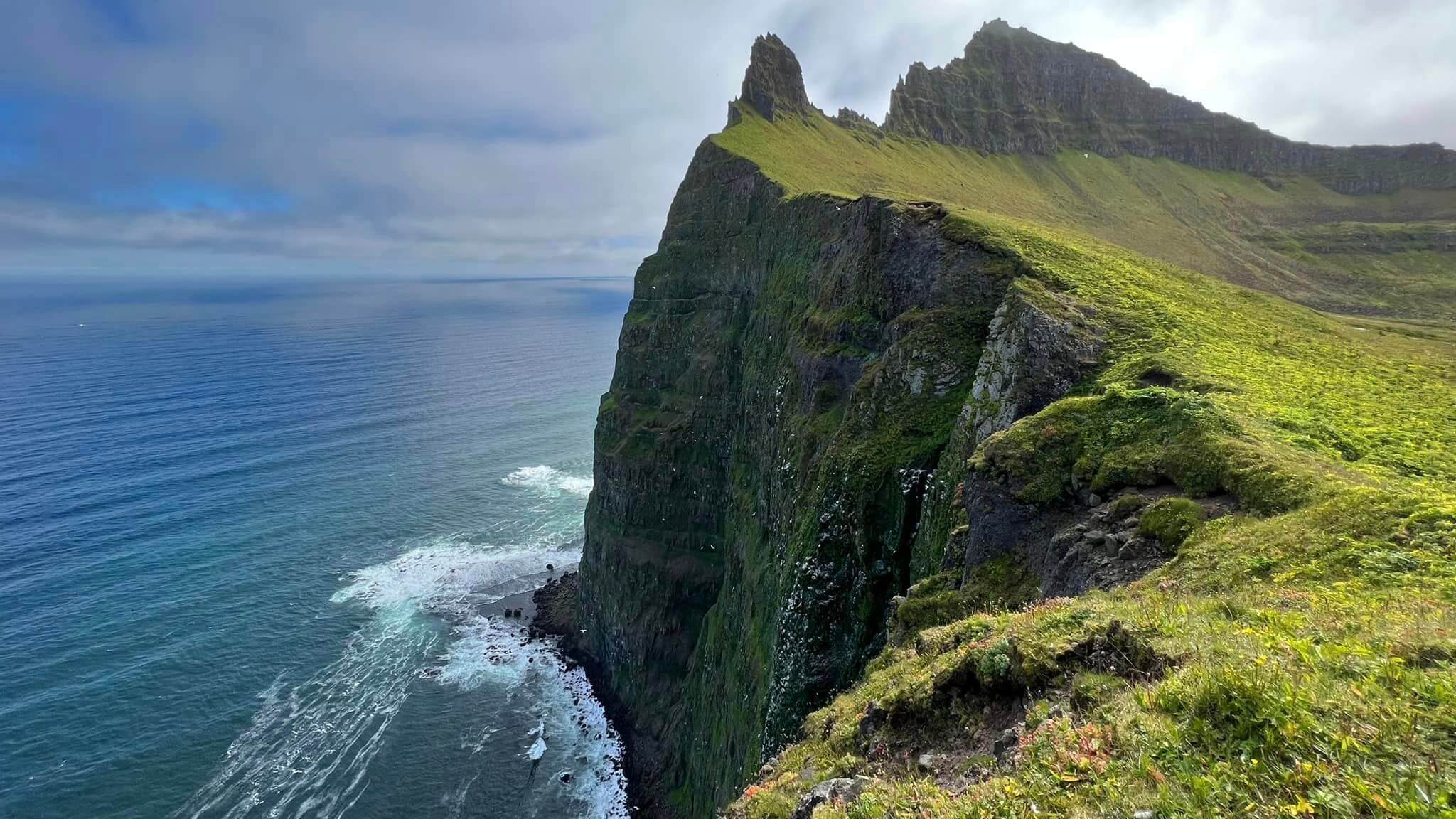
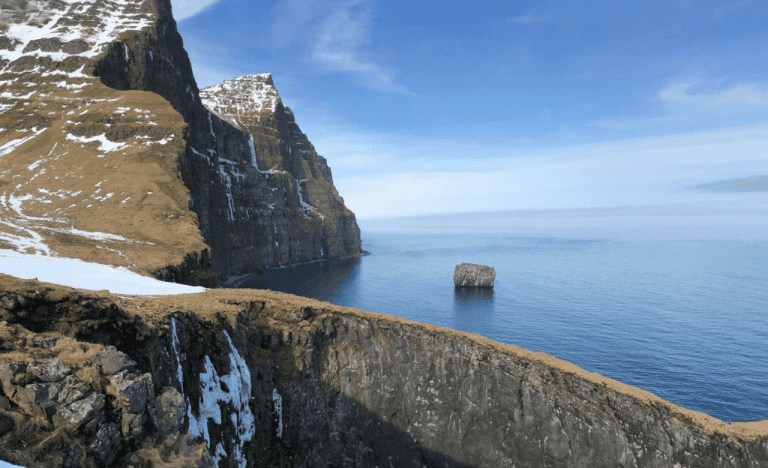
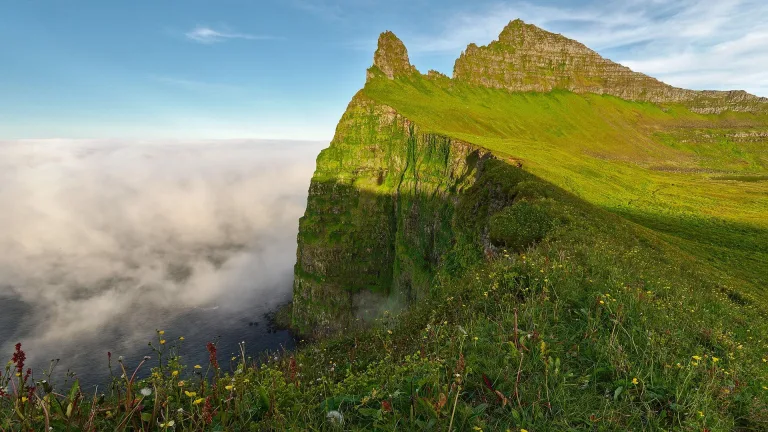
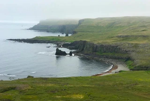
3. Hornbjarg cliffs
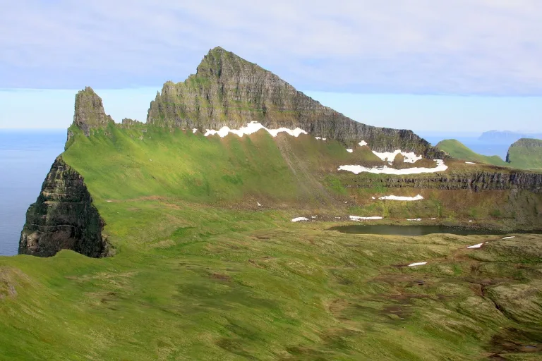
Hornbjarg Horn cliffs are by many considered the most beautiful spot in Hornstrandir. Photo by Evgeniy Metyolkin, CC BY-SA 3.0
The cliffs of Horn and Hornbjarg are undoubtedly the most iconic place in Hornstrandir. The sharp and steep cliffs full of birds entice thousands of photographers a year.
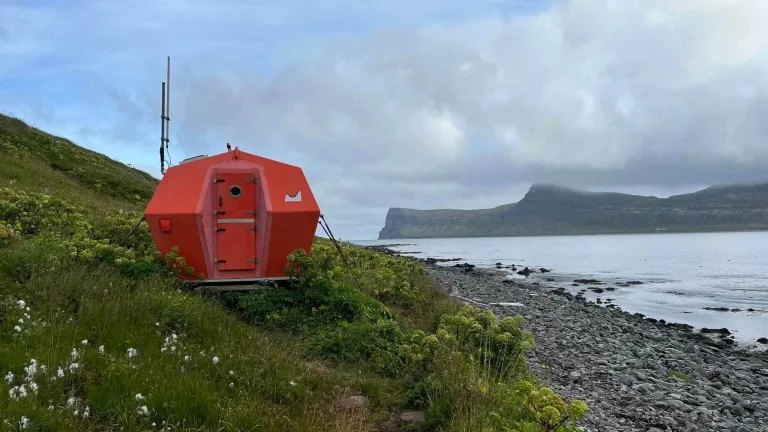
4. Hornbjargsvíti lighthouse
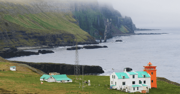
The scenery around Hornbjargsvíti Lighthouse is one of the most beautiful places in Hornstrandir
The views from above the Hornbjargsvíti lighthouse are simply incredible on a nice day. The vibrant colors of the lighthouse create a unique photography contrast against the backdrop of a green, rocky coast.
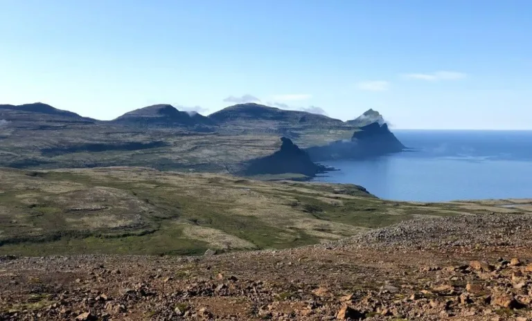
5. Kirfi cliffs
Hælavíkurbjarg bird cliffs at Kirfi in Hvannadalur are one of the most scenic spots of Hornstrandir, still unconquered by crowds. Picture by Náttúrustofa Norðausturlands.
Hælavíkurbjarg cliffs in Hvannadalur, sometimes also called Kirfi cliffs, are one of Hornstrandir’s hidden gems. You can reach them the easiest on a hike to Kirfi from Rekavík. It’s not a hike for the faint of heart, though.
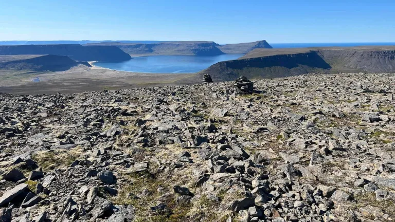
6. Fljótsvatn lake
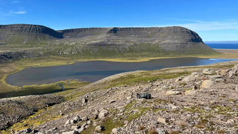
One of the top views you can experience in Hornstrandir is a view over Lake’s Fljótsvatn floodplain. Picture by Reinhold Seiz.
Fljótsvatn Lake is the biggest and most beautiful lake in Hornstrandir. You will find the best views over Fljótsvatn on a hike between Hlöðuvík and Fljótavík or on the Fljótavík-Látrar hiking trail.
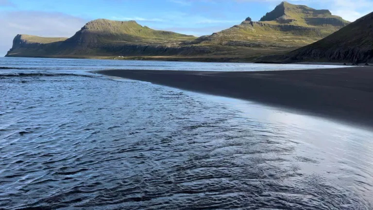
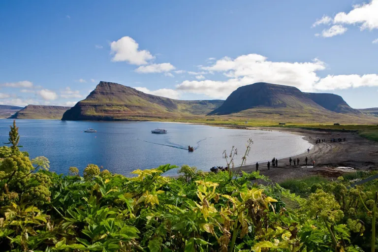
7. Aðalvík fjord
Bird’s eye view over Aðalvík fjord on one of the nearby hikes is one of Hornstrandir’s highlights. Picture by Reinhold Seiz.
You can experience wonderful views over Aðalvík fjord on either the Fljótavík-Látrar hiking trail or on the hike between Látrar and Hesteyri.
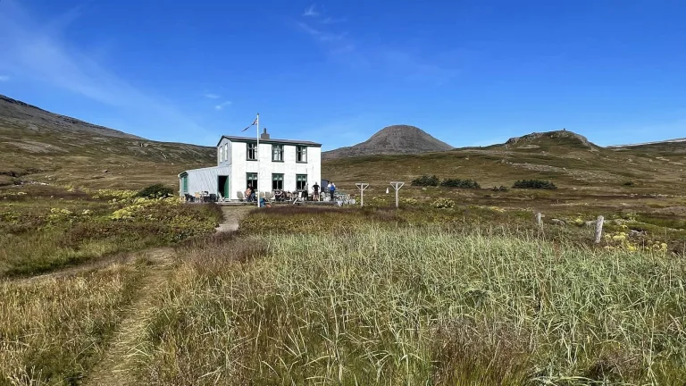
Hornstrandir Accommodation
The only available accommodation in Hornstrandir is 14 campsites and three very simple guest houses with sleeping bag accommodation. Expect all three guesthouses to be fully booked in advance for the majority of summer:
- Læknishúsið (“Doctor’s House”) – book Læknishúsið accommodation here
- Hornbjargsvíti lighthouse – book Hornbjargsvíti lighthouse accommodation here
- Kvíar Lodge – book tours and accommodation in Kvíar Lodge here
Best Places in the Highlands of Iceland.
Remember, Hornstrandir is NOT a typical touristy destination. There is no comfortable lodging, and there are no normal services you are used to in a developed world. There’s wilderness and that’s it.
“No problem, I’m used to camping!” Well, are you? Have you camped in Hornstrandir? A friend of mine lost her top-class, well-pitched tent in Hornstrandir in August due to massive hurricane-force winds. She was lucky to be accommodated by one of the three guesthouses at the time. Is it always like this? No, it is not. But it can be. And you need to be ready for that!
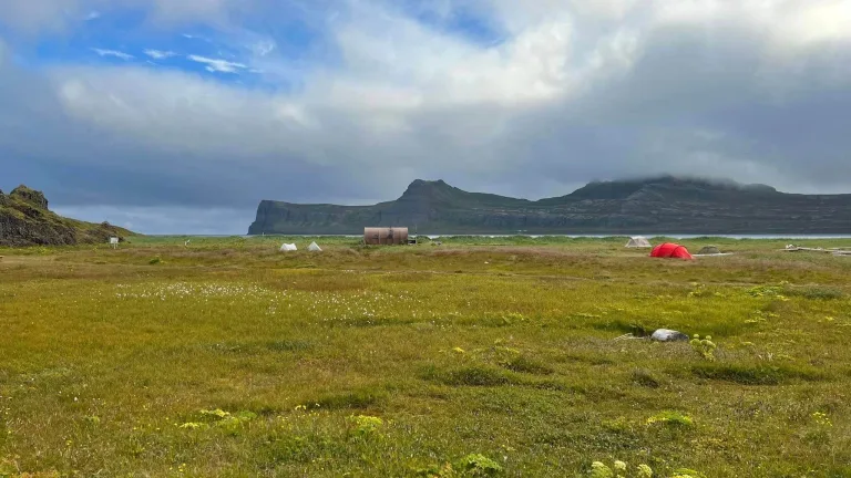
Hornvík campsite, the biggest camping in Hornstrandir. Picture by Reinhold Seiz.
A note of caution! You may encounter a house from time to time. All houses in Hornstrandir are private properties! Don’t invade the privacy of the owners. These may be their holiday houses or a family heritage.
Campsites in Hornstrandir
There are 14 different campsites in Hornstrandir. Six of them also offer an emergency shelter. Here is the list of all Hornstrandir campsites:
- Hornvík Höfn campsite (+emergency shelter)
- Hesteyri campsite
- Hornbjargsvíti campsite
- Látrar campsite (+emergency shelter)
- Sæból campsite
- Atlastaðir Fljotavik campsite (+emergency shelter)
- Smiðjuvík campsite
- Bjarnanes campsite
- Hrafnfjörður campsite (+emergency shelter)
- Glúmsstaðir Fljótavatn campsite
- Veiðileysufjörður campsite
- Við Hlöðuvíkurós campsite (+emergency shelter)
- Horn or Hornsá campsite
- Lónhorn campsite
- Furufjörður campsite (+emergency shelter)
Emergency shelter in Hornvík campsite. Picture by Reinhold Seiz.
Most campsites are equipped with running water and dry toilets. Travelers must camp at campsites if there is one on the ground or in its immediate vicinity.
The biggest campsite is in Hornvík in Höfn. It’s large and well set up. There is a ranger’s cabin, flush toilets, running water, and sinks in the Hornvík campsite.
Meals in Hornstrandir
There are no supermarkets or restaurants in Hornstrandir. You have to bring all the food by yourself or arrange for a food delivery. The basic food delivery can be ordered with any of the ferry companies, just discuss it with them in advance.
In summer, the three guesthouses typically offer snacks, hot beverages, canned drinks, and even soups or hot meals. This heavily depends on availability and their inventory at the time, though, so don’t rely on it!
It’s best you bring a calorie-heavy, lightweight food to Hornstrandir. The longer you stay, the calorie-heavier and more lightweight it should be. Nuts, biscuits, chocolate, and dried meat are some examples of such meals.
Steep drops on unstable terrain are one of the main Hornstrandir hiking challenges, especially with a heavy backpack. Picture by Reinhold Seiz.
What to Pack for Hornstrandir
The equipment you need to hike in Hornstrandir highly depends on how many days you plan to spend here. Is it just a day trip? Or do you intend to do a 2-week-long expedition? This makes a night and a day difference.
Remember you have to buy everything in mainland Iceland or/and in Isafjordur. There are no shops in Hornstrandir! You may be able to buy some essentials in Læknishúsið in Hesteyri or in Hornvík or Hornbjargsvíti, but don’t rely on that. It’s subject to availability.
Multi-Day Hiking Expedition
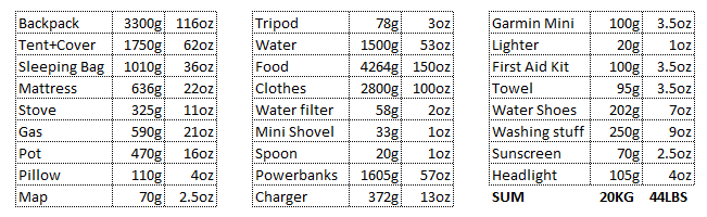
Recommended Hornstrandir hiking gear:
- Backpack, fully waterproof, with a rain cover
- Hiking poles
- Map, GPS, compass, and a satellite device or Garmin InReach in case of emergency
- Sleeping bag, high-quality, light, warm
- Tent, high-quality, light, water and windproof
- Mattress, light, small, inflatable
- Cooking equipment, stove, gas, pot, matches, dish, cup
- Thermos, water bottle, pocket knife
- Sun protection
- Painkillers and emergency medication
- Band-aid and elastic bandages
- Food, light, dry, long-lasting, and high calories, e.g. biscuits, chocolate, dried meat, fruits
- Hot drinks, tea, coffee, cocoa
- Reserve batteries and/or power banks
- Towel, shampoo, toilet paper
- Headlight, lighter
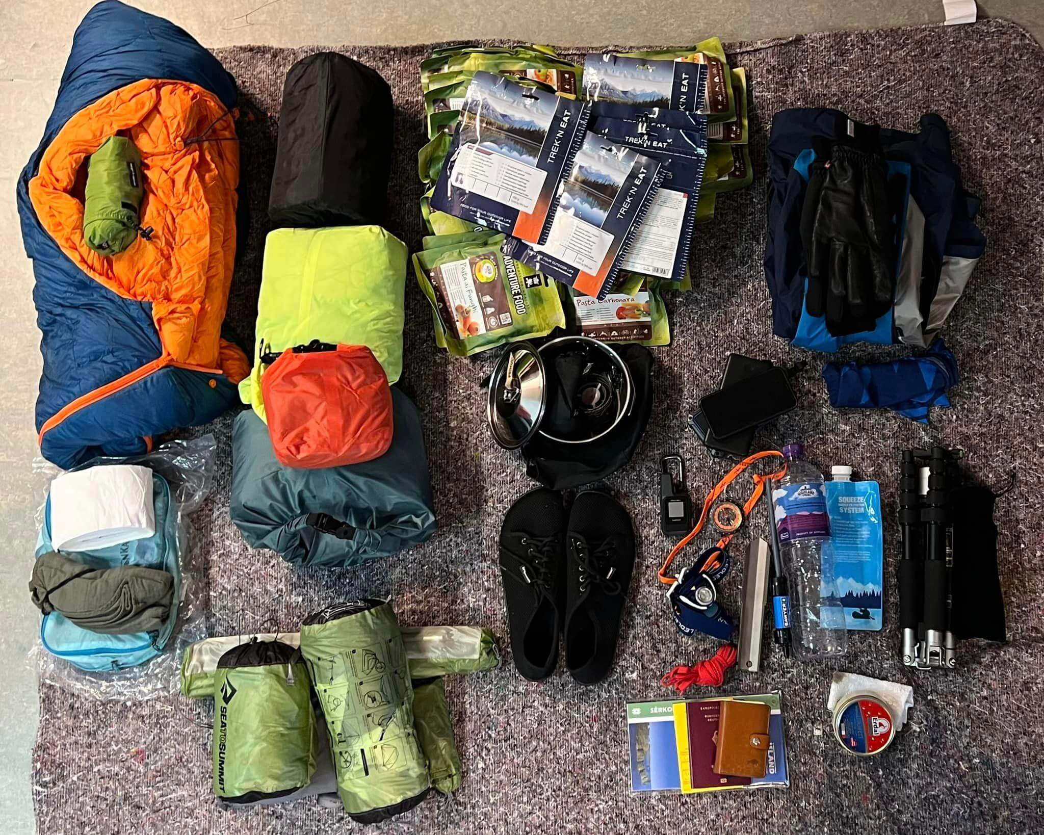
What to pack for Hornstrandir multi-day trek (click to enlarge). Picture by Reinhold Seiz.
Recommended clothes:
- Hiking shoes, waterproof and sturdy
- Wading shoes, to ford rivers, or neoprene socks
- Jacket, waterproof
- Sweater, wool, or thermal
- Trousers, thermal
- Trousers, waterproof
- Gloves
- Hat, windproof
- Wool is the material you want to wear as much as possible to stay dry and warm
Pay special attention to your hiking shoes and the water and wind durability of your clothes. Gore Tex is highly recommended if you are looking for clothes that are really waterproof.
Hornstrandir is wet in many places, rocky, and hiking through wet grass makes most of the shoes leak. Bring shoes that have high ankle support, that are new, and wax leather shoes with fat before your trip. Don’t wear trail shoes.
Here’s an example 2-week trek Hornstrandir packing list, including item weights. Thanks to Reinhold Seiz for providing this:
Day Trip
If you are visiting Hornstrandir as a day trip only, you can skip the following items from the list above:
- Sleeping bag, Tent, Mattress, Cooking equipment, Knife, Medication, Hot drinks, Batteries, Towel, Headlight
If you are visiting Hornstrandir as a part of the guided tour, apart from the items above, you can also skip:
- Map, GPS, compass, satellite device (a guide has these)
- A guide will also inform you about your planned route and clothes requirements as well as any other requirements. Chances are, you won’t be fording rivers, and if yes, you will be informed about it
Hiking Tips from a Local
Official Hornstrandir hiking map (click to enlarge). Only the main hiking trails are displayed here. Source: www.ust.is
- Always check the Icelandic Safe Travel website and the local weather forecast before going.
- Submit your travel plan here before visiting and also provide it to all ferry companies you will be using.
- Consult your plan with an information center in Hornvik or Hesteyri, with a ranger if he/she is present at your point of arrival, and possibly also with a ferry company.
- Practice at home! Practice a multi-day hike in rain, wind, with a heavy backpack (20kg / 44lbs), wet shoes, etc. Practice pitching a tent in these conditions.
- Trails can often get swampy and boggy. Get ready for that with your gear.
- Sometimes, especially over the mountain passes, you can get a limited cell and internet signal. Use it to get the most recent weather info.
- Print the most recent weather forecast at Isafjordur and update it with a pen/pencil every time you receive any internet signal when hiking, and take screenshots of the forecast.
- If there’s a visible path, your best chances are to follow it. If there’s no visible path, use cairns, GPS, compass, and maps.
- Check tidal times here. Or tide times here. You may need to cross tricky parts through beaches.
- Let the boat company you booked a ferry with know of any changes to your plans! The best is to send them an SMS because it may get through even if you think you don’t have any cell coverage.
- The ferry will not be waiting for you. Better wait for a ferry yourself with enough time in advance.
- Take only the main hiking trails displayed above if you don’t have enough previous experience with Hornstrandir! Some of the secondary hiking trails displayed below may be deadly dangerous!
Hornstrandir Hiking Trails
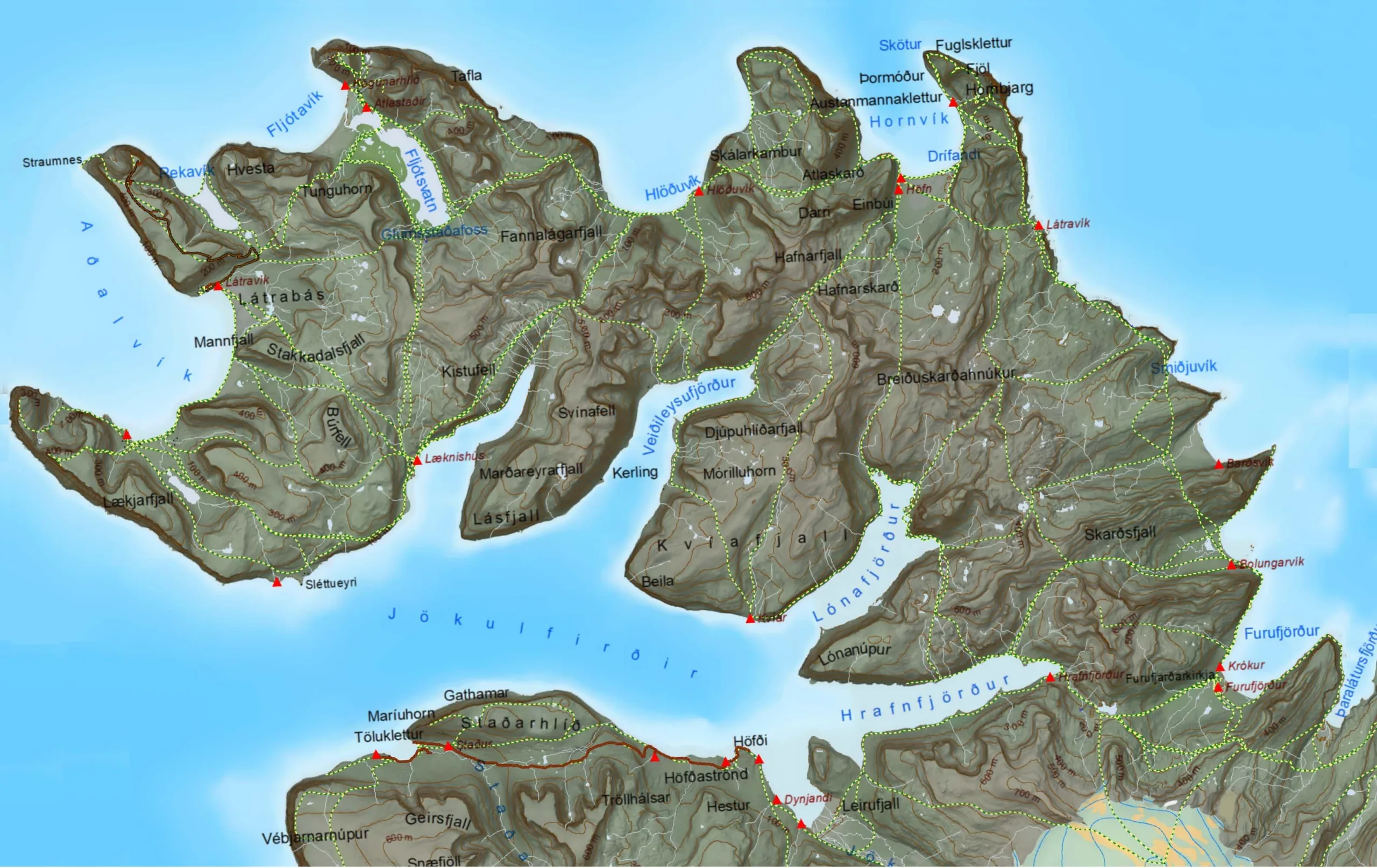
Map of all Hornstrandir hiking trails (click to enlarge). Beware, some may not be passable or only very hard! Source: https://vefsja.iskort.is/
We describe below the fourteen main Hornstrandir hiking trails and twelve secondary trails. The secondary trails are usually less visited, often unmarked and can be very difficult, not always, though.
Bear in mind that the map of each trail may not be exactly precise, and the correct and easiest hiking trail may vary year by year and day by day. Especially the river and water crossing spots change based on the tide and conditions at the time.
The hiking trails in Hornstrandir range from almost invisible and unmarked to partially visible with sticks in the ground or boot prints to very clear when marked with stone cairns.
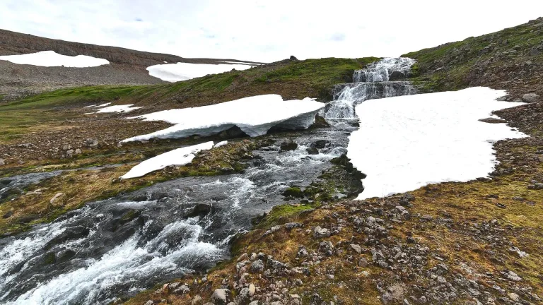
There can often be snowfields on trails, especially early in the season. If you are unsure of where to go, your best guess is to follow the shoe steps made by others.
Veiðileysufjörður – Hornvík
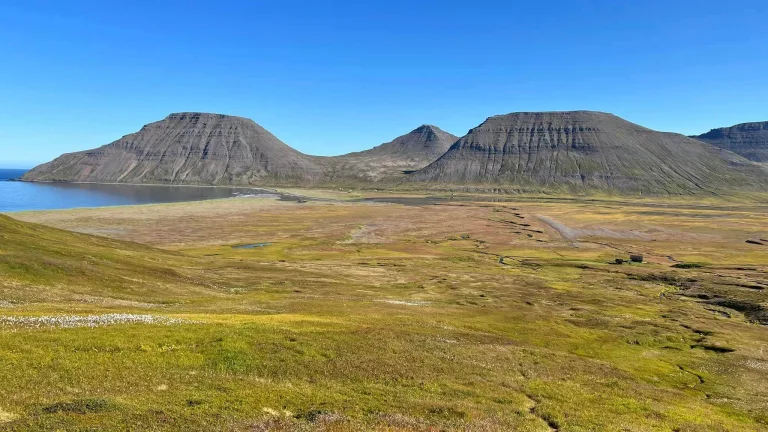
Length: 11km (7mi)
Time: 4-5 hours
Elevation hiked: 550m (1600 ft)
Difficulty: moderate
Hiking Trail: https://www.wikiloc.com/hiking-trails/hornvik-hafnarskard-veidileysufjordur-5199072
View over Veiðileysufjörður on a hiking trail to Hornvík in Hornstrandir. Picture by Reinhold Seiz.
The hiking trail from Veiðileysufjörður to Hornvík via Hafnarskarð pass is the trail multi-day hikers often choose as their starting route. It’s a good warm-up trek, not too long, not too short, giving you a glimpse of what you can expect in Hornstrandir.
The highlight of the trails is definitely the spectacular view from the top of Hafnarskarð pass into both Veiðileysufjörður in the back and Hornvik in the front.
The trail near Veiðileysufjörður is often very swampy and wet, but it becomes drier the higher you go up. The route is clear and easy to follow, thanks to the big cairns that mark the way.
The most difficult spot of the trail is the Hafnarskarð pass. It’s steep and may be covered with snow all year round. Be prepared for steep snow slopes in this area, the bigger the earlier in the season you come.
There are typically no big rivers to cross, just small streams, and you shouldn’t even take your shoes off under standard, not-too-wet conditions.
Hornvík – Horn – Hornvík loop
Length: 16km (10mi)
Time: 6-7 hours
Elevation hiked: 600m (2500 ft)
Difficulty: moderate
Hiking Trail: https://www.wikiloc.com/hiking-trails/hornvik-midfell-hornbjarg-140087904
Hornvík – Horn hiking trail in Hornstrandir, photo by Rob Oo, CC BY 2.0
The hiking trail from Hornvík in Höfn, leading to the famous Horn and Hornbjarg cliffs, is by far the single most popular trail in Hornstrandir. What makes it so much sought-after is that the cliffs are strikingly beautiful, and the path is relatively safe to visit. Secondly, the biggest campsite in Hornstrandir, Hornvík in Höfn, is close by.
Roughly one mile east of Hornvik, you have to cross the Hafnarós river. The river is, on average, knee-deep, and the official river crossing spot is higher up the river, marked by two yellow markers. However, sometimes it makes sense to search for even shallower spots.
You can often find the shallowest spot near the shore, where the river meets the sea, especially during low tide. If you want to minimize the part of your body underwater, take note of tidal times beforehand. Beware, though, here the riverbed may be more sandy.
A river crossing at sea level during low tide near Hornvík on the way to Horn and Hornbjarg. Picture by Reinhold Seiz.
The main highlight of this trek is the otherworldly view that you will get in the Horn and Hornbjarg area, where cliffs as high as 500 meters meet the sea. This is also where puffins and various birds often nest!
From Horn, you can walk in a loop along the cliffs and reach the mountain Miðfell. Please beware that the trail to Miðfell is steep and can be difficult to walk, especially in wet conditions.
The most difficult section of the trail besides the river crossing is the sheer drops right next to the trails. Take special care in the strong wind!
Hornvík – Hlöðuvík
Length: 10km (6mi)
Time: 4-5 hours
Elevation hiked: 500m (1600 ft)
Difficulty: moderate
Hiking Trail: https://www.wikiloc.com/hiking-trails/hloduvik-to-hornvik-107093344
A sketchy spot over Tröllakambur cliffs on a Hornvík – Hlöðuvík hiking trail in Hornstrandir. Picture by Reinhold Seiz.
This trail connects two fjords – Hornvík and Hlöðuvík. Starting at Hornvík, the first part of the trail is a bit sketchy and leads along the edge of Tröllakambur cliffs. You have to watch your steps on the smooth stones, and there’s also a rope to help you pass.
After that, you will get to the bay of Rekavík Bak Höfn. At this junction, you can either continue to Hlöðuvík via Atlaskarð pass or do a detour to Kirfi cliffs in Hvannadalur. We describe the fascinating Kirfi/Hvannadalur trail below, under secondary trails.
The most gorgeous spot of the Hornvík – Hlöðuvík trail is the view from Skálarkambur pass all the way to Hlöðuvík. To reach Skálarkambur, though, you first have to hike up the Atlaskarð pass.
The hiking path to the Atlaskarð pass is well-marked with cairns. From Skálarkambur, you will take a very steep descent down to Hlöðuvík. This section of the trek can be quite dangerous earlier in the season when there’s still a lot of snow.
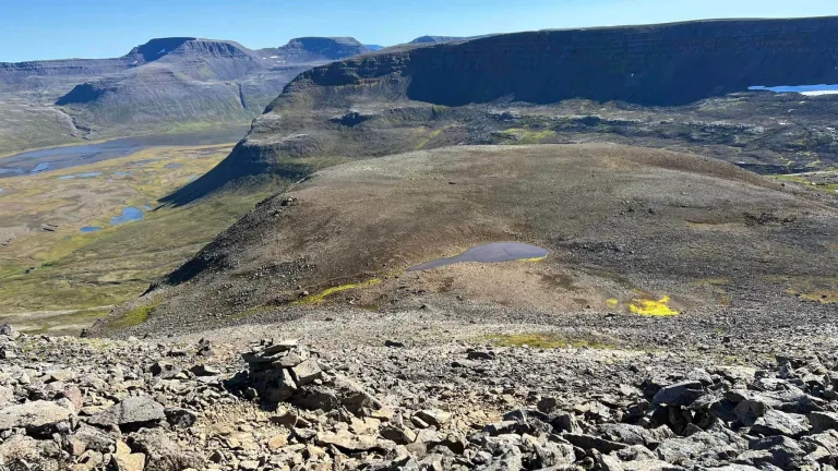
Hlöðuvík – Fljótsvatn
Length: 12km (7.5mi)
Time: 6 hours
Elevation hiked: 550m (1800 ft)
Difficulty: moderate
Hiking Trail: https://www.wikiloc.com/hiking-trails/fljotavik-reida-hloduvik-budir-1120730
Steep rockslides and boulders on the Þorleifsskarð pass on a hiking trail from Hlöðuvík to Fljótsvatn.Picture by Reinhold Seiz.
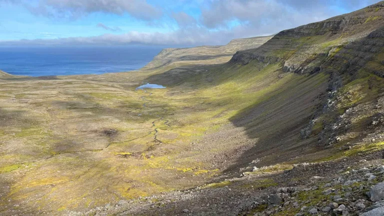
The hiking trail from Hlöðuvík to Fljótsvatn is versatile but also demanding. The highlight of this trail is the view from the Þorleifsskarð pass down into the floodplain at Fljótavatn lake.
Some sections of the trail are marked with wooden sticks, however, you can easily lose your way in a fog. In that case, this will be a difficult and slow hike.
Fog is not the only threat of this trek. There are several sections with steep rockslides and boulders around Almenningar and Þorleifsskarð. Hiking poles will be priceless. And pray for no strong winds!
Apart from the steep parts and some unforgettable views, you will also encounter a seemingly endless stone desert.
Fljótsvatn – Látrar
Length: 11.5km (7mi)
Time: 5 hours
Elevation hiked: 500m (1600 ft)
Difficulty: moderate
Hiking Trail: https://www.wikiloc.com/hiking-trails/latrar-fljotvik-reida-1120718
Beginning of the Fljótsvatn – Látrar trail. Picture by Reinhold Seiz.
The considerable part of the hiking trail from Fljótsvatn campsite to Látrar in Aðalvík leads through the swampy floodplains of Fljótsvatn lake. How wet you get varies strongly based on the current conditions around the lake.
Except for the swamps and pesky flies, this part of the trails is rather easy to walk. Later in the season, you may also be lucky to find a lot of blueberries in this area.
The prettiest part of the Fljótsvatn – Látrar hiking trail is most likely the magnificent view of Látravík after overcoming the Tunguheiði mountain pass southwest of Fljótavatn. This section is marked with cairns, and the initial hike up from Tungudalur is pretty steep.
Fljótavík – Látrar
Length: 12.5km (7.5mi)
Time: 5 hours
Elevation hiked: 500m (1600 ft)
Difficulty: moderate
Hiking Trail: https://www.wikiloc.com/hiking-trails/fljotavik-latrar-1817356
Steep Tunguheiði mountain pass on a Fljótavík – Látrar hiking trail in Hornstrandir. Picture by Reinhold Seiz.
The first real challenge of this trail is the Fljótsvatn Lake crossing next to Fljótavík. The water can be as high as your upper hips. The fording spot by the lake is marked opposite to Langanes.
Then there’s a steep ascent from Tungudalur all the way to Tunguheiði pass. After the pass, you can either continue southwest to Látrar in Aðalvík or choose one of the two detours – Rekavík and/or the Straumnes US Navy base.
By further following the main trail, you will then reach Látrar campsite by hiking alongside the mountain Látrafjall.
Látrar – Hesteyri
Length: 11km (7mi)
Time: 4 hours
Elevation hiked: 300m (1000 ft)
Difficulty: easy to moderate
Hiking Trail: https://www.wikiloc.com/hiking-trails/hornstrandir-day-7-latravik-hesteyri-4986488
View over Látravík from the Stakkadalur pass on a hiking trail to Hesteyri. Picture by Reinhold Seiz.
The trek from Látrar to Hesteyri (or the other way round) is one of the easiest main hiking trails you can take in Hornstrandir. With Hesteyri being one of the main hubs of civilization in Hornstrandir, it’s also a well-trodden path.
While this trail is probably not as breathtaking as the others, the most beautiful section is a wonderful view down to Látravik once you climb up Stakkadalur. You will also meet a nice waterfall along the way.
When climbing up from Stakkadalur, you have to cross the river Stakkadalsós with a sandy bottom. This may be the most difficult spot of this hike. The section between Stakkadalur and Hesteyrarskarð mountain pass is marked with distant cairns. The final part of the trail between Hesteyrarskarð and Hesteyri is an old but well-visible road.
Hesteyri – Sæból
Length: 13.5km (8.5mi)
Time: 5 hours
Elevation hiked: 400m (1000 ft)
Difficulty: moderate
Hiking Trail: https://www.wikiloc.com/hiking-trails/iceland-j5-boat-124098641
On a start to hiking trail from Hesteyri to Sæból in Hornstrandir. Picture by Reinhold Seiz.
The hike from Hesteyri to Sæból again belongs to the easier ones when it comes to hiking trails in Hornstrandir. From Sæból, you can take two side hikes – one to a British Military Base in Darri and one to Rytur mountain.
On your way from Hesteyrarfjörður, you will first overcome the mountain Nóngilsfjall and head towards Sléttuheiði. This part of the trail is well visible and marked with cairns. Then you have to cross the river Sléttuá.
The following part of the hike to Staður church is barely marked with a hard-to-see trail. However, the navigation is not too bad because you just have to keep right of the lake. This is also where the trail often gets wet.
During this trek, you may also make a detour to Slétta, which will extend your hiking time by about 1 to 2 hours. The most difficult part of the hike is the descent to Staður church, or the climb from the church, if you hike the other way round. It’s not any critical, though.
Hesteyri – Hlöðuvík
Length: 16km (10mi)
Time: 6-7 hours
Elevation hiked: 600m (2000 ft)
Difficulty: moderate to difficult
Hiking Trail: https://www.wikiloc.com/hiking-trails/d3-hloduvik-hesteyri-52917311
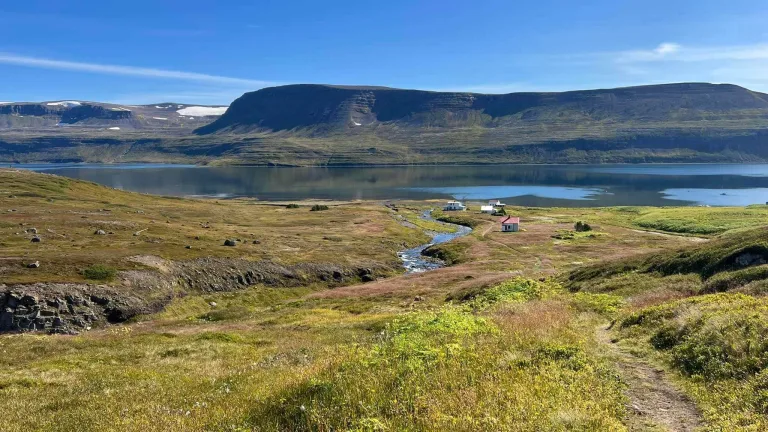
Doctor’s House, or Læknishúsið, in Hesteyri. Picture by Reinhold Seiz.
The hiking trail from Hesteyri to Hlöðuvík is more difficult, yet pretty popular because it’s one of the two shortest trails connecting southern and northern Hornstrandir.
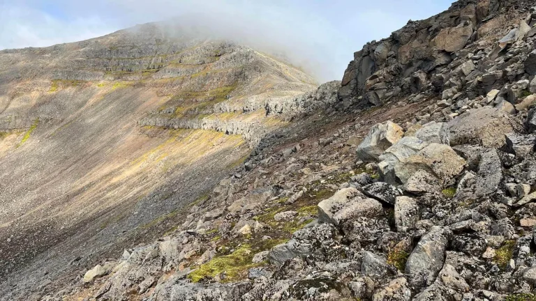
The most difficult sections of the trail include hiking up and down the steep snowfields with an invisible path underneath. The sooner in season you go, the bigger and more dangerous the snowdrifts.
Nevertheless, the trail is marked well with plenty of stone cairns. Just sometimes, the path simply disappears, because of stony terrain or snow where footprints often can’t be seen.
Coming from Hesteyri, the first main challenge is the Kjaransvíkurskarð mountain pass. This is the place where snowdrifts occur often. However, it’s also most likely the prettiest spot of the trail, with a picturesque view back over Hesteyri fjord.
The rest of the trail is rather boring, though, with lots of rocks, cairns, and bogs. Despite cairns, it may be hard to find a trail due to difficult navigation on stones and occasional snowfields. On snowdrifts, your best guess should be the footprints of others, if there are any.
The final challenge of the hike is a crossing of river Kjaransvíkurá, which is most of the time best crossed at the shore.
Horn – Hornbjargsvíti
Length: 9.5km (6mi)
Time: 4 hours
Elevation hiked: 850m (1800 ft)
Difficulty: moderate
Hiking Trail: https://www.wikiloc.com/hiking-trails/vestfirdir-hornstrandir-hornbjargsviti-hornbjarg-22-juni-2012-10524338
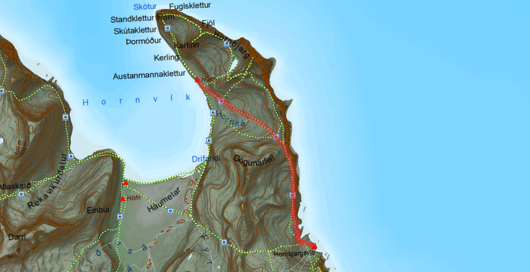
Horn – Hornbjargsvíti trail map
Getting to Hornbjargsvíti is not easy nor comfortable, regardless of the trail you choose. But it’s well worth the effort! Your first alternative is the Horn – Hornbjargsvíti trek along the eastern shore.
The trail from Horn to Hornbjargsvíti is versatile but quite sketchy, especially around the Múli area, if you plan to continue along the eastern shore all the way to Hornbjargsvíti.
The hardest spot is said to be the climb up to Múli and back down to the shore. It’s particularly challenging with a huge backpack. The trails in this area are also not well visible and can be quite a daunting task to follow if it’s too foggy.
On a positive note, though, once at Hornbjargsvíti, you will be rewarded with one of its kind views and a surreal, remote atmosphere. Hornbjargsvíti lighthouse, with its surroundings, is one of the most scenic places in Hornstrandir.
Hornvík – Hornbjargsvíti
Length: 7km (4.5mi)
Time: 4 hours
Elevation hiked: 300m (1000 ft)
Difficulty: moderate to difficult
Hiking Trail: https://www.wikiloc.com/hiking-trails/hornbjargsviti-veidileysufjordur-3008189
A scenic view from over the Hornbjargsvíti Lighthouse in Hornstrandir, the destination of this trek.
The second way to reach Hornbjargsvíti leads south through the Kýrskarð pass. Although seemingly short, the trail is no easier than the second hiking trail. If you get lost, it may take you an entire day to pass.
There are rocky sections where you may even need to climb a bit. Then, there may be steep snow patches where both navigating and not falling would pose a challenge.
Moreover, the track is not that well-trodden and, at times, barely visible. You won’t welcome this in a fog. The only thing helping you not get lost are the wooden sticks along the trail. GPS should help you a lot on this trek.
And if it all wasn’t enough, the trek is not super eventful either and the path can become pretty muddy. Finally, you have to cross the river at the beginning, right next to Hornvík. And this needs to be examined for the best crossing spot, see the Hornvík – Horn – Hornvík loop trail above.
Hornsá – Hornbjargsvíti – Bjarnanes – Smiðjuvík
Length: 15km (9mi)
Time: 7 hours
Elevation hiked: 800m (1600 ft)
Difficulty: moderate to difficult
Hiking Trail: https://www.wikiloc.com/hiking-trails/horn-i-hornvik-bardsvik-09-08-18-28278945
Views from the Hornbjargsvíti – Bjarnanes – Smiðjuvík hiking trail. Source: www.ust.is
This is a longer hike that can be divided into more days if necessary and ends up in Smiðjuvík. The first part of the hiking trail leads through the Innstidalur valley. Then, the section towards Hornbjargsvíti follows. Next, you have to overcome the Axarfjall mountain pass.
The highlight of this trail is the most beautiful and probably also the biggest waterfall in Hornstrandir, called Drifandisfoss. The waterfall is located halfway between Bjarnanes and Smiðjuvík and protrudes from majestic cliffs.
Smidjuvík – Furufjörður
Length: 14km (8.5mi)
Time: 7 hours
Elevation hiked: 750m (1700 ft)
Difficulty: moderate
Hiking Trail: https://www.wikiloc.com/hiking-trails/furufjordur-to-smidjuvik-140422221
Smidjuvík – Furufjörður Hornstrandir hiking trail. Source: www.ust.is
The hiking trail from Smidjuvík to Furufjörður is long and remote. Privacy and no crowds guaranteed. Unfortunately, also almost no marks as well.
From time to time, you will find wooden sticks of various colors but don’t rely on this hike to be marked. Often, you just have to follow your GPS, and there’s no other option.
Your first checkpoint will be the fjord of Barðsvík on your east, and from there, you have to climb over the Göngumannaskörð mountain pass. To reach your next stop, Bolungarvík, you first have to cross the river Bolungarvíkurófæra. Watch out for a low tide time, though! Otherwise, you most likely won’t pass this river.
Finally, an almost never-ending, 7km long stretch of unmarked coastal hiking past tons of stones and driftwood will bring you to Furufjörður.
Furufjörður – Hrafnfjörður south
Length: 8.5km (5mi)
Time: 3 hours
Elevation hiked: 250m (600 ft)
Difficulty:
Hiking Trail: https://www.wikiloc.com/hiking-trails/bardsvik-furufjordur-hrafnfjordur-10-08-18-28279062
Furufjörður – Hrafnfjörður hiking trail. Source: www.ust.is
The hiking trail between Furufjörður and Hrafnfjörður is not long, but it’s very isolated. Hikers often extend this trek with other stops or detours, like Svartaskarð to Þarlátursfjörður or the direction of Reykjafjörður, Ófeigsfjörður and Ingólfsfjörður.
One of the main challenges of this hike is the almost non-existent track east of Skorarvatn Lake. Your only chance there is to follow the cairns. GPS often doesn’t help either.
Coming from the east, after passing the lake, the trail improves and eventually turns into a mountain road between Skorarheiði and Hrafnfjörður.
Secondary Hiking Trails
Látrar – Sæból
Length: 7km (4.5mi)
Time: 2-3 hours
Elevation hiked: 100m (300 ft)
Difficulty: moderate
Hiking Trail: https://www.wikiloc.com/hiking-trails/latrar-i-adalvik-saebol-i-adalvik-dagur-3-107615860
A beach hike with a steep cliff climb on a direct hiking trail between Látrar and Sæból. Source: https://is.nat.is/
You will not find the trail from Látrar to Sæból on the main hiking maps of Hornstrandir. However, this trail exists and hikers do take it every now and then.
This is mostly a coastal trail leading along the beaches of Aðalvík fjord. On a nice day it resembles a summer vacation, just a lot colder one.
The main obstacle and by far the hardest spot of this trail is a 100m high climb up the cliffs with the help of chains. This section is definitely not for the faint-hearted and it’s difficult to carry the bag on your back. After that, it’s easy to get to the campsite of Sæból.
Veiðileysufjörður – Tafla – Veiðileysufjörður
Length: 9km (5.5mi)
Time: 3 hours
Elevation hiked: 550m (1800 ft)
Difficulty: moderate
Hiking Trail: https://www.strava.com/activities/5793034662
From Veiðileysufjörður, you can take a short hike up to Tafla mountain. On a nice day, you will be rewarded with a spectacular view over Veiðileysufjörður fjord.
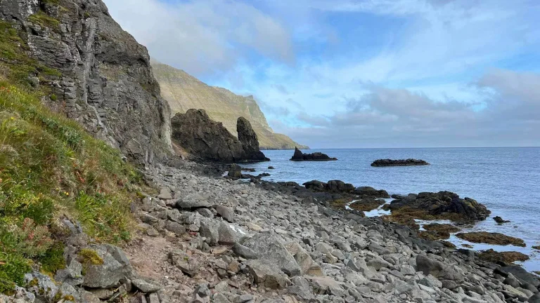
Rekavík – Kirfi – Rekavík
Length: 5km (3mi)
Time: 2 hours
Elevation hiked: 200m (600 ft)
Difficulty: moderate to difficult
Hiking Trail: https://www.wikiloc.com/hiking-trails/rekavik-bak-hofn-hvannadalur-rekavik-bak-hofn-8251036
Hælavíkurbjarg bird cliffs at Kirfi in Hvannadalur, Hornstrandir, Iceland. Picture by Náttúrustofa Norðausturlands.
The hike to Kirfi Hill, also called the Hvannadalur hike, is a popular detour locals often take on their way from Hornvík towards Hlöðuvík.
Since this is an out-and-back hike, it’s best to leave your big backpack on a wooden platform around Rekavík bak Höfn, where the hike starts.
The most difficult spot of the hiking trail is a very narrow section leading on the side of the cliff with pretty scary drops all the way to the ocean below. The beginning of the trail can also be swampy at times, so be prepared for that.
The highlight of the trail is a scenic view of Hælavíkurbjarg cliffs, considered by many to be one of the best views in Hornstrandir. These are huge, vertical cliffs you won’t see anywhere else.
Látrar – Straumnesfjall – Látrar
Length: 17km (10.5mi)
Time: 5 hours
Elevation hiked: 500m (1600 ft)
Difficulty: moderate
Hiking Trail: https://www.wikiloc.com/hiking-trails/hornstrandir-straumnesfjall-78884503
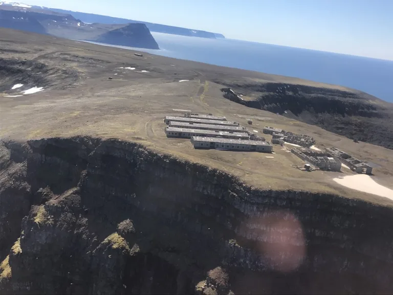
Straumnes or Straumnesfjall US military base in Hornstrandir. Picture by www.ust.is.
Straumnesfjall US military base is a popular day trip hikers take from Látrar in Aðalvík. There are two trails leading to Straumnes – the western one and the eastern one. The western trail is actually a road Americans built in the 50s, and it’s therefore considerably easier.
The highlights of this trail include a view over Aðalvík and, of course, an exploration of the abandoned radar station.
Thanks to the eastern path, you can turn this into a loop hike. This path down from Straumnesfjall leads through the Öldudalur valley in Rekavík. The trail here is almost invisible, but you can sometimes see cairns or pieces of cairns.
For those who still haven’t had enough, you can also hike around the Rekavíkurvatn lake.
Sæból – Darri – Sæból
Length: 8km (5mi)
Time: 3 hours
Elevation hiked: 500m (1600 ft)
Difficulty: ?moderate?
Hiking Trail: https://www.wikiloc.com/hiking-trails/darri-107666880
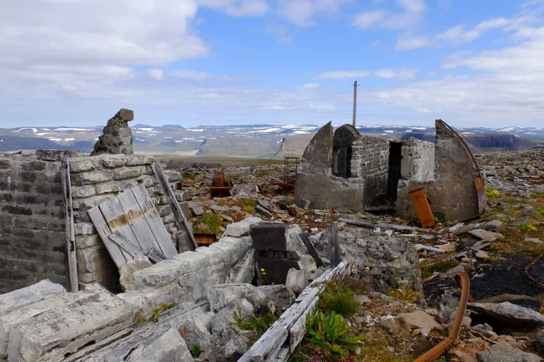
A hike to the former UK radar station in Darri from Sæból in Hornstrandir.Source: Borea Adventures tour.
Straumnes is not the only military station in Hornstrandir. There’s also a British radar station in Darri. You can reach Darri on a day hike from Sæból.
Coming from the campsite in Sæból, you first have to cross the river Traðará. A well-visible path then follows up to the valley of Garðadalur. The ascent up the mountain is steep and challenging.
On top of the hill, there is a road that will take you to the ruins of the British military base on mountain Darri.
Hornvík – Sópandi
Length: 16km (10mi)
Time: 7-10 hours
Elevation hiked: 600m (2000 ft)
Difficulty: very difficult
Hiking Trail: https://www.wikiloc.com/hiking-trails/hornvik-to-sopandi-via-rangalaskard-14011721
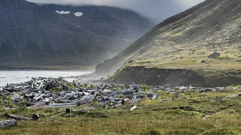
A typical driftwood on almost every coastal hiking path in Hornstrandir. Picture by Reinhold Seiz.
You can hike all the way from Hornvík to Sópandi in Lónafjörður fjord via one of the most challenging trails in Hornstrandir. The trek leads through the highest mountain pass in Hornstrandir called Rangalaskarð.
You should only take this hike with a local or if you are already highly experienced in the area. There are several dangerous sections, and the trail as such is hard to navigate through.
Some of the threats you may expect are no marks, boggy terrain, river crossings, and high tides. You need to plan for a low tide between Miðkjós and Sópandi, otherwise, you most likely won’t pass.
Fljótsvatn – Fljótavík east
Length: 9km (5.7mi)
Time: 3 hours
Elevation hiked: 130m (440 ft)
Difficulty: easy
Hiking Trail: https://www.wikiloc.com/hiking-trails/atlastadir-reida-10469987
This is the trail leading along the eastern bank of the Fljótsvatn Lake to Fljótavík. By taking this path you should be able to avoid the crossing of the lake Fljótavatn.
It’s almost impossible to find any info about this trail, so if you know anything about it, please contact us, and we will give you credit for all the info you provide.
Fljótavík – Kögur
Length: 7km (4.5mi)
Time: 4 hours
Elevation hiked: 600m (2000 ft)
Difficulty: difficult
Hiking Trail: https://www.wikiloc.com/hiking-trails/hornstrandir-krossadalur-sandvikurvatn-og-kogur-upp-af-fljotavik-78884836
The map of a day hike to Kögur from Fljótavík.
Kögur is a mountain near Fljótavík that can be explored on a challenging day trip. You may also add the areas of Krossadalur and Sandvíkurvatn to extend this hike.
Veiðileysufjörður – Kvíar
Length: 17km (10.5mi)
Time: 7-9 hours
Elevation hiked: 500m (1600 ft)
Difficulty: moderate to difficult
Hiking Trail: https://www.wikiloc.com/hiking-trails/veidileysufjordur-kviar-8-juni-2014-7101103
The only way to get to the Kvíar lodge, one of the very few non-camping lodgings in Hornstrandir, is to take a private boat on a guided tour or to hike to it via challenging and unmarked trails.
One such trail leads to Kvíar from Veiðileysufjörður, and you should take it only if you are already well experienced in navigating throughout Hornstrandir.
Veiðileysufjörður – Hlöðuvík
Length: 9km (6mi)
Time: 4 hours
Elevation hiked: 500m (1600 ft)
Difficulty: moderate to difficult
Hiking Trail: https://www.wikiloc.com/hiking-trails/hornstrandir-j6-28131682
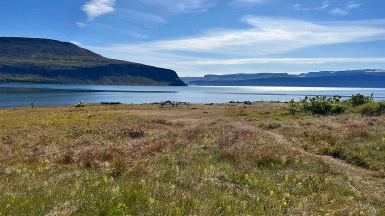
Veiðileysufjörður. Picture by Reinhold Seiz.
It’s possible to get to Hlöðuvík also directly from Veiðileysufjörður and vice versa. However, the hiking trail is unmarked and quite challenging.
There are sections west of Veiðileysufjörður campsite where you basically have to hike in the sea around cliffs for hundreds of meters. Better pick a sunny day and low tide for this activity!
Furufjörður – Hrafnfjörður north
Length: 18km (11mi)
Time: 6 hours
Elevation hiked: 700m (1500 ft)
Difficulty: ???
Hiking Trail: ???
It’s almost impossible to find any info about this trail, so if you know anything about it, please contact us, and we will give you credit for all the info you provide.
FAQ
Is Hornstrandir worth it?
If you are a nature lover and hiking enthusiast, Hornstrandir is totally worth the time and money spent on planning. It’s one of the last pieces of remote hiking heaven on the planet, with no dangerous animals or insects. Just with a very harsh weather.
Can I see Arctic foxes in Hornstrandir?
Yes, you can, and the chances are high! Hornstrandir is by far the best place in Iceland to see an Arctic fox. It’s highly likely they may even start playing with your tent!

How many days do you need for Hornstrandir?
This highly depends on your hiking ambitions. As short as one day is enough to explore some of the most beautiful areas in Hornstrandir as a day trip. On the other hand, as long as two weeks may not be enough to fully explore all the beauty Hornstrandir has to offer.
Is Hornstrandir safe to visit?
Hornstrandir is 100% safe when it comes to:
- Animals – there are no dangerous species,
- Insects – none of them are dangerous,
- Water – it’s fully safe to drink.
However, Hornstrandir can also be dangerous because:
- Weather can get very harsh with strong wind, rain, and fog
- There’s no network or cell coverage
- Hiking trails may be steep and not well visible at times
- If anything happens to you, help is far away
Hornstrandir fjords offer some of the most amazing views in Europe. Picture by Reinhold Seiz.
How to prepare for Hornstrandir?
Plan and study the area in advance. Dress well. Practice long hikes at home. Expect extreme weather conditions. Don’t overestimate your hiking skills.
After reading this article, you should already have a good idea of what to expect in Hornstrandir.
Hornstrandir hiking rules
- Don’t leave any rubbish behind you, take it all with yourself
- Don’t move stones or driftwood in any way
- Follow the trodden path as much as possible
- You can camp only in designated campgrounds
- Most campsites have toilets, use them whenever possible
- Campfires are forbidden
- Do not disturb animals, keep a safe distance of at least 40 meters whenever possible
- It’s strictly forbidden to feed animals
- Drones are forbidden unless you have a special permit
- Don’t pick any flowers, you can pick up berries, though
- You can find detailed Hornstrandir visitors’ rules here
- All the houses are private, don’t disturb anyone’s property!
In the end, I would like to say a huge thank you to Mr. Reinhold Seiz, who contributed sizeably to this article with his stunning photos of Hornstrandir! Here is also his amazing video:

Please, if you have any additional info you believe would be useful to place in this article, or if you believe something should be corrected, contact us, and we will give you all the credit for this info and a bottle of wine when we meet in Iceland 🙂
![]() ask questions or get inspired in our community
ask questions or get inspired in our community


We have hiked Hornstrandir before, but only 2-3 days. We are going back for a longer trip. The official camp map you provide has a campsite for Fljótavík at the very nothernmost tip, but on the trail you provide, you seem to mark a campsite at the south-east corner. Is there a designated site there, or were you wild camping there?
Hi Katie, not sure which trail you mean? On this map, then also on this map and also on this trail – the Fljotavik campsite is marked at the very same spot.
Hi! So it was this map that confused me (https://www.wikiloc.com/hiking-trails/latrar-fljotvik-reida-1120718). The campsite is shown as on the right bottom of the lake, but in the other maps, it is on the left side bottom of the lake. Does that help?
OK i see now that you are asking about the Glúmsstaðir Fljótavatn campsite (not Atlastaðir Fljotavik campsite). Yes, that one should be located southwest of Fljótavatn, this is the location all maps show. But rather double check this with the ferry company and/or rangers at the place of your basecamp. We haven’t camped at this campsite yet.
I can confirm that there is a campsite at Glúmsstaðir Fljótavatn. While I did not stay there, I could see it from the other side of Fljótavatn when I hiked on the east side of the lake.
Hi Igor,
We are visiting the Westfjords this summer. We only have 1 day to visit Hornstrandir. Would you say it is worth it to go for 1 day? And if so, what day hike would you prefer?
Greetings, Lisette
Hi Lisette, if you have a nice weather on that day, it’s definitely worth it!
Borea Adventures has some nice glimpse of good ideas for a 1-day tour.
For example a hike to Horn from Hornvik is one of the most beautiful and sought-after.
Hey there! Planning a trip there for a 3 day hike starting august 31st! Is there anything you would recommend? Im a seasoned hiker/backpacker and want a challenge but of course want to stay safe 🙂
I recommend being flexible as per weather. It’s really best to plan according to weather forecast, because weather can be very harsh when unlucky.
Hi Igor,
We are planning to do a 3 days hike starting Wednesday 31 July, weather is supposed to be ok. What would you recommend ?
We were thinking doing Veidileysufförour to hornvik on day 1, the horn loop on day 2 and the way back to Veidileysufförour on day 3.
Or Veidileysufförour to hornvik on day 1, hornvik to Hlöduvik on day 2 and Hlöduvik to esteyri on day 3 to avoid doing the same path twice. What are your thoughts ? Thanks
bertrand
Hi Bertrand, both plans sound good. It’s up to you if you want to rather see Horn loop which is a bit more scenic but with more people as well, or you prefer the route with less visitors and with no repeating trail. We personally prefer the second options but this is entirely up to you 🙂
Weatherwise I suggest asking a ranger or http://www.ust.is. We don’t give weather advice, unless we are in the area (which we are not).
Thank you for your quick answer. I’ll sleep on it and take a decision tomorrow 🙂
Igor, thank you for this terrific resource. I wish I had found it prior to my 8-day solo backpacking trip in August 2023 (Hesteyri – Latrar – Fljótavík – Hlöðuvík – Hornvik – Horn – Bjarnanes – Hornvik- Veiðileysufjörður). I am glad I have found your website now as I plan a return trip that I hope will be longer.
You note, “It’s almost impossible to find any info about” the Fljótsvatn – Fljótavík east trail. I am happy to share what I know. On 15 August 2023 I hiked from the Atlastaðir Fljotavik campsite southbound on the east side of Fljótsvatn and then up and over to Hlöðuvík. Heading south from the Atlastaðir Fljotavik campsite, it is roughly 2 km past a couple of houses and then grass, sometimes a bit swampy and muddy, to the point where one would cross Fljótsvatn to head to Latrar. From that point it is another 5 km to the southern end of Fljótsvatn where one can head northeast up a steep slope toward Hlöðuvík or southwest toward the Glúmsstaðir Fljótavatn campsite. This 5 km stretch starts with a faint but visible trail that becomes less visible as one proceeds south, at times disappearing entirely. The terrain varies between firm turf, high grass, thick blueberry bushes and other brushes, and a few creek crossings. It is not difficult or dangerous. It took me slightly less than 2 hours from the campsite to the point at the south end of Fljótsvatn where one turns northeast to begin the climb toward Hlöðuvík.
The climb from that point toward Hlöðuvík immediately became much more challenging. I was not able to find any kind of trail to the top of the first ridge. I simply headed up, sometimes grabbing onto rocks or grass to ensure that I did not slip. At the top of that first ridge I finally saw a single post. Then I navigated through the rocks and the ponds before the steep rocky path up to the Þorleifsskarð pass.
Igor, do you know anything about the trail from Grunnavik to the Hrafnfjörður campsite? Your map does not show a trail there, but I can see a route on https://vefsja.iskort.is/
Thanks very much.
-Will
Hi Will and thank you!
You can find some info on this trail here: https://www.wikiloc.com/hiking-trails/grunnavik-flaedareyri-3271034 and here: https://www.wikiloc.com/hiking-trails/grunnavik-flaedareyri-13-agust-2012-3237295
Thanks very much Igor. That looks like a very pleasant hike. Is there a campsite at Flaedareyri?
Hi Igor, planning to do a 1 day tour to the Horn to Hornvik in June, is Borea the only main company offering this tour? Do you have other suggestions? If we just booked the ferry there and back on the same day, it would give us 5.5 hours to complete the hike alone without a guide. Do you think that is enough time for moderately experienced hikers to make it back on time or am I crazy?
Appreciate it, thanks!
Hi Maja, it’s about 9 miles out and back from Hornvik campsite to Horn and back. It theoretically can be done in 5.5 hours in case of good weather, but it would be a very rushed hike. If you have no other sensible option, you may try it and in case you realize you won’t make it back on time, either turn back or spend a night in one of the campsites.
There are two main tour companies operating guided trips to Hornstradir – Borea Adventures and West Tours. Our favorite is Borea.
Maja, I agree with Igor. I strongly recommend staying the night at Hornvik, even better two nights, so that you do not have to rush your hike around the Horn. It’s 9 miles from Hornvik to the Horn and back if and only if you are able to walk on the beach and cross the river at low tide. If you miss low tide, you need to cross the river a bit inland, which adds another 0.7 mile each way.
And you will very likely want to explore more of the Horn once you get to the tip. For example, there is an amazing bird cliff if you continue around the Horn clockwise another 2 miles or so.
Continuing clockwise you drop down to Miðdalsvatn and then go up to the Hornstrandir crest at which point you can continue up to Kalfantindar. I recommend allowing at least 8 hours.
Igor, my map (Gaia GPS) shows a campsite at Bolungarvik on the east side of Hornstrandir, just north of Furufjordur. Is that correct? Thanks very much.
HI Igor,
We have signed up for your site, but I am unsure how to ask questions so doing it here. I should lead with fact that we would cancel trip if weather too bad. will have to decide week or so before or as far as can guess with the changing weather in Iceland.
My wife and I are planning on doing a self-guided camp/hike in Hornstrandir, Westfjords. Has anyone any idea if it is feasible to take the Saturday ferry in late August 2025, August 30, spend the night camping at Hornvik (Hornvik ferry drop off) and then returning to Isafjordur on Sunday on the ferry from Veidileysulfejordur? We would arrive drop our gear at the camp and do as much of the Hornbjarg as is feasible that afternoon. Then we would walk to Veidileysulfejordur to catch the ferry the next day.
Is it possible to stay in the emergency shelter at Hofn, especially if the weather turns bad? How much of the Hornbjarg can we hike that first day? More then the 6km mentioned on one day trip sites? How difficult are the trails around Hornbjarg peninsula to find as well as the 10 km one back to Veidileysulfejordur? I am an experienced backpacker all over the world which means I understand I know little to nothing about a new spot like the Hornstrandir.
We understand that this is roughly the 2-day trip that Borea offers that we can’t afford due toe economic downturn this year.
Thanks for the help.
Michael
Hi Michael, your ferry will arrive to Hornvik sometimes around 12PM the latest. The Hornvik-Horn-Hornvik loop takes about 6 to 7 hours to complete, so it’s doable on that day but only so-so. I recommend watching out for being on time, in late August it gets dark earlier. This really depends on how well you’re able to navigate and how quick you are. It may or may notbe doable on your first day. I also recommend asking rangers about the lunch/afternoon tide conditions, or even in advance at [email protected] and/or [email protected] and/or asking them for a suitable contact.
Be ready that late August the weather might not coopoerate, it’s really a hit or miss.
The difficulty mostly depends on weather: https://epiciceland.net/hornstrandir-guide/#Veidileysufjordur_Hornvik If it’s windy/rainy it gets much more difficult, while in nice weather it’s much easier.
Hello!
Thanks for such a comprehensive article! I need an easy to moderate loop hike recommendation from either Hesteryi, Veioileysufjor, or Aoalyik ferry terminals. The tours don’t seem to run on June 7th or are booked, so my Mom and I are looking to do a day hike by ourselves, but also just enjoy the views from the ferry. Do you have any ideas? We live in the mountains of Colorado (USA) so are in decent shape (though my Mom is in her 70s).
Thanks so much!
Elizabeth
Hi Elizabeth and thank you! You can try emailing Borea, this tour is booked but maybe they can get you in: https://boreaadventures.com/tours/wildlife-and-heritage/
Most of the hikes I know about are out and back, it might be a problem with loop hikes within your parameters. Maybe explore WikiLoc, there are often good ideas: https://www.wikiloc.com/wikiloc/map.do?sw=66.2461208384558%2C-23.19076538085938&ne=66.47546760593752%2C-22.399749755859375&page=1
Hello!
Thanks for sharing so much interesting information. On the map with secondary trails, there ‘s a trail starting in Smidjuvik, heading west, direction breiduskardahnukur, and then turning to the north. As far as I can see, this trail is not described on your website. Do you know if it’s an interesting hike (for mid july)? And would it be possible to make a connection from there to the Rangalaskarð pass?
Kind regards, Jonas (Belgium)
Hi Jonas and thank you! The provided map of secondary trails is an older map where some of the trails might not be in place anymore. It’s best if you ask a ranger in the area so that he gives you the most up to date info. You can email [email protected] and [email protected] to ask.
My best guess is that this trail is difficult and possibly dangerous. The more so with Rangalaskarð being one of the most difficult passes.
Thank you for your answer, Igor. We ‘ll try to ask a ranger when we are around in the area. Kind regards, Jonas
Thank you for this incredible guide! My main goal is to see foxes. Do you think a day trip would be sufficient for this and is Hornvik the most reliable place to see them? Debating whether to stay overnight for one night. If we camp with our own equipment at Hornvik, do we have to reserve the camp site ahead of time? Or just the ferry to get there and back? Is it possible to take the ferry there one day and then back the next day without booking a guided tour? We are seasoned backpackers. Still wondering if we should book the two day Borea tour due to what I’m reading about weather and trail conditions. It’s just quite expensive. But I really want to see foxes. Thanks again for any advice!
Hi Alina and thank you!
We haven’t been to Hornstrandir this season, so I can’t tell you a reliable location to see foxes there this year. It’s best if you ask a ranger there, or someone residing there / doing trips there.
Up to my knowledge over the past years, it wasn’t necessary to reserve a campsite, there should be enough space for everyone. As per the ferry – yes I would book this ahead of time, in summer it might get booked.
Of course you can just take ferry and not take a guided tour 🙂 The decision is up to you. The main advantage of the tour is that they are efficient (they know exactly where to step), they’ll tell you stories and they know all the best spots (e.g. viewpoints, possible fox watching spots etc). If you are seasoned backpackers, you can do all of these yourself, it might just take a bit more time.
P.S. If you like what we do please write us a short review on Google: https://g.page/r/CaJt1bHCTbF1EBM/review it would help us a lot!
Thank you so much for this !!!. I will use this allot for planning my trip to Hornstrandir!
I’m planning to land on Gjogur by plane and hike into Hornstrandir! When I was scouting random on Google Earth I found this pristine looking swimming pool. It is located just outside of Hornstandir (or in, but outside the Hornstrandir hiking map). It is in Reykjarfjordur. From there to the Furufjörður campsite – Smidjuvik – Hornbjargsviti – passing the Hornbjarg cliffs to Hornvik – Veidileysulfjordur – Ferry out 😀
Looking forward to my trip in a few years ^^
Thank you very much Peter! Hope you’ll have an unforgettable trip!
P.S. If you like what we do please write us a short review on Google: https://g.page/r/CaJt1bHCTbF1EBM/review it would help us a lot!
Hola, quería hacer la ruta del cuerno de Horn. Veo que son 16km, que se completan en unas 7h. El problema que veo son los ferrys. Veo que salen sobre 09:30 y que suelen regresar sobre las 15:00, por lo que no me daría tiempo y tendría que hacer noche. ¿Esto es así? ¿Hay algún ferry que salga más tarde para aprovechar bien el día? En caso de que no haya, ¿qué opciones de alojamientos cercanos tengo en esta ruta? Creo que el Faro de Hornbjargsvíti está un poco lejos de esta ruta…
Muchas gracias. Vuestros blogs son de mucha ayuda 🙂
Hi Sheila, no unfortunately there are no other ferries. If I understand it correctly that you want to reach the Horn, then you have two options:
As depicted on our map above and as described in Hornstrandir Campsites section, you have two options – a) Horn/Hornsá campsite between the Horn and the Hornvík fjord beach, b) Hornvík Höfn campsite
Have an amazing trip! 🙂
We are really conflicted about the best tent options. We have a 3 season copper spur UL3 which has withstood some crazy weather but I doubt anything like hornstrandir can have mid August. Any tent recommendations?
It’s a hit or miss. Best case you can have sun and no wind even for 7 days straight. Worst case in Hornstrandir in mid-August, expect strong, potentially gale-force winds, with gusts over 70 km/h (43 mph) common, destroying weaker tents, so you need a robust 3-season or even 4-season tent with a low profile, strong poles, and many guy-out points, plus extra pegs and rocks for anchoring, as you’re hiking in exposed, boggy terrain where lightweight tents can fail.
Which hike do you recommend for a one day self guided hike? Can I rely on the All Trails Map? Do all the ferries drop off at the same locations? We are planning on hiking 8/21/26. This information is quite helpfu.
Hi Elena, Hornvik-Horn hike from Hornvik campsite is most likely the most beautiful option for a day tour. That being said, if you go slower, you might need to stay overnight in the campsite, because catching the afternoon ferry back might not be possible.
For this hike Alltrails is generally good, but it’s always good to ask rangers at Hornvik and/or ferry personnel about current trails conditions and tidal conditions.
I’m not sure I fully understand your question on same dropoff locations, but if you’re asking whether at one dropoff point, for example at Hornvik campsite, all the ferries arrive at the same spot, then the answer is yes.
Have a great trip! 🙂 And if you like what we do please give us a shorty review: https://g.page/r/CaJt1bHCTbF1EBM/review
Hello! Thanks for this amazing resource. My partner and I are planning to visit in early August. We’ll only have a little (+/-1 day) flexibility, so we’ll hope for good weather or perhaps wait until next year. I have two questions. How long are the ferry rides? And below are our two possible itineraries (different for a Monday vs Tuesday departure due to the ferry schedules, as far as I can tell). ANy thoughts/suggestions?
Option 1:
• Mon Aug 3 — Borea 9:00 ferry → Hesteyri → hike to Hlöðuvík (~14 km) — camp Hlöðuvík
• Tue Aug 4 — Hlöðuvík → Hornvík (~10 km) — camp Hornvík
• Wed Aug 5 — Day hike Hornbjarg — camp Hornvík
• Thu Aug 6 — Hornvík → Veiðileysufjörður (~11 km) — camp Veiðileysufjörður
• Fri Aug 7 — Morning ferry → Ísafjörður
Option 2:
• Tue Aug 4 — Borea 9:00 ferry → Veiðileysufjörður → hike to Hornvík (~11 km) — camp Hornvík
• Wed Aug 5 — Day hike Hornbjarg — camp Hornvík
• Thu Aug 6 — Hornvík → Hlöðuvík (~10 km) — camp Hlöðuvík
• Fri Aug 7 — Hlöðuvík → Hesteyri (~14 km) — camp Hesteyri
• Sat Aug 8 — Morning ferry → Ísafjörður
Thank you!
Hi Matthew and thank you!
The ferry from Ísafjörður to Hesteyri/Veiðileysufjörður typically takes slightly more than 1 hour, while the one to Hornvík typically takes more than 2 hours.
Your plan looks good – both versions – and I wish you a great weather! Early August is generally one of the best times to go.
Enjoy your trip!
Hi Igor,
First off, incredible guide on Hornstrandir, easily the most detailed and useful resource I’ve found online. Thank you for putting it together.
I’m a solo hiker planning a 3-day trip to Hornstrandir starting June 1st 2026 and wanted to run my itinerary by you to see if it makes sense.
My three target spots are Hornbjarg cliffs, Hafnarskarð pass, and Skálarkambur pass.
I’m considering this:
– Day 1: Borea Adventures 9:00am ferry Ísafjörður → Hornvík direct. Afternoon day hike up toward Atlaskarð and Skálarkambur for the views, back to camp at Hornvík.
– Day 2: Hornvík → Horn → Hornvík loop (16km).
– Day 3: Hornvík → Hafnarskarð → Veiðileysufjörður. Borea pickup back to Ísafjörður.
I have proper gear including a satellite communicator, topo map, trekking poles, and a 0°C sleeping bag. I’m registered on safetravel.is.
Thanks so much for any input! really appreciate what you do for hikers heading to Hornstrandir.
Best regards
Hi Mouneer and thank you very much, we really appreciate your kind words!
I went through your plan and it’s perfectly doable, regarding hiking times/itinerary.
My only concern is that 1st June is really early in the season, so you might still experience snow on the trails – be ready for that. Do you have a ferry booked? I can’t see any availability for 1st June for Borea.
P.S.: If you like what we do at Epic Iceland and/or if you appreciate my response, please a short review on Google: https://g.page/r/CaJt1bHCTbF1EBM/review would really help us 🙂 Thanks in advance.
Hi Igor!
Thank you so much for putting this guide together. It has been super helpful while I’ve been planning my Hornstrandir route.
I am planning to visit Hornstrandir from August 3–5, 2026, and I wanted to ask if this itinerary sounds realistic/safe based on your experience. I saw that Mr. Dweidari in the comments above had a very similar route, and you said it was good/realistic, but since I am going during the first week of August, hopefully with better conditions, I still wanted to run my specific plan by you.
Day 1 – August 3:
Take the 9:00 AM Borea ferry from Ísafjörður to Hornvík. After landing, set up camp, explore around Hornvík, and possibly do a shorter 3-hour hike around the area if weather and time allow.
Day 2 – August 4:
Do the Hornvík/Hornbjarg loop, around 10 miles with about 2,500 ft elevation gain. This would be the main hike of the trip, so we would start early and only attempt it if the weather is safe.
Day 3 – August 5:
Hike from Hornvík to Veiðileysufjörður for the Borea pickup back to Ísafjörður. I saw on Borea’s schedule that the boat for Veiðileysufjörður is listed at 4:00 PM on August 5, but I believe that is the departure time from Ísafjörður, not the pickup time from Veiðileysufjörður. Because of that, I am assuming we would likely have enough time to make it there before the boat arrives, but I still want to plan with a safe buffer. I saw this route is around 7 miles with about 1,600 ft elevation gain and may take around 4–5 hours, but we would plan to leave early so we have plenty of time before the pickup.
Do you think this plan is realistic for early August? Also, are there any specific weather concerns, river crossings, trail conditions, or route sections we should be extra careful about on these dates?
Thank you again for all the helpful information!
Hi Igor,
Another great page of info!!!
I don’t suppose you have an updated code, for discout at Borea (it says that EPICICELAND has expired)??
Cheers,
Jamie
Hi Jamie and thank you!
Yes there’s a new code in our newsletter.