This article just summarizes in detail our experience during the Fimmvorduhals hike. If you are interested in a detailed Fimmvorduhals hike guide – including tips on weather, season, clothes, transportation, length, and difficulty – read our full Fimmvörðuháls hike guide.
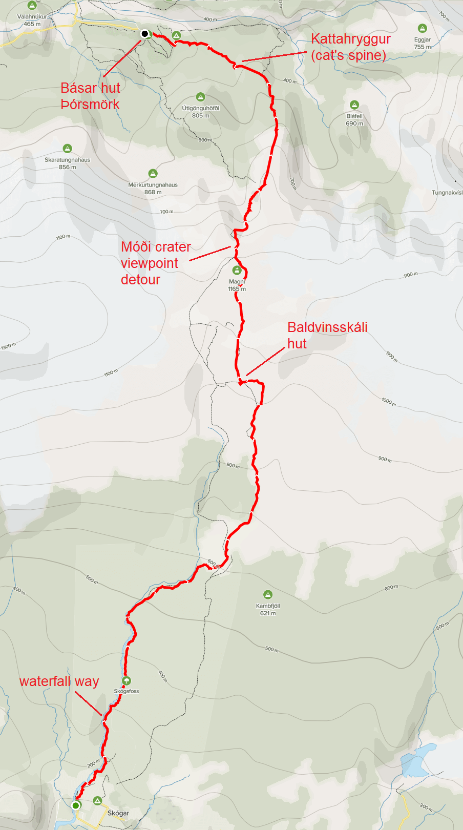
Fimmvörðuháls hike map (from Skógar to Thórsmörk)
Since the day I’ve first seen the Fimmvorduhals hike and read about it, I knew I have to try it 🙂 Planning is crucial for the Fimmvorduhals hike (see below). After many changes, we finally decided to go for the hike on Day 3 of our highlands trip.
A month before the hike I found my hiking buddy via Facebook group Travel Iceland. My wife didn’t feel like going for such a long hike and I didn’t want to push her. My buddy – Vicente – seemed to know what he was doing, although you never know before you really get to know each other 🙂 I took care of the entire organization of the trip – i.e. mainly choosing the specific day, buying bus tickets, and making a bus seat reservation.
The final part of the Fimmvorduhals hike near Thorsmork
Our plan
We had a 3-day window when we could both do the hike (as an intersection of my and Vicente’s schedule). I waited 5 days before the hike and when the weather looked reasonable I booked the highland bus (10% discount code: in our newsletter) and reserved the seats for Friday. I received the response from the bus company anytime from 1 hour after my email to almost 24 hours – but they always responded and always positively. Vicente travelled from Reykjavik, I travelled from Hvolsvollur.
The plan for our trip was as follows:
- Vicente getting on the bus at 7:00 in Reykjavik towards Skogar
- Me coming by car to Hvolsvollur and getting on the same bus to Skogar at 9:00
- Starting the hike at 10:00 in Skogar
- Finish the hike before 20:00 in Basar
- Take the bus back from Basar hut at 20:00 – me to Hvolsvollur, my friend to Reykjavik
The waterfall way in the first third of the Fimmvörðuháls hike
3 days before the hike the weather forecast changed and it looked much better for Saturday. So, I wrote a kind email to the bus company asking for rescheduling and they quickly replied positively. 2 days before the hike the forecast started to show some strong winds exactly in the worst part of the hike – between the two glaciers. I decided to reschedule again – back to Friday – although I must have looked dumb already at that point in the eyes of the bus company.
On a Thursday evening, I looked at the forecast once again and it showed slight rain for Friday and the wind forecast for Saturday disappeared. I felt like an idiot but I decided to write the bus company once again and reschedule the trip for the fourth time. They replied late in the evening that yes, it’s rescheduled. At that moment I just prayed I had made a good decision. And it turned out I did. The weather on our day was almost perfect.
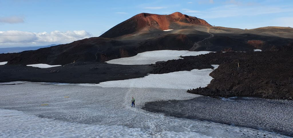
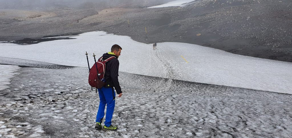
The snowy part of the hike
The Fimmvorduhals trail step by step
1. Skógar and Skogafoss
The Fimmvorduhals trail starts with the magnificent, giant green scenery of Skogar. This is usually the place where most of the tourists both start and finish, as was the case during our first visit to Skogafoss. While Skogafoss is an admiringly beautiful place definitely worth visiting, it’s a mistake not to continue further up the Skogafoss waterfall trail. It doesn’t take too long to finish it, nor is the trail too hard. So we do recommend you reserve some extra time to see it!
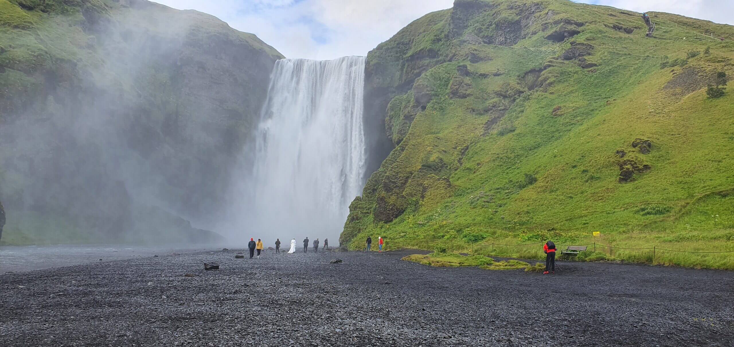
Bottom part of Skógafoss waterfall (and a wedding in the background ☺)
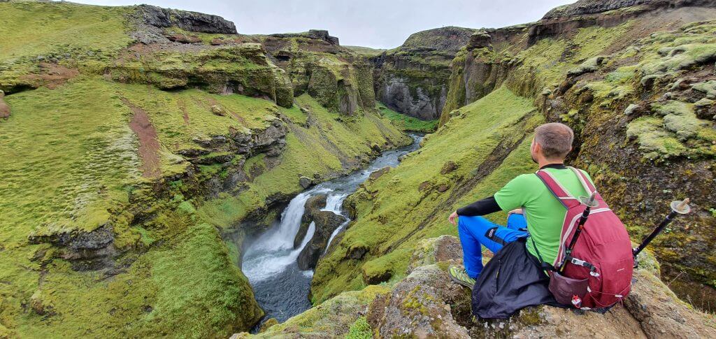
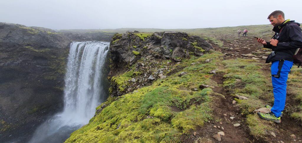
2. The waterfall way
It is the waterfall way that begins with the famous Skogafoss and continues with several other, less known but not any less beautiful waterfalls. The waterfall way is one of the most beautiful short hikes in Iceland I’ve seen. I can highly recommend doing this hike to everyone – even if you don’t want to continue. Just take the waterfall way from Skogar and come back.
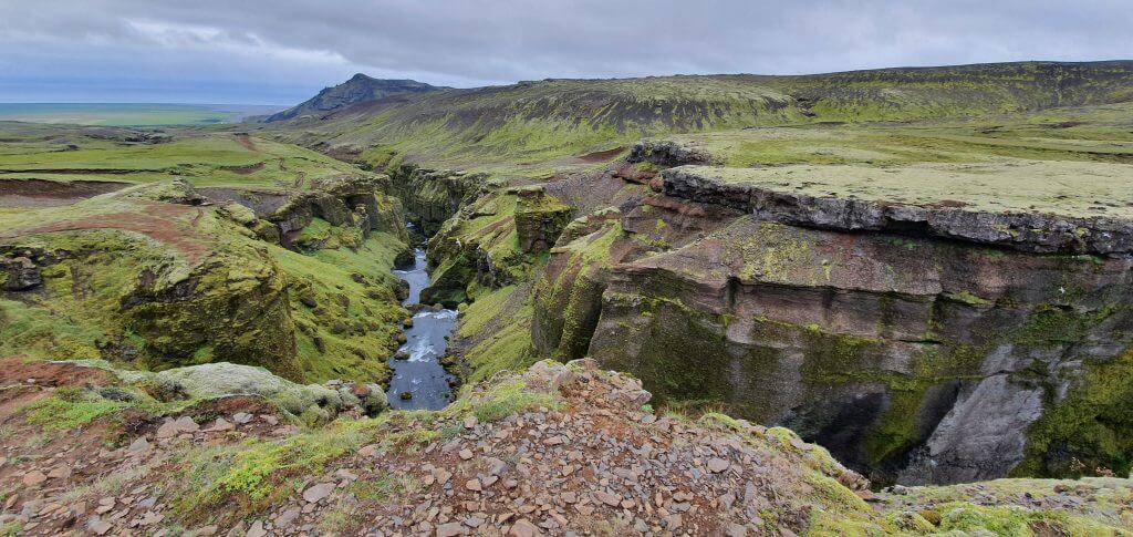
The waterfall way looking back to Skogar
The entire waterfall way is around 8 kilometers long and took us around 2 hours to complete from Skogafoss to the last waterfall on the route. That being said, we hiked very quickly with only short pauses for taking pictures. At a relaxed pace, it may take some 2.5-3 hours one way. But you don’t need to take it all the way to the end. The most beautiful part was its first half, i.e. some first 4 kilometers. Doing that as a roundtrip makes for some 3-hour long hike at a relaxed pace that everyone can make.
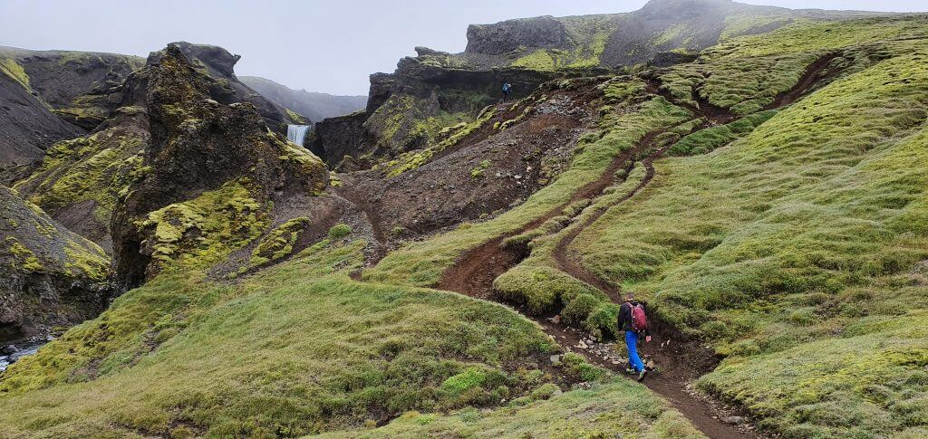
The Fimmvörðuháls hike trail during the waterfall way part
Water and moss are literally everywhere during this part of the Fimmvorduhals hike. We felt as if we were a part of some fairy tale, with hobbits possibly chasing us somewhere. This hike is also doable even if it rains lightly and the visibility isn’t perfect, so it’s a great candidate also for moody days. And what’s one of the best features about Icelandic landscapes – they look very different in the cloudy and in the sunny weather. So, you may even visit them twice and still have a different experience!
One of the largest waterfalls at the waterfall way of the Fimmvorduhals hike
3. The ascent towards Baldvinsskáli hut
The waterfall way ends with a little bridge and roughly marks the first third of the Fimmvorduhals hike. The next part is the most boring one – the first part of the ascent towards Baldvinsskali hut. For around 40-50 minutes there’s pretty much nothing to see and you just have to walk up the gravel road where emergency vehicles can drive to Baldvinsskali hut.
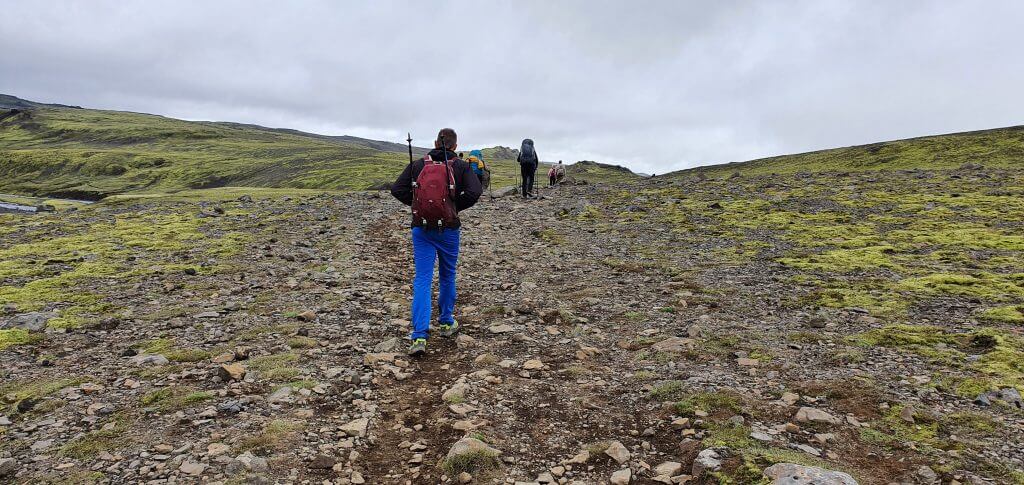
The most boring part of the Fimmvorduhals hike – right after the end of the waterfall way
Then you will reach the area where nice views start to slowly appear – in good weather with good visibility of course. The combination of snow, gravel, and hills in the distance is very nice, though definitely not the best part of the hike. We soon spotted the Baldvinsskali hut in front of us, and, as expected, it was covered in a fog 🙂
Fimmvorduhals trail just before the Baldvinsskali hut
This part of the hike took us around 1.5 hours to complete, still at a pretty quick pace, including a 10-minute lunch break. After 3.5 hours of quick pace, we were supposed to be already almost halfway through the entire hike. This meant, we decided to slow our pace and enjoy the scenery more and take more pictures.
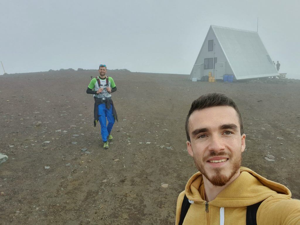
A very bad selfie (and our only picture) of us in front of the Baldvinsskáli hut in a total fog
4. Between the two glaciers
The middle part of the hike – between the Baldivnsskali hut and the Kattarhryggur pass is the most difficult one, yet I still think – not too difficult. This is also where the weather usually gets worse (more foggy, rainy, or windy). We were pretty lucky, though, to have nearly perfect weather with fog only on at a short part near the hut. This middle part is also the one where hiking poles do come in handy.
Right after the Baldvinsskali hut, first glacial snowfields of the Fimmvorduhals trail appear
The first snowfield appears right after the Baldvinsskali hut (coming from the Skogar direction) and in our case was pretty easy to walk on. Just remember we had no rain, no wind, and an occasional fog and sun. There are several other snowfields on a way towards the craters of Magni and Modi. None of the snowfields seemed difficult to us and crampons were useless in our opinion. If you walk carefully and follow the steps in the snow (in case they are there), you shouldn’t have a problem crossing the fields. This part of the hike really felt like “ICEland” thanks to all this snow even in the middle of the summer.
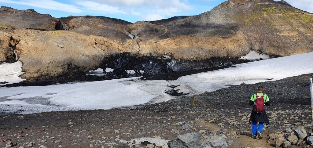
5. The most difficult part of the Fimmvorduhals hike
After a few snowfields, the most difficult part of the hike (at least for me) followed. We descended into the small valley full of ash, clay, and melting ice and snow. Firstly, we had to descend down through the slippery path consisting of ice and ash. It was unclear where exactly the path led and we had to find our own. OK, done. But next, we had to climb the very unpleasant hill. We had already seen several hikers in front of us struggling at this part and in a while, I completely understood why.
For me the most difficult part of the Fimmvörðuháls trail in front of us
The hill in front of us was pretty steep and had a pretty bad grip. It reminded me of the slippery part of the hike to Bláhnjukúr in Landmannalaugar, but this one was much worse. This hill again consisted of black ash, melting ice, gravel, and clay. None of them was any firm and I felt like slipping and falling with each step. And this didn’t feel very pleasant given that you were on a steep slope. This part was the only one where I was a bit scared and which seemed dangerous to me. But that may be only me – I just hate places where I can’t stand firmly on the ground.
The steep and slippery trail made of ash and dry clay. Hiking poles saved my life.
Hiking poles literally saved my life at this part and thanks to them I was able to finish it without stumbling. I cannot imagine hiking this part in rain or strong wind, that must be terrifying.
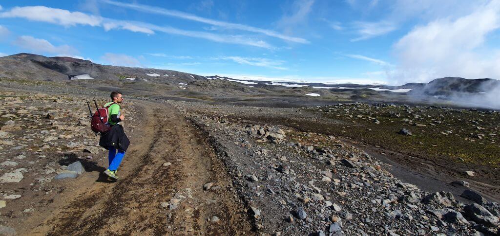
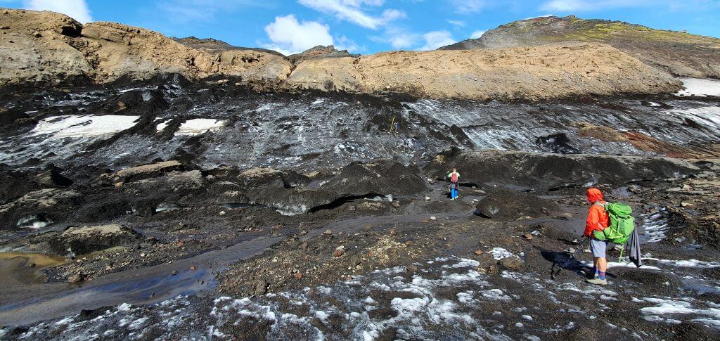
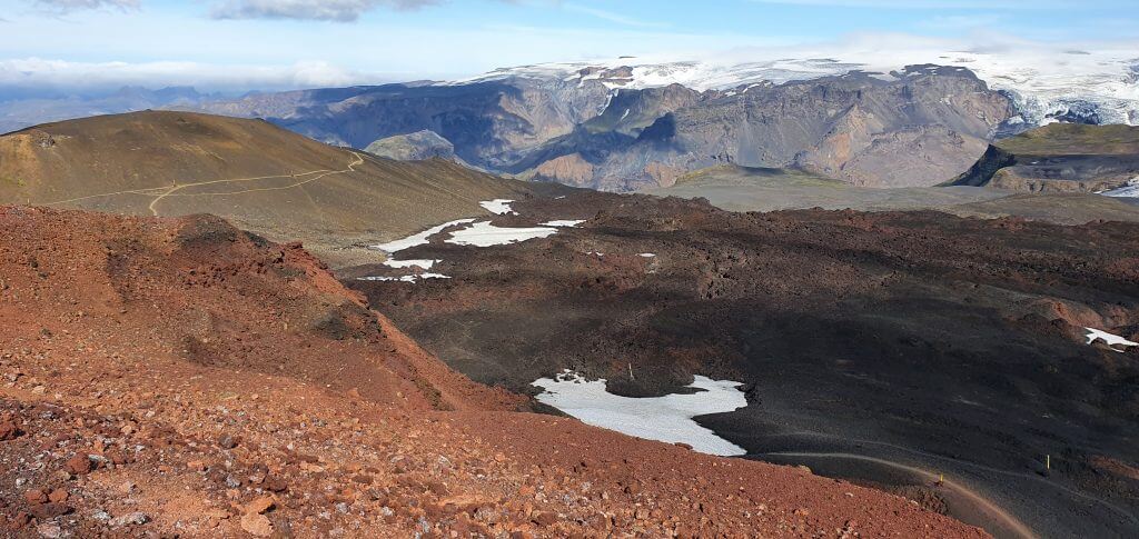
6. Almost two thirds into the hike
Afterwards, several lunar landscapes followed. Red ash, black ash, moon-like hills, really a once-in-a-lifetime experience. The terrain wasn’t difficult anymore at this part. The only spot where we were slightly confused was a crossroad where you had to decide to go on a big snowfield or climb through big black lava stones. We decided to go for the stones and then followed to the nearest yellow stick-mark.
For me one of the 3 most beautiful parts of the Fimmvörðuháls hike
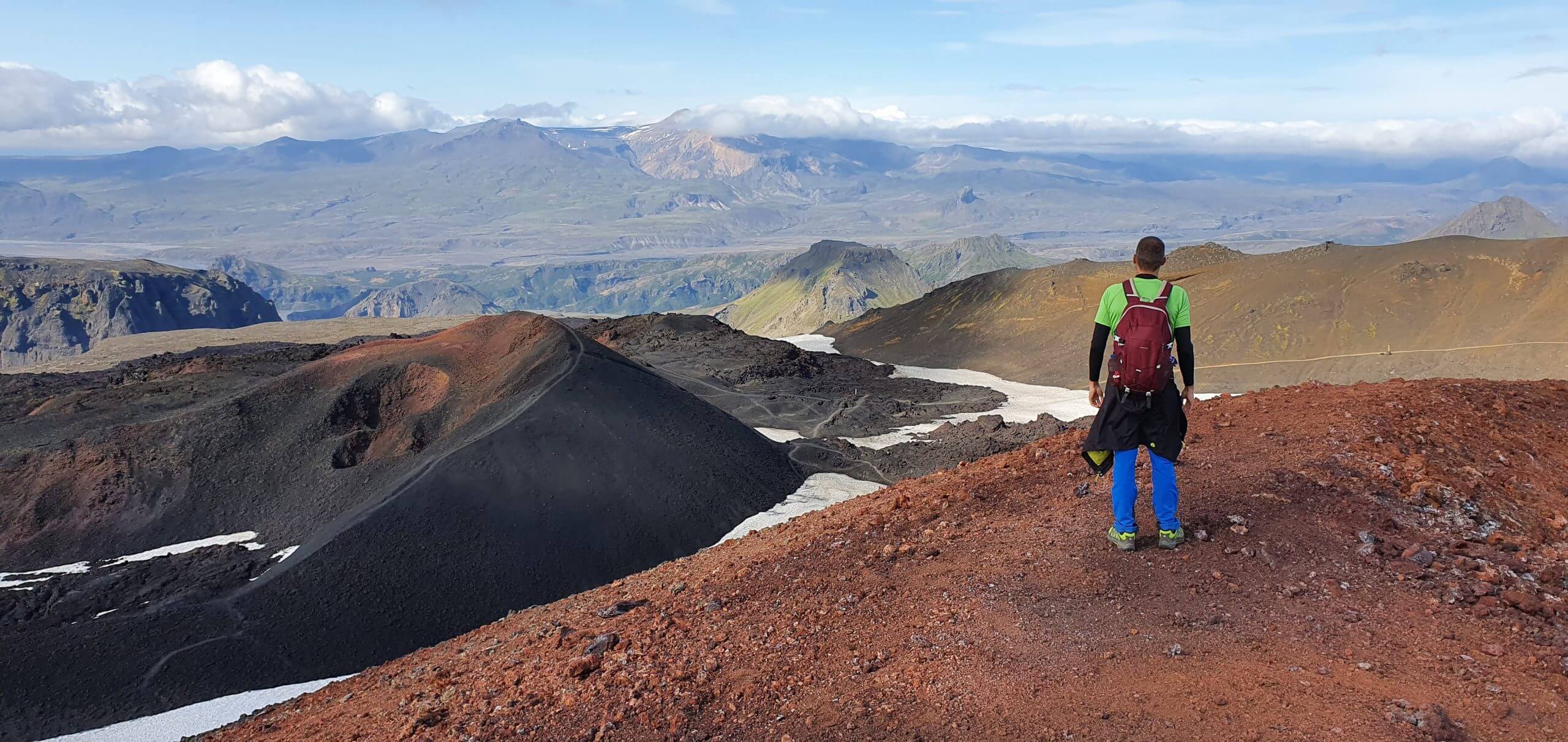
What follows is a beautiful picturesque lunar area around the craters of Magni and Modi. The views are getting better at this part and in nice weather, you are able to already see a bit into Thorsmork valley as well as into the other beautiful valleys in the distance.
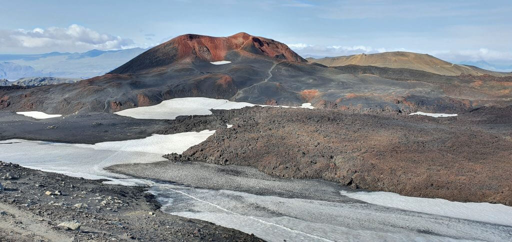
7. Magni and Modi craters
If you have time, definitely go for the little detour up to the Móði crater. It takes less than 10 minutes to reach the top (turn left in the direction of the red peak, coming from the Baldvinsskali hut).
Unforgettable views from the peak of the Móði crater
If the visibility is good, views from the top of the Móði crater are entirely stunning. 5 hours have passed and we were already two-thirds into the entire hike, so we took our time and stayed for a while on top of the Móði, enjoyed the views, and slowly descended back.
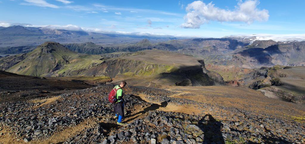
One of the highest points of the Fimmvorduhals hike with stunning views
Shortly after reaching Magni and Modi craters, the magnificent Thorsmork valley starts to reveal itself in front of you. This was one of my favorite views of the entire hike. A huge green valley, mountains, rivers, and different valleys are everywhere in the distance. From this point onwards, only the descent follows – no more climbs 🙂
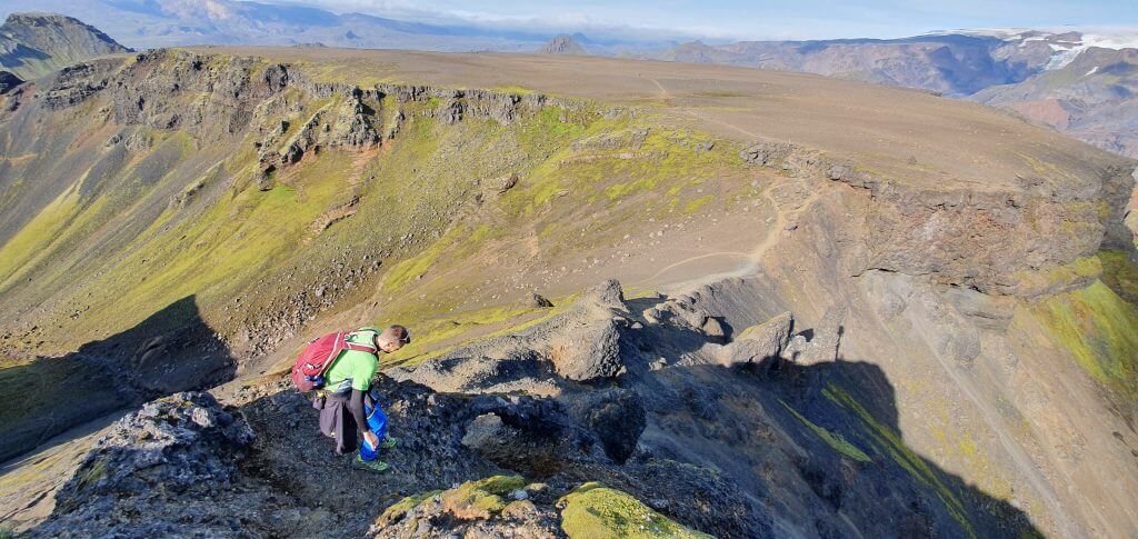
8. The only chains of the hike
The only chains at Fimmvörðuháls trail
As you approach Thorsmork, views are getting better and better. Eventually, we reached the only technical passage of this part of the hike – chains. The descent continues next to the steep ravine and to make it more safe chains were tied into the nearby stones. Take care though, some of them are moving. This passage is a little bit scary when looking at it but otherwise isn’t dangerous because you just walk on the firm flat ground, holding onto chains (and the ravine is below you).
This is the wrong way. The right path leads to the left via chains.
My friend mistakenly took the wrong way and had to literally jump a bit from the cliff to be able to proceed. Do not take this way, it’s dangerous. After seeing him struggling, I took the right path described above. Chains are the right part. Take chains.
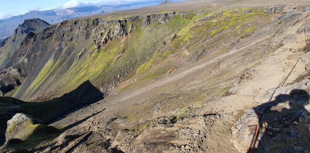
The part many find the most dangerous. Not me. Chains to the right, valley to the left.
These chains at Fimmvorduhals are the part many people described as the scariest one. I definitely didn’t think so. The worst part for me was the one in the middle of the hike with slippery ash and clay without any chains.
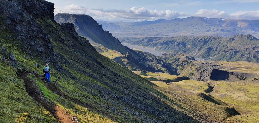
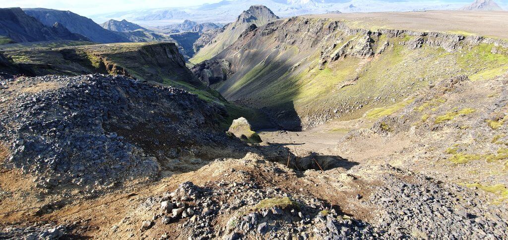
9. Thorsmork valley descent
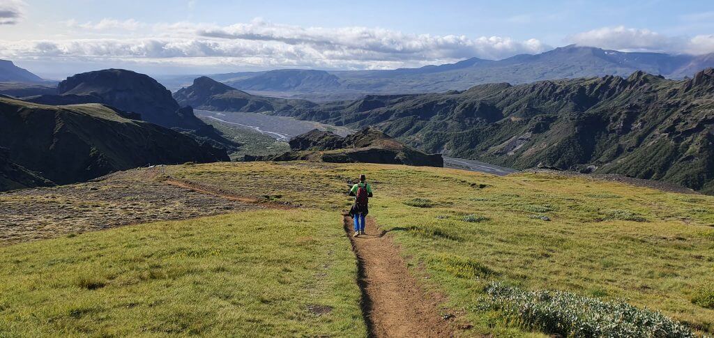
Views of Thórsmörk from the final part of the Fimmvörðuháls trail
The final slightly technical part of the entire hike is the famous Kattarhryggur, or “cat’s spine” pass. It’s a narrow pass where there’s a steep ravine both on your left and on your right. There are no chains, but the pass is pretty flat with firm ground. Unless the weather is very windy or otherwise unpleasant, hiking this part shouldn’t be any problem.
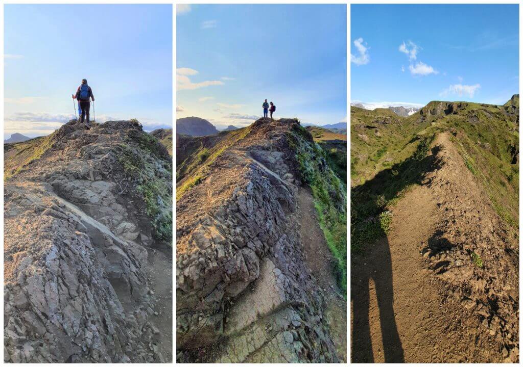
A famous Kattarhryggur (cat’s spine) pass was not that bad in a beautiful weather
The gradual descent into the Thorsmork valley continues afterward. Huge green areas with views towards Thorsmork, Krossa river, and its arms. We made roughly a 1-hour long break before Kattarhryggur to admire the surroundings and arrived down at the Basar hut at 7 PM. Without the break, the hike would take us 8 hours at a medium-to-quick pace, including photo pauses and short food pauses. Our bus was supposed to leave from the Basar hut so we stayed at Basar and waited for it.
Coming back
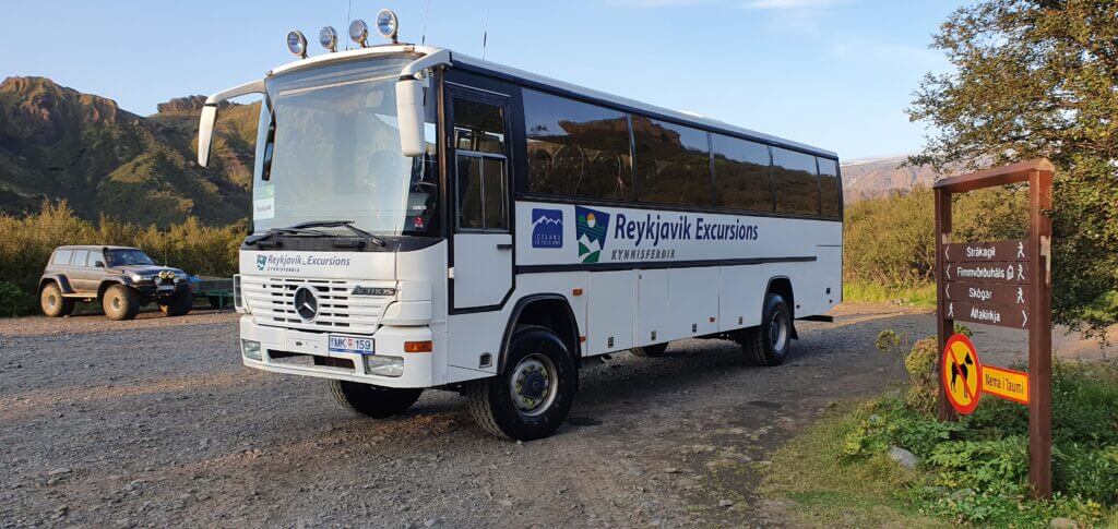
Bus to/from Thorsmork standing at Básar hut
If you have time, energy, or you simply don’t go for the bus from Basar, you may continue on foot to other campsites which are further away. The closest one is the Langidalur campsite (another bus stop), which is roughly 30 minutes by walk from Basar. And then there’s also the Husadalur campsite with well-known Volcano huts, which is another 20-30 minutes by walk from the Langidalur campsite. We took the bus from Basar to Hvolsvollur (and my friend to Reykjavik) at 8 PM and ended our beautiful day.
Fimmvorduhals hike Videos

![]() ask questions or get inspired in our community
ask questions or get inspired in our community


