On this day we wanted to explore south-eastern highlands. Once again, we planned to stay away from typical touristy places and rather explore lesser known hikes and F-roads. Our accommodation base was a picturesque fjord town of Faskrudsfjordur. We’ve never been in the hot spring near Djúpivogur, called Djupavogskorin, so we definitely had to try it out. On a way there, though, I didn’t want to take an easy route and rather planned a drive via an old mountain F-road, former F936.
Contents
As a next stop we wanted to try a hike in Hvannagil valley, a place not many visitors know about. Then we planned to drive a part of the road F980 to Lonsoraefi, until the big river crossing and then turn back. As the only (massively) touristy spot we went to see Vestrahorn and Stokksnes with their black beach. Weather was unbelievably beautiful, so it simply screamed for taking some pictures there 🙂 If we had enough time, I also wanted to drive F985 towards glacier an back. A long day ahead!
Fáskrúðsfjörður
What you can see on a sunny day in Fáskrúðsfjörður
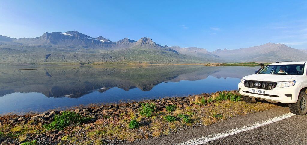
We woke up on an amazingly beautiful sunny morning with the view over the fjord. Mountains were mirroring themselves in the sea. What can be better? Faskrudsfjordur was a real positive surprise of our trip. The whole summer has enjoyed spectacular weather in the north and in the east, while pretty bad one in the touristy south. Our time in Fáskrúðsfjörður only confirmed this. We admired the views and the scenery for quite some time and then moved forward towards our next stop.
F936 – Þórdalsheiðarvegur
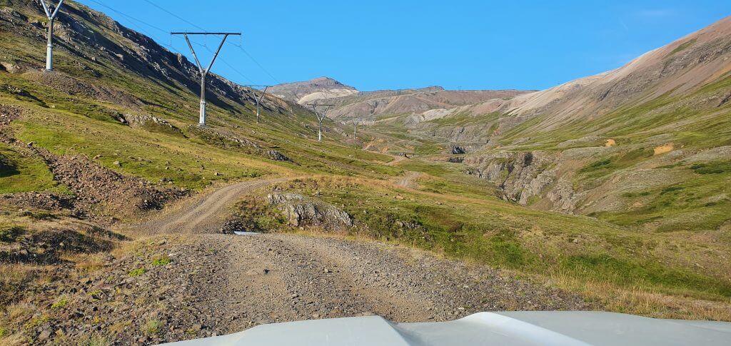
Road 936, Þórdalsheiðarvegur, is the road you won’t find much about on the internet. Some maps mark it as F936, there’s even a sign “F936” right before the road. However, official Icelandic road map says it’s now road 936. So be it. An ideal target for exploration on our own then 🙂
Road 936 (F936), Þórdalsheiðarvegur
Thórdalsheidarvegur is an old mountain road which leads along the power lines in the mountains of Eastfjords, west of Faskrudsfjordur and connects the ring road with the road 95. Compared to road F338, that also leads along the power lines, the F936 is much more eventful, interesting and worth a drive. That being said, there’s probably no reason one would want to drive 936 other than just having an adventurous drive. There are several better quality road alternatives nearby.
What makes 936 unique is a zig-zagged mountain drive through green valley. It sort of resembles F821 in the north in some ways, though 936 is much less driven. There are no river crossings on 936 (hence it’s no F-road anymore). The road is steep and narrow at times, though. I definitely recommend driving a 4wd car on the road, ideally a medium-sized one or bigger. I enjoyed the drive and recommend it to any 4×4 enthusiast.
Djúpavogskörin hot spring
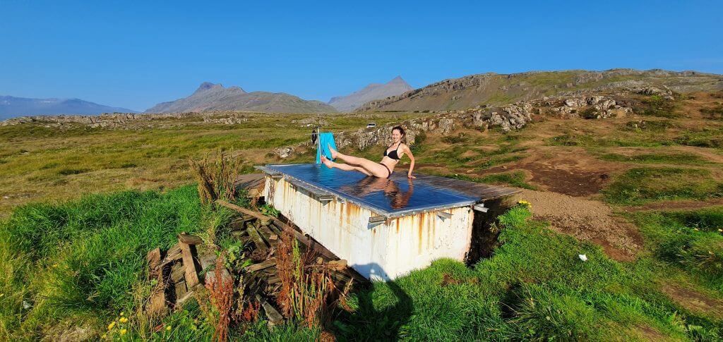
Djúpavogskörin hot spring, Djúpivogur
In short – the only hot spring I couldn’t bathe in. But not because it was dirty or anything, but because it was too hot in summer! In winter it was, however, just right 🙂 So we’ve already given you a spoiler ahead and now let’s talk a bit more about Djúpavogskörin hot spring.
Djupavogskorin is located right next to both the ring road and Djúpivogur. Thus, Djúpavogskörin is pretty well accessible and might get crowded in full season. On the other hand, Djúpavogskörin is not totally easy to find. We tried to follow Google Maps, that at least helped us locate the turn from the ring road. The turn will lead you onto a field track that simply ends at some point soon. That’s probably supposed to be a little “parking spot”. Please take care to not damage anything green with your car.
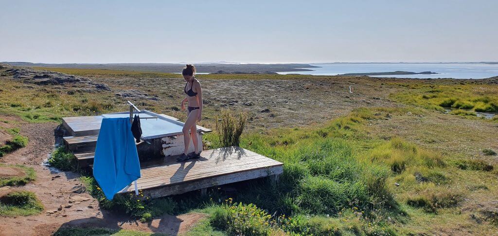
Djúpavogskörin hot spring
The next step was to found the actual Djúpavogskörin hotpot itself. The path leading to the hot spring is not marked. That being said, you don’t have many options, only to follow the only slightly trodden trail you can observe with your eyes. The path will soon bring you to a small steel pool called Djupavogskorin.
There’s no changing room, but there’s a wooden platform right next to the hotpot, where you can leave your towels and change your clothes at. Djúpavogskörin is the hottest hot spring we’ve bathed in. Or at least tried to bathe in. We weren’t able to fully soak in, because the water was simply too hot in the end of August. Djupavogskorin hot spring is free of charge and it’s a nice short stop along the ring road. We were lucky to be alone there, though I do not expect this to happen in the future again in summer.
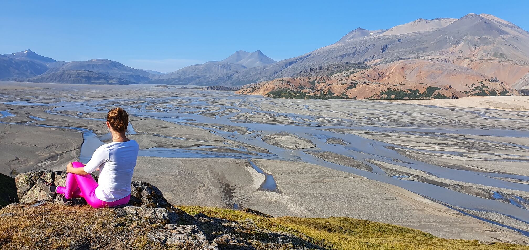
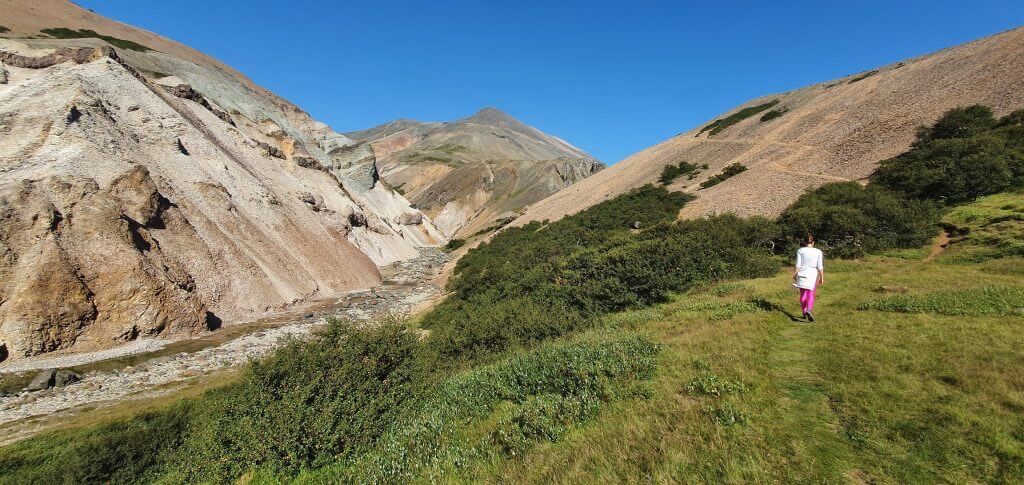
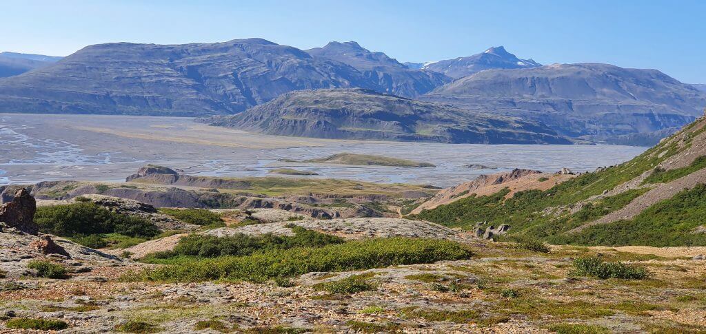
Hvannagil golden valley
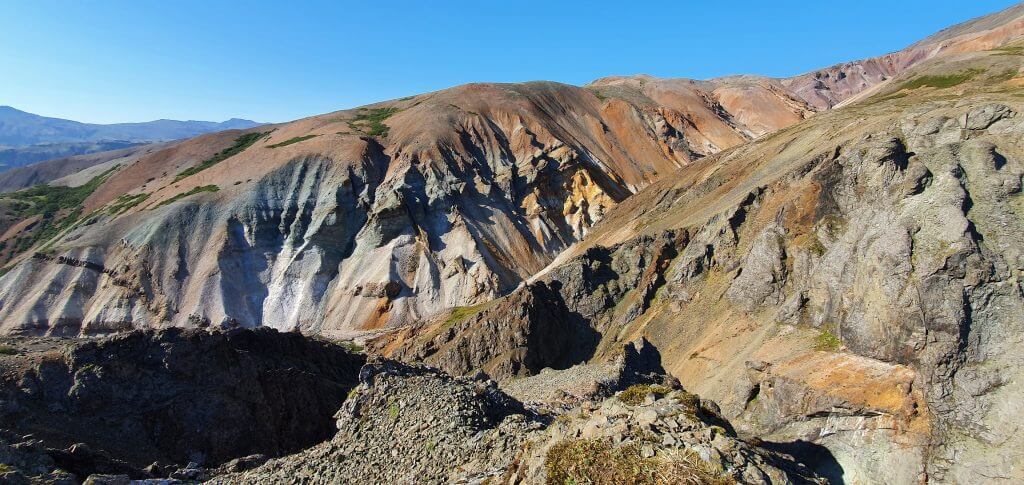
Hvannagil golden valley hike – views from the top
If I had to name one of the “hidden gem hikes in Iceland”, hike to Hvannagil valley would be one of them. Almost nobody knows about this hike, yet it is beautiful. Hvannagil valley is located next to the settlement called Staffafell. Hvannagil is also pretty close to Lonsoraefi nature reserve, just on the opposite side of the river.
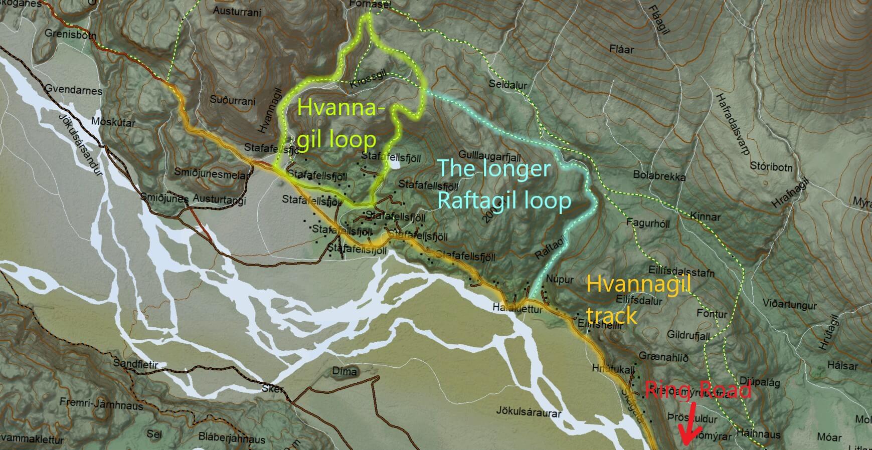
Hvannagil hike map. P.S.: We used to have the wrong Hvannagil hiking trail map here, thanks very much to Jake for telling us!
You may get to the start of the Hvannagil hike trail by any car in summer. The road leading to Hvannagil valley is semi-paved and narrow but without any river crossings. There’s no designated car park, but you can safely park your car at the huge pebbles area located here. This is a good starting point for the hikes in the area. There are two main hikes of Hvannagil valley – shorter clockwise Hvannagil round trip and longer clockwise Hvannagil-Raftagil round trip.
Hvannagil valley hiking trail
Beginning of the Hvannagil golden valley hike
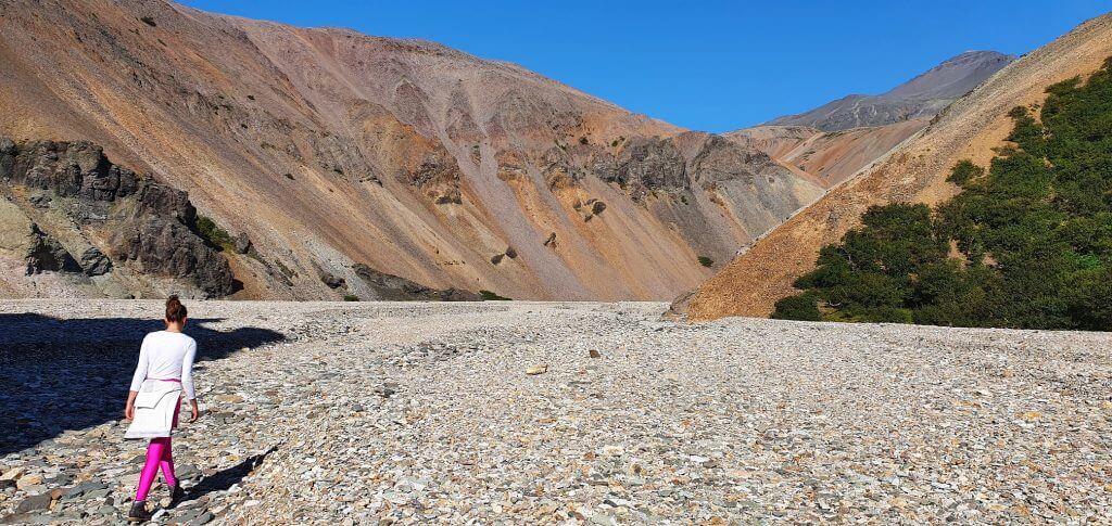
We picked the shorter hike to Hvannagil valley. Hvannagil hike took us 2 hours to complete as a round trip. Hike is not marked at all and most of the time you just have to follow the (sometimes well, sometimes not) trodden trail. The maps like Alltrails or Mapcarta helped a lot. Hvannagil hike starts by walking on pebbles in the direction of the Hvannagil canyon. You will basically be walking through the dry river bed. Hike then continues steeply up the hill on your right via a bit slippery and a bit steep ascent. You should be able to spot this either as a trodden path or on your maps.
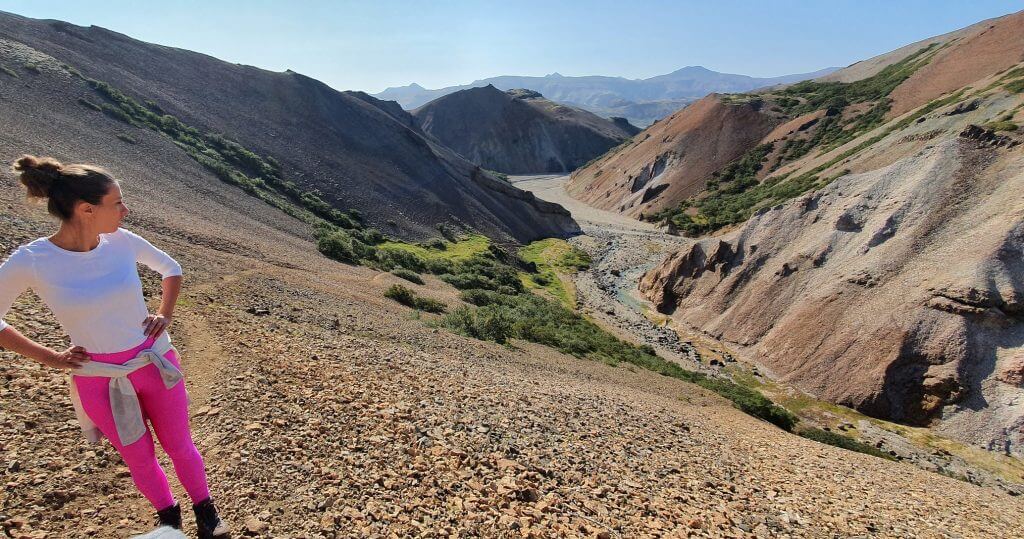
Hvannagil golden valley hike
Both the views of the canyon and the views you will get when you reach the top of the ascent are amazing. And, most likely, you will not meet many fellow visitors in here. So the feeling of remoteness only intensifies the entire experience. Be sure to pick a nice day, i.e. not too foggy or too rainy, otherwise you won’t see much during the hike and the ascent may become a bit dangerous.
Hvannagil golden valley hike – the ascent
If you continue for 5 minutes from the highest point of the hike in a clockwise direction you will have two options for your descent. Either do a longer hike, which continues as a more gradual descent to the left, or descend quickly via a steeper gravel trail on your right. Firstly, we couldn’t even find this second alternative. Luckily, we met one other couple and together we figured out, also thanks to our maps, how to descend back towards our car.
The descent
This steeper descent leads via gravel trail pointed directly towards a lake in Hvannagil valley. You should clearly see this lake, so this will be your lead. Try finding a path leading to the right (not left) edge of the lake. It’s useful to have hiking poles at hand for this section, it can get slippery and a bit steep. Otherwise it’s pretty doable in good weather and in normal health conditions and fitness.
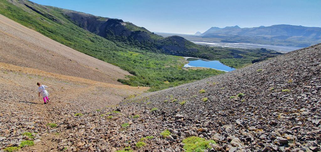
Hvannagil valley hike – the descent
After this descent, you can walk around the lake, or just have a picnic there, or both. At this point, you are already back down at the lowest altitude point of the trail. The only thing left, is to find the way back towards your car. This again took us a few moments, because the trail is not marked. That being said, you don’t have many options, so you will surely find your way. We made a mistake and turned too much to the right, where we got surrounded by a private property soon.
Instead, after passing the lake, we should have gone more to the left (straight ahead from the lake) and not turn right that soon. That way, we soon reached the huge pebbles area where our car was parked in roughly 10 minutes.
Hvannagil track
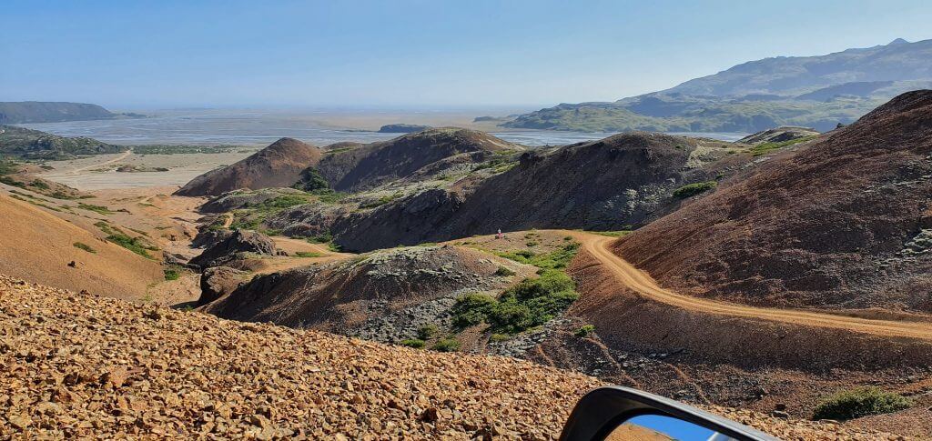
Hvannagil dirt track
After reaching Hvannagil valley car park, it’s possible to continue further following the dirt road, or better said a dirt track, along the river, deeper into highlands. We drove the track for a few more kilometers with our Land Cruiser and you definitely need a 4wd car for this first part of the track. Maybe even a super jeep for latter parts (which we haven’t driven yet).
Hvannagil golden valley track – views from the top
The first part of the track, right next to pebble “car park” of Hvannagil valley, is a narrow and a bit steep ascent on leading on the nearby orange hill. There are steep falls on your sides. Luckily, the ascent is not that long. Once you reach the top, amazing 360° views will open up all around you. It’s definitely worth doing this climb to see these views in good weather.
The track continues further along the river, more into the highlands, but we didn’t follow it anymore, due to the lack of time. There are some huts and settlements in the area, so the track should definitely be accessible in summer, I’m just not sure about the quality of the road, or whether there are any river crossings or not.
F980 – the road to Lónsöræfi

Views halfway into F980 Kollumulavegur
A long day has continued. Our next planned destination was a treacherous F-road called Kollumúlavegur, in other words F980, leading to a huge Lonsoraefi hiking area. F980 itself is not treacherous, however, there is one spot on F980 which makes this road one of the hardest-to-pass F-roads in Iceland. This spot is the huge river crossing right in the middle of Kollumúlavegur.
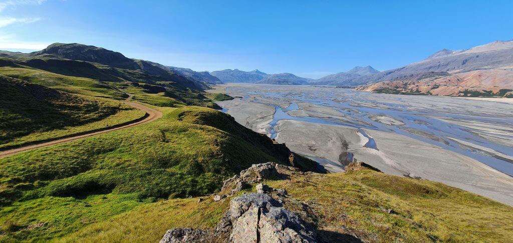
F980 Kollúmulavegur to lonsoraefi
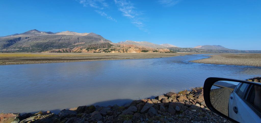
But let’s start from the beginning. We had an amazingly beautiful weather when driving F980 and the surrounding views were simply magnificent. The road starts as a drive through lush, green valley. There’s a small river crossing somewhere around the first quarter of F980. The highlight of the drive came after driving for around 20 minutes, after the first (small) river crossing. We passed a pretty narrow part of the road with a steep fall on our right and then the most beautiful view of the day popped out.
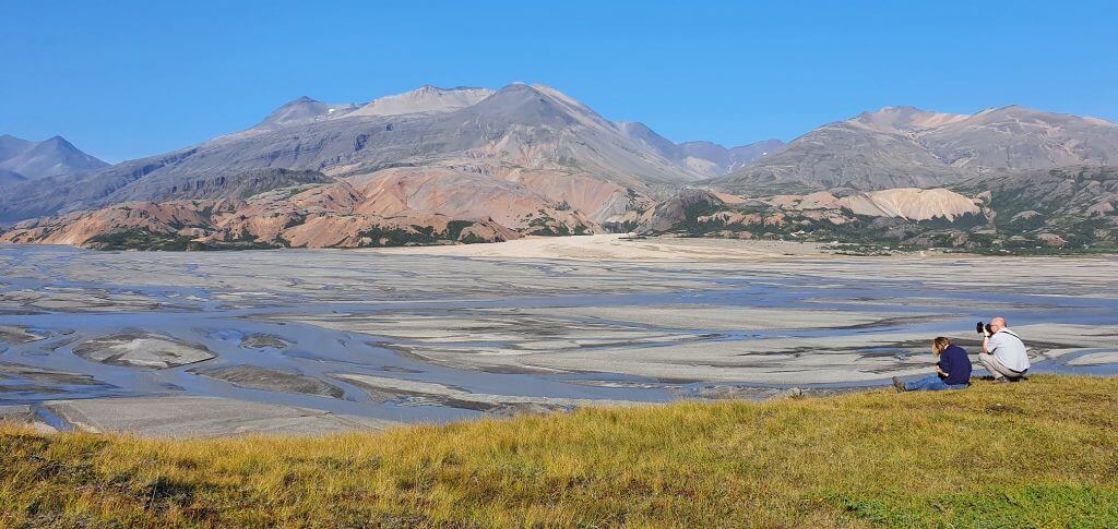
Views at Jökulsá river from F980
On a beautiful day, you can observe endless arms of the river Jökulsá on your right. Some of them are drier, some of them heavier with more water. In the background, mountains of the Hvannagil area stand proudly. This makes for a really unique and picturesque scenery. We’ve even met two local photographs who were taking advantage of this amazingly beautiful day and making their photoshoot of river Jökulsá as well. We’ve taken some pictures of this unforgettable scenery, enjoyed the views and continued towards the biggest threat of the road F980.
Skyndidalsá river crossing
F980 – Kollumúlavegur to Lónsöræfi
This threat is the river crossing of the river Skyndidalsá. And this river crossing is huge. In terms of width and depth Skyndidalsá may be bigger than infamous Krossá in Thórsmörk. On our way to the river crossing we’ve met one local on an older, but bigger car than our Land Cruiser. I asked the driver whether he attempted to cross Skyndidalsá and he just replied “no, I didn’t have the guts, it’s just too big”. Nevertheless, we arrived at the river crossing anyway and made our own assessment.
D980 Kollumúlavegur Skyndidalsá river crossing
Our assessment was in line with that of the local guy. The crossing simply looked too big and dangerous to do, despite the road F980 being marked as “green”, i.e. open and passable on www.road.is. Even this mark is not everything, it’s better to turn back than to get your car drowned. We’ve seen several videos of cars getting entirely drown in Skyndidalsá on this river crossing of F980 (see below) and didn’t want to end up in a same way. That being said, we’ve admired the power of the river for a few moments, turned back and drove all the way back to ring road.

In a beautiful weather, F980 is definitely worth a drive at least up to the river Skyndidalsá , especially due to amazing views over river Jökulsá and Hvannagil in the background.
Vestrahorn
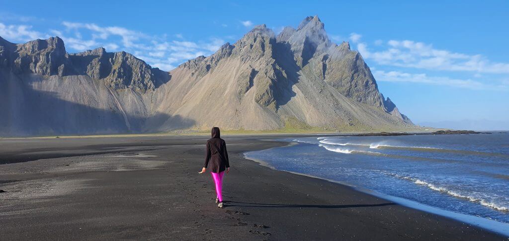
Vestrahorn, a.k.a. Stokksnes on an amazingly beautiful day
For our next stop we headed to the famous and popular Vestrahorn mountain. For the first time. Yes, we always rather avoided this touristy place, in the same way as we up to today still avoid trips like golden circle, because they are just too crowded for us. Anyway, let’s come back to Vestrahorn. Is Vestrahorn worth all its hype and is then Vestrahorn and Stokksnes worth visiting? Well, if you get a nice weather then we have to admit, it really is.
We were lucky to have almost completely clear skies. And that’s exactly one of the settings when we definitely recommend you should visit Vestrahorn. When, on the other hand, we do not recommend the visit, is a too foggy weather. If Vestrahorn is covered in mist, the entire scene loses most of its charm. This luckily wasn’t our case this time.
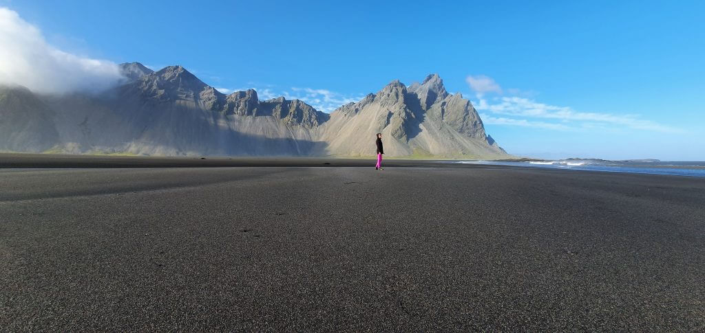
Vestrahorn black beach
We firstly bought 2 tickets for the area at the Viking café (yes, this is private property and you have to pay for the visit). We parked our car roughly on a halfway between Viking café and the Lighthouse. Then we simply walked and enjoyed a picturesque black sand beach. Although sunny, it was still pretty windy, but hey, that’s Iceland, right?
Next, we headed towards the artificial “Viking village” next to a Viking café. We decided to take a walk through the beach to reach the village from the east. And this was not a good idea. The beach soon started to be wet and there was no clear path leading to the Viking village. We spent more than half an hour just figuring out how to find a path to the Viking village without getting our feet wet.
Vestrahorn beach pic
We finally figured that out by zig-zagging in-between all of the puddles. But it took us ages. And the path was much longer than we originally expected. That being said, I recommend you don’t walk to the Viking village through beach but rather drive there and leave your car at the car park.
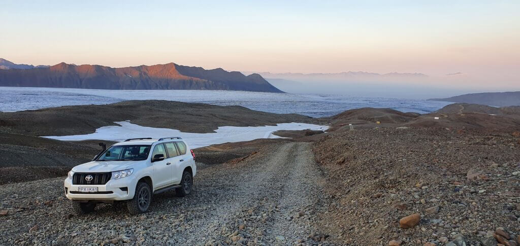
F985 – Jökulvegur
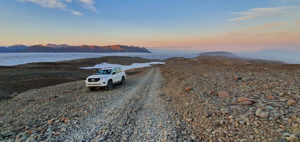
Amazingly beautiful sunset at the peak of F985, Jökulvegur, next to the Skalafellsjökull glacier
As the last adventure of the day, I planned an F-road drive and this time I was determined to finish the road until the end. My target was the road F985 – Jökulvegur, F-road leading to Skálafellsjökull glacier, branch of the biggest Icelandic glacier – Vatnajökull. I already knew that F985 doesn’t contain any river crossing so I expected just a mountain drive, which was exactly the case. But, as usually in Iceland, F985 is no ordinary mountain drive at all.
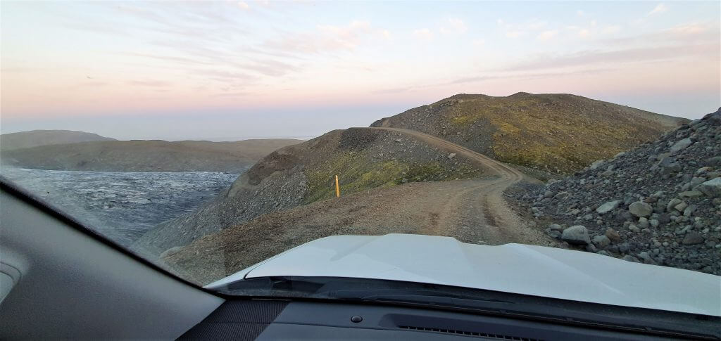
F985 Jökulvegur
F985 has probably the biggest number of zig-zag bends out of all roads I’ve driven in Iceland. F985 will lead you to a pretty high altitude through steep gravel road. F985 seems to be short on the map, but in reality, it felt to be quite a long drive. And the drive is not for those afraid of heights 🙂 Several parts of the road will test your guts.
I drove F985 in our modified Land Cruiser and had no problems at all. It may be dangerous to drive all these steep ascents and rough gravel with Dacia Duster or anything smaller. Yes, it may be possible, but irresponsible. I better recommend taking a Land Cruiser or anything bigger, no shame for a super jeep.
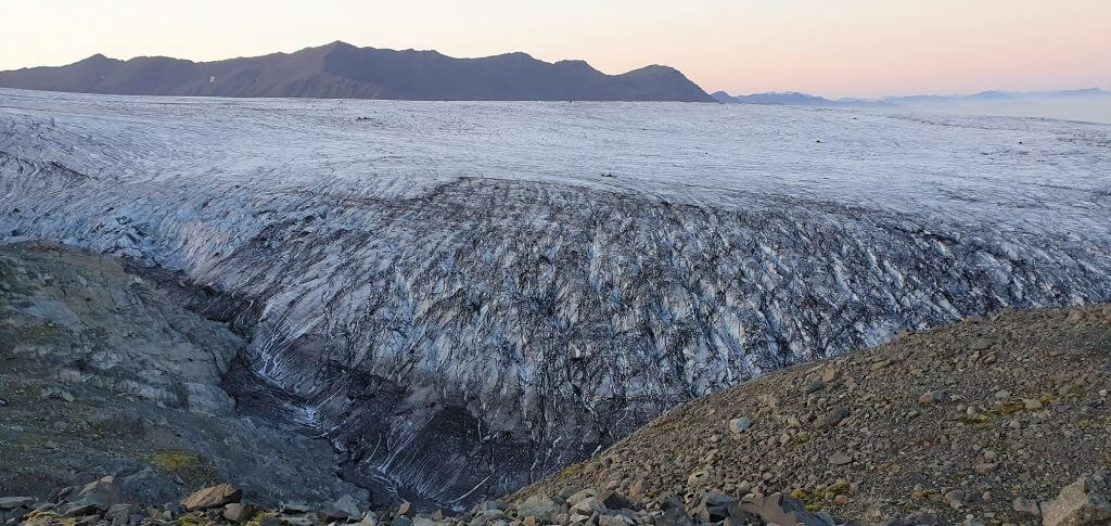
F985 – Jökulvegur, views at Skalafellsjökull glacier
F985 mostly serves as an access road to the glacier. Tour companies take their jeeps with snowmobiles and transport tourists together with snowmobiles directly to the glacier via this road. Once you reach the final bits of F985 in the highest altitude, you will understand what I’m talking about. Hint: you will be really close to the glacier! The downside: F985 gets rougher and harder to drive. At one point, F985 was just too rough and steep even for our Land Cruiser. At that point, already being really close to Skalafellsjökull glacier, I decided to stop, take pictures and turn back.
F985 Vatnajokull glacier
F985 is a pretty adventurous, exciting and also a bit dangerous drive. The main “attraction” of the road is the glacier in the end. Is F985 worth driving for someone who is in Iceland for the first time? Probably not, and it might also be dangerous without prior experience in driving roads like this. For me, F985 was definitely worth a drive for another out-of-this-planet driving experience in Iceland.
Northern lights in Rauðaberg
We finally headed to our accommodation, which was located on a remote farm of Raudaberg. This is a great spot for hunting down the northern lights, if they are present. We stayed at Rauðaberg on a first day of September and we were lucky enough to already see the northern lights, although weak! We had totally clear skies and some aurora activity, so we simply headed out towards midnight and in a few minutes, we were able to take this picture:
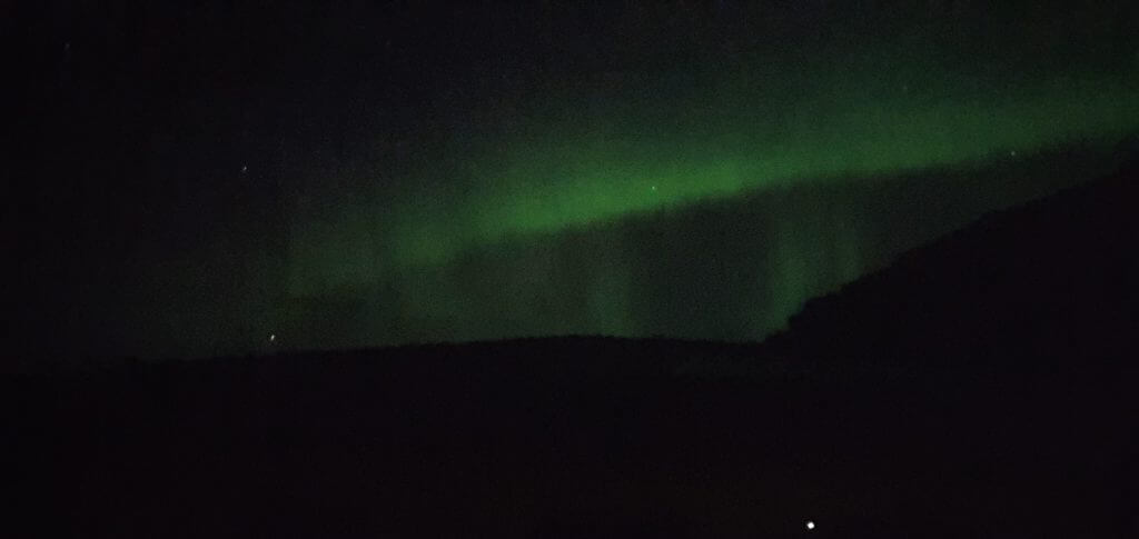
Northern lights in Rauðaberg, 1st September
Beware, though, that in reality aurora at the time of our visit was not as green as the picture shows. It was more like white or faint-green. The entire magic was then performed by the camera of my phone. Nevertheless, it was a beautiful experience anyway.
![]() ask questions or get inspired in our community
ask questions or get inspired in our community


Hi. Thanks again for your wonderful posts. We are spending 3 days at Skaftafell. We will hike to Kristinatindar one day, do a 6 hours hike on the ice another and have a full day to explore. I was wondering if you recommend that we go to Hvannagil and hike there ( we will spend 2 days hiking in Landmannalaugar before). I see you really liked it. Thanks
Hi Veronica, thank you! It depends on what you are looking for – Hvannagil is a short “off the beaten path” hike. If you are looking for a “full day hike” then Hvannagil would be a bit short. Yes, we liked it, it’s a nice hike. It’s definitely not the Top 10 in Iceland but in that area and given the short time it was a nice detour (in good visibility weather).
If you are looking for a full day hike, you may try options in Hoffel or Lonsoræfi (for Lonsoraefi you would however need a jeep/driver to get through the river)
Thanks again! I was now reading your post about weather. And as I just said, I read it and paid attention and even more so, I will try not to feel bad about the fact that this week it is beautiful in the area I am going and the day I get there it starts RAINING!! I will read your post again and try to maintain a good/optimistic/strategic mind. I really appreciate all the time you take to answer questions!
No worries, if you are in Iceland for longer than a week you will experience all kinds of weather – sunny, rainy, windy and combinations of those 🙂 of course it’s nice to have blue skies all the time but that’s simply impossible in Iceland most of the time. So it’s important to be dressed well, enjoy also moodier days (some places are actually nicer when it rains because the moss is greener when it rains) and with some difficult hikes it’s good to be flexible and better reschedule them a day or two before when the forecast doesn’t change that much