Thorsmork is an unbelievably beautiful, one-in-the-world valley located in the southern Highlands of Iceland, near the ring road close to Seljalandsfoss. It is pretty hard to access, mainly due to treacherous river crossings, which need to be managed very very cautiously and with respect.
Contents
Þórsmörk. The “Valley of Thor” has been high on our list of to-visit places since our first ring road trip to Iceland. Why? Because it’s amazingly beautiful and it’s still one of the places which are not crowded yet. The reason behind that is pretty straightforward – it’s accessibility. The road F249 leading there contains several river crossings which get bigger and bigger as the road progresses and eventually end with the biggest one – the Krossá river.
Stakkholtsgjá canyon Þórsmörk
Some say “never go to Thorsmork with a rental car!” or “go to Thorsmork only with a guide!”. While I mostly agree, this is still too much of a generalization. I would rather say: Don’t drive to Thorsmork if you are not WELL PREPARED. What does well prepared mean? You should go in the right season, during the right weather, drive the proper car, study the roads in advance, study the river crossings in advance and on-site.
If this is too much effort for you, then don’t go to Thorsmork with a rental car! For those willing to put up this extra effort, we wrote this guide on visiting Thorsmork.
We also made video footage of our self-drive day trip to Thorsmork, including all of the major river crossings and best stops along the way. Just a word of caution – we went under almost ideal conditions!
Our trip to Thorsmork
We had a base near Hella and were choosing where to go on our first day mostly based on the weather. As the weather looked nice all around the south, the choice was tough. After some thinking, we chose Thorsmork, because you really need a nice day to visit it. Our Icelandic friends had also told us that the water level in the rivers was pretty low these days, which encouraged us to try getting near the Langidalur campsite of the Thorsmork valley.
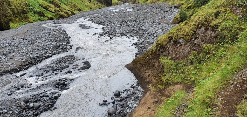
F249, a dangerous road to Thorsmork, due to its river crossings.
We had left our accommodation at 9 AM and headed towards Seljalandsfoss, where a detour towards Thorsmork lies – roads 249 and F249. Our ultimate destination for the day was the Langidalur campsite. We didn’t want to go directly there though, because this would involve crossing the Krossá river. However, it was still possible to avoid Krossá by leaving the car just a few meters away from the crossing and continuing by a footbridge. I also planned for several nice stops along the road, the first of them accessible even with a 2wd car.
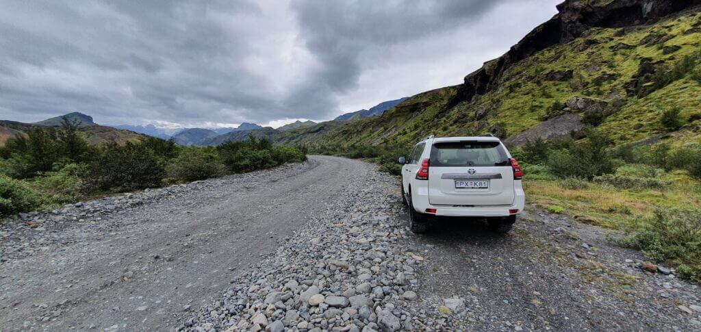
Road 249 and the following F249 are gravel roads without any steep sections and without potholes, which is pretty good, given the roads are F-roads. The only quality issue with the roads (not talking about river crossings) is the big gravel. This means you have to drive really slowly to not damage your car and the journey will be bumpy anyway. The biggest caveat of F249 are river crossings, though.
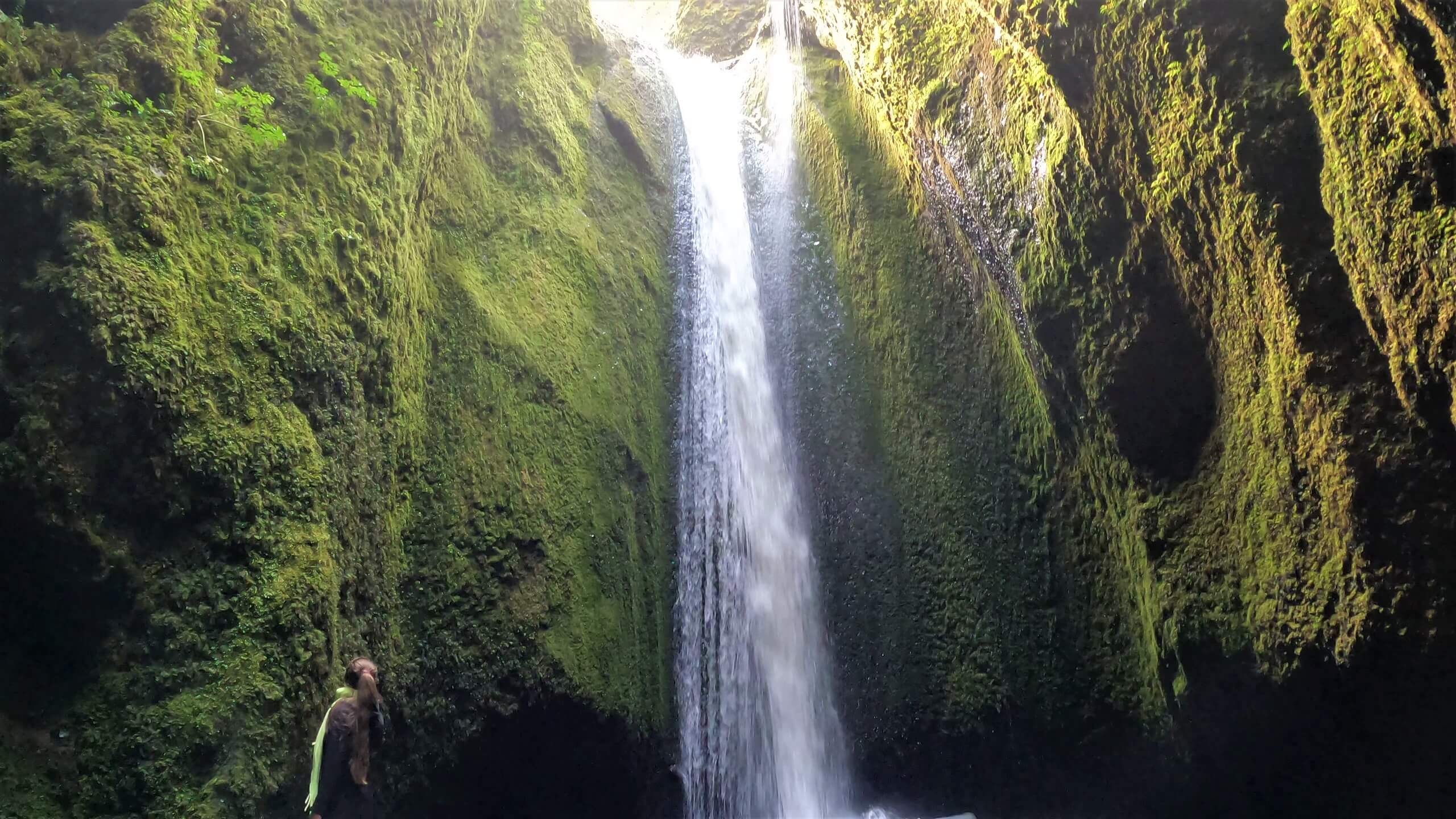
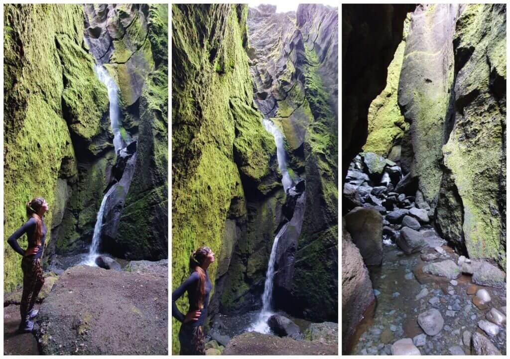
Nauthusagil waterfall
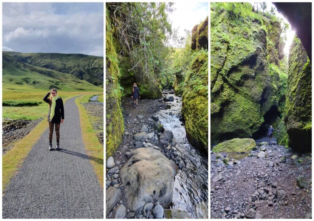
Soon we arrived at the first stop of our trip – Nauthusagil canyon and waterfall. For us, Nauthusagil was one of the most magical places we’ve seen around Iceland. The place is still remote and not that much visited, despite its remarkableness. One way trip to Nauthusagil takes about 20 minutes.
Nauthuságil waterfall “parking” 🙂
The waterfall and the canyon are accessible even by a 2wd car because they still lie next to 249 road only. We left our car at the small car park, where at the time of our visit 3 other cars stood. At that moment, the sun had already started to shine in between the clouds, only confirming our view that this should be a very nice day for visiting Thorsmork.
After parking the car, we followed the paved path along the small stream heading towards (not yet to be seen) the hidden Nauthusagil canyon. The path is easy to follow and it’s almost impossible to get lost since there’s only one way. The path soon gets narrower and changes into the hop-on-the-stones route. The rest of the way is basically walking and jumping on the various types and sizes of stones and boulders in the little water stream.
Nauthusagil waterfall trail
Only walking the entire path is a truly magical experience. We felt like in a fairy tale. This was even underscored by the fact that we hadn’t met a single person yet at that time. The gorge is really beautiful and not that long. Soon you will reach the point where some tend to stop and turn, however that is a huge mistake in our opinion 🙂
If you want to get directly to the Nauthusagil waterfall, you have to climb 2-3 meters of boulders with a help of a vertical chain. Some find this spot intimidating, but even my wife who is afraid of all types of chains during hikes was able to make it with some help. It’s not the place for people with any movement problems, though.
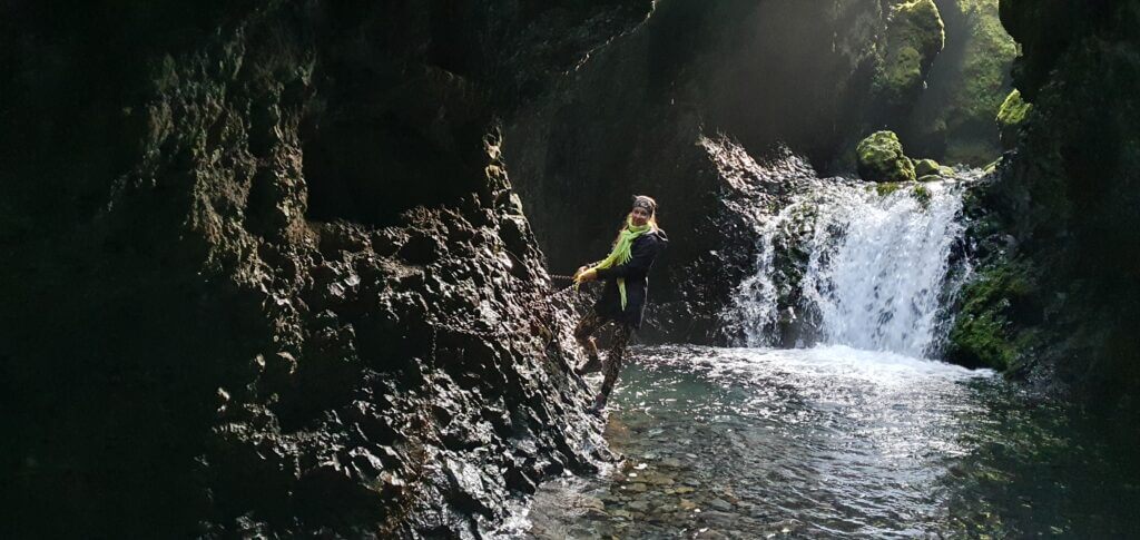
Nauthusagil waterfall chains
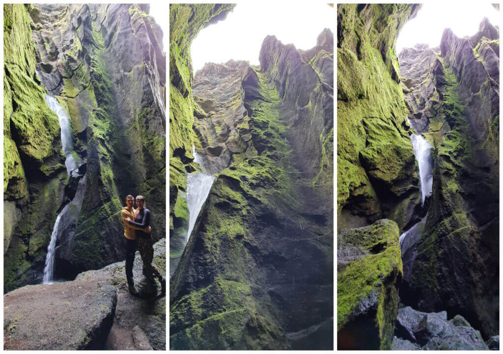
The most beautiful part of this little hike comes right in the end. We reached the source of all this water – the Nauthusagil waterfall. And it quickly became one of our favorite Icelandic waterfalls at all. We were also lucky enough to be there completely alone. Moreover, the sun played its beam game by shining through the cracks from above making it an even more stunning experience. One of the top places in Iceland.
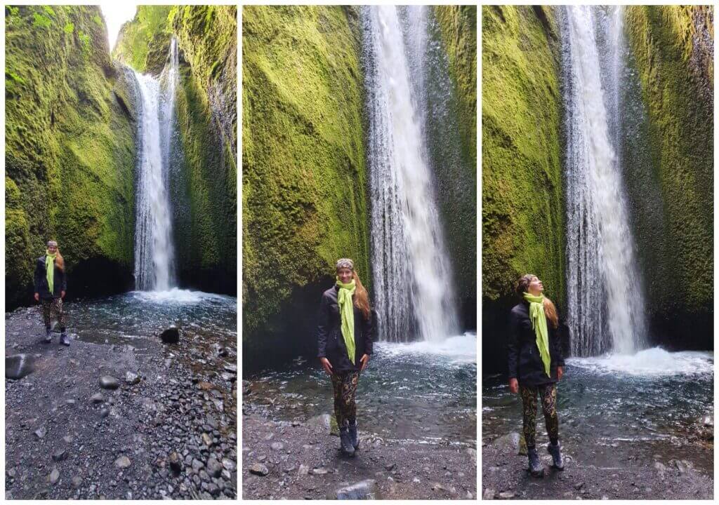
Magnificient Nauthusagil itself
My advice for Nauthusagil would be simple – go for it as soon as you can – before it becomes as crowded as many other Icelandic spots!
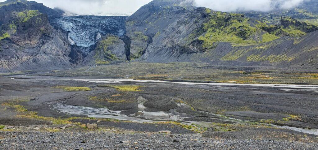
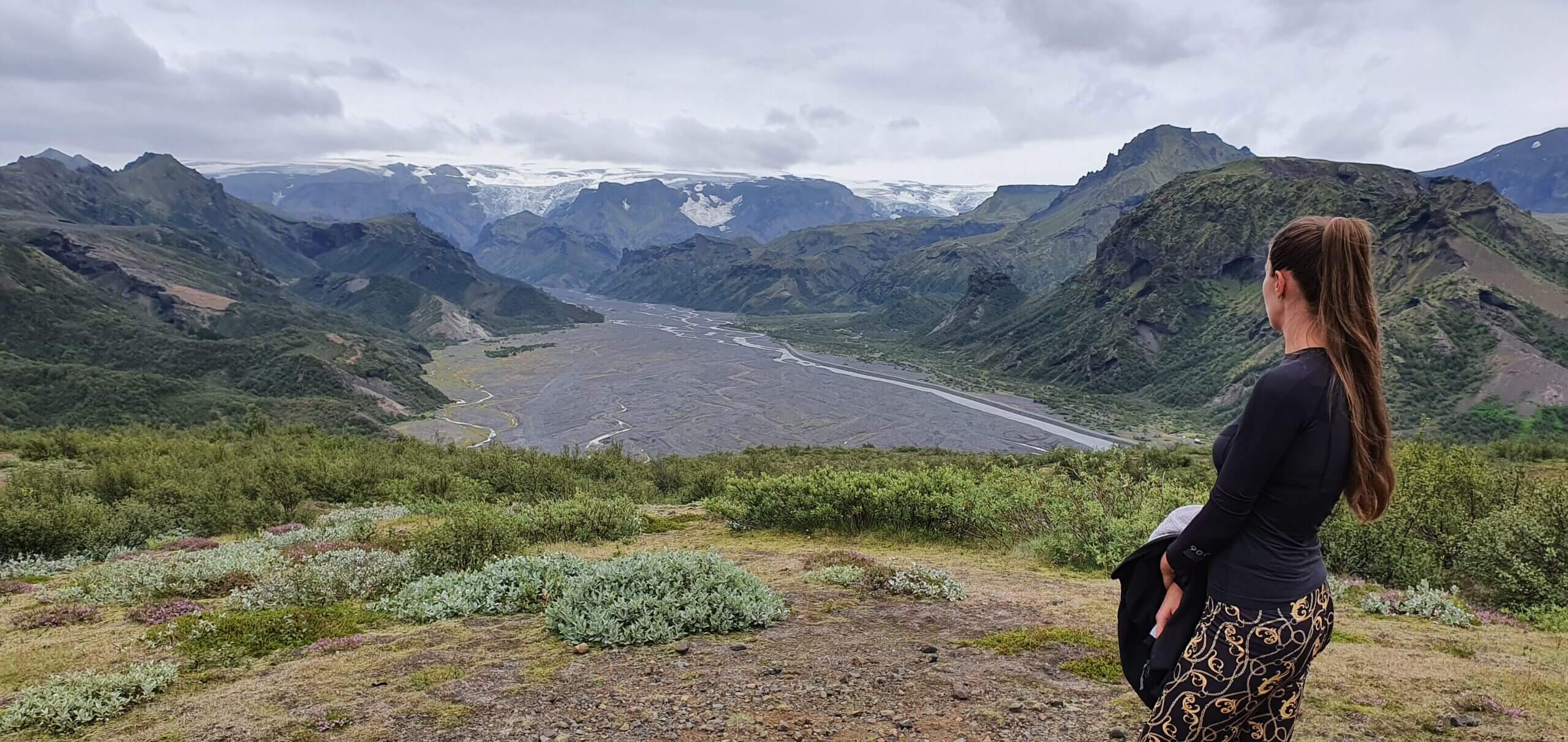
Gigjokull glacier
After leaving Nauthusagil canyon, road 249 soon changes into F249, which means the first river crossings are coming. The tour companies making trips to Thorsmork usually also stop next to the Gigjokull glacier. This is the glacier tongue pretty well visible on your right when coming from Seljalandsfoss direction. If I had to say how is it different from any other Icelandic glaciers – I’m not sure – maybe because of its steepness. Otherwise, it’s a classical blue-white-black color combination of ice-snow-ash when it comes to Icelandic glaciers.
The road to Gígjökull is a detour from 249 to the right towards the mountains. After driving for a few minutes, we reached the pretty fast-flowing river. The river looked like you definitely don’t want to wade into it by feet – which is also a good rule of thumb whether to try to ford it by car or not. If you are afraid to try it by feet, it’s probably too dangerous to drive through it as well. Hence, we decided to turn back. Looking back at the situation, I think our car was pretty much capable of doing that crossing, but never mind – better choose the safer option than to risk wrecking your car if feeling unsure.
Gígjökull glacier and river crossings
Beware, the Gígjökull tracks we drove are just dirt tracks. Not even F-roads. This means they are even harder to drive than F-roads. Always check with your rental company if it allows for such roads, choose your car wisely and study the roads in advance. Mostly only super jeeps are allowed to drive the dirt tracks.
I had studied before there’s also another road leading to Gígjökull – if you continue a few hundred meters further via F249 there’s yet another detour to the right. And yes, we tried even this route. But firstly, you have to cross the first “bigger river” near the Lónið lagoon. This was a first crossing that looked scary. Firstly, the river was flowing really fast, which is a thing you generally want to avoid. Secondly, we were not able to assess what the depth of the river actually was, because the current was dirty and we couldn’t see through to the bottom.
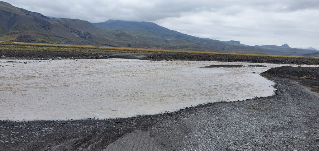
First scarier river crossing on F249 next to Lónið lagoon
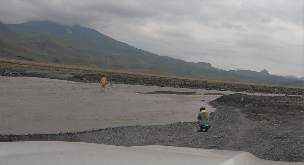
Since trying to “randomly cross” is usually not a good option, I decided to put on my wading socks and get into the river myself. Although the current was strong as expected, the river was pretty shallow. Thus, I decided “it’s time to cross”. The crossing, although bumpy, was otherwise smooth and we safely made it to the other bank. Then we turned on the road to Gigjokull glacier, making it our second attempt to reach it.
Once again, we soon arrived at the fast-flowing river and the little hill leading down to the crossing was in a very bad condition with huge holes, stones, and sharp boulders all over the road. At that point, we already had a pretty nice view of the Gigjokull glacier (and didn’t want to waste the whole day for the glacier) so we decided to turn back and rather enjoy our next stops.
Me wading river Lónið at F249 in Thorsmork
We were heading towards Stakkholtsgja (see below) and on the way there, another major obstacle has been waiting for us. The crossing of the Steinsholtsá river may often be classified as bigger. We arrived at Steinsholtsa with big respect and were ready to turn back in any case if feeling unsure. We were lucky that at the time of our visit 1) water levels were generally low due to the dry period, 2) our friend reassured us this day was good to cross, 3) we could observe a car crossing right in front of us.
We wrote much more about river crossing tips, techniques and warnings here, though. Having almost ideal conditions for crossing, we decided to move forward and were able to finish the Steinsholtsa crossing without bigger problems.
Stakkholtsgja canyon
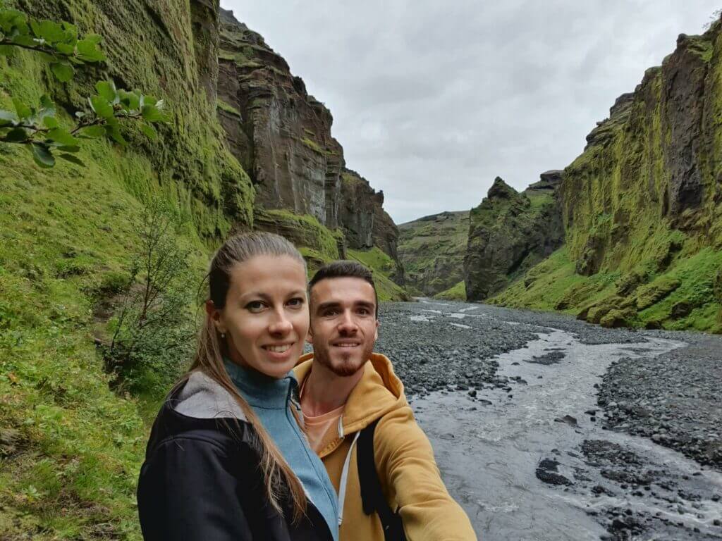
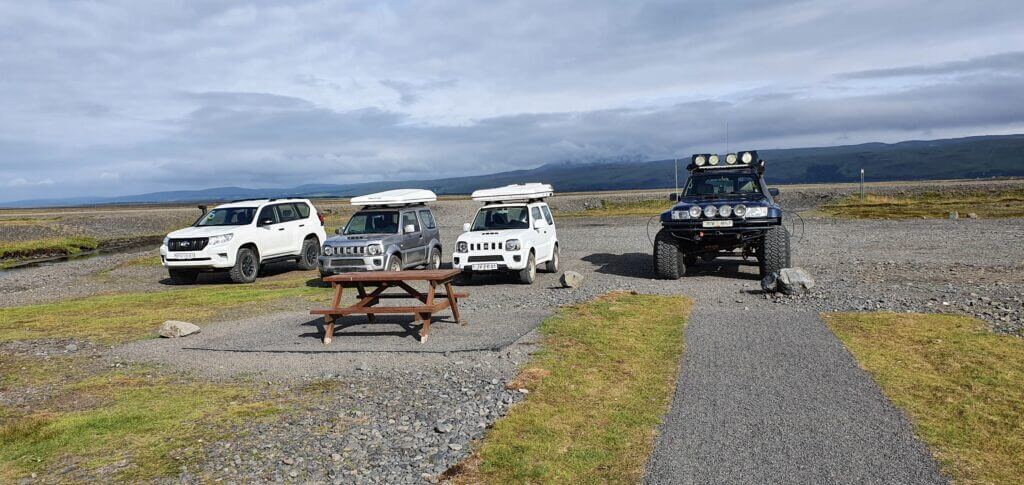
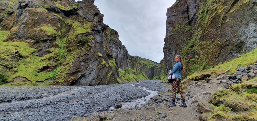
Our next stop was another supposedly-beautiful and not that much visited place – Stakkholtsgja canyon. We arrived at the improvised gravel car park – which can be found thanks to the sign “Stakkholtsgja” (or thanks to cars parking there ;)) We parked our car next to huge modified Land Cruisers with 40”+ tires, making our car look like a small one. I guess this time of the year these huge superjeeps were just overkill because the roads were passable even with a smaller car. But I’m also pretty sure that at many other times these beautiful ones do come pretty handy.
Stakkholtsgja canyon is a stunning ravine carved in between huge rock formations on the sides. The trail towards the end of the ravine (which ends up being surprisingly amazing) is an easy walk that takes around 40 minutes one way if you know the trail. If you don’t know the trail – as was our case – add around 30 minutes for figuring out how to ford the Stakkholtsgja river by feet 🙂
Stakkholstgjá canyon beginning of the trail
Stakkholtsgja ravine trail
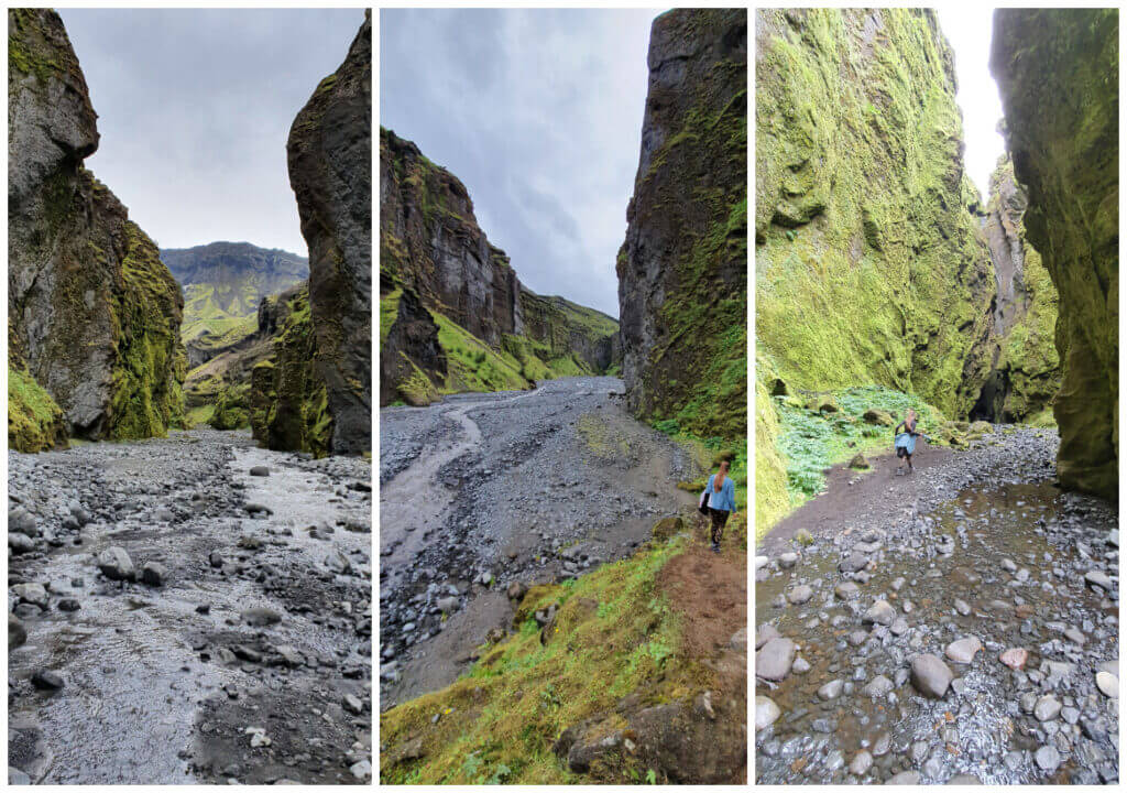
Stakkholtsgja canyon hike is an unmarked hike where you again can’t get lost easily because it leads in between the two bigger hills. In the beginning, the path is a well-trodden mud path, which then turns into a gravel road leading along the river stream. Once again, only walking this path is an amazing experience, where you’re basically strolling through the base of this magnificent canyon. It definitely belongs to one of our favorite Icelandic canyons, easily surpassing e.g. Fjadrargljufur canyon (mainly due to being roughly a thousand times less touristy).
Stakkholstgja canyon trail
After 20 minutes of walking, we arrived at the river which was crossing the path. We met there the group of tourists who were trying to figure out the same as us – how to ford the river without getting wet? This was the question of the day 🙂 For about 20 minutes we desperately searched for a suitable place to ford – without success. The group we met probably made the same conclusion because they got their shoes off and crossed barefoot. This definitely didn’t look like a pleasant experience, not that much because of the cold water but mostly because of the uneven, rocky riverbed.
Fording Stakkholtsgjá
At that point, we looked at our trail map and realized we are already pretty close to the end of the trail, so we wanted to turn back – or more precisely, my wife wanted to 🙂 I didn’t want to give up that easily and persuaded my wife to keep searching for the way to cross. And actually, she was the one who found the proper way soon after our little argument. We crossed the river at its left part, some 100 meters before the river turns right (and crosses the trail). The crossing meant jumping several times from stone to stone and from mud to mud. We successfully didn’t get wet though and didn’t have to ford the river barefoot.
As much as I would love to describe the exact spot where we forded, I’m unable to do so. We didn’t take any footage while holding our hands and jumping from stone to stone. We may reassure you, though, it should be possible even without getting wet 🙂 Just search for the right spot.
Stakkholstgja river fording
After the ford, we continued hiking at the left part of the canyon reaching the final part of this little hike completely from the left (opposite to our first attempt from the right). At that point, we eventually met the group we had met before, that had just finished their barefoot ford. We continued towards the end of the trail (which was located pretty close by). At that moment we realized what a good decision it was not to turn back. We arrived at the end of the canyon which is a huge stony gorge and you may hike it all the way up through the big boulders!
Stakkholstgja ravine waterfall
Rewarding End
This is exactly what we did and didn’t regret doing it at all. It’s a place somewhat similar to Nauthusagil ravine but much much bigger and still somewhat different. I definitely do recommend making the extra effort to get there to be able to admire this beauty. Surroundings like from a different world.
Stakkholstgja ravine with its “secret” endpoint
When coming back from the endpoint of the Stakkholtsja hike, we again struggled a little bit to find the best spot to ford the river, but after a few minutes, we again managed to cross the river without getting wet. Back at the car park, we saw a couple with a guide apparently on a “private tour”. They just went out of the car, looked at the canyon from the distance, and headed back. What a pity they weren’t advised to continue towards the end of the gorge…
F249 river crossings
We already mentioned two major river crossings in the text above – Lónið lagoon river crossing and Steinsholstá river crossing. The Steinsholtsa river is notoriously known for getting some tourist cars drowned regularly. You really ideally need to do all of the following: 1) ask locals for conditions, 2) look at the weather forecast, 3) have a proper car, 4) have already some experience with river crossings, 5) check for conditions onsite, ideally by wading the river yourself by feet or watching someone cross before you. Read more on river crossing rules and techniques on our blog.

On our way to Langidalur campsite (towards Valahnjukur hike), there were 3 more major river crossings. The first of them was the Stakkholstgjá river, the second crossing was the Hvanná river and the third one was the famous Krossá river. We did the first two crossings (Stakkholtsgja and Hvanna) in our car and definitely wanted to avoid Krossá as it is too dangerous. We highly recommend you avoid it as well.
Crossing Steinsholtsá river on F249
F249 river crossings of Stakkholstgjá and Hvanná were very similar to the Steinsholtsá crossing we described above. We were lucky with having almost perfect conditions of low water levels, i.e. shallow rivers and even some drivers crossing right before us, so we didn’t even have to wade these two rivers by feet. However, oftentimes the conditions are much worse! That being said, if you are unsure, better try fording by feet / or wait for someone else to cross first. And if still feeling unsure, better always turn back!
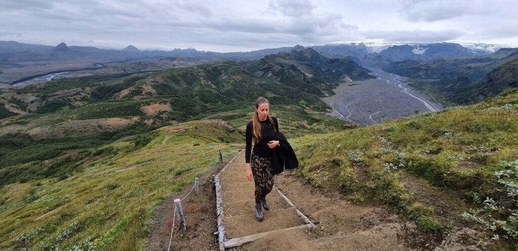
Valahnjukur hike
As a next activity, I wanted to do a hike which would give us a nice view from above the entire Thorsmork area. I studied beforehand all of the hikes available around the area (and there are many of them) and finally opted for probably the shortest one. Not because we couldn’t do a longer one, but because the Valahnjukur hike seemed to be the best in terms of view/difficulty ratio. And it was 🙂
Valahnjukur hiking trail
Thorsmork hiking trails
Thorsmork is a hiker’s paradise. Here is the map of all Thorsmork hiking trails (or at least most of them). If you are into hiking, you may easily spend here a week and still not be able to hike every trail. That being said, the area has a similar “nature shape” around all of the hikes. This means if you choose just one good hike during the good weather (no rain and good visibility) it will give you a very good overview of the area. And any other hike will be pretty similar in terms of views and surroundings.
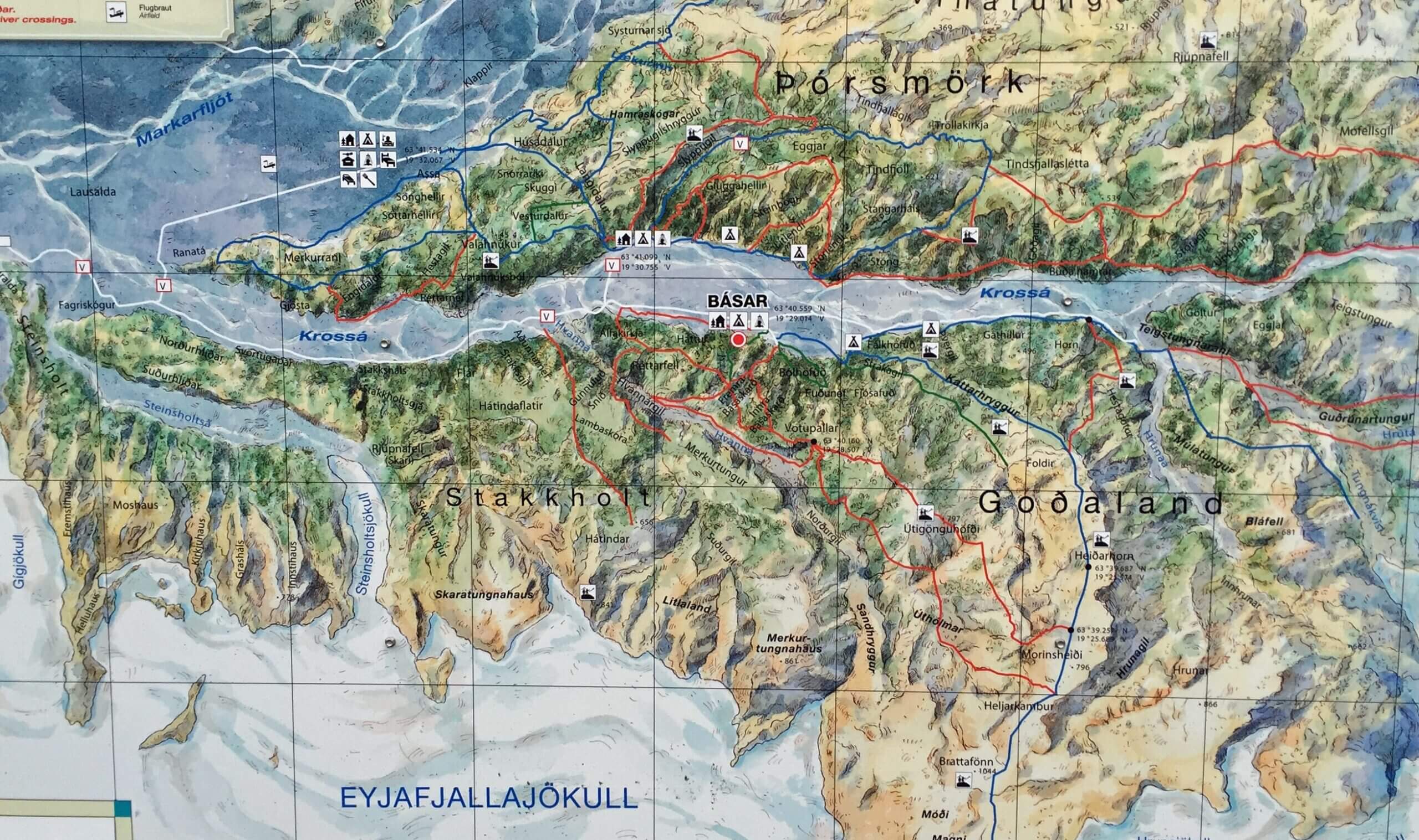
Thorsmork hiking trails map
On the next day, I did a Fimmvorduhals hike, which actually was much higher in terms of peak height compared to Valahnjukur. But the view over the Thorsmork valley still wasn’t as good as from Valahnjukur – so the height isn’t everything, also the location is.
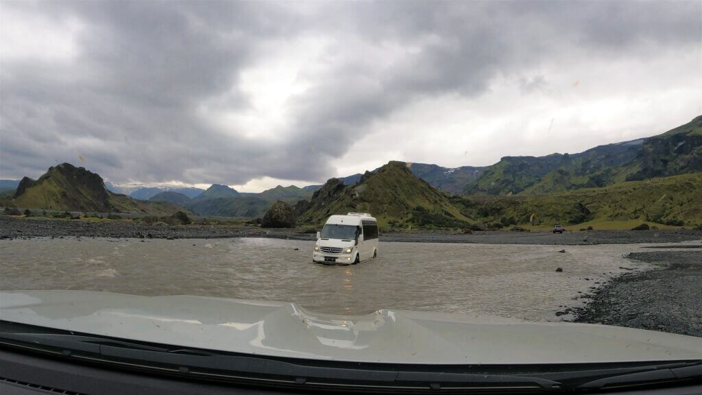
Crossing Krossá
An ideal start point for the Valahnjukur hike is the Langidalur campsite, which is located right next to it. How to get to the Langidalur campsite? To get to Langidalur, you need to cross the Krossá river. We definitely didn’t want to do this in the car, even when the water levels were pretty low and we had a big car. Krossá is notoriously known to be one of the most dangerous river crossings in Iceland, due to its strong current, uneven riverbed, and deep water levels.
So what if you don’t want to ford Krossá by car? Well, you can either take the bus (as we mentioned in our Thorsmork guide), or call the “Krossa taxi” at Volcano huts (but you need to get closer to Husadalur campsite in this case). Or you may use the footbridge over Krossa – if it’s there – as we did.
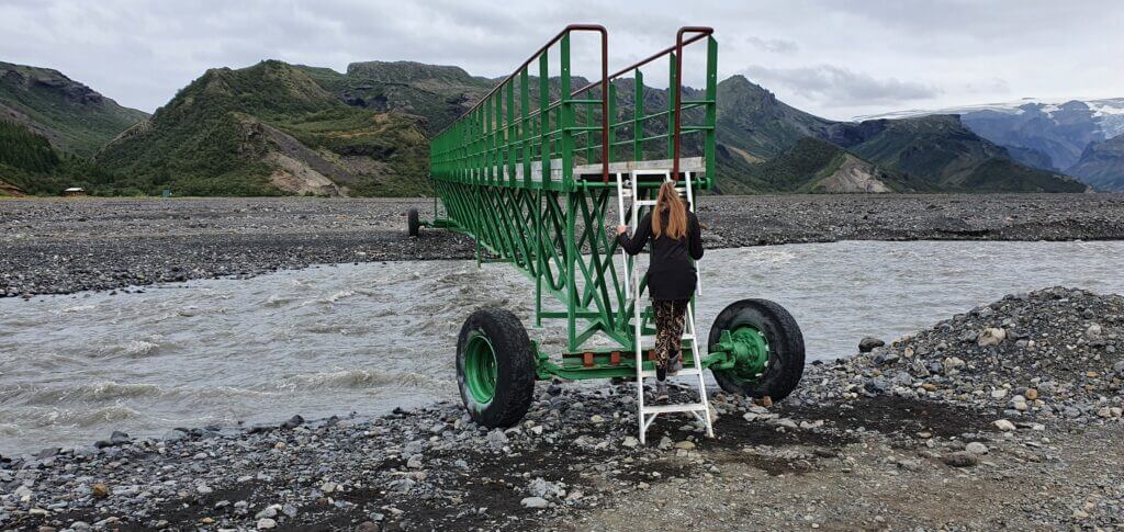
Thorsmork Krossá Langidalur footbridge
When are the footbridges in place and when not? They are in place during summer if it is not too dangerous. What does it mean too dangerous? Well, mostly high water levels and/or bad weather. Yes, that water level can even reach the footbridge – in that case, the footbridge is removed by rangers and you cannot cross Krossa any other way than by superjeep/bus. Exactly this was the case some 4-5 days after our trip – it rained a lot in the area and the footbridges were removed. And even the Icelandic bus got stuck in Krossa at that time!
However, as I mentioned, at the time of our visit Krossá was calm. We parked the car close to the big green footbridge over Krossá and used the bridge. Please, be sure to park the car in the right spot – i.e. NOT on the road and NOT even on any tracks which you see on the ground. Buses and modified superjeeps use this way, so please don’t get your car in their way to not get yourself fined. Leave your car next to the road on the gravel – use your common sense.

Right after we climbed on the bridge, we spotted an Icelandic bus nearby. We waited to watch it do the Krossá crossing. It’s always admirable to see it being done correctly 🙂 The bus didn’t go exactly where the road led, but rather it made a turn and positioned itself in the direction of the stream. Exactly as you should do it according to the river crossing rules – go down the stream. Even under these very good, dry conditions, we saw how the bus was shaking on an uneven riverbed. We just got a visual confirmation that the decision to not do the crossing on our own was good.
Valahnjukur
Coming back to Valahnjukur – Valahnjukur is a really easy, quick, and very rewarding hike in terms of views all around the Thorsmork valley. You can easily do it with your family or your older relatives. Even in rain, the hike seems to be pretty doable. Just keep an eye on visibility – if it’s foggy, you won’t see anything, I’m sorry. But since Thorsmork is located in between the mountains, all the storms and clouds tend to “break” on them, and the weather in the valley is usually much better compared to all the nearby places (e.g. Fimmvorduhals pass). More about this in our “How to find nice weather in Iceland” article.
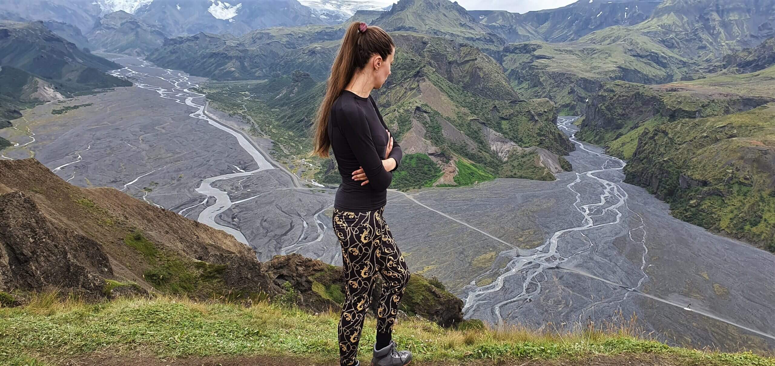
A spectacular view from the top of Valahnjukur
Valahnjukur hike is well marked right from the Langidalur campsite, and, again, it’s almost impossible to get lost. It took us around 30 minutes one way to get to the peak, including pauses for photos and view admiration.
We arrived at the peak of Valahnjukur at 4 PM. We were lucky enough to both – be there alone and have beautiful visibility all around the area. This is one of the best short hikes all around Iceland. If you are able to reasonably get here, I definitely do recommend you take it. Views are simply stunning.
Thorsmork Valahnjukur hike
To come back to Langidalur, you may either use the same trail (the quickest option) or take the loop firstly to Husadálur and then back to Langidalur. We went for the first option because there is pretty much nothing special to be seen on the second route.
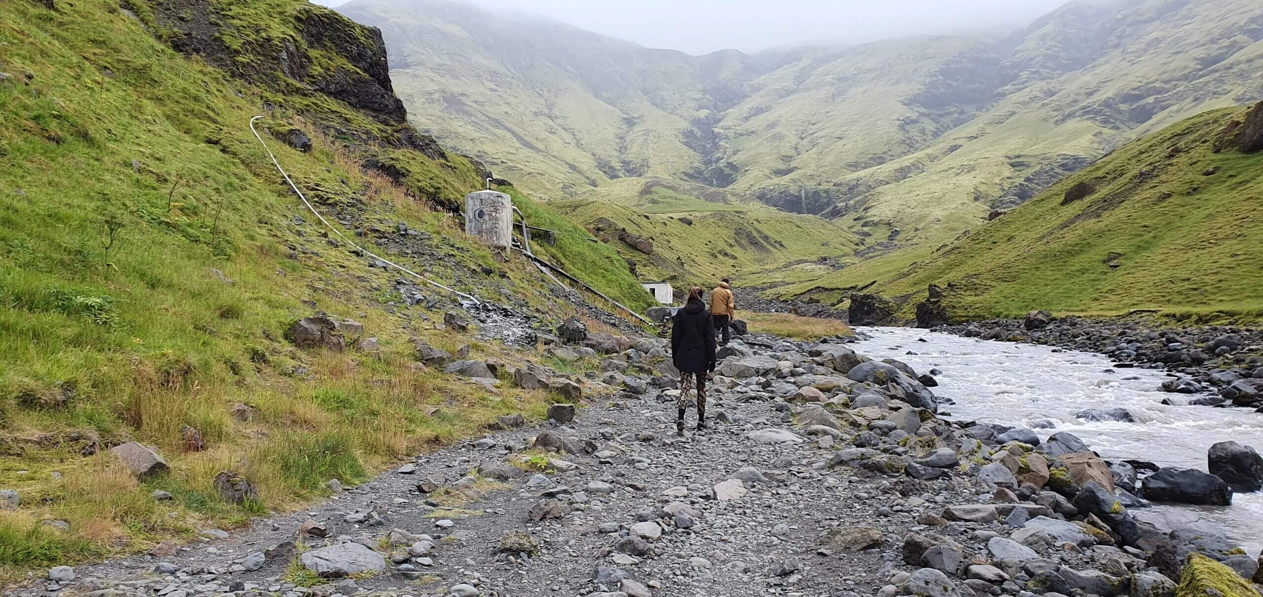
On our way back to Hella I wanted to make two more stops – Gljufrabui waterfall and Seljavallalaug hot spring (yes, both the really touristy ones, we had not been there yet before and wanted to see them). Anyway, my wife told me she has enough energy for one more stop only, so we compromised on picking Seljavallalaug hot spring.
The water level in the rivers usually tends to be higher in the afternoon/evening due to melting ice. At the time of our visit, however, this wasn’t the case. We already knew from the crossings in the morning that the rivers are pretty shallow, so the crossings weren’t problematic nor time-consuming this time. Please take special care that this is also true in your case – it doesn’t have to be!
Seljavallalaug hot spring
If I said that Nauthusagil, Stakkholtsja, and Valahnjukur were some of the most beautiful places in Iceland, with Seljavallalaug this was not exactly the case. The surroundings of the pool were beautiful – untouched nature all over the place. However, the pool itself was one of the worst of all hot springs in Iceland – dirty, slippery, not very hot, and full of tourists. Still worth visiting, though.
Seljavallalaug hot spring trail
Seljavallalaug is located on private land and to get there you need to walk. You can park your car also on the private land – there are 2 not very big car parks, which, however, weren’t completely full at the time of our visit. We parked the car at the one closer to the pool (but it really doesn’t make any difference, because they are both next to each other). Luckily for visitors, the landowners have not yet started to get money for the parking and visit of the pool. This may change in the future, though.
After parking your car it’s a 30 minutes (one way), non-demanding walk around a nice area. It’s not marked, but it also isn’t hard to follow because a) there’s no other route, b) you will probably meet several fellow tourists on the way there. Exactly as I explained above about the weather in Thorsmork, while Thorsmork was partially sunny at the time of our visit, here at Seljavallalaug the sky was clouded completely and it rained lightly.
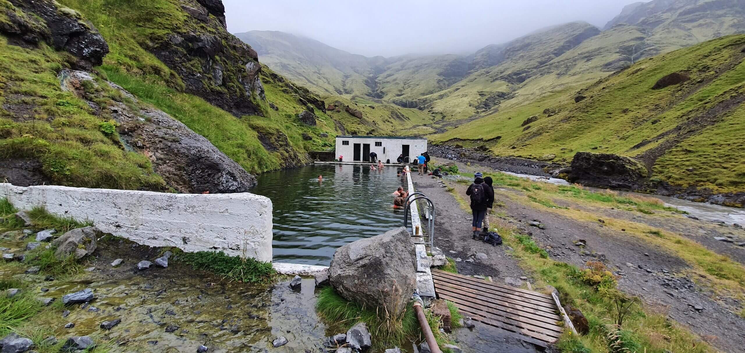
Seljavallalaug hot spring
There’s an old changing room at Seljavallalaug (actually 2 rooms, maybe supposed to be for men and women, but people mixed it anyway). As I said above – the pool is big, full of algae, slippery, and with water of a temperature of around 30°C+, which is not that much compared to several other 40°C+ Icelandic hot springs. Nevertheless, many other visitors seemed to enjoy the pool very much anyway. To sum it up, Seljavallalaug was still a nice experience, although we prefer other Icelandic hot springs and pools much more.
Videos


![]() ask questions or get inspired in our community
ask questions or get inspired in our community


Hi Igor,
Thank you for all the detailed information on so many Icelandic trails and sites on this page! I have found it really helpful.
I have a question for you – if the road to Gigjokull is a detour from road 249 rather than F249, does it mean that I can get to the point of that detour with a 2wd car? We are going in the end of June and have decided to refrain from river crossings, but we still want to visit Thorsmork if we can. Our plan at the moment is to go as far we can on road 249 and walk from there (or hitchhike maybe). If we are able to park at the Gigjokull detour, it will make for a 6-hour hike, but that’s fine.
Note: I know about the bus, but I read it can sell out and we would like to plan according to the weather and not the bus schedule.
Thank you!
Hi Elena and thank you!
Yes, you can get right before the Gigjokull river crossing with a 2wd car, here https://vegasja.vegagerdin.is/eng/ and here http://vefsja.iskort.is/ are the maps. Just bear in mind when hiking, you will still need to cross the rivers! This can be even more dangerous than driving through them. That being said, I suggest the buses or hitchhiking. I doubt the buses will be sold out in June, it may happen, but I dont think so.
Thank you!
We have recently returned from our trip and I would like to clarify for anyone reading this.
Road 249 is NOT usable by a 2wd at all. After all roads opened, it was clear on road.is that the road after Bru Base Camp is not allowed for non-4×4 vehicles and our rental company confirmed (although at first they also told us that we could go there as far as the point where the road becomes an F-road).
On sight, there was a big sign at the first notable river that the road is only for good 4×4 vehicles. All the rivers we saw in that valley were grey and nearly all the vehicles we saw were rather big trucks, so if you just rent a normal 4×4, you MUST wade all rivers before entering them to verify the depth and the type of the river bed – beware of sand! We saw no flags in rivers there unfortunately. We did go after a week of rain, but even in good weather, a 2wd would still be not allowed there.
Still, thanks for the info on this website. It was indeed useful. I feel like there should me more info like this available online.
Hi Elena, you can get to Nauthusagil waterfall without crossing any rivers – this is where you can get by a 2wd car, as we write in our guide and trip report 🙂
After Nauthusagil it’s only for big 4×4 cars exactly as you mention.
Thank you and hope you had a great trip!