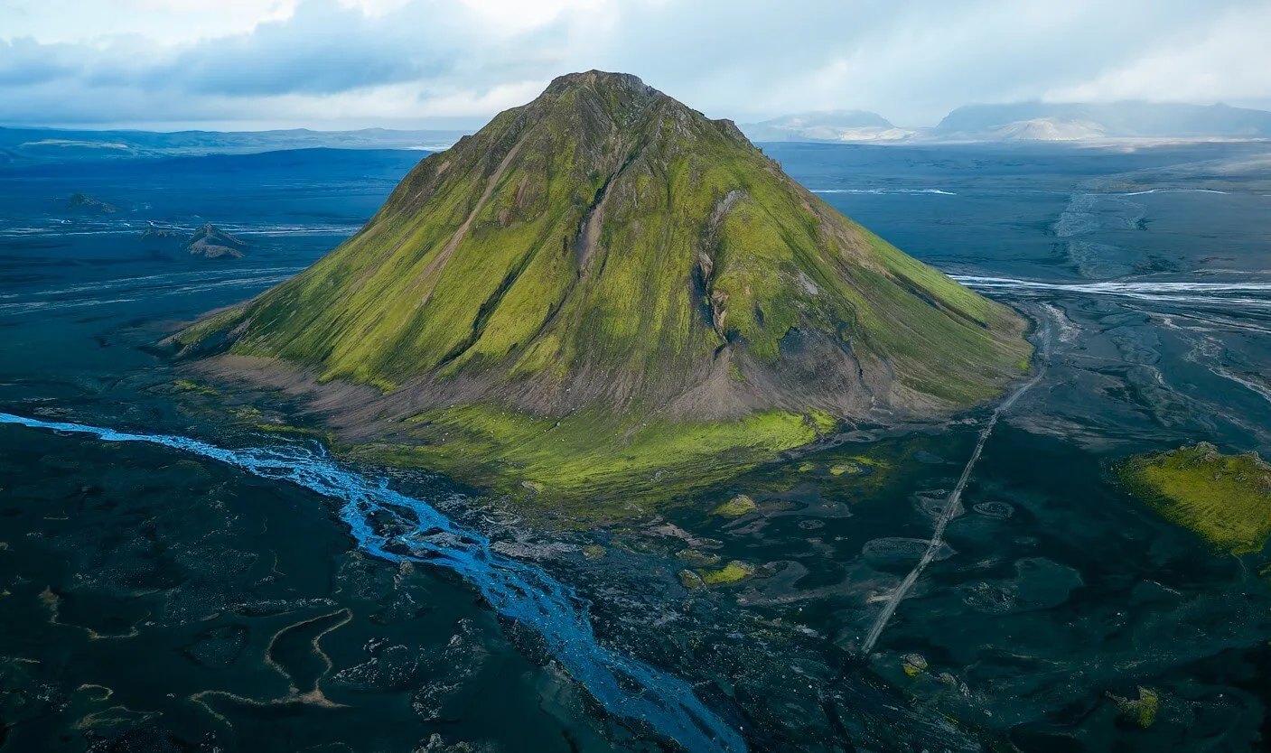
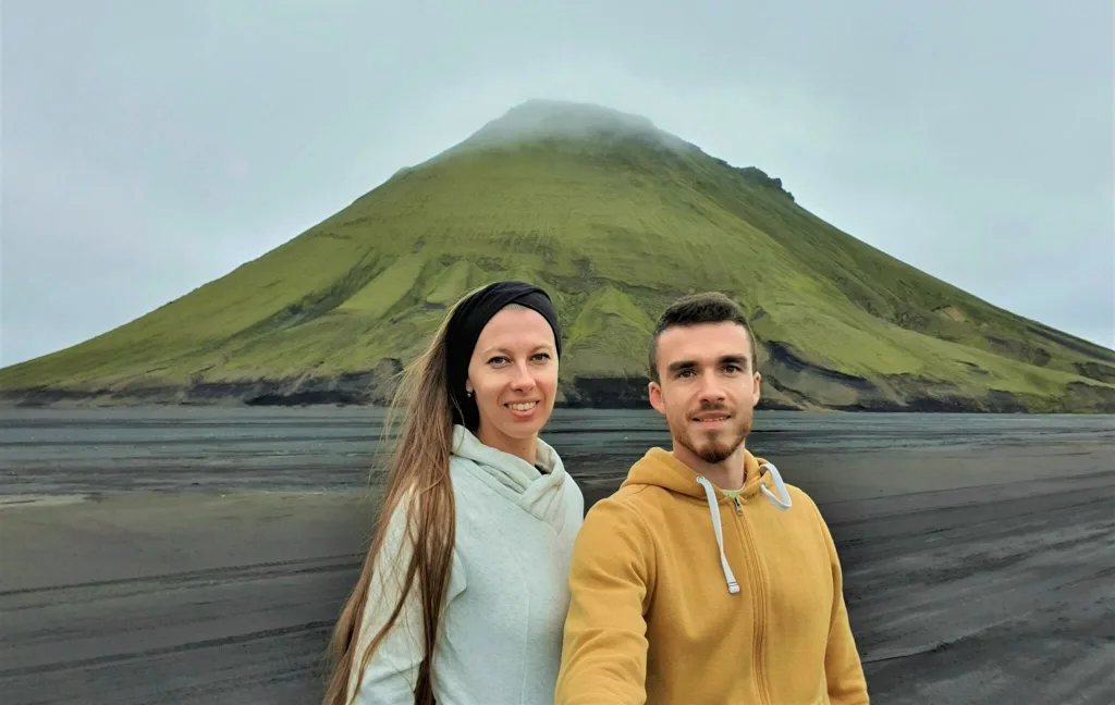
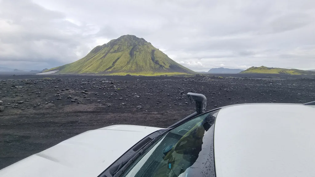
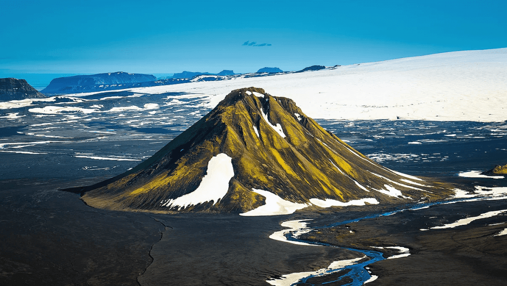
Maelifell is an epic green volcano hidden in the black Icelandic desert in the southern Highlands of Iceland.
Did you know that there is not just one Maelifell in Iceland? There are about 20 of them. Maelifell means “measuring mountain” in Icelandic, or an “orientational hill”. And Icelanders in the past were not very original in naming their mountains. So, yes, there are many Maelifells in Iceland.
Below we explain in deep detail how to reach Maelifell. Information in this article is based on our multiple visits to the volcano over several years. There’s no guarantee the conditions will be the same at the time of your visit, though! More on this below.
Contents
Maelifell Video Guide

Maelifell Map
How to get to Maelifell
You have three options:
- Drive to Maelifell yourself
- Take a public super jeep tour (10% discount code: EPICICELAND10)
- Or take our Epic Private Super Jeep tour
There are no buses or bigger group tours.
Driving to Maelifell
You have three options to reach Maelifell:
- From the West – the most scenic route
- From the South – the easiest route
- From the East – route with the biggest river crossing
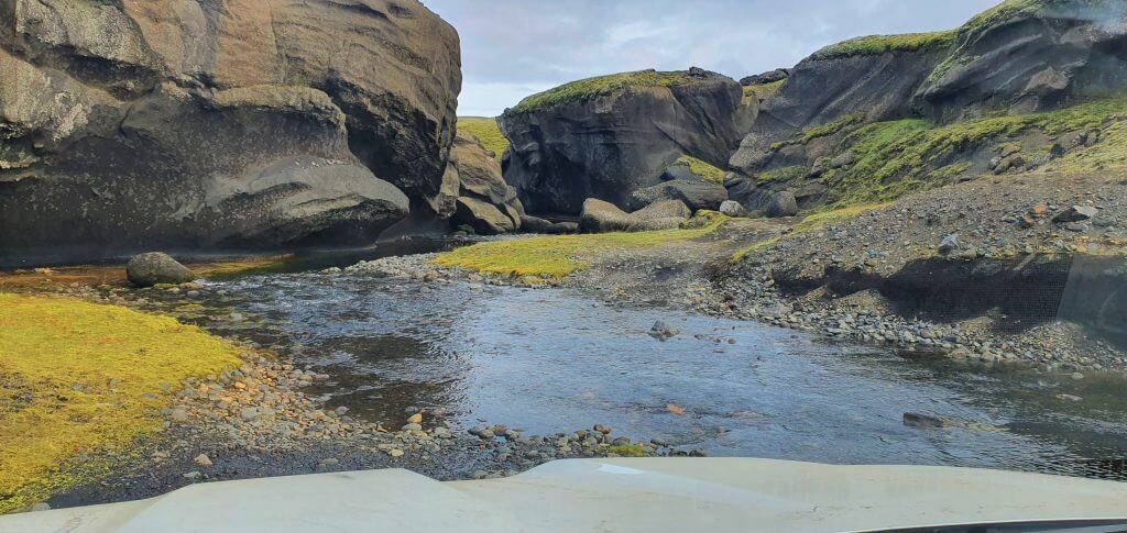
How to visit Maelifell volcano in Iceland
First of all – it is NOT EASY to get to Maelifell. It’s not a trip for beginners.
You need to drive a big 4wd car AND you have to cross the unpredictable rivers.
Maelifell is disguised deep in the southern Icelandic Highlands. To reach it, you need to take the difficult Highland roads, which are also called the F-roads.
For all of this, you HAVE TO prepare in advance.
Western route

You can reach Maelifell from the west by either
- Road F210 only, or
- Roads F261 and F210
Both of these roads are incredibly scenic and rough highland roads. You have to cross medium-sized rivers on both.
F210 only
F210 west near Keldur
My favorite option is to take the F-road F210 from the west only. It’s one of the most beautiful roads in Iceland. Views on a nice day are simply amazing.
You will have to cross several small to medium rivers on F210. Moreover, you will also drive in a river bank for about 100 meters (yards).
The most significant river crossing is located near the crossroads with F261, and the river is called Kladaklofskvisl:

There are no more river crossings after Kaldaklofskvisl, but the road gets rougher and rougher.
You will, for example, encounter huge volcanic boulders that require a high ground clearance and cautious driving.
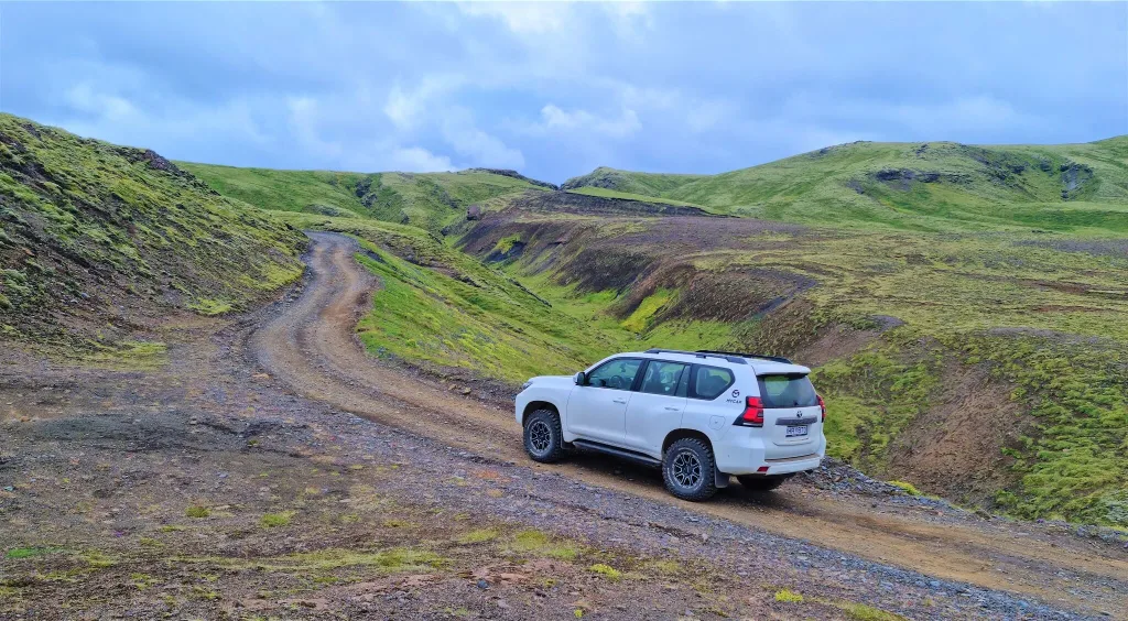
What Car do you need for F210?
F-roads around Maelifell
To pass F210 safely, you must drive at least a Toyota Land Cruiser, Toyota Hilux, or Jeep Wrangler.
The best option is to drive a super jeep. Super Jeep is a modified vehicle with big tires and a snorkel. Some examples include Land Rover Defender, Land Rover Super Defender or a modified Land Cruiser.
You can rent all of these in Iceland. Check out our article on How to Rent a Super Jeep in Iceland.
F261 and F210

The second option from the west is to use the combination of the roads F261 and F210.
F261 is a bumpy road with one medium-sized river crossing at the end. The river is called Blafjallakvisl and requires just about the same cars to pass as F210.
F261 is also beautiful and worth the drive.
Southern route
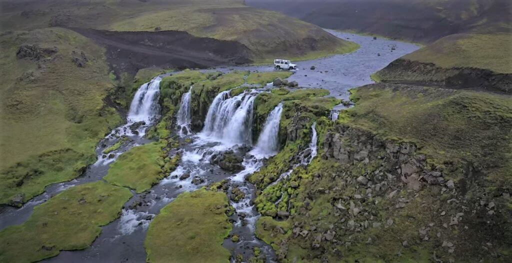
F232 Bláfjallafoss waterfall
F232 from the south is the easiest road.
It is the least bumpy road and there is just one medium-sized river crossing. Or better said – a waterfall crossing.
There are huge stones at the bottom of the river and the crossing is very bumpy.
F232 south of Maelifell
This one particular spot – the waterfall crossing of Blafjállafoss – is great for drone lovers, and it’s very picturesque.
Other than that, there’s nothing super highly interesting along the road, just one more cute waterfall called Holmsarfoss.
To pass F232, we again recommend ideally a Land Cruiser or something bigger.

On a dry day, you may be able to pass with Dacia Duster, Suzuki Jimny, Nissan Qashqai, or something similar. BUT you need to drive well without mistakes. To be sure not to damage your car, it’s better to rent something bigger.
Eastern route
The final option is to take F210 from the east. Eastern F210 is not difficult, but there is one major obstacle on the road.
F210 East of Maelifell
A big river crossing of Holmsa river. This river crossing is located east of Maelifell, right next to the Raudibotn craters area.
To pass this ford safely, it’s best to drive a super jeep. On a dry day you may be able to pass with Land Cruiser or Hilux or something similar.
Please never cross Holmsa in a Duster, Jimny or anything similar!
When to visit Maelifell
In short, you can visit Maelifell only in summer AND only when the roads to Maelifell are open.
Our first visit of Maelifell in August
The roads to Maelifell typically open in the beginning of July and usually become impassable around mid-September.
Always check this upfront on www.road.is or www.trafficinfo.is, that is the same website of Icelandic Road Administration.
You can drive to Maelifell only if the road is marked green or dashed green.
What to do around
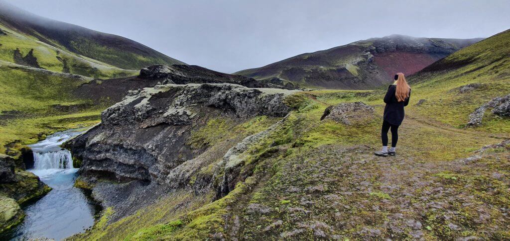
Our favorite hidden gems near Maelifell are Raudibotn craters, Strútslaug hot spring, Markarfljotsgljufur canyon, and Hungurfit dirt track.
Raudibotn craters
Raudibotn waterfalls
Raudibotn craters are an out-of-this-world secluded area full of waterfalls, rivers, and craters. Beware, though, to reach Raudibotn from Maelifell, you must cross the more giant Holmsa river.
Or you need to go all the way back to the ring road and access Raudibotn by F210 from the south.
You can read more about our Raudibotn experience here.
Strutslaug hot spring
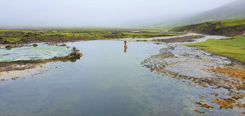
Strútslaug hot spring deep in the Fjallabak highlands of Iceland
Strútslaug is most likely the least visited hot spring in Iceland. This is a truly wild hot pot, unlike many other touristy ones in Iceland.
To reach Strútslaug, you have to cross one medium-sized river several times and then hike for about 1.5 hours.
You can read more about our Strútslaug experience here.
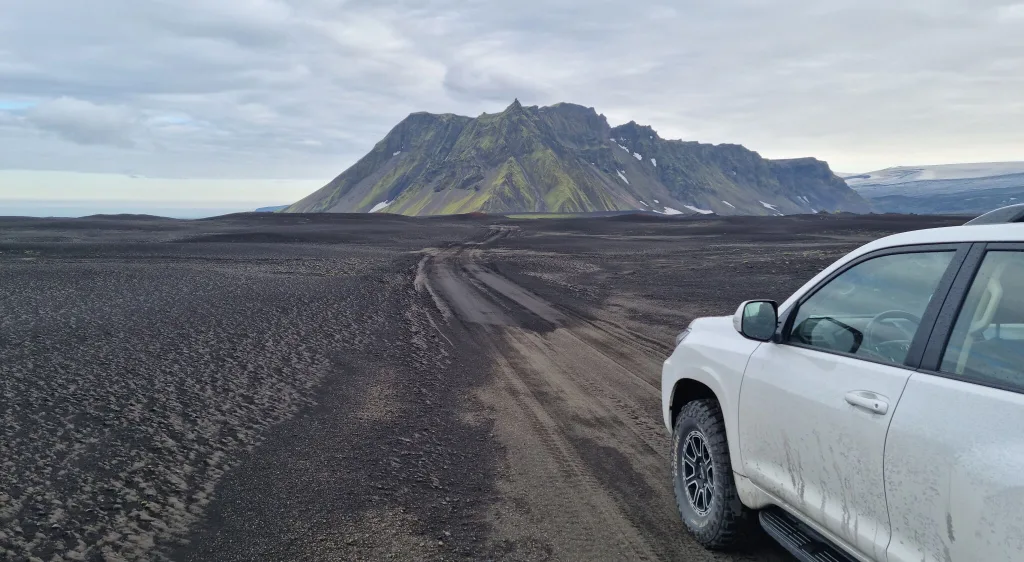
Markarfljotsgljufur canyon
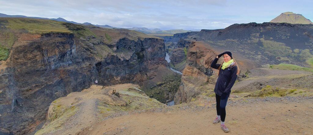
East viewpoint of Markarfljótsgljúfur Canyon
Markarfljótsgljúfur Canyon is one of our favorite canyons in Iceland. You are almost guaranteed to be alone when you reach it.
That being said, Markarfljótsgljúfur belongs to some of the most difficult-to-access canyons in Iceland.
You can get to Markarfljótsgljúfur either from the west or from the east. We describe in detail both of these options in the article about our Markarfljótsgljúfur experience.
Hungurfit dirt track

We will finish our list of the most secluded and fascinating spots in Iceland by Hungurfit track. This is one of our favorite deserted and totally remote dirt tracks in Iceland.
Driving the Hungurfit track involves steep ascents and descents, driving next to the deep ravines, as well as crossing numerous rivers and streams.
The most sought-for spots on Hungurfit, even for locals, is one of the tightest boulder-passes in Iceland – see video thumbnail above.
Tips and Safety
How do you prepare for a trip like this?
- Watch road videos and read blog posts to know what to expect
- Rent a proper car – Land Cruiser, Hilux, or a super jeep
- Practice on easier roads first
- Don’t go alone, ideally, go with more than just one car
- Go only when the weather is good, and the roads are open for tourists
- Check road and weather conditions on road.is or trafficinfo.is and en.vedur.is in advance
- Check with your car rental company if you are allowed to drive the roads to Maelifell
- Read our Highlands road trip guide
FAQ
Driving around Maelifell
Is there any accommodation near Maelifell?
There is no hotel or hostel anywhere nearby. Only mountain huts with sleeping bag accommodation.
The closest ones are Hvanngil hut, Strútur hut, Alftavatn hut, Alftavotn hut and Emstrur-Botnar hut.
Can I get to Maelifell in Dacia Duster or Suzuki Jimny?
Long story short – we do not recommend it.
It is theoretically possible on a nice and dry day. And only if you use the easiest southern route F232. But you are risking damaging your car.
Can I take small children to Maelifell?
Well, like generally? NO. Only if you already have experience with the highlands, otherwise not.
Maelifell in the highlands of Iceland. Photo credit to: snorrithorphotography.com
How much time do I need?
It takes roughly 2 hours to reach Maelifell from the town of Vik and roughly 2.5hours from Hella.
If you want to see just Maelifell and nothing else, the roundtrip will take you around 6 hours.
Is it worth going in a fog?
Unfortunately not really. But this depends on how heavy the fog is and if it’s persistent or not. This is impossible to predict. So you just need to take your chances!
Why can I visit Maelifell only in summer?
Because there is snow or mud on the roads. You would get stuck or you could damage the fragile soil.
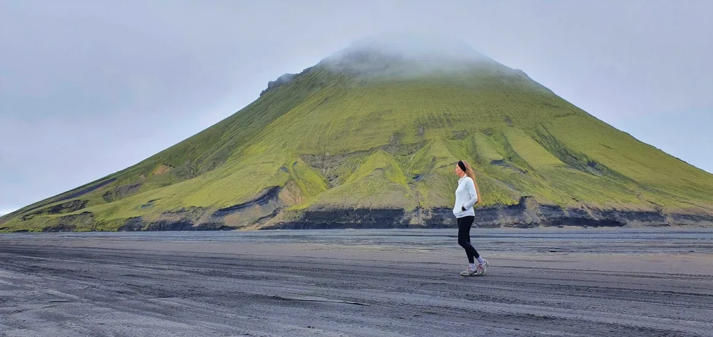
Can I hike Maelifell?
Yes you can, BUT it is a very hard hike on an unmarked trail. It’s very steep and only for highly experienced hikers.
Our Experience
The gem on the highlands of Iceland
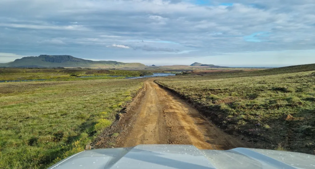
Our first trip to Maelifell started in Hella via F210 from the west.
Most of the F210 is without bigger river crossings, so in case of good weather, even if you don’t feel like doing bigger river crossings, you may try to drive it in a proper 4×4 (ideally Land Cruiser or bigger, see our guide on how to choose a proper car for Iceland) – up to Alftavatn mountain hut.
F210 west of Alftavatn
Up to Alftavatn hut, the road is just bumpy, with potholes and some steep sections, but really picturesque and one of my favorite Icelandic roads. You will get amazing views in each direction – seeing Landmannalaugar from the distance and a big part of Fjallabak Park.
Even until Alftavatn, you will still have to cross several smaller streams, and even drive in the riverbed for around 100 meters! This is really one of the “once in a lifetime” experiences, for anyone not used to it (yes, maybe not for Icelanders ;).
F210 west of Alftavatn
As I mentioned, the road leads through multiple mountainous areas, so if you are unsure about driving in such an environment, please don’t go. Once you pass Alftavatn, the first real obstacle gets into your path – crossing the Kaldaklofskvisl river.
F210 to Alftavatn
Hence, we drove F210 all the way to Alftavatn lake. The road was admiringly beautiful. The part I liked the most was the highest spot just before Alftavatn, where you could see all the surrounding land, including Landmannalaugar in the distance, almost from the “bird’s eye” point of view.
We took a short break at Alftavatn lake, which is a very nice, calm, and quiet spot to stop at and have a picnic or short stay during nice weather. We were lucky enough that exactly after our arrival at Alftavatn the sun started to fight its way between the clouds and we could even walk in the T-shirt outside.
F210 Fjallabaksleið Syðri to Alftavatn
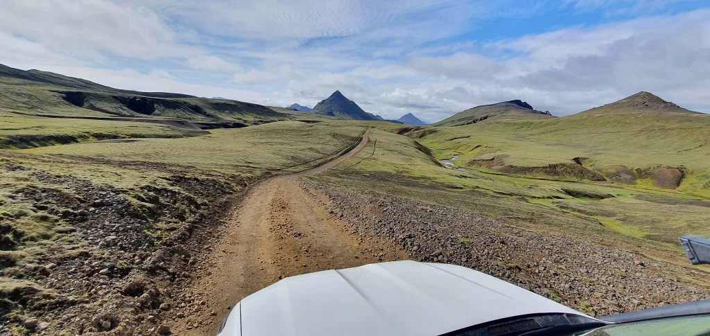
F210 after Alftavatn then continues in two directions – south towards F261 and east towards Maelifell and Holmsa river. Since our journey went smoothly up to this point, we definitely wanted to take a detour toward Maelifell and so we did. We turned left on the eastern part of F210. Here’s where the truly lunar landscapes have begun to emerge.
Kaldaklofskvisl river crossing
Kaldaklofskvisl crossing on F210 can get tricky at times because there are some large boulders in the river that you are unable to see beforehand. Secondly, the water level in the river may get too high to allow for safe crossing in vehicles not big enough.
It’s always necessary to strictly adhere to all the river crossing rules, watch someone cross before you, wade the river yourself if feeling unsure, and if still feeling unsure better turn back.
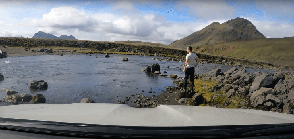
Kaldaklofskvísl river crossing F210
We had nice partially cloudy/partially sunny weather, luckily with no fog and no rain. We already knew from our friends and from the day before, that the water level in rivers is favorably low and rivers are shallower than usual. These are practically one of the best conditions possible.
F210 to Maelifell
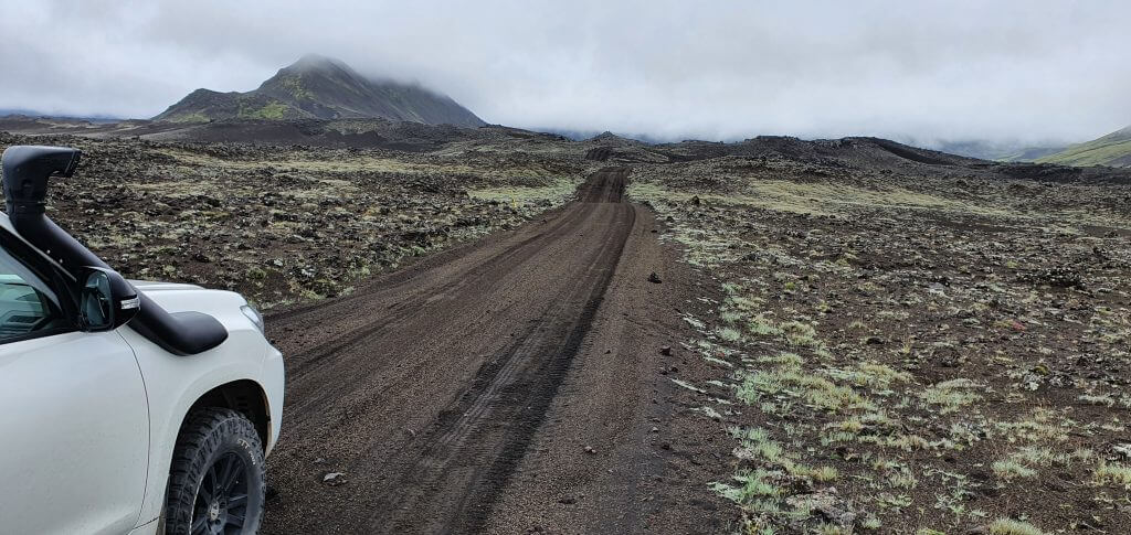
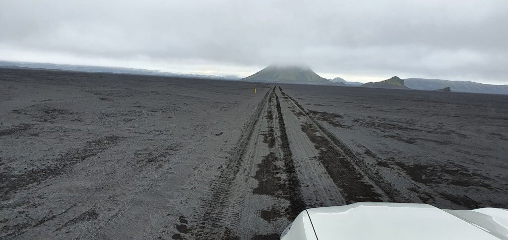
F210 towards Maelifell is definitely one of the most unique Icelandic roads. Firstly, the weather almost always changes when driving on this road. F210 towards Maelifellsandur literally feels like a gateway towards another world, thanks to this. Secondly, the road itself is very specific – it starts with huge boulders and continues as a black sand road.
And it’s almost always covered with some kind of mist – either light or heavy. Huge boulders are the most difficult part of F210 towards Maelifell. The road doesn’t have a clearly visible track, and if you don’t take enough care, you may damage the underside of your car.
F210 Fjallabaksleid Sydri east to Maelifell
After basically driving on huge stone plates rather than an ordinary road, the route turns into tracks in the black sand. Oftentimes expect it to be wet and muddy because this is the area where it may rain occasionally. This part of the road doesn’t have any huge obstacles, or rivers, so it looks like a giant moon highway.
There are no more river crossings going from Kaldaklofskvisl to Maelifell. If you are the only car on the road (which is frequently the case, as with us) then your only guides are the tracks in the sand and yellow sticks marking the side of the road.
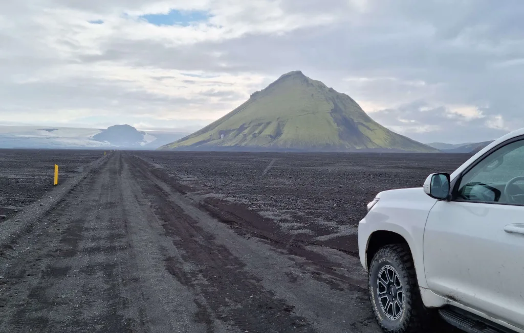
Maelifell
After a drive in the middle of “black sand nowhere”, you will be able to spot majestic Maelifellsandur in the distance. If you are lucky enough, and Mr. Maelifell is not covered in fog – which he likes to do – your view will be truly amazing. As I already mentioned, the weather usually changes to worse after turning towards Maelifell. This was exactly our case (multiple times). This time it, however, only changed to cloudy with occasional little rain – which is still considered good weather.
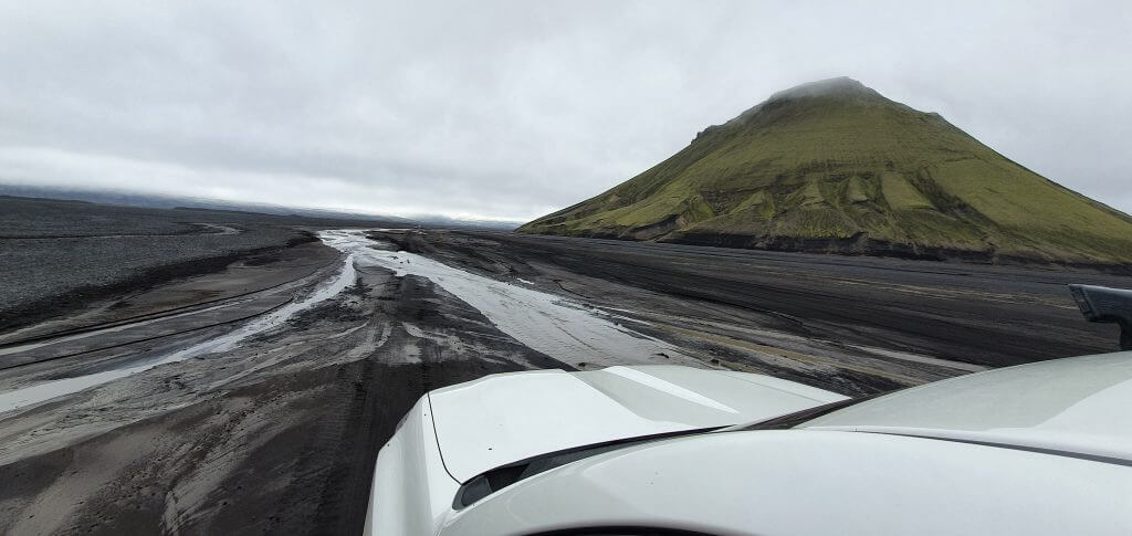
Maelifell in Fjallabak nature reserve
Finally, after an adventurous drive – there it stood – Maelifell volcano. It’s a view as if you were on a deserted planet. A huge green volcano in front of you, surrounded by black sand fields, with occasional little lakes created by past rain and absolute silence in the air.
It’s even possible to climb the Maelifell, but we don’t recommend doing that unless you are really experienced in performing steep, unmarked hikes unless there’s ideal weather and ideally only with a guide. We didn’t go for the hike as it may be really dangerous (and the view from above wouldn’t be great in partially foggy weather).
Holmsa river crossing
We still had enough time at that point of the day, because everything went pretty smoothly. Thus, we decided to take a look at the Holmsa river crossing with an aim of seeing Raudibotn – the beautiful hidden (from a typical tourist) area with a crater, river, and amazing landscapes all around.
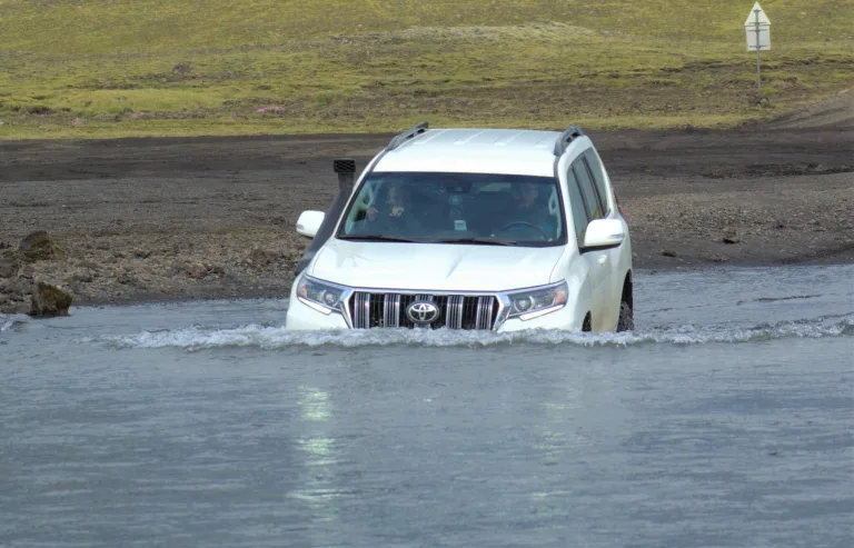
Me crossing bigger Hólmsá river by Land Cruiser on F210 near Maelifell
After reaching Maelifell, we continued east and we soon arrived at the Holmsá river crossing. According to a friend of mine, the crossing was supposed to be doable, without problems, at this time of the year (especially due to low water levels). Beware, this is the river crossing which may get pretty nasty. Always check both beforehand and on-site.
The crossing looked exactly like my friend Haraldur described it – this time harmless. I examined the river anyway and it looked calm and shallow. Because of this, we decided to go for a ford even without wading the river on foot. And the crossing went smoothly. There’s a small hill with the road, usually easy to spot on your left after the Holmsa crossing.
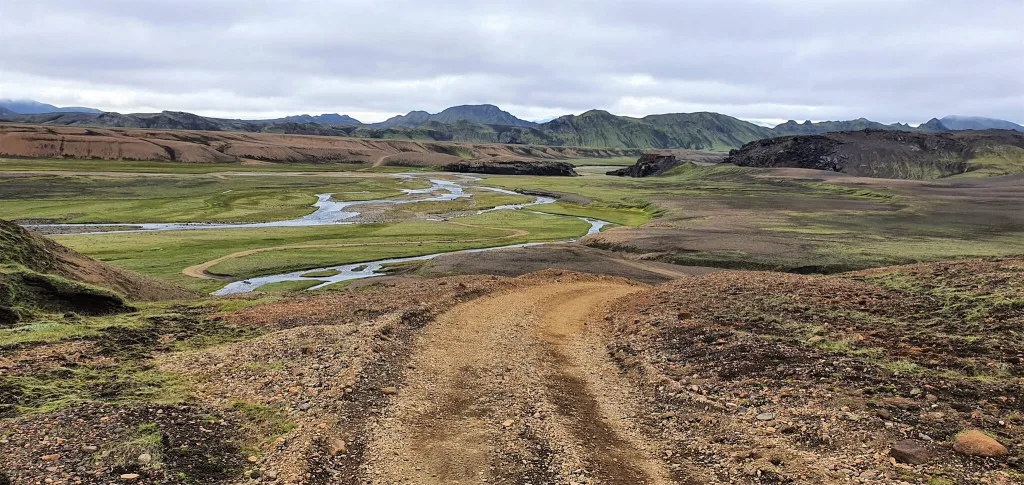
Raudibotn, Markarfljostgljufur and Hungurfit
After crossing Holmsa we went hiking all the way to Raudibotn craters. Highly recommended and totally worth a tiring day!
Many small to medium river crossings are an amazing part of the Hungurfit track
After Raudibotn, we didn’t have enough and explored also Markarfljotsgljufur canyon and drove Hungurfit track. You can read in detail about our Fjallabak highlands day involving all these activities.
![]() ask questions or get inspired in our community
ask questions or get inspired in our community


I congratulate you for the great information you provide to be able to visit Maelifell. I had been looking for days how to go on foot but I didn’t find any information until now. I was trying to make this journey but I couldn’t know the distance until I saw your image with the 10 km scale. Therefore, I deduce that the walking distance is approximately 100 kilometers (go and return), which makes this route unfeasible (there is a lot to see in Iceland!). To make things easier for hikers, perhaps you could include the distances to be covered. At least, I didn’t find it in your text.
Thanks again from Spain.
Hi Carlos, and thank you for your message!
We do our best to provide as much information as possible. As for the distances you mention – it’s impossible to include these, because there are infinity different hiking route combinations one can reach Maelifell (and other places) from. So we only list hiking distances for the main hikes, not for multi-day hikes that cannot be reasonably estimated. Nevertheless, we always provide links to maps, where you can check these yourself 🙂
All the best!
Hi Igor,
I’m an spanish photographer and I’m planning our trip to Iceland (first part of September) and we want to have 2 or 3 days in the Highlands.
We are going to sleep in Landmannalaugar Camping one night and the day after we are leaving the highlands we would like to visit Ofaerufoss, Rauðibotn and Maelifell, and finishing in Vik or somewhere around Þakgil, to visit it the next day. We would rent a Dacia Bigster. Do you think we could visit those three places the same day?
Thanks, Luis.
Hi Luis,
Dacia Duster is too small to reach Maelifell – as we describe in this article. You’re risking getting your engine flooded and pay hefty bill (tens of thousands of euros), and if you take a wrong road you can even die when crossing the rivers. The minimum we recommend is Toyota Hilux or bigger.
Which road you want to take? Your only chances in Dacia Duster are F232 from the south, if it’s a really dry weather and if you know what you’re doing, know how to cross the river etc. But it’s still a risk. We always go here in bigger cars.
Hello, I’m from China. Many Chinese netizens have recommended your articles—thank you for your efforts. I’d like to know if it’s possible to access Maelifell from the southern route with a rented RAV4 4WD, as we plan to depart from Vik. Additionally, could you provide your rates for guiding services? We’re planning to visit Iceland in July. Thank you!
Hi Lee and thank you!
Yes, it’s possible to access Maelifell from south by road F232 with RAV4. There is just one problematic spot – Blafjallafoss river crossing. This one is bumpy and might be watery. If it doesn’t rain too much before your trip, and if you cross the river well, you should be able to pass. Please always check http://www.trafficinfo.is before going.
Our rates for guiding start at 180 000 ISK per day, including vehicle, guide and fuel. You can write us your request at [email protected]
Hi, I would like to ask if our car is not big enough to cross the Holmsa River, can we cross the river on foot and reach Raudibotn?Thanks.
Hi, unfortunately you can’t. If a river is too deep and fast-flowing (like Holmsa often is), it’s too dangerous to cross it on foot. You can eventually take a hiking trail from Strutskalli to Raudibotn and back. Long hike, but it’s an option.
Thank you so much, Igor! Your article helps us a lot in planning the trip. Indeed, I am curious about the route from Maelifell (via F232) to Landmannalaugar (via F210 and F233). In your articles, I have learnt that there are two big river crossing: Hólmsa on East F210 and Syðri-Ófæra on North F233. I think with Toyota FJ Cruiser (equipped with snorkel and high clearance) should work but in case the road is blocked due to high level of water what would be your personal suggestions? Our trip will be around Aug. 25.
Hi Frank and thank you!
There’s a lot of water around Maelifell this year, and visitors are asked to avoid it, at least this has been the case for the past month or so. It might change in 2 weeks. See http://www.trafficinfo.is. The only way to visit it now is from the west (F210).
P.S. If you like what we do please write us a short review on Google: https://g.page/r/CaJt1bHCTbF1EBM/review it would help us a lot!
Will a Jeep Renegade be able to cross the Blafjallafoss?
Yes it should if the rivers aren’t too watery, you can check on http://www.trafficinfo.is
thanks for your reply,I don’t seem to have found “Strutskalli” on the map, but I noticed that the route from the east via 208-210-F210 might access to Rauðibotn without crossing a river? Additionally, I’d like to ask about the likelihood of driving a Subaru Forester through Kaldaklofskvisl(F210) and Bláfjallakvisl(F261) in late August. Also, since there are no gas stations in the highlands, can a full tank of fuel cover a 400km journey?
I meant this hike – see this map.
Yes, form the east you can access Raudibotn without crossing Holmsa and you should be able to do it in Vitara via F210 if the road conditions are alright. But you cannot see maelifell this way because you would need to cross Holmsa.
Forester is definitely not the right vehicle for F210/F261. You can pass only theoretically under ideal conditions but I just don’t recommend it. These roads are for jeeps, Hilux is the minimum we recommend.
Regarding your third question, in highlands count for 10-15L / 100km fuel consumption. The bigger the vehicle the more. Based on that you can calculate how much fuel do you need.
P.S. If you like what we do please write us a short review on Google: https://g.page/r/CaJt1bHCTbF1EBM/review it would help us a lot!
Thanks again. But you don’t seem to mention the braided river around Maefifell volcano, Is it easy to pass? I read on the Internet that some cars got stuck in a river of sand.
Hello,
May I ask if it’s okay to watch the Maelifell from a spot nearby and not crossing the severe river? We’d like to rent a Kia sportage 4×4.
Thanks
Hi Xavier, no that is not possible. You cant see Maelifell from any spot nearby. To reach such spot you have to cross rivers first. And Kia Sportage is not suitable for that.
The easiest way is F232 from south and for that you ideally need a Hilux or bigger.