When searching for the top places in the highlands of Iceland, you will often find the same 5 or 6 spots being listed all over again. We will take a different approach.
We have spent months over several years exploring Icelandic highlands and have personally been to all the spots we write about in this article. We’ve compiled this list of the 25 most amazing places in the highlands based on our own experience with lots of personal tips.
Highlands have a special place in our hearts. New hidden corners pop out each time we come back, which is why we love them so much. It’s scarce these days to find spots like these in a civilized and safe country, which Iceland undoubtedly is!
Contents
- Map
- 1. Thórsmörk
- 2. Askja
- 3. Kerlingarfjöll
- 4. Langisjór
- 5. Maelifell
- 6. Landmannalaugar
- 7. Thakgil
- 8. Laki craters
- 9. Laugavallalaug
- 10. Aldeyjarfoss
- 11. Fjallabak nature reserve
- 12. Raudibotn
- 13. Eldgjá
- 14. Raudufossar
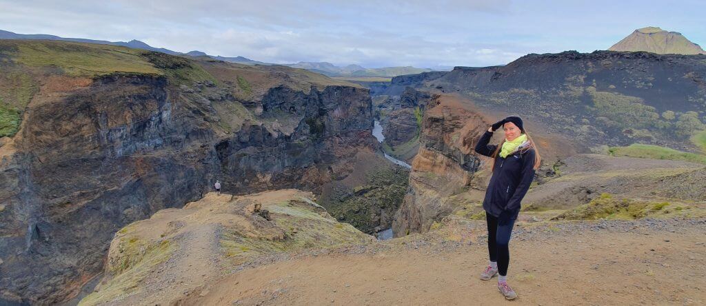
- 15. Mulagljúfur Canyon
- 16. Strútslaug
- 17. Hornstrandir
- 18. Fimmvörðuháls
- 19. Stórurð
- 20. Markarfljótsgljúfur
- 21. Kerlingarfjöll hot spring
- 22. Bláfjallafoss
- 23. Gjáin
- 24. Kverkfjöll
- 25. Lónsöræfi
Map
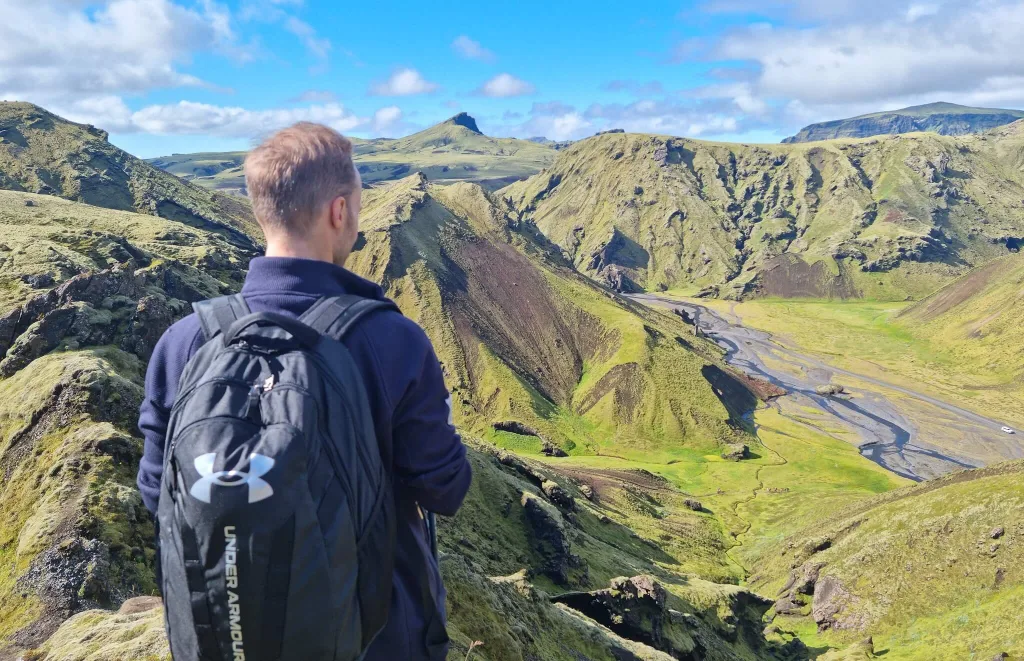
1. Thórsmörk
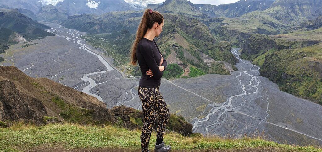
Thórsmörk offers amazing hikes and is one of the best places in the Highlands of Iceland
Why go
If we had to pick the three most beautiful places in the Icelandic Highland, Thórsmörk would surely be among them. The Valley of Thor, or in Icelandic “Por”, is a one-of-its-kind hiking area full of incredible rivers and lush green canyons.
Thórsmörk is a hiker’s paradise and a dream destination for any highlands enthusiast seeking shelter from the crowds of typical touristy destinations.
How to get there
Getting to Thórsmörk is tricky and complicated. We wrote a detailed guide about Thórsmörk to help you plan your trip. You can go by bus (10% discount code: EPICICELAND), join a guided tour or drive there yourself.
10% discount code for the best local Thórsmörk super jeep tour from Hvolsvöllur: EPICICELAND10
In short, the highland road F249 leads to Thórsmörk. It contains several river crossings, which get bigger and bigger the further you drive into the valley. The most significant river crossing is the infamous Krossá River, and it should never be attempted without a guide.

It’s possible to reach Básar hut in Thórsmörk and also all the most beautiful spots by driving yourself if you follow the three rules below:
- You must drive a proper car, at least a big 4×4 SUV or a super jeep.
- You need to practice on easier F-roads first and follow the river crossing rules well.
- You can go only if the river levels are low and the weather is not too rainy. Always check www.trafficinfo.is.
We can also take you to Þórsmörk on our fully tailored Epic Private tour. Just e-mail us at [email protected]!
Tip from a local
The three most photogenic spots in Thórsmörk we enjoyed the most are:
- Nauthúsafoss waterfall. This is a short and adventurous hike through the incredible Nauthuságil Canyon.
- Stakkholtsgjá canyon. A beautiful hike with a little surprise in the end.
- Valahnúkur hike. An easy-to-reach summit with one of the most beautiful views over Thórsmörk.
2. Askja
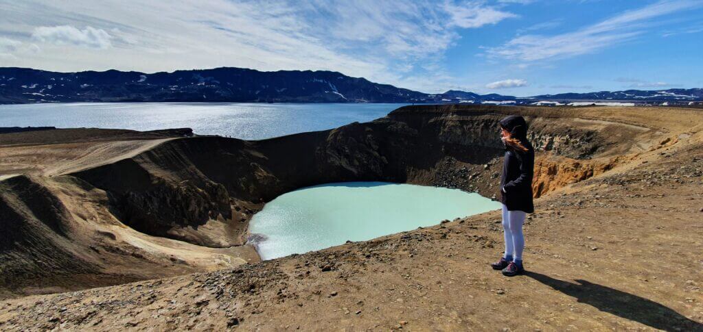
Askja
Why go
Askja is one of the most magical places in Iceland. It’s an old crater filled with crystal-clear and warm water where you can even bathe!
The best Askja super jeep tour from Lake Mývatn.
Askja is our favorite because the drive there and the visit to the Askja volcano genuinely feel like hiking on another planet. We wrote a detailed guide on visiting Askja to help you prepare for the trip.
How to get there
The drive to Askja is long but worth every hour. All routes involve crossing medium-sized rivers. The two most accessible options to reach Askja are:
- Eastern route (slower, more versatile, and adventurous), via F-roads F905, F910, and F894.
- Northern route (quicker, along beautiful Herdubreid volcano), via F-roads F88, F910, and F894.

Alternatively, you can take a super jeep tour to Askja from Akureyri.
This is a volcanic area. Have a quick chat with a ranger in Dreki before every trip to check the current seismic conditions. You can also give him a call in advance.
Tip from a local
You can hike down to the bottom of Askja Caldera on a nice day. The hike is short, steep, and slippery. Bring hiking poles to avoid any injuries. When swimming in Askja, follow the signs to avoid areas with dangerous geothermal activity.
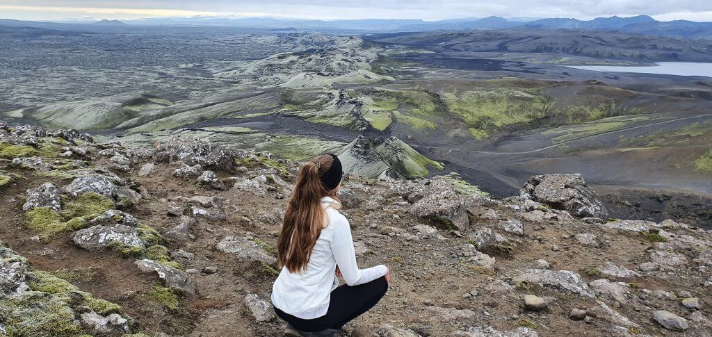
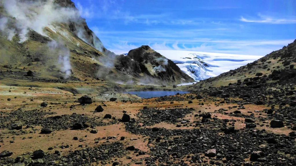
3. Kerlingarfjöll
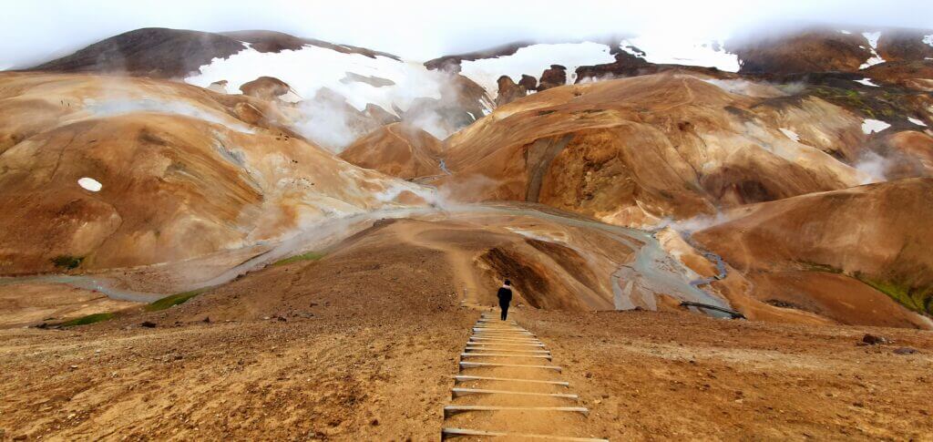
Kerlingarfjöll can rightly be marked as one of the top places in the Icelandic Highlands
Why go
Kerlingarfjöll is a must-see place in the highlands of Iceland because of its unique orange-colored soil. You will hardly find similarly picturesque hiking trails anywhere else. And that is not all Kerlingarfjöll has to offer!
The most famous part of Kerlingarfjöll is a geothermal area full of little hot springs called Hveradalir. You can take several different hikes from Hveradalir. All of them are amazingly beautiful, with pieces of snow contrasting the orange mountains even in summer.
There is also one hidden hot spring where you may soak yourself in with a view over a remote canyon. You can reach the hotpot via a 1-hour hike from the Kerlingarfjöll mountain resort.

How to get there
Kerlingarfjöll is one of the easiest-to-reach places in the highlands. Just take Road 35 and then an F-road F347. These roads have no river crossings, and they are typically accessible from June to October. Any 4wd car would be sufficient to drive these roads.
10% discount code for the great Kerlingarfjöll guided bus tour from Reykjavik: EPICICELAND24
The accessibility of Kerlingarfjöll will soon improve even further. The new luxurious Highland Base will open there in the summer of 2023, and the connecting roads will likely improve even more.
10% discount code for the best Kerlingarfjöll super jeep tour from Akureyri: EPICICELAND
Alternatively, you can also take a super jeep tour to Kerlingarfjöll from Akureyri or a guided tour to Kerlingarfjöll from Reykjavik.
Tip from a local
Kerlingarfjöll is often very foggy and rainy. If you want to enjoy it to the fullest, wait for a day with clear skies, you will not regret it! We visited the orange mountains several times and never had clear skies, so it will be challenging.
4. Langisjór
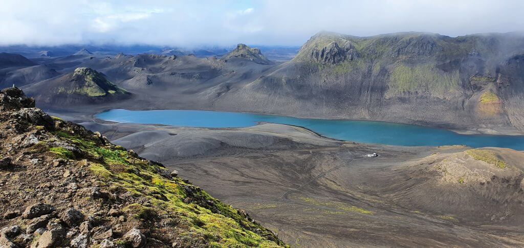
View over the Langisjór lake from the Sveinstindur trail
Why go
Lake Langisjór is one of the most beautiful lakes in Iceland. It is well hidden from any crowds deep in the Icelandic Highlands. Standing alone in total silence and observing the crystal-clear waters of Langisjór is almost a soul-healing experience.
There are also many amazing hikes and roads leading to and around Lake Langisjór, making it one of the best places in the highlands of Iceland. The most beautiful hike in the area is definitely a hike to the mountain Sveinstindur.

How to get there
The easiest way to reach Langisjór is to take an F-road F235. This is one of the easiest F-roads in Iceland, with only small river crossings. Moreover, the surrounding moon-like landscapes make it totally worth a drive!
All you need to know about How to Choose the Best Car for Iceland.
You need a medium-sized 4×4 car to reach Langisjór because the connecting road F208 is slightly harder to drive with medium river crossings.
There are also three alternative roads leading to Langisjór, or better said, dirt tracks. These are mainly for off-road enthusiasts, and all require a big 4×4 car or a super jeep. Their names are Skaelingar-Blautulón track, Faxasund track, and Botnlangalón track.
Don’t want to go on your own? We can take you on our Epic Langisjór Private tour! E-mail us your wishes at [email protected]!
Tip from a local
If you want the best view over the entire Langisjór area, hike Mt. Sveinstindur. The panoramic views from the summit of Sveinstindur on a nice day are unbelievable.
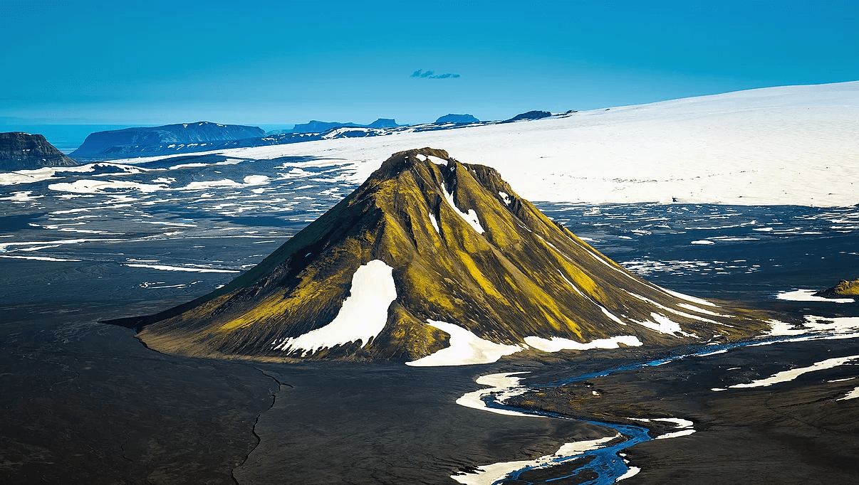
5. Maelifell
Maelifell volcano
Why go
Maelifell is Iceland’s most famous and picturesque volcano, and deservedly so! The otherworldly green volcano sits right in the middle of the black ash desert, making Maelifell one of the top places in the Icelandic Highlands.
Visiting Maelifell was one of the most surreal moments of all our trips around Iceland. The atmosphere surrounding the volcano is almost indescribable, and you have to experience it yourself!

How to get there
The journey to Maelifell is even more adventurous than hiking the volcano itself. We described it in our step-by-step guide to reaching Maelifell.
Discounts for our readers on Icelandic car rentals and Guided tours.
In short, you have several options. None of them is easy, and all require at least a sizeable 4wd car like Land Cruiser and involve crossing medium-sized rivers. The most popular routes include:
- Southern route (the easiest), via road F232 as an out-and-back trip
- Western route (the most beautiful), via roads F210 and/or F261
- Eastern route via roads 210 and F210
We can also take you to Mælifell on our fully customized Private Maelifell tour.
Tip from a local
If you are an experienced hiker, you may try to hike all the way to the top of Maelifell. Beware, though; it’s a steep and slippery hike. Wait also for nice weather; the trek doesn’t make sense in a fog.
6. Landmannalaugar
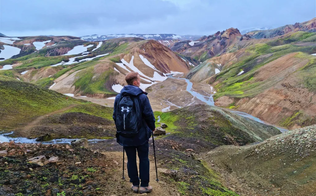
Unbelievably colorful Landmannalaugar can’t miss among the top places in Icelandic Highland
Why go
The rainbow mountains of Landmannalaugar proudly belong to an exclusive club of the most impressive spots in the highland of Iceland.
If you want to see one of the most colorful places on earth, then take a hike in Landmannalaugar! Not only are the rainbow mountains astonishingly picturesque, they are also pretty safe to visit. There’s a campsite, Landmannalaugar hot spring, and you will also meet many fellow hikers.
There are several magnificent hikes of various difficulties and lengths in Landmannalaugar. If you are fit enough, we highly recommend hiking an Orange Mountain – Blue Mountain loop trail. When taking this trail, you will enjoy some of the best views in Landmannalaugar.

How to get there
You can take a bus (10% discount code: EPICICELAND), hop on a super jeep tour or drive there yourself. Roads to Landmannalaugar are open for tourist driving only in summer, typically from June until September. Super jeep tours can access Landmannalaugar almost all year round, though.
10% discount code for the best local Landmannalaugar super jeep tour from Hvolsvöllur: EPICICELAND10
There are three main routes leading to Landmannalaugar:
- Northern route (the easiest), via roads 26, 208, and F224, small 4wd car required
- Western route (the quickest), via roads 26, F225, and F224, medium 4wd car required
- Southern route (the most beautiful), via roads F208 and F224, medium 4wd car required
10% discount code for the great Landmannalaugar guided bus tour from Reykjavik: EPICICELAND24
If you want to be alone and fully flexible, we can take you on an Epic Private Landmannalaugar tour!
Tip from a local
One day is enough to explore the most beautiful hikes in Landmannalaugar, like Bláhnúkur or Brennisteinsalda. However, if you want to go more off-the-beaten-path, go for two days. With two days, you will also have a higher chance of catching the nice weather with clear skies.
7. Thakgil
Views from Thakgil hikes are one of its kind
Why go
Thakgil is a paradise for all hiking enthusiasts. You will find gigantic canyons, melting glaciers, hundreds of waterfalls, and lush green canyons almost instantaneously.
Together with Thórsmörk and Landmannalaugar, Thakgil is one of Iceland’s three must-see hiking areas. It is its unique canyon ecosystem you won’t find anywhere else in Iceland or even in the world!
Thakgil hikes are of various difficulties and lengths. Be sure to check the map of the Thakgil trails, as well as what you can expect. Avoid heavy rain or strong winds; they can make hiking uncomfortable and dangerous.

How to get there
Getting to Thakgil is very straightforward. There’s just one route leading there – Road 214 to Thakgil. The road is open only in summer, usually from June until September, and is very bumpy.
All you need to know about visiting Highlands in Iceland.
Technically, you can drive to Thakgil in any car. Given the bumpiness of the road, it’s advantageous to take a vehicle with higher ground clearance, though, for example, Dacia Duster, to avoid any car damage.
Tip from a local
If you can spend a whole day in Thakgil, we highly recommend hiking to the melting Huldujökull glacier. It’s a once-in-a-lifetime experience to see the glacier with your bare eyes! We suggest taking a yellow and red trail loop if you are a good hiker. It offers the most beautiful views over Thakgil.
8. Laki craters
Mount Laki views at Laki craters are a must-see in the Highlands of Iceland
Why go
Fancy a volcano? What about more than ten volcanos? When visiting Laki, you will see even more!
Laki craters are an area full of many hundreds of years old volcanos and craters, which changed the history of Europe. These days they are luckily already covered with flourishing moss. You can become a part of this surreal scene if you visit this extraordinary place in the highlands.
Don’t forget to also stop by the spectacular Fagrifoss waterfall along the way and the fairy-tale-like Tjarnargigur Lake! We wrote a guide on all you need to know about Laki craters.

How to get there
You can get to Laki Craters by a proper 4wd car or take a guided super jeep tour. Two F-roads lead to Laki – F206 and F207. A medium-sized 4×4 car is a minimum, and a large 4×4 car is definitely advantageous.
How to rent a super jeep in Iceland?
Roads to Laki craters are slow, bumpy, and full of twists and turns. They are also remote, with sparse network coverage, and involve two river crossings.
You can also take a super jeep tour to Laki.
Tip from a local
The best viewpoint of Laki craters is from Mt. Laki. Don’t miss this spot on a clear day! The hike to Mt. Laki is short and a bit steep but very worth every step! Jaw-dropping 360° views will be your reward soon after you finish the climb.
9. Laugavallalaug
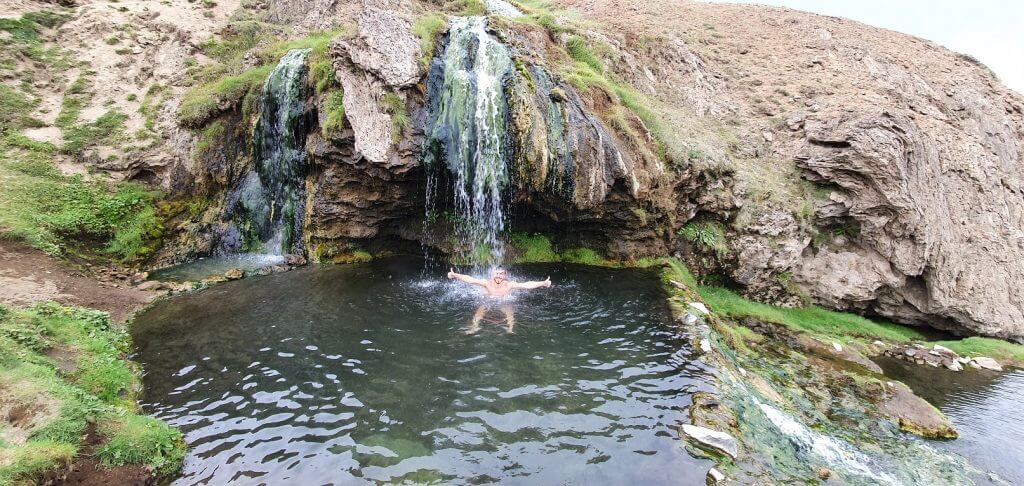
Laugavallalaug hot waterfall spring in the eastern Icelandic Highlands
Why go
Laugavallalaug is one of the wildest hot springs in Iceland. It is actually a hot waterfall! This makes Laugavallalaug an unforgettable experience in the middle of the very remote corner of the Icelandic Highlands.
After a long drive to Lagavallalaug, you will be rewarded with the peaceful surroundings of a small rustling river and sheep gazing at you while you bathe in this otherwordly hotpot.
How to get there
You can get to Laugavallalaug by:
- Roads 910 and F910 from the south or by
- Roads 923 or 907 and then F910 from the north
For all F-roads leading to Laugavallalaug, you need to drive at least a small 4wd car.
The Ultimate List of all hot springs in Iceland.
Roads to Laugavallalaug are open and accessible to the public only in summer. Please find detailed info on getting to Laugavallalaug in our Icelandic hot springs guide.
Tip from a local
If you want to be alone at Laugavallalaug, try coming before 10 AM or after 7 PM. When walking from the outdoor changing room, you better take slippers or sandals; you will need to descend down a little hill.
10. Aldeyjarfoss
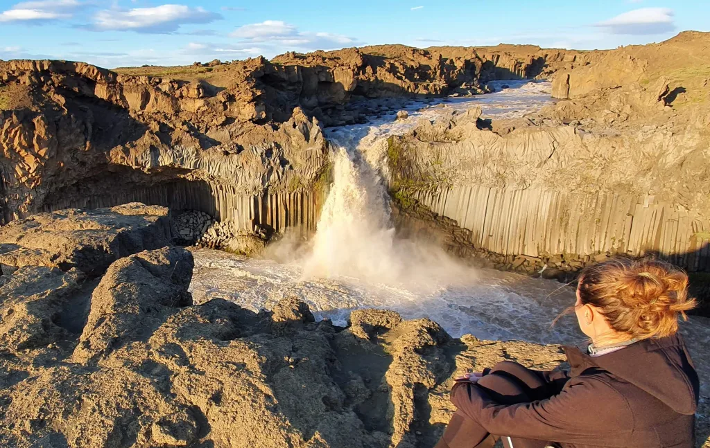
Aldeyjarfoss waterfall
Why go
Aldeyjarfoss is, without a doubt, one of the best waterfalls in the highlands. Its basalt columns are shaped exactly like the cliffs at the famous black sand beach Reynisfjara.
This makes Aldeyjarfoss unique and picturesque, yet not that hard to reach! The major part of the journey to Aldeyjarfoss is a drive, and then it takes just a short hike everyone can make to reach the stunning scenery of the waterfall.

How to get there
The shortest way to reach Aldeyjarfoss is to start in the north near Fossholl and drive south via roads 842 and a short section of F26. Any 4wd car is sufficient for this drive.
The detailed List of 130+ Icelandic Waterfalls.
The second option is to take a long and dark road F26 from the south across entire Iceland. You need to drive a large 4×4 car and already have some experience with river crossings in Iceland to pass F26 safely.
10% discount code for the private Aldeyjarfoss super jeep tour from Akureyri: EPICICELAND
There’s also an option to take a private super jeep tour to Aldeyjarfoss. Our readers can enjoy a 10% discount on this tour as well as all tours by Star Travel with a discount code: EPICICELAND.
Tip from a local
The best times for photography at Aldeyjarfoss are during sunrise and sunset. The more cozy time out of these two is the sunset because you don’t have to get up crazily early.
11. Fjallabak nature reserve
Just driving the F-roads around Fjallabak Reserve is a once-in-a-lifetime experience
Why go
Fjallabak nature reserve is the name of the immense area in the southern highlands of Iceland. Besides many hidden spots, it also encompasses the famous Landmannalaugar.
Everybody knows about the rainbow mountains of Landmannalaugar, but did you know that tens of fabulously adventurous roads stretch across an entire Fjallabak park?
The most well-known ones are the F-roads F210, F261, or F233, but this is nowhere near the end of the list! Multiple wild and harsh dirt tracks like Hungurfit, Strútur, or Krakatindur also exist.
And why drive these difficult roads? Because you will feel like you are on the moon! There are countless hidden hills, canyons, waterfalls, and even hot springs everywhere around these roads.

How to get there
There are several roads leading to the Fjallabak nature reserve. Some examples include roads F208, F225, F210, or F261.
10% discount code for the Fjallabak super jeep tour from Hvolsvöllur: EPICICELAND10
These roads are no joke! They involve steep and narrow terrain and crossing medium-sized and big-sized rivers. We highly recommend driving at least a large 4×4 jeep around Fjallabak, ideally a super jeep. Alternatively, you can also take a Fjallabak super jeep tour.
If you want to be alone on tour, we can take you on an Epic Private Fjallabak tour; just email us at [email protected] 🙂
Tip from a local
If you want to explore Fjallabak fully, you will need several days. The area is vast, and all drives take a lot of time due to rough terrain.
12. Raudibotn
Raudibotn waterfalls
Why go
Raudibotn is a tiny natural wonderland hidden in the middle of nowhere, deep in the highlands. The area features cute waterfalls, volcano craters, twisted river beds, and, most importantly – zero visitors!
How to get there
To reach Raudibotn, you can take an easy hike through a lush green valley that starts a few kilometers east of the famous Maelifell volcano. It takes about 3 hours as a roundtrip to complete.
The catch lies in getting to the trailhead. It’s a difficult drive. You can get to Raudibotn from the west or the east.

Roads F261 and F210 leading to Raudibotn from the west are two of the most beautiful Icelandic F-roads; however, they are tough. You have to cross several medium to big rivers. For that, you need a large 4×4 car or a super jeep.
Read about our visit to Raudibotn in detail.
You can reach Raudibotn also from the east, by road F210. This is the easiest way with only small to medium rivers involved and a medium-sized 4wd car required. But you can’t continue any further because both F210 west of Raudibotn and F233 east of Raudibotn contain river crossings that are dangerous for any smaller cars.
Tip from a local
Rent at least a Land Cruiser or a super jeep when visiting the highlands. It will give you the freedom to see much more and an increased safety in case of difficulties.
Afraid to go alone? No tours go to Rauðibotn, but we do! On our Epic private tours, just email us your wishes!
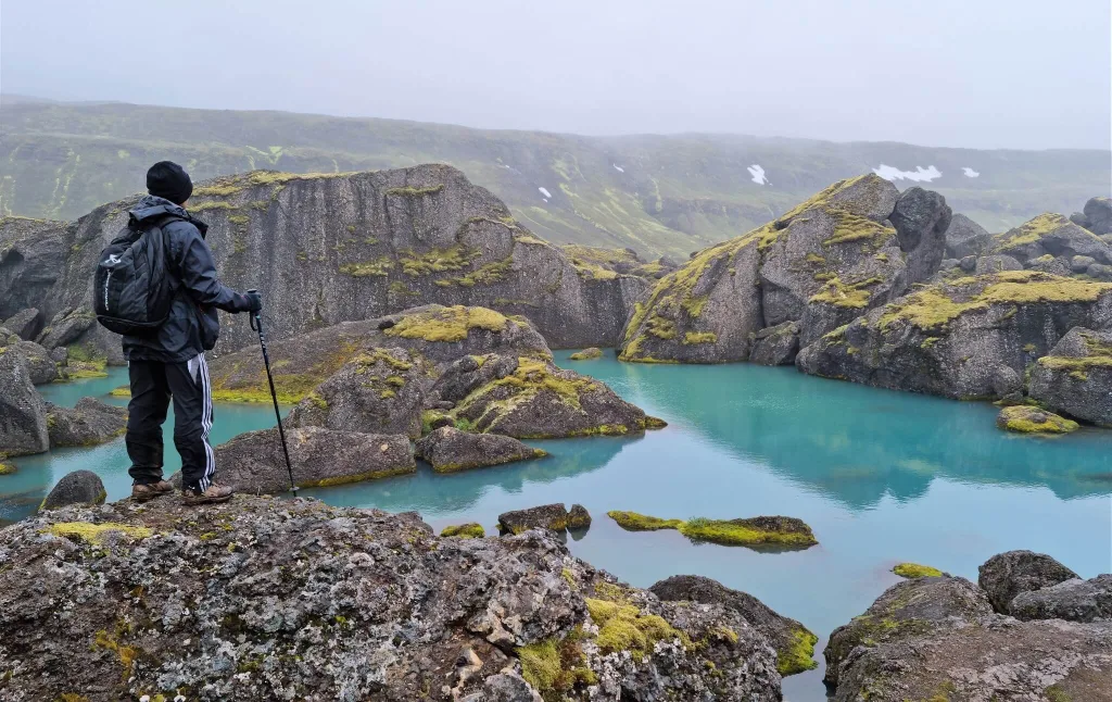
13. Eldgjá
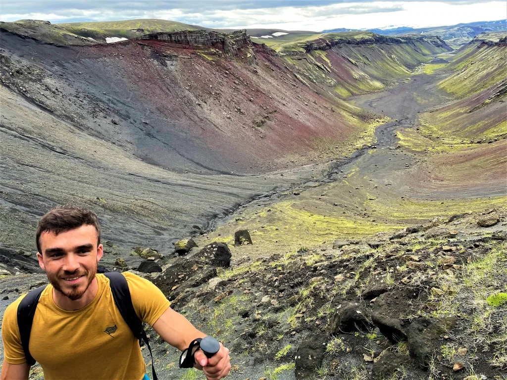
Happy me hiking to Gjátindur over Eldgjá canyon
Why go
Eldgjá Canyon is something like Silfra. Eldgjá is a more than 1000 years old fissure and chain of craters. Many Icelanders think this is one of the most beautiful places in the highlands.
You can take several hikes in Eldgjá. The shortest, easiest, and most popular one is a walk to Ófærufoss, one of the prettiest Icelandic waterfalls.
Read our guide on How to avoid crowds in Iceland.
You can also go for a longer hike to the peak of Gjátindur or continue even further towards Lake Langisjór. All these hikes offer scenic views making Eldgjá worth visiting.
How to get there
You can get to Eldgjá by F-roads F208 and F224 either from the north or from the south. Regardless of the way you choose, you need to cross medium-sized rivers on F208, and for that, you need at least a medium-sized 4wd car. Road F224 is very easy, then.
Tip from a local
After seeing all the other incredible places in the highlands, Eldgjá seemed a bit boring to us. However, a view of the Eldgjá fissure from above is an exception, and we recommend hiking for it. You can reach one of the best viewpoints halfway into the Gjátindur hike shortly after climbing up from the Eldgjá valley.
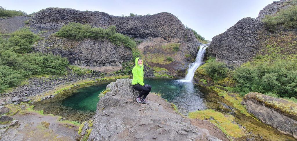
14. Raudufossar
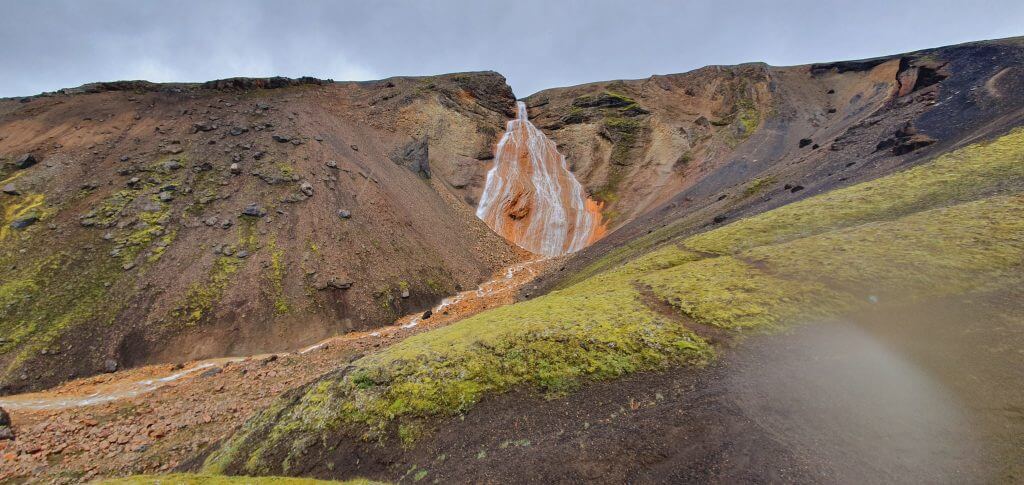
Rauðufossar, Raudfossar, or Raudafoss – all the different names for the same picturesque waterfall.
Why go
Raudufossar is an unbelievably colored orange waterfall not known to many visitors. It proudly belongs to the top places in the highlands of Iceland.
The hike to Raudufossar is simple and doesn’t require any special experience. You can take a shorter version of the trek, just to the bottom of the waterfall, in about 20 minutes one way.
Read in detail about our trip to Raudufossar.
There’s also an option to hike above the waterfall and continue deeper in the highlands towards the source of Raudufossar. It’s called Raudufossafjoll, and it features another orange waterfall! This part of the hike takes an additional 1 hour one way.

How to get there
Raudufossar trailhead and parking lot are located in the eastern part of the F-road F225. Landmannaleið, or F225, is one of the easiest F-roads in Iceland. In good weather, you can definitely drive it in any 4wd car in summer. Just don’t continue west from the parking lot via the Krakatindur track. It’s very precarious.
Tip from a local
Don’t get discouraged by bad weather! Raudufossar is one of those places you can also visit in the pouring rain, as we did. Moreover, if it rains, you will most likely be entirely alone.
15. Mulagljúfur Canyon
Us hiking a Mulagljúfur canyon in September
Why go
Mulagljúfur Canyon is one of the most spectacular yet well-accessible Icelandic canyons. It takes about 3 hours to explore it on a beautiful hike fully. The hike leads along the western edge of the Mulagljúfur Canyon and offers breathtaking canyon views.
It’s an out-and-back hike suitable also for fit families and belongs to the most beautiful half-day hikes in the highlands. Please visit the canyon only in nice weather and ideally only in summer; otherwise, the trails might be dangerous.
All you need to know about car rental insurance in Iceland.
There are also two giant waterfalls in Mulagljúfur called Hangandifoss and Múlafoss. Hangandifoss can be easily seen from about the trail’s midpoint, and Múlafoss is hidden deeply in the canyon and can only be observed from a distance.
How to get there
Múlagljúfur Canyon trailhead is easy to reach and located just west of the Fjallsárlón glacier lagoon. A hard-to-be-seen gravel road leads to Múlagljúfur car park as a short detour from the ring road. It’s very bumpy, but you can slowly drive it in any car in summer.
Tip from a local
Múlagljúfur is one of the dream places for anyone flying a drone. Please check the current Icelandic drone flying regulations before flying one there.
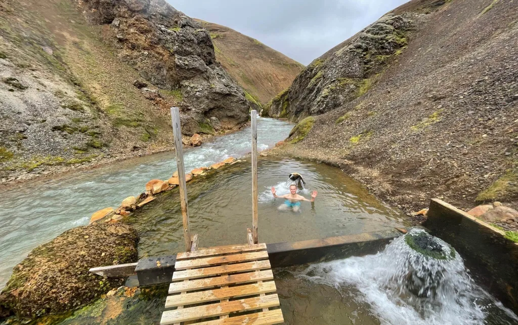
16. Strútslaug
Strútslaug hot spring deep in the Fjallabak highlands of Iceland
Why go
Strútslaug is most likely the least-known hot spring in Iceland. If you are looking for a totally remote hotpot bathing experience in the middle of nowhere, look no further!
There’s just one little caveat – Strútslaug is pretty hard to reach. Getting to Strútslaug involves a difficult drive followed by a 1.5-hour long hike.
Once you reach it, though, you will be rewarded with an authentic Icelandic natural experience. Don’t expect any changing rooms or hot spring stairs – you are out in the wild here!

How to get there
Regardless of the way you choose, you will need to cross several medium-to-big-sized rivers to reach the Strútslaug trailhead. To do that, you need to drive at minimum a large 4×4 car, ideally a super jeep.
Ultimate guide on How to cross rivers in Iceland.
The closest access point to Strútslaug is the end of the Strútur dirt track next to the Strútur hut. The Strútur dirt track starts just west of the popular Maelifell volcano. We wrote a detailed guide about visiting Strútslaug.
Tip from a local
Strútslaug can easily be visited also when it rains. The hiking trail is easy, and it’s a very enjoyable experience to soak up in the hot spring with rain pouring on your head!
17. Hornstrandir
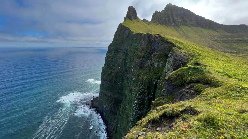
Hornbjarg Horn cliffs in Hornstrandir, photo by Reinhold Seiz
Why go
If you are looking for a true wilderness, love long and rough hikes, and prefer being totally alone, then your no.1 destination in Iceland will be Hornstrandir.
Hornstrandir is one of the last places on earth with still untouched nature and yet within reach from populated areas of Iceland.
You’ve probably already seen the picture of the most famous spot in Hornstrandir – the pointy Hornbjarg cliffs right next to the ocean’s edge. Well, that is just one amazing spot. There are so many hidden corners in Hornstrandir; it’s even impossible to list them all!

How to get there
Hornstrandir is the most remote region in Iceland, with no roads. The only way to get to Hornstrandir is by ferry. And then your only mode of transportation will be your own feet.
Our guide on How to find nice weather in Iceland.
Ferry is running daily, only in summer, from the beginning of June until the end of August, from Ísafjörður to the following settlements in Hornstrandir: Adalvík, Hesteyri, Veidileysufjordur, Hornvík, Grunnavík, Fljótavík.
Be sure to book the ferry in advance and better reschedule later. The slots are limited and may be fully booked. Secondly, if you don’t make a reservation, the ferry may simply not stop at your spot!
Tip from a local
Prepare well for any trip to Hornstrandir longer than a day, and don’t go alone. Practice especially carrying a big heavy backpack (20kg / 45lb) in strong winds and rains on steep hiking trails. This will sooner or later happen in Hornstrandir, even in summer.
18. Fimmvörðuháls
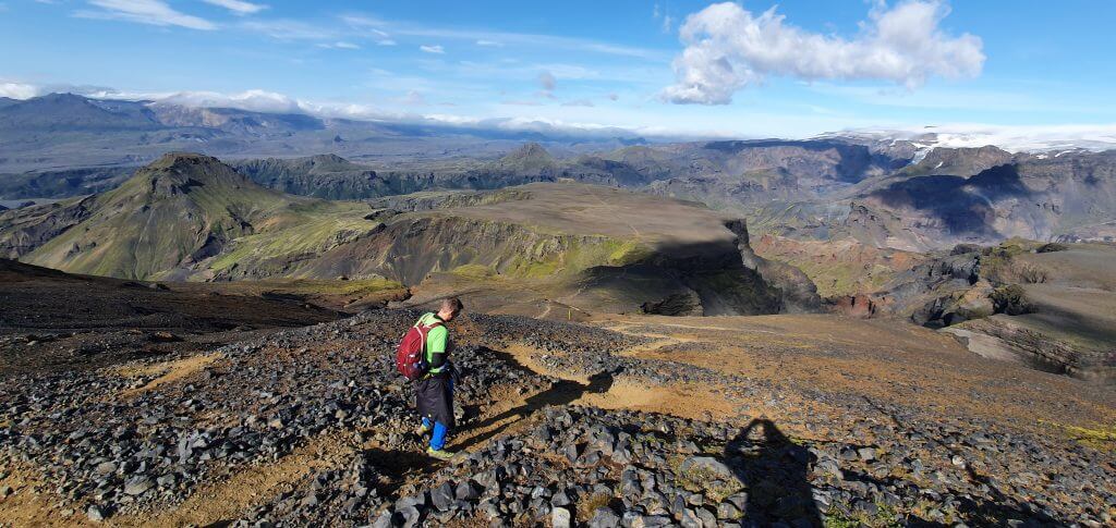
One of the highest points of the Fimmvorduhals hike with stunning views
Why go
Fimmvörðuháls hike is considered by many to be the most beautiful 1-day hike in Iceland. And we can’t disagree, it’s surely one of the best places in the highlands.
Fimmvörðuháls is a long hike, and it’s not for beginners, but it will reward you with some of the best views Iceland has to offer.
It’s very versatile, with the first part full of countless lush green waterfalls called The Waterfall Way. What follows next is the otherworldly volcanic area of red-colored craters Magni and Móði. The last part, where you descend to Thórsmörk, then features the most stunning views of the Fimmvörðuháls hike.

How to get there
You can start the Fimmvörðuháls hike either at the southern end in Skógar or at the northern end in Thórsmörk.
Read our detailed Fimmvörðuháls hike guide.
The southern trailhead is very easy to reach, located right next to the famous Skógafoss waterfall.
On the other hand, the northern trailhead is located at the end of the treacherous F-road F249 in Thórsmörk. You need a large 4×4 car or a super jeep, good weather, and river-crossing skills to reach it. Or take a highland bus (10% discount code: EPICICELAND) to/from there, operated by 2 companies.
Tip from a local
Bring hiking poles. They are priceless on steep and slippery terrain. And plan a hike for a nice day. Trust me, you don’t want to hike Fimmvörðuháls on a rainy and windy day!
19. Stórurð
Stórurð hike in the highlands of east Iceland near Borgarfjörður eystri
Why go
Stórurð is a magical crystal blue-colored lake with huge stones sitting up in the mountains of Borgarfjörður Eystri. You will feel like being in a fantasy movie when visiting Stórurð.
Stórurð is an easy hike even for families and is a must-see in East Iceland. Several different trails lead to Stórurð, with the easiest one being the Njarðvík hiking trail.
We also wrote a list of the 15 Best summer guided tours in Iceland.
How to get there
Stórurð trailheads can easily be reached by any car; all the roads around are paved. You can park your car at each trailhead, whether it’s an easier Njarðvík trail or a more difficult Vatnsskarð trail.
Tip from a local
The hiking paths are typically snow-free from around early July until late September. You can hike Stórurð even if it rains lightly, but you better avoid fog. You can’t see the lake well when it’s too foggy.
20. Markarfljótsgljúfur
East viewpoint of the otherworldly Markarfljótsgljúfur Canyon deep in the Icelandic Highland
Why go
Markarfljótsgljúfur Canyon is one of the most impressive canyons in Iceland that almost nobody knows about, entirely away from all the crowds.
Markarfljótsgljúfur is breathtakingly huge, and you can hike along its edge for as long as you wish. A mighty river carves its way through the bottom of the gorge.
How to get there
You can reach Markarfljótsgljúfur either from the west or the east and only in summer. All roads leading to the canyon are difficult highland roads and require at least a large 4×4 car.

The western viewpoint is easier to get to. You need to take a short but very rough detour east from the road F261.
We wrote a detailed guide on visiting Markarfljótsgljúfur canyon.
The eastern viewpoint offers the best views but is harder to drive to. Emstrur dirt track is steep and rough, and you should ideally drive it in a super jeep only.
Tip from a local
Don’t try to visit Markarfljótsgljúfur in a Dacia Duster; rent a proper and reliable 4×4 car. You may be the lucky one who made it here in the Duster, but you will most likely be a star of the rescue operation.
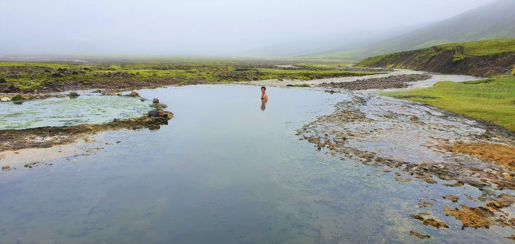
21. Kerlingarfjöll hot spring
Bathing alone at Kerlingarfjöll hot spring
Why go
Kerlingarfjöll hot spring is one of the most stunning hot springs in Iceland. What makes it unique is its remote location tucked inside a scenic canyon. You can get here only by hiking, and you will often be alone.
The hike to the Kerlingarfjöll hot spring is a piece of cake and takes about 1 hour one way. Even the trek itself is worth your time because its surroundings are very picturesque. The pleasant hotpot dip at the end is just a free bonus.
How to get there
The hiking trail to the Kerlingarfjöll hot spring starts at the Kerlingarfjöll Mountain Resort, which has recently been renamed the Highland Base. The hike is well-marked.
We also wrote a detailed guide to Kerlingarfjöll.
In summer, you can get to the Kerlingarfjöll Highland Base by any 4wd car via roads 35 and F347.
Tip from a local
There’s no changing room next to the hot springs. Get ready for that, or simply don’t be shy. Don’t forget to bring a bag for a wet swimming suit on your way back.
22. Bláfjallafoss
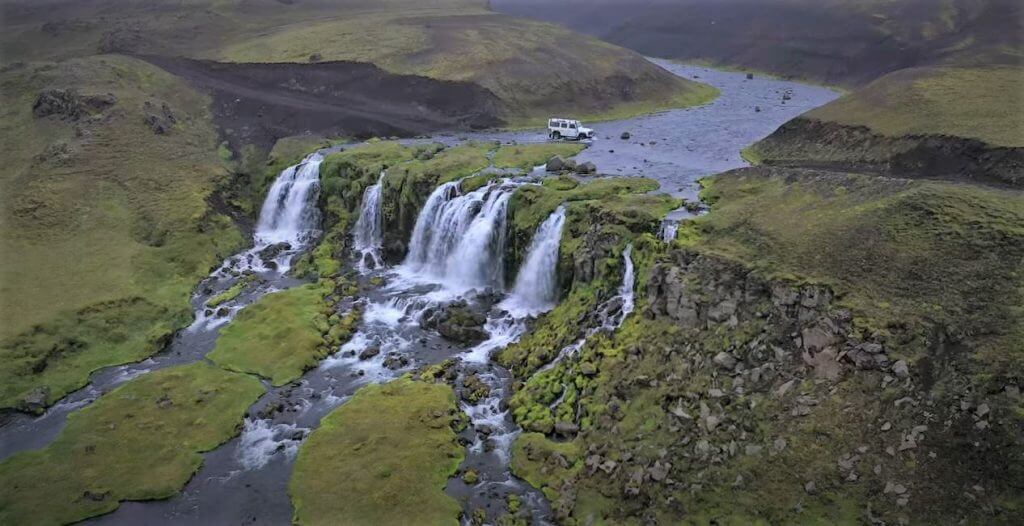
Bláfjallafoss waterfall on a highland F-road F232
Why go
Did you know that Bláfjallafoss is the only waterfall in Iceland you can actually drive through? This makes visiting Bláfjallafoss a once-in-a-lifetime experience.
Photographers love to take drone pictures of jeeps driving through the upper bank of the waterfall. It’s an amazingly beautiful and surreal scene that never gets old.
Be sure to read our one-of-its-kind list of all Icelandic F-roads.
How to get there

Bláfjallafoss is situated in the middle of the F-road F232. You need at least a medium-sized 4wd car to reach it and, most importantly, to cross the river/waterfall itself. The river crossing is very bumpy, and we advise you to only take a car with sufficient ground clearance here.
Tip from a local
You can hike down to the bottom of the waterfall to get the best views of the waterfall itself. This spot, however, is not the best for photographing cars passing through the waterfall. The best place for photography is from one of the banks or by drone.
23. Gjáin
Everything is smaller in Gjáin. Especially waterfalls. Tiny Highlands.
Why go
Gjáin is a cute little highland wonderland. It resembles a miniature of Iceland. There are many mini waterfalls, tiny valleys, and petite rock formations.
Gjáin is worth visiting on your way to Haifoss or towards Landmannalaugar, as it’s located nearby. You can easily explore Gjáin in less than half a day or even an hour if quick enough.

How to get there
You can drive to Gjáin in summer by gravel road 327. It’s a bumpy road where a car with higher ground clearance is advantageous. Still, you can come here in any car when going slowly and cautiously.
You can read more about our visit to Gjáin.
Tip from a local
Gjáin is a great family hiking spot because all its hiking trails are straightforward and short. It’s also a cool place to see when it rains for the same reasons.
24. Kverkfjöll
One of the least visited corners of the Highland of Iceland – Hveradalur in Kverkfjöll
Why go
Kverkfjöll is a very scarcely visited magnificent mountain range and glacier area south of Askja in eastern Iceland.
Kverkfjöll is also geothermally very rich and active, with several little hot springs spread all over the area.
You can explore Kverkfjöll exclusively by hiking. There are several hidden ice caves and hot springs. On a nice day, you will be able to see the panoramic views only very few visitors see in Iceland.
How to get there
The only way to reach Kverkfjöll is by driving several highland F-roads. You need to start on F910 and then take either a combination of the road F903 and F902 or drive just F902 directly to the Kverkfjöll lodge.
When is the best time to visit Iceland? Pros and Cons of every season.
The roads are open to foreign visitors only in summer.
Tip from a local
Kverkfjöll is full of glacier tongues with crevasses, so we highly recommend you take a guided tour of the area. In any case, always consult a ranger in a Kverkfjöll mountain hut before embarking on any hikes! Ideally, even a few days in advance.
25. Lónsöræfi
Lónsöræfi Highlands by talented photographer Snorri Þór Tryggvason
Why go
Lónsöræfi is a colorful, hard-to-reach hiking area similar to Landmannalaugar, just totally out of sight of any foreign tourists.
There are many hiking trails in Lónsöræfi of various lengths and difficulties. Lónsöræfi is also popular among locals for multi-day hikes in the wilderness with stunning views.
The main caveat of visiting Lónsöræfi lies in a very challenging access road. This is the main reason why almost nobody tends to visit the area.

How to get there
The only way to reach the main Lónsöræfi hiking trail is to drive the mountain road F980. And the problem is that F980 is one of the hardest F-roads in Iceland, probably even the hardest.
We partially visited Lónsöræfi ourselves, but only a part of F980 up to Skyndidalsá river.
The main obstacle is a massive, unbridged Skyndidalsá river, which you must cross. The only way to do that is by driving a huge super jeep and, at the same time, having the exact knowledge of the optimal fording spot. Always leave this to locals!
Tip from a local
To arrange a river crossing transfer to Lónsöræfi, contact Stafafell Guesthouse or a tour company called South East Iceland.
![]() ask questions or get inspired in our community
ask questions or get inspired in our community


Sorry, the Lotus Land Cruiser has 35″ tyres
Yes, you’re right. It’s a fresh addition, from like 2 days ago 🙂
hi Igor. just wanted to say thanks for this website! reading all your detailed info gave me the courage to leave Landmannalaugar
via 208 south a couple days ago, raidibotn (you can complete the loop around the crater btw and avoid stepping on moss) water levels were low I waded the holmsa) so we did 210 to maefils and out to vik on 232 . one of our best days travelling in years!
Hi Tim, thank you! Glad you had an amazing trip!
Hello Igor. I’m really struggling with our 11 day itinerary for our visit to Iceland in September. If you had to choose between Landmannalaugar or Kerlingerfjall, which would you choose? If we only do one, we may be able to squeeze in Askja. We are renting a Toyota Hilux with a camper top. We like to hike, but probably no more than 7-10 miles a day.
Thanks for your advice. I appreciate your website!
Marge
Hi Marge, we wrote a short comparison between Landmannalaugar vs Kerlingarfjoll that may help 🙂
Thanks Igor for the great article on the highlands. Very informative and very detailed. You did an amazing job. I will be relying on your insights to plan for few days in the highland area.
Thank you very much George!
If you like what we do please write us a short review on Google: https://g.page/r/CaJt1bHCTbF1EBM/review and possibly copy paste it to Facebook: https://www.facebook.com/EpicIcelandReal/reviews too, it would help us a lot!
Thank you!
Hi Igor,
what a great article! Thanks so much for all the detailed info!
I have a question about the Laugavallalaug hot spring or rather the roads around it.
We want to do the Waterfall Circle hike first and then go to the Laugavallalaug hot spring following the directions you described and in the end go to the Studlagil Canyon (the side where you can go down to the river). I googled the roads along with your directions and it seems that that route should be fine (without any river crossings), but on one other blog I found the info that if we go as planned we will only be able to get to the viewing platform in Studlagil Canyon on the other side of the river. Could you please confirm? Thank you so much!
Thank you Maja!
Yes, the road from Waterfall Circle to Laugavallaug doesn’t have any river crossings, only small streams to cross, but it’s quite bumpy, that’s why the bigger car may not be a bad idea either.
As per your Studlagil question – you can get to both sides, you just need to cross the bridge first and park car there, and then hike for about an hour, if you want to reach the interior of the canyon and not just the viewing platform.