
For this day I planned some beautiful short hikes in Eastfjords and hikes in Borgarfjörður Eystri. And, as always, I also planned to drive some amazing mountain roads in the Eastfjords highland of Iceland. I’ve done thorough research for most beautiful places in Eastfjords and ended up with the following list.
Contents
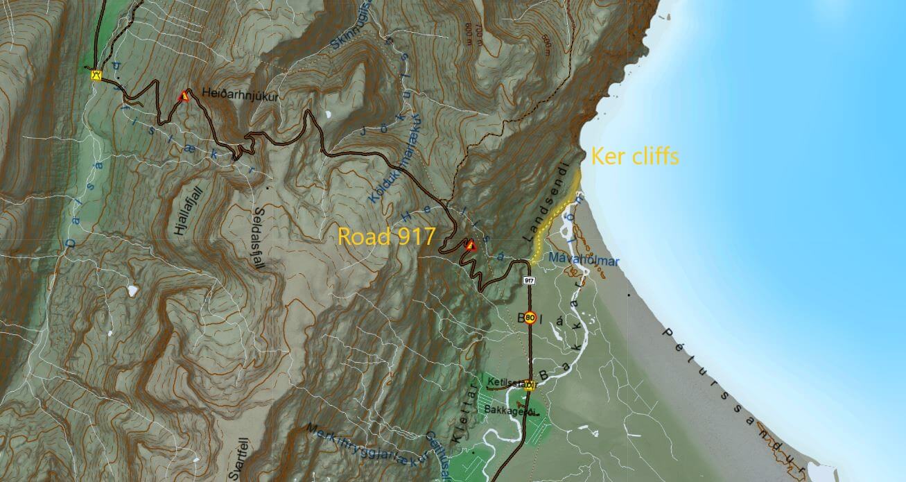
The plan was to start by driving north from our accommodation in Hrafnabjorg and do the short hike to picturesque sea cliffs called Ker. Then I wanted to do some mountain driving with nice views from above, so I planned to drive road 917, enjoy the view from above and come back. Our next destination was Borgarfjordur Eystri and I planned a beautiful short hike to Brunavik beach there. Our hike to Brúnavík beach turned out to be one of the most amazing short hikes we’ve done in Iceland. Definitely recommended!
Enjoy car rental discounts and tour discounts in Iceland for our readers.
If we had enough time, energy and daylight I also wanted to drive the legendary F946 F-road all the way to Loðmundarfjorður. But not in a straightforward way, rather driving via detour to Breidavik beach first, via Breiðavík track. The aim was then to end the day in Seydisfjordur. A long day full of adventures ahead!
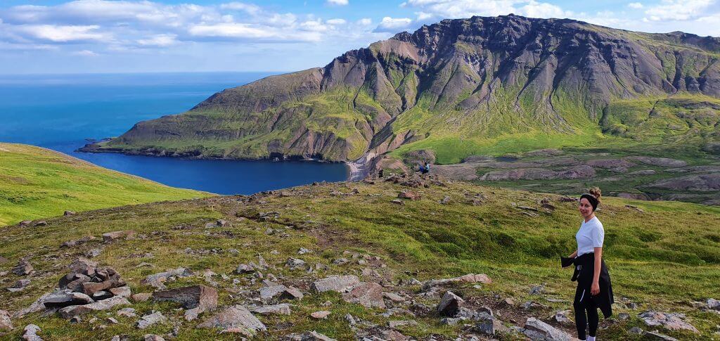
Hike to Ker
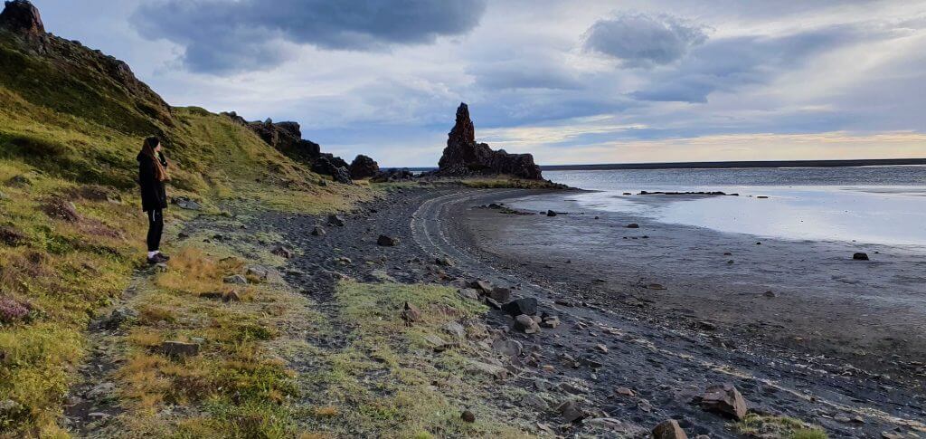
Ker
There’s one pretty overlooked short hike that almost nobody seems to be mentioning which I somehow managed to dig out from local Icelandic sources. It is called Ker. The area of Ker is a coastal area and the entire hike leads along the beautiful coast. It ends in front of picturesque cliffs that carry the name Ker.
Hiking trail to Ker cliffs
In late August, the weather at the time of our visit was amazing in the north and in the east. Weeks and weeks of sunshine and hot weather of 20°C (68°F) and more almost every day. We took advantage of this and planned some amazing hikes in Eastfjords, one of them being hike to Ker, which was really enjoyable in sunny weather.
Map of the hiking trail to Ker
Hike to Ker is a short and easy hike even families or elderly will definitely be able to do. It takes around 30-40 minutes one way and along the entire trail you will have a nice coastal view of the sea and nearby cliffs. The trail is not well marked, but there’s a semi-trodden path that can be distinguished with some effort. The entire hike starts here and leads along the coast, closer to Ker cliffs. There are multiple nice viewpoints along the trail.
Ker cliffs
You’re gonna pass black beaches, cliffs with black beaches and all that near the sea. And you’ll meet almost no visitors. The hike is not being done by typical tourists. We’ve met just one couple during the entire hike. I can definitely recommend a hike to Ker as a nice short hike in Iceland.
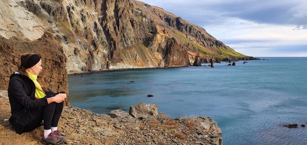
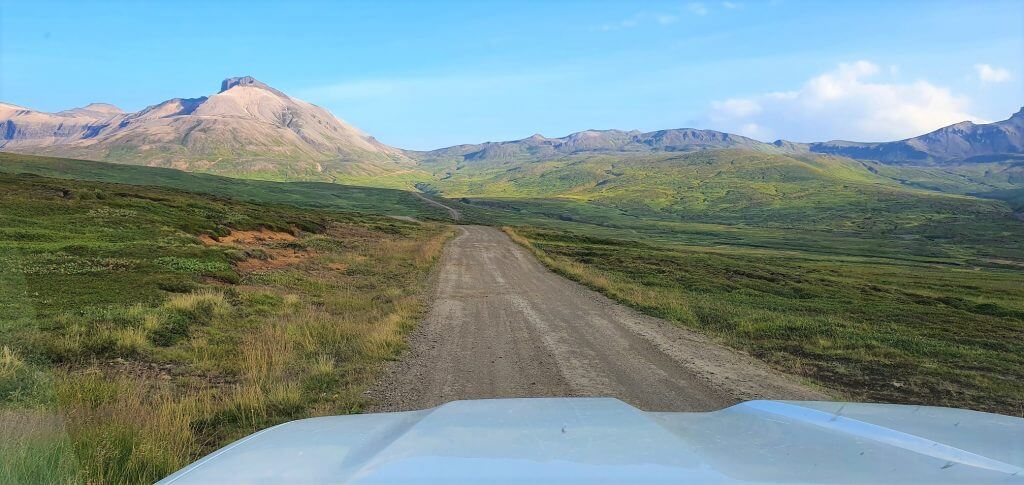
Road 917 Hlíðarvegur
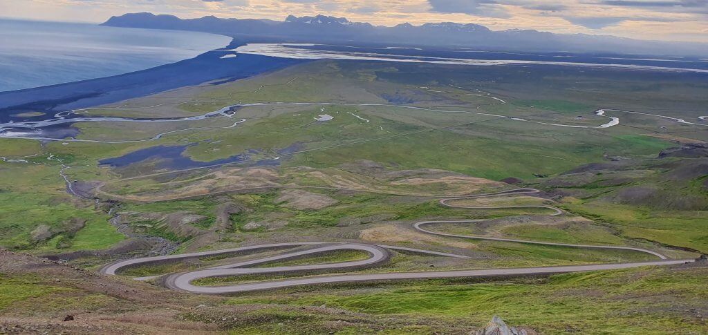
Road 917, Hlíðarvegur
The next on the plan was a drive towards zig-zagged mountain road 917, Hlídarvegur. Driving up the road 917 is a pretty decent climb which can be done by any car in summer, because Hlídarvegur has quite good quality and is almost fully paved. The more you go outside of the full summer season (July and August), the lower the chances you can drive the road in any car. If you plan to drive the road in a more off-season period I definitely do recommend a 4×4 car.
On top of the road 917, Hlidarvegur
Views from Hlídarvegur are very nice, especially in a good weather with good visibility. You are able to see all nearby beaches from above as well as Borgarfjörður Eystri further in the distance. For me, road 917 was worth a short detour, not for my wife though, who doesn’t enjoy driving Icelandic mountain roads as much as me :))
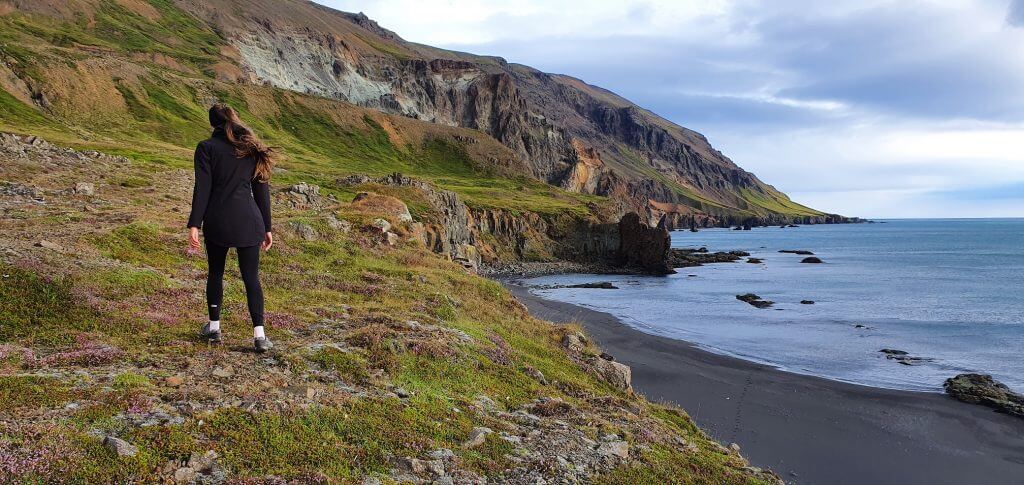
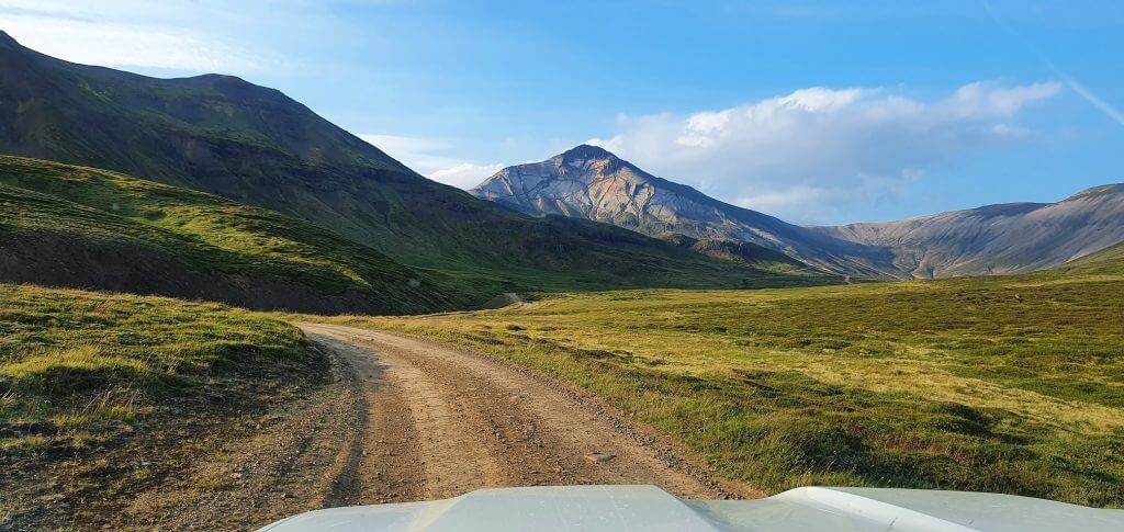
Borgarfjörður Eystri
Our main activities of this day in Iceland were the hikes in Borgarfjordur Eystri and driving the F-roads in Borgarfjörður Eystri. That being said, our next stop was exactly this amazing mountainous area. Borgarfjordur is a group of several mountains in Eastfjords and is truly a hikers’ paradise. There are more than 40 different hiking trails and if you wanted to explore only half of them, you could easily spend here a month or more. Here is the map of Borgarfjörður Eystri hikes.
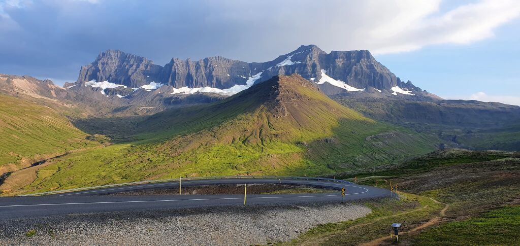
Dyrfjöll mountains in Borgarfjörður Eystri
We obviously didn’t have a spare month to spend in Borgarfjordur, so the hardest task was to choose. What short and beautiful hike should we take in Borgarfjörður Eystri to have a good glimpse of the entire area? After some research I finally settled with a hike to Brúnavík beach. And now I can conclude it was a good decision.
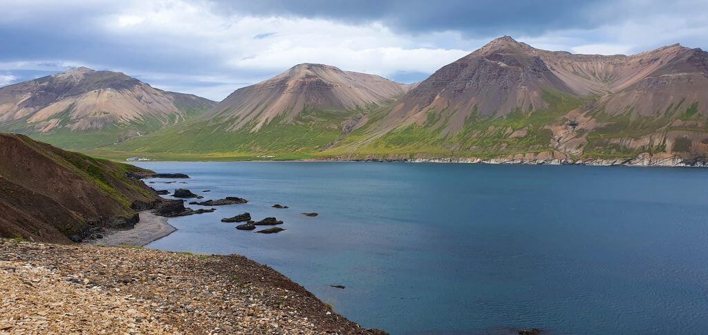
View over Borgarfjörður Eystri
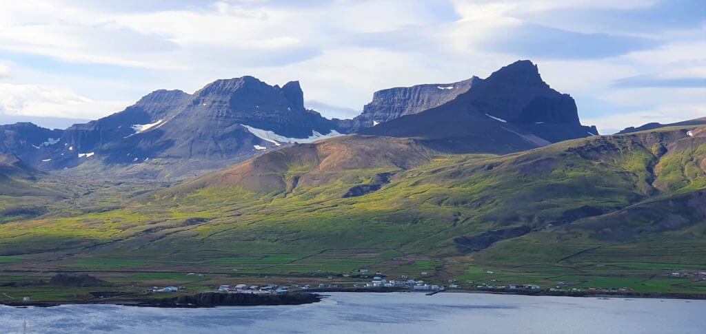
Luckily, just driving to Borgarfjörður Eystri made it for amazing views. You will be driving coastal zig-zagged roads which are fully paved with views over sea and over massive mountains of Dyrfjöll. There are places at the side of the road where you can stop and take a picture of this beautiful area, so take advantage of it 🙂
The actual village of Borgarfjordur is pretty small with limited meal and accommodation options. But, this is what makes this area so unique – remoteness and endless surrounding nature.
In the middle of the trail to Brúnavík beach in Eastfjords
There are two alternatives of hiking to Brúnavík beach – a longer one and a shorter one. A longer one starts closer to Bakkagerði (see our map below) and you can either make a loop trip or a roundtrip via same trail. It is 15km long and will and the roundtrip will take you roughly 5 hours.
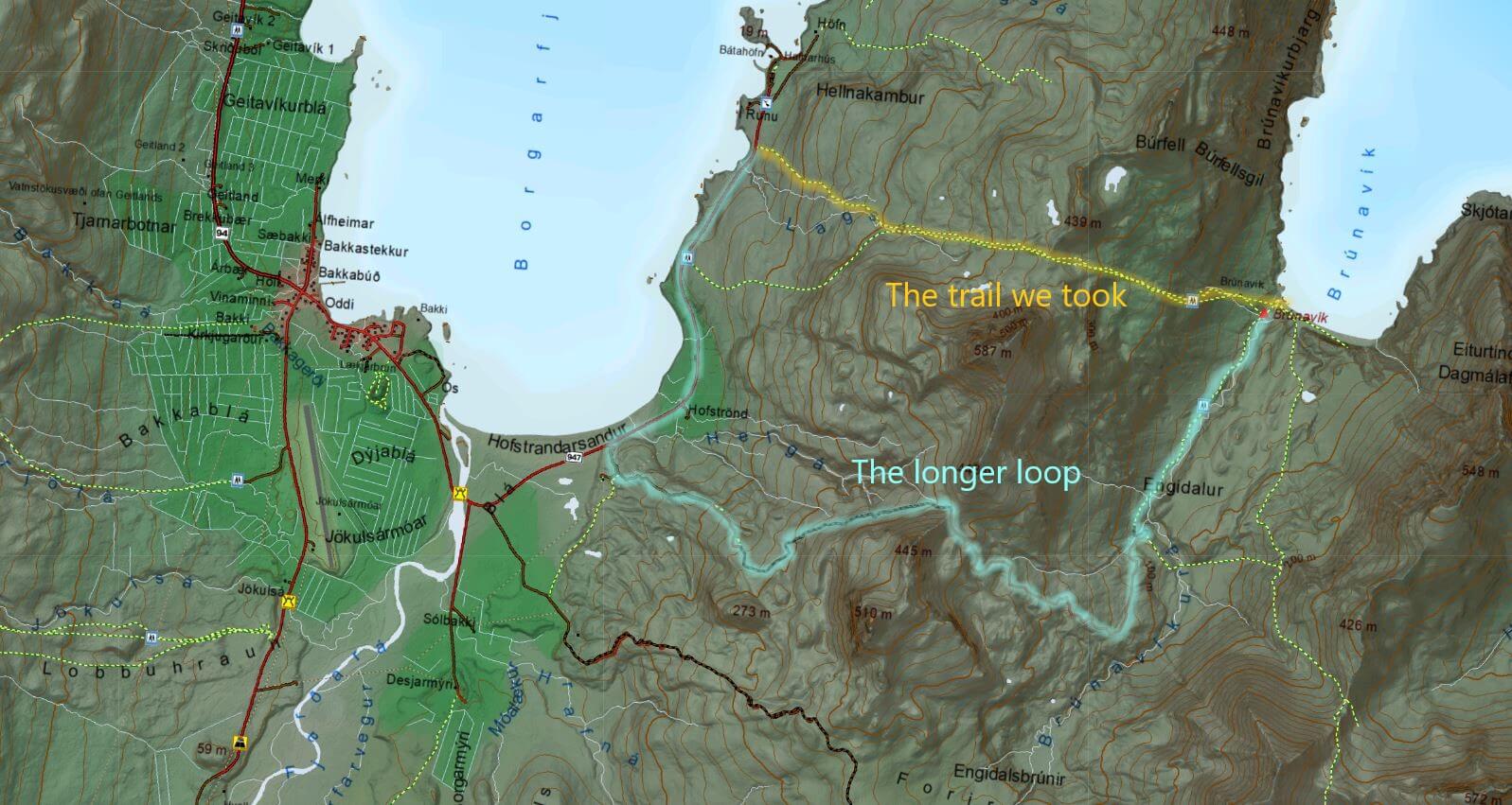
Brunavik beach hike map
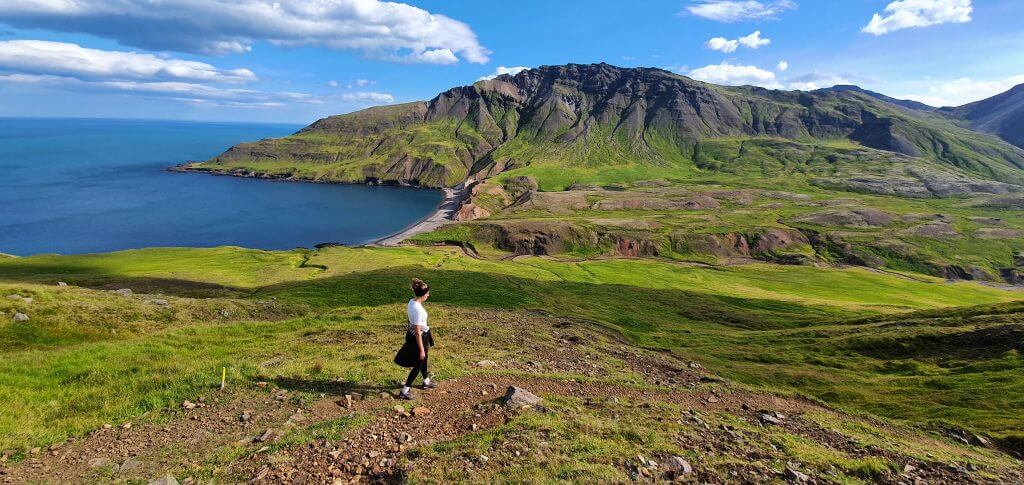
The shortest hike to Brunavik beach starts at a little carpark near Borgarfjarðarhöfn (see the trail marked with yellow in our map). This is where we started our hike to Brúnavík. The roundtrip hike to the Brunavik beach and back from this spot is roughly 8km long and it took us 3.5-4hours to finish the roundtrip using the same trail there and back. Hiking trail is marked with yellow sticks so it’s easy to follow the path.
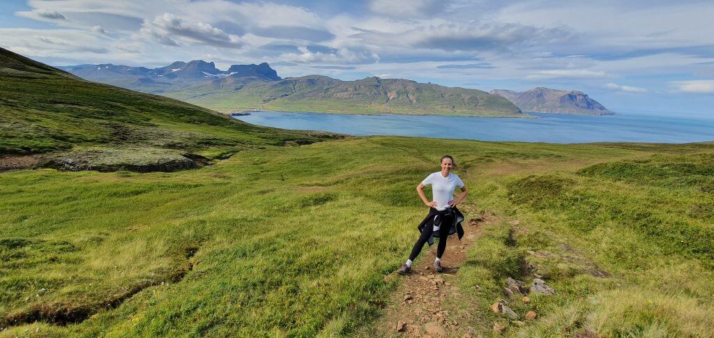
View over Dyrfjöll mountains from the hiking trail to Brúnavík
The hike connects the western and eastern part of the coast via small mountain pass. Brunavik hike starts with a rather uneventful ascent, but turning back and looking at the coast you will soon be getting really nice views over Borgarfjörður Eystri and mountains of Dyrfjöll. After roughly an hour of ascent, you will reach the highest point of the trail where you cannot sea either part of the coast (yet). After continuing forth for a few minutes, the best views will slowly start to reveal in front of you.
Hiking trail to Brúnavík beach
In a good weather you will soon realize what is this entire hike to Brúnavík beach about. The view over Brunavik beach is one of its kind and truly amazing. Brúnavík beach was one of the most beautiful places we’ve seen during our trip. Even my wife, that is not much into hiking, was amazed by this hike. The second part of the hike is a descent towards the beach. At times it gets a bit steep but the hiking trail is in good conditions so anybody in at least a medium shape should be able to do it. Just don’t expect a 10-minute flat walk.
Hike to Brúnavík beach
Brúnavík beach was lovely at the time of our visit. And completely deserted. We enjoyed our time at the beach so much, the more so in warm and sunny weather. It’s an amazing picnic spot and both a place to just sit, relax and enjoy the beauty of Icelandic fjords. We were able to take some of our most beautiful photos here just with our phones.
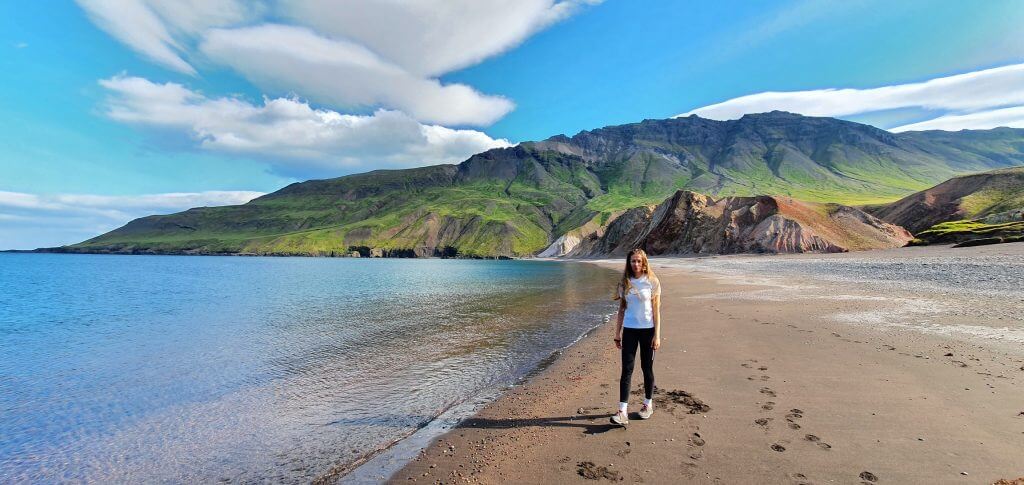
Amazing Brúnavík beach hidden in Borgarfjörður Eystri
Rather than doing a longer loop-trip to Bakkagerði, we took the same way back. Thus, we firstly had to ascend the steeper part near the beach and then to descend back to the car park. When we finished the hike, it was around 16:30, so we still had a few hours of daylight and I definitely wanted to spend them by driving some amazing F-roads.
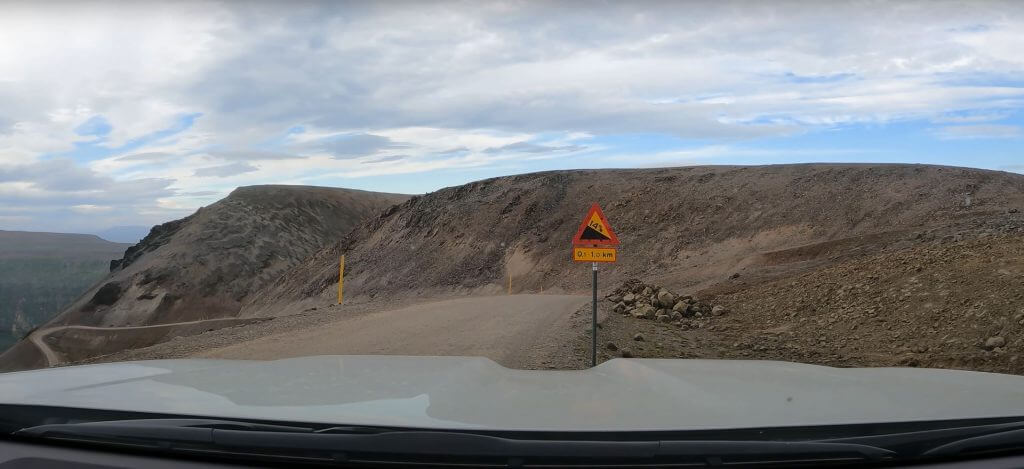
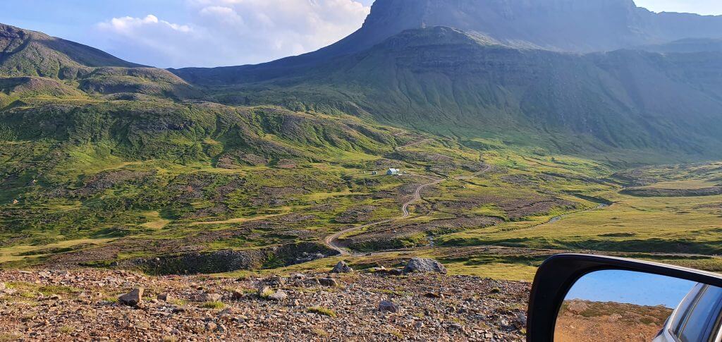
Breiðavík track
If you want to drive the road F946, Loðmundarfjarðarvegur, all the way to Loðmundarfjorður and Klyppstaðarkirkja, you can either drive road 946 first and then directly proceed to F946 or you can do a mountain drive detour to another beach called Breidavik. Since I don’t like the easier roads, of course I wanted to rather drive the Breiðavík beach track.
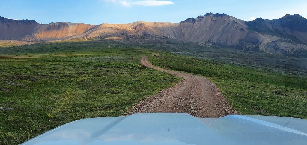
Breiðavík track in Borgarfjörður Eystri leading to Breiðavík beach
The Breiðavík track starts by driving a few kilometers of road 946 first and then turning left to the Breiðavík track. Keep in mind this is just a track, i.e. the road quality is even worse than F-roads. You definitely need at least a big 4×4 to drive the road and ideally a super jeep. Also, please check with you car rental company if you are allowed to drive the track. If you rent a super jeep, it’s usually allowed (that’s what super jeeps are for, right?).
The Breiðavík beach track starts as a pretty scary steep and narrow ascent with abyss to one or both sides right next to you. Although we had a great car for such roads, my wife was still freaking out. And yes, I have to admit, this road is nothing for 4×4 beginners and neither for those who are afraid of heights.
Breiðavík track in Borgarfjörður Eystri leading to Breiðavík beach
After a few minutes of drive, you will reach the point where you can see another steep, narrow and really zig-zagged part of the track in front of you. This was the spot where my wife refused to continue, so we turned back and didn’t finish the track. But I definitely plan to finish it sometimes soon all the way to Breiðavík. After doing that, I will also complete this article about the Breidavik track and report on the quality of the second half of the track.
F946 – Loðmundarfjarðarvegur
We drove back from the Breiðavík track to the beginning of road 946. You have to first drive 946 to reach F946. The “simple” 946 makes for roughly a half of the entire path to Loðmundarfjorður. 946 is a semi-paved road, technically possible to be driven by a 2wd vehicle only, but we recommend to take a 4×4 for it, especially if you plan to reach the end of the road, not just the beginning.
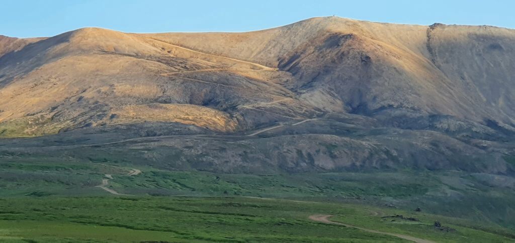
F946 in Borgarfjörður Eystri
The second half of the road 946 turns into a mountain drive and you will begin a zig-zagged and steep ascent into the Borgarfjörður Eystri mountains. You will eventually reach the point where 946 turns into F946. This is where the road conditions worsen. Road gets even bumpier, steeper and narrower. There are no river crossings on F946, though.
F946 – Loðmundarfjarðarvegur
We recommend driving F946 in at least a medium-sized 4×4 car, ideally a large 4×4, especially if you don’t have much experience with steep mountain drives. The main danger of the road lies in steep and narrow ascents and descents and all that on a gravel track with potholes. We’ve seen also small 4wd cars driving F946 (like Jimny) but they were struggling and we consider using such cars irresponsible and dangerous.
F946 Loðmundarfjarðarvegur Borgarfjörður Eystri
Views all around F946 are simply amazing and you will be passing many different types of mountains and mountain passes of the beautiful Borgarfjordur Eystri area. Once you climb the highest point, which is located after the Húsavikúrskáli hut, you will then need to make a longer descent all the way to Klyppstaðarkirkja. This part of Iceland is inhabited only scarcely, mostly by rangers or researchers and only during summer. We didn’t have many hours of daylight remaining so we turned back soon and drove all the way to Seydisfjordur for our next accommodation stop.


I did not know about Breiðavík track, need to try it in summer. I assume you have no video with the first part.