F26, or in Icelandic Sprengisandsleið, or Sprengisandur is an F-road leading through central Icelandic highlands. It connects the area around Akureyri in the north with an area around Hella in the south. Sprengisandur is the more difficult of the two roads vertically intersecting Iceland, with the easier one being road 35, Kjalvegur, or Kjölur.
There are several river crossings along Sprengisandsleið, with the biggest one located roughly in the middle of the road. A proper 4×4 car is necessary to pass and you need to follow the river crossing guidelines as well. F26 as such is very remote with scarce cell phone coverage, no gas stations, nor any shops along the road. The only settlement is a Nyidalur Mountain hut situated right next to the biggest river crossing, which serves also as a campsite.
Contents
Overview of F26
Length: 156km | 97 mi
Driving time: 3-4 hours
Difficulty: moderate
Opening time: end-June to mid-July
Closing time: mid-September to end-September
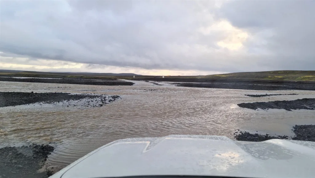
F26 river crossing Hagakvislar river
Feel free to read how to choose a proper car for F-roads in Iceland or how to pick the best Icelandic car rental insurance. We also collaborate with the best Icelandic companies to give you a car rental discount and us a small commission at no extra cost to you.
Map
Google Maps incorrectly mark a long part of Road 26 in the south near Landmannalaugar as F26. This part of the road has been already paved and reclassified to Road 26. Correct F26 on Google Maps:
Icelandic Maps:
Connecting roads
- Road 26
- F881
- F752
- F910 central
- Road 842
- Svarthöfði track to Vonarskarð
- Many other wild and rough dirt tracks
A drive through central F910 from Nyidalur to Askja
River Crossings and Obstacles
River Crossings
There’s one small, one medium, and one medium-to-big river crossing on F26. The biggest ford is located just slightly north of Nyidalur mountain hut. It’s called the Hagakvislar river, and it can get pretty wide and deep when it rains or when glaciers melt. This one spot is the main reason why you need a big car for this road. Sprengisandsleið sometimes even gets closed (marked impassable) in the middle of summer due to too high water levels.
Here is a Hagakvislar river crossing video from July and here is a video of the ford in September. Both these times were drier, with lower water levels, making it a medium-sized river crossing at that time. We filmed all the fords on F26 and you can find them in the videos below. Where to cross the river? Just stay between the sticks on both sides of the river – that’s the optimal spot for crossing. When crossing rivers in Iceland, please always follow the river crossing guidelines thoroughly!
Obstacles
There are no main obstacles along F26 and the terrain is relatively easy to drive and navigate through, with the exception of the Hagakvisla river crossing. If it wasn’t for this crossing, I would say even a 2wd car can make it through the road. However, the ford makes a huge difference.
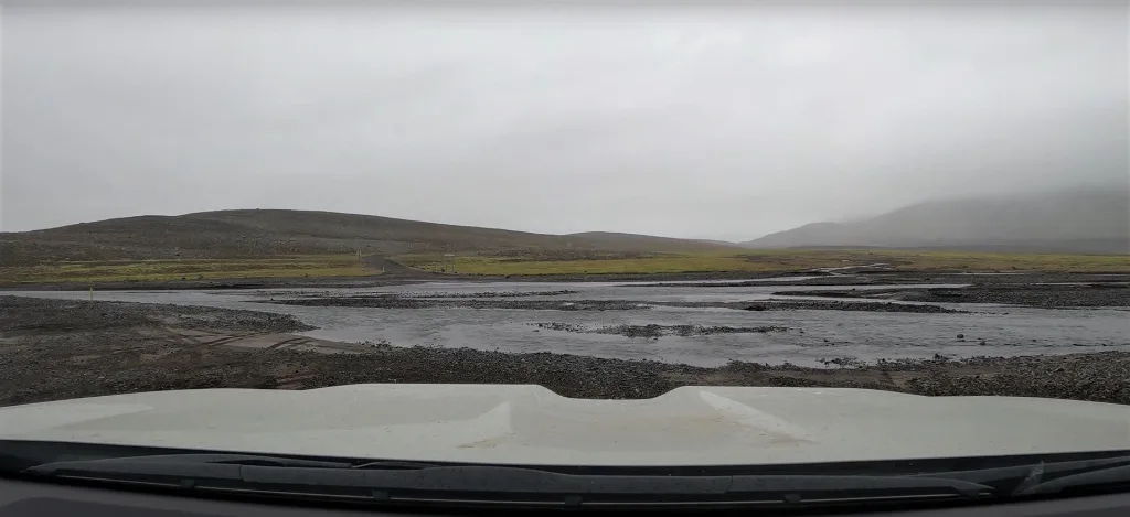
The easier of the two bigger river fords on Sprengisandur
Car Requirements, Weather, and Safety
A medium-sized 4×4 SUV, such as the Dacia Duster, is the minimum requirement for driving on F26. Nevertheless, a larger vehicle is more advantageous. Choosing a super-jeep will give you almost a certainty to pass under any weather conditions, given the road is marked green/passable.
The main problem is with the Hagakvislar river crossing. Sometimes it may just become too big for Dacia Duster and you may flood your engine. If you want to have a certainty to pass, we strongly recommend a Land Cruiser type car or bigger.
Before embarking on your journey, please always check Icelandic weather forecast, the current status of road conditions, and also potential alerts and travel warnings in Iceland. We also advise bringing a reserve fuel jerry can and buying or renting a satellite location device, which comes in handy in case of an emergency.
Highlights and Attractions
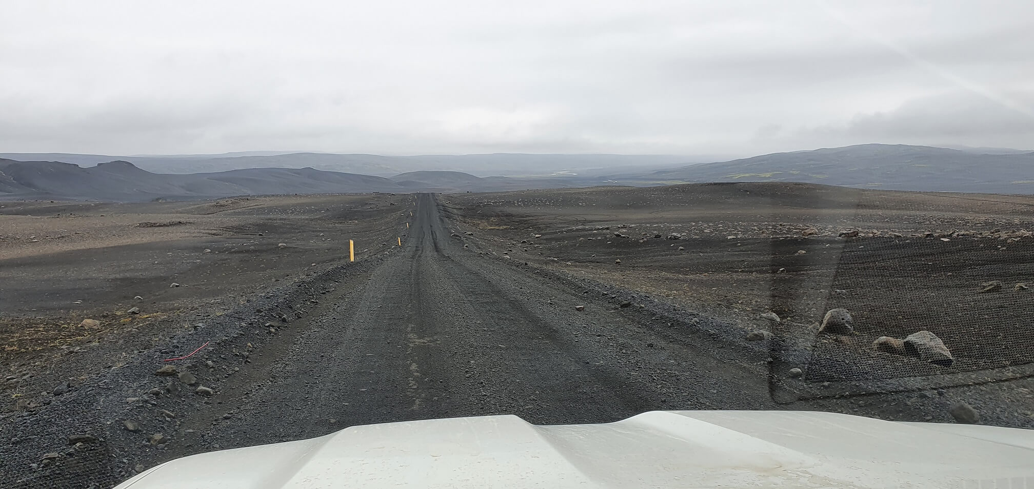
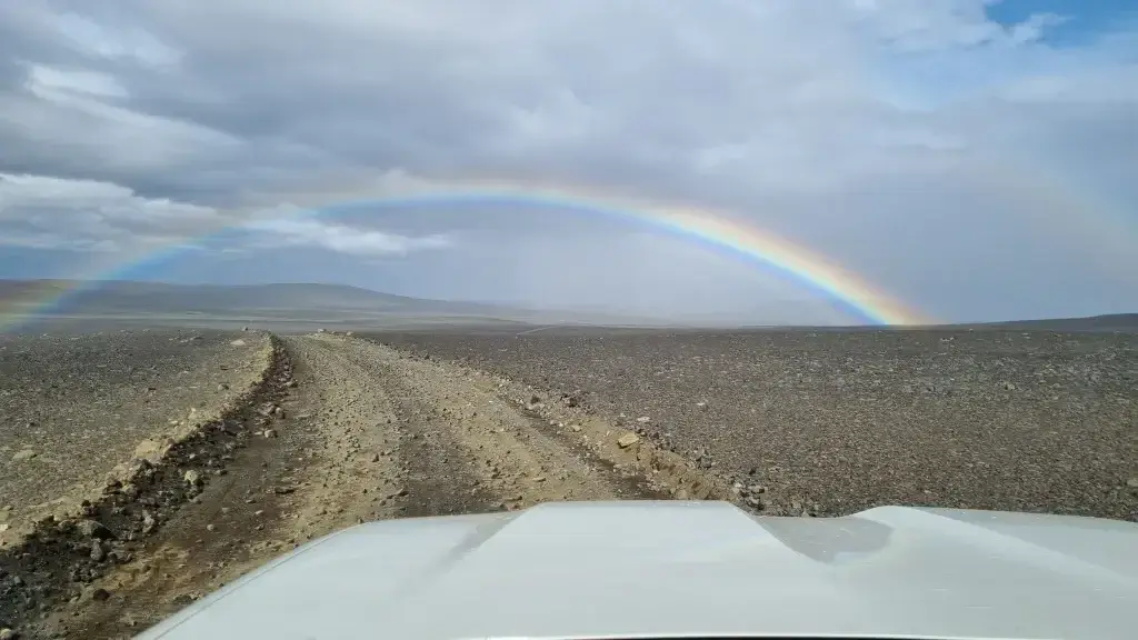
F26 is characterized by vast expanses of black volcanic ash, moon-like landscapes, and small volcanoes, making it less visually diverse compared to other F-roads.
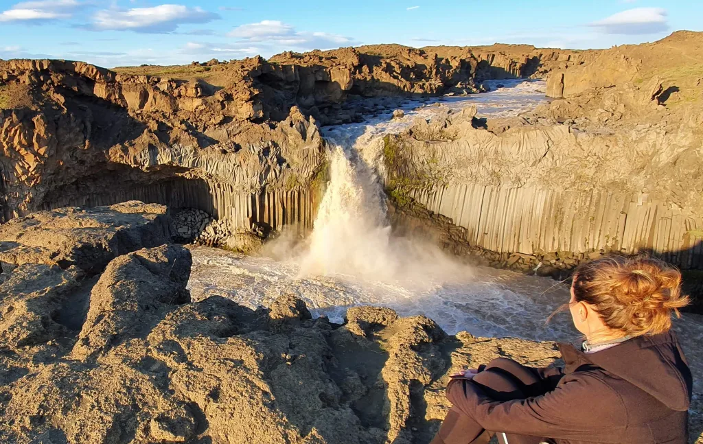
Aldeyjarfoss waterfall
Off-the-beaten-path Spots
- Aldeyjarfoss waterfall
- Hrafnabjargafoss waterfall
- Dynkur, or Búðarhálsfoss waterfall (farther detour)
- Vonarskarð (farther detour)
During our visit to the central highlands, we found a hidden hot spring area called Vonarskarð almost nobody knows about! It is pretty hard to access, though and we will soon write a detailed guide about it.
Did you know that
- There are many connecting dirt tracks you will never find on Google Maps?
- There’s one campsite in the middle of the road?
- F26 is actually easy to drive except for the river crossings?
Comparison to other F-roads
- Road (F)35, as an alternative, is bumpier than F26 but has no river crossings. If you want to avoid rivers, use (F)35 instead.
- Compared to an “average F-road”, F26 is more comfortable to drive and less bumpy but also has a bit harder river crossing.
- Compared to F26, many other F-roads, such as e.g. southern F208, offer a more diverse landscape, passing through lush valleys, rugged cliffs, and vast lava fields.
Road Videos
Our September drive from South to North:

Our friend Ervin’s July drive from North to South:

Personal Experiences and Tips
We’ve driven F26 several times in various weather and road conditions. We almost always experienced foggy and rainy weather when driving on Sprengisandur, so be prepared for that. Having driven almost all F-roads Iceland has to offer, Sprengisandsleið is now a rather easy highland road for us. This can be different for you, though, if you don’t have enough experience, so please treat the road with respect.
Once we even experienced the road being marked impassable in the middle of August, due to very high water levels, as a result of heavy rain. If this is the case, only experienced local super jeep drivers can pass.
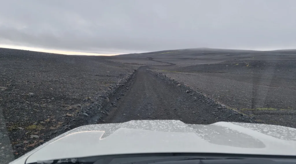
A typical landscape around F26
Another example of our visit and drive of F26 was when we hiked Vonarskarð in July, a very remote hot spring area located right in the middle of the highlands. We arrived at the Nyidalur mountain hut in the evening around 6 PM and booked a night in the cabin. We soon realized we were lucky because we grabbed the last two free spots in the hut. If the weather is bad, booking the place in advance is often needed, however when it’s good, many visitors rather sleep in tents outside. On the next day, we then headed via central, or west, F910 to Vonarskarð and then all the way east to Askja.
Next time, we simply traversed Iceland from Hella via F26 and turned west to F752 to visit the Laugafell hot spring in the middle of nowhere. We then continued via picturesque F821 to Akureyri.
![]() ask questions or get inspired in our community
ask questions or get inspired in our community


