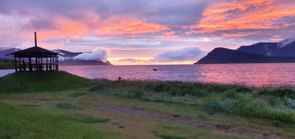
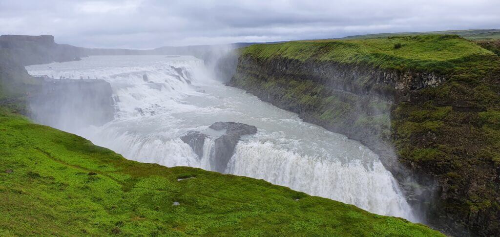
![Westman Islands – Full Guide + Top Things to Do [our experience]](https://epiciceland.net/wp-content/uploads/2022/12/westman-islands-guide.jpg)
We wrote this detailed guide to Westman islands, including top things to do in Westman islands, to help you with our practical, in-depth experience, unlike other often very shallow blogs out there. We include detailed info about what to see in Westman Islands, a ferry to Heimaey island, the need to have a car, the best hikes, our favorite spots, puffins and many more.
Contents
- Map of Westman Islands
- How to get to Westman islands?
- How much time do you need on the Westman Islands?
- Do you need a car on the Westman islands?
- Can you walk around Vestmannaeyjar?
- When to visit Westman islands
- Should I visit Westman islands if …?
- Parking, Accommodation, and Food
- How to see puffins on the Westman Islands
- How to see the best of the Westman Islands in 1 day – our itinerary
- Are Westman islands worth it for a day?
- Top things to do on the Westman islands – our experience
- What are the best hikes on the Westman islands?
- Hike to Heimaklettur
- Hike to Eldfell volcano
- Hike to Herjólfsdalur
- Hike to Stórhöfði
- Puffins of Westman islands
- Elephant rock
- Black beach Vikin
- Urðaviti Lighthouse
- Eldheimar museum
- Beluga whale sanctuary
- Smaller islands of Vestmannaeyjar
- Westman islands summer festival
- Guided tours to Westman islands
- Best guided tours on Westman islands
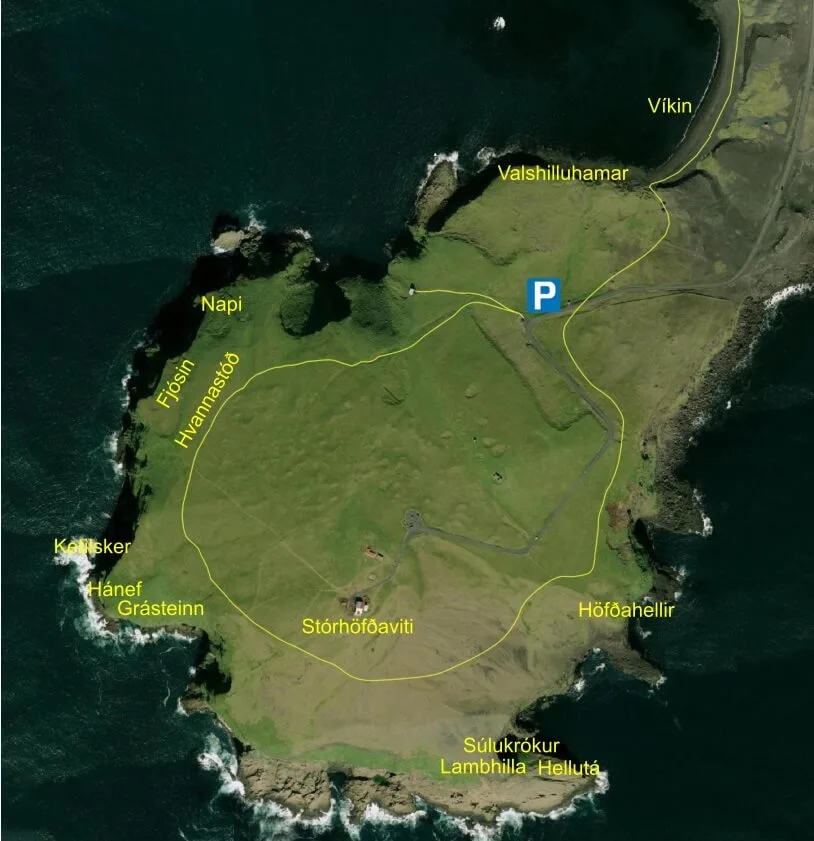
Map of Westman Islands
Below you may find the handy map of Heimaey, the biggest of all Westman islands. Heimaey map depicts all interesting spots on the Westman Islands and should help you orientate much better. Here is also the detailed map of Vestmannaeyjar town.

Local map of the Westman islands (click to enlarge)
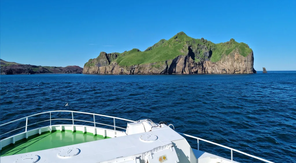
Westman Islands, or in Icelandic Vestmannaeyjar, is an amazingly picturesque group of islands very close to and well accessible from the touristy south coast of Iceland. Are Westman islands worth visiting? The answer depends, but most of the time it’s definitely yes.
What are the top places in the Westman islands? And how much time should you devote to a visit to Vestmannaeyjar? We answer all of these questions in our new guide to the Westman islands below. We also include a lot of our own experience with visiting the islands.
The main, the most diverse, and the most visited Westman island with all the infrastructure is called Heimaey. In the entire text below, we will be referring to Heimaey only, if not stated otherwise.
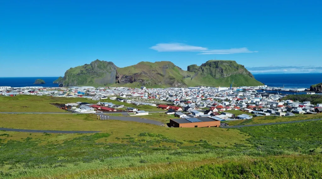
Vestmannaeyjar Heimaey town
How to get to Westman islands?
First and foremost, the only way to get to Westman islands is by ferry, a private boat, or by plane. Undoubtedly, the most comfortable and also the most widely used option is to take a ferry. The easiest way is to rent a car and drive to the ferry port in Landeyjahöfn yourself. Alternatively, you may:
- Take a Bus from Reykjavik to the ferry port in Landeyjahöfn
- Take a Group tour from Reykjavik to Vestmannaeyjar
- Take a Private tour from Reykjavik to Heimaey
- Book a Boat tour around the Westman Islands, see the best Westman Islands tours below
There’s also a small airport for small airplanes, though this option is usually not used much, because it’s definitely the most expensive one and also not that flexible.
A detailed guide on How to choose the best Car for Iceland.
Westman Islands Ferry
The most used, most flexible, most affordable, and in our opinion also the best option to visit Westman islands is by taking a ferry. You can check all the current information about the ferry on the official Icelandic website of the Westman islands ferry company called Herjólfur.
Ferry heading from Landeyjahöfn to Vestmannaeyjar
Westman Islands ferry schedule
In summer AND when the weather is fine, the ferry departs from the closest possible harbor, the harbor in Landeyjahöfn. How long is the ferry? The sailing time is about 40 minutes and in summer there are 7 different time slots available each day. In case the weather is NOT favorable, the ferry has to take the longer route and it departs from Þorlákshöfn instead and just twice a day. The journey from Þorlákshöfn to the Westman islands takes about 3 hours and can be very bumpy.
Landeyjahöfn ferry schedule:
- Departures from Landeyjahöfn daily at 8:15, 10:45, 13:15, 15:45, 18:15, 20:45 and 23:15
- Departures from Vestmannaeyjar daily at 7:00, 9:30, 12:00, 14:30, 17:00, 19:30 and 22:00
Þorlákshöfn ferry schedule:
- Departures from Þorlákshöfn at 10:45 and 20:45
- Departures from Vestmannaeyjar at 7:00 and 17:00
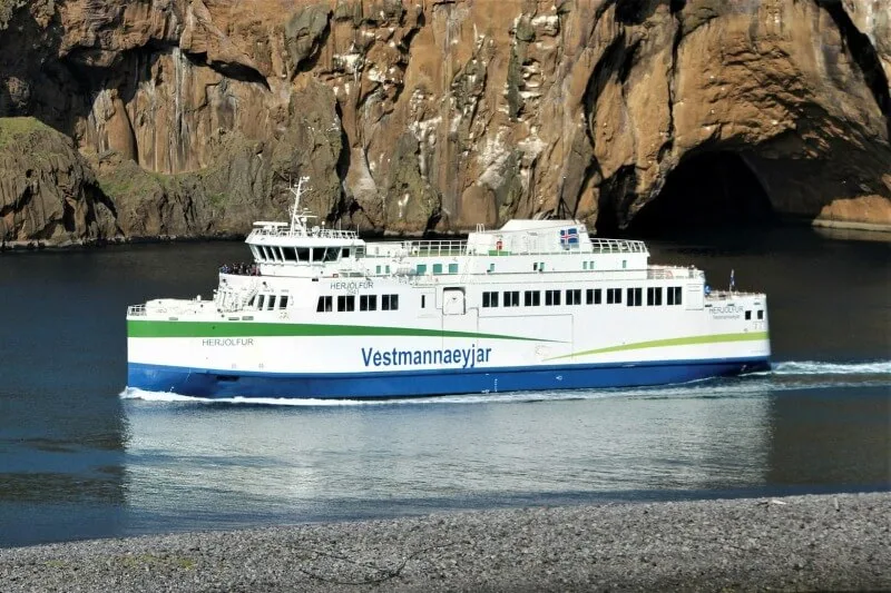
Westman islands ferry. Source: https://herjolfur.is/
How to book a ferry to the Westman islands?
Book only and only via the official Icelandic ferry company called Herjólfur. Although this name is not very user-friendly, this is the ONLY OFFICIAL ferry website! All the other websites (for example www.visitwestmanislands.com) are just re-sellers or other tour operators. This means they will take a commission to book on Herjólfur on your behalf. We always book directly with Herjólfur, because booking with someone else is an unnecessary complication.
To book a ferry, simply visit www.herjolfur.is and make a booking for the desired time. There’s a full refund policy up to 24 hours before the departure for all payments made by a debit/credit card. You’re gonna pay 500ISK (about 4 USD) for each change/cancellation. If your sail is canceled, you will be offered an alternative time. If there’s a chance a ferry may be full, you will be put on a waiting list – see below.
Ferry to Westman islands, passenger deck
How far in advance should you buy a ferry ticket to the Westman islands?
To have a 100% certainty to get a spot (especially if you take your car), of course, you need to book in advance. Is there a chance you will get a spot even if you don’t book in advance? Yes, most of the time you can get the spot, even in summer. What we’ve done and what we also suggest is booking a few days in advance. This way you can book only on a day with nice weather and you have a high chance to get the spot as well.
The alternative with even bigger certainty, just a little bit more work, is booking further in advance and then rescheduling a few days before your trip. Yes, it will cost you a few dollars but it will leave you full peace of mind.
The ferry is usually fully booked on Icelandic summer holidays and also during summer festivities and festivals. Check those carefully, because if you plan to visit Westman islands on these dates, you really need to book very far in advance (months). You can find the list of all events happening on the Westman Islands here.
Moreover, if you are visiting without a car, the chances for a free slot are very high most of the time. Because there are naturally much more spots available for pedestrians compared to cars.
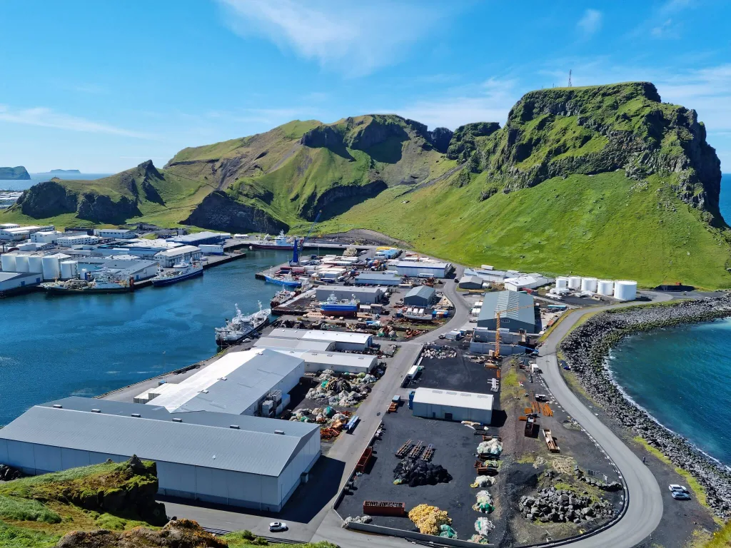
Heimaey harbor, Vestmannaeyjar
We wanted to visit Westman islands with our car in July, i.e. in full season, but only on a nice day (see weather section below). In Facebook groups, everybody was scaring people out that they should book the ferry months in advance. We didn’t follow this advice. Instead, I checked every day the availability on www.herjolfur.is for our planned days of visit and what I observed was that the availability was always there even for all the time slots. Hence, I booked the ferry just 3 days in advance, to be sure about the nice weather.
I recommend you the same strategy as we conducted above. Just beware of the Icelandic holidays and festivals. And, secondly, I don’t recommend booking totally last minute (like on the same day). This is a bit too late in my opinion.
We actually even had a pretty good “last minute” booking and rescheduling experience with the ferry. We booked a ferry from Landeyjahöfn for 20th July for 2 people and also for 1 normal car for 8:30 in the morning and back from Westman islands at 22:00. Finally, we finished our day quite soon, around 16:00, so we decided to try our luck and catch a ferry back at 17:00. I asked at the ticket office at 16:30 and they told me that they need to first put us on the waiting list to see whether there’s any spot left. The ferry had first boarded everyone else and in the end, they shouted our names to indicate there was still some space. This way we got back 5 hours earlier, even at the last minute without re-booking in advance.
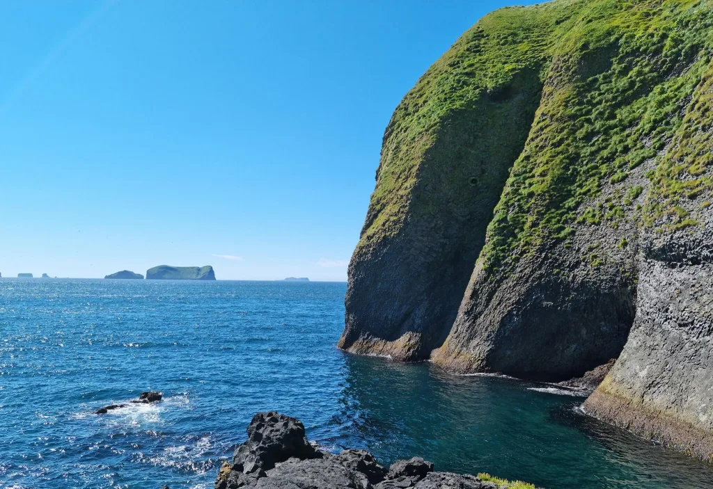
The famous Elephant rock on the western coast of Vestmannaeyjar
How often does the ferry to Westman Islands get Canceled?
Cancellations happen only when the weather or seas are too harsh to sail. This almost never happens in summer, i.e. between June and September. From October until May cancellations happen from time to time, usually during weather alerts, i.e. on average around twice a month.
The ferry is only very rarely canceled completely, instead, it sails from the bigger harbor called Þorlákshöfn instead. The sail in this case, however, takes a very long time, usually around 3 hours. It Is also often pretty unpleasant due to huge waves. If the ferry gets canceled last minute, you will be always offered an alternative time slot, just bear in mind your trip schedule will change in this case. But hey, that’s Iceland, get used to it!
Eldfell volcano hike is one of the easiest and most beautiful ones
How much time do you need on the Westman Islands?
You can easily see the best spots of the Westman Islands in 1 day. The main Heimaey island is pretty small and if you have a car, 1 day is more than enough to explore it. If you enjoy traveling slowly, you can go for 2 days, but not more.
So how should you decide? We managed to see everything we wanted in under 7 hours, including the two most beautiful hikes of the Westman islands. We had a car, which helped a lot with cutting down the transportation times. To sum up – for us – 1 day was more than enough. If you have nice weather. And if you have a car.
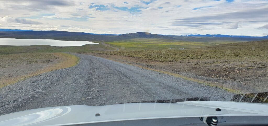
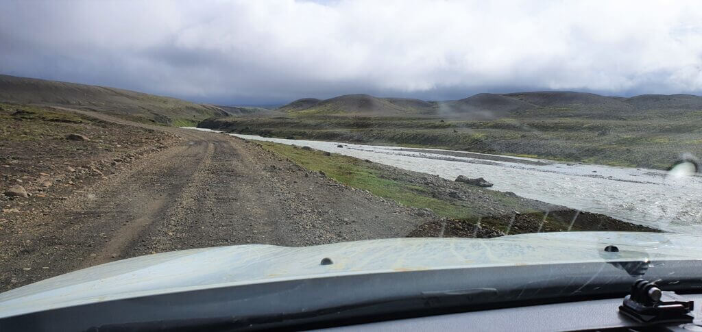
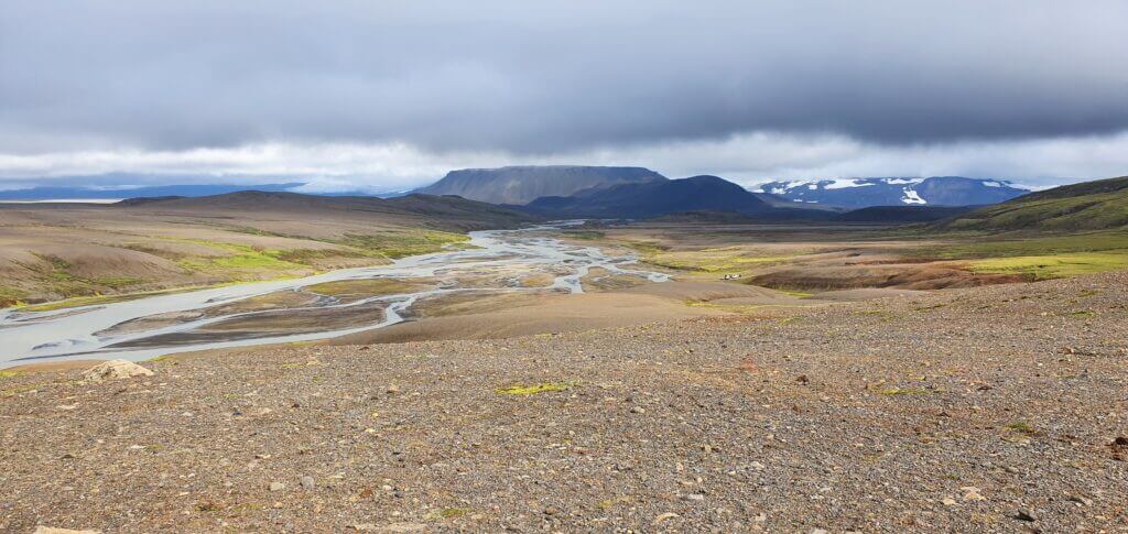
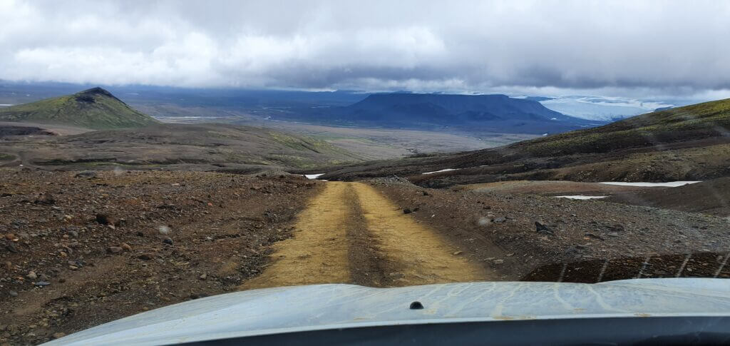
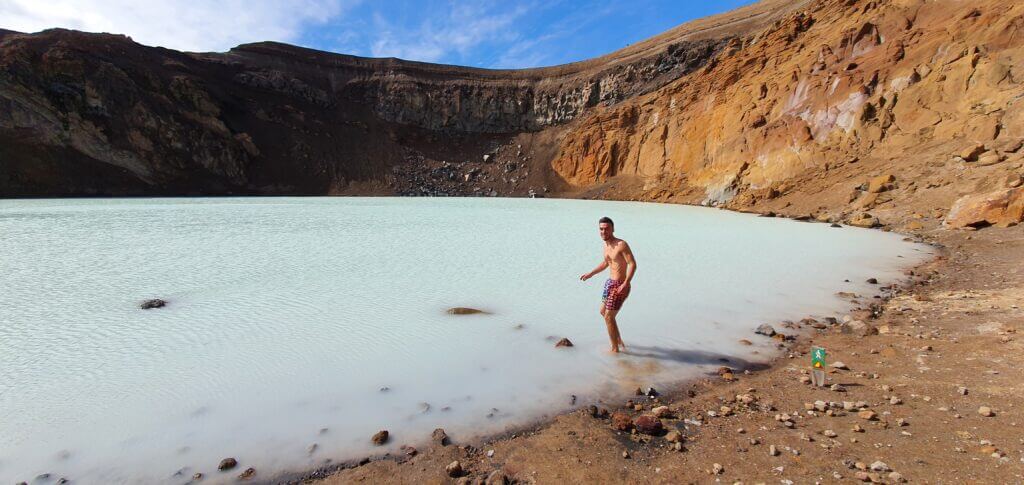
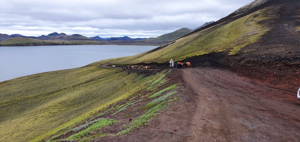
Tips on the most beautiful places in Icelandic Highlands.
If you really want to take it slowly and/or you simply have to arrive late, and/or the weather is not that nice, in that case, I recommend you go for 2 days, but not more. Heimaey is not that big and, unless you just want to sit and chill, you will not have much to do there after some time.
Heimaklettur hike is our favorite hike of the Westman islands
Do you need a car on the Westman islands?
You don’t need a car, but we recommend you bring one. A car will make your visit to the Westman islands much more comfortable and flexible. Why? Well, yes, everything is within “walking distance” on Westman islands. BUT. This walking distance sometimes means walking 40-60 minutes just on an ordinary road for cars. And that’s not very pleasant. We’ve actually met several walking-only visitors who tried to hitchhike with us, unfortunately, our car was totally packed up with stuff.
Not to mention if the weather worsens. Trust me, you don’t want to stay outside in bad weather on the Westman islands 😉 That being said, if you have a lot of time and you really need to save money, then yes, you can definitely visit Westman islands also without a car. However, if you are either short on time or if you prefer more comfort, I totally recommend rather bringing a car, the cost of doing so is not that horrible.
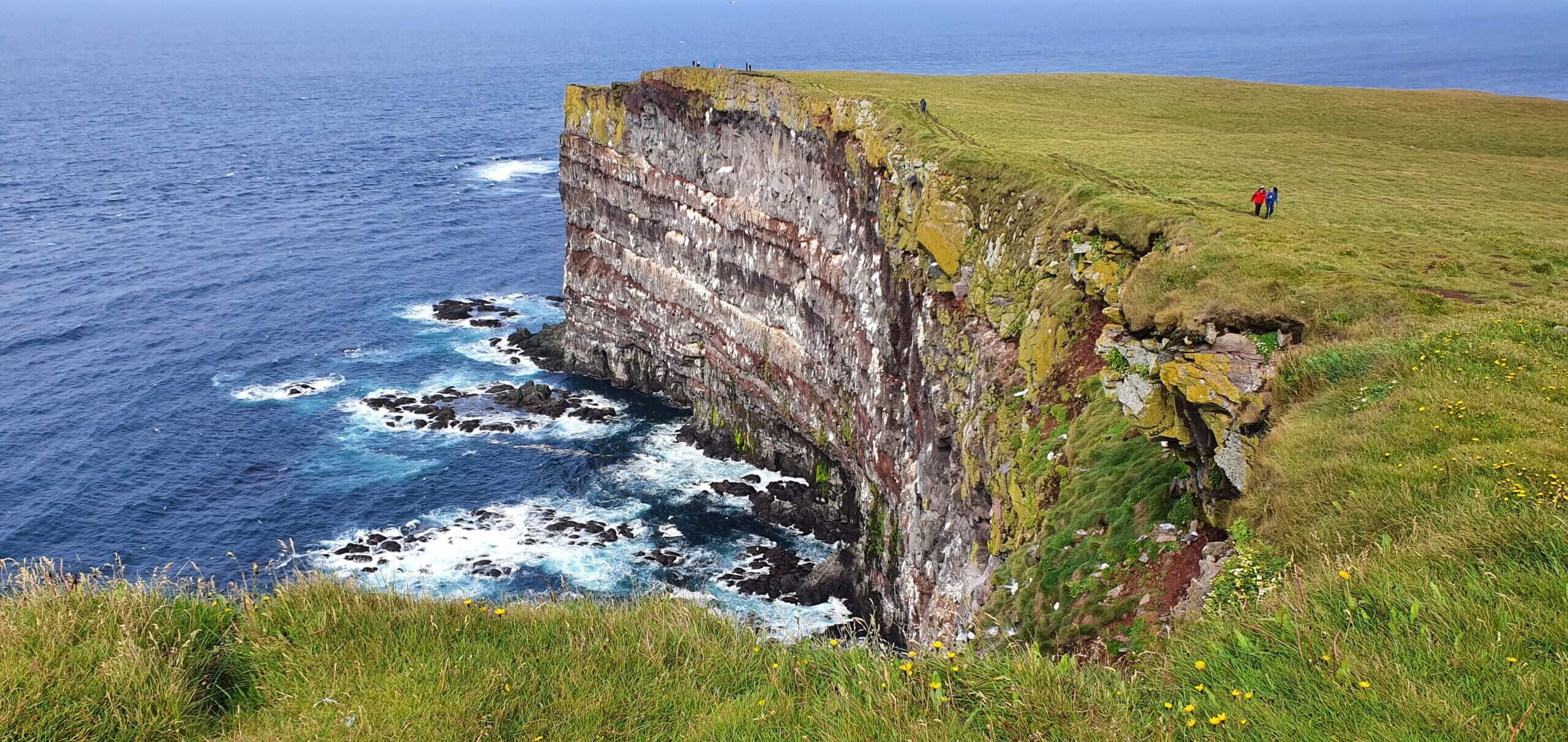
The western coast of Heimaey, popular puffin watching area
Can you walk around Vestmannaeyjar?
Yes, everything on the main Heimaey island is within a walking distance. Just bear in mind weather may often be uncomfortable for walking. Secondly, if you plan to see puffins in the southern part of the island, the walk there from the harbor is a pretty long one and takes around 40-60 minutes. Thirdly, there are no pedestrian roads, so you will need to walk on normal roads for cars.
When to visit Westman islands
Long story short, in good weather 🙂 I know this is easier to be said than done, but it is especially true for Vestmannaeyjar. In our opinion visiting the islands in foggy weather is simply not worth it. Westman islands are all about amazingly beautiful views and you will get none of these in a fog or mist. The same applies to heavy rain or heavy wind.
Sun shining in July during the Heimaklettur hike
Westman islands are sometimes called the windiest place in Europe. For some reason. Weather can get pretty ugly here from time to time, especially the wind. That being said, do what you can to try and pick a nice day for a visit – we wrote a guide on that. Now, what is a nice day? Well, ideally no heavy rain, no heavy wind, and no fog. Light rain is OK, the medium wind is OK, and a light fog is OK.
Westman islands in Summer
Logically, summer is the most popular time to visit Vestmannaeyjar. Seas are calm, the weather is at its best and naturally also the number of visitors skyrockets. We carefully waited for a day with blue skies in July to visit Westman islands and we didn’t regret it, not even for a second. Crowds were bearable and nice weather was more than just worth waiting for it.
Judge yourself from our pictures taken just by our phones. To conclude – we totally recommend a visit in summer, i.e. from June to September. An alternative to visiting islands in the main season is a near-summer shoulder season when the old snow has already melted and the new one hasn’t arrived yet. This period usually lasts during a warm April or May, and October.
Eldfell hiking trail is best enjoyed in summer
When visiting Heimaey, definitely consider also a puffin-watching season! Puffins typically arrive at Westman islands in late April, or in May and leave in the second half of August, when they begin to migrate south for the winter.
Westman islands in Winter
It’s definitely possible to visit Westman islands also in winter. The ferry runs all year long. One of the things you will be rewarded with in winter is you will probably be there alone with locals only. Very few visitors come to Vestmannaeyjar in winter. Why? It’s much harder to catch a day with nice weather, plus islands may be covered with snow. And Westman islands are at their most beautiful in lush green colors.
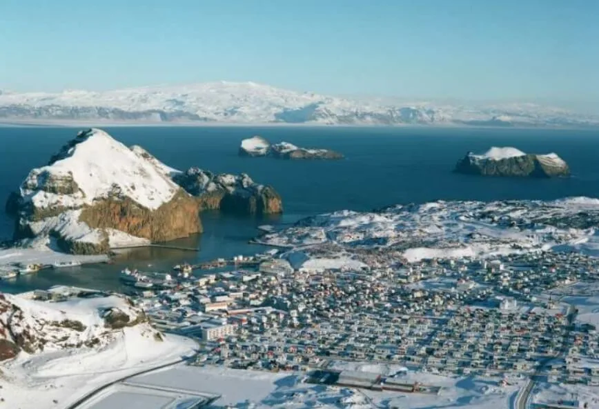
Westman islands in winter
Moreover, you will often need to take a much longer ferry ride from Þorlákshöfn, due to harsh weather or rough seas, which may cost you not only time but probably also several unpleasant moments of sea sickness. Is it then worth it to visit Westman islands in winter? We recommend a winter visit only if you have a lot of time and if you can be flexible and reschedule your trip based on nice weather. We think Vestmannaeyjar is much nicer in summer, with melted snow.
Should I visit Westman islands if …?
I have 7 days to do the ring road
Personally, I would visit Westman islands only if I had enough time for a time-flexible, stress-free visit in nice weather. 7 days for the ring road doesn’t sound like enough time at all. Therefore, the answer is no, I would not visit Vestmannaeyjar in this case.
I have 14 days in Iceland
Well in this case it depends on what your priorities are. Is it a ring road at a relaxed pace? Do you want to do a lot of highlands? All of these are definitely manageable also along a visit to Westman islands, but you need to set your priorities. If you are able to wait for nice weather to visit the islands and this will not ruin your plan, then definitely go for Westman islands.
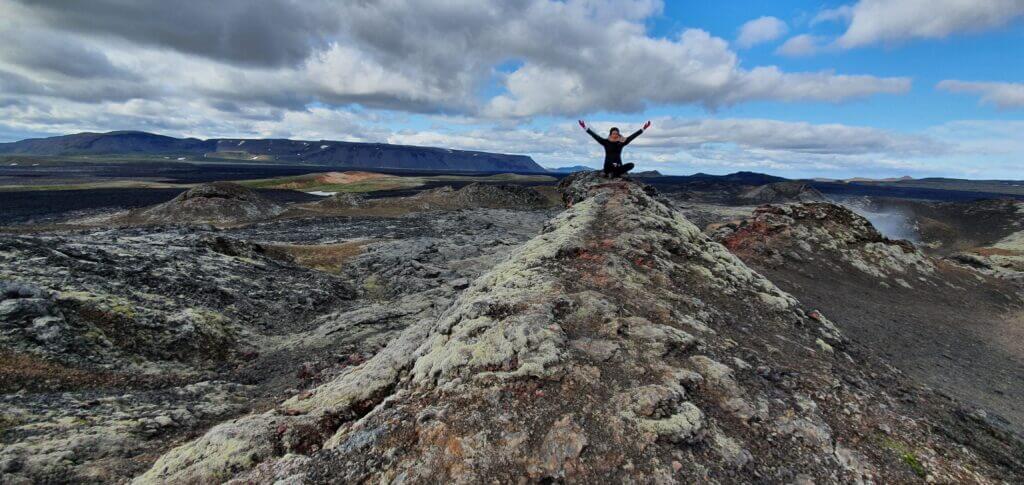
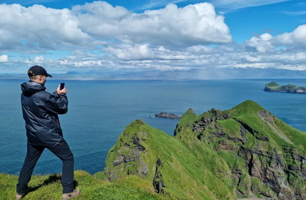
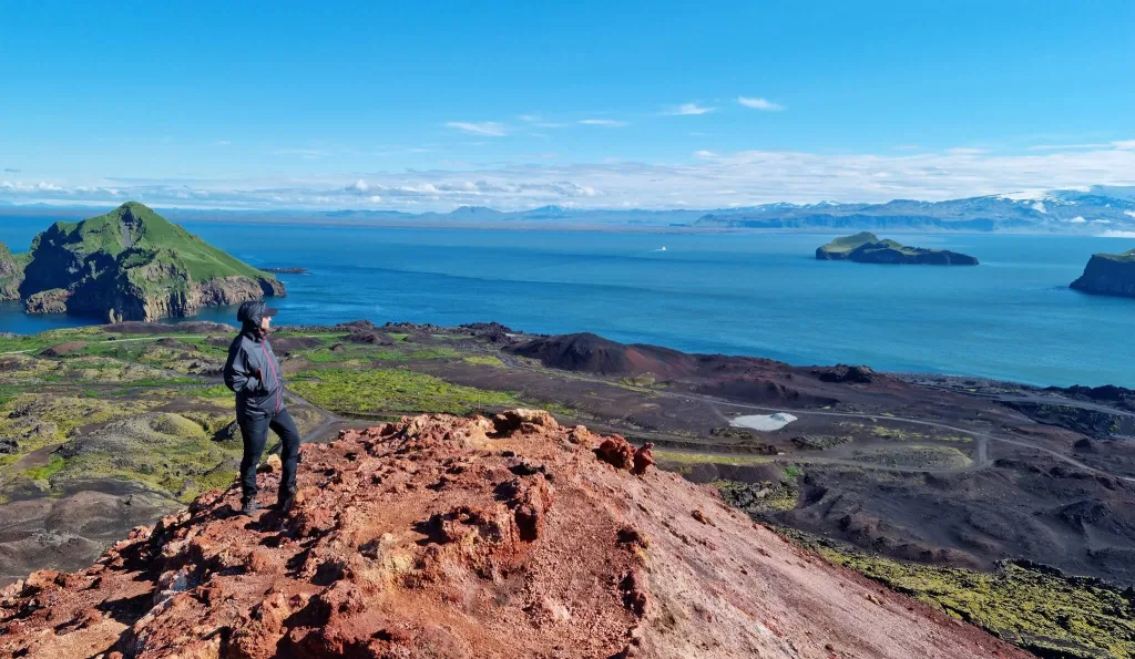
Chilling at the peak of Heimaklettur on a beautiful July day
I stay just 4 days in Reykjavik
If you stay in Reykjavik only, this probably means you will be taking some day trips only and probably by tour companies only. So, a better question would be – should I book a day tour to Westman islands (10% discount code: EPICICELAND24)? My answer would be – on a nice day, why not? It would be an amazingly beautiful, but long day.
I will be in Iceland for a month
Totally go also for the Westman islands. Totally worth it. And wait for nice weather, please 🙂
Many useful discounts on Icelandic car rentals and Guided tours.
Parking, Accommodation, and Food
All of the above, parking, food, and accommodation are easy to get on Heimaey. Just with accommodation be sure to book enough in advance.
Where to park on Westman islands?
Parking is free at Westman islands and there are enough car parks. Just adhere to basic parking rules. For example, don’t block the roads, someone’s private property, or anything similar. You can park for free also at Landeyjahöfn harbor when waiting for a ferry and also at Heimaey island harbor.
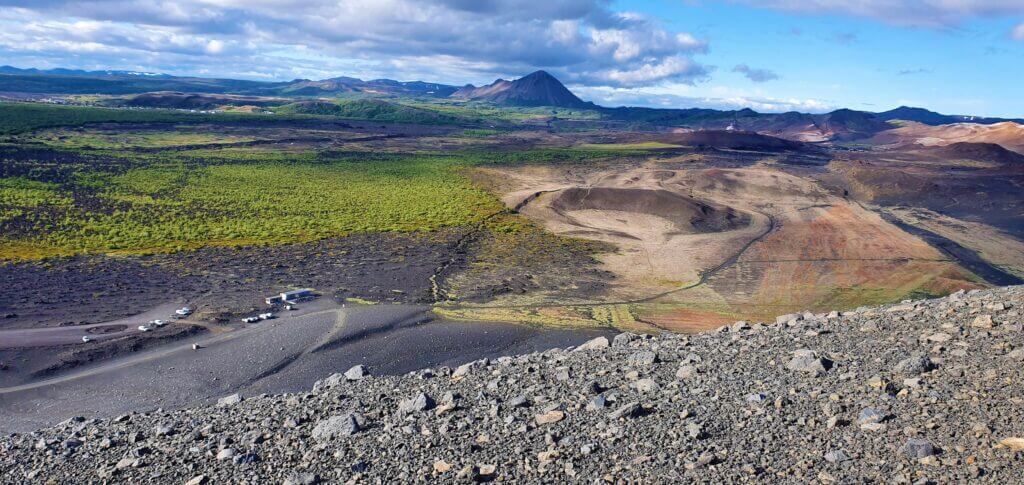
Views from Eldfell volcano, the most popular Westmann islands hike
Where to stay?
There are several cozy accommodation options. We recommend you take a look yourself and pick the one you like.
Should you book accommodation on Westman islands in advance? Totally. With lodgings, we recommend booking them several months in advance, when coming in summer. Hotels and guesthouses (excluding dorm rooms) tend to get fully booked. Dorm rooms are usually available even last minute.
Where to eat?
There are several restaurants, don’t worry, you will definitely find something which suits your taste buds. Just look at Google Maps. We dined at a gas station, which is the cheapest option. Food definitely isn’t our priority when coming to Iceland 🙂
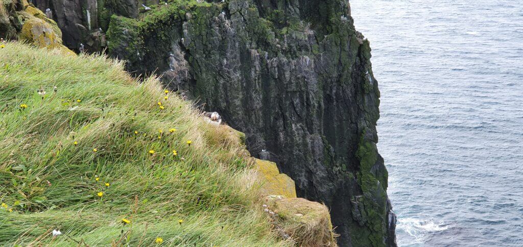
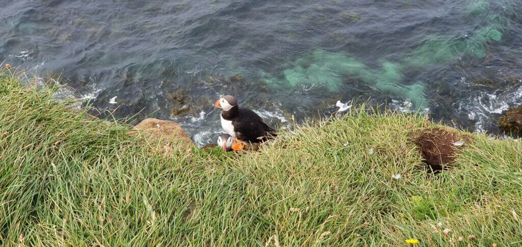
How to see puffins on the Westman Islands
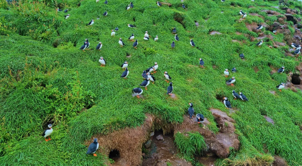
Heimaey is home to the largest puffin colony in the world, with over a million puffins nesting on the island each year. That’s why many visitors come to the Westman islands specifically to see the puffins. Your chances of seeing puffins at Vestmannaeyjar from May until August along the southwestern coast will be pretty high.
Vestmannaeyjar puffins, Stórhöfði puffin lookout
To see the puffins, you can also take a boat tour from the town of Vestmannaeyjar on Heimaey. These tours depart from the harbor and take you to several locations around the islands where you can observe the puffins in their natural habitat nesting and hunting near the cliffs.
Are Westman islands the best place in Iceland to see puffins?
There are many great spots to observe puffins in Iceland. Vestmannaeyjar is just one of many. Other popular puffin-watching spots include Dyrhólaey in the south, Borgarfjörður eystri in the east, Grimsey island in the north, Látrabjarg cliffs in Westfjords or Lóndrangar cliffs on Snæfellsnes. Westman islands are not superior to any of these spots, so just pick the place which suits you.
Where to see puffins on the Westman Islands?
The puffins can be observed at several locations on the island, including Stórhöfði, a rocky headland on the southern coast of Heimaey, or the entire western coast all the way up to the famous Elephant rock in the northwest.
The best spot to see puffins on Vestmannaeyjar is in our opinion the puffin lookout located right before the final ascent to Stórhöfði. The easiest way to get to the puffin lookout at Stórhöfði is by car or by minibus tour.
Stórhöfði puffin lookout
When to see puffins on the Westman Islands?
The highest chances of observing puffins are from the second half of May until the end of July. Puffins typically come back to the Westman islands in late April, or in early May and leave in the second half of August, when they begin to migrate south for the winter.
Is there any specific time of the day when puffins are the most active? Puffins are most active early in the morning and late in the evening, as they spend much of the day out at sea feeding. Late afternoons are also favorable because the puffins are more likely to return to their nests or leave to go to sea. That being said, there are almost always some puffins during the main season, throughout the day. The specific time of the day is just about their quantity and their specific behavior rather than seeing them at all.
How to see the best of the Westman Islands in 1 day – our itinerary
- Arrive by a morning ferry from Landeyjahöfn at 8:55 or 11:20
- Take a car to have maximum flexibility
- Hike the Eldfell volcano from the western car park
- Go see puffins at the Stórhöfði lookout
- Visit Elephant rock via the golf course
- Hike the steep Heimaklettur hill
- Pay a short visit to the Urðaviti Lighthouse
- Bonus places: Herjólfsdalur hike, Beluga whale sanctuary, Eldheimar museum, Vikin black beach, Guided boat tours
- Take a ferry back to Landeyjahöfn in the evening
Are Westman islands worth it for a day?
Westman islands are definitely worth a 1-day visit. In fact, 1 day is more than enough to see the best of Vestmannaeyjar, when the weather is favorable. Heimaey island is pretty small and with the help of a car, you can easily see everything in one day. We don’t recommend a visit in bad weather, including huge fog, strong rain, or very strong winds. In that case, either reschedule your trip or book for more days to wait for a clear day.
Heimaklettur hike steep trailhead (click to enlarge)
Top things to do on the Westman islands – our experience
We wanted to visit Westman islands sometime between 19th and 23rd July, waiting for nice weather. We had accommodation within a 2-hour drive from Landeyjahöfn. I finally made a booking for a ferry 3 days in advance and booked for 2 people plus a car. Roundtrip at 8:15 from Landeyjahöfn and back at 22:00. This should have been more than enough and it actually even was. We returned earlier, already seeing everything we wanted (including the 2 most beautiful hikes) in roughly 7 hours, at a relatively quick pace.
What are the best hikes on the Westman islands?
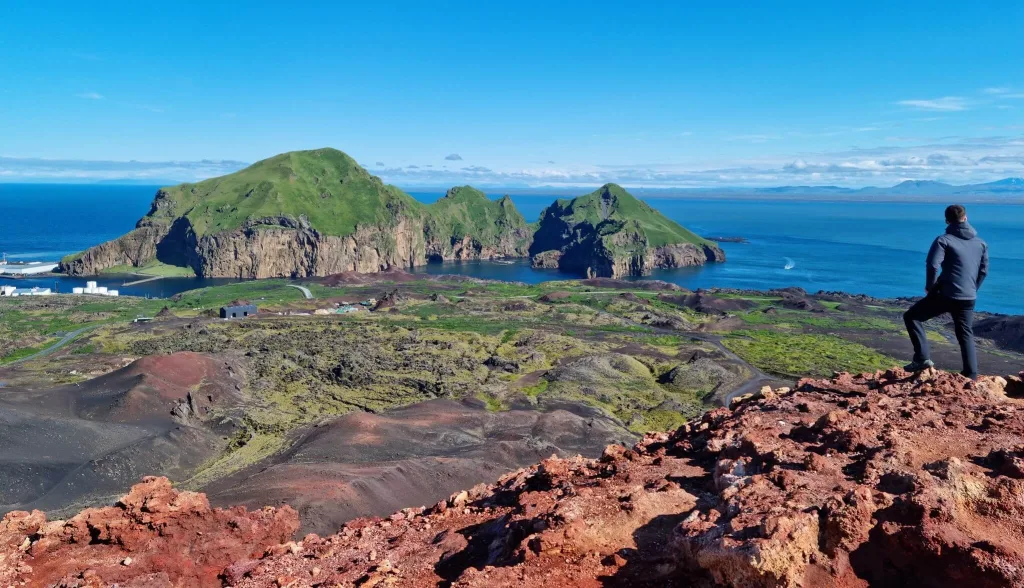
There are basically only 4 main hikes which you may all easily complete even in one day. Our favorite hikes were an easy hike to the Eldfell volcano and a technically difficult hike to Heimaklettur with amazingly beautiful views over the islands.
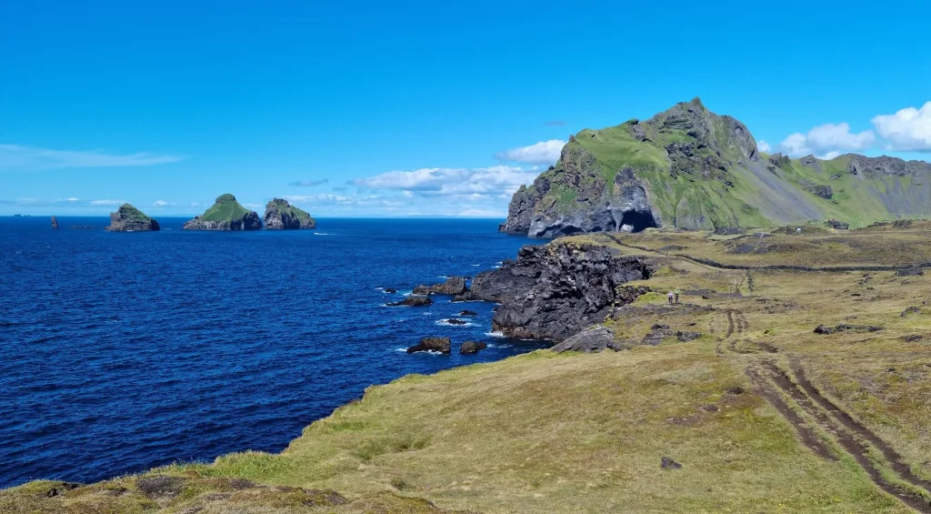
Views from the Heimaklettur hike on the Westman islands
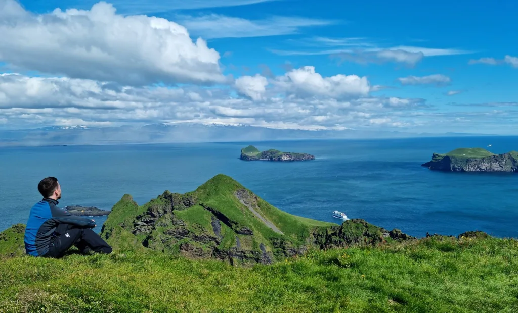
The number one activity we more than just recommend in Westman islands is hiking. There are several amazingly beautiful hikes, each one a bit different and you should totally do at least two of them. These hikes were an absolute highlight of our trip to Vestmannaeyjar. Here is the list of all Westman islands’ hiking trails.
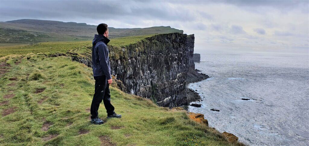
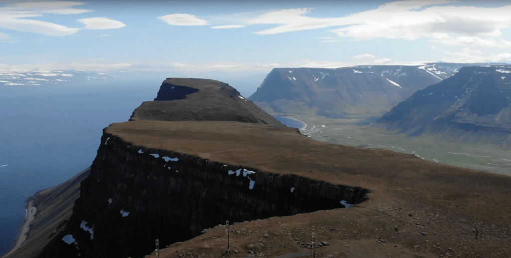
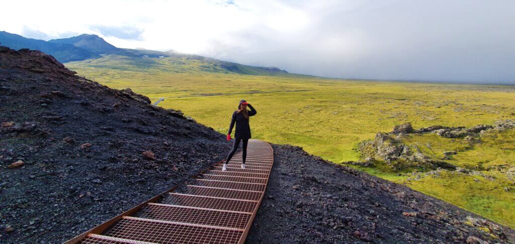
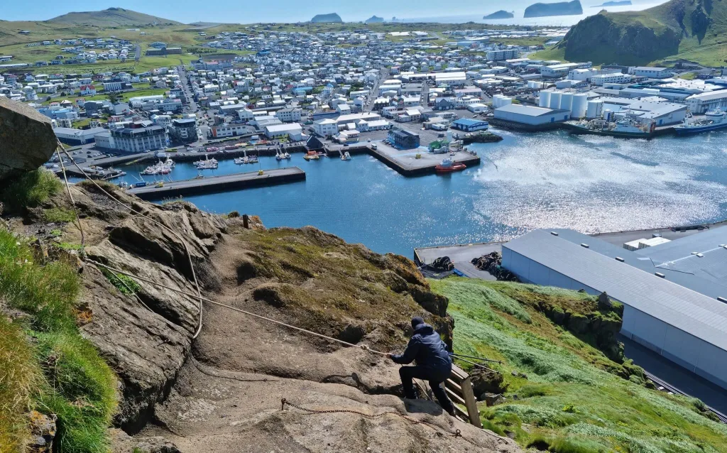
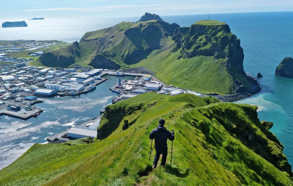
Hike to Heimaklettur
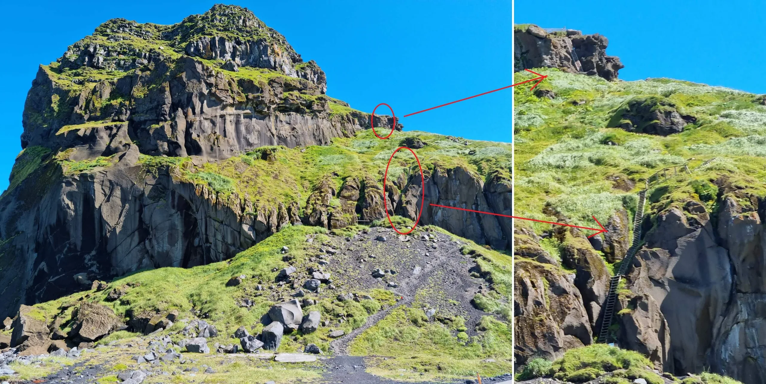
If I had to pick one most amazing and beautiful place on Westman islands, it would be Heimaklettur. The hike to Heimaklettur starts as a bit scary ascent with ladders, ropes, and chains, but soon turns into one of the most beautiful views I’ve ever seen. If you are fit enough and have nice weather, then go and hike Heimaklettur in the Westman islands!
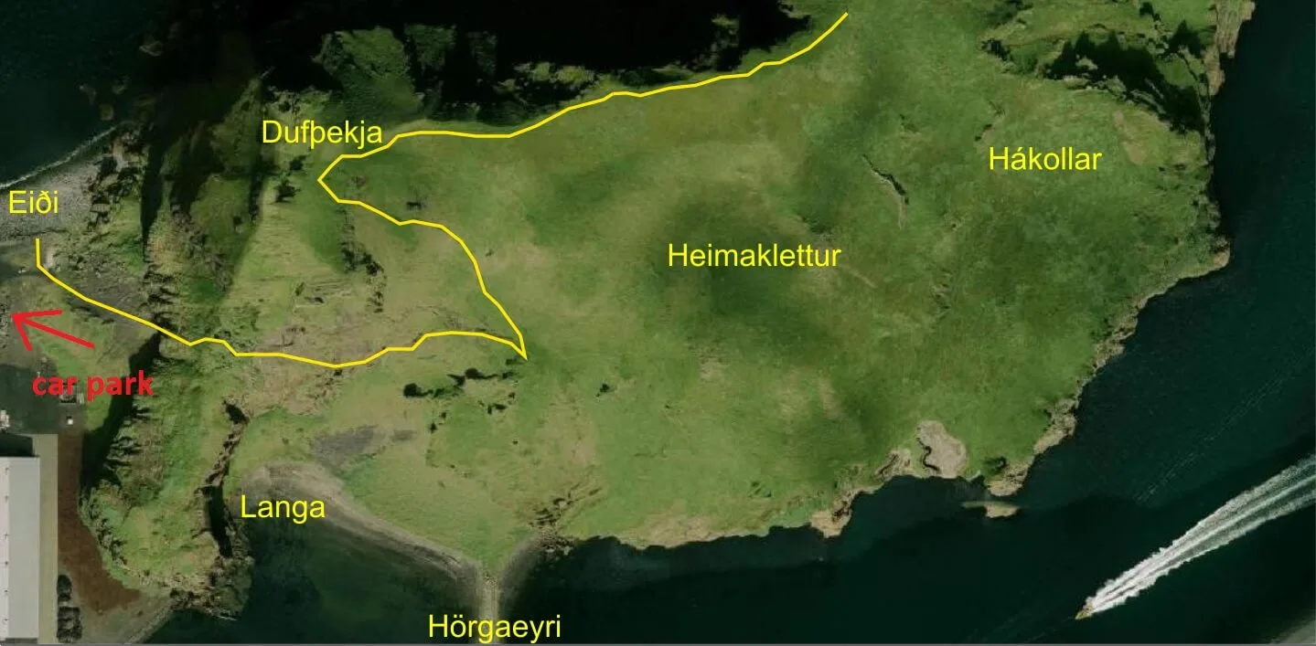
Heimaklettur hiking trail map (click to enlarge)
We started our hike with a very steep ascent, which soon leads into two series of steep ladders and follows by ropes and chains to help you climb off the ladders. This part is definitely not for anyone afraid of heights and/or someone not physically fit and/or not to be done in stronger rain or wind. Otherwise, this hike was a truly unforgettable adventure. We brought our hiking poles with us but then regretted it because they only slowed us down when climbing all these ladders.
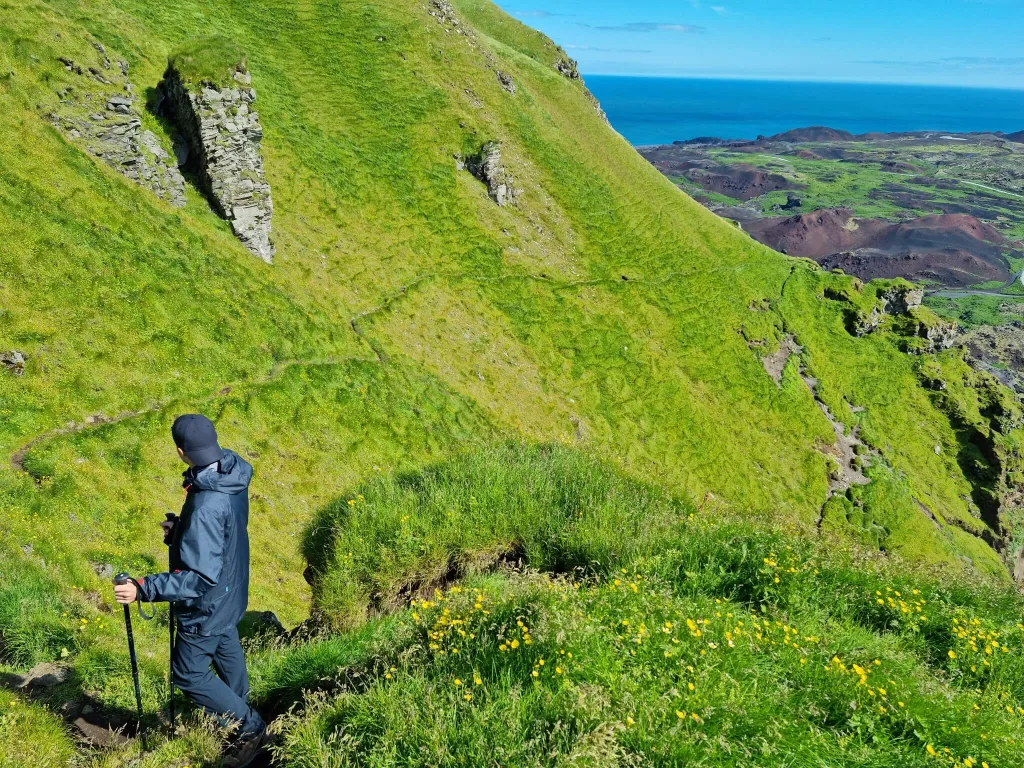
After finishing the steepest section, the part with the ladders, chains, and ropes ends and the trail continues as a typical Icelandic hiking trail of medium difficulty. After a few tens of minutes of ascending the marked trail leading via grass fields, you will soon reach one of the most spectacular views Westman islands have to offer. It took us less than 1 hour of quick hiking to reach the top.
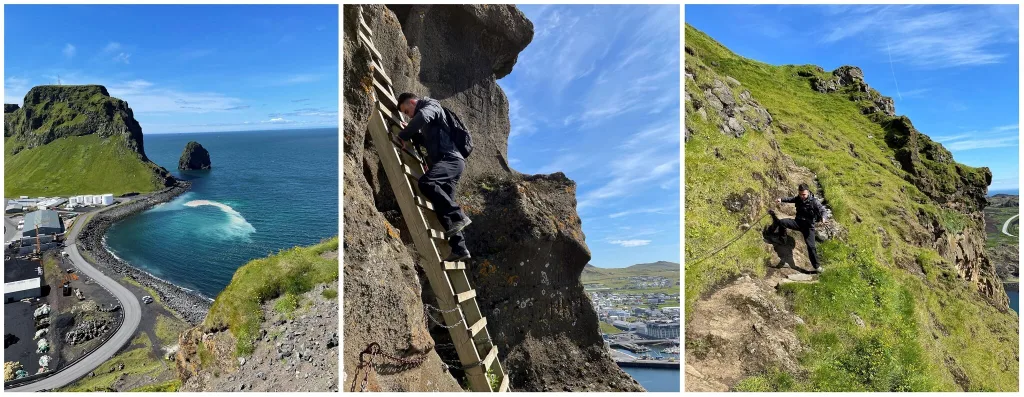
Heimaklettur hiking trail – ropes, chains and ladders
From the top of Heimaklettur, you will be rewarded with the best views of Westman islands available out there. The views stretch to all sides and you really do feel like a master of the universe when standing here and admiring the surroundings. It’s an amazing place for a picnic as well.
Heimaklettur hiking trail
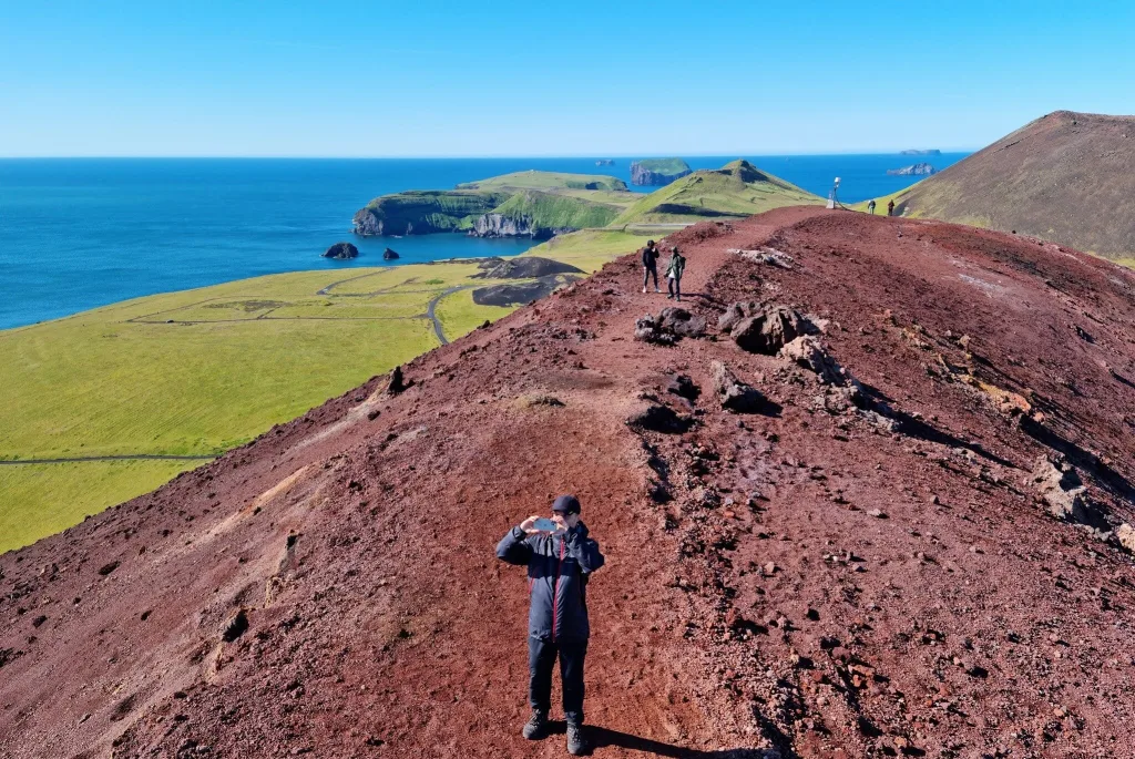
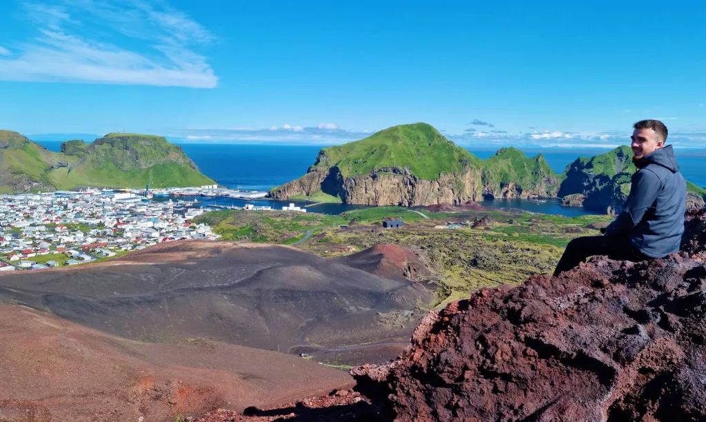
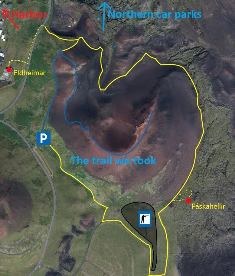
Hike to Eldfell volcano
A hike to Eldfell is the easiest and most touristy hike on the Westman islands. Eldfell volcano also offers the best “price-to-value” views, because it only takes a few minutes to reach the top and the views are spectacular on a nice day. There are a few small car parks next to Eldfell – several in the northern direction and one main car park in the west. The main western car park is located next to the shortest hiking trail. The northern car parks are located a bit farther, but it’s probably only some 10 additional minutes of hiking.
Eldfell volcano hiking trail
Hiking Eldfell is a must if you are visiting Vestmannaeyjar. The view from the summit of the volcano is the most famous and photographed view of the Westman islands. And you’ll quickly understand why, once you get there. It’s totally worth seeing it, even though you most probably won’t be alone there. We took a western trail to Eldfell from the western car park and it took us around 10 to 15 minutes to get to the top. A very easy walk for virtually anyone. We met several guys with either jeans or shorts or sandals along the way.
Eldfell volcano hiking map (click to enlarge)
The peak of Eldfell offers magnificent photo opportunities in all directions. Even if you share this hike with other tourists, you are almost guaranteed to take a picture without them, there are more than enough spots for that. Once again – judge for yourself from some of our pictures taken by our phones.
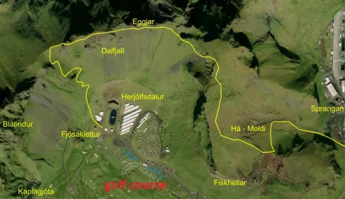
Hike to Herjólfsdalur
Right next to the popular Elephant rock there lies a hidden and not much-known hike called Herjólfsdalur. It starts from the side of the golf course and leads steeply up the nearby hills. We haven’t done the hike to Herjólfsdalur ourselves, because we rather opted for hiking the nearby Heimaklettur. However, given the altitude of Herjólfsdalur hills, great views will be guaranteed once you get to the top on a nice day. See also the map of a hike to Herjólfsdalur below:
Herjolfsdalur hiking trail, sometimes called also Dalfjall hike (click to enlarge)
Hike to Stórhöfði
Stórhöfði hiking trail
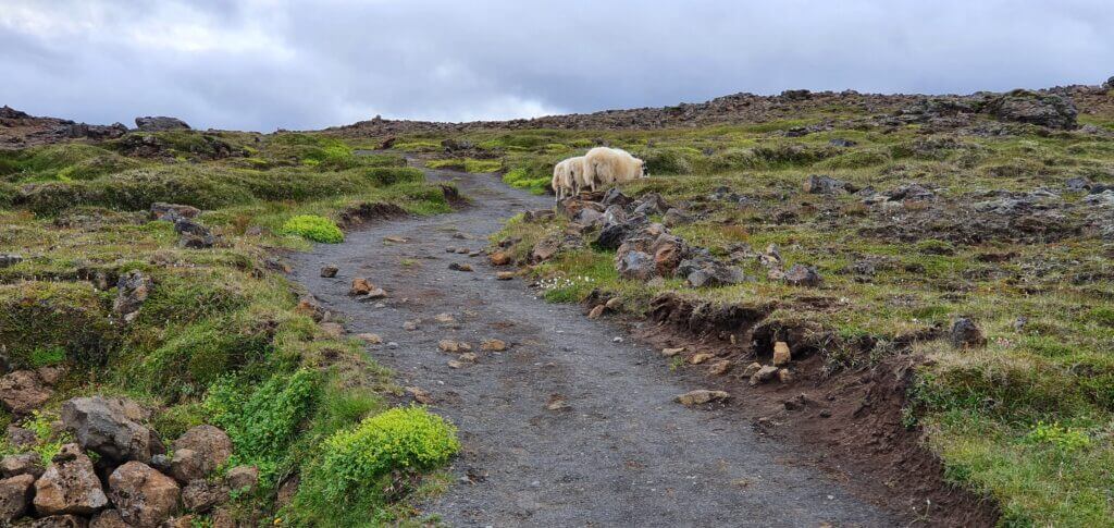
Stórhöfði is the southernmost area of Westman islands, visited primarily due to the presence of puffins. Except for puffins, there are also easy hiking trails at Stórhöfði offering sea views and views of the neighboring smaller islands with cute and lonely houses. Stórhöfði hikes lead via grass fields and are fairly easy. Views are less spectacular compared to Eldfell or Heimaklettur, though, simply because there’s no ascent anywhere.
Stórhöfði hiking trails map (click to enlarge)
Puffins of Westman islands
Many visitors come to Westman islands because there’s one of the largest puffin colonies in Europe residing in Westman islands. Puffins are present in Westman islands usually from May until August/September.
There are two main puffin lookouts in Vestmannaeyjar. The first one is located in Stórhöfði. There’s a little car park right in front of it and the wooden shelter has been built there as an observatory. The second series of viewpoints is along the western coast of Heimaey all the way from Stórhöfði to Elephant rock, on the coast.
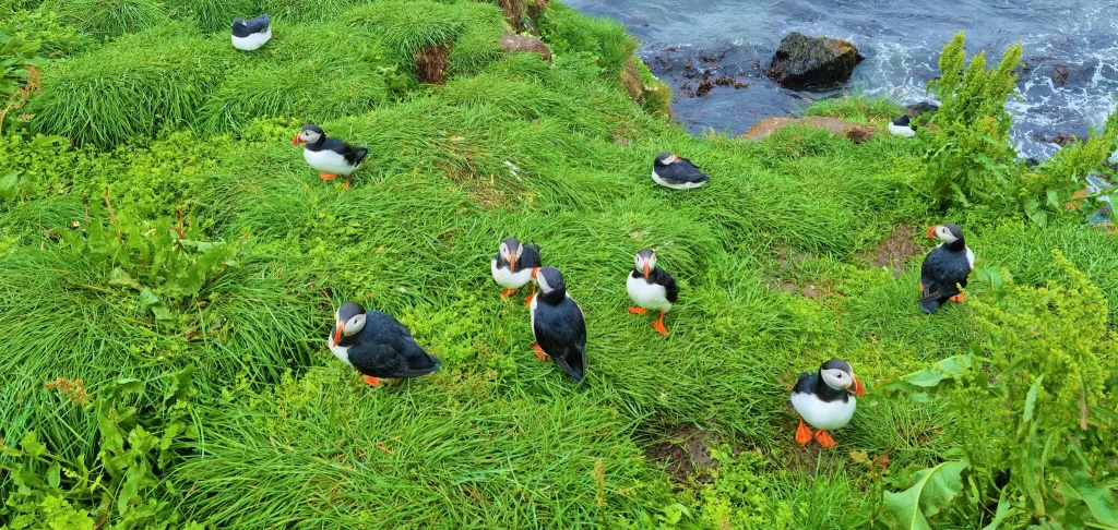
Westman islands puffins at Stórhöfði
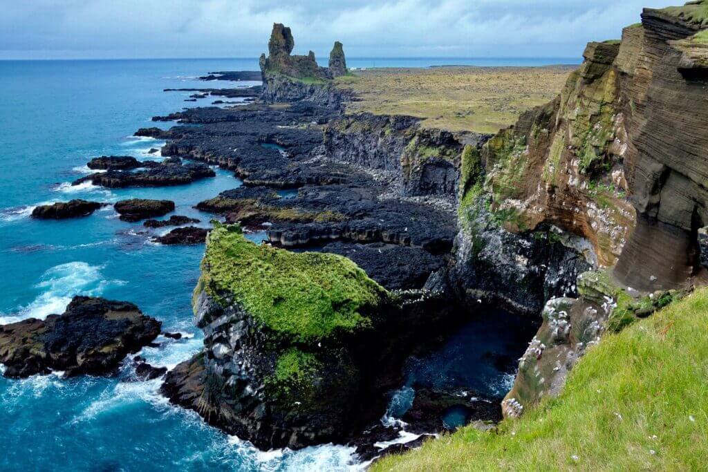
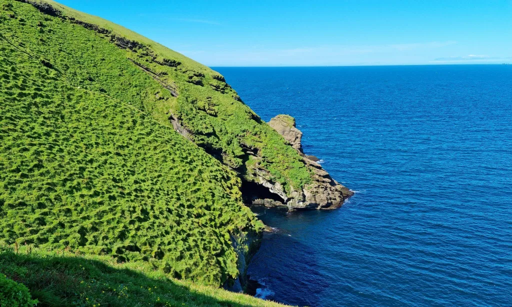
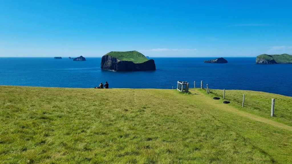
Elephant rock
Halldórsskora in Icelandic, or Elephant rock in English, is a popular photo spot on the westernmost part of Westman islands. As the name suggests, Elephant rock is an interestingly shaped rock in a way that resembles a head of an elephant. You can observe elephant rock either from the west coast or arrive close to it by a walking path leading via a golf course. Please take care and don’t get hit by a golf ball. This is surprisingly a pretty popular golf course.
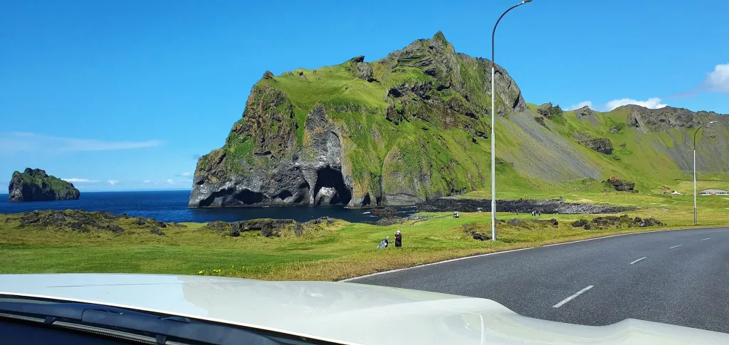
Elephant rock as seen from the car
Black beach Vikin
Only a few hundred meters north of Stórhöfði, there’s a cute little black sand beach. There’s also a picnic table and Vikin black beach makes it a nice little spot for a short pause. Not overwhelming, though.
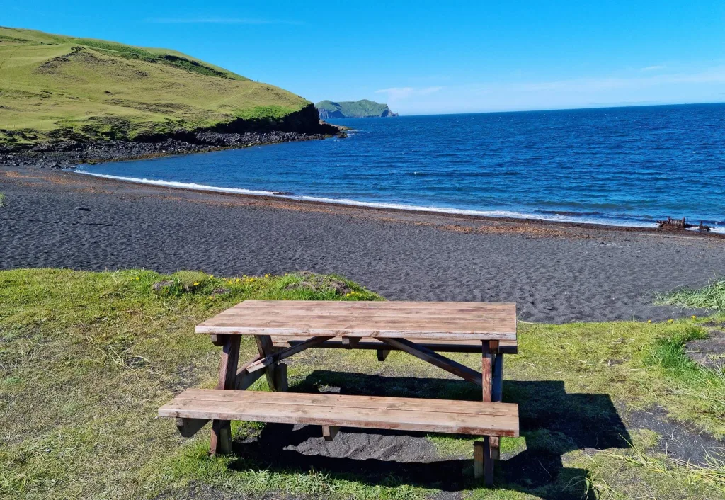
Black sand beach Vikin
Urðaviti Lighthouse
Another place worth visiting for someone who would like to tick off visiting all the sightseeing spots in Westman islands. We didn’t spend much time visiting Urðaviti lighthouse, though. I think there are many more interesting lighthouses all over Iceland.
Eldheimar museum
For those interested in museums or simply if the weather worsens, there’s a most popular museum of Westman islands called Eldheimar. Not our cup of tea, though. Here is the website of the museum.
Beluga whale sanctuary
The Sea Life Trust Beluga Whale Sanctuary is a famous aquarium located on Vestmannaeyjar. Once again, it makes for a nice stop during bad weather, when visiting for more days, or with children. We wouldn’t come here specifically to see the aquarium, though. There are more interesting aquariums around the world than the Beluga whale sanctuary. Here is the website of the Beluga whale sanctuary.
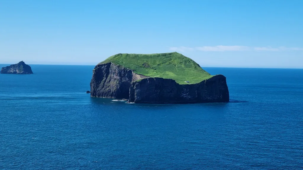
Suðurey island, one of the small Westman islands
Smaller islands of Vestmannaeyjar
Heimaey is not the only island of Westman, despite being the biggest and the most versatile. There are several smaller islands nearby and many of them are actually settled! You will generally find just one lonely house located in the flattest area of these islands. And yes, it’s possible to get to these houses! But only by boat (or helicopter). One of these tiny Westman islands actually even offers accommodation, with somewhat scary reviews. If you wonder how people get up to these houses when getting off their boat, the answer is there are usually either some hidden stairs or a path leading to these houses.
Westman islands summer festival
There’s a huge festival taking place every summer on the Westman islands. It’s called Þjóðhátíð and of course, you can visit it too. You can find all the necessary info about the festival here.
Just bear in mind, cars are banned from the festival. Secondly, we highly recommend not coming for hiking or any peaceful sightseeing during the festival. Heimaey is just totally full at that time. This is one of the biggest Icelandic festivals, often with tens of thousands of visitors.
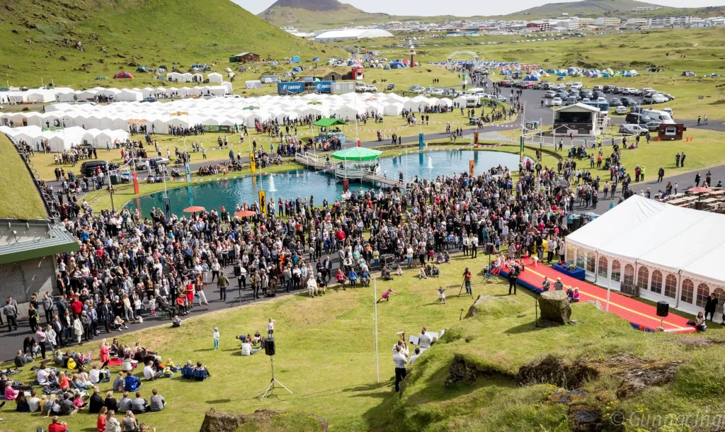
Westman islands summer festival, source: https://www.dalurinn.is/en
Guided tours to Westman islands
There are several guided group tours that will take you to Westman islands from Reykjavik, operated by several tour providers. And then, we can take you on our Epic Private Tour of the Westman Islands! Fully tailored to you, no other tourists and any departure point! So your options are:
- A small group tour to Westman islands from Reykjavik
- An Epic Iceland private tour to Westman islands
There are two main advantages of taking a guided tour to Westman islands. Firstly, as with any other tour, you simply don’t have to take care of anything. The guide will take care of it. Secondly, you don’t have to rent a car, the guide will pick you up from your hotel in Reykjavik.
Best guided tours on Westman islands
So, you’re already on Heimaey, and you don’t only want to explore the island on your own? Well, there are plenty of great tour choices. We picked a few of our favorites below.
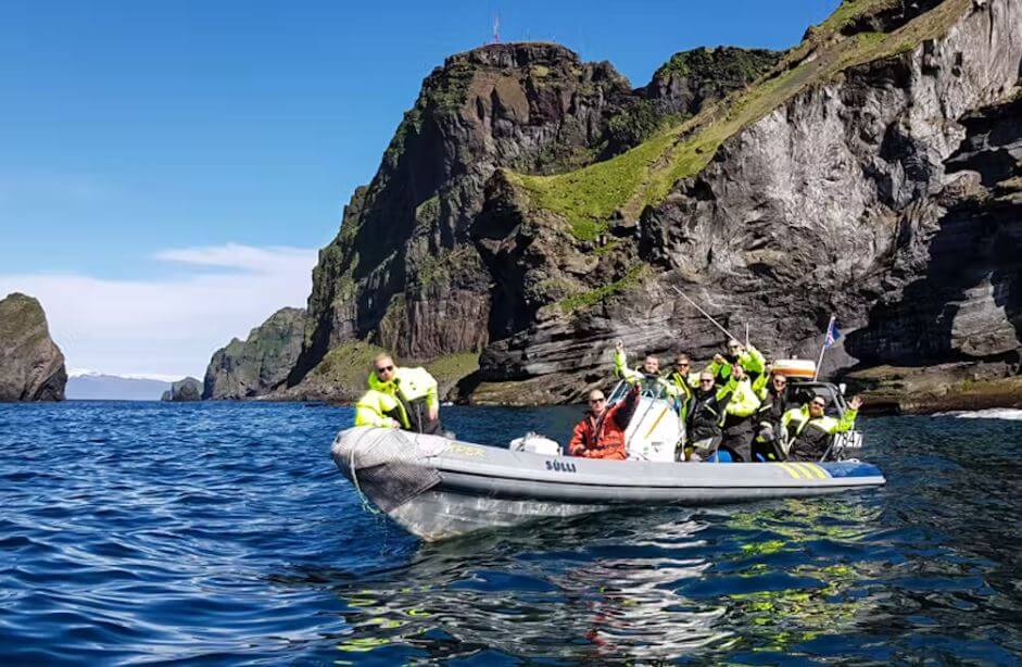
Puffin watching boat tour
Seeing islands from the boat is definitely an adventure. A Westman Islands boat tour will also give you an entirely different perspective of the islands. Some spots are definitely nicer for a photo shoot from the perspective of a boat. Some are even accessible exclusively by boat. These are the three boat tours we think are the best:
- 1-hour RIB boat small group tour
- 1.5-hour Cheap regular boat tour
- 2-hour Speedboat tour including puffins!
Coming without a car and want to see most of Heimaey in 1 day? Our ultimately favorite tour for those without a car on Westman islands is a 2-hour bus tour of the main Heimaey island.
What about an ATV volcano tour on the Westman islands? Our favorite is this Vestmannaeyjar ATV tour.
Don’t have enough time for a guided tour? No worries, in our opinion, you will not miss out much by not taking a boat tour. Instead, when going on your own, you will gain a lot of flexibility and you may have all the places for yourself, not sharing them with your tour group. But that’s just us, someone else may prefer the comfort of a tour.
YOU MAY ALSO LIKE:
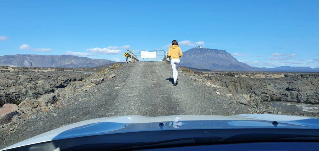
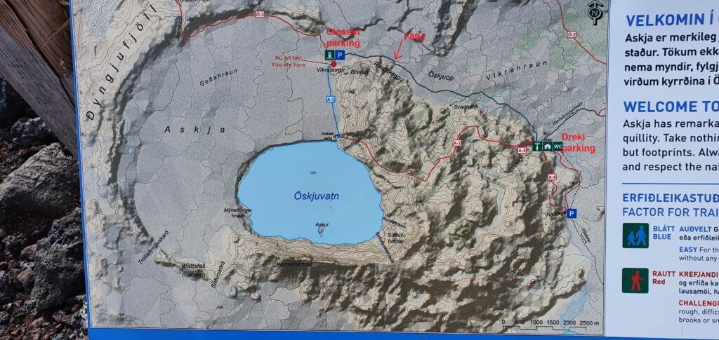
- Guide to Incredible Askja
- Best Places and Hikes in Kerlingarfjöll
- Top 25 Places in the Highlands
- Landmannalaugar Hiking Guide
- Hiking the Amazing Thakgil
- 25 Hidden Gems in Iceland Nobody Writes About
- How to visit the Highlands of Iceland
- Everything about the Fimmvörðuháls hike
- How to Visit Mælifell
![]() ask questions or get inspired in our community
ask questions or get inspired in our community