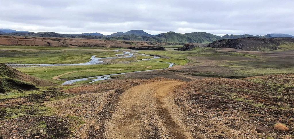
F210, or in Icelandic Fjallabaksleið Syðri, is an F-road in the southern Icelandic Highlands. It runs from Hvolsvöllur in the west, continues south of Landmannalaugar, and ends southeast of the famous Maelifell volcano. F210 passes through some of the most remote and moon-like landscapes Iceland has to offer. This is one of the most beautiful yet also one of the most demanding F-roads in Iceland.
The main reason most people drive F210 is the legendary Maelifell volcano – a perfectly cone-shaped green volcano rising out of a black sand desert. But there is a lot more to this road than just Maelifell. The western section leads past the beautiful Álftavatn lake and crosses several medium-sized rivers. The eastern part opens up to hidden spots like Rauðibotn craters or Markarfljótsgljúfur canyon.
F210 is only minimally maintained and pretty remote. Significantly fewer cars take this route compared to better-known highland roads like F208. If you are looking for a road where you will be essentially alone in the Icelandic wilderness, this is it.
We’ve driven the F210 several times under various conditions and have written a guide based on our experience. We aim to cover everything you need to know before driving F210 – road conditions, river crossings, the right car, best stops, and our own experience driving it.
Contents
Overview of F210
F210 is a long road that can be divided into a western section and an eastern section, split roughly in the middle by the junction with F261 – Emstruleið. The two sections are quite different in character.
The western section (Keldur to the F261 junction near Hvanngil) is a bumpy but mostly manageable gravel road with several small to medium-sized river crossings and one medium to big – Kaldaklofskvísl.
The eastern section (from Hvanngil towards Maelifell and beyond) transitions into a much rougher terrain – volcanic boulders, black sand tracks, and the noto Holmsá river crossing, which is the biggest challenge on this side of the road.
F210 – Fjallabaksleið Syðri
Length: ~110 km | 68 mi
Driving time: 3-5 hours one way (without stops)
Difficulty: 8/10 - Difficult
Steepness / roughness: steep parts, huge boulders, etc
Unbridged river crossings: several - small to big (Kaldaklofskvísl, Holmsá)
Opening time: early July
Closing time: September
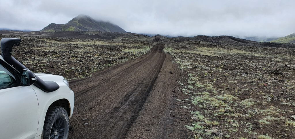
F210 Fjallabaksleid Sydri east of Maelifell
F210 opening dates
F210 is listed in the official Vegagerðin (Icelandic Road Administration) opening date statistics. The road is divided into two sections for this purpose.
The table below shows historical opening dates for F210 that we gathered based on our and Vegagerðin data (2017-2024).
| F210 section | Earliest opening | Latest opening | Median opening |
|---|---|---|---|
| 1. Keldur – Hvanngil (west) | June 21 | July 15 | July 7 |
| 2. Hvanngil – Skaftártunga (east) | June 23 | July 13 | July 4 |
- 2024 opening: 4th of July
- 2023 opening: 23rd of June
- 2022 opening: 15th of July
- 2021 opening: 9th of July
- 2020 opening: 13th of July
- Earliest opening (2017-2024): 23rd of June
- Latest opening (2017-2024): 15th of July
In practice, plan your trip at least for the second half of July to be on the safe side, especially if you want to reach Maelifell on the eastern section. Always check the current road status at www.umferdin.is before going. A green status is a good sign, but it does not tell you the actual water level of individual rivers. When in doubt, ask locals.
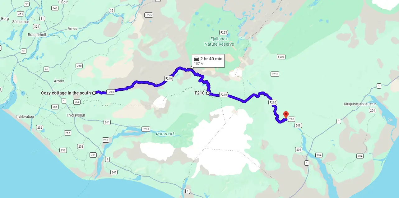
F210 Map
Note that there’s also Road 210 in the east, which transitions into F210 later on.
F210 Fjallabaksleið Syðri on Google Maps:
Icelandic Maps:
Connecting roads
- Road 264 (Rangárvallavegur) – paved road leading from the Ring Road towards Keldur, western start of F210
- Road 210 (Ljótarstaðavegur) – paved road transitioning into F210 at Snæbýli cottages
- F261 – Emstruleið (connects to F210 in the middle, near Hvanngil)
- F232 – Öldufellsleið (connects from the south, near Maelifell – the easiest approach to Maelifell)
- F233 – Álftavatnskrókur (connects F210 east to F208 south, near Landmannalaugar – difficult river crossing)
Kaldaklofskvísl river crossing F210
F210 River Crossings and Obstacles
F210 River Crossings
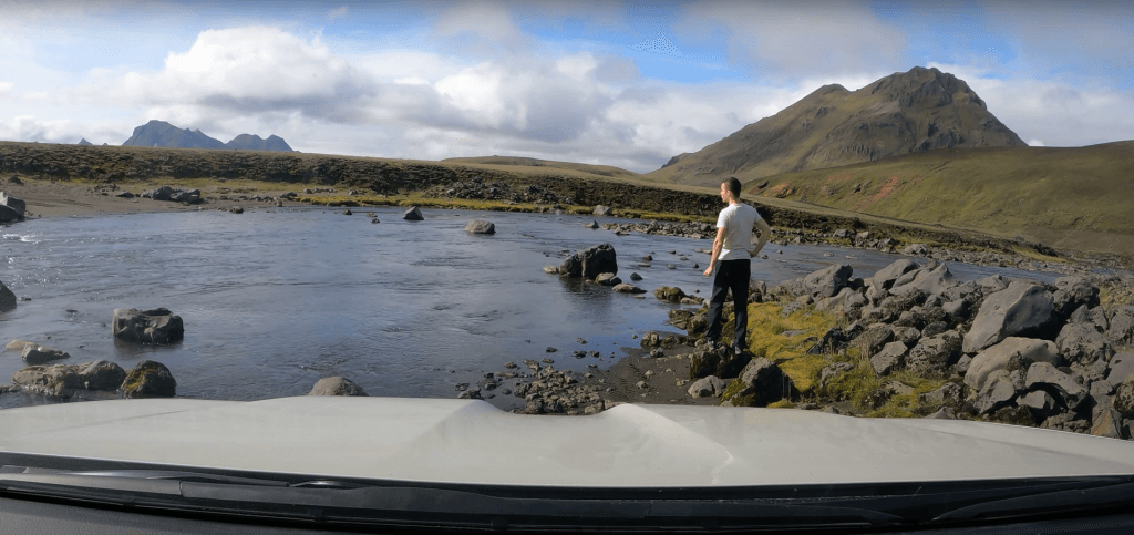
F210 has multiple river crossings across its entire length. The good news is that the two main ones – Kaldaklofskvísl and Holmsá – are well-known, and most of the other crossings in between are small to medium-sized and manageable under normal conditions. The road’s remote character is what makes every single crossing more serious, though – there is often nobody around to help you if something goes wrong.
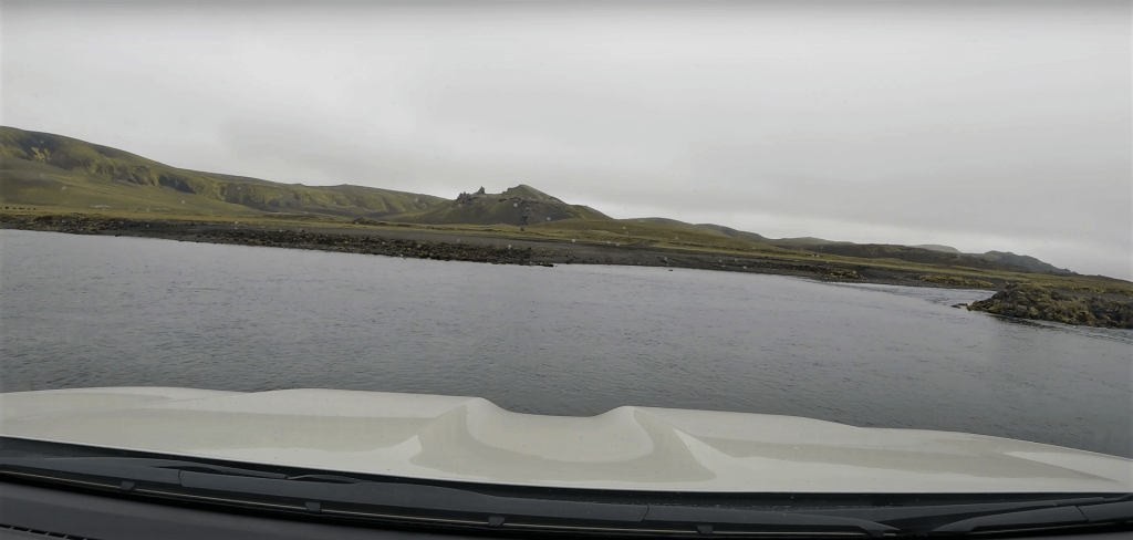
The western section between Keldur and Álftavatn has several small-to-medium crossings. Nothing too alarming under average conditions. What is unique here, though, is that there is a stretch of around 100 meters where you literally drive in the river, along the stream itself. This is one of those once-in-a-lifetime experiences for anyone not used to it. We definitely weren’t expecting it the first time.
Holmsá river crossing at F210
The Kaldaklofskvísl river is the main challenge on the western section of F210. It is located just past Álftavatn, near the crossroads with F261. What makes Kaldaklofskvísl tricky is not necessarily its depth – it’s the large boulders on the riverbed that you cannot see beforehand. These can cause serious damage to your car if you hit them incorrectly. The water level can also rise significantly after rain or glacial melt. Always wade it on foot first, and watch someone else cross before you if at all possible.
From Kaldaklofskvísl towards Maelifell, the road continues without any major river crossings. But the terrain gets rougher. After Maelifell, the Holmsá river is the main obstacle on the eastern section of F210. This is a bigger, less predictable crossing – that our local friend describes as follows:
“River by Mælifell has a rocky bottom and a small steep bank right after you cross the river from the east, and the sand can be wet, and there is a risk of getting stuck – also people tend to hurry across the river because of the steep bank not knowing that the riverbed has quite a lot of rocks that could cause you problems…”
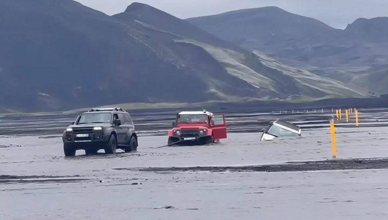
Flooded Holmsá river with a stuck jeep – this is how you don’t want to end up
Never take Holmsá lightly. Always check beforehand and on-site. Holmsá is the crossing that separates the Maelifell area from the Rauðibotn craters on the other side. If the crossing looks dangerous, it’s better to turn back rather than get stuck in the middle of nowhere. Read more about how to cross rivers in Iceland before driving F210.
Obstacles
Outside the river crossings, F210 has its own set of challenges compared to easier F-roads. The western part is bumpy gravel with potholes and some steep sections, but nothing extreme. The eastern section towards Maelifell is where things get significantly harder.
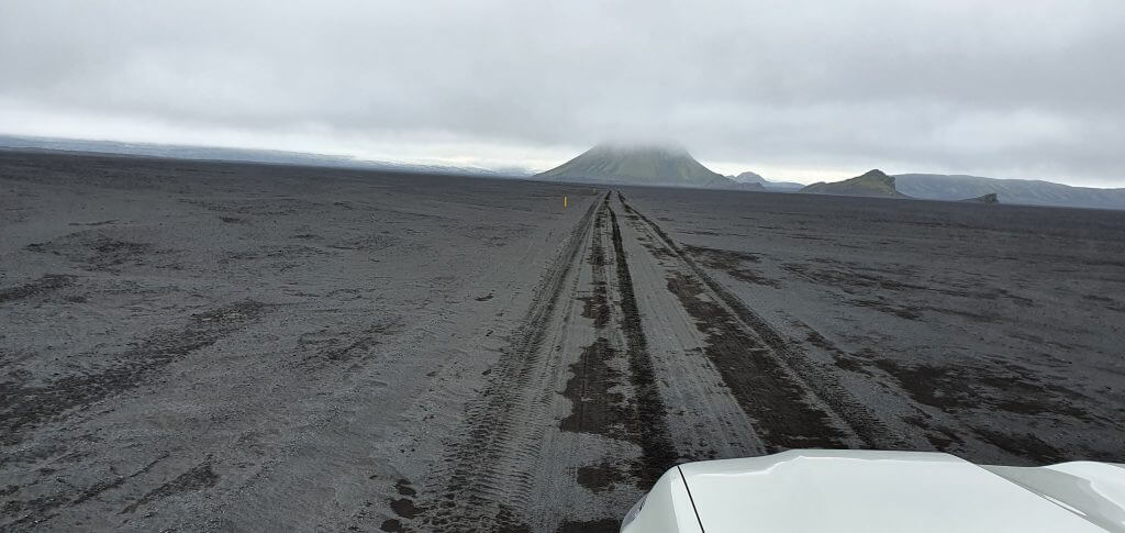
After Kaldaklofskvísl, the road transitions into an area with large volcanic boulders. The track is not always clearly visible and requires careful navigation. Ground clearance matters a lot here – hitting the wrong boulder can cause serious damage to your car’s undercarriage. Then the road turns into black sand tracks through Maelifellsandur.
This part has no major obstacles, but the road markings are minimal – just yellow sticks on the sides and the tire tracks in the sand. If you are the only car, those tracks become your guide. The biggest danger is the black sand fields getting too watery with rain and eventually turning into braided rivers – see picture below. You can easily get stuck if this happens!
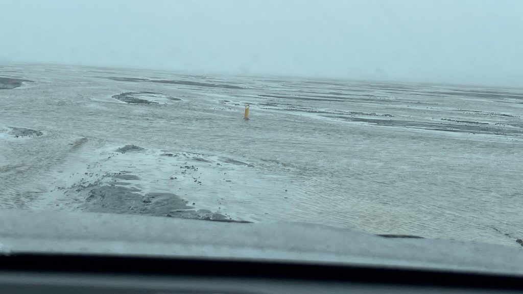
This is how flooded river braids near Maelifell volcano can look like
The terrain around Maelifell is often covered in mist or light rain. Visibility can drop quickly. Take it slowly and stay on the tracks. Getting off the marked route in wet black sand can get you stuck very easily.
Car Requirements, Weather, and Safety
F210 Car Requirements
F210 is a road where the car choice matters a lot. The western section up to Álftavatn is manageable in a proper Land Cruiser-type car under good conditions. But once you plan to go all the way to Maelifell and cross Holmsá, you really need to think carefully about what you are driving.
Minimum F210 Car Requirement: medium to big 4×4 – a Land Cruiser or Hilux class vehicle (*under ideal conditions, western section only)
Recommended F210 Car: a 33″+ super jeep with snorkel (**under average conditions, full road including Holmsá)
“Peace of Mind” F210 Car: as big a super jeep as possible, w.g. 38″+ Land Rover Defender with snorkel (*for worse conditions or added safety margin)
Never drive the road in any car when it’s marked red = impassable on www.umferdin.is or when conditions are too difficult. Even the big jeeps can drown in rivers!
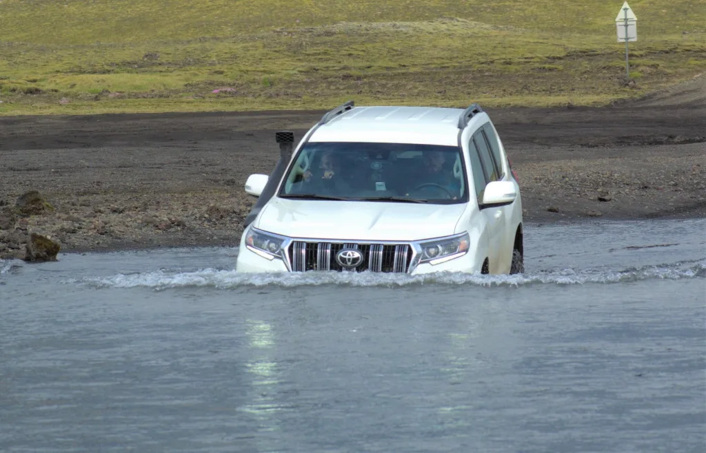
Me crossing bigger Hólmsá river by Land Cruiser on F210 near Maelifell
The boulder terrain between Kaldaklofskvísl and Maelifell also demands high ground clearance – this is not about river depth, it’s about the physical rocks on the road. Even if you clear Kaldaklofskvísl, you may still damage your car’s undercarriage if you are in a car that sits too low.
Please never attempt the Holmsá crossing in a Duster, Jimny, or anything similar. Read how to choose a proper car for Iceland or how to pick the best Icelandic car rental insurance. We also collaborate with the best Icelandic companies to give you a car rental discount and us a small commission at no extra cost to you.
F210 Weather and Safety
Before driving F210, always check the Icelandic weather forecast, current road conditions, and travel warnings. The area around Maelifell is particularly prone to sudden weather changes – it’s common to drive through fog, light rain, and sun in the same hour.
F210 west near Keldur
The eastern section of F210, especially around Maelifellsandur, sits at a higher elevation where the weather can shift dramatically. Even on a day that looks clear from Hella, the area around Maelifell may be completely fogged in. This matters for safety because navigation without visibility is extremely difficult on a road with minimal markings.
River levels on F210 can change fast with rain or warming temperatures, causing glacial melt from Mýrdalsjökull nearby. A warm sunny afternoon can actually make rivers higher than they were in the morning – plan accordingly and do not cross in the afternoon if conditions deteriorate during the day.
Bring enough fuel. There are no gas stations along F210. Cell coverage is very limited or absent for most of the route. If you feel unsure, register your trip at safetravel.is before going. Ideally, do not drive F210 alone – going with at least two cars is much safer in case something goes wrong.
Highlights and Attractions
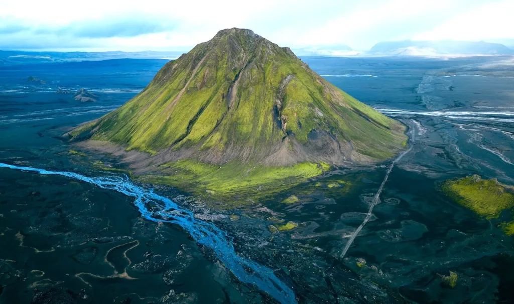
Maelifell is one of the most picturesque places in Iceland away from the crowds
F210 is one of those roads where the journey itself is the destination. But there are also several extraordinary spots along the road that are worth stopping for – some of them are among the best places we have ever seen in Iceland.
Maelifell volcano is the main draw. A perfectly symmetrical green cone volcano rising from a black sand desert – it looks like a movie set. But the road itself and everything around it deserves just as much attention. Once you are in the eastern section of F210, you enter a world that feels genuinely like another planet.
Off-the-beaten-path Spots
- Maelifell volcano – the iconic green volcano in the black sand desert, one of the most unique views in Iceland. You can also attempt to climb it, but only if you are an experienced hiker and the conditions are ideal.
- Álftavatn lake – a calm and beautiful mountain lake on the western section. A perfect spot to stop, have a picnic, and take in the views of the surrounding highlands. The Álftavatn hut is located here too.
- Rauðibotn craters – a remote, out-of-this-world area with waterfalls, rivers, and volcanic craters. To get there from Maelifell, you need to cross the Holmsá river or just come from the east. Totally worth the extra drive.
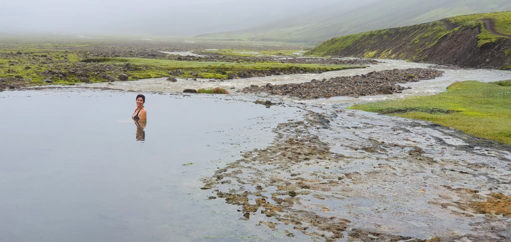
A really surreal place. This is a hidden hot spring Strútslaug
- Strútslaug hot spring – possibly the least visited hot spring in Iceland. A truly wild natural hot pot that requires a medium river crossing and a ~1.5 hour hike to reach. Zero tourists, maximum reward.
- Markarfljótsgljúfur canyon – one of the biggest and most beautiful canyons in Iceland, yet still largely unknown. Accessible from F210 via dirt tracks from the Emstrur area. One of the most dramatic places we’ve been to in Iceland.
- Hungurfit dirt track – a remote, challenging dirt track connecting F210 with F261 through the inner highlands. Includes steep hills, river crossings, and the famous narrow boulder passage that even locals come to try. Super jeep only. Not for beginners.
Did you know that
- There are actually about 20 places in Iceland called Maelifell? It means “measuring mountain” in Icelandic – basically an orientational hill. Icelanders in the past were not very creative with mountain names 🙂
- On the western section of F210, there is a stretch where you literally drive in the river, along the stream for around 100 meters? It’s one of the most unique driving experiences you will find on any F-road.
- The area around Maelifell is almost always covered in some form of mist – even on days that look clear at lower elevations?
- Markarfljótsgljúfur canyon – one of the most spectacular canyons in Iceland – is accessible from F210 and yet most tourists have never even heard of it?
- Strútslaug, the remote hot spring near F210, is considered by many to be the least visited hot spring in all of Iceland?
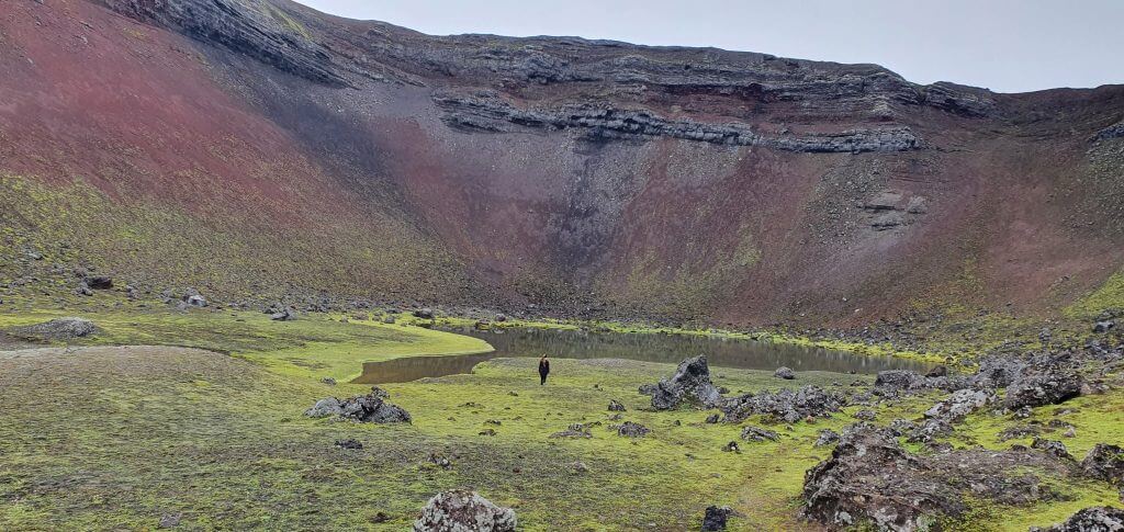
Rauðibotn volcano crater
Where to Stay near F210
There are a few good accommodation options depending on which part of F210 you are exploring.
Near the western start (Hella area):
- Accommodation near Hella – we based ourselves in this area multiple times. A very convenient base for an early start on F210 from the west.
Mountain huts along F210:
- Álftavatn hut – on the western section, great for a multi-day highland trip. On average open from late June.
- Hvanngil hut – near the Kaldaklofskvísl crossing. A good base if you want to explore both the western and eastern sections of F210. Open roughly from June 25 on average.
- Strútur hut – located near Strútslaug hot spring, more remote.
- Emstrur-Botnar hut – accessible from the western part of F210 via Emstrur tracks, also a shelter on the Laugavegur hiking trail.
Note that all mountain huts offer only basic sleeping bag accommodation – no hotels anywhere along F210. Plan and book your hut accommodation well in advance, especially in July and August.
Road Videos
Our drives on F210 and the surrounding area:


Personal Experiences and Tips
Let’s talk about our first full F210 drive, because this is the trip most of you will want to replicate.
We based ourselves near Hella and chose F210 for Day 2 of our highlands trip. The weather the evening before looked decent for the next day – not perfect, but workable. Our Icelandic friends confirmed that water levels were low, which made the decision easy. We planned to drive F210 from the west, stop at Álftavatn, continue to Maelifell, and attempt Holmsá if it looked safe. Everything after that was optional, depending on time and conditions.
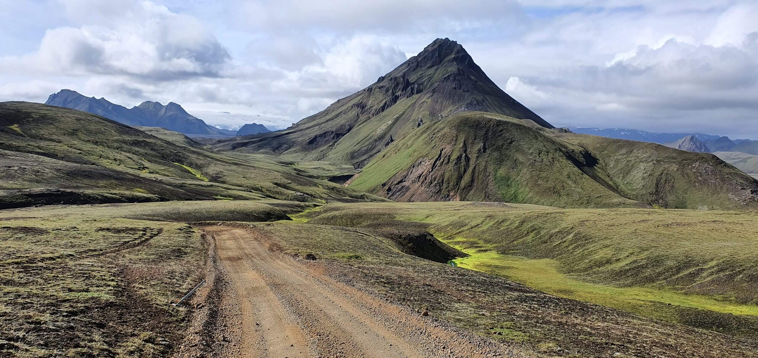
F210 west of Alftavatn
We left at 7 AM from Hella. Getting to the start of F210 via the Keldur area takes roughly an hour on paved roads. Once on F210, the road immediately gives you that highland feeling – bumpy gravel, big views, no other cars. The western section was really picturesque. The highest point before Álftavatn – where you can see Landmannalaugar in the distance – was one of the best views of the day. We stopped the car and just stood there for a bit.
The small river crossings along the western section were no problem. But the section where you drive in the river itself was something else entirely. We were not expecting to literally follow the stream for 100 meters with water flowing around the car. A proper “what are we even doing here” moment – in the best possible way.
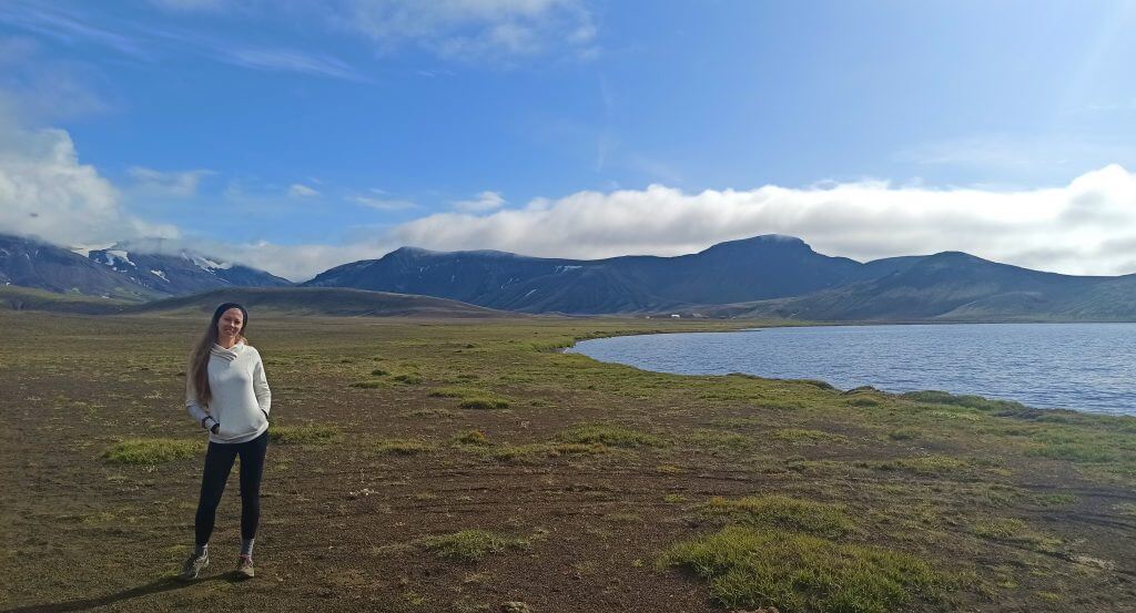
Álftavatn lake
After Álftavatn, we approached Kaldaklofskvísl with full respect. We waded it on foot first – the water was cold and reached knee-height in the deepest part. The boulders on the bottom were exactly as described. We chose our line carefully, crossed slowly, and had no issues. But we could clearly see how this crossing would become genuinely dangerous if the water level was even 20-30 cm higher.
The section between Kaldaklofskvísl and Maelifell is probably the most dramatic stretch of F210. The road gets rougher, the boulders are everywhere, and the landscape shifts into something that looks more like Mars than Iceland. We were completely alone on this part of the road. When Maelifell finally appeared through the mist – a bright green cone in the middle of a black sand desert – we both went quiet for a moment. It genuinely looks like nothing else in the world.
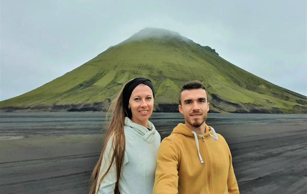
Our first visit of Maelifell in August
We continued to Holmsá. The crossing was shallow that day and we made it without drama, though we waded first meters anyway. We then hiked to Rauðibotn, which deserves its own guide entirely – a hidden world of craters and waterfalls that almost nobody sees.
A few tips from our side:
- Start as early as possible. F210 with all its stops can easily fill a full day, and river levels in the afternoon can rise due to glacial melt.
- Try wading rivers before crossing by car – You learn a lot about depth and current just by walking in.
- Don’t underestimate the boulder terrain east of Kaldaklofskvísl. Drive slowly, pick your line carefully, and don’t rush.
- Plan for the weather to change near Maelifell. It almost always does. Bring layers and waterproofs even on a sunny day at lower elevations.
- Have everything on your phone downloaded offline – maps, route, this guide. Cell coverage is essentially zero on the eastern section of F210.
- Check road conditions at umferdin.is the morning of your trip. Check again before you leave. And ask locals if you can.
- If possible, don’t go alone. Driving in convoy with at least two cars gives you a real safety net in a very remote area.
- Consider a guided super jeep tour (10% discount code: EPICICELAND10) if you are not fully confident with big river crossings or highland driving. The local drivers know every bend on this road.
![]() ask questions or get inspired in our community
ask questions or get inspired in our community