Our 12-day self-drive once in a lifetime Icelandic itinerary. List of ALL PLACES to be found here.
Day 2
Contents
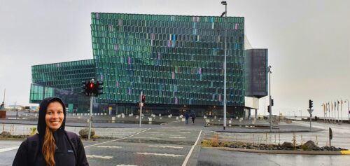
1: Harpa Concert Hall on a rainy evening
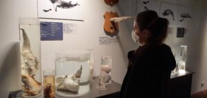
2: Reykjavik phallological museum, during Covid-19 pandemic
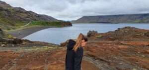
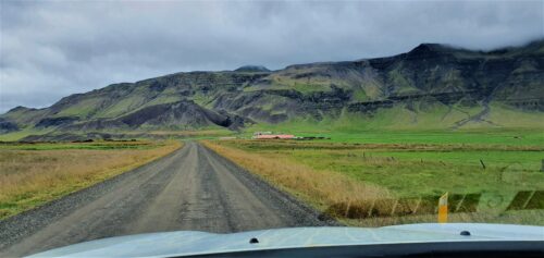
3: Kleifarvatn lake near the Seltún geothermal area on our way from Reykjavik towards Keflavik
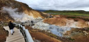
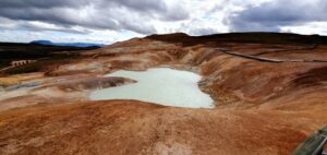
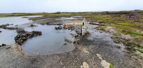
4: Seltún geothermal area on our way from Reykjavik towards Keflavik
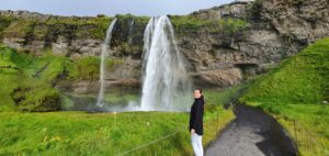
5: Seljalandsfoss at 7pm
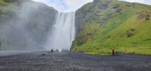
6: Bottom part of Skógafoss waterfall (and a wedding in the background ☺) at 8pm
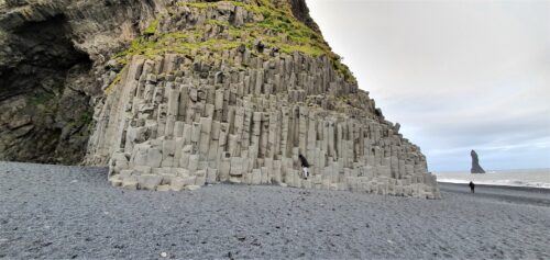
7: Basalt columns at Reynisfjara beach
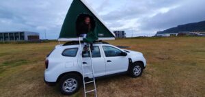
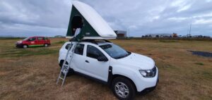
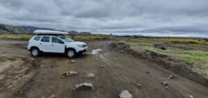
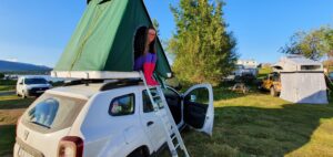
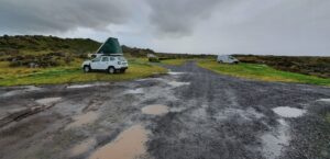
8: Going to sleep in a rooftop tent in Vik campsite
Day 3
Contents
1: Going to sleep in a rooftop tent in Vik campsite
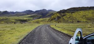
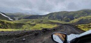
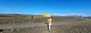
2: Road F208 near Vik towards Landmannalaugar
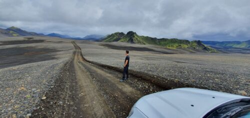
3: Out of this world landscapes surrounding F235 road towards Langisjór lake
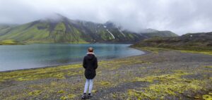
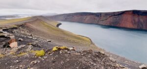
4: Langisjór lake next to Langisjór campsite mark on the map

5: Upper part of the hike on Sveinstindur near Langisjor lake on a foggy day with slight rain
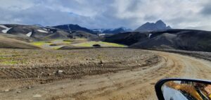
6: Road F208, or Fjallabaksleið Nyrðri, after crossing with F235 towards Landmannalaugar
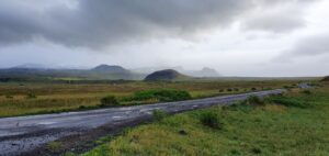
7: Road F208, or Fjallabaksleið Nyrðri, south of Landmannalaugar, coming from Vik direction
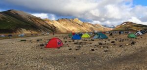
8: Landmannalaugar Brennisteinsalda campsite on a summer evening
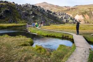
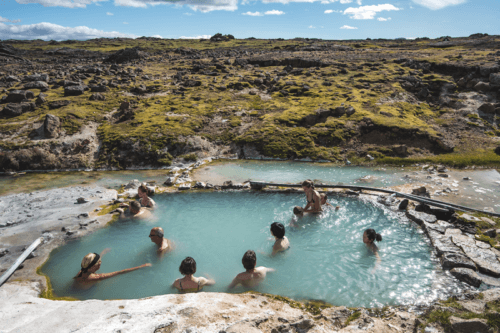
9: Landmannalaugar hot spring. Picture taken from https://www.foodiebaker.com/day-4-iceland-travelogue/
Day 4
Contents
1: Landmannalaugar Brennisteinsalda campsite on the summer evening
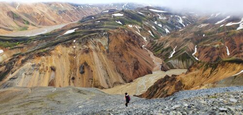
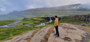
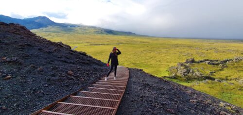
2: One of the views from the peak of Bláhnjúkur towards Landmannalaugar and 2nd (steeper) hiking trail
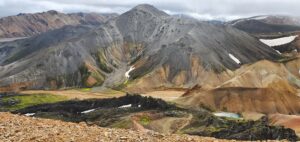
3: View from the top of Brennisteinsalda towards Bláhnjúkur
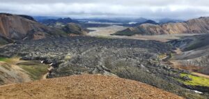
4: View from the top of Brennisteinsalda towards Laugahraun
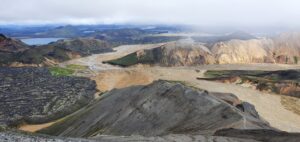
5: Another view from the peak of Bláhnjúkur towards Landmannalaugar camp, Laugahraun and 2nd (steeper) hiking trail
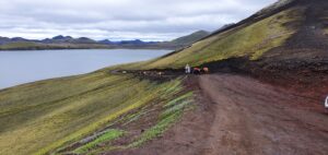
6: Horses or “Icelandic ponnies” blocking the F208 road Fjallabaksleið Nyrðri north of Landmannalaugar
7: Ljotipollur trail
8: Sigoldugljufur canyon. A remote, magical, non-touristy place.
9: Just Haifoss
10: F208 road from Landmannalaugar towards F26 on a cloudy day
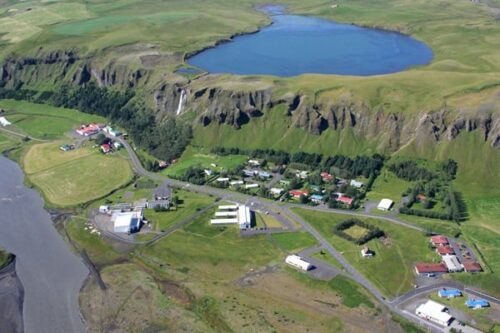
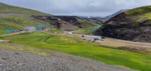
11: Kirkjubaejarklaustur
Day 5
Contents
1: Kirkjubaejarklaustur
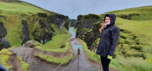
2: One of the main viewpoints at Fjaðrárgljúfur canyon
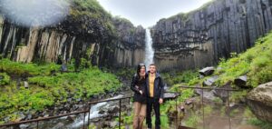
3: The closest viewpoint to Svartifoss after sky finally cleared a bit. Still, we are wet in the pic as you may see.
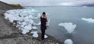
4: Making fancy iceberg pictures near Fjallsárlón
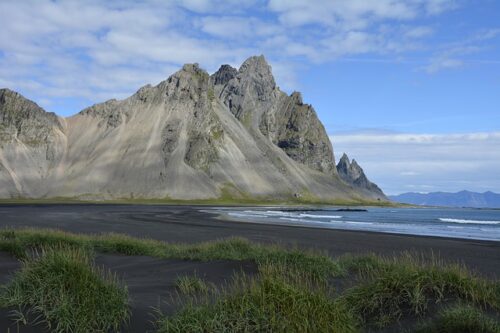
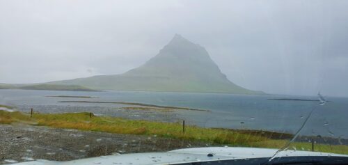
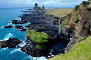
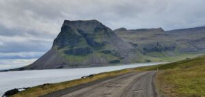
5: Vestrahorn near Hofn
6: Icelandic crazy Oxi road 939
7: Fellabær campsite next to Egilsstaðir
Day 6
Contents
1: Fellabær campsite next to Egilsstaðir
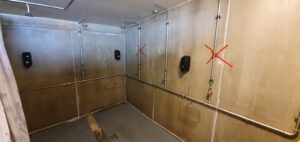
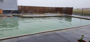
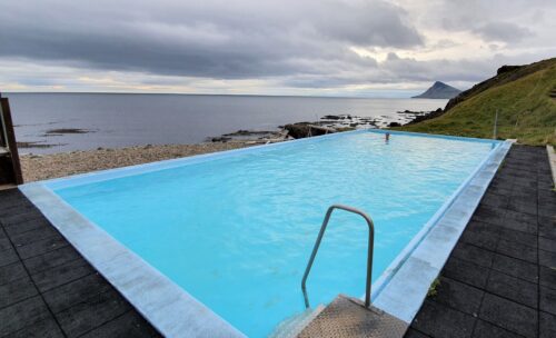
2: Lýsuhólslaug hot springs, showers, during Covid-19 pandemic
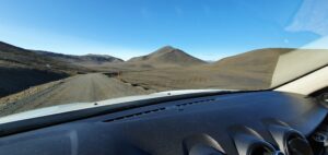
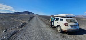
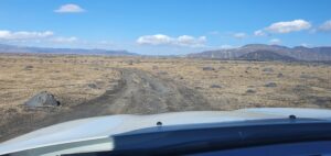
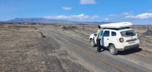
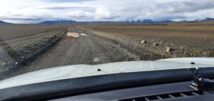
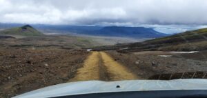
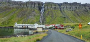
3: Möðrudalsleið road, the first gravel road you’re gonna encounter when coming from Egilsstaðir direction
4: F905 to Askja on an exceptionally beautiful sunny summer day
5: F910 towards Askja
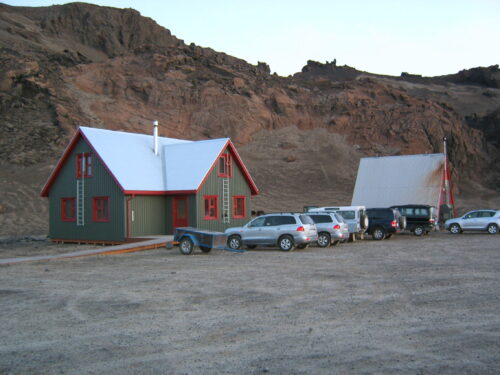
6: Dreki Mountain Huts
7: Vikraborgir car park, the closest point available on your route towards Askja/Víti crater
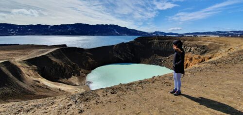
8: Amazingly beautiful Askja (the whole area), Víti (the crater lake) and Öskjuvatn (the bigger lake nearby) all in one picture
9: F910, or Austurleið, continuation of road F905 towards Askja
10: Crossroads between Möðrudalsleið road and F905
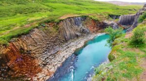
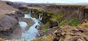
11: Stuðlagil Canyon, view from the western side
12: Möðrudalur campsite
Day 7
Contents
1: Möðrudalur campsite
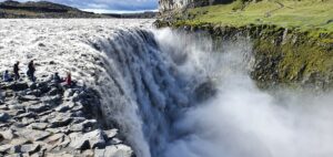
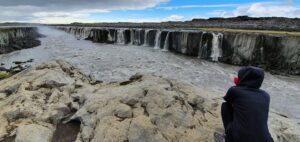
2: Observe tourists on our side (east) and the other side (west) of the Dettifoss
3: East viewpoint of the Selfoss waterfall
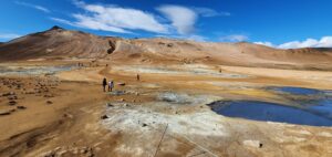
4: Hverir, aka Námaskarð, in the front with Námafjall mountain in the background
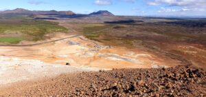
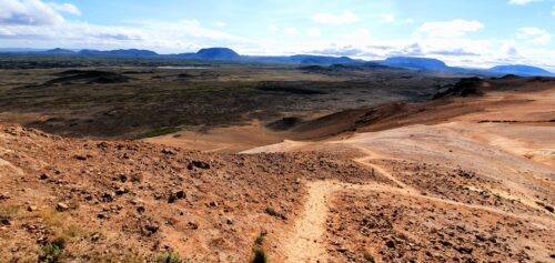
5: View from the Namafjall mountain
6: Námafjall clay trail
7: Krafla, start of the Leirhnjukur trail
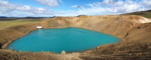
8: Víti lake in the Krafla area
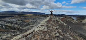
9: Krafla lava fields
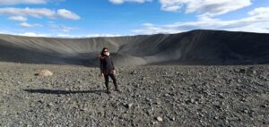
10: At the summit of Hverfjall
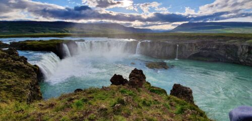
11: Godafoss before sunset
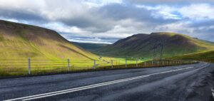
12: Ring road no. 1 between Varmahlíð and Svínavatn
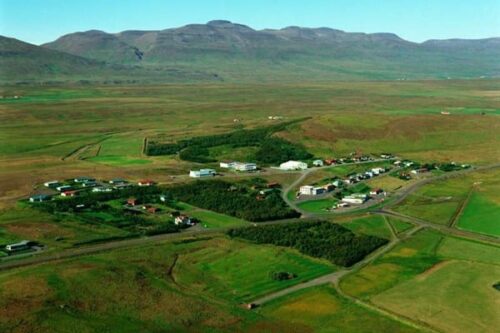
13: Varmahlid campsite
Day 8
Contents
1: Varmahlid campsite
2: F35, aka Kjalvegur, near Hveravellir
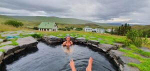
3: The only Hveravellir hot spring for bathing. Image: courtesy of hiticeland.com
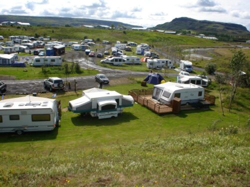
4: Kerlingarfjöll mountain resort campsite
5: F347 road next to Hveradalir hot spring area in Kerlingarfjoll
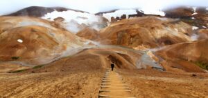
6: Clay staircase in Hveradalir area of Kerlingarfjöll
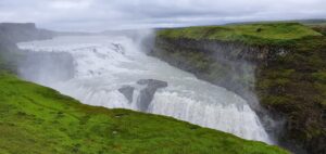
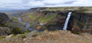
7: Gullfoss at the time of our visit, i.e. 7pm
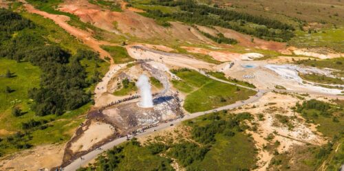
8: Strokkur by www.iceland360vr.com
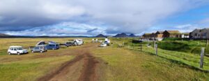
9: Fludir campsite
Day 9
Contents
1: Fludir campsite
2: Tranquil scenery of Hruni hot spring
3: Road 55 – Heydalsvegur
4: Closed Landbrotalaug hot spring, resembling a mud hole
5: Útnesvegur road near Hellissandur
6: Kirkjufell on a rainy, foggy summer day
7: Hellissandur campsite on a foggy, rainy evening
Day 10
Contents
1: Hellissandur campsite on a foggy, rainy evening
2: Saxhóll crater – staircase
3: This is how Londrangar cliffs are supposed to look like on a beautiful day. We, however, saw only their silhouette in the fog
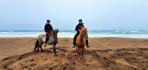
4: Horse riding on a Snaefellsnes beach
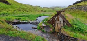
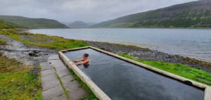
5: Lýsuhólslaug hot spring
6: Neighborhood of the Guðrúnarlaug hot spring
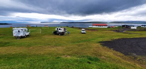
8: Drangsnes campsite next to the beautiful fjord
Day 11
Contents
- 1. Drangsnes camping
- 2. 643 – Strandavegur – towards Krossneslaug
- 3. Krossneslaug
- 4. Djupavik
- 5. The long road from Djupavik towards Gjörvidalslaug
- 6. Gjörvidalslaug (really hidden?) hot spring
- 7. Hörgshliðarlaug
- 8. Road 61 – Djúpvegur – towards Ísafjörður
- 9. Seal lookout
- 10. Ísafjörður, Tjöruhúsið
- 11. Bolafjall
- 12. Þingeyri camping
1: Drangsnes campsite next to the beautiful fjord
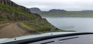
2: Overview of Strandavegur, a.k.a. road 643
3: Krossneslaug
4: Djupavik
5: Semi-paved road 643 with many potholes
7: Hörgshliðarlaug hot spring in the heart of fjord
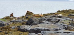
9: If you want to approach the seals, you have to jump through these very slippery blocks
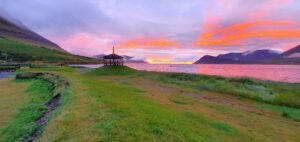
12: Picturesque sunset at Þingeyri campsite
Day 12
Contents
- 1. Þingeyri camping
- 2. Road 60 – Vestfjarðavegur – towards Dynjandi
- 3. Dynjandi waterfall
- 4. Road 63 – Bíldudalsvegur, and road 62 – Barðastrandarvegur, towards Látrabjarg
- 5. Reykjafjarðarlaug Hot Pool
- 6. Road 612 a.k.a. Örlygshafnarvegur to Látrabjarg
- 7. Látrabjarg
- 8. Hnjótur museum
- 9. Plane wreck
- 10. Shipwreck Garðar BA 64
- 11. Rauðisandur beach
- 12. Road 62 – south – Barðastrandarvegur towards Flókalundur
- 13. Hellulaug hot spring
- 14. Road 60 – south – Vestfjarðarvegur towards Kinnarstaðir
- 15. SjávarSmiðan
- 16. Búðardalur camping Dalakot
1: Picturesque sunset at Þingeyri campsite
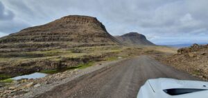
2: Road 60, or Vestfjarðavegur in Westfjords towards Dynjandi waterfall
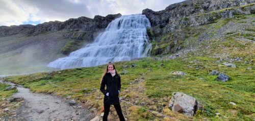
3: Dynjandi waterfall trail
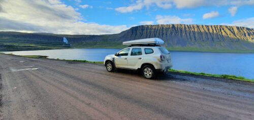
4: Crossroads of the roads 60 and 63 or Bíldudalsvegur and Vestfjarðavegur
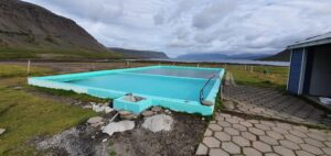
5: Reykjafjarðarlaug hot pool
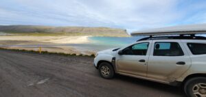
6: Breiðavík beach next to the road 612
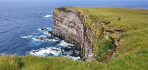
7: Látrabjarg on a sunny day
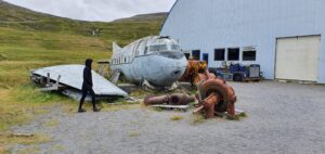
8-9: Plane wreck in front of the Hnjótur museum
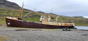
10: Garðar BA 64 shipwreck next to the road 612 Örlygshafnarvegur
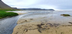
11: Rauðisandur beach
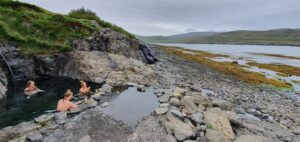
13: Hellulaug hot spring