The ultimate guide to the most spectacular Icelandic roads. How to prepare for the roads, choose the proper car, our experience and many tips.
Contents
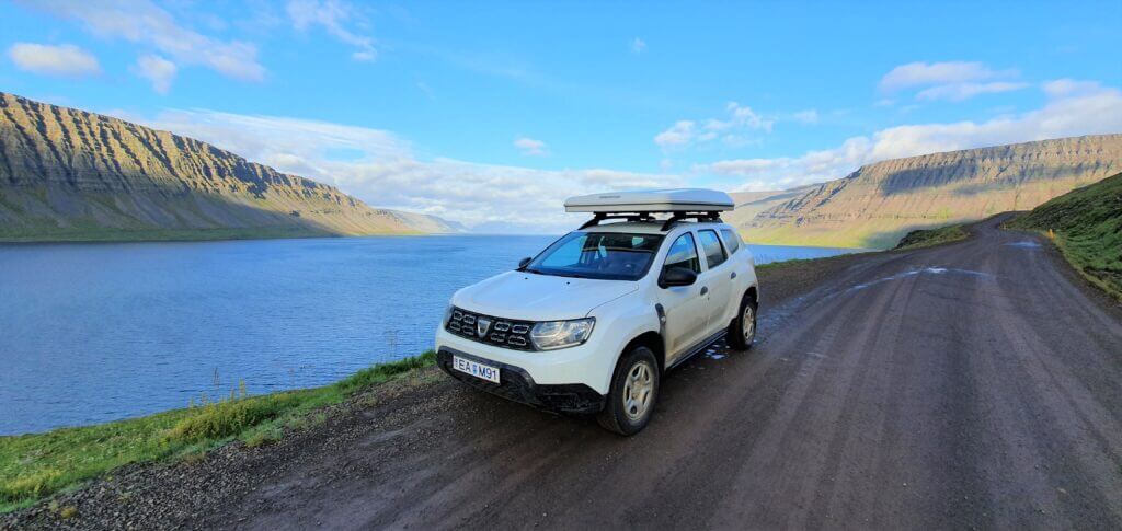
9. BILDUDALSVEGUR 63 TO PATREKSFJORDUR
Crossroads of the roads 60 and 63 or Bíldudalsvegur and Vestfjarðavegur
Summary
Worth visiting even with bad weather: yes, probably
Interesting index: 2 – great (1-amazing, 2-great, 3-nice)
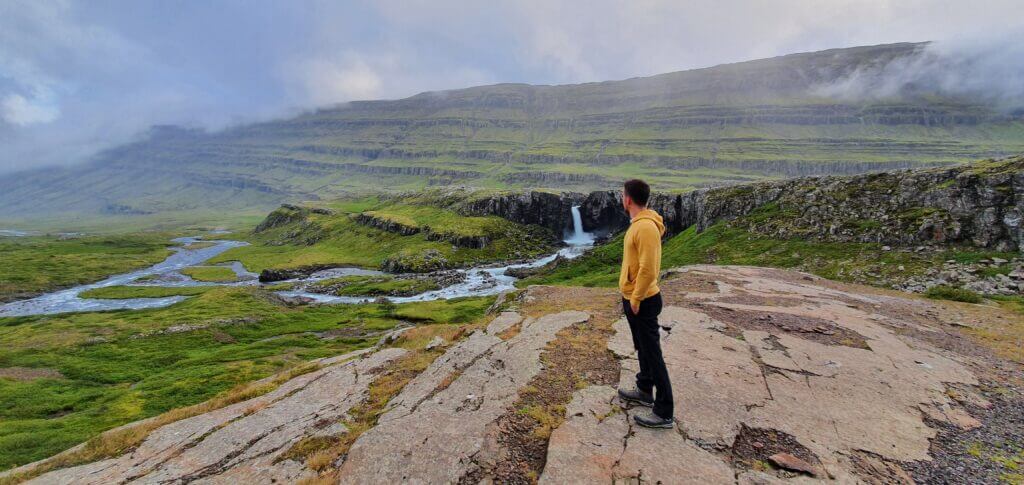
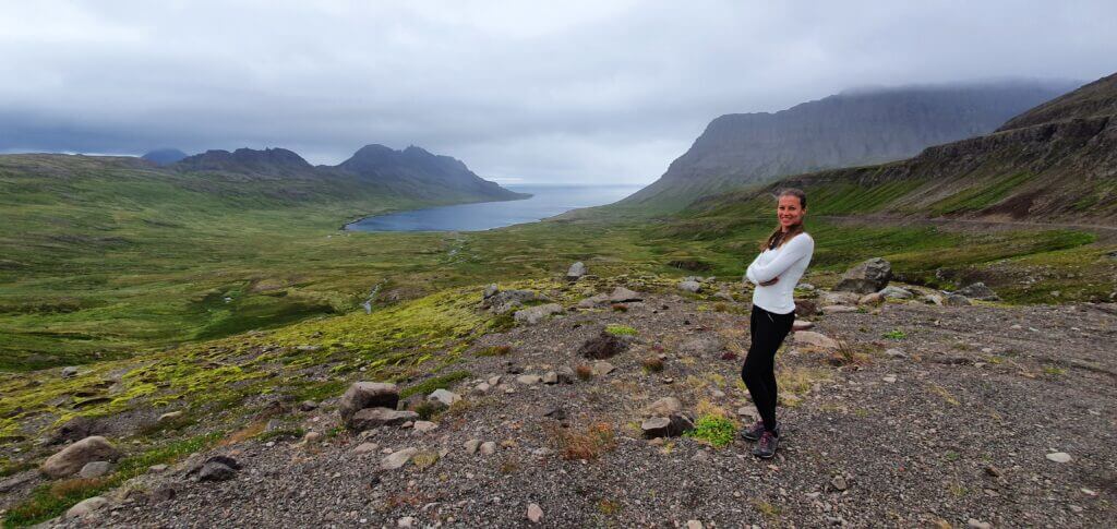
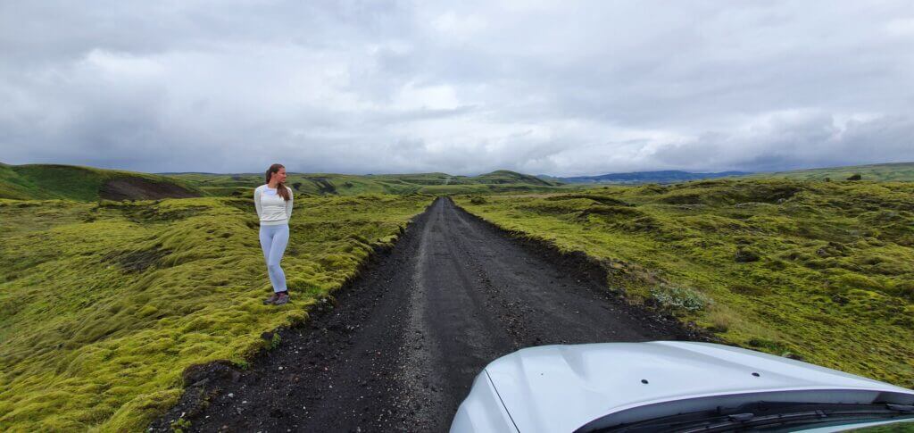
Bildudalsvegur is located in the western part of Westfjords. It’s one of the most scenic roads in Westfjords.
How to drive road 63, Bildudalsvegur
In summer, road 63 is accessible by any 2wd car. Read about how we chose our car. Or just get free discounts for your Icelandic car rental.
Road 63 consists of a combination of normal paved roads and semi-paved gravel roads with some potholes. And of a combination of mountain roads and coastal fjord roads. That means – absolutely OK with any 4wd and also fine with 2wd, you will just need to drive carefully and more slowly compared to Google Maps’ estimates.
Road 63 Bíldudalsvegur
Our experience with road 63
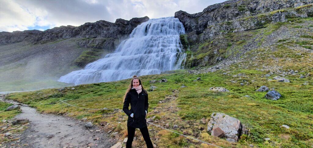
We were coming from the Dynjandi waterfall direction (road 60) and used the road to get to our final destination for that day – Látrabjarg cliffs.
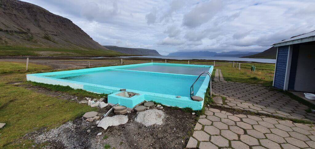
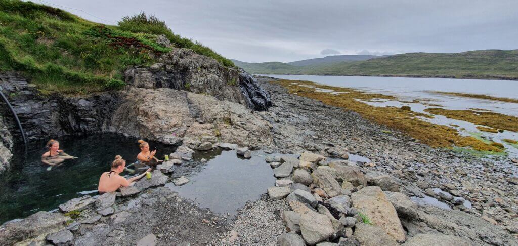
We didn’t have any problems driving the road with our Dacia Duster and made a quick stop at Reykjafjarðarlaug hot spring.
Tips about Bildudalsvegur
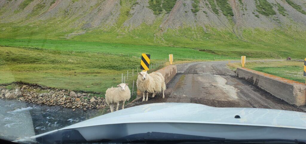
General advice as for any other semi-paved Icelandic road applies – beware big potholes, beware sheep on the road, drive really carefully if it rains heavily or snows, beware blind corners on the roads and don’t stop in the middle of the road.
8. F347 TO KERLINGARFJOLL
F347 near Kerlingarfjöll mountain resort
Summary
Worth visiting even with bad weather: yes (not pleasant but should be ok to drive)
Interesting index: 2 – great (1-amazing, 2-great, 3-nice)
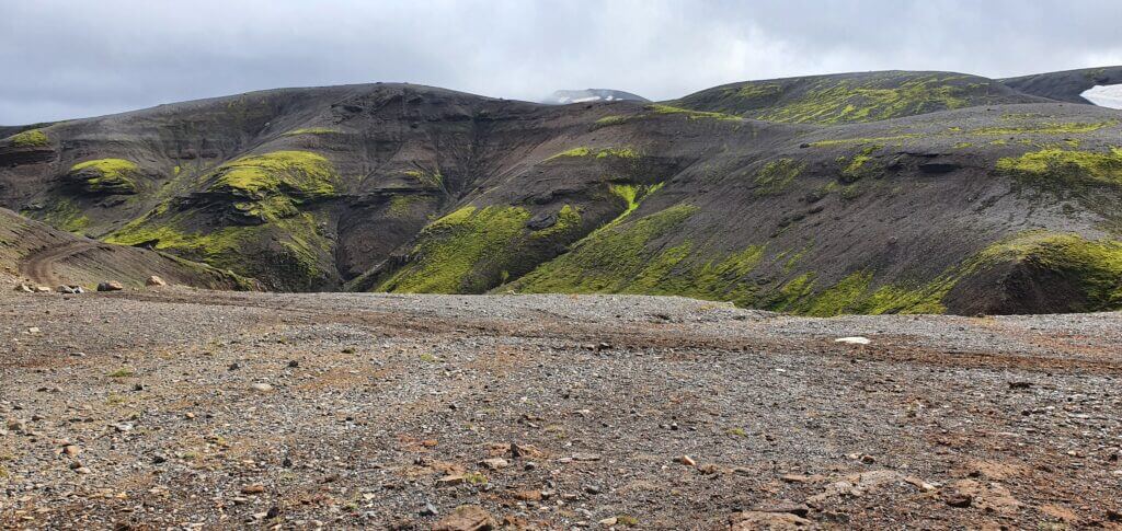
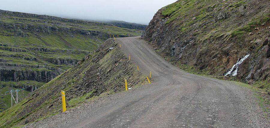
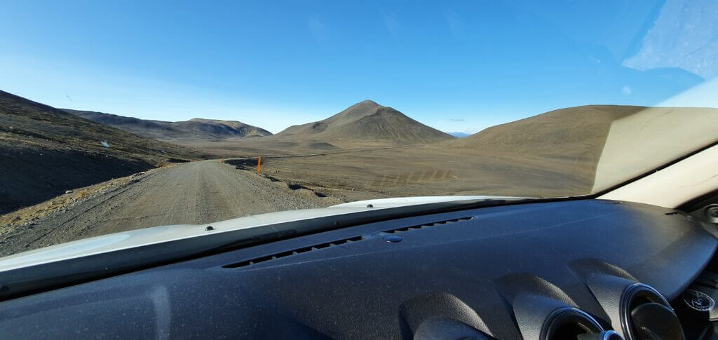
F347 is the only road leading to magnificent Kerlingarfjoll area. The road itself and the surrounding landscapes are picturesque as well.
How to drive F347
I do recommend a medium-sized 4wd car to drive F347.
The toughest part of the drive to Kerlingarfjoll is the last ascent of F347 towards the main area of Hveradalir. It’s quite steep and we’d seen several cars turning back, being afraid of making the ascent with their car. If you are interested in details, read our guide on Kerlingarfjoll. To sum up, you definitely need a medium-sized SUV to reach Hveradalir (or some big guts).
Read about how we chose our car. Or just get free discounts for your Icelandic car rental.
F347 road next to Hveradalir hot spring area in Kerlingarfjoll
Our experience with F347
F347 doesn’t have any river crossings and is mostly pretty similar to F35. The closer you approach Kerlingarfjöll Mountain Resort, the more the road starts getting more mountainous and more interesting.
Once you reach the mountain resort, the entire scenery gets really picturesque. We decided to continue as close as possible to the epicentre of the area – Hveradalir – by car. That meant, to continue driving the steepest part of F347 to the end of the road, or, Hveradalir area.
F347 near Kerlingarfjöll mountain resort
Tips about F347
The final part of the F347 road is the most challenging one and probably the steepest we drove on in Iceland. Again, there are no river crossings, just the road is really bumpy and towards the end quite steep. However, in good weather (read – no snow, no heavy rain) it’s definitely doable by any medium-sized SUV and better, like our Dacia Duster. If you feel unsafe, go slowly, turn 4×4 on or watch someone else go first in front of you.
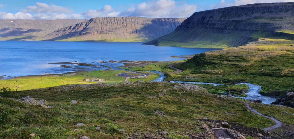
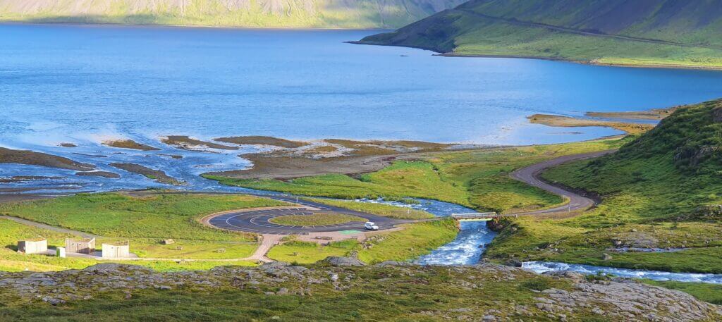
7. VESTFJARDAVEGUR 60 TO DYNJANDI
Road 60, or Vestfjarðavegur in Westfjords near Dynjandi waterfall on a sunny day
Summary
Worth visiting even with bad weather: yes, probably
Interesting index: 1 – amazing (1-amazing, 2-great, 3-nice)
Vestfjardavegur is located in the western part of Westfjords. It’s one of the most scenic roads in Westfjords.
How to drive road 60, Vestfjardavegur
In summer, road 60 is accessible by any 2wd car. Read about how we chose our car. Or just get free discounts for your Icelandic car rental.
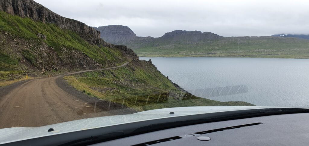
It’s a kind of semi-paved road with occasional potholes, so definitely not the best, but not an F-road as well. It’s doable by 2wd, you’ll just have to drive carefully and more slowly than Google times suggest.
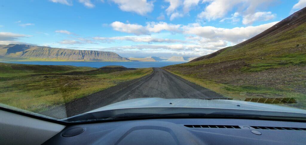
Road 60 (Vestfjarðavegur) between Þingeyri and Flókalundur
Our experience with road 60
We were coming from the Thyngeiri direction and used the road to get to Dynjandi waterfall and then towards our westernmost destination – Látrabjarg cliffs.
Road 60 is a beautiful fjord road. It firstly crosses the mountainous landscapes and then leads along the coastline. Views along the road are amazing and unique, though. The road is definitely worth taking.
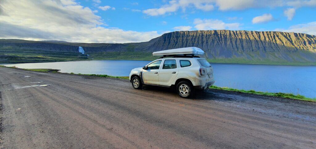
Road 60, or Vestfjarðavegur in Westfjords towards Dynjandi waterfall
Tips about Vestfjardavegur
General advice as for any other semi-paved Icelandic road applies – beware big potholes, beware sheep on the road, drive really carefully if it rains heavily or snows, beware blind corners on the roads and don’t stop in the middle of the road.
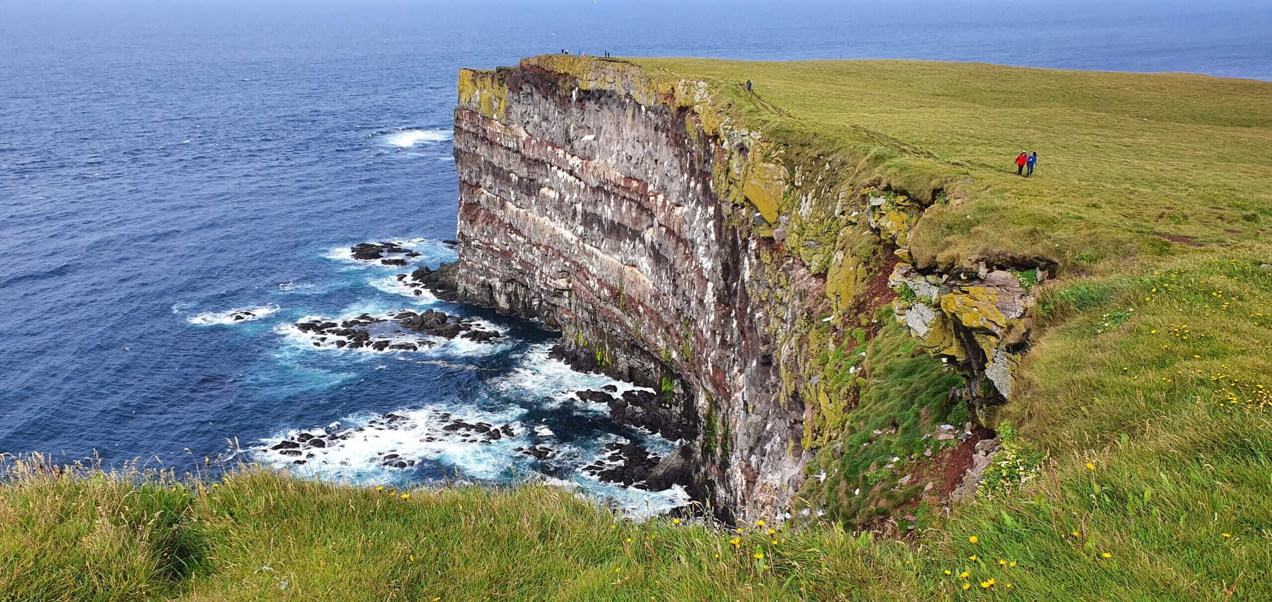
6. ORLYGSHAFNARVEGUR 612 TO LATRABJARG
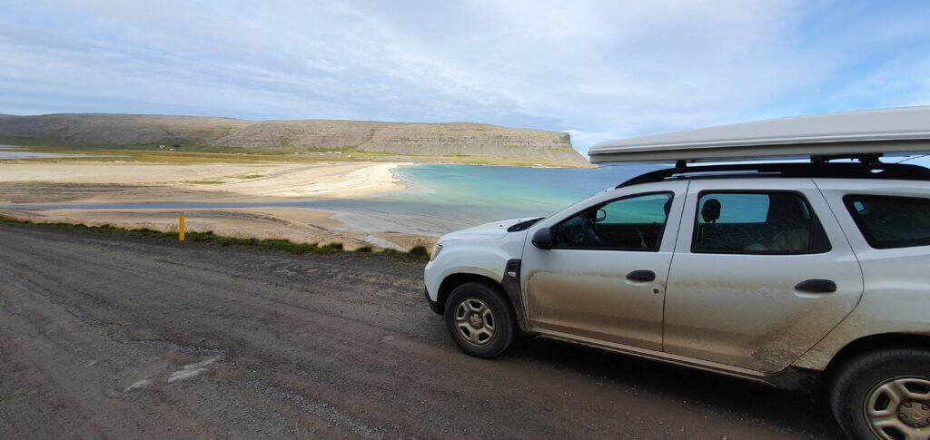
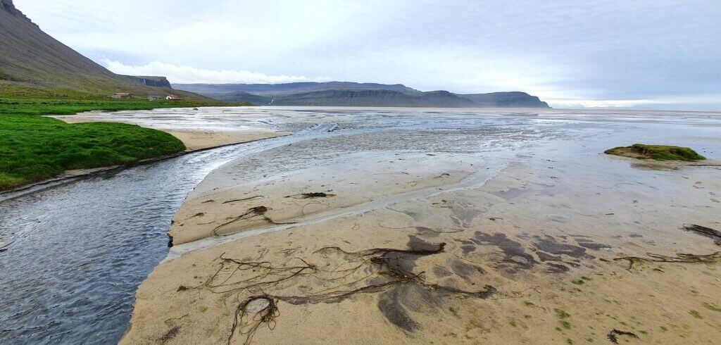
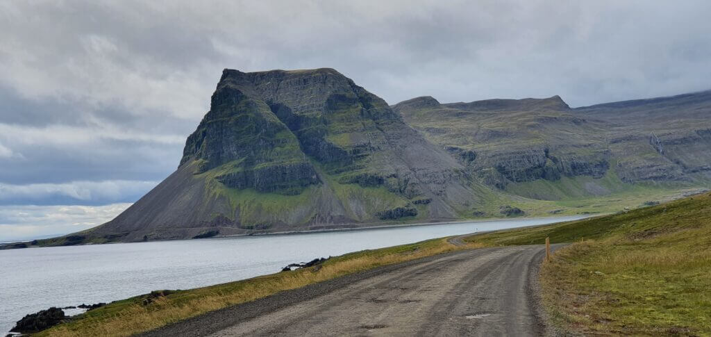
Breiðavík beach next to the road 612
Summary
Worth visiting even with bad weather: no, probably
Interesting index: 1 – amazing (1-amazing, 2-great, 3-nice)
How to drive road 612, Örlygshafnarvegur
Officially, 612 is accessible by any 2wd car. I do recommend a 4wd though, at least a smaller one. The road eventually gets rough and you may damage the undercarriage of your car if its ground clearance isn’t big enough. Read about how we chose our car. Or just get free discounts for your Icelandic car rental.
The last part of Örlygshafnarvegur is a rough, narrow gravel road with many potholes, leading across the mountainous area and sometimes even next to the coastal edge simultaneously. It’s definitely doable by any 4wd (not sure how it looks in rough weather, though). We also met several 2wd cars, but they were struggling at least. Sure, in good weather you can make the last part even with 2wd, it will just take you much longer than in 4wd and you will be probably blocking many 4wds waiting behind you.

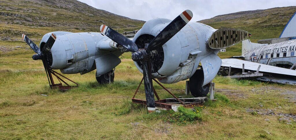
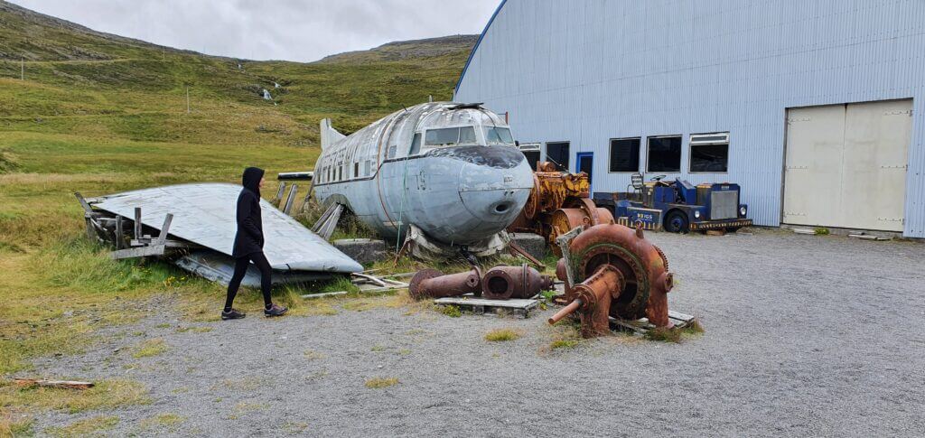
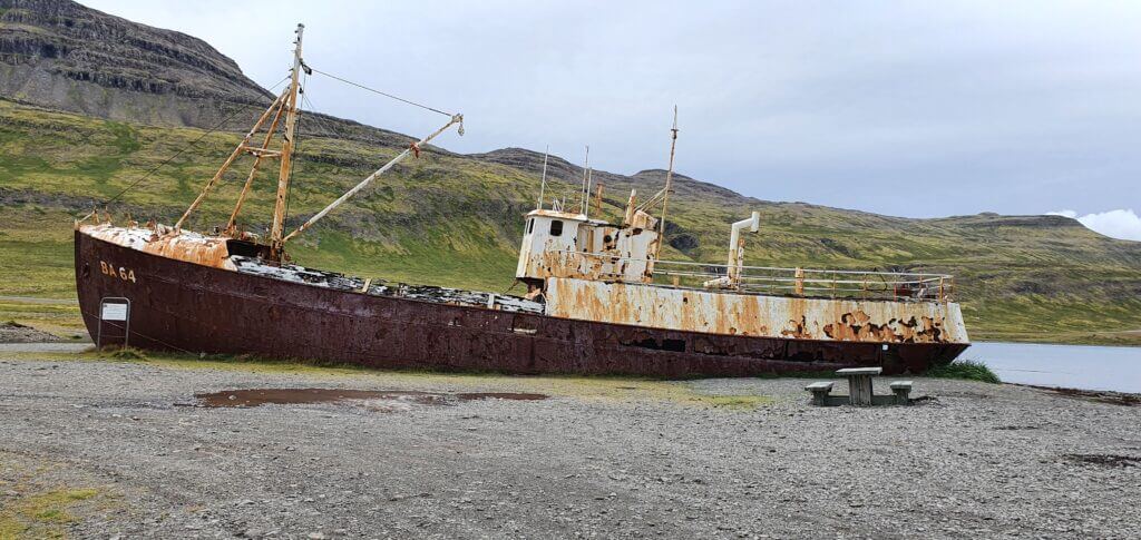
Our experience with road 612
The “rough part” of 612 is not very long, so if you are patient enough, feel free to take it even in 2wd. Views along the road are breath-taking. You will pass a shipwreck, a plane wreck, a car scrap yard, some small settlements and, most importantly, the picturesque Breiðavík beach. Is Orlygshafnarvegur dangerous? No, just don’t look down too much when driving near the edge of the mountain 🙂
Tips about Orlygshafnarvegur
We had already realized that the more difficult the name of the road in Iceland is to pronounce, the shittier the actual road will be. Orlygshafnarvegur was in line with this newly found rule of ours. Road 612 starts neatly but gets rougher and rougher with each additional kilometre.
5. OXI 939 TO EGILSSTADIR
Icelandic crazy Oxi road 939
Summary
Worth visiting even with bad weather: yes, probably
Interesting index: 1 – amazing (1-amazing, 2-great, 3-nice)
Oxi was the most surprising road we had driven. Öxi is a shortcut in the southeastern part of Iceland from Djupivogur towards Egilsstadir.
How to drive road 939, Oxi
In summer, Oxi is accessible by any 2wd car. For the more comforting feeling, I would drive it with at least a small 4wd SUV, though. The road is mountainous, steep and the weather may get ugly around the area.
Read about how we chose our car. Or just get free discounts for your Icelandic car rental.
Our experience with road 939
We turned to 939, or the so-called “Öxi road”, not knowing at that time why the road has a name. Many other roads in Iceland don’t have any name. Well, we shortly found out why. Öxi road looked like a former F-road, or at least something very similar to the F-road. It was a gravel road with a lot of potholes and right after turning to it, it started to be quite steep.
Source: https://www.dangerousroads.org/europe/iceland/6361-%C3%B6xi-pass.html
This was the time when we finally realized why this road has a name. Öxi was a quite steep mountain road with lots of turns, potholes and beautiful scenery alongside it. I’d never read about it beforehand, but whatever, that’s Iceland, right? Our weather wasn’t ideal at all, with fog getting heavier and rain starting to pour persistently. Hence, the entire Öxi experience had become quite scary at some point, with my girlfriend starting to have a facial expression as if she were in a horror movie. The entire drive took some fair 45 minutes in these weather conditions.

Tips about Oxi
Soon after driving on Öxi (from the south), we reached a small car park where we saw several people taking pictures. This spot wasn’t marked on the Google maps, nor had I read anything about it. Nevertheless, we parked our car, got out of it and realized why do so many people take pictures.
An amazingly picturesque valley full of waterfalls, fairytale-like green moss and cliffs emerged in front of us. Out of this world experience once again. One of the most beautiful photo spots of our entire trip. It was probably possible even to come closer to the waterfall valley by walking, but we remained satisfied with the look we just saw and continued through Öxi further.
4. STRANDAVEGUR 643 TO KROSSNESLAUG
Overview of Strandavegur, a.k.a. road 643
Summary
Worth visiting even with bad weather: yes, hopefully
Interesting index: 1 – amazing (1-amazing, 2-great, 3-nice)
Road 643 or Strandavegur is the only road leading to legendary Krossneslaug hot spring. It is the terminal road of the area.
How to drive road 643, Strandavegur
Road 643 heading towards Krossneslaug is definitely doable by any SUV in summer and definitely was doable by our Dacia Duster. Officially, you’re allowed to drive the road even with a normal 2wd car. However, road 643 is of the very few “normal” roads in Iceland, where I don’t recommend using a 2wd car. There are just too many potholes for it. Yes, you can do it also with 2wd, but take a lot of additional time. We’ve done it in about 2 hours (one way) and I would say with 2wd it’s additional 1-2 hours.
Read about how we chose our car. Or just get free discounts for your Icelandic car rental.
Semi-paved road 643 with many potholes
Our experience with road 643
Road 643 belongs to one of the most breath-taking coastal roads I’ve ever driven. So, it’s definitely worth taking. There are numerous spots where you just have an urge to stop, soak up the atmosphere and take photos to remember it. It’s also almost deserted, we met a single-digit number of cars during our drive.
Beautiful views along Strandavegur, road 643
Strandavegur could easily be classified as an Icelandic F-road. It doesn’t contain any river crossings but it contains almost everything else an F-road may contain. Potholes, gravel, narrow passages, steep parts, driving on the edge of the cliffs, … When I had googled about the road, one review stated that it’s the most dangerous road the guy had ever driven. Well, I don’t agree with that, it’s not necessarily dangerous, but it may be a bit scary at some parts.
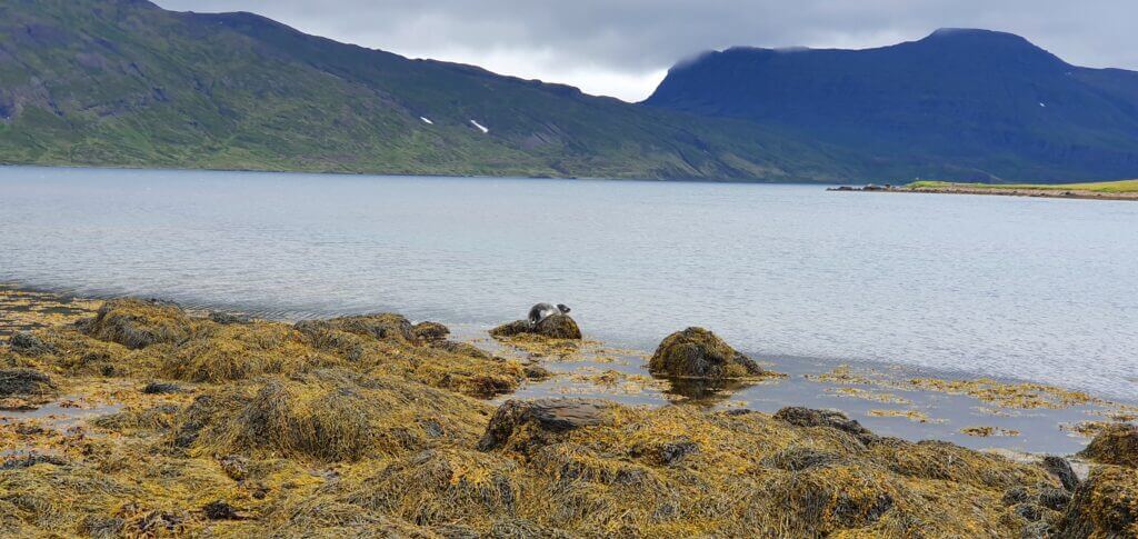
Surprise! Our first seals spotted on 643
Tips about Strandavegur
One of the highlights of the road was a moment when my girlfriend spotted a seal sunbathing on the rock in the sea. We stopped the soonest we could, got out of the car and observed a seal family enjoying their day under sunbeams. It was a once in a lifetime experience to spot wild seals out of the blue.
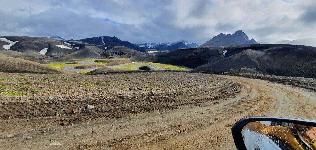
3. F905, F910 AND F894 TO ASKJA
F905 coming from Möðrudalsleið, towards Askja
Summary
Worth visiting even with bad weather: yes (not pleasant but worth the experience)
Interesting index: 1 – amazing (1-amazing, 2-great, 3-nice)
The roads leading to Askja are one of the most out-of-this-world roads, and so are the landscapes surrounding them.
How to drive F905, F910 and F894
Choose your car wisely to get to Askja. There are 2 major medium-sized river crossings along these roads. You’re gonna need at least a small to medium-sized 4wd car to drive them, preferably a medium-sized 4wd. Read about how we chose our car. Or just get free discounts for your Icelandic car rental.
We’ve covered all of the river crossings in detail in this post about Askja.
F910 towards Askja
Our experience with F905, F910 and F894
Once we turned to F905, a real adventure began. By “a real adventure” I don’t mean anything dangerous (at least with our dream weather it definitely wasn’t), just endless out of this world landscapes as if you were on another planet. F905 and the ones following were the most beautiful roads we drove and are definitely highlights of our entire Icelandic trip.
Different types of surface alternate between each other, each one the more beautiful than the one before. Gravel, clay, rocks, sand, sulphur – anything you can imagine, all of this surrounded by unforgettable views of the volcanic hills around. I don’t remember any river on F905 (maybe only some small ponds, which shouldn’t cause you any trouble at all).
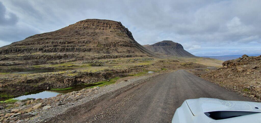
Möðrudalsleið road, the first gravel road you’re gonna encounter when coming from Egilsstaðir direction
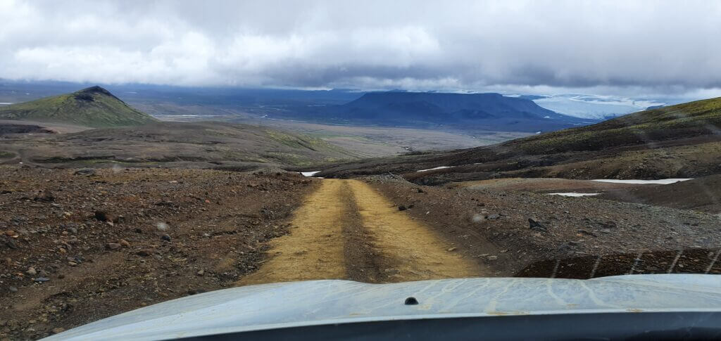
After spending some time on F905, the road turns into F910, which is very similar in its character to F905, just, once again a bit different. There are a few parts of the road where you’re going to drive literally on huge volcanic rocks and you have to drive really carefully not to damage your car – this is where a good 4×4 with high ground clearance happens to be useful. The most important part of an Icelandic F-road which you should pay attention to (as I wrote here) is the regular rivers and their existence on your road.
Vikraborgir car park, the closest point available on your route towards Askja/Víti crater
Tips about F905, F910 and F894
We’ve covered all of the details about river crossings, roads and Askja in this detailed guide about Askja.
Once you arrive at Dreki huts, you may already leave your car here and go for 8km hike towards Viti and Öskjuvatn and you’d definitely enjoy the beautiful mountain area even more. What we did, was to come as close to the actual geothermal Víti lake as possible and spend most of our time there.
To do that, you have to take the F894 road, i.e. slight turn right coming from F910 direction, standing in Dreki huts spot. The road is really rough and rocky, with volcanic stones and rocks about everywhere. At the end of the road, you will reach the car park with another toilet booth, called the Vikraborgir car park. This is where you have to leave your car.
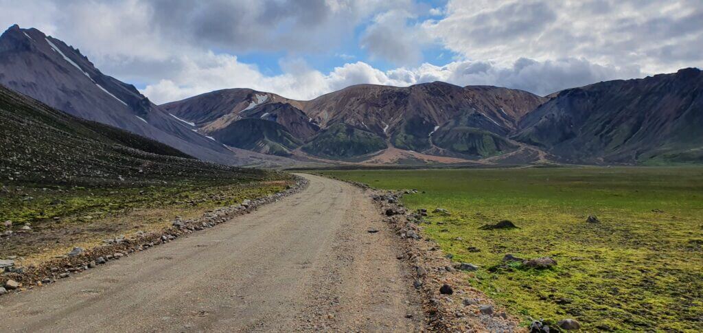
2. F208 SOUTH TO LANDMANNALAUGAR
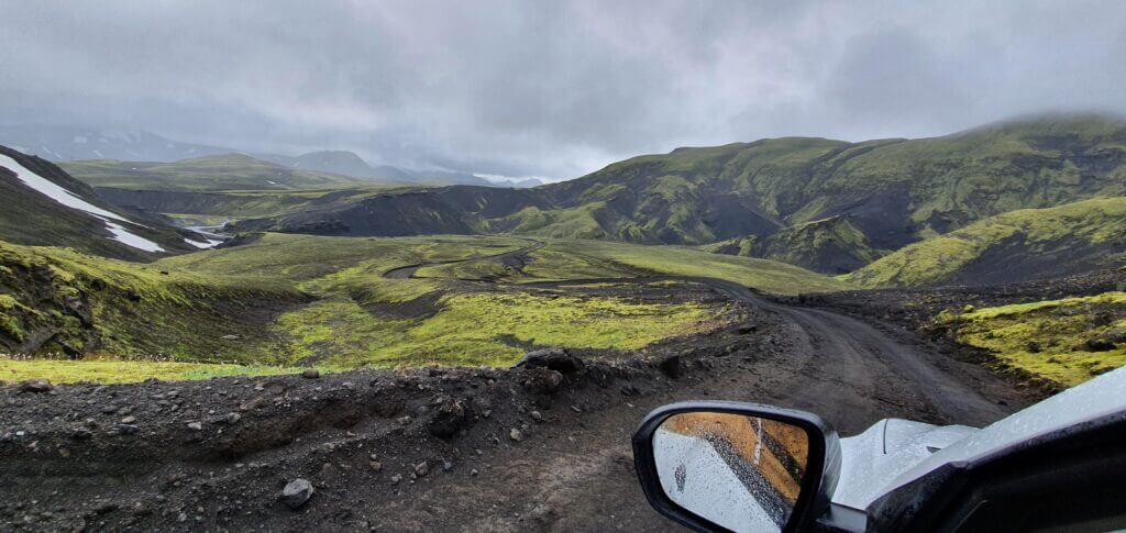
Road F208, or Fjallabaksleið Nyrðri, after crossing with F235 towards Landmannalaugar
Summary
Worth visiting even with bad weather: no
Interesting index: 1 – amazing (1-amazing, 2-great, 3-nice)
The southern part of F208 or Fjallabaksleið Nyrðri from Vik towards Landmannalaugar is one of the most beautiful Icelandic roads.
How to drive southern F208 from Vik
The southern part of Fjallabaksleið Nyrðri has everything that an Icelandic F-road may have – serious river crossings, narrow roads, potholes, gravel, sand, remoteness. You need a proper 4wd car, preferably at least a medium-sized SUV. Read about how we chose our car. Or just get free discounts for your Icelandic car rental.
There are several river crossings along the road, some of them smaller, some of them bigger. If you are interested in details about each significant river crossing, reach out for the detailed description of our journey.
F208, or Fjallabaksleið Nyrðri, after crossing with F235 towards Landmannalaugar
Our experience with southern F208
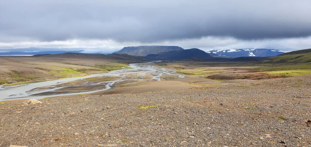
This is a once in a lifetime experience. I’ve never seen such out of this world stunning landscapes as on these roads. Southern F208, for me, was one of the TOP3 experiences in Iceland. Although driving the roads for some 6-7 hours we met just a handful of cars which is also a part of this secluded Icelandic experience. The wi-fi/cell network coverage sometimes works and sometimes not, so be prepared for that.
Road F208, south of Landmannalaugar, coming from Vik direction
After the junction of F208 and F235, you will be driving north to reach the Landmannalaugar. Along this part of the road, even more surreal landscapes continued to surround us and the journey was more than just worth it – it was spectacular.
There are several river crossings along the road, some of them smaller, some of them bigger. If you are interested in details about each significant river crossing, reach out for the detailed description of our journey.
Road F208, or Fjallabaksleið Nyrðri, south of Landmannalaugar, coming from Vik direction
Tips about southern Fjallabaksleið Nyrðri
Definitely take your time, start your ride early in the morning and focus on driving for 100% of the time. All of the rules for F-roads driving and river crossing do apply for southern F208. Once you are prepared and choose your car wisely, don’t be afraid though. The road is doable with the right car even if you are not that much experienced in highlands driving.
I also highly recommend a detour towards Langisjor lake via F235. See below.
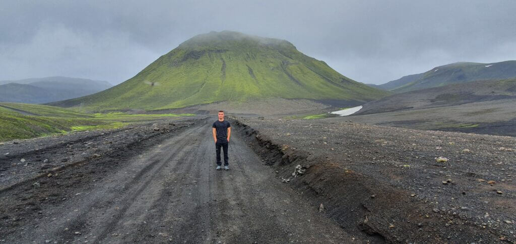
1. F235 TO LANGISJOR
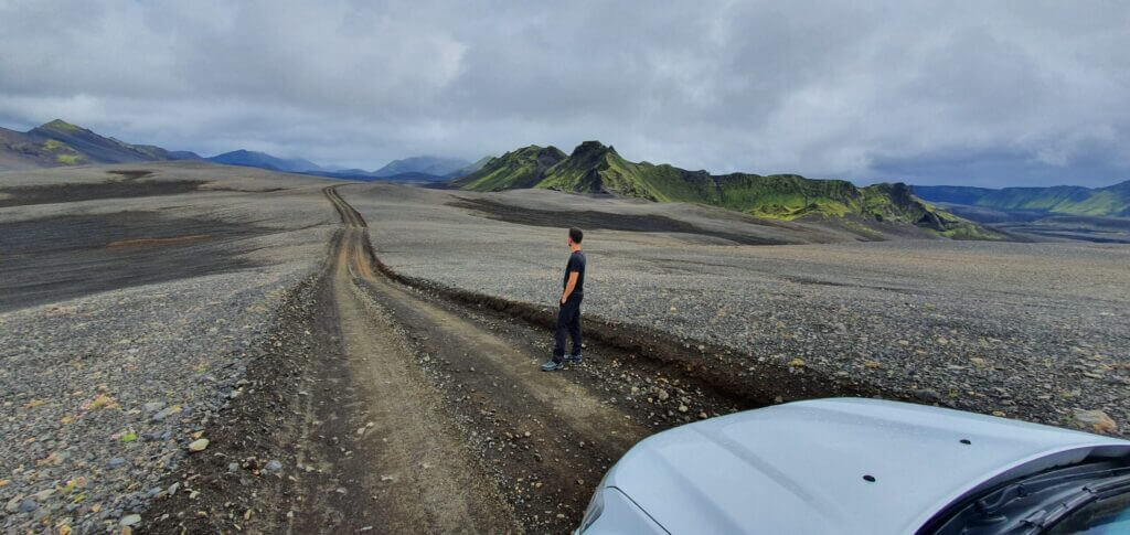
Out of this world landscapes surrounding F235 road towards Langisjór lake
Summary
Worth visiting even with bad weather: no
Interesting index: 1 – amazing (1-amazing, 2-great, 3-nice)
F235 towards Langisjor was the most beautiful and out-of-this-world road I’ve ever driven.
How to drive F235
When it comes to difficulties and obstacles, F235 is pretty similar to the southern part of F208. That means you’re gonna encounter rough terrain, river crossings (although a bit smaller compared to serious medium-sized ones at F208), sand and potholes. You need a proper 4wd car, preferably at least a medium-sized SUV. Read about how we chose our car. Or just get free discounts for your Icelandic car rental.
If you are interested in details about each significant river crossing, reach out for the detailed description of our journey.
Surreal landscapes on road F235 towards Langisjór lake
Our experience with F235
Landscapes everywhere along the road are out of this world and no words can precisely describe them. We were the only car driving the road. We reached the “Langisjór camping”, or at least that’s what Google maps said, which was just a small cottage with 2 nice modern toilets at the end of the world.
F235 was a great fit for my itinerary – non-touristy, amazing views, not so long, out of this world landscapes everywhere around. Beware of the bad weather though. If it gets too foggy, you won’t see a thing and your experience, although exciting thanks to driving, would deteriorate considerably.
If you are interested in details about specific river crossings, different parts of F208 and how to get to Langisjor and Sveinstindur, reach out for the detailed description of our journey.
This you should NOT do (stand on the moss). Road F235 after turning right from F208 towards Langisjór lake
Tips about F235
We continued back via the same F235 road to continue our journey to Landmannalaugar. Surely there are other roads to get back, but these are the roads you can’t find on Google maps, so I called them “unmarked roads” like the one towards Blautalón lake described for example here. Should we have a bigger car I would probably use a different way back as I usually try to avoid going on the same road twice.

![]() ask questions or get inspired in our community
ask questions or get inspired in our community