We were planning to drive multiple F-roads with multiple river crossings towards Landmannalaugar on this day. And also, hopefully, a detour to Langisjór lake and maybe even the Sveinstindur mountain peak hike. As the forecast stated cloudy or partly cloudy weather for both days (without rain or wind), we decided to go on. Nice weather was really important for this day!
We woke up on a cloudy morning without mist and the entire day’s weather forecast was supposed to be the same. This still qualifies to be good weather in Iceland so we decided to continue with our main plan. And this meant – let’s explore one of the most beautiful areas of Icelandic highlands!
Contents
F208 towards Landmannalaugar – 1st part
9:30-11:00
Worth visiting even with bad weather: no
Interesting index: 1 – amazing  (1-amazing, 2-great, 3-nice)
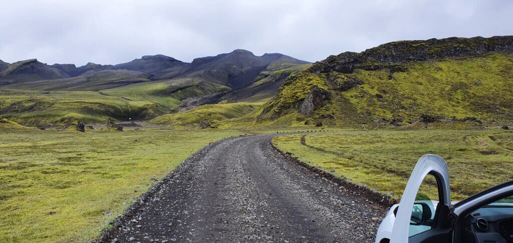
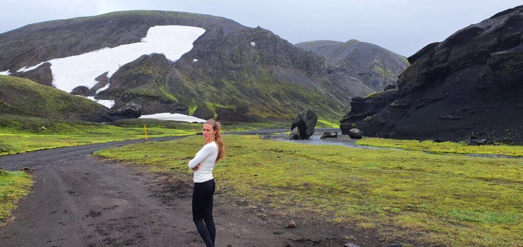
Road F208 near Vik towards Landmannalaugar
The table above applies to all F-roads in the area south of Landmannalaugar. F208 south is a once in a lifetime experience. I’ve never seen such out-of-this-world stunning landscapes as on these roads. The southern part of F208, for me, was one of the TOP3 experiences in Iceland. Although driving the roads for some 6-7 hours we met just a handful of cars which is also a part of this secluded Icelandic experience. The wi-fi/cell network coverage sometimes works and sometimes not, so be prepared for that.

The first part of the road bears no river crossings, just rough gravel F-roads with picturesque landscapes. First river crossing comes right after reaching Hólaskjól centre and during the day a ranger “guards” the river giving advice to travellers like us. She gave us a handout explaining how to cross the rivers and how to behave in a national park and asked me whether I have an experience with crossing Icelandic rivers. Well here we are, this is my favourite – how the hell are you supposed to be experienced with river crossing if they require you to be experienced for your first river crossing? I replied: “I studied it a lot” which was true. She gave us that type of smile as if she was saying “I see, tourists, see you when I’ll be getting you out of the river”, and we continued.
As all guides do state, I firstly examined the river by eyes and it looked to be some 40-60centimeters deep at the deepest point. “If you feel unsure about crossing the river, turn back,” everyone says. Well, the hell I was feeling unsure but let’s go. I’ve read what to do a thousand times and the worst case – we still have our car insured even for river crossings thanks to Lotus.
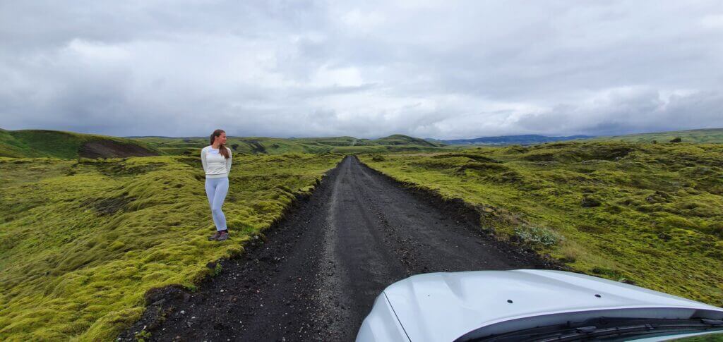
This you should NOT do (stand on the moss). Road F235 after turning right from F208 towards Langisjór lake
Laura at the front desk of Lotus car rental told us that she recommends going into the rivers on a 2nd gear on Dacia Duster because the 1st gear is usually used only for starting the engine and pulling the car off the ground. So I set the 2nd gear and went into the river really slowly, trying not to splash the water into the engine. Although not very smoothly, the car seemed to move. But, somewhere around in the middle of the river, I could feel the engine was about to die on this 2nd gear, so knowing you shouldn’t do this I switched into the 1st gear not wanting to risk the engine dying completely.
A few centimetres before the end of the river we reached the deepest point where the water felt really deep and the car was slowing considerably but the momentum of the car kept going and we successfully pulled the car out of the river on the other bank. Afterwards, I realized I forgot to turn 4×4 on. Well, first river crossing and first 2 mistakes. Never mind, we made it and now I know that i) I have to go on a 1st gear and ii) I shouldn’t forget to turn 4×4 mode on.
F235 towards Langisjór
11:00-12:00
Worth visiting even with bad weather: no
Interesting index: 1 – amazing  (1-amazing, 2-great, 3-nice)
We were driving according to our schedule so we continued with our plan to make a detour to the Langisjór lake. Shortly after turning right to F235 towards Langisjór, we encountered our first river crossing on F235. This one looked slightly less deep than the last one (some 30-40cm). I learnt from previous mistakes, so I shifted into 1st gear and turned the 4×4 mode on. Or at least that’s what I wanted to do. I realized I don’t know how to do it. There was a switch for 4×4 near the gear handle, but when I switched it to 4×4 it kept switching itself back to 2wd.
We panicked for a while because we didn’t want to go without 4×4 and we already didn’t have any network or wi-fi coverage on F235. After 30 minutes of studying the manual of the car (which I downloaded beforehand in English, just in case) I realized that it’s OK that the switch keeps coming back to 2wd mode and that 4×4 is already turned on after I just once switch it to 4×4 (regardless of the switch coming back to 2wd). What a relief. We started to laugh and proceeded with our 2nd river crossing. This one seemed easier compared to the first one. Are we now already experienced river crossers? Haha, I guess no.
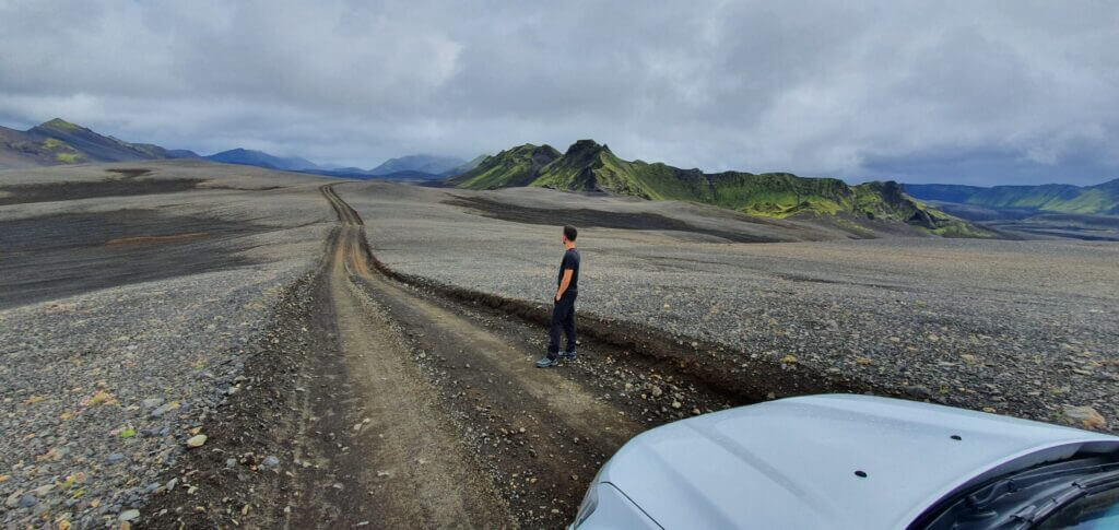
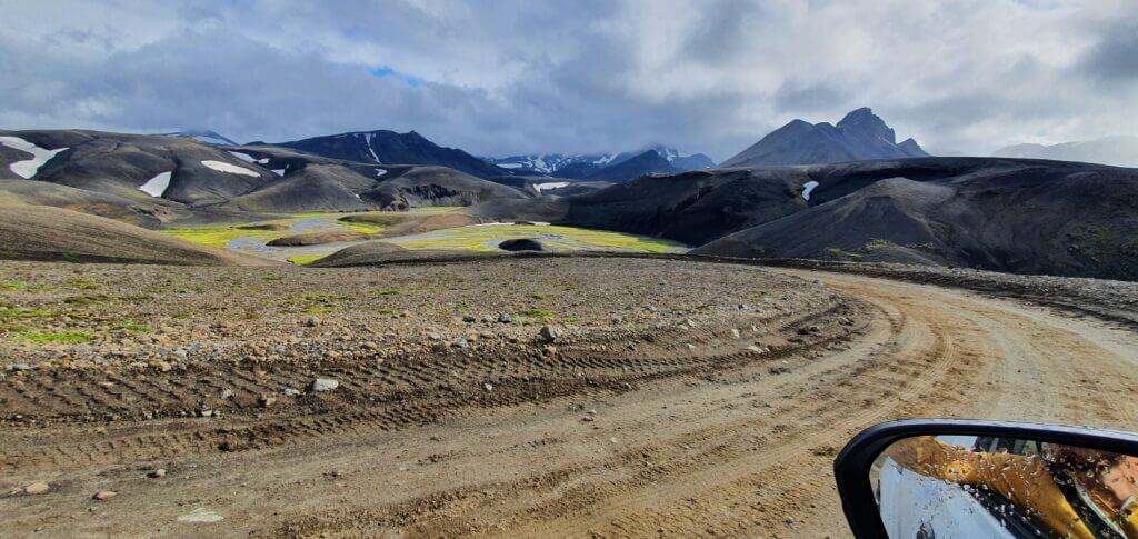
Out of this world landscapes surrounding F235 road towards Langisjór lake
Shortly thereafter we arrived at another river crossing, again a bit smaller (some 20-30cm) so now without any hesitation we repeated the steps above – turn 4×4 on, go slowly, don’t stop, don’t switch gears. Piece of cake. Then the next river crossing (as 20cm is not actually a river I guess, pond crossing would be a better phrase to use) came, then the next and next and next. Altogether we crossed some 10 ponds before finally arriving at Langisjór, none of them, however, was that big compared to the first one after Hólaskjól centre.
Langisjór
12:00-12:30
Distance from car park: 2 minutes
Time spent at: 20-45 minutes
Worth visiting even with bad weather: no
Physical condition needed: little
Interesting index: 1 – amazing  (1-amazing, 2-great, 3-nice)
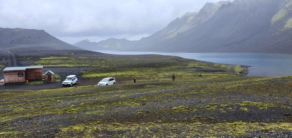
This was supposed to be Langisjór campsite according to maps. It just turned out to be a remote place with nobody being there.
Landscapes everywhere along the road are out of this world and no words can precisely describe them. We were the only car driving the road. We reached the “Langisjór camping”, or at least that’s what Google maps said, which was just a small cottage with 2 nice modern toilets at the end of the world.
Langisjór lake next to Langisjór campsite mark on the map
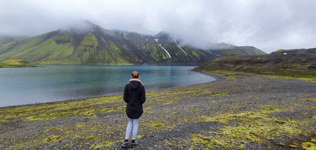
We continued to the point on Google maps named “Langisjór campsite” where the road ended. Wow, another car. One group of French tourists, apparently going fishing there, and us. That’s it for the entire area. Shortly we realized why they went fishing. The water in Langisjór had been crystal clear and the complete silence surrounding the area was both amazing and a bit scary at the same time. First time in my life I experienced what one may call “absolute silence”.
Sveinstindur hike
13:00-15:00
Distance from car park: 0 minutes
Time spent at: 2-3 hours
Worth visiting even with bad weather: no
Physical condition needed: medium to advanced
Interesting index: 1 – amazing  (1-amazing, 2-great, 3-nice)
After spending some time admiring the silence and beauty of Langisjór glacial lake we proceeded to our next stop – an attempt to hike the Sveinstindur mountain. Quick advice – definitely go only when the weather is nice! It’s not a very pleasant experience when it’s not. Trust me, we’ve experienced it.
Sveinstindur parking. This is how a parking lot in highlands looks like.
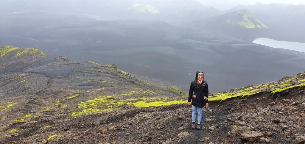
Sveinstindur seemed to be a great fit for my itinerary – non-touristy, amazing views from the top, not so long hike, out of this world landscapes everywhere around. Unfortunately, the weather started to be much foggier at the time of our visit and it even started to rain. OK, Icelandic weather, I told myself, we shouldn’t get discouraged by this. Well, I changed my mind later. It’s not a very good idea to climb Sveinstindur when it rains and when you don’t see anything because of the fog.
Sveinstindur hiking trail, somewhere near half of the road towards peak
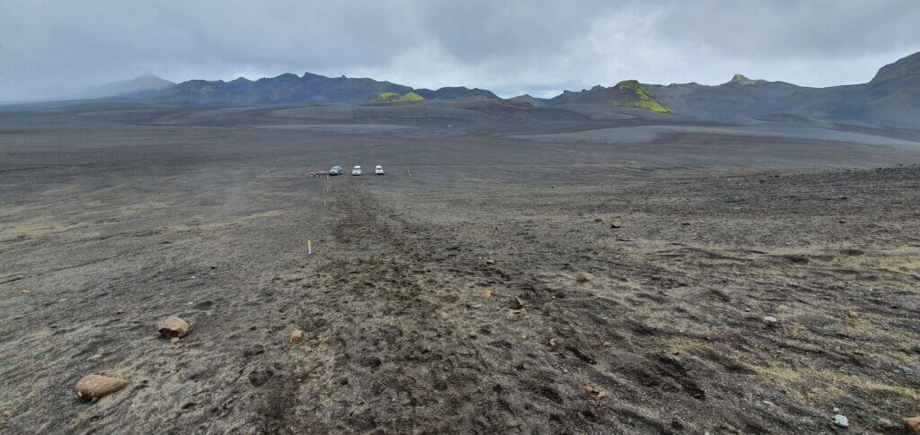
First of all, finding the start of the hiking trail was not an easy task at all. There are no signs indicating where should you go or park your car if you want to hike Sveinstindur. I just guessed – it’s not along the road we’d already driven (or at least I think so), it’s not near the lake, so let’s take the only road left – the road continuing on an unmarked F-road (described for example here). Shortly after pursuing the road, we found a car park with 2 cars, which I again guessed, is maybe a car park for Sveinstindur? Yes, probably I’m right – I realized shortly after seeing first yellow sticks indicating a hiking trail, though still no signs or names which would say “Sveinstindur”.
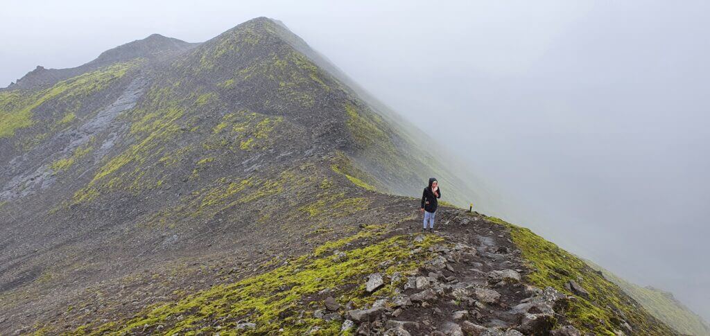
The upper part of the hike on Sveinstindur near Langisjor lake on a foggy day with slight rain
In the beginning, the hike seemed to be doable – the ground was OK to walk on, the visibility was so-so, the rain was light, so we continued. However, after some 20-30 minutes of hiking, we walked right into the big fog and we could see that everything above this point is covered in fog as well. Together with that, the rain intensified and the path got steeper and slippery. At this point, we decided to turn back, as it was not worth it to continue the climb when we couldn’t see a thing. On our way back, we met a really fast hiker coming back from the top so I asked him whether he’d seen anything from the top. “Not a thing” he replied, which just reassured me to continue on our way back to the car. It’s a pity but what should we do – next time.
Start of the Sveinstindur hiking trail. View towards improvised car park lot.
We continued back via the same F235 road to continue our journey to Landmannalaugar. Surely there are other roads to get back, but these are the roads you can’t find on Google maps, so I called them “unmarked roads” like the one towards Blautalón lake described for example here. Should we have a bigger car I would probably use a different way back as I usually try to avoid going on the same road twice.
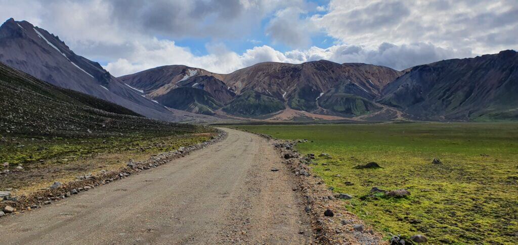
F208 towards Landmannalaugar – 2nd part
16:00-17:30
Worth visiting even with bad weather: no
Interesting index: 1 – amazing  (1-amazing, 2-great, 3-nice)
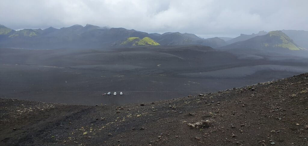
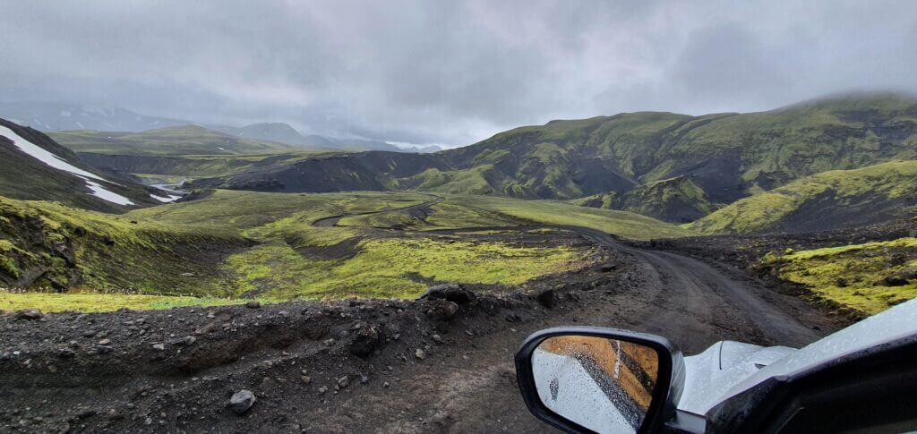
Once we reached the junction of F208 and F235 again, we continued north in the direction of Landmannalaugar. Even more surreal landscapes continued to surround us and the journey was more than just worth it – it was spectacular. Now having crossed 1-2 medium-sized rivers and many small ponds we already felt like experienced river crossers, right? Bullshit, I knew rivers in Iceland may be much trickier and treacherous, but I chose our roads specifically so that we can make it. At least that’s how I tried to plan the trip. As we were approaching Landmannalaugar, we started to observe more and more cars (compared to low single-digit numbers before, now it was like high single-digit) coming from the opposite direction.
Surreal landscapes on road F235 towards Langisjór lake
After another few kilometres, another river crossing appeared. However, now the river was so wide I wasn’t able to see the exact depth of the water after maybe the middle point of the river’s width. Every guide I’d read states that you should carefully inspect the path you want to go through when crossing the river, to be sure that depth of the ford is doable by your car. Or wait for another car to cross it to see how deep the ford actually was. Unfortunately, no car was in our sight at that time, so I had to opt for my backup option – walk the river on foot to see the depth.

I’m a passionate beach volleyball beginner and it’s not very pleasant to play beach volleyball in the winter in Slovakia. That being said, I already had experience with neoprene socks. Hence, I knew, exactly these may be useful in case I needed to ford a river on foot and not soak up my entire feet in. Of course, best would be gaiters/gumboots, but those I couldn’t pack to our small flight suitcase.
So, I put on my neoprene socks and went for the river wandering only to find out that depth of the river is same along entire width and we should be able to cross it safely (some 30-40cm) and so we did. Neoprene socks helped a bit but mostly with me not getting hurt by hard stones at the bottom of the river than keeping the ice-cold water away from my feet. These socks, unfortunately, don’t isolate completely against water leakage so my feet enjoyed some really cold shower anyway.
Road F208, or Fjallabaksleið Nyrðri, after crossing with F235 towards Landmannalaugar
After a short time, another wide river crossing, which I wasn’t able to assess from our side of the bank, emerged. Still feeling my cold feet, I grumbled for a while and repeated the procedure above. This time I had to wander inside the river for a while because the left side I entered seem too deep to me, reaching more than 60cm. I tried the right side and that one seemed a little shallower but still quite deep (around 40-50cm). When I was about to turn back from the middle of the river ford the big modified super-jeep car appeared. The driver watched me going out of the river and she followed by crossing the river without hesitation exactly via the right side which I assessed to be shallower. Then she stopped by our car, opening her window and giving me a wide smile.

She turned out to be a local ranger (that explains her going without hesitation via right side). She appreciated that I first wandered through the river by feet and said that she likes me doing that and that everyone should act like me. On top of that, she confirmed that yes, the right side of the river is the shallowest and she told me that 2 more river crossings are ahead of us before we reach Landmannalaugar area. I asked whether they are deeper, she replied: “yes, deeper”. Great, we told ourselves, there will be even bigger ones than this? Our river crossing courage deteriorated after this. Nevertheless, we continued.
F208 after crossing with F235 towards Landmannalaugar
Exactly as the ranger advised, shortly we arrived at our 4th medium river crossing. I examined the river by eyes and it looked very similar to the last one in terms of depth. Again right side looked like the shallowest one and this time I’d been already tired of wandering by feet in ice-cold water so we took our chances and attempted to cross the river via right side – luckily successfully. Again the depth seemed somewhere around 40-50cm. One funny moment before our crossing happened when another car coming from the opposite direction stopped just before the ford and they didn’t want to go first. They wanted to wait for someone else to cross first. Since there was no other car than us and I didn’t want to wait anymore, I decided to go for the cross and after us, the car followed the same path.
Road F208, just south of Landmannalaugar, coming from Vik direction
5th crossing emerged soon afterwards and the river looked slightly shallower than the last one, so after a short visual examination, we went for the crossing and without any problems. I just wonder whether/how bigger may these rivers get in case of heavier rain or in another season? Breath-taking views of Landmannalaugar surroundings started to emerge in front of us.
F224 to Landmannnalaugar
17:40-18:00
Worth visiting even with bad weather: if next day’s Landmannalaugar weather is good then yes
Interesting index: 3 – nice  (1-amazing, 2-great, 3-nice)
After many exciting hours spent admiring moon-like landscapes of F208 and F235, we finally reached a junction for Landmannalaugar and turned left accordingly to F224. Well F224 isn’t much appealing, it’s just a really bumpy gravel road with thousands of potholes. The only exciting thing about it is, that it leads to picturesque Landmannalaugar. And because of that, it’s definitely worth a drive. The road itself isn’t challenging either, just go slowly and focus on avoiding the biggest potholes to spare your car bumpers.
Road F208, south of Landmannalaugar, coming from Vik direction
The biggest challenge comes once you reach the end of the road. This is the place you’d probably already read about also elsewhere. There are 2 river crossings just before the camp which are not trivial. That’s why many people choose to park their car in the car park just before the river crossings and walk the remaining 10 minutes to the camp. We’d seen many Dacia Duster cars parking before the river crossings and even some bigger cars opting for that as well. To sum up, again – you may go for 2 medium river crossings to reach the Landmannalaugar camp (official name is Brennisteinsalda camping) by car or you may leave your car just before river crossings.
Since we had a rooftop tent and we needed to use the facilities of the campsite, we didn’t think long about what option to choose and soon I started inspecting the first river crossing. One of the few good things about Landmannalaugar being a touristy place is that it doesn’t take long to wait for another car to cross the river so that you can see which part is easy to cross. Unfortunately, in our case only much bigger cars were crossing the rivers at the time we were watching. Those cars didn’t give a damn about any river crossing rules and just went for the quick ford via the centre of the river splashing the water everywhere around.
Landmannalaugar river crossing. Picture taken from https://www.foodiebaker.com/day-4-iceland-travelogue/
I definitely didn’t want to go for another river wandering by feet in ice-cold water so I opted just for a visual inspection. The river looked to be of almost the same depth in its entire width, just the right part seemed to be a little shallower. We slowly went for the right part and the water level seemed to be highest so far compared to all fords before, but we managed to do it without problems.
Second river crossing seemed very similar and we had a chance to watch Suzuki Jimny crossing it right before us. They went for the left side, which seemed to be quite deep (50-70cm at least) and their car didn’t look stable at all during the ford but they’ve made it. So, we opted for the same side. This time almost entire wheels were below water during the ford and the car slowed considerably while I was driving, but we managed to reach the other bank and the car continued working as before. This had been definitely our biggest river crossing at that time.
Brennisteinsalda camping
18:00-
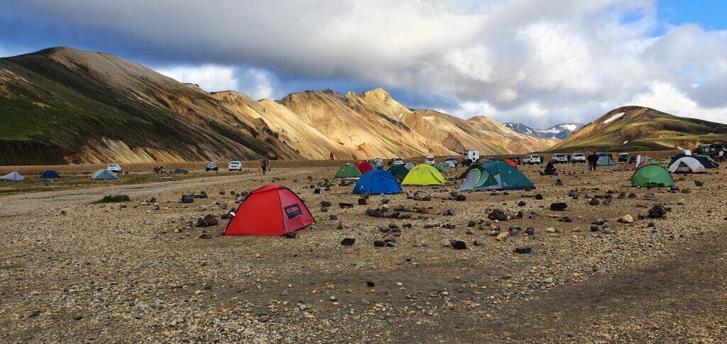
Landmannalaugar Brennisteinsalda campsite on a summer evening
Brennisteinsalda camping is the worst campsite we’ve been to in Iceland. It’s also the most expensive one. The only advantage (the one why everyone, including us, chooses to stay here) is its proximity to Landmannalaugar and that it’s the only campsite around. Toilets were in bad condition, I don’t remember seeing any showers, kitchen area was non-existent and we had to walk really long (5-7 minutes) from the spot where cars were supposed to camp to reach the campsite’s facilities like toilets or water pipes. Nevertheless, the surrounding views were more than just breath-taking when the weather was good – which was the case when we arrived.
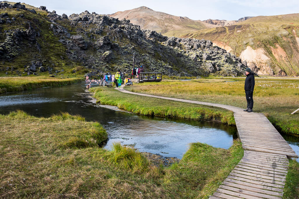
Brennisteinsalda hot spring
Distance from car park: 5-7 minutes from both car parks (in camp and before camp)
Time spent at: 20-40 minutes
Worth visiting even with bad weather: yes
Physical condition needed: little to medium
Interesting index: 1 – amazing (1-amazing, 2-great, 3-nice)
Brennisteinsalda hot spring is the only real natural hot spring (without any human interference) we’ve seen in Iceland so it’s definitely worth trying. It’s basically a stream of some really hot water (>50°C) flowing into the small river and you may bath in this river. There’s no place to change your clothes, just a wooden structure to put leave your clothes on, which also serves as an entrance to the hot river. The river actually isn’t so hot, maybe around some 26-30°C which doesn’t feel so fantastic when it’s like 5-10°C outside. But the more you approach the actual hot stream, the warmer it gets. The warmest place is, of course, just near the place where the stream flows into the water. This is the place you want to aim for (but so will all your fellow co-campers). You will probably have to wait some time to get to that source.
There’s also another smaller stream a few meters to the right, so these 2 streams flowing into the river are the hottest spots. The river is also really shallow, only some 40-70cm deep, so you basically have to lie in it to be covered by water. Nevertheless, it’s definitely worth the experience and it’s a really cool thing to try as Brennisteinsalda hotpot is one of the very few “wild” hot springs not artificially modified by locals.
Landmannalaugar hot spring. Picture taken from https://www.foodiebaker.com/day-4-iceland-travelogue/
More Videos

![]() ask questions or get inspired in our community
ask questions or get inspired in our community