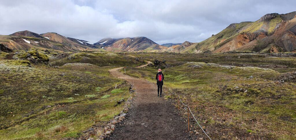
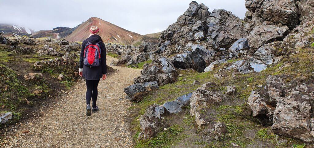
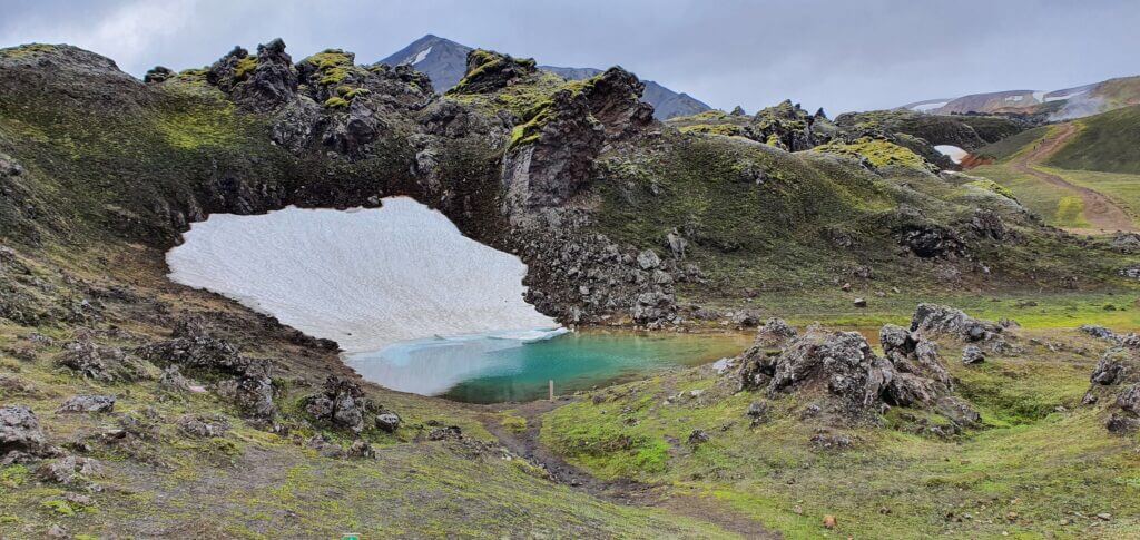
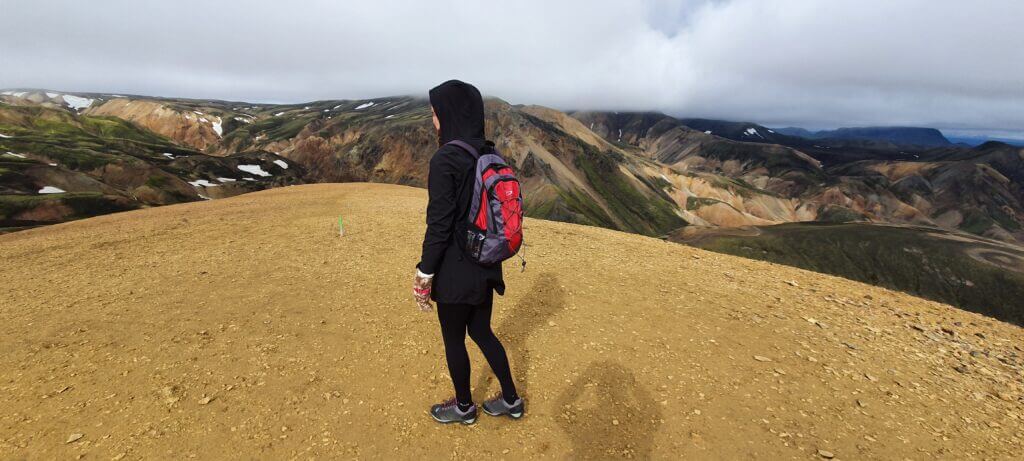
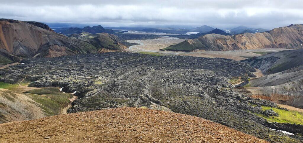
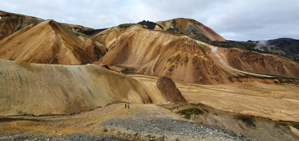
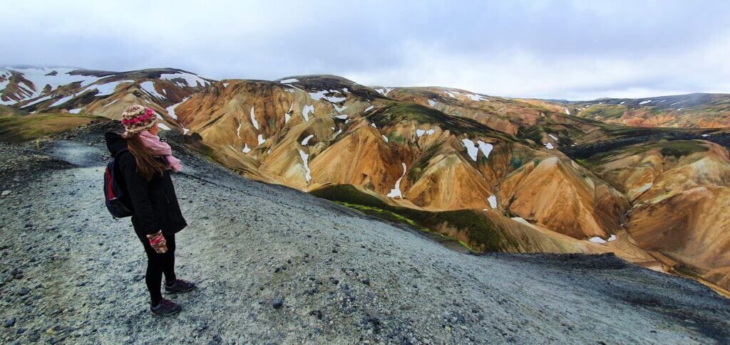
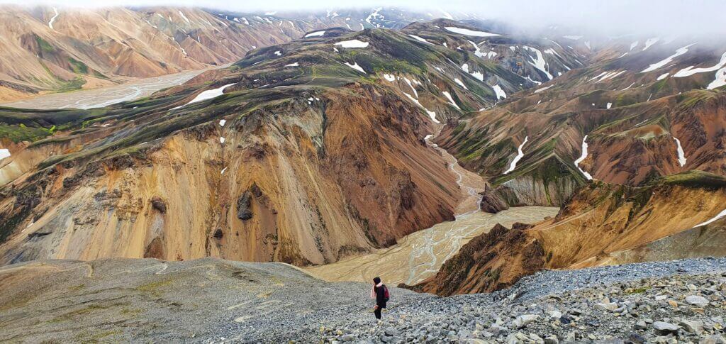
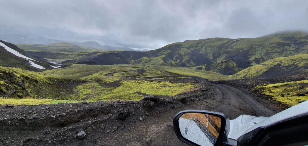
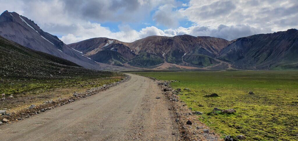
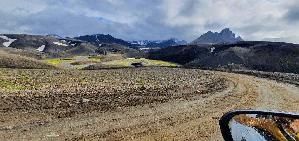
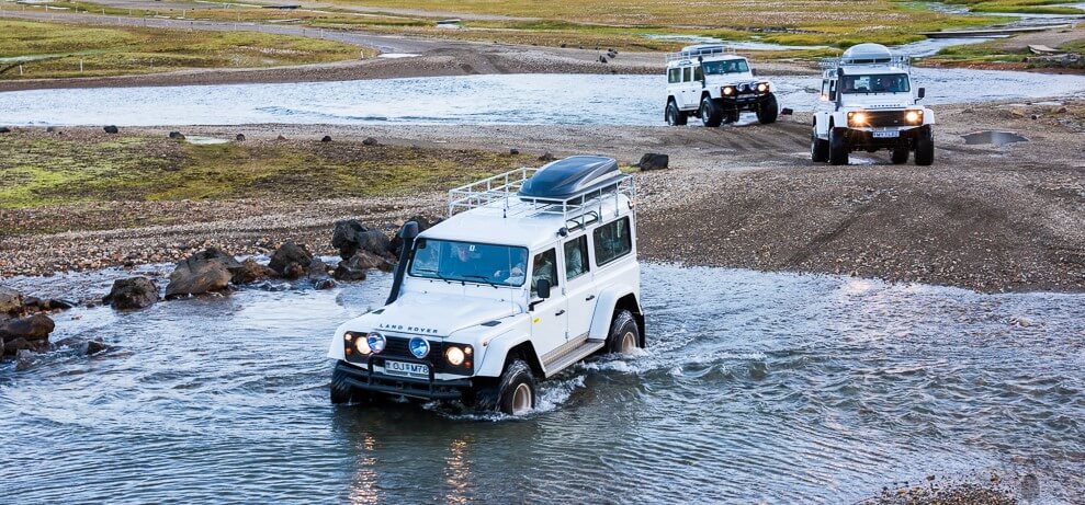
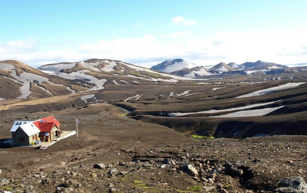
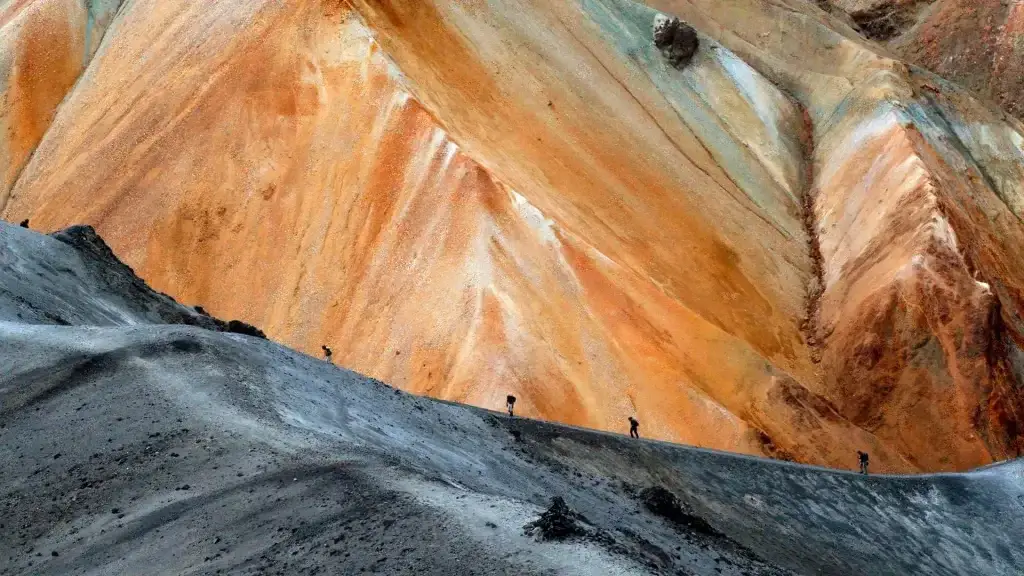
Landmannalaugar

Best Icelandic Landscapes

Best Icelandic Landscapes

Best Icelandic landscapes in our humble opinion 🙂

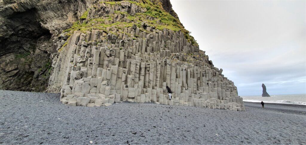
9. REYNISFJARA BEACH

Basalt columns Reynisfjara beach

Basalt columns at Reynisfjara beach

Summary

Distance from car park: 2 minutes 
Time spent at: 15-40 minutes 
Worth visiting even with bad weather: yes, just beware dangerous waves
Physical condition needed: little Interesting index: 1 – amazing (1-amazing, 2-great, 3-nice)

Reynisfjara beach is a beautiful easy-to-reach beach just next to the ring road, in the south, near Vik.

How to get to Reynisfjara

In summer, Reynisfjara is easily accessible by any 2wd car, by road 215. Read about how we chose our car. Or just get free discounts for your Icelandic car rental.

The main viewpoint for the beach with famous basalt columns is located here. That’s where we visited the beach. However, you may enjoy the beauty of the beach from several more viewpoints. For example, the eastern trail, which continues towards Vik to another black sand beach. If you are going for the Dyrhoaley cliffs, then there’s also a western viewpoint, here.
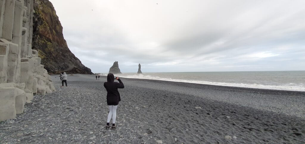
Reynisfjara beach

Reynisfjara beach at 9pm in the evening

Our experience with Reynisfjara

Reynisfjara was one of the most beautiful beaches we’ve seen around entire Iceland so it’s definitely worth a visit. All – the beach itself, the sea waves (which may be deadly, so keep a safe distance) and the nearby rock formations are stunning. Beware the strong wind, which we had a chance to experience, and I guess it may be even much stronger.

Tips about Reynisfjara

Don’t get too close to the sea waves. They may be deadly. Take care especially during windy weather. Several people have actually died at Reynisfjara beach, getting devoured by “sneaky” waves.

Reynisfjara beach is a touristy place. Want to avoid crowds of tourists? Read our guide on how to avoid tourists in Iceland.

There are also some beautiful Virtual Reality tours of Icelandic south coast and Reynisfjara beach.

8. STUDLAGIL CANYON
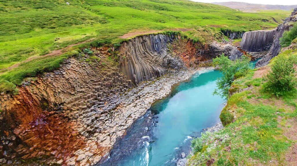
studlagil canyon west side

Stuðlagil Canyon, view from the western side

Summary

Distance from car park: 5 minutes / 30-40 minutes 
Time spent at: 20-40 minutes / 1-2 hours 
Worth visiting even with bad weather: yes, probably 
Physical condition needed: little / medium 
Interesting index: 1 – amazing (1-amazing, 2-great, 3-nice)

Stuðlagil canyon is a picturesque canyon near Egilsstaðir, but away from the main tourist areas.

How to get to Studlagil

In summer, Studlagil canyon alone is accessible also by a 2wd car, via road Jokuldalsvegur. It’s a semi-gravel road with some parts paved better and some worse, without any river crossings.

If you want your ride to be less bumpy, or if you want to combine Studlagil with a trip to Askja as we did, definitely go for a 4wd car. Read about how we chose our car. Or just get free discounts for your Icelandic car rental.

Two main viewpoints of the canyon do exist, i.e. there are two possible ways how to explore the canyon – from two different sides. Choose the side before your trip, because the time required for doing each side is significantly different.

The western side of Studlagil canyon

The western side we explored was the one suitable for those who don’t have enough time or energy to discover the canyon by walking along. On the western side (left from the south, right from Egilsstaðir) there’s a car park and stairs taking you down to the man-made viewpoint. It takes some 5 minutes to climb down the stairs. From there you may admire most of the beautiful views of the canyon. It’s not possible to descent down to the canyon itself though, compared to the other side.
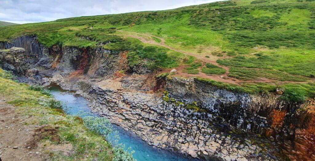
studlagil canyon western view

Stuðlagil Canyon, another view from the western side

The eastern side of Studlagil canyon

The eastern side is the one where it’s possible to hike down right to the canyon itself. The car park you will aim for is this one. You have to first cross the small bridge to the eastern side of the canyon, where you have to leave your car (or eventually you may leave your car somewhere before the bridge). Then you have to walk along the bank of the canyon towards the south to see its most beautiful part. From there you are able to descent down to the river and make some amazing photos from the close distance.

The entire roundtrip including canyon exploration will take you some 2-3 hours to complete at minimum.

Our experience with Studlagil

We combined the visit of Studlagil canyon with a visit to Askja. Our priority for the day was Askja. That meant that, once we arrived at Studlagil, we had already been awake and on our feet for some 13 hours on that day. That’s why we chose an easier way to explore the canyon – from the western side.

The canyon was beautiful, and we were able to admire it from the bird’s eye view. The disadvantage, of course, was that we couldn’t make a descent to the base of the canyon itself (which is possible from the eastern side).

Tips about Studlagil

If you are lucky enough, water in the canyon will be crystal clear (as in our pictures). In case you are not, the glacier water of the Kárahnjúkar dam will change the colour of the water to a less picturesque one. Nevertheless, the canyon columns will remain the same at any time 🙂

7. LJOTIPOLLUR
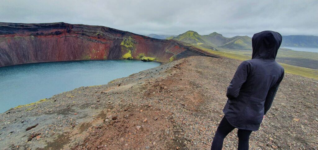
ljotipollur

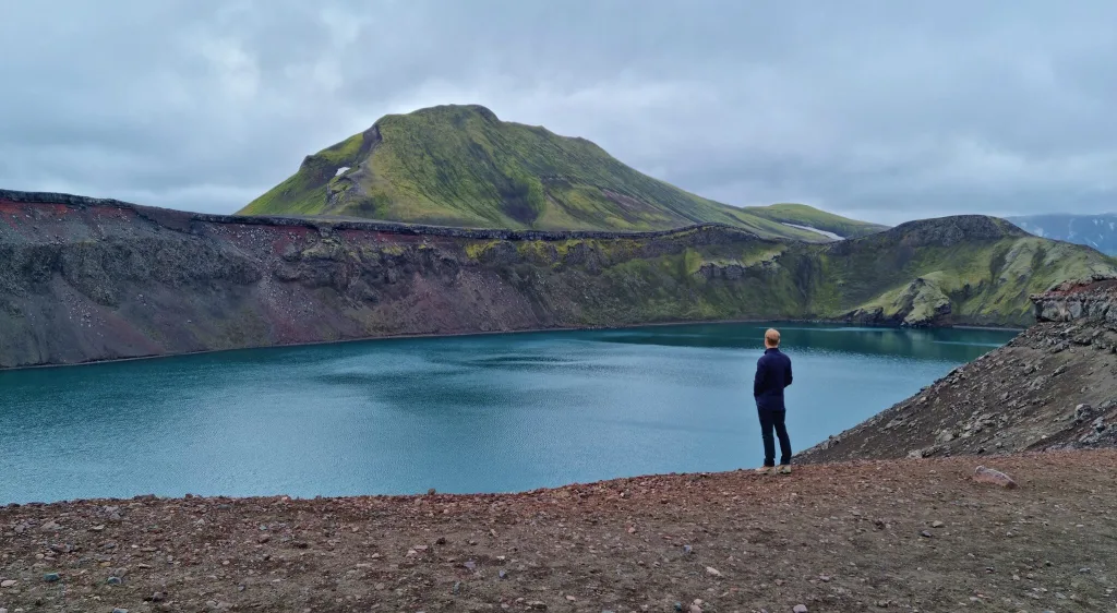
Ljótipollur

Summary

Distance from car park: 5 minutes ascent 
Time spent at: 15-30 minutes 
Worth visiting even with bad weather: yes, probably 
Physical condition needed: little 
Interesting index: 1 – amazing (1-amazing, 2-great, 3-nice)

Ljotipollur is a breathtaking colourful lake near Landmannalaugar.

How to get to Ljotipollur

You have to use the 4wd car to reach Ljotipollur. Read about how we chose our car. Or just get free discounts for your Icelandic car rental.
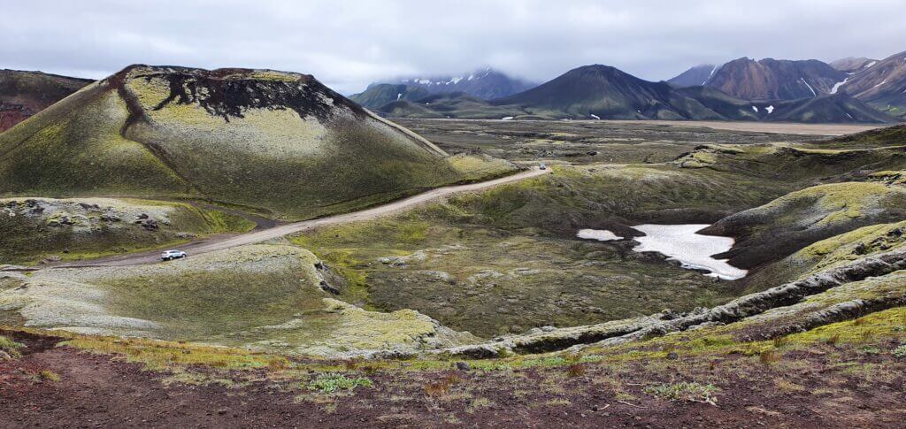
road to ljotipollur

F-road towards Ljótipollur

If you put name Ljótipollur into Google maps, it will navigate you towards detour in the right direction from northern F208 road, coming from Landmannalaugar direction (left, coming from F26 direction). There aren’t any good road signs so just follow Google and you should be fine. You’re going to drive nice black gravel road in the middle of nowhere which will end with the sign “cars forbidden” again in the middle of nowhere.
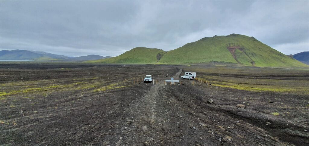
ljotipollur parking

Ljótipollur “parking”

The place with the sign served as a car park at the time of our visit (2 more cars were parked there, what a crowd). We left our car at this improvised car park and continued walking towards Ljótipollur direction a Google was pointing at.

Our experience with Ljotipollur

The walk from the parking lot took us around 5 minutes and a majestic red volcanic crater suddenly stood in front of us. We were the only visitors admiring it at that time (I don’t have any idea where were the people who arrived by the other 2 cars parked in the car park). Just us, absolute silence and the picturesque canyon filled with crystal clear water.
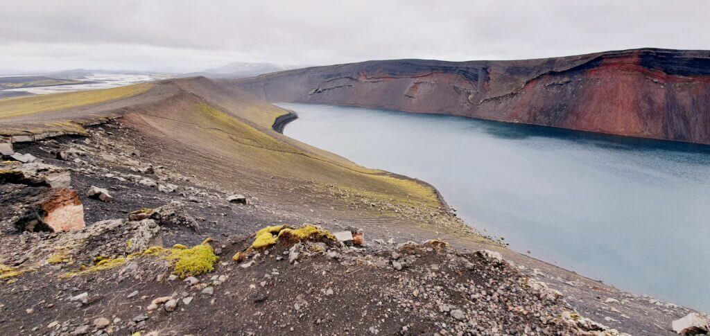
Ljotipollur trail

Ljotipollur trail

You can also hike around the Ljótipollur area but that wasn’t our plan, because Ljótipollur was already supposed to be the highlight of the area and we were really tired after our Landmannalaugar hikes.

Tips about Ljotipollur

Ljótipollur is a remote canyon where you will meet out of this world colours on every corner. It definitely didn’t look like a touristy place at the time of our visit and we had it all for ourselves at around 3 pm which is I guess still a peak hour.

6. LATRABJARG
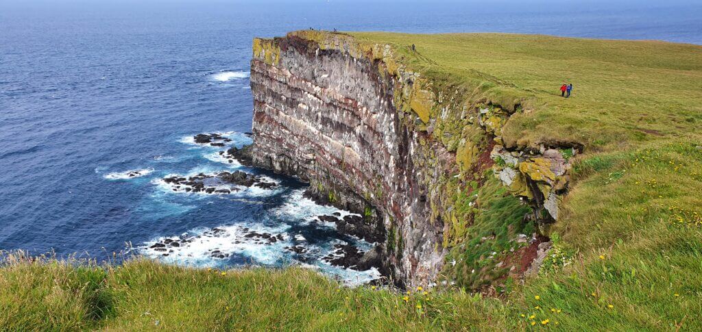
latrabjarg westfjords

Látrabjarg on a sunny day

Summary

Distance from car park: 2-15 minutes 
Time spent at: 20-60 minutes 
Worth visiting even with bad weather: no, probably 
Physical condition needed: little 
Interesting index: 1 – amazing (1-amazing, 2-great, 3-nice)

Látrabjarg cliffs are gigantic cliffs at the westernmost point of Iceland.

How to get to Latrabjarg

Latrabjarg is officially accessible also by the 2wd car in the summer. Nevertheless, I recommend you to have a 4wd car to get there. Not only will it be safer, but also quicker and less bumpy. The last part of the road 612 leading there could easily be an F-road. It’s a gravel coastal road full of potholes. It doesn’t contain any river crossings, though.

Read about how we chose our car. Or just get free discounts for your Icelandic car rental.

Our experience with Latrabjarg

We spent some time observing strange puffin flights and their landing, often, right next to us. Truly once in a lifetime experience. You may hike along the edge of the cliff as long as you want. We did so for some 15 minutes and then turned back. Although Latrabjarg was the place where we saw the biggest number of cars parked in Westfjords, it still didn’t seem to be crowded because of the size of the entire area.
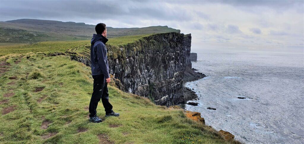
latrabjarg cliffs

Látrabjarg cliffs

To conclude – Latrabjarg is definitely worth making a detour.

Tips about Latrabjarg

Not only are Latrabjarg cliffs the westernmost place in entire Europe, it is also the place with one of the most unique floras and faunas. Secondly, the actual Latrabjarg cliff is more than just magnificent. It’s huge and admirable. And as a bonus, guess who is here? Puffins!
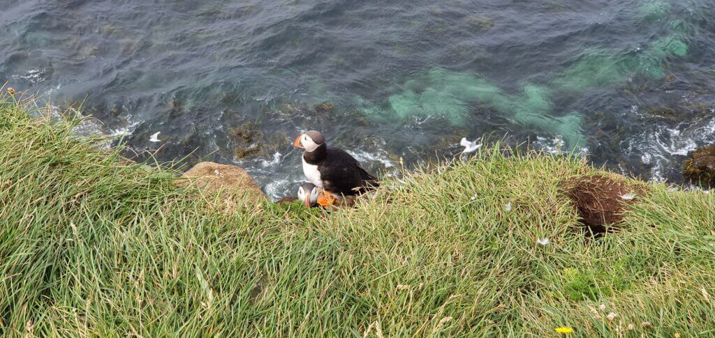
puffins at latrabjarg

Last puffins spotted during our journey. At Latrabjarg

During our entire 12-day trip this was the first and last place where we saw puffins. Later on, I read that Latrabjarg is a place where “it’s guaranteed to see puffins”. It seems to be so!

5. SIGOLDUGLJUFUR CANYON
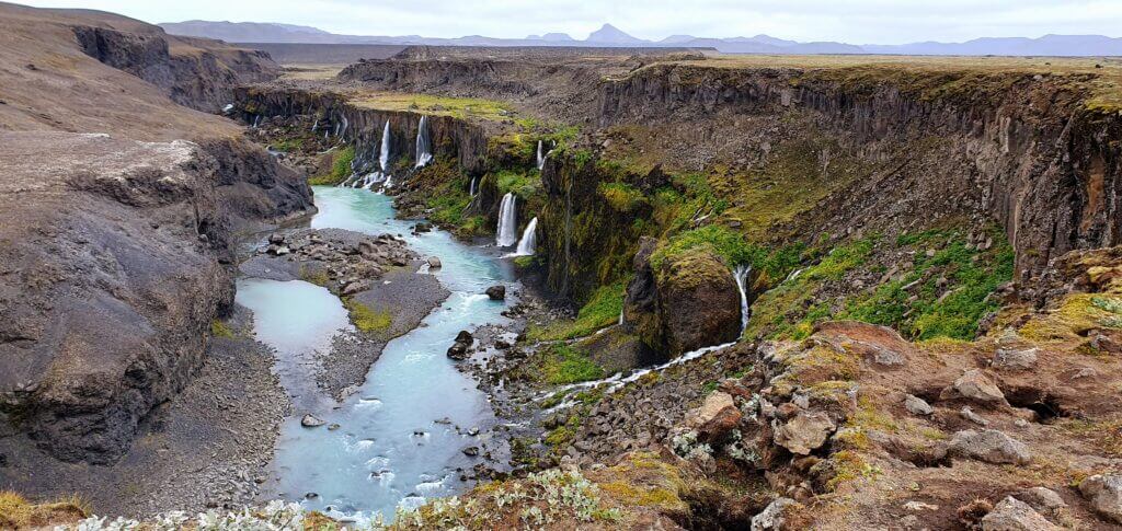
sigoldugljufur canyon

Sigoldugljufur canyon. A remote, magical, non-touristy place.

Summary

Distance from car park: 10 minutes 
Time spent at: 20-40 minutes 
Worth visiting even with bad weather: yes, probably 
Physical condition needed: little 
Interesting index: 1 – amazing (1-amazing, 2-great, 3-nice)

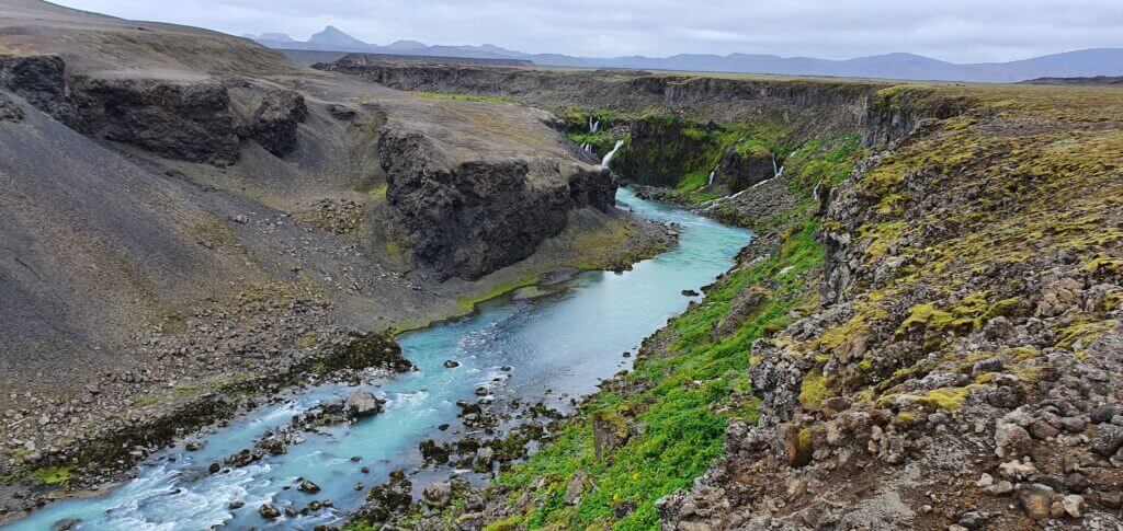
Sigöldugljufur canyon is a secluded canyon located north of Landmannalaugar.

How to get to Sigoldugljufur

Although the northern part of F208 leading to the canyon is just a normal gravel road, you still officially need the 4wd car, because it’s an F-road. You don’t need any hardcore jeep to reach it, however. Read about how we chose our car. Or just get free discounts for your Icelandic car rental.

Google maps are quite precise with the location of the canyon, although you won’t find any road signs indicating it, so you have to rely solely on Google maps. The canyon is located on the right side of F208 coming from the Landmannalaugar direction (i.e. naturally on the left side coming from the F26 direction). The only sign telling you “there’s something nearby” is the little car park near the spot which is the closest point connecting the road and the canyon marked on Google maps.

When you leave the car park, you continue walking along the unmarked gravel road (used only by locals) and you keep on the left side of it, exactly as suggested by google maps. After some 10 minutes of walking, you will arrive at the right bank of the canyon and a huge network of small rivers and waterfalls of unbelievable colours will emerge in front of you.
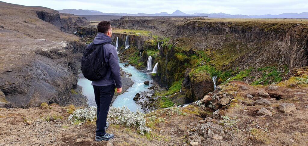
sigoldugljufur canyon

All alone at Sigöldugljufur canyon

Our experience with Sigoldugljufur

You will literally find yourself as in the middle of the fairy tale, especially if you’re as lucky as we were, and will be there all by yourself.

Sigöldugljufur canyon was our favourite canyon in Iceland because it was the least touristy and, in our opinion, the most beautiful. With all its remoteness it embodies for me the spirit of Iceland, i.e. a picturesque hidden place in the middle of nowhere.

Tips about Sigoldugljufur

There’s actually no marked trail, so unless they make one anytime soon, you’re going to slightly break the rules, as you will be walking on an “unmarked path” and therefore destroying Icelandic nature a bit. We tried to go the same way back to spare the nature of our footsteps. That being said, I think it’s inevitable someone will build a marked trail heading to the canyon soon as it’s becoming more and more touristy from what I’d read before our trip.

It’s also possible to continue several kilometres ahead along the valley, so it’s just up to you how far you want to go. You are able to see the major part of the canyon already from the first moment you have it in your sight, however. That’s exactly what we did – admired it for a couple of minutes and didn’t continue further along the valley.

4. LANGISJOR AND SVEINSTINDUR
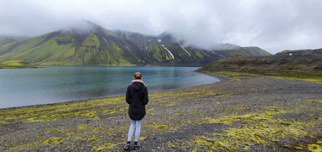
Langisjór lake

Langisjór lake next to Langisjór campsite mark on the map

Summary

Distance from car park: 2 minutes 
Time spent at: 20-45 minutes Langisjor, 2-3 hours Sveinstindur
Worth visiting even with bad weather: no 
Physical condition needed: little for Langisjor, advanced for Sveinstindur
Interesting index: 1 – amazing (1-amazing, 2-great, 3-nice)

Langisjór is a huge glacial lake located far away from any populated areas.
Sveinstindur is the tallest peak in the area.

How to get to Langisjor

Langisjor and Sveinstindur are not easy to access. You will definitely need at least a medium-sized 4wd car. There are several river crossings, some of them with small rivers, some of them with medium-sized rivers. Read about how we chose our car. Or just get free discounts for your Icelandic car rental.

If you are interested in specific details about getting to Langisjor and types of river crossings you will have to encounter, read our post about getting to Langisjor.

We reached the “Langisjór camping”, or at least that’s what Google maps said, which was just a small cottage with 2 nice modern toilets at the end of the world. We continued to the point on Google maps named “Langisjór campsite” where the road ended.
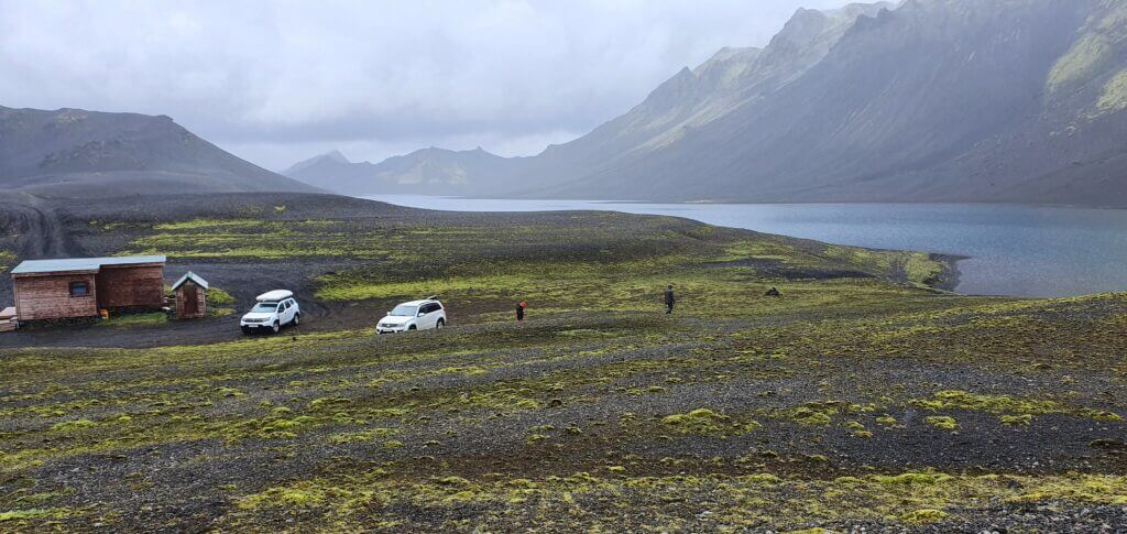
Langisjór campsite

This was supposed to be Langisjór campsite according to maps. It just turned out to be a remote place with nobody being there.

Our experience with Langisjor

The water in Langisjór had been crystal clear and the complete silence surrounding the area was both amazing and a bit scary at the same time. First time in my life I experienced what one may call “absolute silence”.

You may just walk to the lake and enjoy its marvellous water and atmosphere around. There’s also a small hill nearby, which you may climb as well if you are up to.

Tips about Langisjor

The campsite looked a bit hostile for camping in our opinion. The only facilities there were toilets. So be aware of that, when planning your trip.

Langisjor was also one of the least touristy places we had been to during our trip around Iceland.

How to get to Sveinstindur

Sveinstindur is just next to the point named on Google Maps as “Langisjór camping”.

First of all, finding the start of the hiking trail was not an easy task at all. There are no signs indicating where should you go or park your car if you want to hike Sveinstindur. I just guessed – it’s not along the road we’d already driven (or at least I think so), it’s not near the lake, so let’s take the only road left – the road continuing on an unmarked F-road (described for example here).
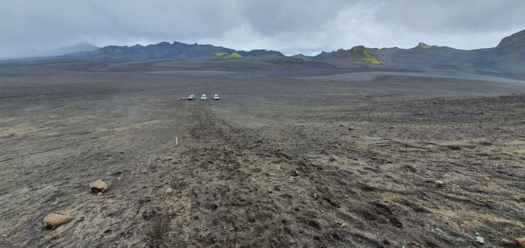
Sveinstindur parking

Sveinstindur parking. This is how a parking lot in highlands looks like.

Shortly after pursuing the road, we found a car park with 2 cars, which I again guessed, is maybe a car park for Sveinstindur? Yes, probably I’m right – I realized shortly after seeing first yellow sticks indicating a hiking trail, though still no signs or names which would say “Sveinstindur”.

Our experience with Sveinstindur

Sveinstindur seemed to be a great fit for my itinerary – non-touristy, amazing views from the top, not so long hike, out of this world landscapes everywhere around. Unfortunately, the weather started to be much foggier at the time of our visit and it even started to rain. OK, Icelandic weather, I told myself, we shouldn’t get discouraged by this. Well, I changed my mind later. It’s not a very good idea to climb Sveinstindur when it rains and when you don’t see anything because of the fog.
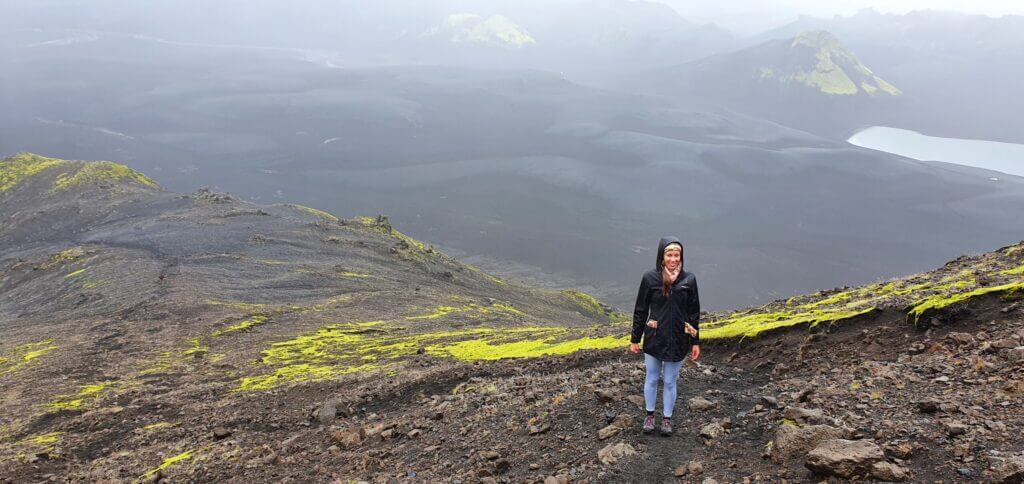
Sveinstindur hiking trail

Sveinstindur hiking trail, somewhere near half of the road towards the peak. In the beginning, the hike seemed to be doable – the ground was OK to walk on, the visibility was so-so, the rain was light, so we continued. However, after some 20-30 minutes of hiking, we walked right into the big fog and we could see that everything above this point is covered in fog as well. Together with that, the rain intensified and the path got steeper and slippery.

At this point, we decided to turn back, as it was not worth it to continue the climb when we couldn’t see a thing. On our way back, we met a really fast hiker coming back from the top so I asked him whether he’d seen anything from the top. “Not a thing” he replied, which just reassured me to continue on our way back to the car. It’s a pity but what should we do – next time.

Tips about Sveinstindur
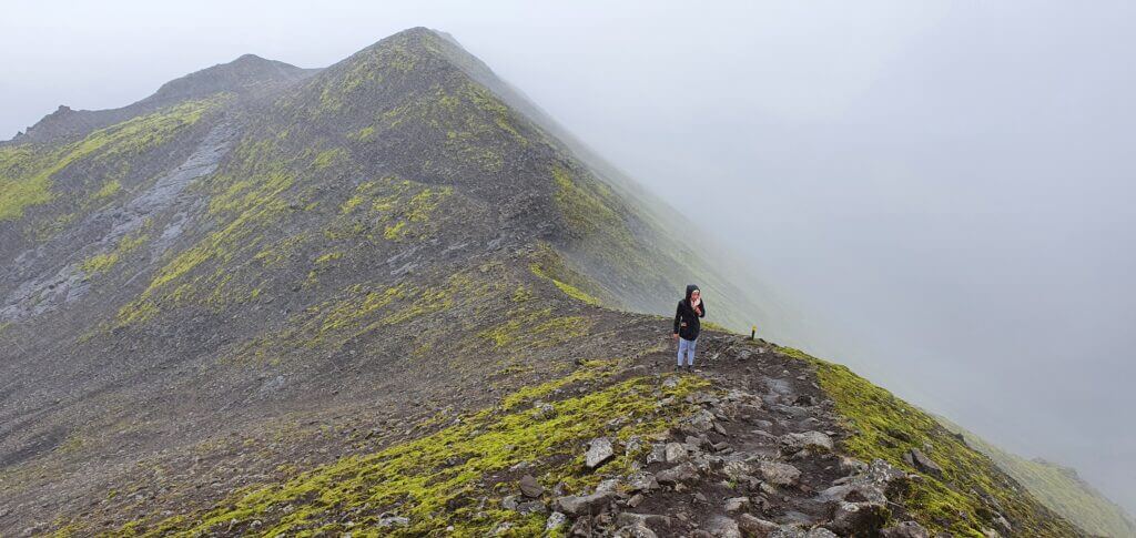
Sveinstindur near Langisjor

The upper part of the hike on Sveinstindur near Langisjor lake on a foggy day with slight rain

Quick advice – definitely go only when the weather is nice! It’s not a very pleasant experience when it’s not. Trust me, we’ve experienced it.

3. LANDMANNALAUGAR
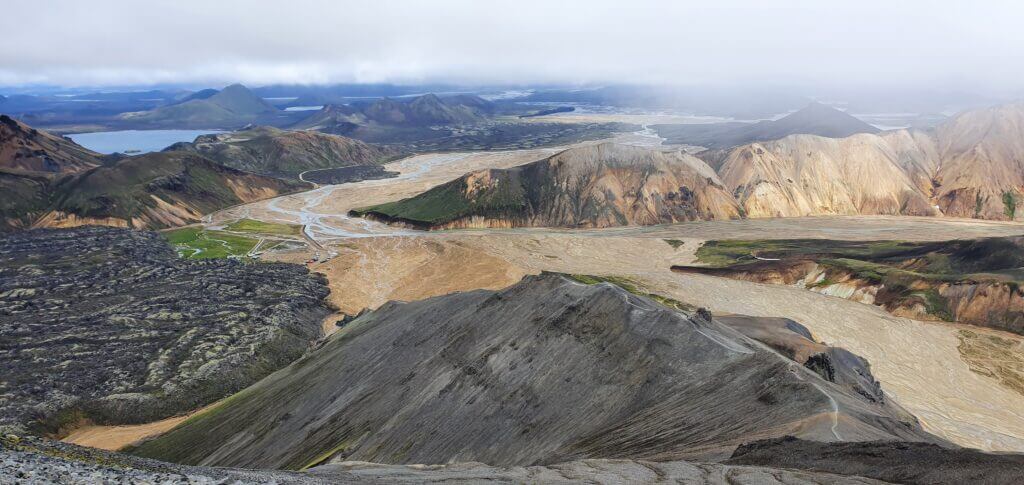
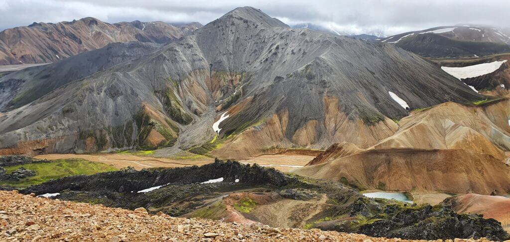
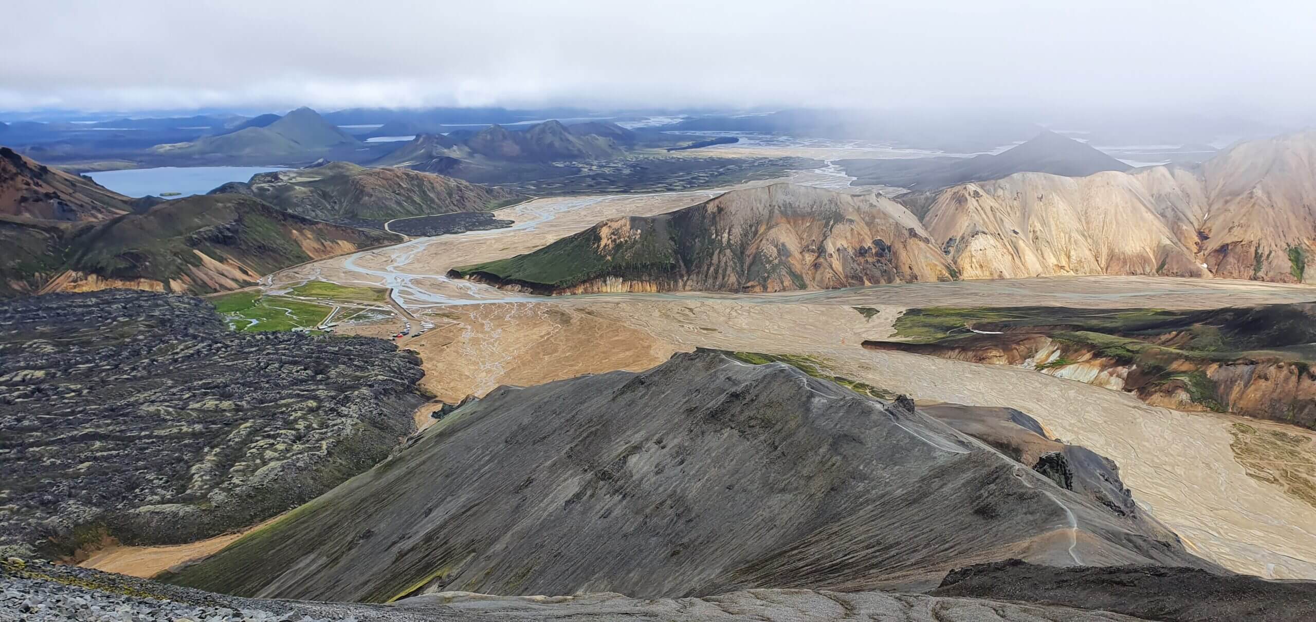
blahnjukur top view

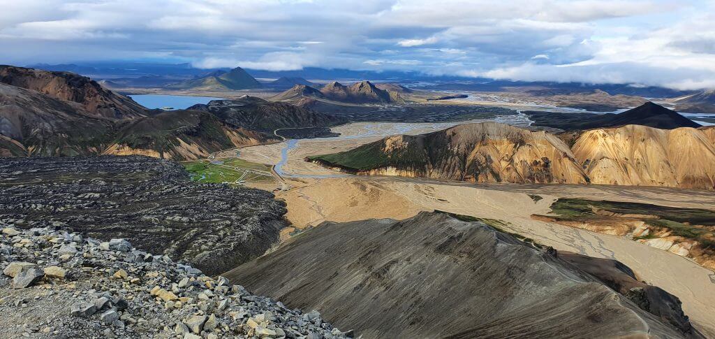
View from the peak of Bláhnjúkur towards Landmannalaugar camp, Laugahraun and 2nd (steeper) hiking trail

Summary

Distance from car park: 5-10 minutes 
Time spent at: from 3 hours to several days
Worth visiting even with bad weather: no
Physical condition needed: medium to advanced
Interesting index: 1 – amazing (1-amazing, 2-great, 3-nice)

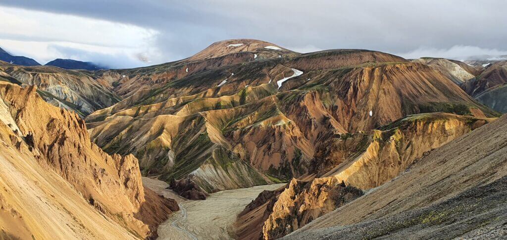
Landmannalaugar, or “rainbow mountains”, is a huge area full of breath-taking natural wonders of Iceland. It mostly refers to mountains and peaks of Brennisteinsalda, Blahnjukur and those nearby. It’s, however, huge and stretches itself all the way to Thorsmork. 

How to get to Landmannalaugar

There are basically two main ways to reach the area. The northern one and the southern one. I personally recommend you to take both of them, but your plans might be different. For both of them, you will need a 4wd car, but they are as different as the night and the day are. That means, also the choice of a specific 4wd car should be made according to which route will you plan to take. 

Read about how we chose our car. Or just get free discounts for your Icelandic car rental.

The northern part of F208

F208 north is the easier route because there are no river crossings. The majority of guides and blogs would recommend you this route since it’s generally easier and safer. I do agree it’s easier, but I don’t agree you should take only the northern part of F208.
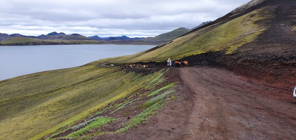
F208 north horses

Horses or “Icelandic ponies” blocking the F208 road Fjallabaksleið Nyrðri north of Landmannalaugar

There are several nice stops along the road like Ljotipollur lake or Sigoldugljufur canyon. Other than that, however, the landscapes around the road are not so spectacular. Definitely not, compared to the southern route. Read more about our journey along the northern part of F208.

The southern part of F208

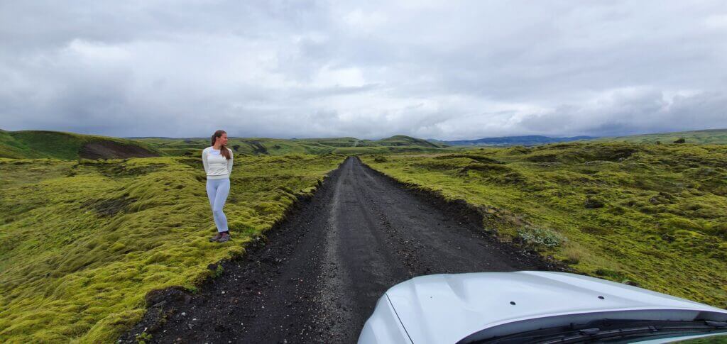
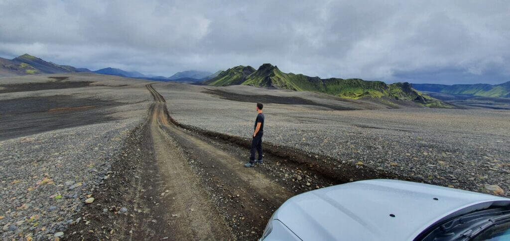
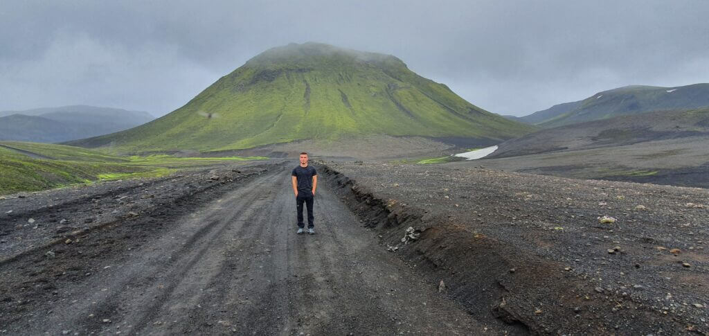
Despite (or thanks to?) being long and containing several river crossings of different sizes, from small to medium-sized ones, F208 south is one of my favourite Icelandic roads. Landscapes surrounding the road are once in a lifetime experience and so is the drive itself. 
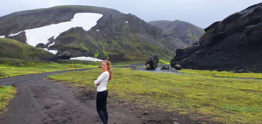
F208 Fjallabaksleið Nyrðri

F208, or Fjallabaksleið Nyrðri, after crossing with F235 towards Landmannalaugar

Choose your car wisely and you will never forget about your journey on the southern F208.

Our experience with Landmannalaugar

There are basically 3 types of activities you may do around Landmannalaugar. Hiking, bathing or driving. Hiking would probably be the number one activity visitors go to Landmannalugar for. That’s why we’ve put up a 1-day hiking guide in Landmannalaugar for you. 

On our journey, we linked together driving the southern part of F208, with the visit of Langisjor and Sveinstindur and finally with the arrival to Landmannalaugar. That being said, we arrived at Landmannalaugar in the evening, camped at the Brennisteinsalda campsite and went for hiking on the following day. 
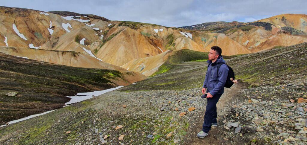
blahnjukur hike views

Spectacular views right from the beginning of the hike on Bláhnjúkur and even on the slightly foggy day

We devoted just 1 (not even entire) day to Landmannalaugar so we wanted to see as much as we could with the best views over the area in the shortest time possible. That’s why we chose the combination of hiking the two most beautiful relatively easily accessible peaks – Brennisteinsalda (the orange mountain) and Blahnjukur (the blue peak). 

Tips about Landmannalaugar

Landmannalaugar may be a bit touristy. Read our tips on how to avoid touristy places in Iceland. 

Plan for the good weather. This one is a must. Strong wind or rain may even be very dangerous during the hikes in Landmannalaugar. 
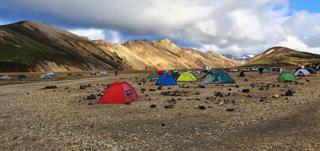
Landmannalaugar Brennisteinsalda campsite

Landmannalaugar Brennisteinsalda campsite on a summer evening

If you are seeking tips for hiking in Landmannalaugar, read our hiking guide. If you are interested in our entire experience including what we’d done before and after Landmannalaugar or how we camped, read about day 3 of our journey and about day 4 of our journey.

There’s even a Virtual reality tour of Landmannalaugar!

2. KERLINGARFJOLL
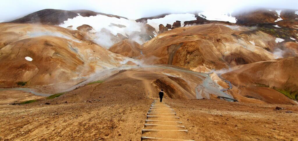
kerlingarfjoll hveradalir stairs

Clay staircase in Hveradalir area of Kerlingarfjöll

Summary

Distance from car park: 2 minutes 
Time spent at: 1-3 hours (or more according to your hiking passion) Worth visiting even with bad weather: no, probably
Physical condition needed: medium to advanced
Interesting index: 1 – amazing (1-amazing, 2-great, 3-nice)

Kerlingarfjoll belongs to the category of another “out of this world” Icelandic experiences. It’s an area full of orange mountains and sulphuric (mostly not for bathing) hot springs.

How to get to Kerlingarfjoll

There are two main ways to reach the area. From the north and from the south, both via F-road F35. Technically, from the south of F35, it’s a shorter route. But, it doesn’t matter much which way you choose to start from – north or south. What matters more is, what you plan to do before and after your Kerlingarfjöll trip. Read more about what route we chose here.
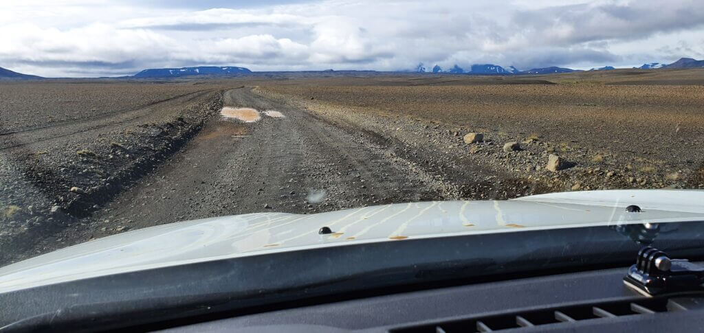
f35 kjalvegur

F35, aka Kjalvegur, near Hveravellir

Officially, you need a 4wd car to drive the F35. It’s a gravel road with many potholes, but it would be definitely doable also by a 2wd (if it were not for the 4wd restriction). By saying that I mean, F35 is not hard to drive and doesn’t contain any river crossings. 

The toughest part of the drive to Kerlingarfjoll is the last ascent towards the main area of Hveradalir. It’s quite steep and we’d seen several cars turning back, being afraid of making the ascent with their car. If you are interested in details, read our guide on Kerlingarfjoll. To sum up, you definitely need a medium-sized SUV to reach Hveradalir (or some big guts). 
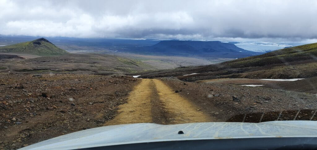
f347 near hveradalir

F347 road next to Hveradalir hot spring area in Kerlingarfjoll

Our Dacia Duster has done its job well and we reached Hveradalir area of Kerlingarfjoll without any problems. Read about how we chose our car. Or just get free discounts for your Icelandic car rental.

Our experience with Kerlingarfjoll

We chose to arrive at Hveradalir geothermal area by car and to explore it from there. You may hike around the area as long as you want and as far as you want and turn back at any moment. This is the most time-efficient option and allows you to see one of the most beautiful views of Kerlingarfjoll in quite a short amount of time.

Hveradalir area is one of the most beautiful and breath-taking places I’ve ever been to in my life – together with Askja, Landmannalaugar and the F-roads south of Landmannalaugar. You literally feel like you’re on a different planet. This time it’s not rainbow mountains, no black sand, no green moss. This time, it’s orange mountains mixed with wild sulphuric hot springs and snow. A lot of snow. And cold. And the wind. Welcome to Hveradalir.
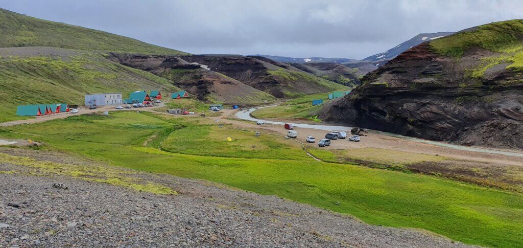
kerlingarfjoll mountain resort

Kerlingarfjöll mountain resort campsite

There are several smaller hills and there are also smaller wooden stairs-like steps almost on each of them to help you with the ascent. And I do understand why. If it weren’t for them, every 10th visitor would have slipped on the clay and injured or killed himself. The views and the atmosphere of the place is truly amazing. Hot springs with hot sulphuric steam are everywhere and they help create an occasional feeling of warmth. There are, however, no hot springs to bath in Hveradalir area. This is contrary to Google maps calling the location “hot springs” or “geothermal area”.
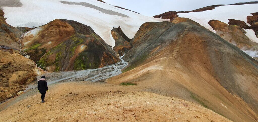
kerlingarfjoll hveradalir hike

One of the summits of the several smaller hills around the Hveradalir in Kerlingarfjöll

Interested in more details about hot springs or hiking options in Kerlingarfjoll? Read our guide.

Interested in what we’d done before and after the trip to Kerlingarfjoll, which routes we chose, where we camped and many more? Read about day 8 of our journey

Tips about Kerlingarfjoll

Once in Kerlingarfjöll, you have numerous hiking options. You may for example hike the red loop trail, getting to all of the biggest summits around the area, sleeping over at mountain huts. This is a very challenging hike, where you will be going to need very good gear (e.g. crampons) and be in a very good physical condition. And it will take you about 3 days. Read more here.
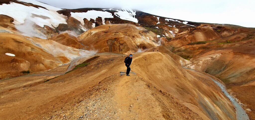
kerlingarfjoll hveradalir trail

One of the numerous trails in Hveradalir area of Kerlingarfjoll

Also bear in mind, that on the 8th August, 3 pm in the afternoon (i.e. probably one of the warmest times possible) the temperature climbed to tropical 5°C. And the strong wind didn’t help it at all, making everything feel even some 5°C colder. If you plan to camp here, you’re going to be freezing for sure.

1. ASKJA
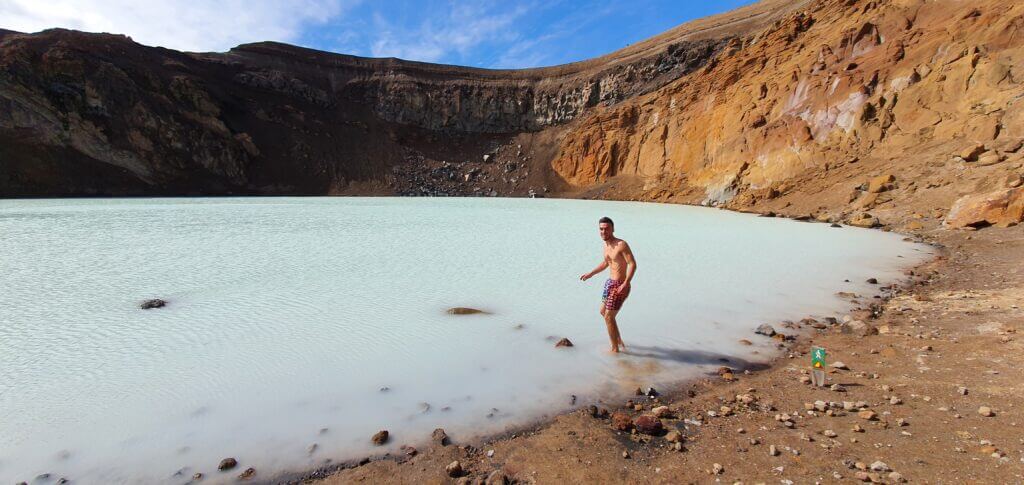
swimming in askja crater

Me swimming in 25°C sulphuric water of Víti crater in Askja

Summary

Distance from car park: 20-30 minutes one way (from Vikarborgir) 
Time spent at: >1 hour
Worth visiting even with bad weather: yes, probably
Physical condition needed: medium to advanced (depends if you want to climb Viti)
Interesting index: 1 – amazing (1-amazing, 2-great, 3-nice)

Askja is a hidden gem of Iceland. It’s a picturesque volcanic crater filled with warm sulphuric water in the middle of nowhere. The drive to Askja is strenuous but more than worth it. 

How to get to Askja

To drive to Askja you definitely need a 4wd car.  There are two main routes available to reach Askja. The northern one (F88) and the eastern one (F905, F910).

The northern route is the toughest one because F88 contains several big, treacherous rivers. You will need a large super-jeep if you want to take F88.
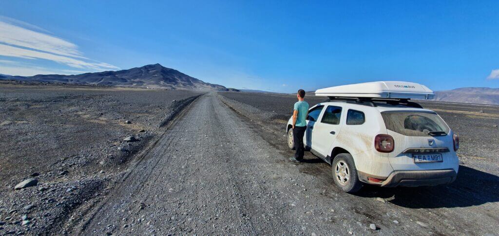
f905 to askja

F905 to Askja on an exceptionally beautiful sunny summer day

The eastern route contains river crossings as well, but only small and medium-sized ones, so it’s doable also with a medium-sized SUV. If you are interested in specific details about each road and each river crossing, you may read our guide on how to visit Askja.

It’s important to choose your car carefully for your visit to Askja. Read about how we chose our car. Or just get free discounts for your Icelandic car rental.

Our experience with Askja

From the car park it takes some 20-30 minutes of walking via a well-marked path with yellow sticks to reach the place everybody sees in the pictures – i.e. Víti crater. Sun still shined, the sky was still clear and the wind was still mild – what a wonderful day! And Viti crater looked even better than in the photos! Fairy-tale-like blue water with moon-like surrounding landscapes. Askja was the highlight of our trip.
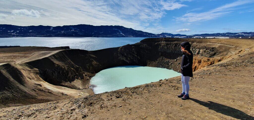
askja oskjuvatn viti

Amazingly beautiful Askja (the whole area), Víti (the crater lake) and Öskjuvatn (the bigger lake nearby) all in one picture

We also decided to descent down to the crater itself and take a bath. This was one of the two moments during our journey when I was a bit scared (first one when hiking up the Blahnjukur peak in Landmannalugar, climbing the steep clay slippery trail). Here again, the descent was steep and the ground was covered with slippery clay, which means you’re unable to control any fall of yours, in case it happens.

Nevertheless, it’s a short descent and not too dangerous, so in good weather, you should be able to make it. Once down in the caldera, you may enjoy swimming in the water with a temperature around 25°C, which is definitely not a hot spring but it’s definitely warmer than air (at the time of our visit around 10-15°C). Once in a lifetime experience.

Tips about Askja

  • Askja = name of the entire area.
  • Viti = volcanic crater you are probably aiming for as we were, with blue picturesque geothermal water.
  • Oskjuvatn = big lake just next to Viti, with no geothermal water (Google calls Oskjuvatn “Lake Askja”).
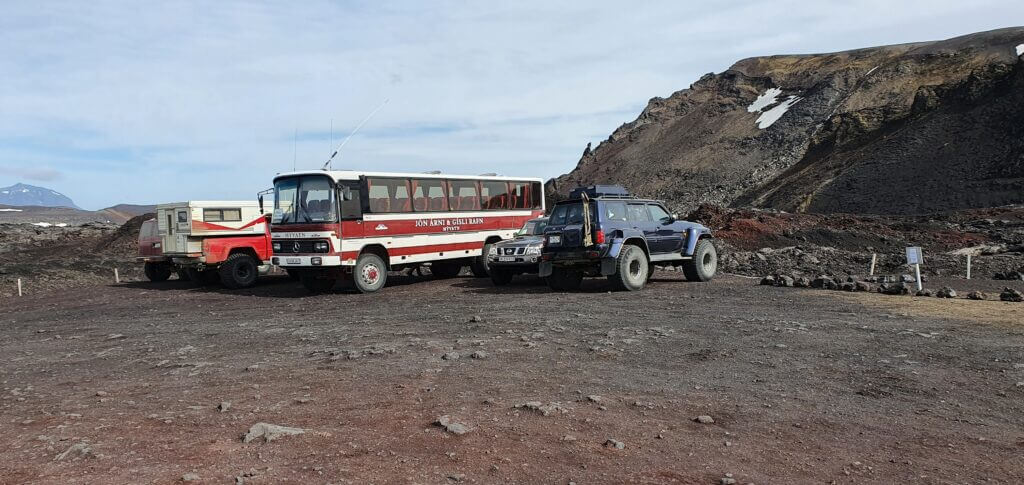
vikraborgir parking askja

Vikraborgir car park, the closest point available on your route towards Askja/Víti crater

Once you reach Viti, you may either:

  1. Just admire the beauty of Viti crater and monumental Oskjuvatn lake next to it, or
  2. Hike around the area, or
  3. As we chose (or as my girlfriend persuaded me), hike down the Viti crater and swim in the green/blue geothermal water.
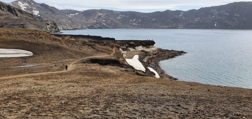
oskjuvatn lake askja

Öskjuvatn lake in Askja area, next to famous Víti crater

Interested in more details on different hikes, map of the area and our experience? Read our guide on Askja.

Interested in how we combined Askja with the visit of Studlagil canyon, where we camped and where we went next? Read about day 6 of our journey.
epic iceland facebook group ask questions or get inspired in our community

Posted by Igor in Top Places, 0 comments
Day 4 – Landmannalaugar and Highlands in the north

Day 4 – Landmannalaugar and Highlands in the north


Landmannalaugar hikes

There are two main, most beautiful, one-day hikes you can do from the Brennisteinsalda campsite. And it can be a bit confusing to understand the difference between them and how to get to each trail. At least for me, it was in the beginning. So let’s get to the point.

First of the hikes, the easier and quicker one, is the hike ending at the top of the Brennisteinsalda volcano, or “orange mountain”. It takes about an hour to reach the top and some 30 minutes to come back. The ascent is of normal difficulty and everyone should be able to make it.

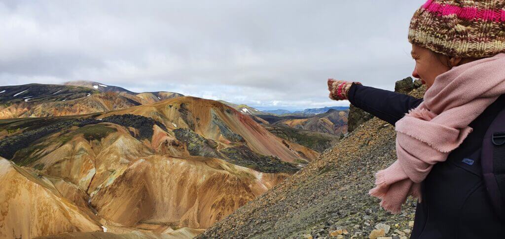
pointing at brennisteinsalda

Pointing at Brennisteinsalda from Bláhnjúkur hiking trail

The second hike, for me even more beautiful, is the hike to the Bláhnjúkur peak or “Blue peak”. It’s a bit longer hike, it took us 1,5 hour to get to the top and some 1 hour to get back to the campsite and you should be in good physical condition to make it, at least compared to other places in Iceland where you just step out of your car and make a 5-minute walk. But it’s definitely doable for everybody and more than just worth it as it’s one of the most beautiful views in entire Iceland. Just be prepared for a mountain hike.

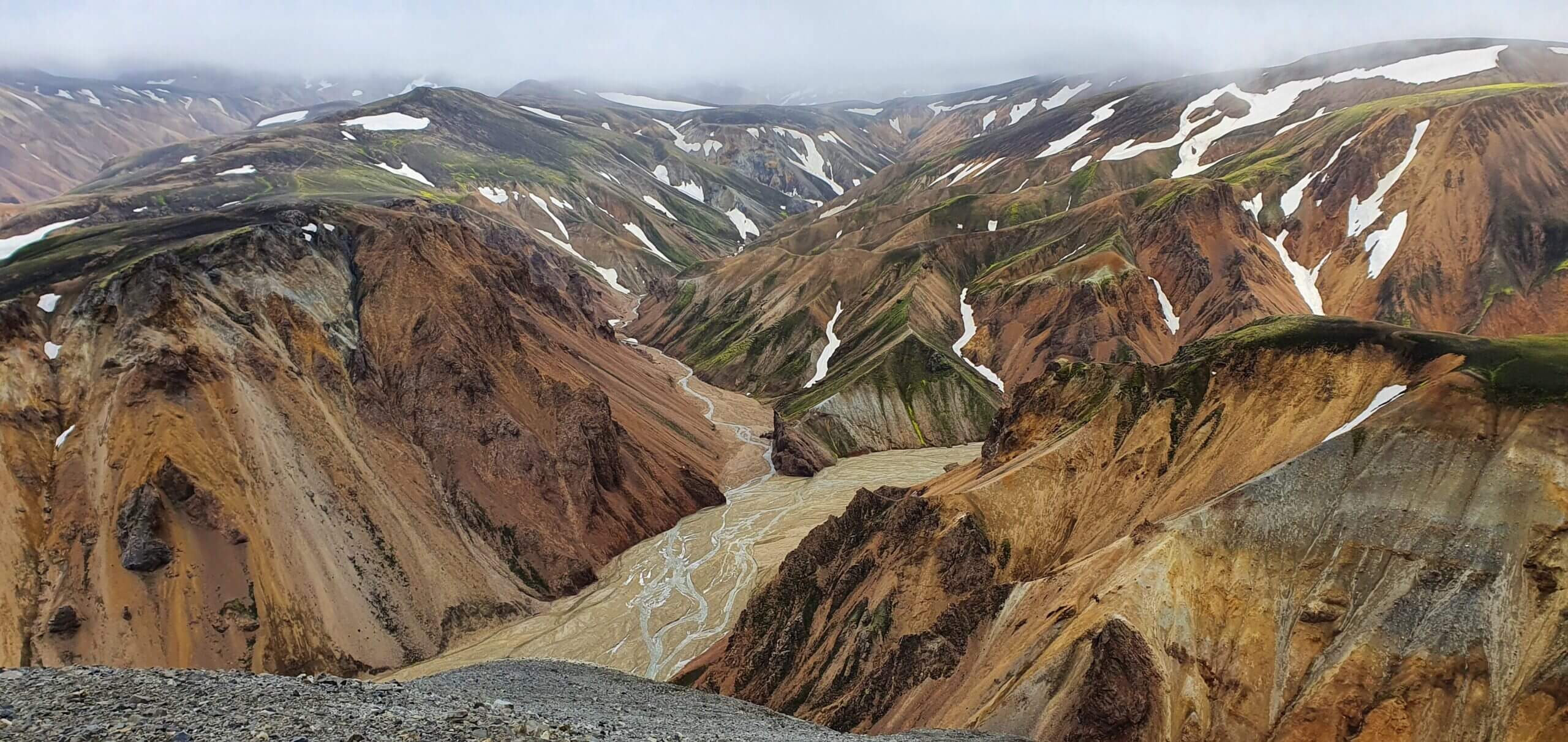
brennisteinsalda top view

View from the top of Brennisteinsalda towards Bláhnjúkur

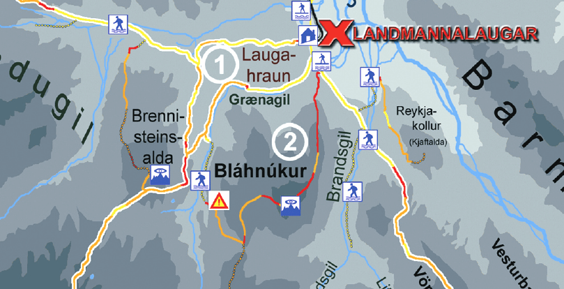
What helped me the most with orientation was this map. I wonder why it’s so hard to find this map online, but this map is basically all you need to know. If you are in a good physical condition and weather is good, I definitely do recommend you to go for both peaks – Brennisteinsalda and Bláhnjúkur as well. It’s a beautiful loop trail, so you don’t go twice via same trail and all the views around it are breath-taking. On a halfway to Brennisteinsalda you’re going to cross lava field called Laugahraun which is interesting as well, although compared to the other peaks it’s not that special.

landmannalaugar map

The most important slice of Landmannalaugar map for your 1 day trip

There are of course many other trails in the Landmannalaugar area. If you are really into hiking or if you’re planning to spend more days in the area, you’re more than welcome to go for the other trails as well. The longest one is supposed to take some 3-4 days and ends in Thórsmörk, another magnificent valley. You will be probably spending nights in mountain huts along the way if you choose this hike. We didn’t go for it, as we wanted to see as many different parts of Iceland in possible in 12 days, but next time – why not? Just be prepared for rough cold weather even in summer and its sudden changes.

Brennisteinsalda hike

9:00-10:30

Distance from car park: 5/10 minutes (to the start of the trail, from camping/car park in front of the camping)
Time spent at: 1 hour to the top
Worth visiting even with bad weather: no
Physical condition needed: medium
Interesting index: 1 – amazing  (1-amazing, 2-great, 3-nice)

brennisteinsalda hike start

This is how the start of the hiking trail towards Brennisteinsalda looks like

Hike for Brennisteinsalda volcano is quite easy and takes around 1,5 hour round trip. If you either don’t have much time, or weather is worsening or you simply aren’t into hiking that much, you can definitely make this one. The trail to the top and the view from the top itself are definitely worth it. We experienced it in slightly foggy weather and it was still beautiful.

brennisteinsalda hiking trail

Easy Brennisteinsalda hiking trail

You start at the main building of Landmannalaugar/Brennisteinsalda campsite where there are red signs pointing to two opposite directions. When coming from the river crossings facing the campsite, the one pointing left is the one for Bláhnjúkur and the one facing right is the one for Laugahraun lava field and Brennisteinsalda. The other way how to orientate yourself is simply to go in the direction of the mountain (you can see it throughout almost the entire trail) and use common sense.

Although the trail is well marked, the signs are not very helpful because they contain just the name of the entire trail and they don’t point specifically to Brennisteinsalda. It’s important to stick to the marked trail to not destroy Icelandic untouched nature and not get yourself fined heavily.

brennisteinsalda hike

Views from the Brennisteinsalda hike

Your first checkpoint would be crossroads with Laugahraun lava field where you will continue to the upper right, i.e. above the field. Then you will eventually arrive at another crossroad just below Brennisteinsalda where you should turn right, to face the only little steeper part of the hike right towards the peak. Once you reach the peak, you can enjoy 360° views of surrounding landscapes, Laugahraun field from bird-eye view and also majestic Bláhnjúkur peak nearby.

brennisteinsalda top

View from the top of Brennisteinsalda on a slightly foggy day. Still very windy at the top, despite calm day.

There was no wind below Brennisteinsalda at the time of our visit, but at the peak wind was blowing like crazy. So be prepared for this. After Brennisteinsalda you may either come back to the campsite or continue for the Bláhnjúkur peak – as we did. If you have enough energy and the weather is alright I definitely do recommend to go for Bláhnjúkur as well as the views surrounding that route are even more amazing.

Laugahraun

11:00-11:10

Distance from car park: 5/10 minutes (to the start of the trail, from camping/car park in front of the camping)
Time spent at: 15-20 minutes
Worth visiting even with bad weather: yes
Physical condition needed: little
Interesting index: 3 – nice  (1-amazing, 2-great, 3-nice)

brennisteinsalda peak view

View from the top of Brennisteinsalda towards Laugahraun

Laugahraun is a lava field with interesting rock formations formed from volcanic lava eruptions. It takes some 30-40 minutes to reach it from the campsite and it stands on the halfway to Brennisteinsalda mountain. It’s a nice place to see but it was not that amazing for us compared to other sights like peaks of Bláhnjúkur or Brennisteinsalda. We didn’t go particularly for it, but we stumbled upon it on our way back from Brennisteinsalda peak and on our path further towards Bláhnjúkur mountain.

If you have enough energy and good weather I recommend you to take the same route as we did so that you can admire all of them. Coming from Brennisteinsalda, if you leave the Laugahraun field at its top-right part, you will find yourself at the beginning of the trail for Bláhnjúkur , the Blue peak.

Bláhnjukúr hike

11:15-13:45

Distance from car park: 15 or 40 minutes (if you want to go only for Blahnjukur or if you firstly want to go for Laugahraun lava field)
Time spent at: 2 hours to the top, 60-90 minutes back down
Worth visiting even with bad weather: no
Physical condition needed: advanced
Interesting index: 1 – amazing  (1-amazing, 2-great, 3-nice)

blahnjukur hiking path

Slippery clay slope at the start of the hike to Bláhnjúkur or Blue peak

For us hike to Bláhnjúkur, or the Blue peak, was the most beautiful, the most rewarding and the most difficult part of our one day visit of Landmannalaugar. We had to find the beginning of the trail, we had to ford the small river, we had to climb the steep muddy hill and then we had to cope with a strong cold wind at the top. All of these were definitely worth the experience. Views encompassing the route are amazing if you are lucky with the good weather. View from the peak is even more breath-taking. So how do you reach Bláhnjúkur?

You have three options to reach the top (including circular round trip we did, starting with Brennisteinsalda and continuing to Bláhnjúkur or vice versa). Arriving from river crossings before Landmannalaugar you may:

  1. either turn left and go directly for Bláhnjúkur or
  2. you may turn right, reach the Laugahraun lava field first and then continue for Bláhnjúkur hike or
  3. of course, you may choose the order we chose, i.e. after reaching Laugahraun continue for Brennisteinsalda peak, then come back to Laugahraun and then go for Bláhnjúkur.

I recommend the way we did it, i.e. go for the circular route, so that you can see everything.

blahnjukur hike views

Spectacular views right from the beginning of the hike on Bláhnjúkur and even on the slightly foggy day

After you leave the upper right part of Laugahraun field (coming from Brennisteinsalda trail), you will arrive at the small river. Despite the river being small, there’s no bridge or a designated place where the river should be crossed. We spent almost 30 minutes searching for the spot where to cross the river to not get our feet wet in this cold weather. And up to this day, I don’t know where was the “official” spot meant for this river to be crossed.

What we finally did was going almost 10 minutes to the right along the bank of the river coming to the place where the river was shallow enough with enough pebbles to jump on and pass. Then we had to come these 10 minutes on the other side of the river back again to reach the yellow marks marking the trail towards Bláhnjúkur. So, after 30 minutes of struggle, we managed to ford the river without getting wet, although I’m not sure whether this was the way meant for crossing, probably no.

blahnjukur hike near top

Bláhnjúkur hike near the top

Afterwards, for us, the most dangerous part followed. A trail is well marked with yellow sticks so you shouldn’t get lost. You will shortly arrive at the steep clay slope going up closer towards Bláhnjúkur. The ascent is not hard or anything, but it’s quite steep and you don’t have a good grip on the ground because of the clay. So with each step, you feel like slipping on the smooth clay. I was equipped with high-quality La Sportiva hiking shoes and those didn’t help either. There are neither stairs nor chains so you can only help yourself by going slowly zig-zag to the top.

Fortunately, this part is not too long and takes some 10 minutes to complete. What follows next is just a typical gravel hiking trail and you shouldn’t have any problems continuing up the path. Magnificent views will shortly emerge and will accompany you all the way to the top.

blahnjukur peak view

One of the views from the peak of Bláhnjúkur towards Landmannalaugar and 2nd (steeper) hiking trail

We had a semi-clear sky with partially sunny, partially cloudy weather and light fog. This is still supposed to be good weather so we enjoyed every moment of it. Visibility (although not perfect) was fine and the views were, as I already mentioned, breath-taking. We met only a single-digit number of visitors at the peak, so at the time of our visit, peak being crowdy wasn’t an issue. It was really windy and temperature felt like 5°C even on the sunny summer day like ours, so be prepared for that. Once reaching the top, you will be rewarded with the best views over the area.

blahnjukur top view

Another view from the peak of Bláhnjúkur towards Landmannalaugar camp, Laugahraun and 2nd (steeper) hiking trail

We started our descent from the other side of the mountain (the one where you may access Bláhnjúkur right from the campsite), which was supposed to be much steeper, according to guides I’ve read. That definitely wasn’t true and compared to the steep clay part we had to overcome before, this was a piece of cake. I wonder what’s worse – to ascent the clay part or descent? I guess descent would be worse.

The trail continued without any obstacles until we reached the point where we could see the small river we’d forded before from above. At this point we’d also seen the campsite from above already, so we continued pursuing that direction. The entire descent wasn’t hard and it took us some 1 hour at maximum to reach our campsite again. We went for a hot chocolate at the nearby snack bar and ate a little. It was still only before 3 pm so we had enough time to continue with our journey.
F208 north towards Sigöldugljufur canyon

15:00-15:30

Worth visiting even with bad weather: yes
Interesting index: 3 – nice  (1-amazing, 2-great, 3-nice)

F208 north horses

Horses or “Icelandic ponies” blocking the F208 road Fjallabaksleið Nyrðri north of Landmannalaugar

This is the F208 all of the guidebooks out here suggest you use if you want to go for Landmannalaugar. Well, if you are afraid of, or if you simply don’t want to cross rivers, then yes, this is the right way to arrive and leave Landmannalaugar as well. All the other ways like F208 to the south, F233 and F210 towards Maelifell or Landmannaleið – the shortcut in/out of Landmannalaugar, all contain some serious river crossings.

The beginning of the road near Landmannalaugar, until Ljótipollur detour, is very beautiful. Afterwards, the road shortly turns into a dull gravel road. Hence, the majority of the road is just a normal gravel road with potholes without any nice views alongside it. Compared to the out of this world, amazing F208 to the south there isn’t much to see.

road to ljotipollur

F-road towards Ljótipollur

But the views you see from this road are not the reason why people like us use it. Apart from not going back down the same road to the Vik, there lie two very nice stops along the road. Namely, two beautiful canyons entirely different in appearance, both definitely worth visiting. These were among the most beautiful places we’ve seen.

The northern part of F208 is actually definitely doable also by 2wd car, it would just be a really bumpy ride. That’s what I meant by saying “it’s all about river crossing” when it comes to the difficulty of Icelandic F-roads., Since there’s no river crossing on this part of the road, it’s doable also by a normal car.

Ljótipollur

15:30-15:50

Distance from car park: 5 minutes ascent
Time spent at: 15-30 minutes
Worth visiting even with bad weather: yes, probably
Physical condition needed: little
Interesting index: 1 – amazing  (1-amazing, 2-great, 3-nice)

ljotipollur parking

Ljótipollur “parking”

Ljótipollur is a remote canyon where you will meet out of this world colours on every corner. It definitely didn’t look like a touristy place at the time of our visit and we had it all for ourselves at around 3 pm which is, I guess, still a peak hour.

If you put name Ljótipollur into your Google maps, it will navigate you towards detour in the right direction from northern F208 road, coming from Landmannalaugar direction (left, coming from F26 direction). There aren’t any good road signs so just follow Google and you should be fine. You’re going to drive nice black gravel road in the middle of nowhere which will end with the sign “cars forbidden” again in the middle of nowhere. The place with the sign served as a car park at the time of our visit (2 more cars were parked there, what a crowd). We left our car at this improvised car park and continued walking towards Ljótipollur direction a Google was pointing at.

ljotipollur

Ljótipollur

The walk took us around 5 minutes and a majestic red volcanic crater suddenly stood in front of us. We were the only visitors admiring it at that time. I don’t have any idea where were the people who arrived by the other 2 cars parked in the car park. Just us, absolute silence and a picturesque canyon filled with crystal clear water.

The weather was supposed to worsen considerably in the evening according to the weather forecast and there were already clouds gathering in the sky. Still, we were lucky that up to this point of our trip we hadn’t experienced any persistent rain. You can also hike around the Ljótipollur area but that wasn’t our plan, because Ljótipollur was already supposed to be the highlight of the area and we were really tired after Landmannalaugar hikes. That said, we left Ljótipollur and continued further towards one of the three most famous Icelandic canyons – Sigöldugljufur canyon.

Sigöldugljufur canyon

16:30-17:00

Distance from car park: 10 minutes
Time spent at: 20-40 minutes
Worth visiting even with bad weather: yes, probably
Physical condition needed: little
Interesting index: 1 – amazing  (1-amazing, 2-great, 3-nice)

sigoldugljufur canyon

Sigöldugljufur canyon just by ourselves

Sigöldugljufur canyon was our favorite canyon in Iceland, because it was the least touristy and, in our opinion, the most beautiful. With all its remoteness it embodies for me the spirit of Iceland, i.e. a picturesque hidden place in the middle of nowhere. And that’s exactly where you will find Sigöldugljufur canyon, at the end of the road F208, in the middle of nowhere.

Google maps are quite precise with the location of canyon, although you won’t find any road signs indicating it, so you have to rely solely on Google maps. The canyon is located on the right side of F208 coming from the Landmannalaugar direction (i.e. naturally on the left side coming from the F26 direction). The only sign telling you “there’s something nearby” is the little car park near the spot which is the closest point connecting the road and the canyon marked on Google maps.

sigoldugljufur canyon

All alone at Sigöldugljufur canyon

When you leave the car park, you continue along the unmarked gravel road (used only by locals) and you keep on the left side of it, exactly as suggested by google maps. After some 10 minutes of walking, you will arrive at the right bank of the canyon and a huge network of small rivers and waterfalls of unbelievable colours will emerge in front of you. You will literally find yourself as in the middle of the fairy tale, especially if you’re as lucky as we were, and will be there all by yourself.

It’s possible to continue several kilometres ahead along the valley, so it’s just up to you how far you want to go. You are able to see the major part of the canyon already from the first moment you have it in your sight, however. That’s exactly what we did – admired it for a couple of minutes and didn’t continue further along the valley.

There’s actually no marked trail, so unless they make one anytime soon, you’re going to slightly break the rules, as you will be walking on an “unmarked path” and therefore destroying Icelandic nature a bit. We tried to go the same way back to spare the nature of our footsteps. That being said, I think it’s inevitable someone will build a marked trail heading to the canyon soon as it’s becoming more and more touristy from what I’d read before our trip.

Haifoss

18:00-18:20

Distance from car park: 5 minutes
Time spent at: 15-30 minutes
Worth visiting even with bad weather: yes
Physical condition needed: little
Interesting index: 1 – amazing  (1-amazing, 2-great, 3-nice)

haifoss

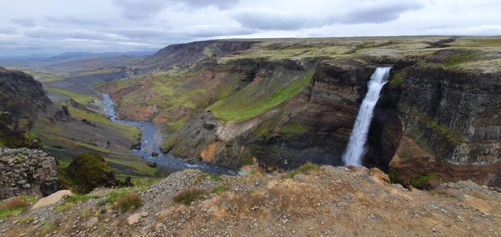
Just Haifoss

It was already around 6 pm when we were deciding whether to make a detour to Haifoss or not. I persuaded my girlfriend to do so, because this was the only time we had Haifoss quite nearby. And it was also supposed to be the tallest waterfall in Iceland, hence the one you’re going to probably include into your to-do list. The road leading to Haifoss (332) is the gravel road which you will be able to drive fast on, because it doesn’t have any potholes just a lot of gravel on it. That’s also why it’s not marked as an F-road.

Once you reach the well-marked car park, Haifoss is just a few steps next to it, in a huge moss-covered green valley with many sheep around. This is the place which is supposed to be more touristy, due to its accessibility also by 2wd cars, and yes it was even during our visit. There were some 3-4 cars other than us parking at the car park, which seemed like a lot compared to our experience at that time. There are several viewpoints of the waterfall, all next to each other so you will have enough space to admire the waterfall from and make same nice pictures. Despite weather being cloudy already, we were able to make some nice pictures anyway.

Long road towards Vik with heavy rain

18:30-22:00

After leaving Haifoss, a long road towards Vik stood in front of us. Yes, we could camp anywhere closer, but I still felt like having enough energy to do the drive and my girlfriend didn’t mind and, also, I didn’t want to camp again in the same camp – Vik. That’s why our next target destination I chose for us was the campsite in Kirkjubaerklaustur, as it had some really good reviews in Google maps. So I drove a lot. Back via road 332, then the road 32, then the road 30 and then kilometers along the road 1 just to reach the Kirkjubaerklaustur camping around 10pm. This was our most exhausting day and I’d already been tired as hell after 15 hours of being awake.

Moreover, shortly after leaving Haifoss, the weather forecast proved itself to be correct and the promised rain started and it intensified with each hour passing by. In the middle of our journey to Kirkjubaerklaustur the rain started to be really heavy and the roads were full of water, so we had to drive more carefully i.e. slower.

Kirkjubaerklaustur camping

22:00-

We reached Kirkjubaerklaustur camping in a heavy rain after 10pm and there was a huge ramp in front of the entrance to the campsite, so our first thought was “oh my god, we’re really late, what if nobody’s there?”. Luckily for us, there was still a campsite manager at that time guarding the ramp and hence we were able to pay for the camping and proceed. The campsite is very nice in a good condition and I definitely recommend camping in here. Although the weather was brutal at the time of our visit with heavy rain and wind, we still remember the campsite as one of the best.

Skipped places

  • Longer hikes near Landmannalaugar
  • Hjalparfoss waterfall

Landmannalaugar area is a paradise for hikers. You may easily spend there several days and still don’t have enough. We didn’t go for longer hikes this time, due to either shortage of time and us not being that much into more hardcore hiking. Not to mention, we were not equipped well enough for hikes lasting longer than just a single day.

There’s another nice waterfall near the route we drove called Hjalparfoss which we skipped. The reason for skipping it was quite straightforward – we’d already seen a ton of fascinating things on that day and Hjalparfoss was not supposed to be any special compared to the other ones we’d seen already.

More Videos

Posted by Igor in Our Journey, 7 comments
Day 3 – to Highlands near Landmannalaugar

Day 3 – to Highlands near Landmannalaugar

We were planning to drive multiple F-roads with multiple river crossings towards Landmannalaugar on this day. And also, hopefully, a detour to Langisjór lake and maybe even the Sveinstindur mountain peak hike. As the forecast stated cloudy or partly cloudy weather for both days (without rain or wind), we decided to go on. Nice weather was really important for this day!


We woke up on a cloudy morning without mist and the entire day’s weather forecast was supposed to be the same. This still qualifies to be good weather in Iceland so we decided to continue with our main plan. And this meant – let’s explore one of the most beautiful areas of Icelandic highlands!

F208 towards Landmannalaugar – 1st part

9:30-11:00

Worth visiting even with bad weather: no
Interesting index: 1 – amazing  (1-amazing, 2-great, 3-nice)

F208 near Vik

Road F208 near Vik towards Landmannalaugar

The table above applies to all F-roads in the area south of Landmannalaugar. F208 south is a once in a lifetime experience. I’ve never seen such out-of-this-world stunning landscapes as on these roads. The southern part of F208, for me, was one of the TOP3 experiences in Iceland. Although driving the roads for some 6-7 hours we met just a handful of cars which is also a part of this secluded Icelandic experience. The wi-fi/cell network coverage sometimes works and sometimes not, so be prepared for that.

The first part of the road bears no river crossings, just rough gravel F-roads with picturesque landscapes. First river crossing comes right after reaching Hólaskjól centre and during the day a ranger “guards” the river giving advice to travellers like us. She gave us a handout explaining how to cross the rivers and how to behave in a national park and asked me whether I have an experience with crossing Icelandic rivers. Well here we are, this is my favourite – how the hell are you supposed to be experienced with river crossing if they require you to be experienced for your first river crossing? I replied: “I studied it a lot” which was true. She gave us that type of smile as if she was saying “I see, tourists, see you when I’ll be getting you out of the river”, and we continued.

As all guides do state, I firstly examined the river by eyes and it looked to be some 40-60centimeters deep at the deepest point. “If you feel unsure about crossing the river, turn back,” everyone says. Well, the hell I was feeling unsure but let’s go. I’ve read what to do a thousand times and the worst case – we still have our car insured even for river crossings thanks to Lotus.

F235 to Langisjór

This you should NOT do (stand on the moss). Road F235 after turning right from F208 towards Langisjór lake

Laura at the front desk of Lotus car rental told us that she recommends going into the rivers on a 2nd gear on Dacia Duster because the 1st gear is usually used only for starting the engine and pulling the car off the ground. So I set the 2nd gear and went into the river really slowly, trying not to splash the water into the engine. Although not very smoothly, the car seemed to move. But, somewhere around in the middle of the river, I could feel the engine was about to die on this 2nd gear, so knowing you shouldn’t do this I switched into the 1st gear not wanting to risk the engine dying completely.

A few centimetres before the end of the river we reached the deepest point where the water felt really deep and the car was slowing considerably but the momentum of the car kept going and we successfully pulled the car out of the river on the other bank. Afterwards, I realized I forgot to turn 4×4 on. Well, first river crossing and first 2 mistakes. Never mind, we made it and now I know that i) I have to go on a 1st gear and ii) I shouldn’t forget to turn 4×4 mode on.

F235 towards Langisjór

11:00-12:00

Worth visiting even with bad weather: no
Interesting index: 1 – amazing  (1-amazing, 2-great, 3-nice)

We were driving according to our schedule so we continued with our plan to make a detour to the Langisjór lake. Shortly after turning right to F235 towards Langisjór, we encountered our first river crossing on F235. This one looked slightly less deep than the last one (some 30-40cm). I learnt from previous mistakes, so I shifted into 1st gear and turned the 4×4 mode on. Or at least that’s what I wanted to do. I realized I don’t know how to do it. There was a switch for 4×4 near the gear handle, but when I switched it to 4×4 it kept switching itself back to 2wd.

We panicked for a while because we didn’t want to go without 4×4 and we already didn’t have any network or wi-fi coverage on F235. After 30 minutes of studying the manual of the car (which I downloaded beforehand in English, just in case) I realized that it’s OK that the switch keeps coming back to 2wd mode and that 4×4 is already turned on after I just once switch it to 4×4 (regardless of the switch coming back to 2wd). What a relief. We started to laugh and proceeded with our 2nd river crossing. This one seemed easier compared to the first one. Are we now already experienced river crossers? Haha, I guess no.

F235 to Langisjor

Out of this world landscapes surrounding F235 road towards Langisjór lake

Shortly thereafter we arrived at another river crossing, again a bit smaller (some 20-30cm) so now without any hesitation we repeated the steps above – turn 4×4 on, go slowly, don’t stop, don’t switch gears. Piece of cake. Then the next river crossing (as 20cm is not actually a river I guess, pond crossing would be a better phrase to use) came, then the next and next and next. Altogether we crossed some 10 ponds before finally arriving at Langisjór, none of them, however, was that big compared to the first one after Hólaskjól centre.

Langisjór

12:00-12:30

Distance from car park: 2 minutes
Time spent at: 20-45 minutes 
Worth visiting even with bad weather: no
Physical condition needed: little
Interesting index: 1 – amazing  (1-amazing, 2-great, 3-nice)

Langisjór campsite

This was supposed to be Langisjór campsite according to maps. It just turned out to be a remote place with nobody being there.

Landscapes everywhere along the road are out of this world and no words can precisely describe them. We were the only car driving the road. We reached the “Langisjór camping”, or at least that’s what Google maps said, which was just a small cottage with 2 nice modern toilets at the end of the world.

Langisjór lake

Langisjór lake next to Langisjór campsite mark on the map

We continued to the point on Google maps named “Langisjór campsite” where the road ended. Wow, another car. One group of French tourists, apparently going fishing there, and us. That’s it for the entire area. Shortly we realized why they went fishing. The water in Langisjór had been crystal clear and the complete silence surrounding the area was both amazing and a bit scary at the same time. First time in my life I experienced what one may call “absolute silence”.

Sveinstindur hike

13:00-15:00

Distance from car park: 0 minutes
Time spent at: 2-3 hours 
Worth visiting even with bad weather: no
Physical condition needed: medium to advanced
Interesting index: 1 – amazing  (1-amazing, 2-great, 3-nice)

After spending some time admiring the silence and beauty of Langisjór glacial lake we proceeded to our next stop – an attempt to hike the Sveinstindur mountain. Quick advice – definitely go only when the weather is nice! It’s not a very pleasant experience when it’s not. Trust me, we’ve experienced it.

Sveinstindur parking

Sveinstindur parking. This is how a parking lot in highlands looks like.

Sveinstindur seemed to be a great fit for my itinerary – non-touristy, amazing views from the top, not so long hike, out of this world landscapes everywhere around. Unfortunately, the weather started to be much foggier at the time of our visit and it even started to rain. OK, Icelandic weather, I told myself, we shouldn’t get discouraged by this. Well, I changed my mind later. It’s not a very good idea to climb Sveinstindur when it rains and when you don’t see anything because of the fog.

Sveinstindur hiking trail

Sveinstindur hiking trail, somewhere near half of the road towards peak

First of all, finding the start of the hiking trail was not an easy task at all. There are no signs indicating where should you go or park your car if you want to hike Sveinstindur. I just guessed – it’s not along the road we’d already driven (or at least I think so), it’s not near the lake, so let’s take the only road left – the road continuing on an unmarked F-road (described for example here). Shortly after pursuing the road, we found a car park with 2 cars, which I again guessed, is maybe a car park for Sveinstindur? Yes, probably I’m right – I realized shortly after seeing first yellow sticks indicating a hiking trail, though still no signs or names which would say “Sveinstindur”.

Sveinstindur near Langisjor

The upper part of the hike on Sveinstindur near Langisjor lake on a foggy day with slight rain

In the beginning, the hike seemed to be doable – the ground was OK to walk on, the visibility was so-so, the rain was light, so we continued. However, after some 20-30 minutes of hiking, we walked right into the big fog and we could see that everything above this point is covered in fog as well. Together with that, the rain intensified and the path got steeper and slippery. At this point, we decided to turn back, as it was not worth it to continue the climb when we couldn’t see a thing. On our way back, we met a really fast hiker coming back from the top so I asked him whether he’d seen anything from the top. “Not a thing” he replied, which just reassured me to continue on our way back to the car. It’s a pity but what should we do – next time.

Sveinstindur hiking trail beginning

Start of the Sveinstindur hiking trail. View towards improvised car park lot.

We continued back via the same F235 road to continue our journey to Landmannalaugar. Surely there are other roads to get back, but these are the roads you can’t find on Google maps, so I called them “unmarked roads” like the one towards Blautalón lake described for example here. Should we have a bigger car I would probably use a different way back as I usually try to avoid going on the same road twice.

F208 towards Landmannalaugar – 2nd part

16:00-17:30

Worth visiting even with bad weather: no
Interesting index: 1 – amazing  (1-amazing, 2-great, 3-nice)

Once we reached the junction of F208 and F235 again, we continued north in the direction of Landmannalaugar. Even more surreal landscapes continued to surround us and the journey was more than just worth it – it was spectacular. Now having crossed 1-2 medium-sized rivers and many small ponds we already felt like experienced river crossers, right? Bullshit, I knew rivers in Iceland may be much trickier and treacherous, but I chose our roads specifically so that we can make it. At least that’s how I tried to plan the trip. As we were approaching Landmannalaugar, we started to observe more and more cars (compared to low single-digit numbers before, now it was like high single-digit) coming from the opposite direction.

F235 towards Langisjór

Surreal landscapes on road F235 towards Langisjór lake

After another few kilometres, another river crossing appeared. However, now the river was so wide I wasn’t able to see the exact depth of the water after maybe the middle point of the river’s width. Every guide I’d read states that you should carefully inspect the path you want to go through when crossing the river, to be sure that depth of the ford is doable by your car. Or wait for another car to cross it to see how deep the ford actually was. Unfortunately, no car was in our sight at that time, so I had to opt for my backup option – walk the river on foot to see the depth.

I’m a passionate beach volleyball beginner and it’s not very pleasant to play beach volleyball in the winter in Slovakia. That being said, I already had experience with neoprene socks. Hence, I knew, exactly these may be useful in case I needed to ford a river on foot and not soak up my entire feet in. Of course, best would be gaiters/gumboots, but those I couldn’t pack to our small flight suitcase.

So, I put on my neoprene socks and went for the river wandering only to find out that depth of the river is same along entire width and we should be able to cross it safely (some 30-40cm) and so we did. Neoprene socks helped a bit but mostly with me not getting hurt by hard stones at the bottom of the river than keeping the ice-cold water away from my feet. These socks, unfortunately, don’t isolate completely against water leakage so my feet enjoyed some really cold shower anyway.

F208 after F235 junction

Road F208, or Fjallabaksleið Nyrðri, after crossing with F235 towards Landmannalaugar

After a short time, another wide river crossing, which I wasn’t able to assess from our side of the bank, emerged. Still feeling my cold feet, I grumbled for a while and repeated the procedure above. This time I had to wander inside the river for a while because the left side I entered seem too deep to me, reaching more than 60cm. I tried the right side and that one seemed a little shallower but still quite deep (around 40-50cm). When I was about to turn back from the middle of the river ford the big modified super-jeep car appeared. The driver watched me going out of the river and she followed by crossing the river without hesitation exactly via the right side which I assessed to be shallower. Then she stopped by our car, opening her window and giving me a wide smile.

She turned out to be a local ranger (that explains her going without hesitation via right side). She appreciated that I first wandered through the river by feet and said that she likes me doing that and that everyone should act like me. On top of that, she confirmed that yes, the right side of the river is the shallowest and she told me that 2 more river crossings are ahead of us before we reach Landmannalaugar area. I asked whether they are deeper, she replied: “yes, deeper”. Great, we told ourselves, there will be even bigger ones than this? Our river crossing courage deteriorated after this. Nevertheless, we continued.

F208 Fjallabaksleið Nyrðri

F208 after crossing with F235 towards Landmannalaugar

Exactly as the ranger advised, shortly we arrived at our 4th medium river crossing. I examined the river by eyes and it looked very similar to the last one in terms of depth. Again right side looked like the shallowest one and this time I’d been already tired of wandering by feet in ice-cold water so we took our chances and attempted to cross the river via right side – luckily successfully. Again the depth seemed somewhere around 40-50cm. One funny moment before our crossing happened when another car coming from the opposite direction stopped just before the ford and they didn’t want to go first. They wanted to wait for someone else to cross first. Since there was no other car than us and I didn’t want to wait anymore, I decided to go for the cross and after us, the car followed the same path.

F208 south near Landmannalaugar

Road F208, just south of Landmannalaugar, coming from Vik direction

5th crossing emerged soon afterwards and the river looked slightly shallower than the last one, so after a short visual examination, we went for the crossing and without any problems. I just wonder whether/how bigger may these rivers get in case of heavier rain or in another season? Breath-taking views of Landmannalaugar surroundings started to emerge in front of us.

F224 to Landmannnalaugar

17:40-18:00

Worth visiting even with bad weather: if next day’s Landmannalaugar weather is good then yes
Interesting index: 3 – nice  (1-amazing, 2-great, 3-nice)

After many exciting hours spent admiring moon-like landscapes of F208 and F235, we finally reached a junction for Landmannalaugar and turned left accordingly to F224. Well F224 isn’t much appealing, it’s just a really bumpy gravel road with thousands of potholes. The only exciting thing about it is, that it leads to picturesque Landmannalaugar. And because of that, it’s definitely worth a drive. The road itself isn’t challenging either, just go slowly and focus on avoiding the biggest potholes to spare your car bumpers.

F208 south near Landmannalaugar

Road F208, south of Landmannalaugar, coming from Vik direction

The biggest challenge comes once you reach the end of the road. This is the place you’d probably already read about also elsewhere. There are 2 river crossings just before the camp which are not trivial. That’s why many people choose to park their car in the car park just before the river crossings and walk the remaining 10 minutes to the camp. We’d seen many Dacia Duster cars parking before the river crossings and even some bigger cars opting for that as well. To sum up, again – you may go for 2 medium river crossings to reach the Landmannalaugar camp (official name is Brennisteinsalda camping) by car or you may leave your car just before river crossings.

Since we had a rooftop tent and we needed to use the facilities of the campsite, we didn’t think long about what option to choose and soon I started inspecting the first river crossing. One of the few good things about Landmannalaugar being a touristy place is that it doesn’t take long to wait for another car to cross the river so that you can see which part is easy to cross. Unfortunately, in our case only much bigger cars were crossing the rivers at the time we were watching. Those cars didn’t give a damn about any river crossing rules and just went for the quick ford via the centre of the river splashing the water everywhere around.

iceland river crossing

Landmannalaugar river crossing. Picture taken from https://www.foodiebaker.com/day-4-iceland-travelogue/

I definitely didn’t want to go for another river wandering by feet in ice-cold water so I opted just for a visual inspection. The river looked to be of almost the same depth in its entire width, just the right part seemed to be a little shallower. We slowly went for the right part and the water level seemed to be highest so far compared to all fords before, but we managed to do it without problems.

Second river crossing seemed very similar and we had a chance to watch Suzuki Jimny crossing it right before us. They went for the left side, which seemed to be quite deep (50-70cm at least) and their car didn’t look stable at all during the ford but they’ve made it. So, we opted for the same side. This time almost entire wheels were below water during the ford and the car slowed considerably while I was driving, but we managed to reach the other bank and the car continued working as before. This had been definitely our biggest river crossing at that time.

Brennisteinsalda camping

18:00-

Landmannalaugar Brennisteinsalda campsite

Landmannalaugar Brennisteinsalda campsite on a summer evening

Brennisteinsalda camping is the worst campsite we’ve been to in Iceland. It’s also the most expensive one. The only advantage (the one why everyone, including us, chooses to stay here) is its proximity to Landmannalaugar and that it’s the only campsite around. Toilets were in bad condition, I don’t remember seeing any showers, kitchen area was non-existent and we had to walk really long (5-7 minutes) from the spot where cars were supposed to camp to reach the campsite’s facilities like toilets or water pipes. Nevertheless, the surrounding views were more than just breath-taking when the weather was good – which was the case when we arrived.

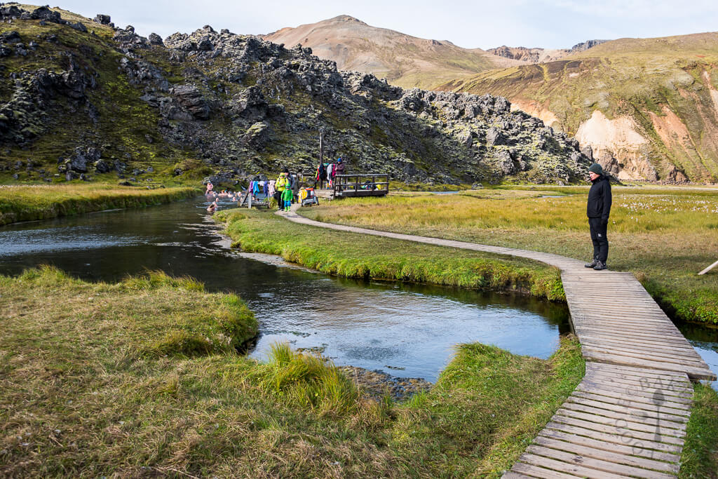
Brennisteinsalda hot spring

Distance from car park: 5-7 minutes from both car parks (in camp and before camp)
Time spent at: 20-40 minutes 
Worth visiting even with bad weather: yes
Physical condition needed: little to medium
Interesting index: 1 – amazing (1-amazing, 2-great, 3-nice)

Brennisteinsalda hot spring is the only real natural hot spring (without any human interference) we’ve seen in Iceland so it’s definitely worth trying. It’s basically a stream of some really hot water (>50°C) flowing into the small river and you may bath in this river. There’s no place to change your clothes, just a wooden structure to put leave your clothes on, which also serves as an entrance to the hot river. The river actually isn’t so hot, maybe around some 26-30°C which doesn’t feel so fantastic when it’s like 5-10°C outside. But the more you approach the actual hot stream, the warmer it gets. The warmest place is, of course, just near the place where the stream flows into the water. This is the place you want to aim for (but so will all your fellow co-campers). You will probably have to wait some time to get to that source.

There’s also another smaller stream a few meters to the right, so these 2 streams flowing into the river are the hottest spots. The river is also really shallow, only some 40-70cm deep, so you basically have to lie in it to be covered by water. Nevertheless, it’s definitely worth the experience and it’s a really cool thing to try as Brennisteinsalda hotpot is one of the very few “wild” hot springs not artificially modified by locals.

Landmannalaugar hot spring

Landmannalaugar hot spring. Picture taken from https://www.foodiebaker.com/day-4-iceland-travelogue/

More Videos

epic iceland facebook group ask questions or get inspired in our community

Posted by Igor in Our Journey, 23 comments
Landmannalaugar Full Hiking Guide

Landmannalaugar Full Hiking Guide

What is the best hike in Landmannalaugar? When to visit it and how to get there? These are the question we asked when visiting Landmannalaugar for the first time. Below we describe what we think are the most beautiful hikes in Landmannalaugar.

We have visited Landmannalaugar many times and explored all the hikes. That’s why we decided to create the most detailed guide for first-time visitors you can possibly find. Let us know in the comments if we were successful!

How to get to Landmannalaugar?

Landmannalaugar is located in the Fjallabak Nature Reserve, in the southern Highlands of Iceland.

You can get to Landmannalaugar by car, by bus, or by a super jeep tourHighland Buses (10% discount code: in our newsletter) run only during the main season, typically from mid-June until mid-September. Outside of the main summer season, it’s highly recommended to take the super jeep tour instead. The roads leading to Landmannalaugar are often full of snow and impassable at that time. 

Landmannalaugar by car

f208 landmannalaugar iceland

Amazingly beautiful roads around Landmannalaugar

How to get to Landmannalaugar by car? You have 3 options on how to reach Landmannalaugar. You can either take the southern route (the most beautiful and difficult),  the western route (something in between), or the northern route (easiest). 

Firstly, you can drive to Landmannalaugar only when the roads leading there are open. Roads to Landmannalaugar typically open in June and usually close in September. This can vary depending on the toughness of the past and the upcoming winter. Secondly, you need to rent a 4wd car to reach Landmannalaugar.

1. From the south (Road F208)

The southern road to Landmannalaugar is the most difficult and also the most beautiful one. The route leads via an F-road called Fjallabaksleið Nyrðri, or southern F208. This is one of the most beautiful F-roads in Iceland. There are several small and medium-sized river crossings along the way. Dacia Duster or a medium-sized 4wd car is a minimum for this road.

F208 south is our favorite road to and from Landmannalaugar. It’s a once-in-a-lifetime experience to drive it. There are also multiple wonderful detours along the road like Eldgjá or F235 towards lake Langisjór. Take a proper car, study the proper river crossing techniques, and go for it! If you don’t feel like doing these things then take an easier road or a guided tour. 

2. From the west (Road F225)

The western route to Landmannalaugar is a good compromise between the beauty of the surroundings and the difficulty of the road. To get to Landmannalaugar from the west, you have to take the paved road 26 and then turn east to an F-road called Landmannaleið or just F225. This is one of the easiest F-roads with one small-to-medium river crossing. This river crossing is great for practice because it’s quite easy to pass. 

The road F225 is also the quickest option to drive to Landmannalaugar. The road is shortest by distance and the quality of the road is alright, with no major obstacles. Even Icelandic buses use F225 to drive to Landmannalaugar! The surroundings of Landmannaleið are picturesque and much nicer compared to northern road 208. 

3. From the north (Road 208)

The northern road to Landmannalaugar is the easiest and the most boring one. There are no river crossings on this route, just the one final river crossing right before the Landmannalaugar campsite. Officially, you don’t even need a 4wd car for the majority of the route, only for the last part – road F224

This route consists of driving via road 26, road 208, and road F224. Road 26 is paved and road 208 is a bumpy gravel road with pretty monotonous surroundings. We recommend taking this route only if you are really afraid about driving to Landmannalaugar.

4. Road F224

The last part of the road to Landmannalaugar is a short F-road Landmannalaugavegur or F224. It’s very bumpy and full of potholes, and there is one medium river crossing right at the end of the road, before the campsite. There’s also a car park before the crossing, so you may leave your car there and continue by footbridge to the campsite.

Landmannalaugar by bus

You can get to Landmannalaugar by bus from Reykjavik, Selfoss, or Hella. Buses run only during the main summer season, typically from 15th June until 15th September. See Landmannalaugar bus schedules below. Two main Landmannalaugar bus companies are running the so-called Highlands buses:

The main disadvantage of the buses is that they typically arrive at Landmannalaugar at lunch and leave around 4 pm or 6 pm at the latest. This means you will have only around 4 to 6 hours to explore the area if you want to come back the same day. 

Don’t want to go on your own? Take an epic Landmannalaugar super jeep tour! 10% discount code: EPICICELAND10

Landmannalaugar by guided tour

landmannalaugar super jeep tour

Landmannalaugar super jeep tour by Midgard Adventure, 10% discount code: EPICICELAND10

There are 3 types of guided tours going to Landmannalaugar:

So which one is our personal choice number one? The most authentic way to reach Landmannalaugar is to take a super jeep tour. The experienced local driver will take care of everything and you can just sit and take pictures on the seat of a huge super jeep with a snorkel. 

There are many Landmannalaugar super jeep tours, but if we have to recommend just one, it would be a super jeep Landmannalaugar tour by Midgard Adventures. They are a small, local, family company, with 5* reviews only. Their guides are funny, personal, and knowledgeable and their jeeps are majestic. Our readers can also enjoy a 10% discount on all tours by Midgard Adventure with the discount code: EPICICELAND10

There are also many stunning places in the Highlands that are lesser-known than Landmannalaugar.

Parking in Landmannalaugar in 2025

Beginning June 20th, 2024 there’s a new parking reservation system in place in Landmannalaugar. You have to reserve your parking spot in advance when arriving at Landmannalaugar between June 20th and September 15th, 2025, between 8AM and 3PM. Otherwise you may be denied parking.

Landmannalaugar parking reservation

You have to reserve your parking spot in Landmannalaugar between 8AM and 3PM.

You can reserve your Landmannalaugar parking space here.

The reservation is compulsory for any type of a private or rental car. It’s not necessary for guides and bus tours.

This system is a pilot program and has been introduced only very recently (spring 2024) due to parking chaos that ocurred during the summer season of 2023 in Landmannalaugar.

When to go to Landmannalaugar?

The best time to visit Landmannalaugar is during summer. More specifically, from mid-June until mid-September. This is when roads and hiking trails are typically open. If winter is too strong, roads can sometimes open as late as the beginning of July. On the other hand, if the winter is really mild, roads can open as soon as the end of May. Then they typically close anytime between the beginning of September and mid-October. 

landmannalaugar from blahnukur

Sunny summer view over Landmannalaugar from the peak of Bláhnúkur

Landmannalaugar in summer

Summer is the only time when you can drive to Landmannalaugar on your own or catch a bus to Landmannalaugar. It’s also a time when you can safely hike in Landmannalaugar because the hiking trails are snow-free. Last but not least, the colors of Landmannalaugar are most beautiful exactly in summer, or on the edge of spring/summer or summer/autumn. 

Summer weather in Iceland is usually the most merciful. There’s much more to say about Icelandic weather though. In very short words – never underestimate the harsh Icelandic weather and overestimate your physical condition.

Landmannalaugar in winter

private super jeep tour

Private super jeep tour to Landmannalaugar in winter

It’s possible to visit Landmannalaugar also in winter, but only by a super jeep tour. Winter conditions in Icelandic highlands are very harsh and often life-threatening. This is where you simply need a super jeep and the experience of the local driver. Even they may decide not to go if the weather and road conditions are unfavorable. 

That being said, visiting Landmannalaugar in winter is a very unique experience and you will 100% be alone there only with your tour guide. We can highly recommend the winter Landmannalaugar super jeep tour by Glaciers and Waterfalls, for which you can enjoy a 10% discount with the discount code: EPICICELAND

10 best hikes in Landmannalaugar

There are many beautiful hiking trails in Landmannalaugar. If you are really into hiking then Landmannalaugar is a place where you should spend more than just a few hours. Hiking trails in Landmannalaugar range from as short as 30 minutes to as long as 3-4 days. Below are summarized the 10 most popular hikes in Landmannalaugar.

Note: In this article, we list only the best 10 Landmannalaugar hikes in the main area around the Landmannalaugar campsite. There are many other hikes in a wider area called Fjallabak nature reserve and also around Hekla volcano! Be sure to read our articles on these too!

Landmannalaugar hiking map

landmannalaugar map

The most important slice of the Landmannalaugar map for your 1-day trip

Above is the map of the most popular hikes in Landmannalaugar – Blahnukur, Brennisteinsalda, and Laugahraun. These are the hikes accessible right from the Landmannalaugar campsite. This Landmannalaugar map helped us a lot with orientation. I wonder why it’s so hard to find this map online, but this map is basically all you need to know. 

1. Brennisteinsalda

pointing at brennisteinsalda

Pointing at Brennisteinsalda from the Bláhnúkur hiking trail

Distance from the car park: 5/10 minutes (to the start of the trail, from camping/car park in front of the camping)
Hiking time: 1 hour to the top (one-way)
Worth visiting in bad weather: depends
Difficulty: moderate
Hiking trail: Brennisteinsalda hiking trail

There are two main, most beautiful, one-day hikes you can do from the Brennisteinsalda campsite. And it can be a bit confusing to understand the difference between them and how to get to each trail. At least for us, it was in the beginning. So let’s get to the point.

The first of the hikes, the easier and quicker one, is the hike ending at the top of the Brennisteinsalda volcano, or “orange mountain”. It takes about an hour to reach the top and some 30 minutes to come back. The ascent is of normal difficulty and everyone should be able to make it.

2. Bláhnúkur

brennisteinsalda top view

View from the top of Brennisteinsalda towards Bláhnjúkur

Distance from the car park: 15 or 40 minutes (if you want to go only for Blahnukur or if you first want to go for Laugahraun lava field)
Hiking time: 1 hour to the top by the eastern trail, 2 hours by the western trail (both one-way)
Worth visiting in bad weather: no
Difficulty: moderate
Hiking trail: Bláhnúkur hiking trail

The second hike, for me even more beautiful, is the hike to the Bláhnúkur peak or “Blue peak”. It’s a bit longer hike, it took us 1,5 hours to get to the top and some 1 hour to get back to the campsite and you should be in good physical condition to make it, at least compared to other places in Iceland where you just step out of your car and make a 5-minute walk. But it’s definitely doable for everybody and more than just worth it as it’s one of the most beautiful views in entire Iceland. Just be prepared for a mountain hike.

If you are in good physical condition and the weather is good, I definitely do recommend you to go for both peaks – Brennisteinsalda and Bláhnúkur as well. It’s a beautiful loop trail, so you don’t go twice via the same trail and all the views around it are breathtaking. On halfway to Brennisteinsalda, you’re going to cross a lava field called Laugahraun which is interesting as well, although compared to the other peaks it’s not that special.

3. Brennisteinsalda Bláhnúkur loop

blahnukur view over landmannalaugar

View from Bláhnúkur over Landmannalaugar

Distance from the car park: 5/15 minutes (to the start of the trail, from camping/car park in front of the camping)
Hiking time: 4-6 hours round-trip depending on your pace
Worth visiting in bad weather: usually no
Difficulty: moderate to difficult
Hiking trail: Brennisteinsalda Blahnukur loop hiking trail

If we had only 1 day in Landmannalaugar, and if we had to choose just 1 hike, then the single best hike in Landmannalaugar is undoubtedly the Brennisteinsalda Bláhnúkur loop hike. Why? Because you can see the majority of the most beautiful parts of Landmannalaugar from the peaks of Brennisteinsalda and Bláhnúkur and the hike is nicely doable in just one day. 

Bláhnúkur Brennisteinsalda loop, or the “orange mountain – blue mountain” loop, is not for the elderly or small children, but you can surely do it if you are at least in average shape. Reserve a whole day for this hike and don’t go if it rains considerably or if the wind is too strong. Some parts of the hike are rather steep. We wrote a step-by-step guide to hiking Brennisteinsalda Bláhnúkur loop below.

4. Grænihryggur

Graeihryggur hike

Epic Grænihryggur hike almost nobody knows about

Distance from the car park: 5 minutes (to the start of the trail, from the roadside car park)
Hiking time: 6-8 hours round-trip depending on your pace and how far you go
Worth visiting in bad weather: usually no
Difficulty: moderate to difficult
Hiking trail: Grænihryggur hiking trail

Our personal favorite in Landmannalaugar is the Grænihryggur hike. This is a true hidden gem almost nobody knows about. Yet, it offers some of the most beautiful views in Landmannalaugar with almost no co-hikers! The hiking trail is official and is no secret, and despite this fact, typically only locals hike Grænihryggur, the green ridge.

To hike Grænihryggur you need a full day and preferably no rain and no strong wind. Some parts of the Grænihryggur hiking trail are a bit steep and slippery. It is a one-way there and same-way back hike. Nevertheless, the surrounding landscapes are more than just worth being seen twice! We recently wrote a brand new detailed guide to the Grænihryggur hike. Hope it helps you plan your trip!

5. Laugahraun

brennisteinsalda peak view

View from the top of Brennisteinsalda towards Laugahraun

Distance from the car park: 5/10 minutes (to the start of the trail, from camping/car park in front of the camping)
Hiking time: 15-20 minutes (one-way)
Worth visiting in bad weather: yes
Difficulty: easy

Laugahraun is a lava field with interesting rock formations formed from volcanic lava eruptions. It takes some 30-40 minutes to hike it from the campsite and it stands halfway to Brennisteinsalda mountain. It’s a nice place to see but it was not that amazing for us compared to other sights like the peaks of Bláhnúkur or Brennisteinsalda.

6. Ljótipollur

ljotipollur

Ljótipollur

Distance from the car park: right next to it
Hiking time: 10 minutes (one-way)
Worth visiting in bad weather: yes
Difficulty: easy

Ljótipollur is a red crater lake with amazingly colored water situated in the moon-like highlands of Landmannalaugar. It’s a nice and short stop close to the campsite. Unfortunately, the place has become pretty popular recently, because it’s very easily accessible and doesn’t require a huge jeep or a long hike to reach. We wrote in detail about our visit to Ljótipollur

There’s a short F-road leading to Ljótipollur, suitable for almost any 4wd car. At the end of the road, there’s a little black-ash car park. From the car park, it takes just about 5-10 minutes of uphill walking to reach some of the best viewpoints of Ljótipollur. It’s possible to hike even further around the area, but most of the visitors turn back after seeing the crater from above.

7. Hnausapollur

hnausapollur blahylur iceland

Hnausapollur, or Bláhylur volcano lake in Landmannalaugar

Distance from the car park: right next to it
Hiking time: 1 minute
Worth visiting in bad weather: yes
Difficulty: easy

Hnausapollur, or Bláhylur, is another crater lake that looks like from another planet. It is located right next to road 208 north of Landmannalaugar. It’s possible to drive and park your car right at the edge of the Hnausapollur crater lake. You can then either admire the lake from the viewpoint next to the car park, or the more adventurous souls may take a long walk around the crater. It is almost guaranteed you will be alone throughout your walk. This can’t be said about the main car park, though, where even tour buses stop.

8. Stútur

road to ljotipollur

Stútur volcano hike to the left

Distance from the car park: right next to it
Hiking time: 10 minutes (one-way)
Worth visiting in bad weather: yes
Difficulty: easy to moderate

What about hiking a little volcano in 10 minutes? Well, go and hike Stútur then! Stútur is a little old volcano covered by moss, located just a short drive north of Landmannalaugar. There’s a tiny car park with a place for 2-3 cars and a little sign indicating a hiking area. All-in-all, the Stútur hike is nicely hidden from the crowds. Even we didn’t spot it when we visited Landmannalaugar for the first time. 

It takes just a short uphill hike to reach the top of the Stútur volcano. Once at the top, you can admire both the 360° views of the area around and also the inner part of the volcano. This is an easy hike that even a family should be able to do. The same can be said about the harsher weather – Stútur can be typically visited even if the weather isn’t ideal. 

9. Hrafntinnusker

hrafntinnusker hut iceland

Hrafntinnusker hut in the heart of the highlands

Distance from the car park: 5-10 minutes from the campsite/car park
Hiking time: 4 hours (one-way)
Worth visiting in bad weather: no
Difficulty: moderate to difficult
Hiking trail: Hrafntinnusker hiking trail

Hrafntinnusker is a geothermal area close to Landmannalaugar with an ice cave, a mountain hut, and a lot of hiking trails everywhere around. The only catch is, Hrafntinnusker is a very hard-to-access place. One of the options is to grab a super jeep and drive there. Yes, you need a super jeep to reach Hrafntinnusker even in summer. Don’t even think about winter! Impossible!

The other option is to get to Hrafntinnusker by hiking. Hrafntinnusker is actually a part of the famous Laugavegur trek (see below). The shortest hiking trail to Hrafntinnusker starts at Landmannalaugar campsite and takes about 4 hours (one way) to complete. Once there, you will be rewarded with one of the most remote and highest-altitude corners of Iceland.

10. Laugavegur trek

best laugavegur hike guided tour

By far the best Laugavegur hike guided tour by Icelandic Mountain Guides, 5% discount code: EPICICELAND24

Distance from the car park: 5-10 minutes from the campsite/car park
Hiking time: 3-7 days (one-way, depends if you include also connecting Fimmvorduhals hike)
Worth visiting in bad weather: no
Difficulty: difficult
Hiking trail: Laugavegur hiking trail

The most epic hike in Iceland is the Laugavegur hike, many would say. The Laugavegur trail typically takes about 4 days to complete. Hikers spend their nights at the mountain huts or at the campsites located right next to the huts. The hike is difficult mainly due to the length and unpredictable weather, but the trail is doable for anyone who is fit and used to hiking.

Laugavegur hike is the most legendary hike in Iceland and even many Icelanders are still taking it every year over and over. During the 4 days of hiking Laugavegur, you will be guaranteed to see the best Iceland has to offer. Little volcanoes, out-of-this-world canyons, magnificent valleys, adventurous river crossings, snow spots even in summer, waterfalls, and hot springs. This is just a very short glimpse of all the spectacular things you will see along the Laugavegur trek.

Hiking the Brennisteinsalda Bláhnúkur loop

We had only 1 day in Landmannalaugar, so we decided to go for the best 1-day hike in Landmannalaugar, the Brennisteinsalda-Laugahraun-Bláhnúkur loop. We first climbed the orange mountain, or Brennisteinsalda, coming from the campsite. Then we turned back towards Bláhnúkur and traversed across the Laugahraun lava field to the blue peak of Bláhnúkur.

Brennisteinsalda hike

brennisteinsalda hike start

This is how the start of the hiking trail toward Brennisteinsalda looks like

Hike for Brennisteinsalda volcano is quite easy and takes around 1,5 hours round trip. If you either don’t have much time or weather is worsening or you simply aren’t into hiking that much, you can definitely make Brennisteinsalda hike. The trail to the top and the view from the top itself is definitely worth it. We experienced it in slightly foggy weather and it was still beautiful.

You start at the main building of Landmannalaugar/Brennisteinsalda campsite where there are red signs pointing to two opposite directions. When coming from the river crossings facing the campsite, the one pointing left is the one for Bláhnjúkur and the one pointing right is the one for Laugahraun lava field and Brennisteinsalda.

brennisteinsalda hike

Views from the Brennisteinsalda hike

The other way how to orientate yourself is simply to go in the direction of the mountain (you can see it throughout almost the entire trail) and use common sense. Although the trail is well marked, the signs are not very helpful because they contain just the name of the entire trail and they don’t point specifically to Brennisteinsalda. It’s important to stick to the marked trail to not destroy Icelandic untouched nature and not get yourself fined heavily.

Your first checkpoint would be crossroads with the Laugahraun lava field where you will continue to the upper right, i.e. above the field. Then you will eventually arrive at another crossroad just below Brennisteinsalda where you should turn right, to face the only little steeper part of the hike right towards the peak. Once you reach the peak, you can enjoy 360° views of surrounding landscapes, Laugahraun field from a bird-eye view, and also majestic Bláhnjúkur peak nearby.

brennisteinsalda top

View from the top of Brennisteinsalda on a slightly foggy day. Still very windy at the top, despite a calm day.

There was no wind below Brennisteinsalda at the time of our visit, but at the peak, the wind was blowing like crazy. So be prepared for this. After Brennisteinsalda you may either come back to the campsite or continue for the Bláhnúkur peak – as we did. If you have enough energy and the weather is alright I definitely do recommend going for Bláhnúkur as well because the views surrounding that route are even more amazing.

Laugahraun hike

Laugahraun hiking trail

Easy Laugahraun hiking trail

We didn’t go particularly for the Laugahraun hike, but we stumbled upon it on our way back from Brennisteinsalda peak and on our path further towards Bláhnúkur mountain. Laugahraun is a nice and easy family walk through the old black lava field. Coming from Brennisteinsalda, if you leave the Laugahraun field at its top-right part, you will find yourself at the beginning of the trail for Bláhnúkur, the Blue peak.

Bláhnúkur hike

blahnjukur hiking path

Slippery clay slope at the start of the hike to Bláhnjúkur or Blue peak

For us hike to the Bláhnúkur, or the Blue peak was the most beautiful, the most rewarding, and the most difficult part of our one-day visit to Landmannalaugar. We had to find the beginning of the trail, we had to ford the small river, we had to climb the steep muddy hill and then we had to cope with a strong cold wind at the top.

All of these were definitely worth the experience. Views encompassing the route are amazing if you are lucky with the good weather and the view from the peak is even more breathtaking. So how do you reach Bláhnjúkur?

You have three options on how to reach the top (including the circular round trip we did, starting with Brennisteinsalda and continuing to Bláhnúkur or vice versa). Arriving from river crossings before Landmannalaugar you may either:

  1. turn left and go directly for Bláhnúkur or
  2. you may turn right, reach the Laugahraun lava field first and then continue for the Bláhnúkur hike or
  3. of course, you may choose the order we chose, i.e. after reaching Laugahraun continuing for Brennisteinsalda peak, then coming back to Laugahraun, and then going for Bláhnjúkur.

I recommend the way we did it, i.e. the circular route so that you can see everything.

blahnjukur hike views

Spectacular views right from the beginning of the hike on Bláhnjúkur and even on the slightly foggy day

After you leave the upper right part of Laugahraun field (coming from Brennisteinsalda trail), you will arrive at the small river. Despite the river being small, there’s no bridge or designated place where the river should be crossed. We spent almost 30 minutes searching for a spot where to cross the river to not get our feet wet in this cold weather. And up to this day, I don’t know where was the “official” spot meant for this Landmannalaugar river to be crossed.

What we finally did was go almost 10 minutes to the right along the bank of the river coming to the place where the river was shallow enough with enough pebbles to jump on and pass. Then we had to come these 10 minutes on the other side of the river back again to reach the yellow marks marking the trail towards Bláhnjúkur. So, after 30 minutes of struggle, we managed to ford the river without getting wet, although I’m not sure whether this was the way meant for crossing. Probably no.

blahnjukur hike near top

Bláhnjúkur hike near the top

Afterward, for us, the most dangerous part followed. The trail is well-marked with yellow sticks so you shouldn’t get lost. You will shortly arrive at the steep clay slope going up closer to Bláhnúkur. The ascent is not hard or anything, but it’s quite steep and you don’t have a good grip on the ground because of the clay. So with each step, you feel like slipping on the smooth clay. I was equipped with high-quality La Sportiva hiking shoes and those didn’t help either.

There are neither stairs nor chains so you can only help yourself by going slowly zig-zag to the top. Fortunately, this part is not too long and takes some 10 minutes to complete. What follows next is just a typical gravel hiking trail and you shouldn’t have any problems continuing up the trail. Magnificent views will shortly emerge and will accompany you all the way to the top.

blahnjukur peak view

One of the views from the peak of Bláhnjúkur towards Landmannalaugar and 2nd (steeper) hiking trail

We had a semi-clear sky with partially sunny, partially cloudy weather, and light fog. This is still supposed to be good weather so we enjoyed every moment of it. Visibility (although not perfect) was fine and the views were, as I already mentioned, breathtaking. We met just a single-digit number of visitors at the peak, so at the time of our visit, the peak being crowdy wasn’t an issue.

It was really windy and the temperature felt like 5°C even on a sunny summer day like ours, so be prepared for that. Once reaching the top, you will be rewarded with the best views over the area.

blahnjukur top view

Another view from the peak of Bláhnjúkur towards Landmannalaugar camp, Laugahraun, and 2nd (steeper) hiking trail

The way back

We started our descent from the other side of the mountain (the one where you may access Bláhnjúkur right from the campsite), which was supposed to be much steeper, according to guides I’ve read. That definitely wasn’t true and compared to the steep clay part we had to overcome before, this was a piece of cake. I wonder what’s worse – to ascent the clay part or descent? I guess descent would be worse. The path continued without any obstacles until we reached the point where we could see the small river we’d forded before from above.

At this point we’d also seen the campsite from above already, so we continued pursuing that direction. The entire descent wasn’t hard and it took us some 1 hour at maximum to reach our campsite again. We went for a hot chocolate at the nearby snack bar, ate a little, and it was still only before 3 pm so we had enough time to continue with our journey.
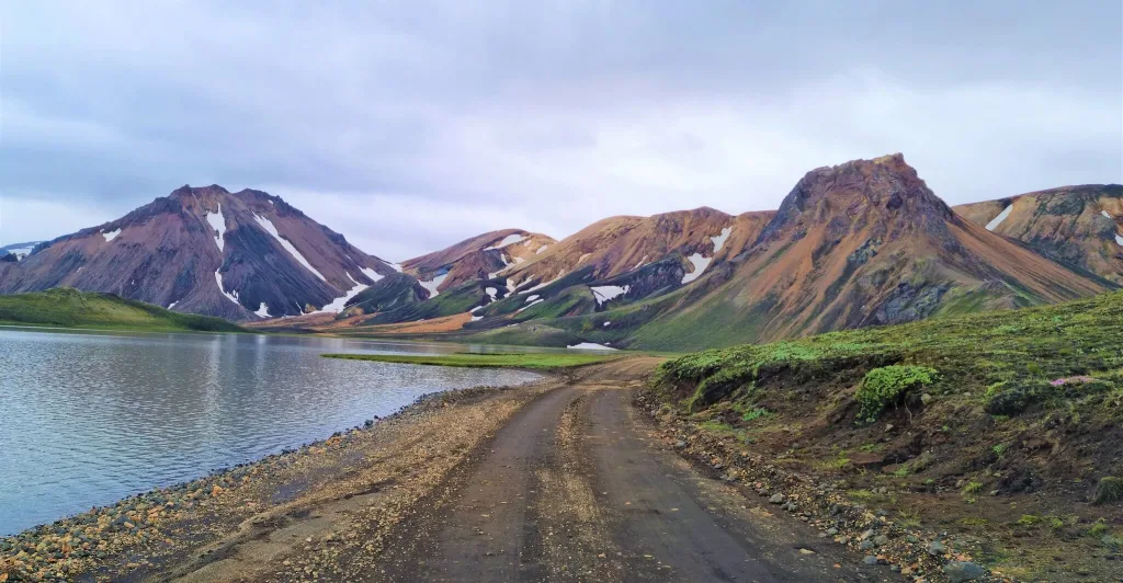
Landmannalaugar hot spring

landmannalaugar hot spring

Landmannalaugar hot spring

The hot spring in Landmannalaugar is one of the most popular wild hot springs in Iceland. Landmannalaugar hot spring is located next to the Landmannalaugar campsite and it takes about 5 minutes of walking to reach it. The hot spring is quite big and it forms sort of a hot river. 

There are two little caveats, though. The first one is, the Landmannalaugar hot spring is quite shallow, just around 50cm / 1.5 feet. The second catch is, the temperature varies considerably around the hot spring. There are parts, where the water is actually cold (close to the clothes-changing deck), and parts where it’s very warm (next to the spring itself). This means all the people try to come as close to the little spring as possible.

There’s a wooden clothes-changing deck, where you may leave your clothes. It is uncovered, hence, if it rains, be sure to use a rain cover for your clothes. Landmannalaugar hot spring is free of charge and it’s a great way to relax after a long day full of hiking. It is not our favorite hot spring, we think there are many other, much greater hot springs. Anyway, it’s definitely nice, unique, and worth trying. 

Landmannalaugar campsite

Landmannalaugar Brennisteinsalda campsite

Landmannalaugar Brennisteinsalda campsite on a summer evening

Landmannalaugar campsite is one of the most beautiful campsites in Iceland. It sits right in the middle of the colorful rhyolite rainbow mountains of Landmannalaugar. On a nice day, even the pictures of the tents at the campsite are lovely. The camping costs 2500 ISK per person (as of summer 2023).
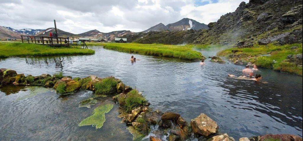
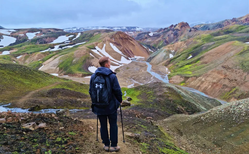
Many come to the Landmannalaugar unprepared for the weather. The campsite is located in the heart of the Icelandic highlands and especially the night temperatures even in summer may reach freezing. Not to mention, if a strong wind and/or rain arrives, the fun begins (hint: irony; the campsite is very uncomfortable in bad weather). Keep track of the weather forecast closely!

There are also mountain huts at the Landmannalaugar campsite, where you may spend the night under the shelter. It is highly recommended to book them in advance due to the huge demand in summer. They are of course much more expensive (11 000 ISK per person as of summer 2023). 

Weather, Roads, and Trail conditions

Below are the useful links for Icelandic weather forecast, road conditions, trail conditions and many more:

F208 after F235 junction

Road F208, or Fjallabaksleið Nyrðri, the southern F-road to Landmannalaugar

FAQ

Below are the most frequently asked questions about Landmannalaugar with the current, up-to-date answers for all of them.

Do you need a 4X4 car to get to Landmannalaugar?

Yes, you need a 4wd car to get to Landmannalaugar. You can get to Landmannalaugar on 3 different roads:

  • Northern route (26, 208, F224) – 4wd is compulsory for the last 2km (F224), and road 208 is very bumpy anyway
  • Western route (26, F225, F224) – 4wd is compulsory
  • Southern route (F208, F224) – 4wd is compulsory, and better take at least a medium-sized vehicle

Do you have to cross the river to get to Landmannalaugar?

Yes, you need to cross the river right before the Landmannalaugar campsite. However, you don’t have to cross the river in your car. You can leave your car at the car park before the river crossing and use the footbridge to walk the last 10 minutes to reach the campsite. To cross the river, it is recommended to drive at least a medium-sized 4wd car.

Below is a video of how NOT to cross the Landmannalaugar river in your car:

What is the easiest road to Landmannalaugar?

The easiest road to Landmannalaugar is the northern route. First, you have to drive the paved road 26, then the unpaved road 208, and finally the gravel road F224. There are no river crossings on this route, but it’s bumpy and rather boring. The only river crossing is located right before the Landmannalaugar campsite and you may leave your car in front of it. 

What is the most beautiful road to Landmannalaugar?

The most beautiful road to Landmannalaugar is called Fjallabaksleið Nyrðri. It is an F-road leading to Landmannalaugar from the south. The other name of the road is F208. The landscapes around the road are amazingly beautiful and unique. Southern road F208 is also the most difficult way to reach Landmannalaugar. There are several medium-sized rivers that need to be crossed. You need to drive a medium-sized 4wd car or bigger to safely pass this road.

What are the best hiking trails in Landmannalaugar?

The best hiking trails in Landmannalaugar are:

This list is of course highly subjective, but the hikes above are otherworldly beautiful and there is no doubt they belong to the most beautiful hikes in Iceland.

landmannalaugar Grænihryggur hike iceland

Grænihryggur hike

What is the easiest hike in Landmannalaugar?

The easiest hike in Landmannalaugar is the short walk around the Laugahraun lava field. It takes only around 30-40 minutes to complete it. One of the easiest and also the most beautiful hikes in Landmannalaugar is the Brennisteinsalda hike. Brennisteinsalda is the orange mountain and the views from the top of it are picturesque. It takes about 1-hour (one way) to complete the hike.

Besides the two hikes mentioned above, there are also many easy and short hiking stops around Landmannalaugar. They involve almost no hiking because you just get out of your car and walk anywhere between 1 minute to 10 minutes to reach your destinations. These include the Stútur volcano, the Ljótipollur crater lake, and the Hnausapollur crater lake. 

I arrive by bus, will I have enough time?

You will have around 4 to 6 hours to explore the area if you want to come back the same day. This is enough time to complete only one hike of your choice, like Bláhnúkur or Brennisteinsalda, but no more. If you want to come and leave by bus on the same day, you will definitely be in the rush. It is advised to spend a night and come back by bus the next day. 

How much time do you need for Landmannalaugar?

If you want to fully enjoy Landmannalaugar you need to spend there at least one full day. Avid hikers will not make a mistake by devoting 2 or more days to Landmannalaugar. There are enough beautiful hiking trails to fill your schedule. But to have a good overview of Landmannalaugar, one day with nice weather is usually enough. 

Landmannalaugar Videos

YOU MAY ALSO LIKE:

epic iceland facebook group ask questions or get inspired in our community

Posted by Igor in Guide, Highlands, 35 comments