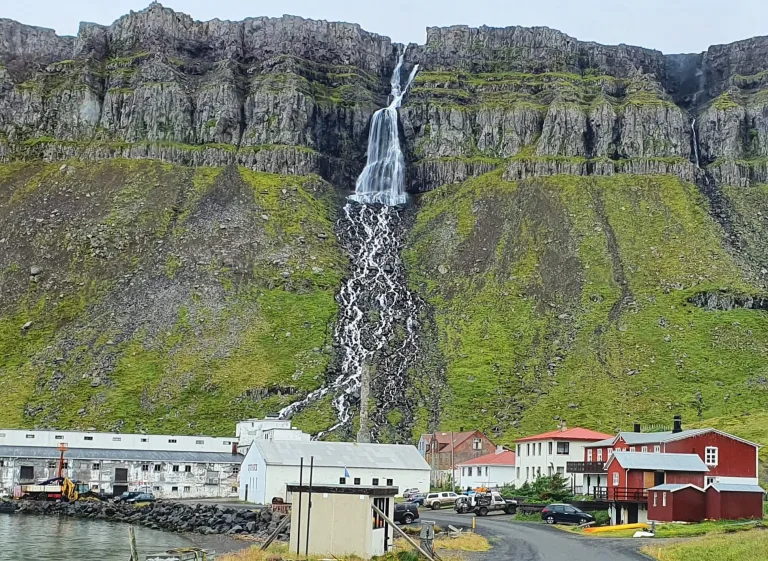
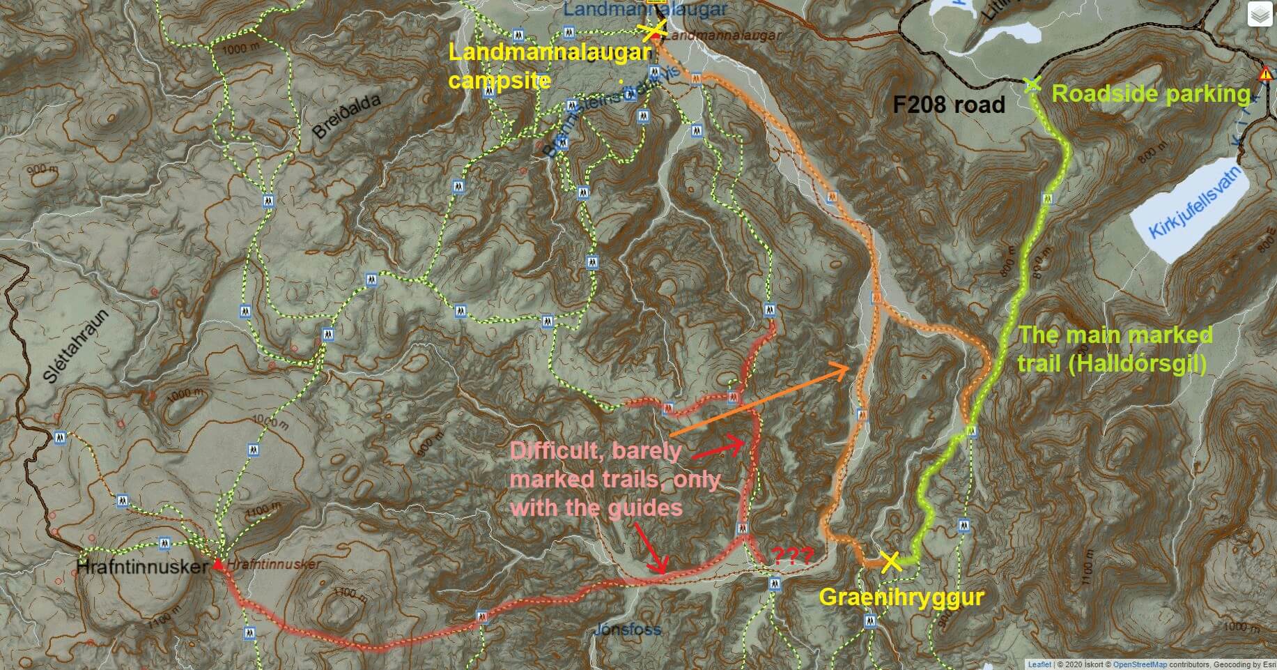
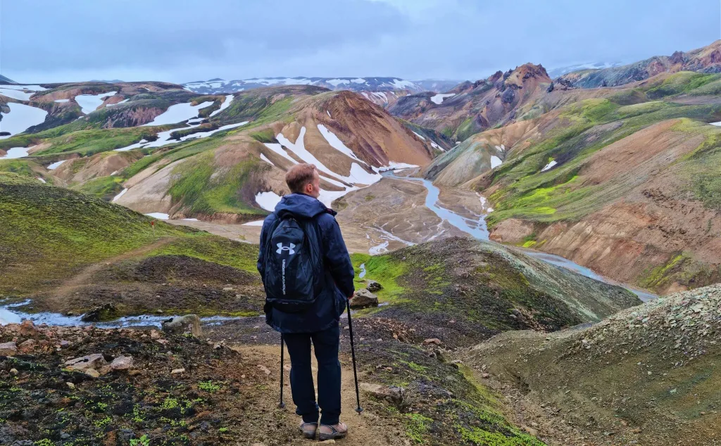
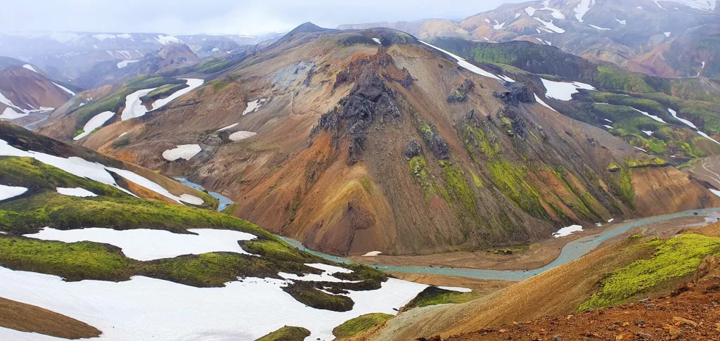
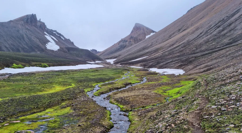
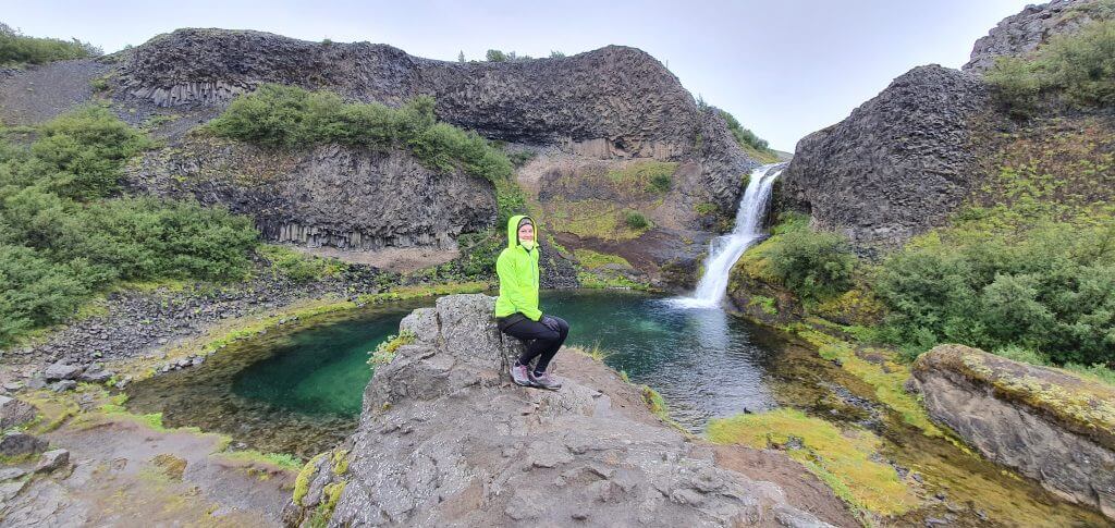
We made a list of more than 130 most beautiful waterfalls in Iceland. This is of course nowhere near the list of all, because there are thousands of them. Nevertheless, we believe that our detailed guide to waterfalls in Iceland covers all you need to know about famous Icelandic waterfalls. We hope it will help you choose your favorite waterfalls to see in Iceland and plan your trip.
All the waterfalls in this article are accessible to visitors. Many of them easily, some of them not. We list the exact location of every waterfall, its photo, its height, and if a waterfall is accessible in winter. If a hike to a waterfall is necessary, we include all info about the hike – distance, difficulty, and hiking trail itself. Importantly, we also describe what type of car you need to reach every single waterfall, or in Icelandic, “foss”.
Note: We will be adding even more waterfalls. Please, if you know of any beautiful waterfall we have not covered yet, send us your picture and waterfall info and we will give you all the credit for it (and a bottle of wine when we meet in person)!
Map of waterfalls in Iceland
Below is the map of more than 500 waterfalls in Iceland, including 130 most beautiful waterfalls:
All the GPS points on this map are under strict copyright and are being tracked for an illegal use. You can’t copy any content without our consent.
Green = easy in summer, easy in winter
Red = easy in summer, harder in winter
Black = harder in summer, hard in winter
Grey = smaller or lesser-known waterfalls
The tallest waterfalls
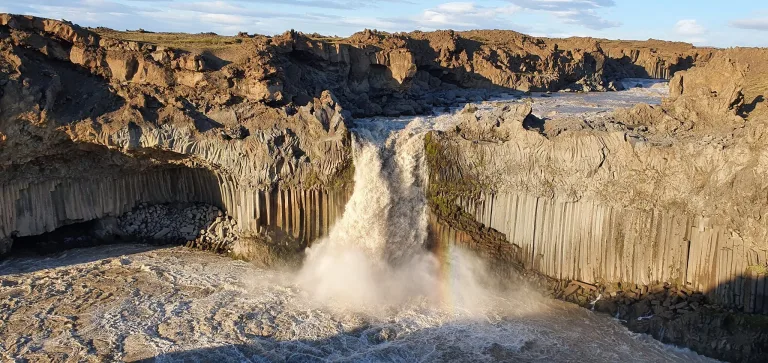
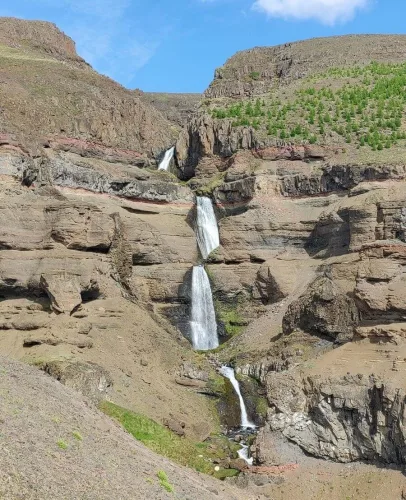
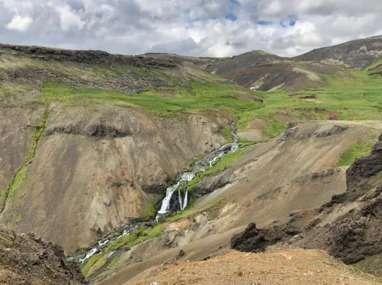
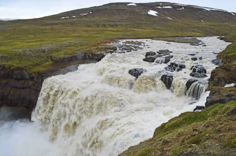
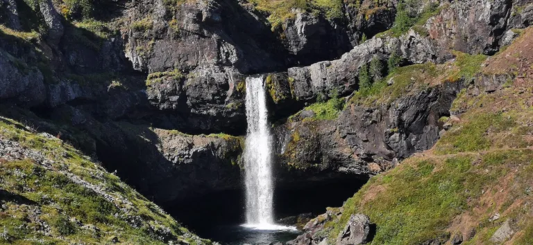
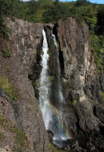
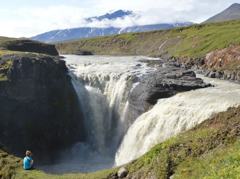
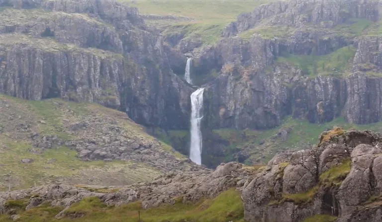
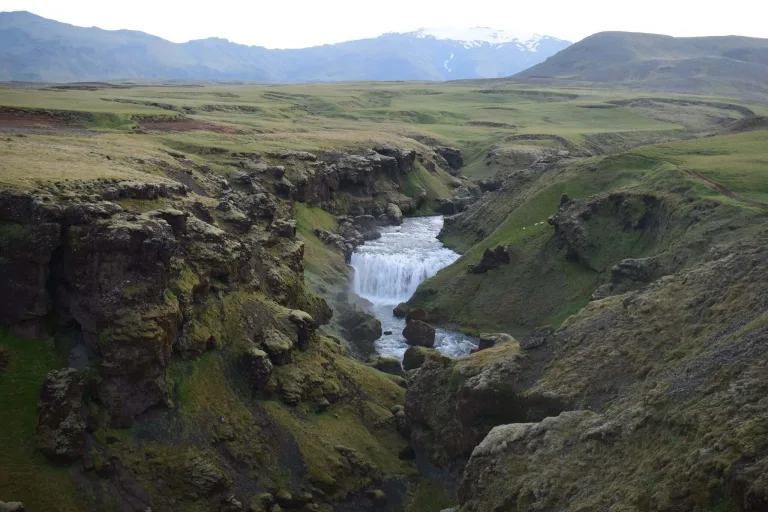
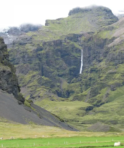
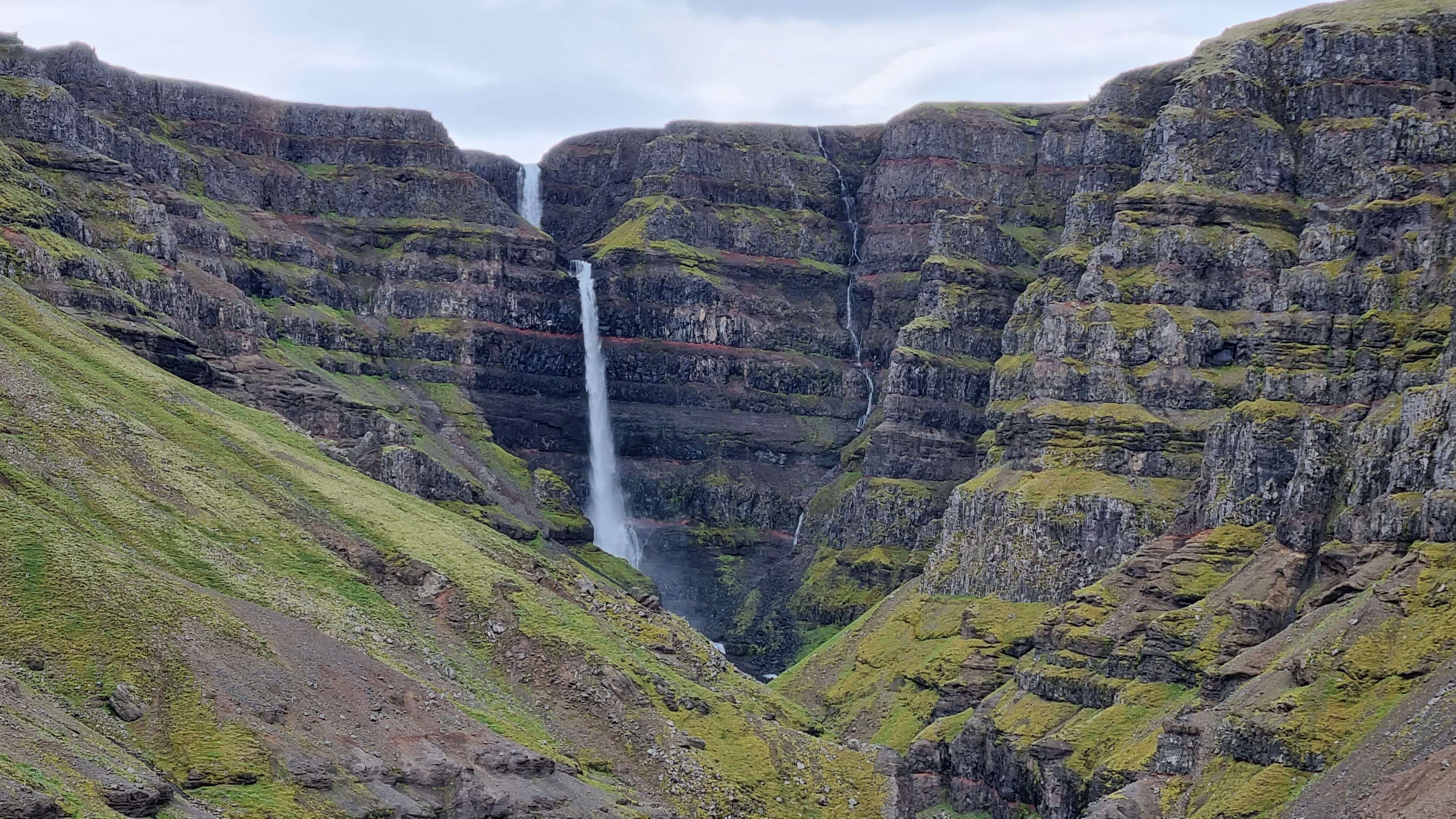
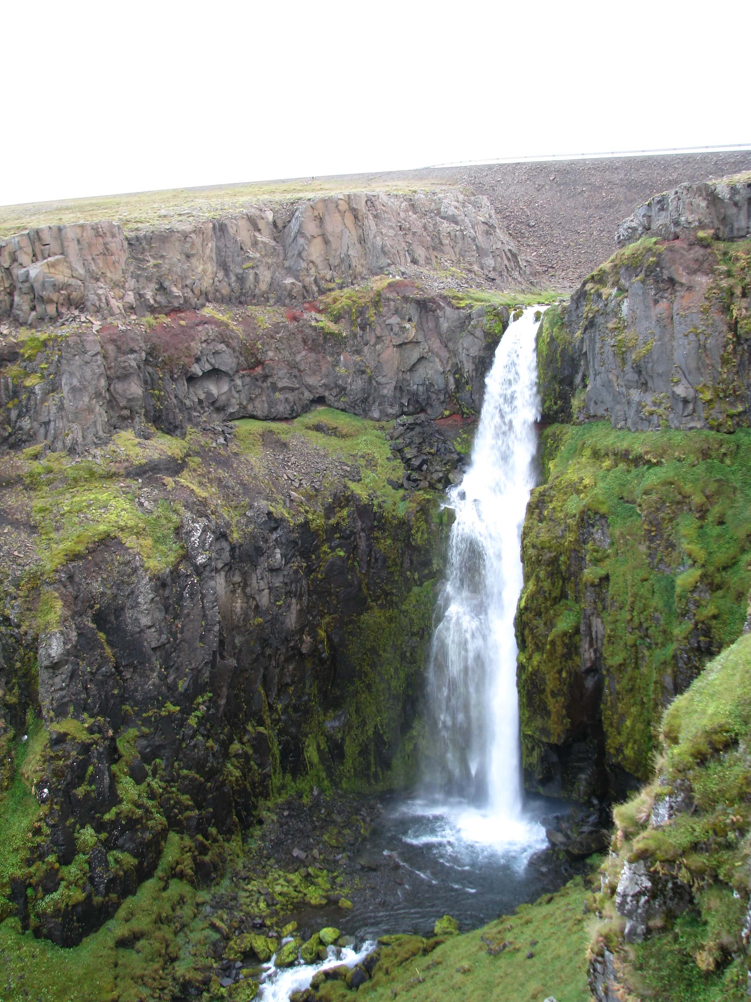
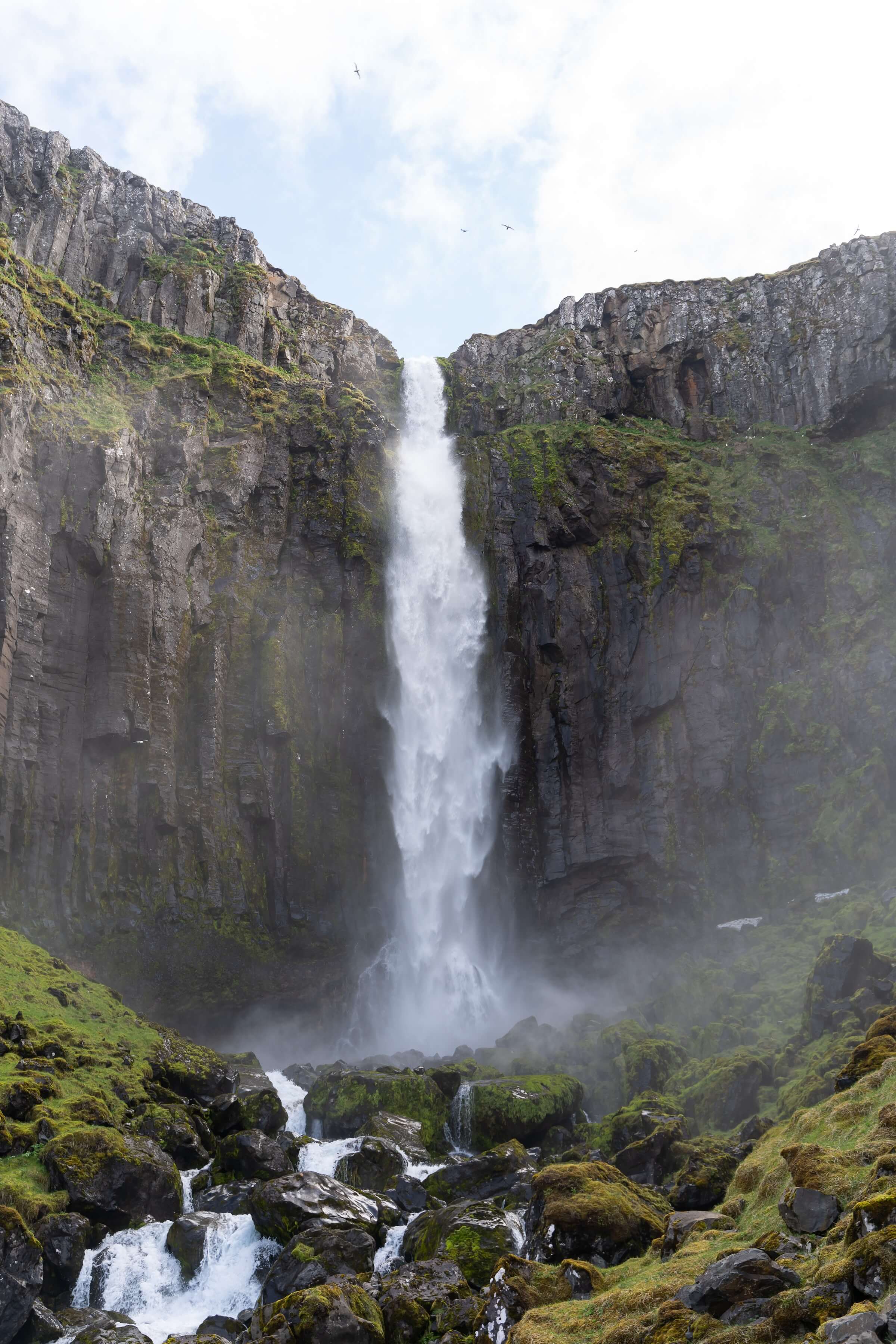
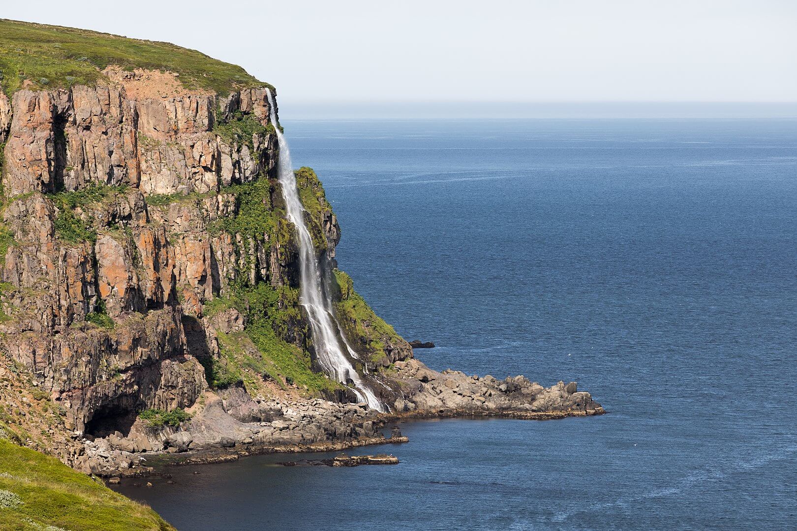
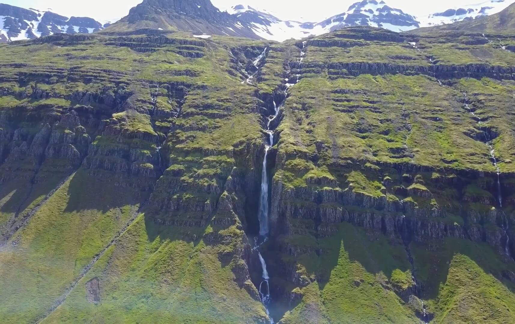
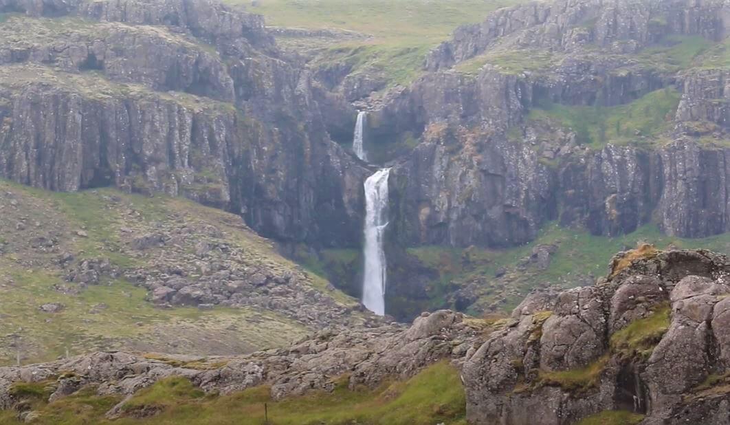
The tallest waterfalls in Iceland are Morsárfoss (235m), Glymur (198m), Strútsfoss (175m), Prestagilsfoss (160m), and Stigafoss (137m). Various sources state various waterfall heights. We combined multiple sources and averaged them to arrive at our ranking. It’s interesting to note that out of the 5 tallest Icelandic waterfalls, only Glymur is well-known and highly visited.
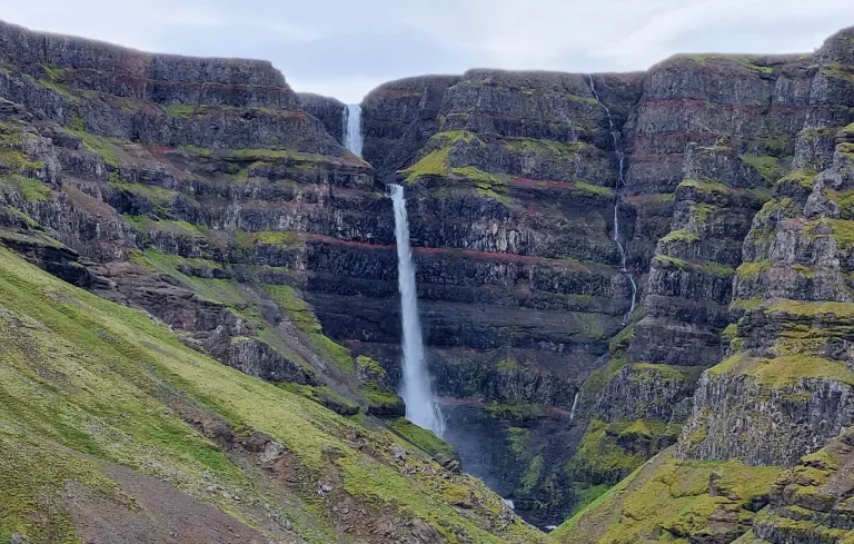
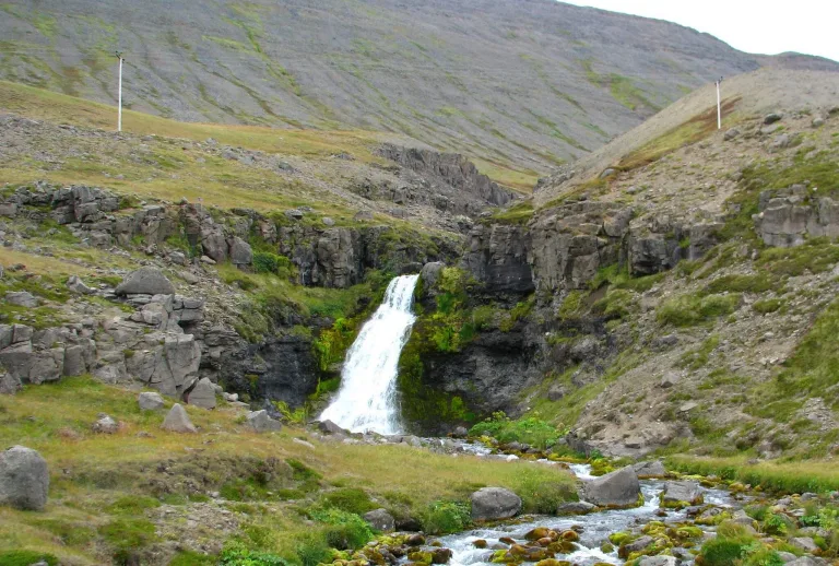
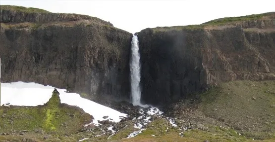
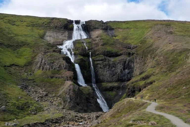
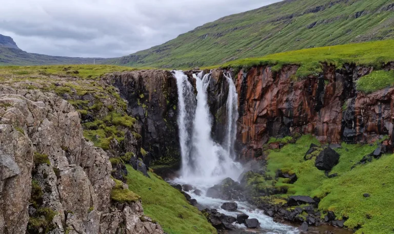
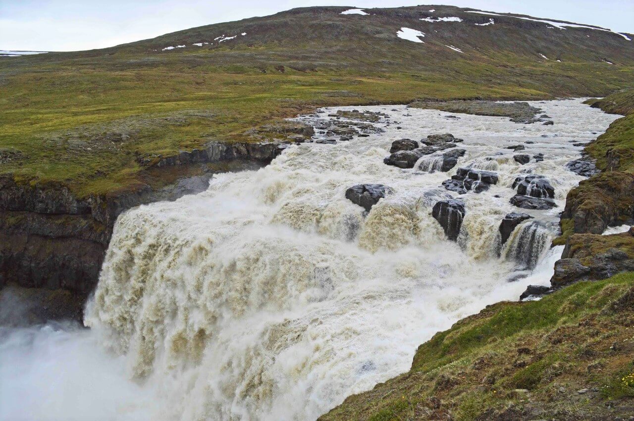
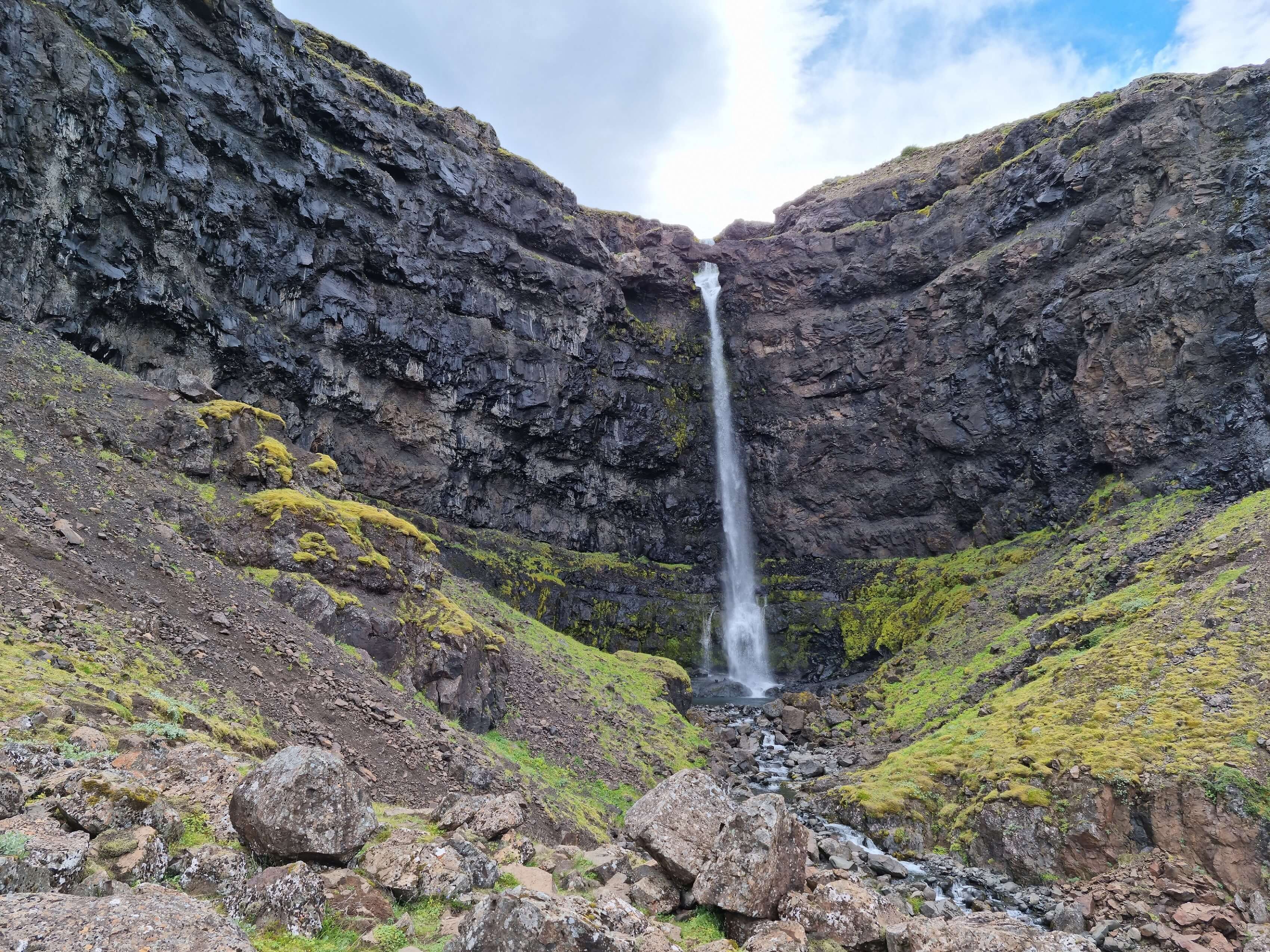
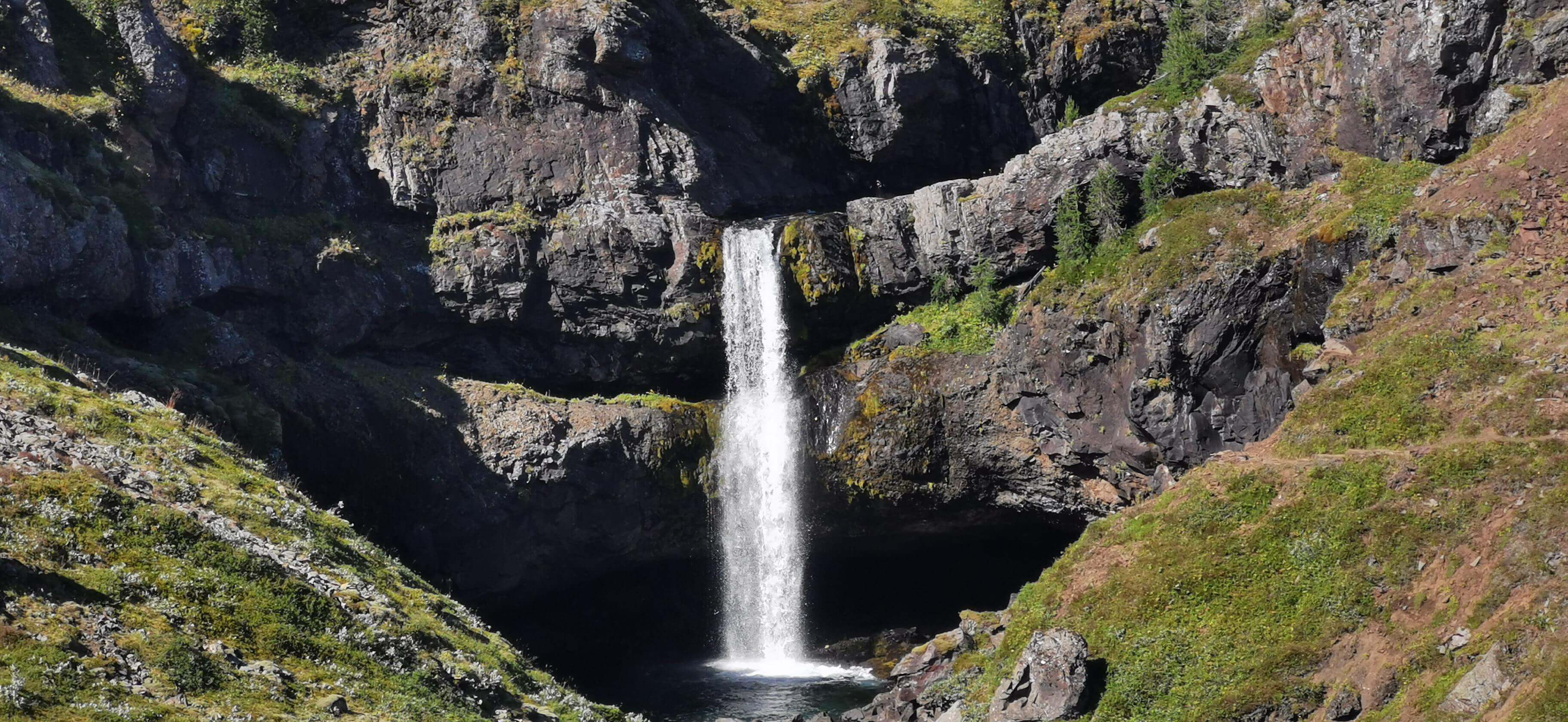
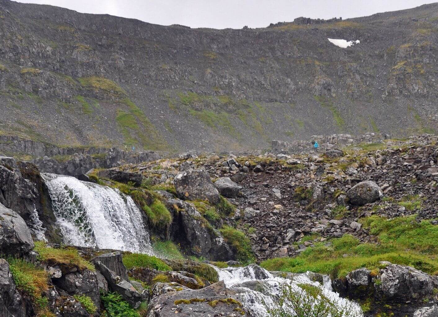
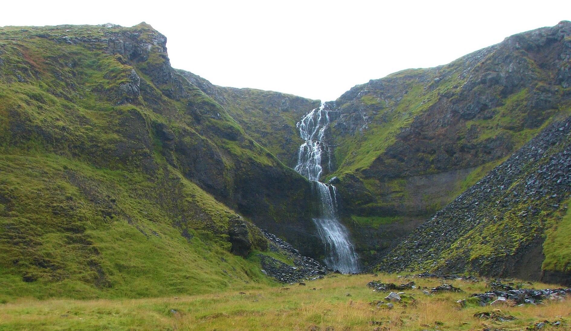
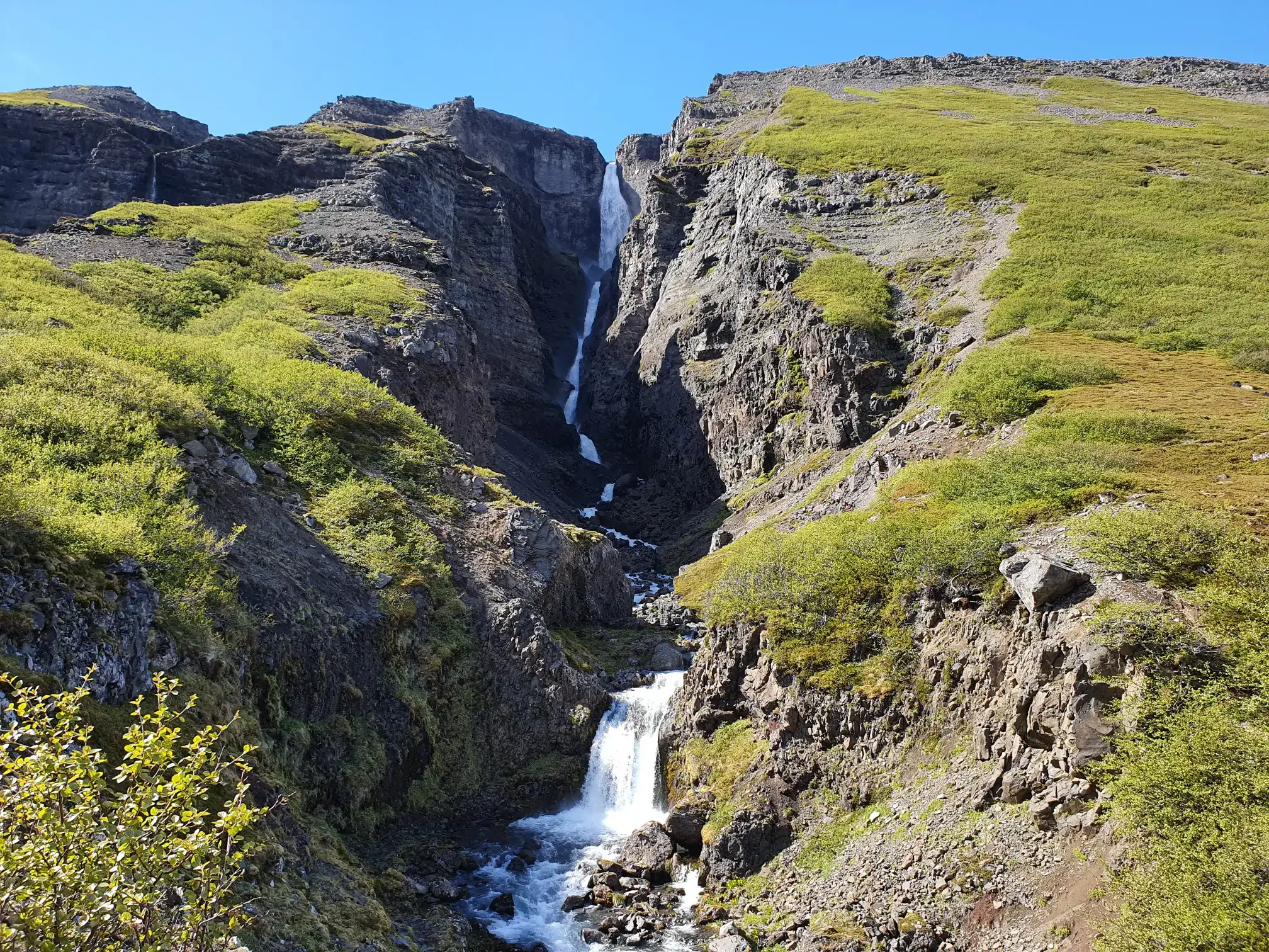
Strútsfoss waterfall (click to enlarge).
The 10 highest waterfalls in Iceland:
- Morsárfoss (235m / 770ft)
- Glymur (198m / 650ft)
- Strútsfoss (175m / 575ft)
- Prestagilsfoss (160m / 525ft)
- Stigafoss (137m / 450ft)
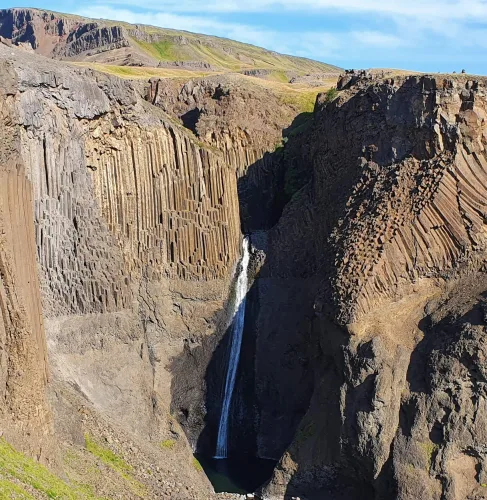
- Hengifoss (128m / 420ft)
- Granni (127m / 120ft)
- Hangandifoss (123m / 405ft)
- Háifoss (121m / 400ft)
- Múlafoss (101m / 330ft)
The biggest waterfalls
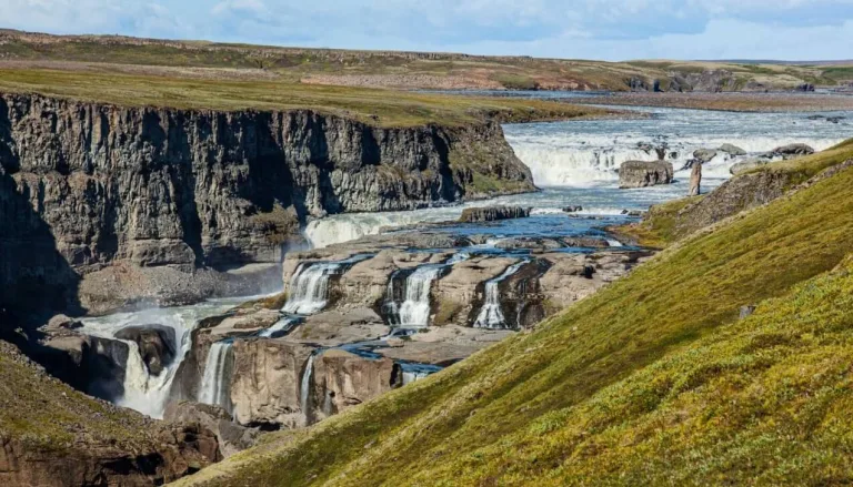
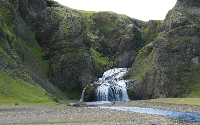
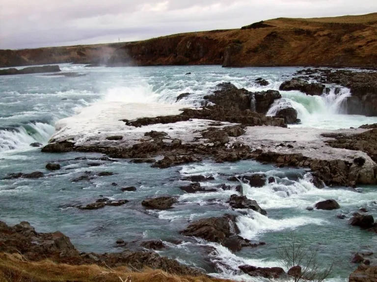
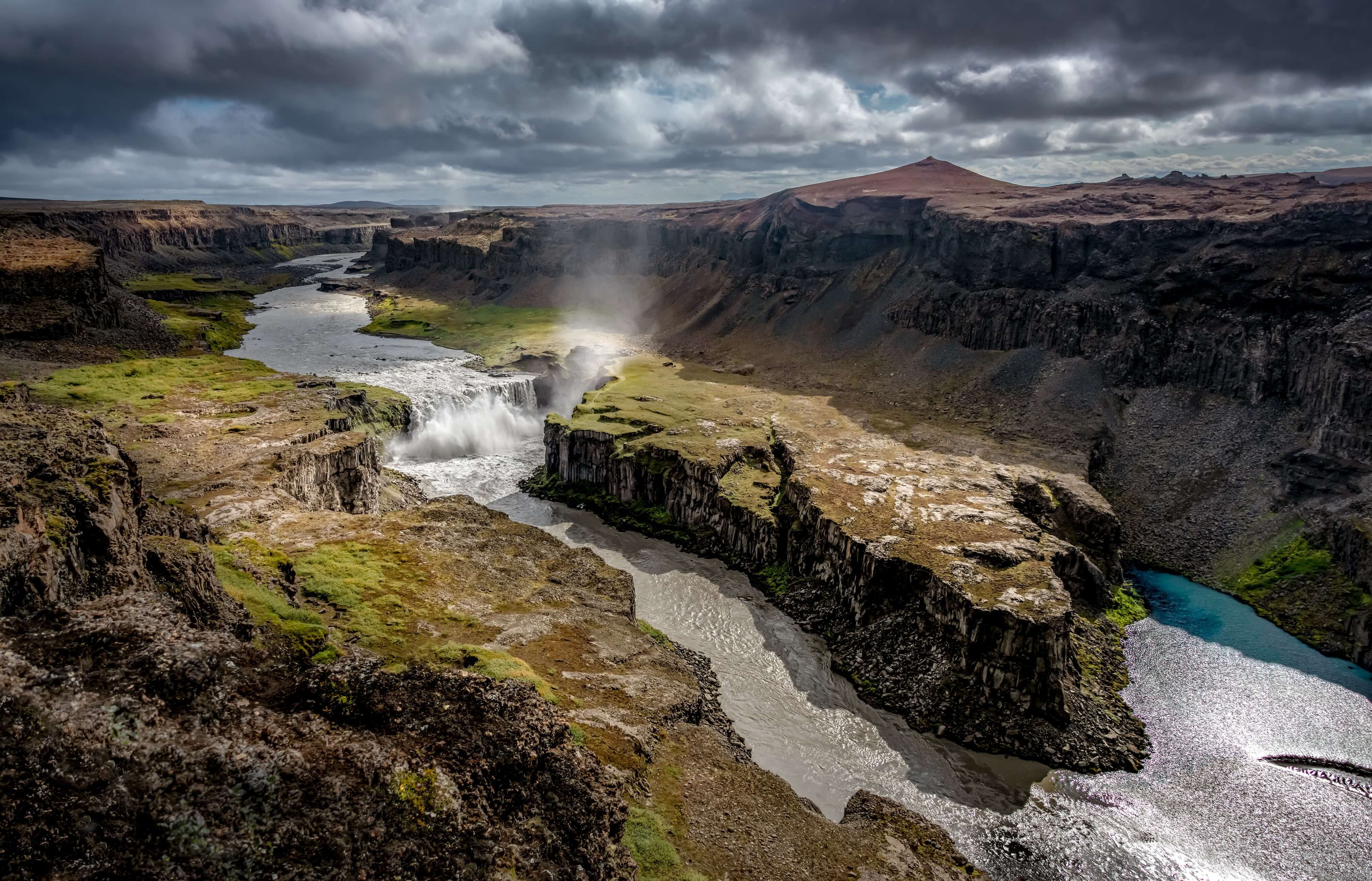
The biggest waterfalls in Iceland by volume are Urriðafoss, Dettifoss, Hafragilsfoss, Selfoss, and Goðafoss. Measuring volume is tricky and there are scarce data. The volume of the waterfalls varies seasonally and also in time. This means that any list of the largest Icelandic waterfalls can’t be entirely precise. Nevertheless, all these waterfalls are definitely big.
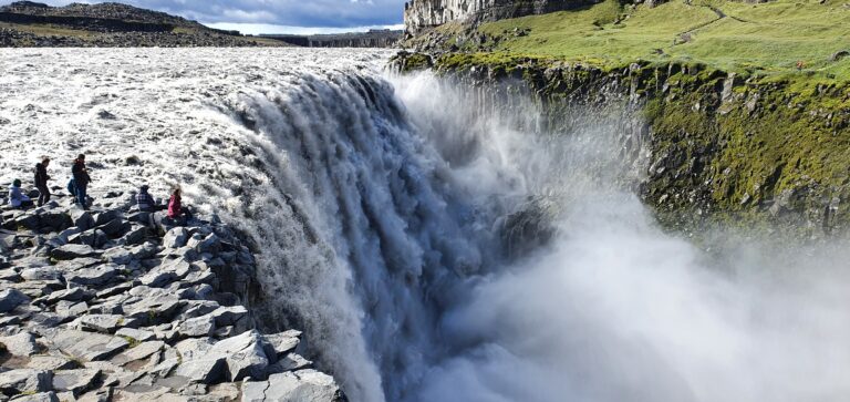
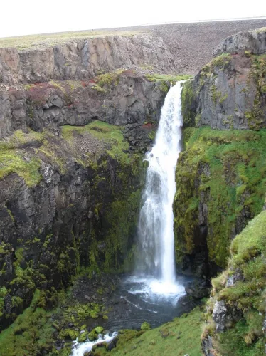
Dettifoss
The 10 biggest waterfalls in Iceland by volume:
- Urriðafoss (350-400 m3/sec)
- Dettifoss (110-280 m3/sec)
- Hafragilsfoss (100-270 m3/sec)
- Selfoss (100-270 m3/sec)
- Gullfoss (100 m3/sec)
- Goðafoss (40-120 m3/sec)
- Aldeyjarfoss (20-100 m3/sec)
- Faxafoss (38 m3/sec)
- Kirkjufoss (20-50 m3/sec)
- Búðarhálsfoss (Dynkur) (20-50 m3/sec)
The widest waterfalls
The widest waterfalls in Iceland are Selfoss (400m), Urriðafoss (230m), Hraunfossár (220m), Gullfoss (180m), and Dettifoss (170m). In summer all of these waterfalls are easily accessible and we highly recommend visiting them, because they are all spectacular. Urriðafoss, Hraunfossár, and Gullfoss are also easy to visit in winter. To visit Dettifoss and Selfoss in winter you need a big 4wd car and proper winter hiking gear like crampons.
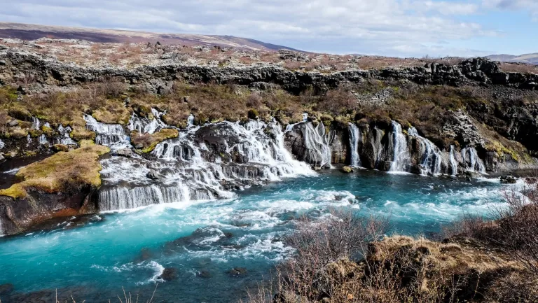
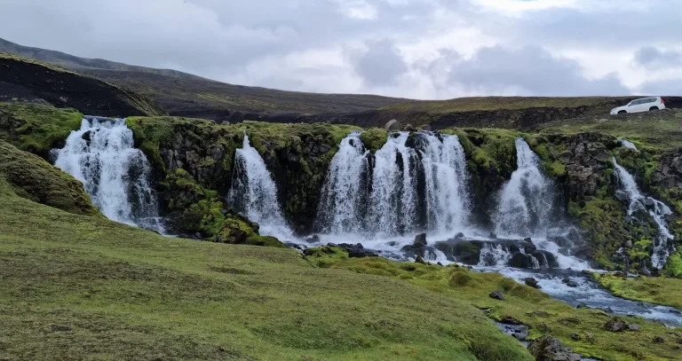
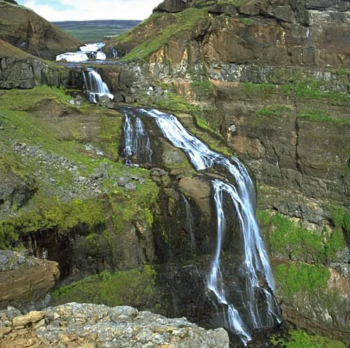
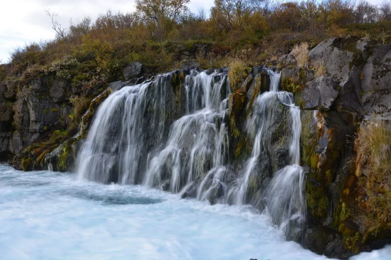
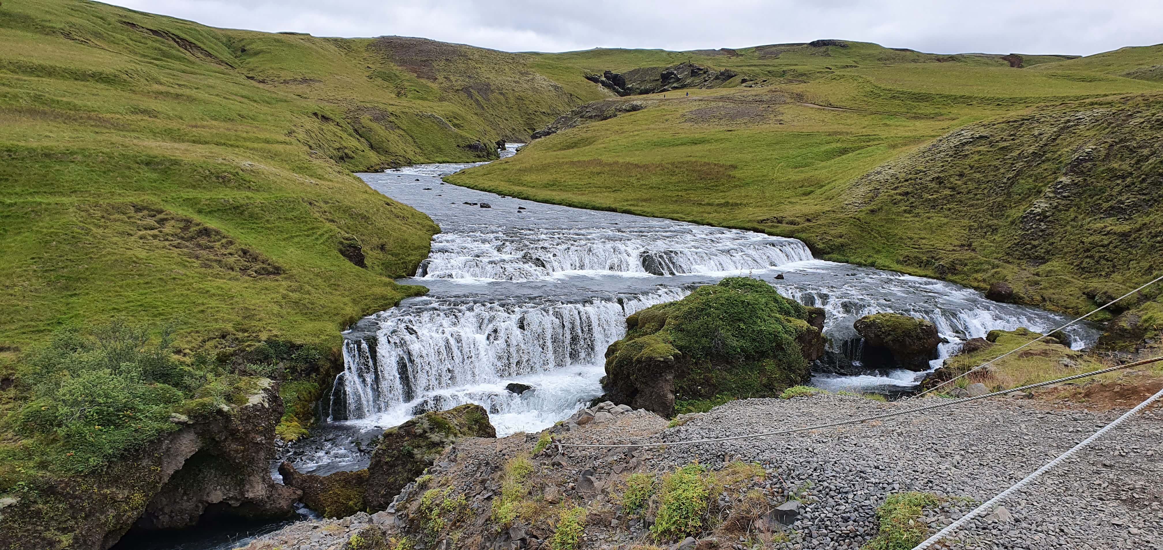
Hraunfossár
The 10 widest waterfalls in Iceland are:
- Selfoss (400m / 1300ft)
- Urriðafoss (230m / 750ft)
- Hraunfossár (220m / 720ft)
- Gullfoss (180m / 590ft)
- Dettifoss (170m / 560ft)
- Goðafoss (120m / 390ft)
- Tungnaárfellsfoss (100m / 330ft)
- Holmsárfoss (100m / 330ft)
- Faxafoss (90m / 300ft)
- Hafragilsfoss (90m / 300ft)
The most popular waterfalls
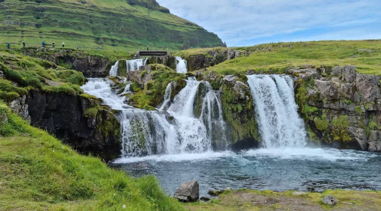
The most popular waterfalls in Iceland are Gullfoss, Seljalandsfoss, Skógafoss, Gljúfrabúi, and Dettifoss. Most of these waterfalls are located around the easily accessible south coast. These are not only the most visited Icelandic waterfalls but also the most visited places in entire Iceland. These waterfalls are very touristy and in full season you may meet tens of tourist buses there. To enjoy them to the fullest, it’s best to arrive at off-peak hours or during a shoulder season.

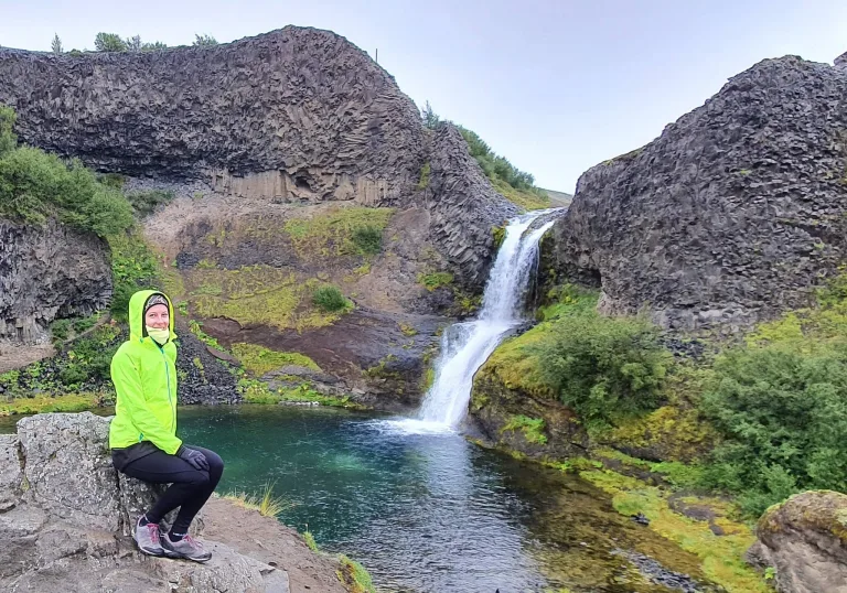
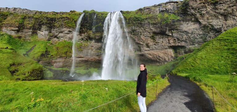
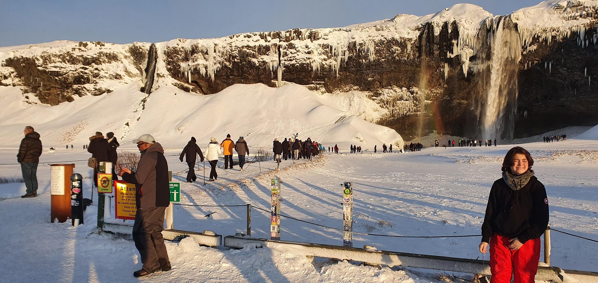
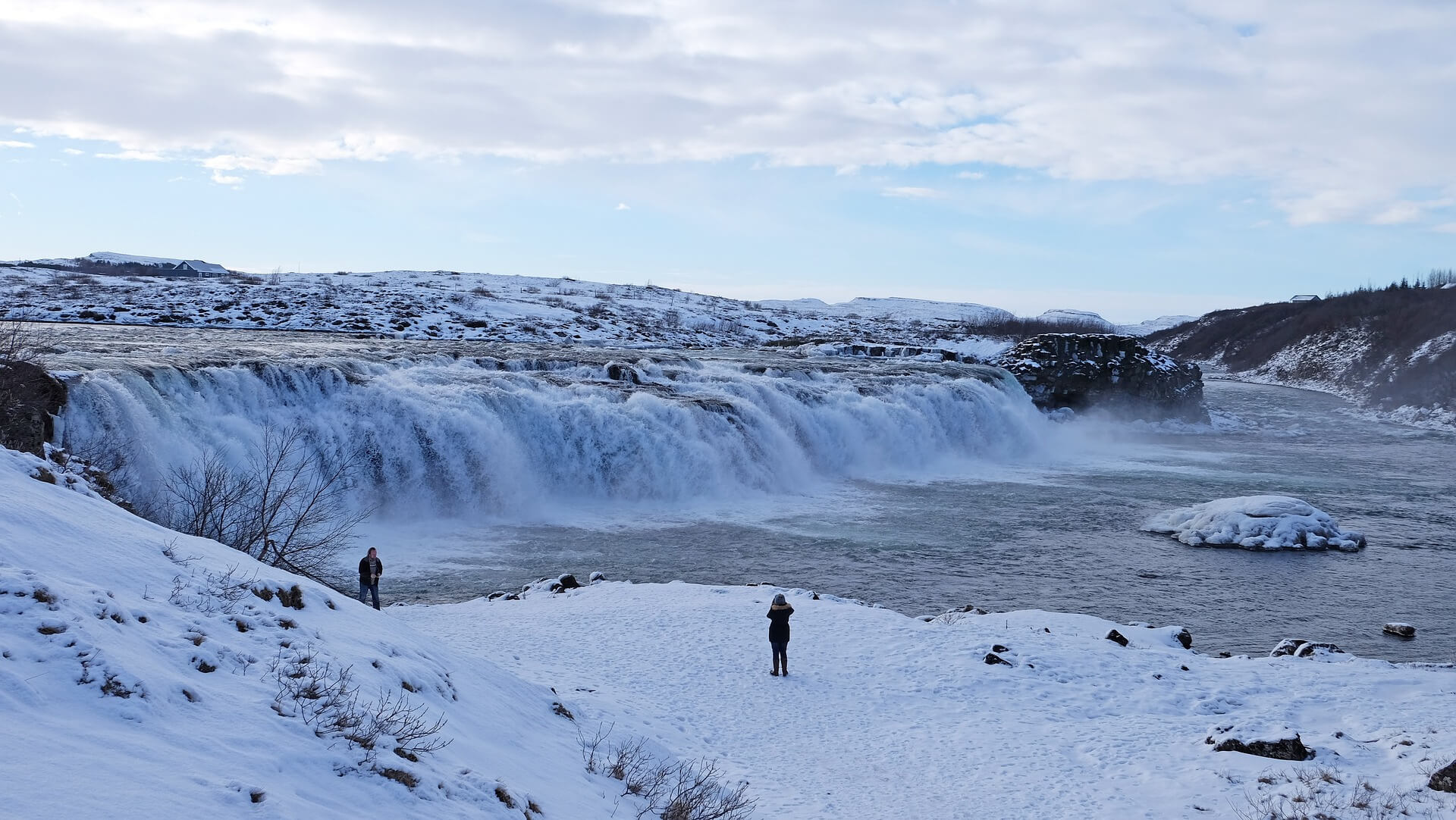
Tourists near Seljalandsfoss in February
The 10 most popular waterfalls in Iceland:
- Gullfoss
- Seljalandsfoss
- Skógafoss
- Gljúfrabúi
- Dettifoss
- Kirkjufellsfoss
- Goðafoss
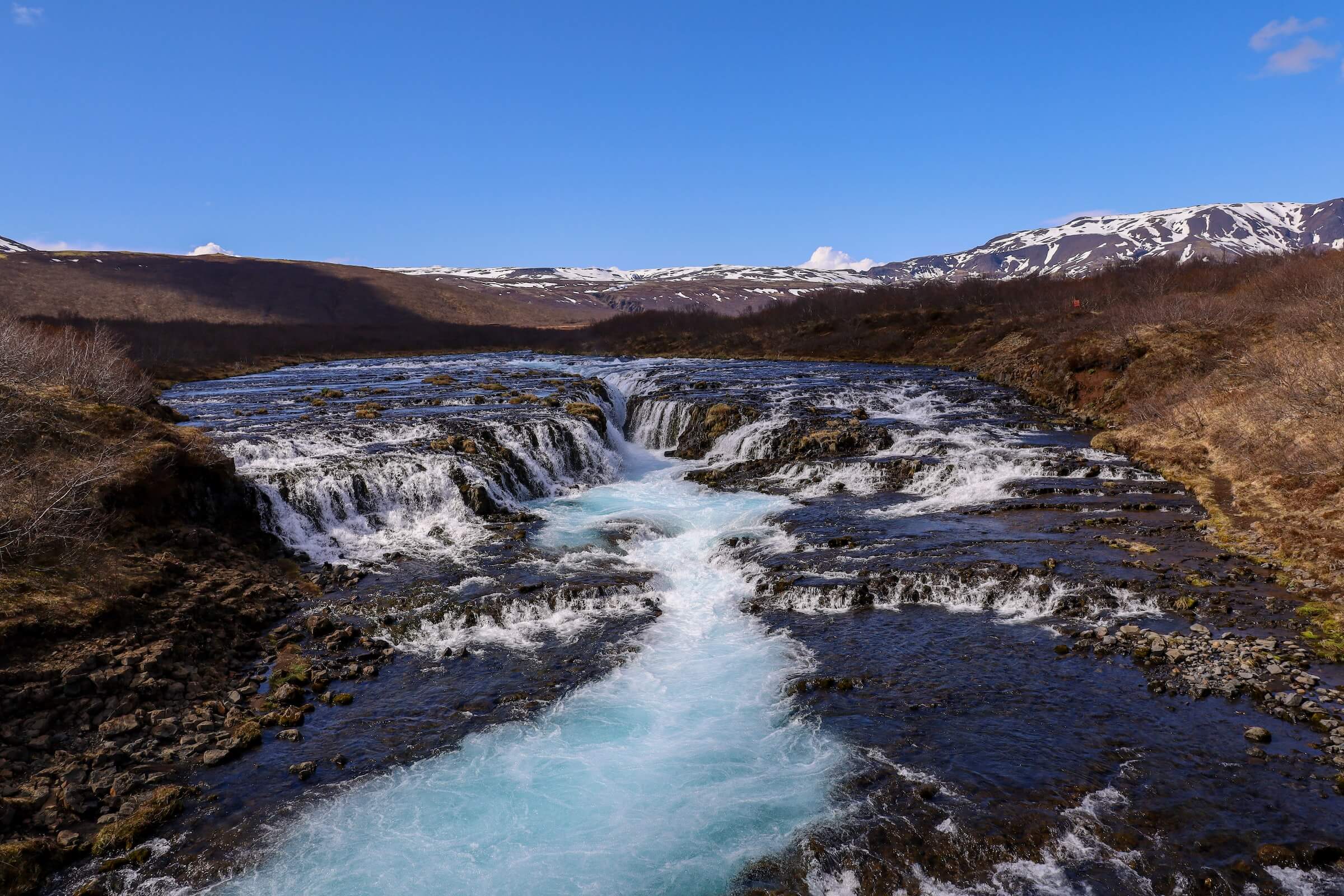
- Bruárfoss
- Hengifoss
- Hraunfossar
The most beautiful waterfalls
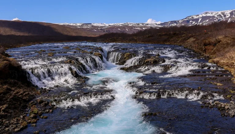
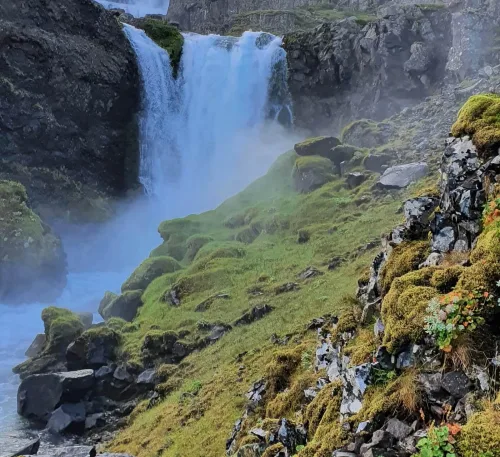
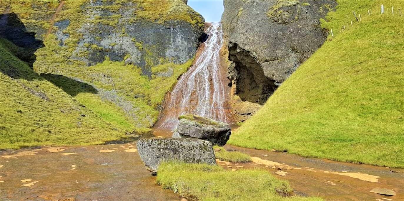
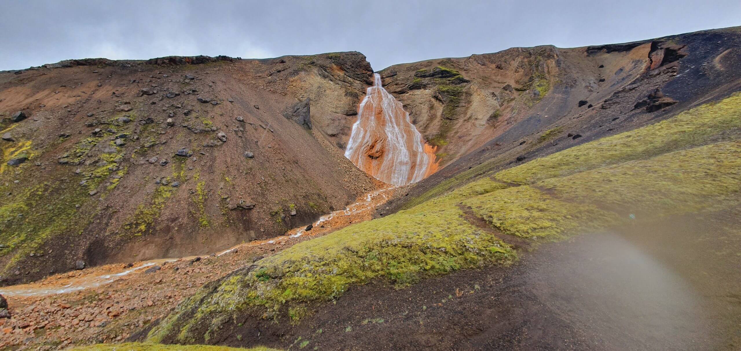
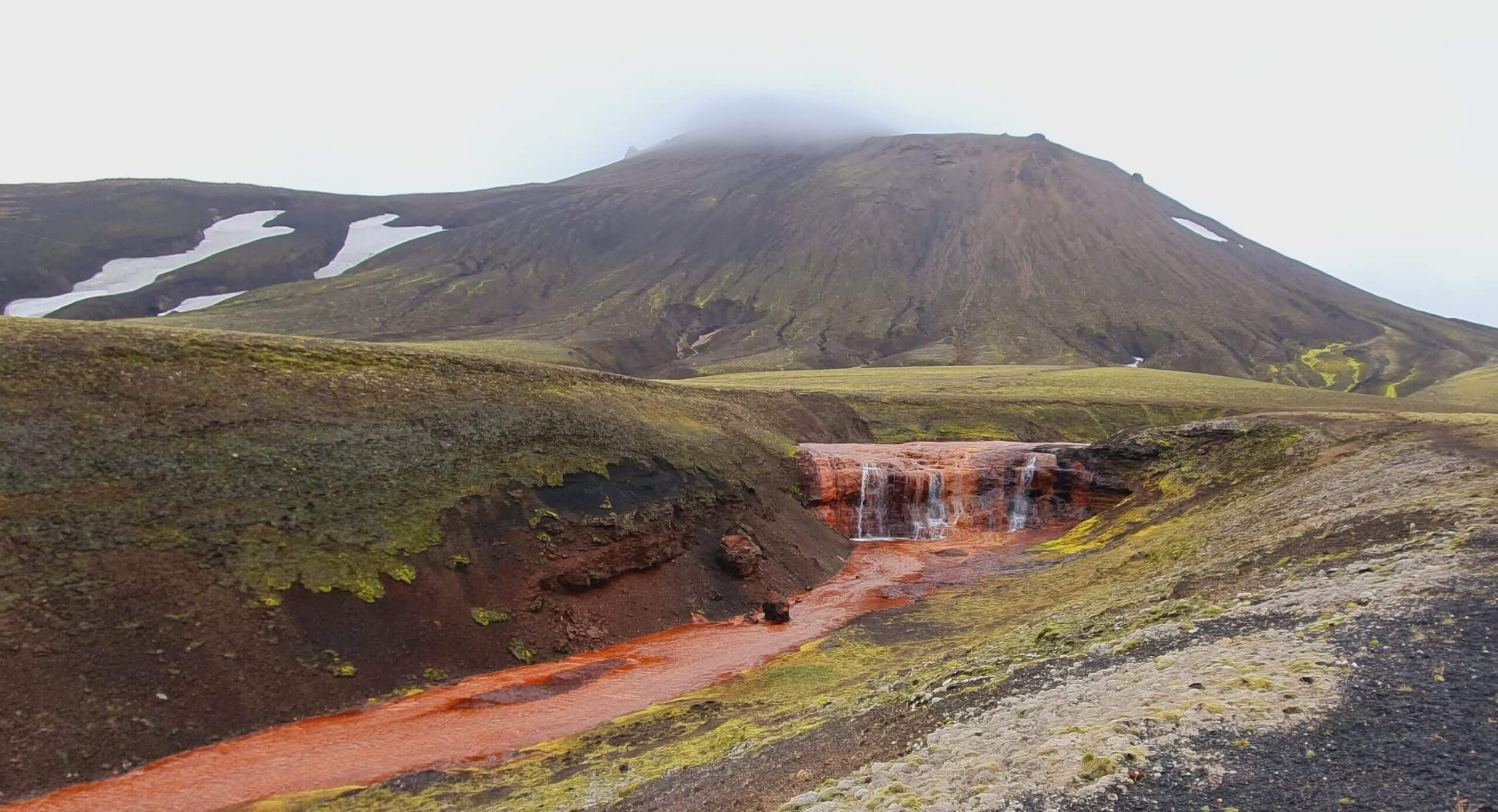
The most beautiful waterfalls in Iceland are said to be Dettifoss, Skógafoss, Seljalandsfoss, Dynjandi, and Gljúfrabúi. This list is of course highly subjective and everyone has to choose his own favorite waterfall. Some prefer big waterfalls, some prefer remote waterfalls. This list is a blend of all waterfalls the most frequently referred to as the most beautiful ones.
Dettifoss is said to be the most beautiful because it’s one of the biggest, Skógafoss because it’s big and in picturesque surroundings, and Seljalandsfoss because you can walk behind it in summer. Dynjandi is probably the prettiest waterfall in Westfjords, Gljúfrabúi is uniquely hidden in a ravine, Aldeyjarfoss in the highlands, and Fagrifoss on a way to Laki craters. Bruárfoss has the bluest water, Raudufossar is fully covered in orange and Ófærufoss is the highlight of the Eldgjá reserve.

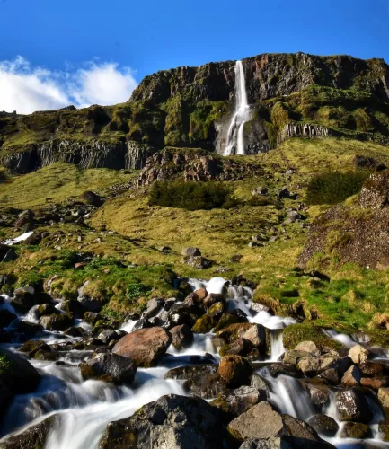
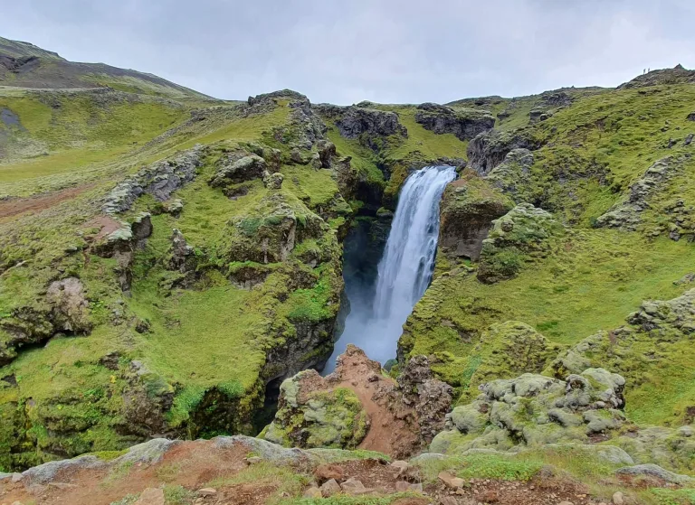
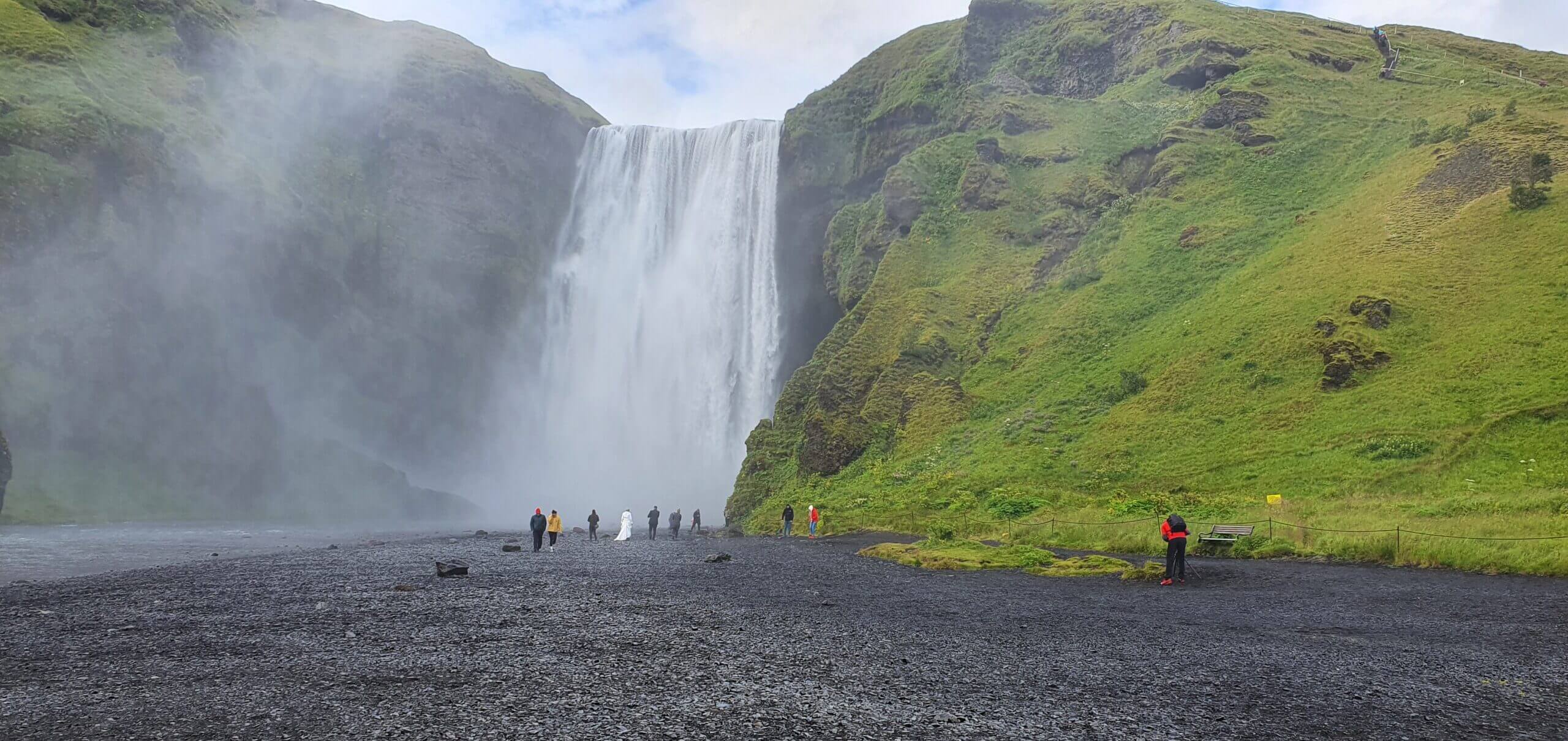
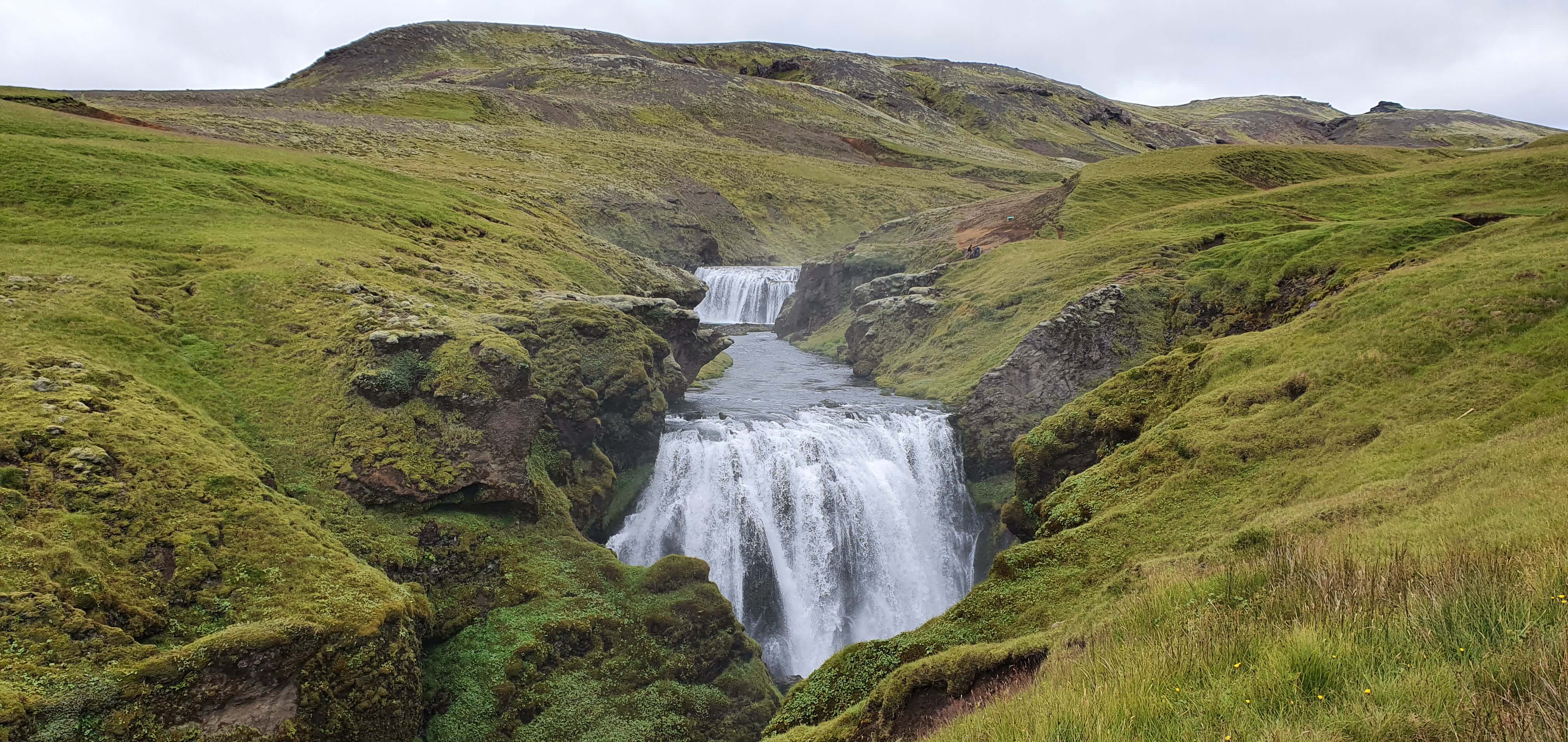
Skógafoss waterfall
The 10 most beautiful waterfalls in Iceland:
- Dettifoss
- Skógafoss
- Seljalandsfoss
- Dynjandi
- Gljúfrabúi
- Aldeyjarfoss
- Fagrifoss
- Bruárfoss
- Raudufossar
- Ófærufoss
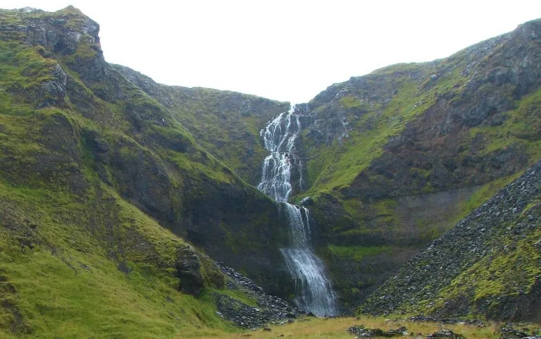
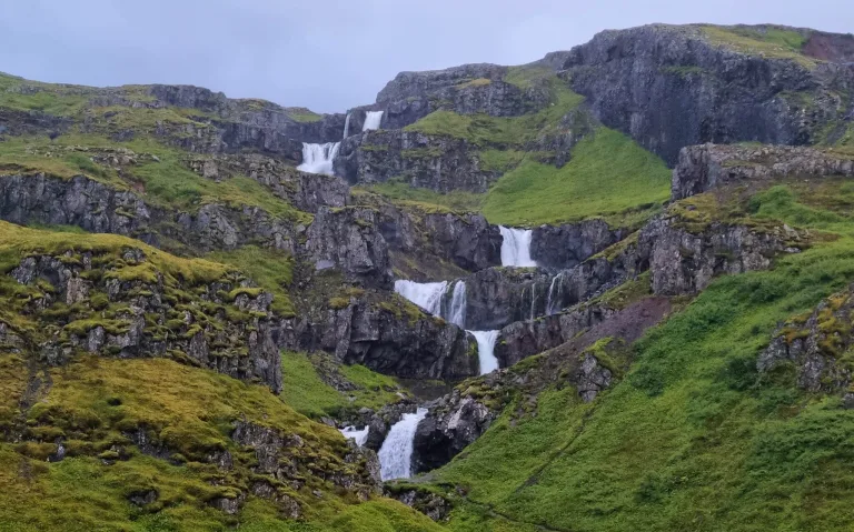
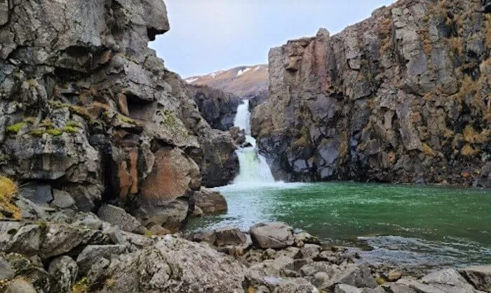
The most hidden waterfalls
The most hidden waterfalls in Iceland are Drifandisfoss, Nýifoss, Núpsárfoss, Bolugil, and Möngufoss. All of these are among the most remote Icelandic waterfalls, yet still accessible and amazingly beautiful. It is of course impossible to exactly tell which waterfall is the most hidden one, but this list should give a good overview of such waterfalls.
Prepare well when visiting the hidden Icelandic waterfalls. Most of them are hard to access and hidden in the highlands. You either need a proper car or proper hiking gear, or both. You should also visit them only in good weather conditions. That being said, there are nearly as many undiscovered waterfalls in Iceland as those that are already discovered. This means there’s still a huge room for exploration and adventure.

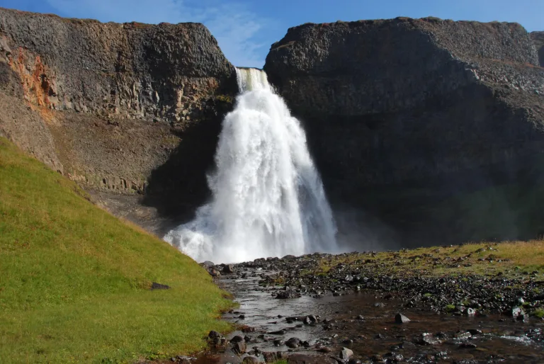
Stakkholtsgjáfoss
The 10 most hidden waterfalls in Iceland:
- Drifandisfoss
- Nýifoss
- Núpsárfoss
- Bolugil
- Möngufoss
- Bergárfoss
- Axlafoss
- Múlafoss
- Blafjállafoss
- Stakkholtsgjáfoss
FAQ
Below are the most frequently asked questions about Icelandic waterfalls with up-to-date answers.
How many waterfalls does Iceland have?
There are thousands of different waterfalls in Iceland. If someone counted also all the sub-waterfalls the number can easily grow to tens of thousands. Most of the waterfalls in Iceland have actually not been discovered yet. They are hidden in uninhabited and remote parts of Iceland, often referred to as the highlands.
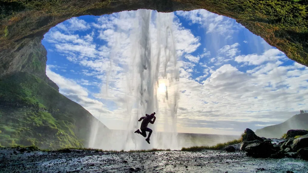
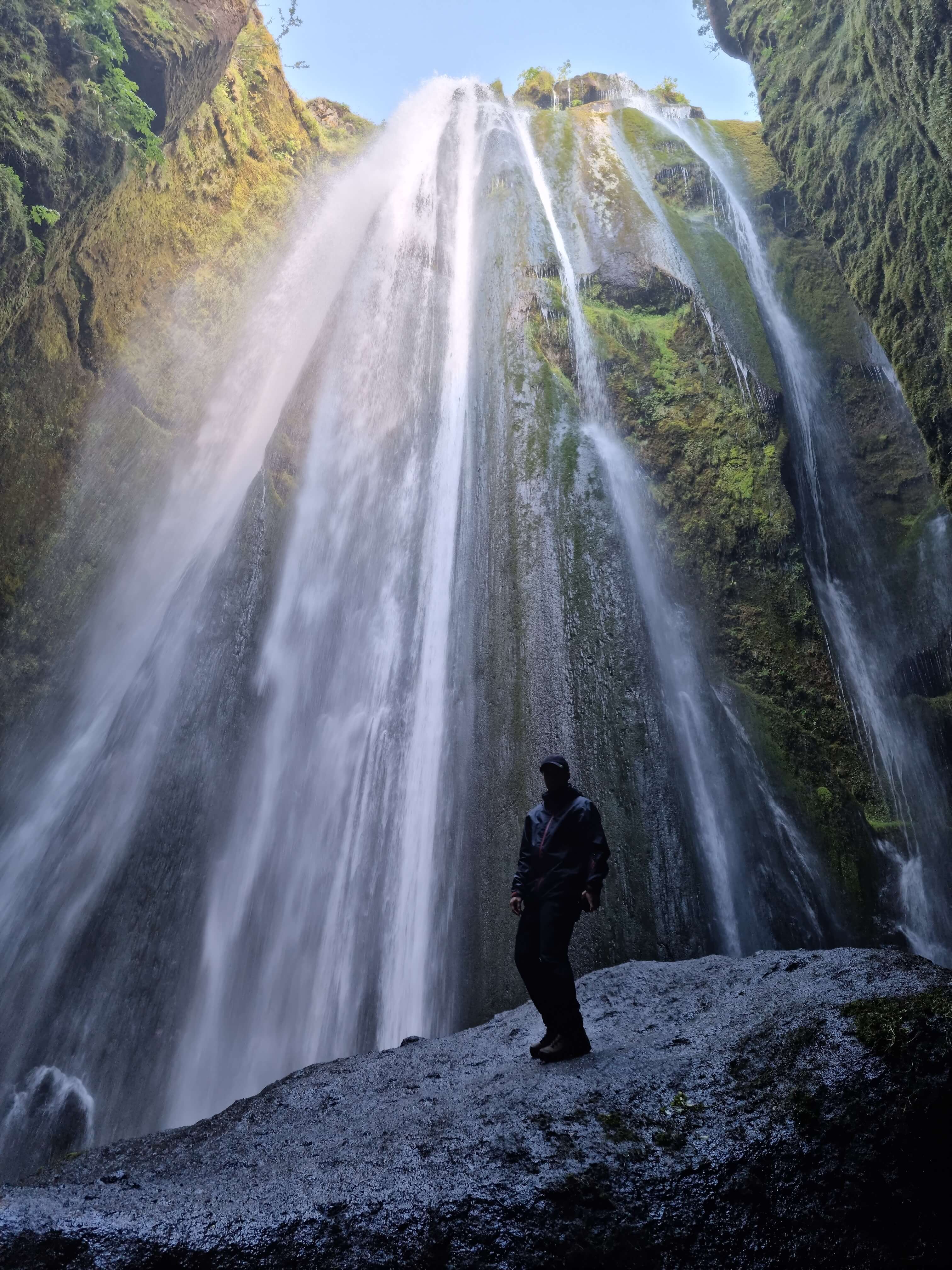
Which Iceland waterfall can you walk behind?
You can walk behind 4 Icelandic waterfalls – Seljalandsfoss, Kvernufoss, Selvallafoss, and Skútafoss. The most famous waterfall you can walk behind in Iceland is Seljalandsfoss. Most of the sources wrongly state that this is the only waterfall you can walk behind. This is incorrect information. You can also walk behind Laugavallalaug, but it’s so small it doesn’t count.
When walking behind the waterfalls, please take special care. The terrain may be slippery and dangerous. Never do this in snowy or icy conditions. Typically you can walk behind the waterfalls in Iceland only in summer.
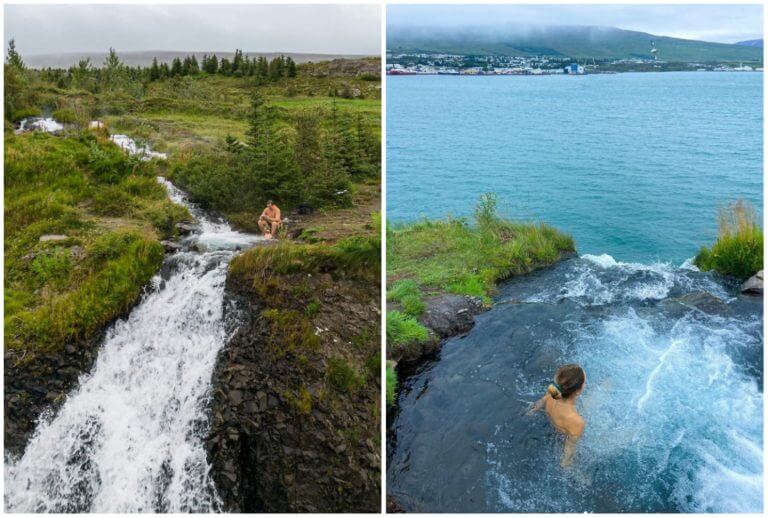
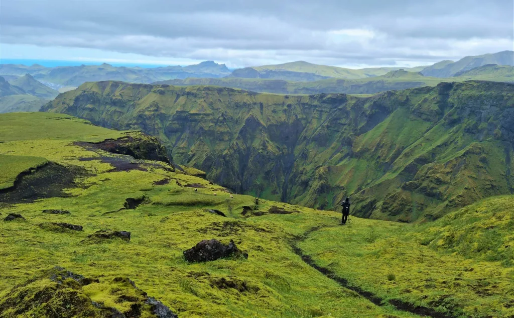
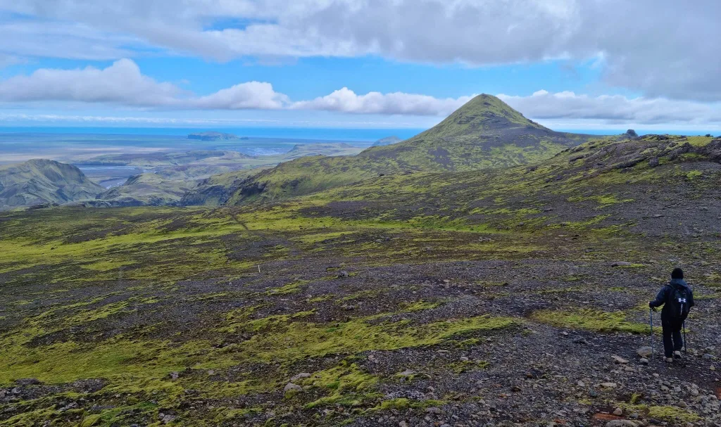
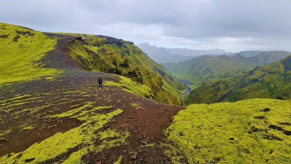
Is there a valley of waterfalls in Iceland?
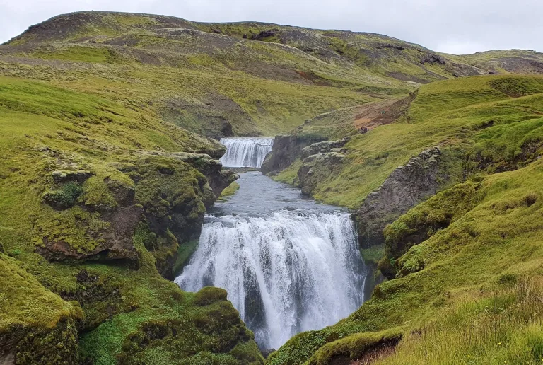
There are 3 well-known waterfall valleys in Iceland:

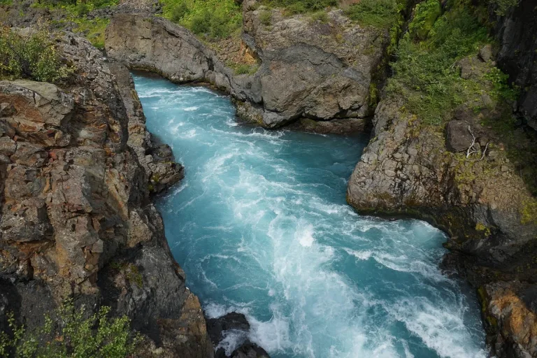
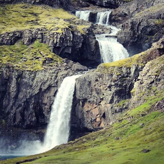
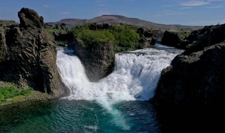
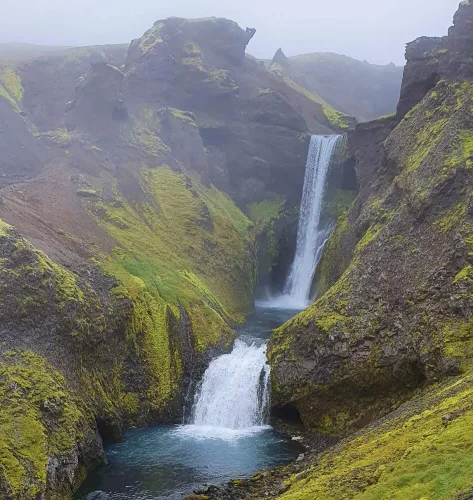
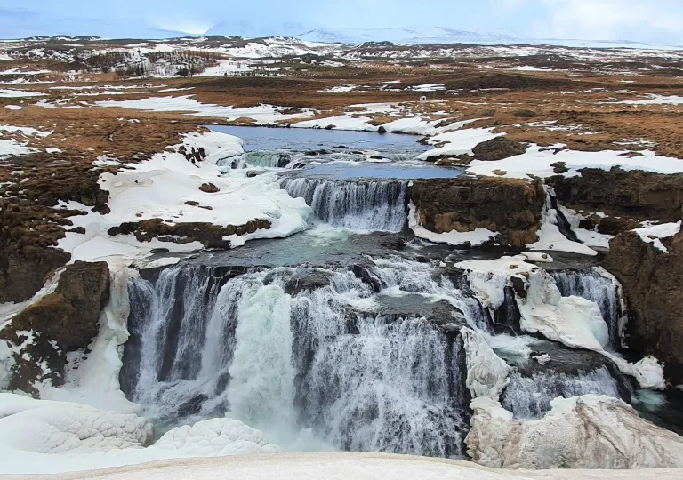
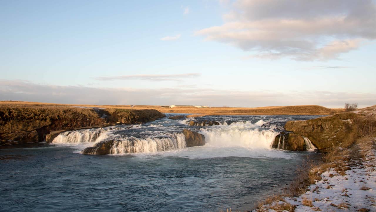
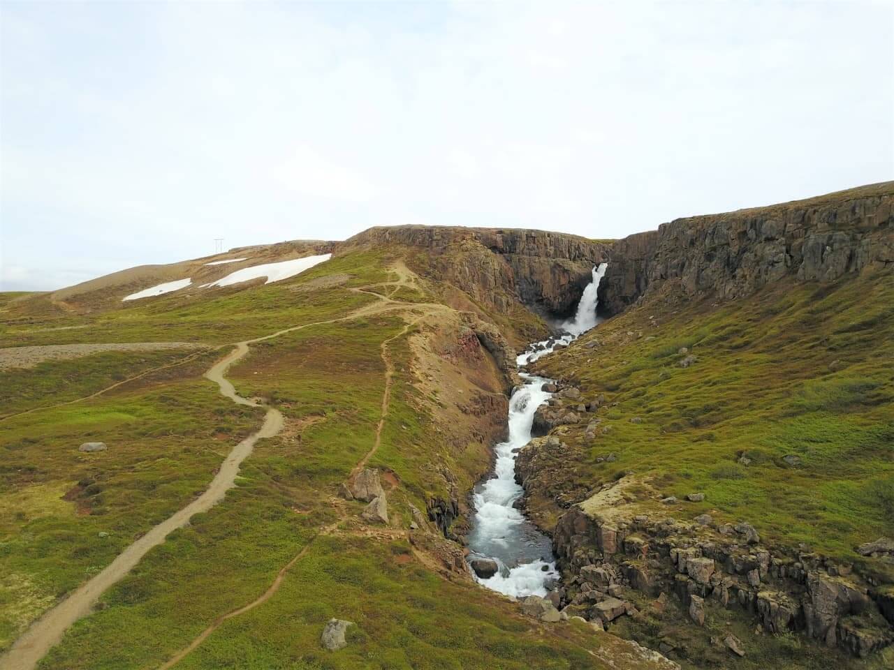
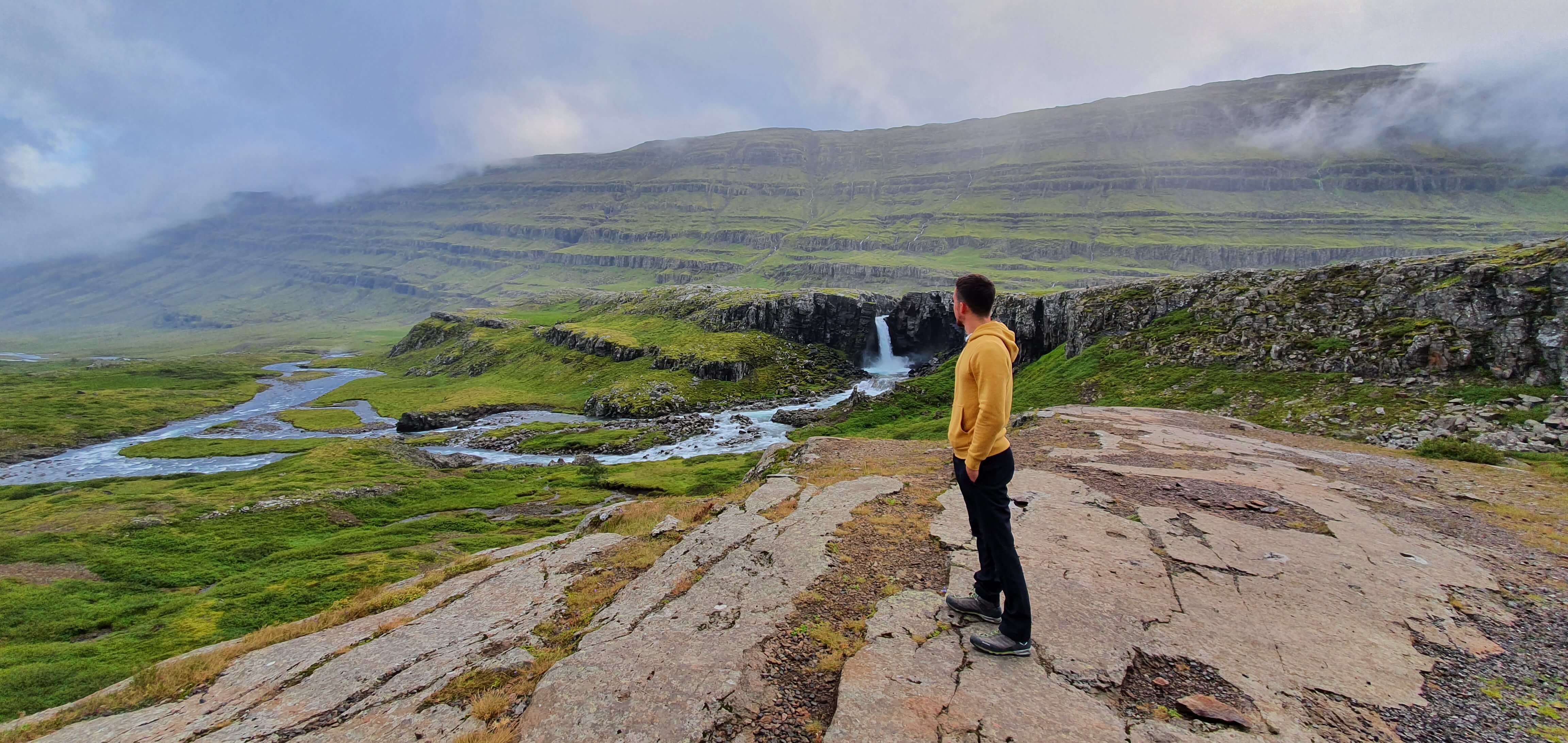
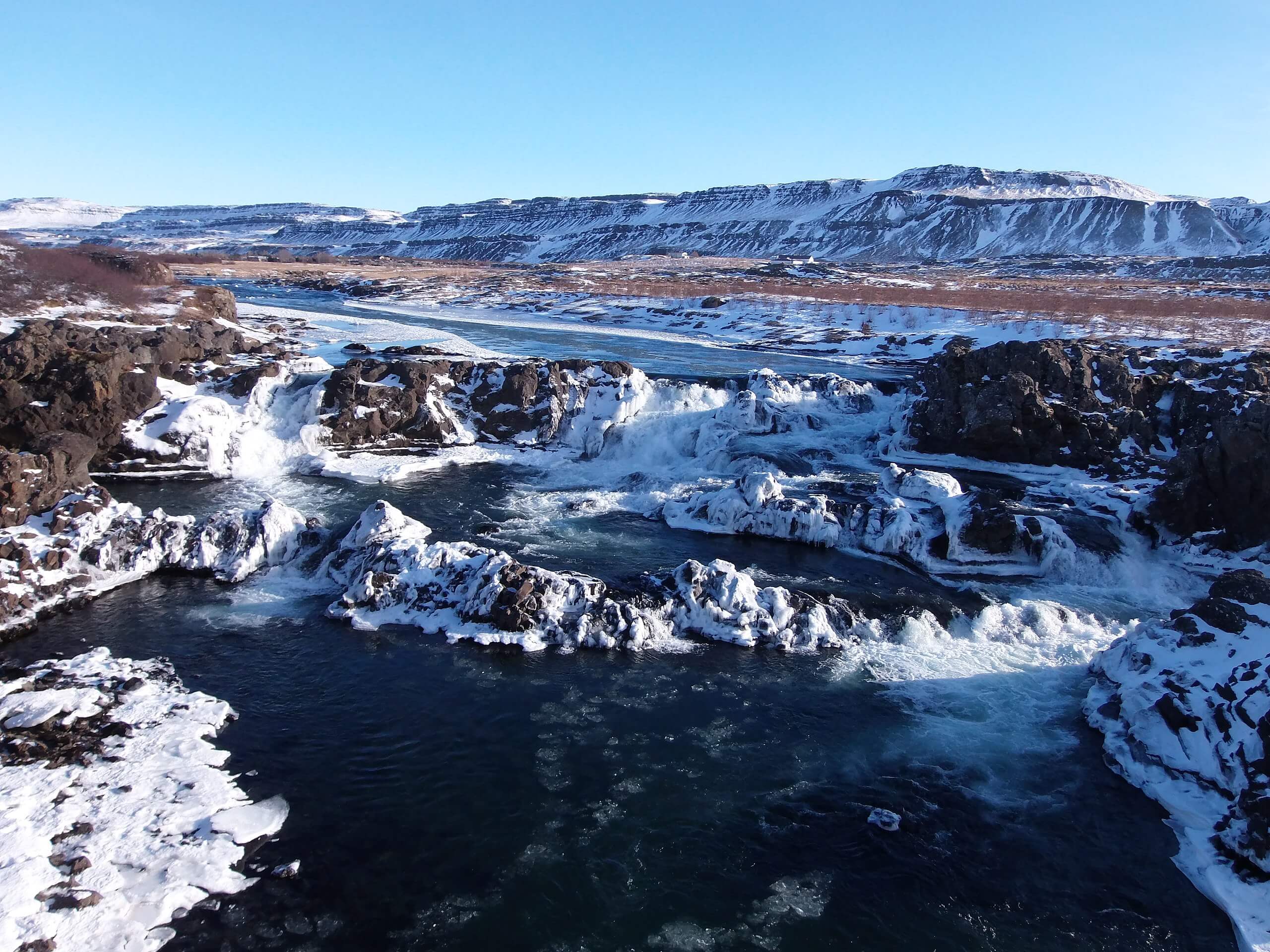
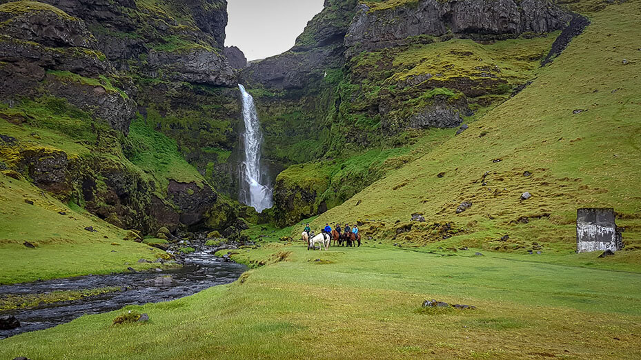
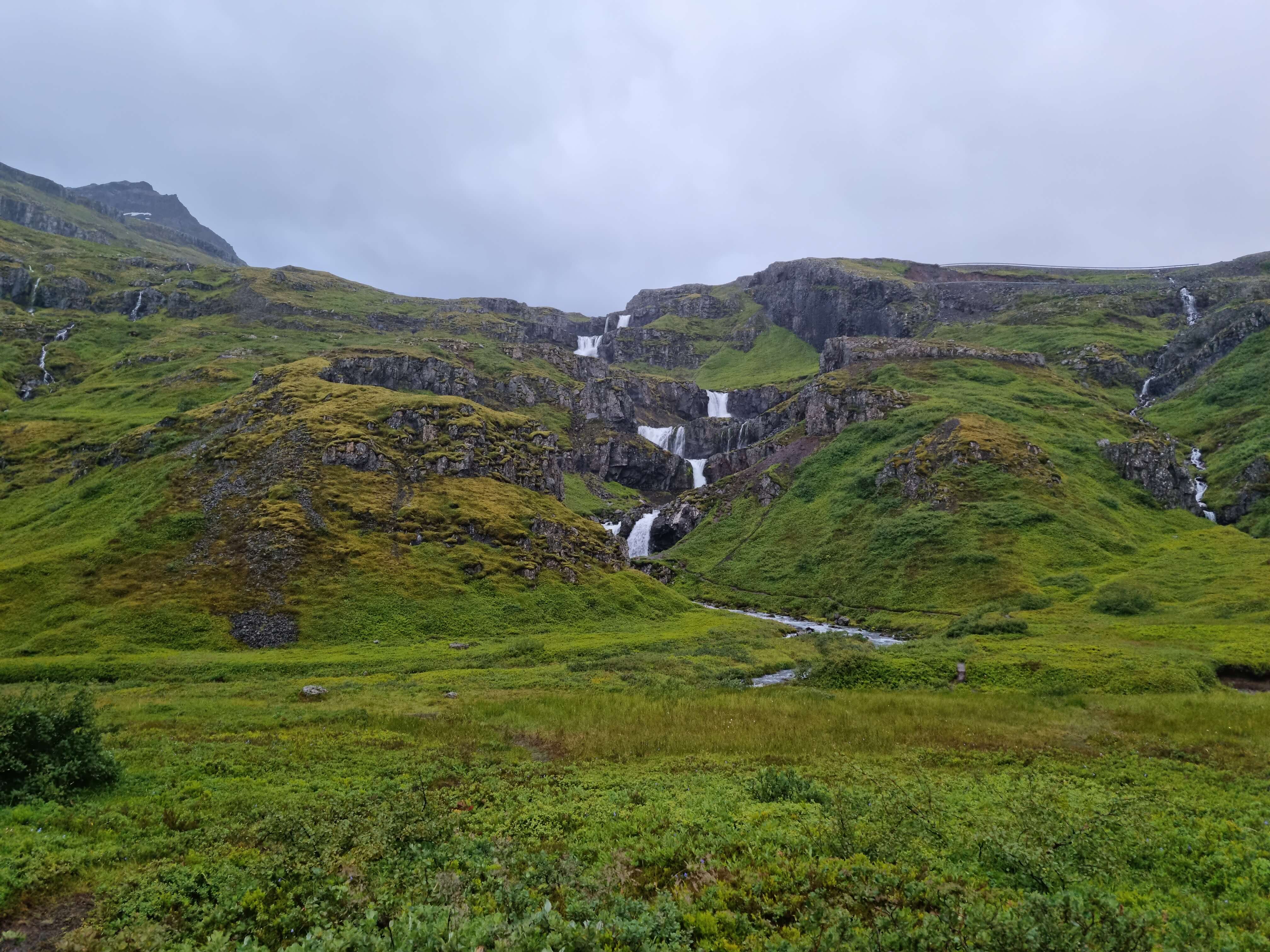
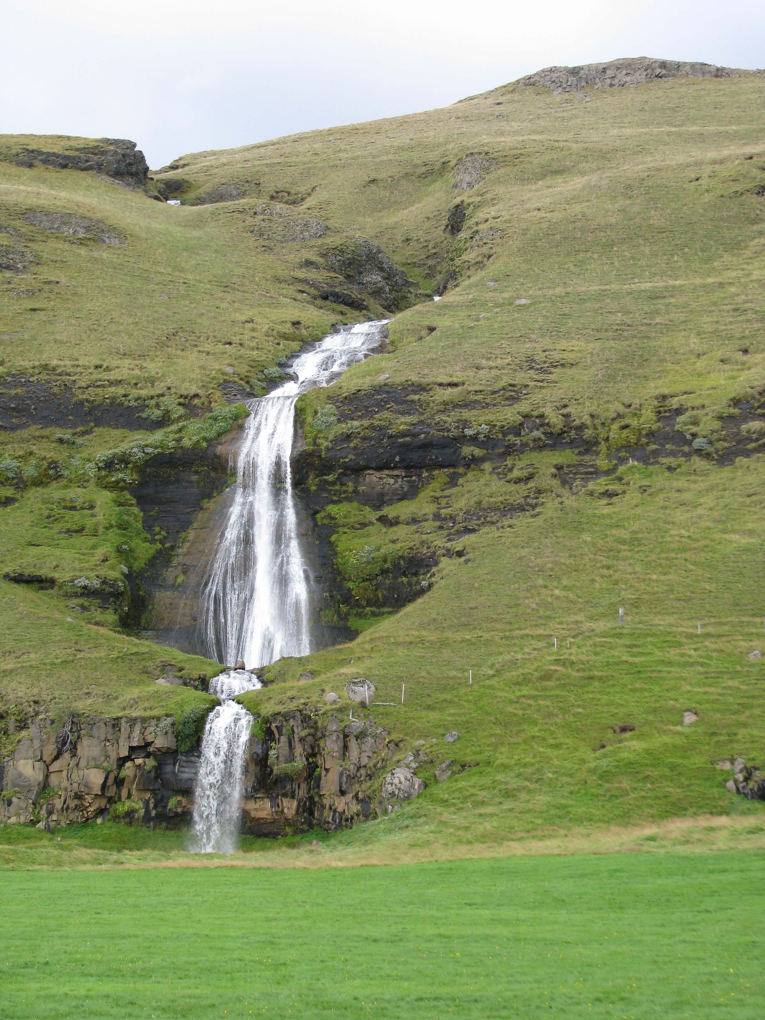
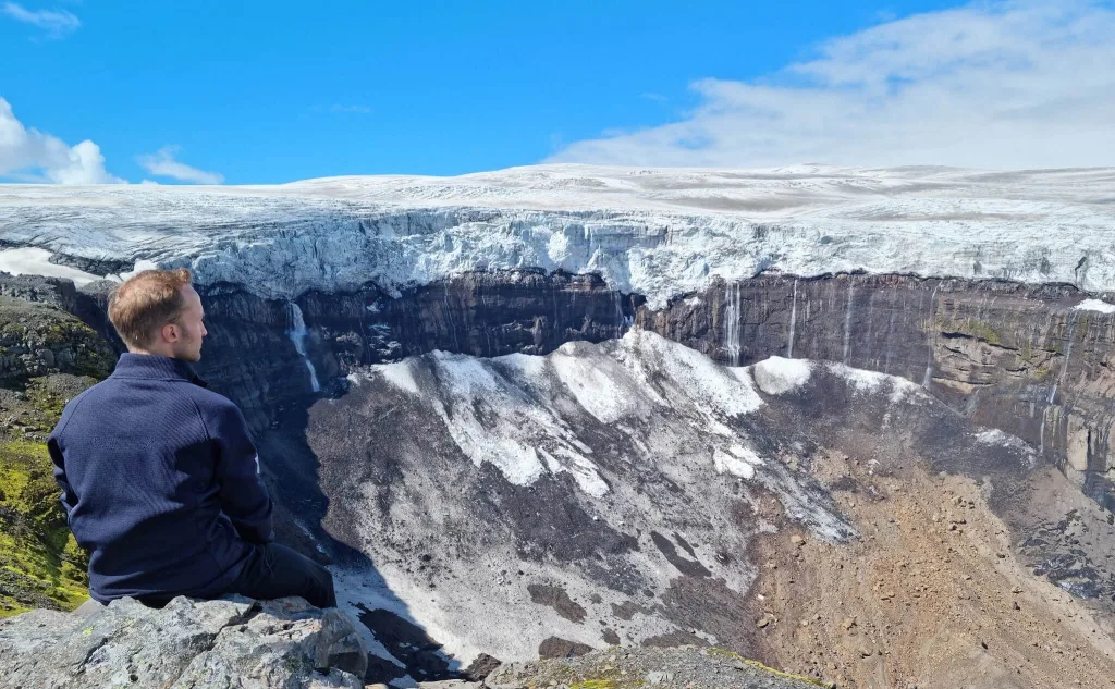
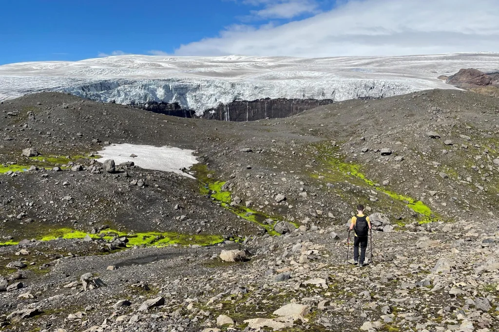
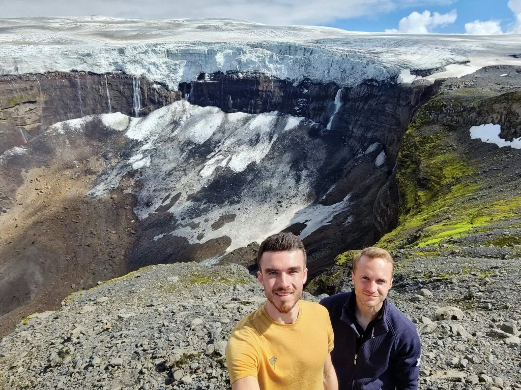
Kirkjufoss, part of the hidden waterfall circle in East Highlands
Are Icelandic waterfalls free?
All waterfalls in Iceland are free to visit. The only thing you pay for is the parking. Parking is paid only at some of the most popular waterfalls, like Seljalandsfoss or Kirkjufellsfoss. There are no opening hours for the waterfalls in Iceland. You may visit them anytime you want. Just bear in mind, a visit may be dangerous in the dark in winter.
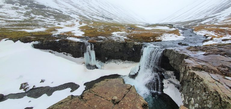
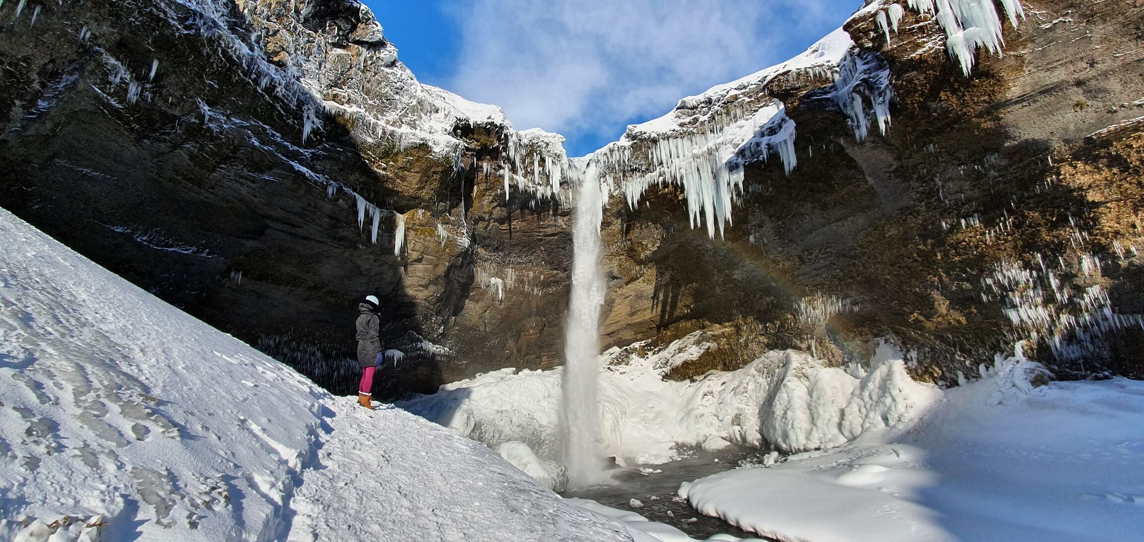
Are Icelandic waterfalls accessible in winter?
Waterfalls situated near the main roads are usually well-accessible in winter. On the other hand, the waterfalls located in the highlands or at more remote places may not be accessible at all. For each waterfall, we list below whether you can see it in winter easily, hardly, or not at all. Here you can also the list of all waterfalls we visited in winter.
List of all waterfalls – Legend
Road accessible by = what type of car you need to reach the car park or the beginning of the hiking trail for every waterfall
Hiking time and distance = the average one-way hiking time and distance from the nearest car park in summer
Hiking difficulty = easy – no/short hikes, moderate – more hiking, difficult – long and/or difficult hike
Trail in winter = typical winter trail conditions (November-April), when there’s no storm or weather alert
* = an asterisk means conditions vary a lot according to weather/snow
Æðarfossar
Æðarfossar waterfall (click to enlarge). Photo by Bromr, CCM license. Source link.
Location: North, see the map of Aedarfossar
Height: 3m (10ft)
Road accessible by: 2wd car in summer, 4wd car/super jeep in winter
Hiking time: next to the road/parking
Hiking distance: 50m* (60yd*)
Hiking difficulty: easy
Trail in winter: easily accessible*
Trail link: –
Ægissíðufoss

Ægissíðufoss waterfall (click to enlarge). Source link.
Location: Southwest, see the map of Aegissidufoss
Height: 3m (10ft)
Road accessible by: 2wd car
Hiking time: next to the road/parking
Hiking distance: 50m (60yd)
Hiking difficulty: easy
Trail in winter: easily accessible
Trail link: –
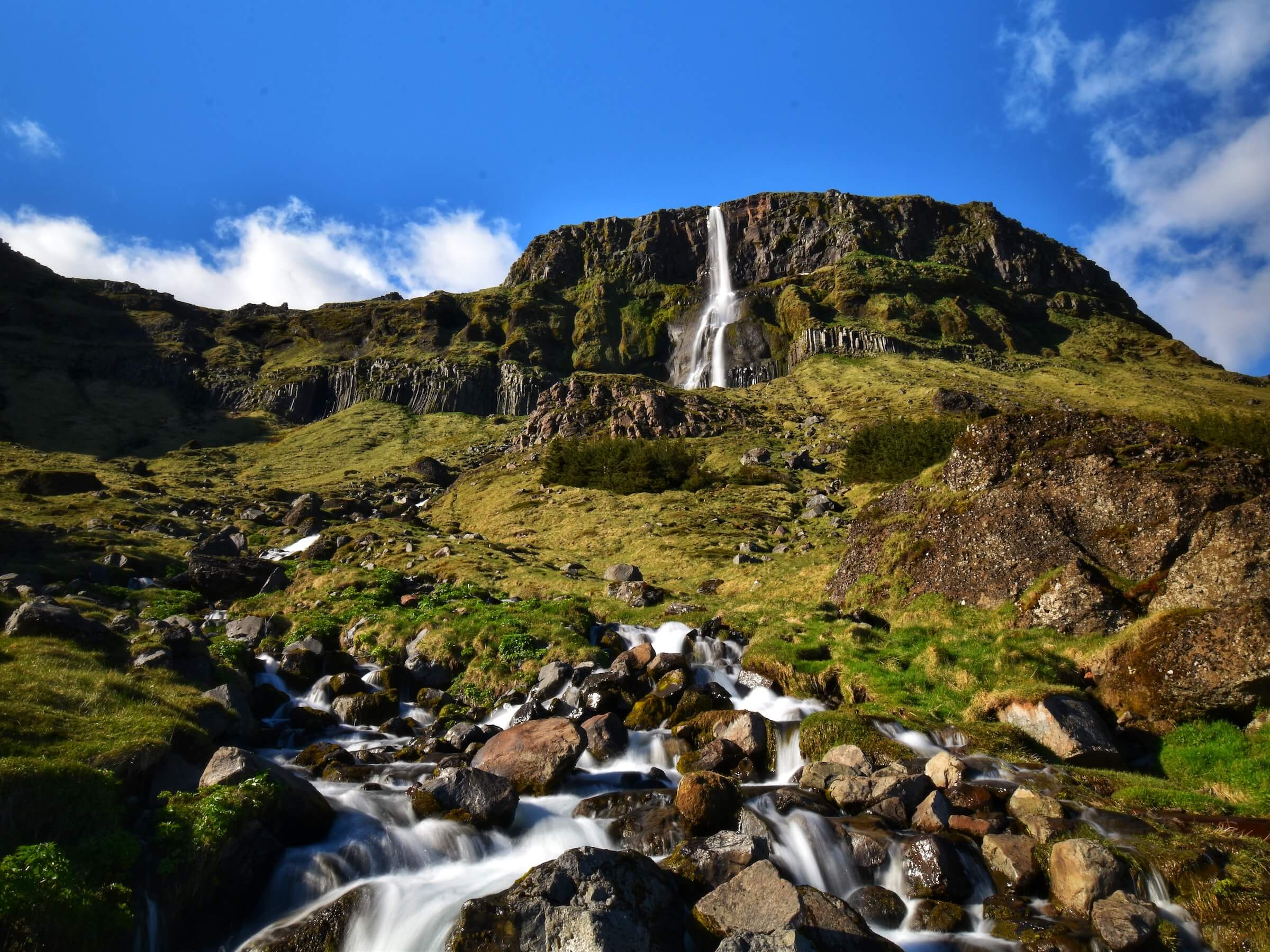
Aldeyjarfoss
Aldeyjarfoss waterfall (click to enlarge).
Location: North Highlands, see the map of Aldeyjarfoss
Height: 20m (66ft)
Road accessible by: 4wd car in summer (F-road), super jeep/inaccessible in winter
Hiking time: 5 minutes
Hiking distance: 300m (330yd)
Hiking difficulty: easy
Trail in winter: hardly/inaccessible
Trail link: Aldeyjarfoss hiking trail
Árbæjarfoss
Árbæjarfoss (click to enlarge). Photo by Bromr, CCM license. Source link.
Location: Southwest, see the map of Arbaejarfoss
Height: 10m (33ft)
Road accessible by: 2wd car
Hiking time: next to the road/parking
Hiking distance: 50m (60yd)
Hiking difficulty: easy
Trail in winter: easily accessible
Trail link: –
Axlafoss
Axlafoss (click to enlarge)
Location: South Highlands, see the map of Axlafoss
Height: 7m (22ft)
Road accessible by: 4wd car in summer (F-road), super jeep/inaccessible in winter
Hiking time: next to the road/parking
Hiking distance: 50m (60yd)
Hiking difficulty: easy
Trail in winter: hardly/inaccessible
Trail link: –
Bæjarfoss
Bæjarfoss waterfall (click to enlarge).
Location: Westfjords, see the map of Baejarfoss
Height: 6m (20ft)
Road accessible by: 2wd car in summer, 4wd car in winter
Hiking time: next to the road/parking*
Hiking distance: 50m (60yd)
Hiking difficulty: easy
Trail in winter: snowy/icy but accessible
Trail link: Baejarfoss hiking trail
Our experience: Baejarfoss visit
Bárðarfoss
Bárðarfoss waterfall (click to enlarge). Photo by Bromr, CCM license. Source link.
Location: West, see the map of Bardarfoss
Height: 8m (26ft)
Road accessible by: 2wd car in summer, better 4wd in winter*
Hiking time: 2 minutes
Hiking distance: 50m (60yd)
Hiking difficulty: easy
Trail in winter: muddy/snowy/icy but accessible
Trail link: –
Barnafoss
Barnafoss waterfall (click to enlarge).
Location: West, see the map of Barnafoss
Height: 5m (16ft)
Road accessible by: 2wd car in summer, better 4wd car in winter
Hiking time: 5 minutes
Hiking distance: 300m (330yd)
Hiking difficulty: easy
Trail in winter: easily accessible
Trail link: Barnafoss hiking trail
Bergárfoss
Bergárfoss waterfall (click to enlarge). Photo by Hörður Kristinsson, CCM license. Source link.
Location: Northwest, see the map of Bergarfoss
Height: 40m (131ft)
Road accessible by: 4wd car in summer (F-road), 4wd car/super jeep in winter*
Hiking time: 20 minutes
Hiking distance: 1km (0,6mi)
Hiking difficulty: moderate
Trail in winter: snowy/icy but accessible
Trail link: –
Bjarnarfoss
Bjarnarfoss waterfall (click to enlarge).
Location: Snaefellsnes, see the map of Bjarnarfoss
Height: 80m (262ft)
Road accessible by: 2wd car in summer, better 4wd car in winter
Hiking time: 15 minutes
Hiking distance: 500m (0,3mi)
Hiking difficulty: easy
Trail in winter: snowy/icy but accessible
Trail link: Bjarnarfoss hiking trail
Blafjállafoss
Blafjállafoss waterfall (click to enlarge).
Location: South Highlands, see the map of Blafjallafoss
Height: 5m (16ft)
Road accessible by: 4wd car in summer (F-road), super jeep/inaccessible in winter
Hiking time: next to the road/parking
Hiking distance: 50m (60yd)
Hiking difficulty: easy
Trail in winter: hardly/inaccessible
Trail link: –
Bolugil
Bolugil waterfall (click to enlarge). Photo by roquenval, CCM license. Source link.
Location: North, see the map of Bolugil
Height: 140m (459ft)
Road accessible by: 2wd car in summer / better 4wd car in winter*
Hiking time: 15 minutes
Hiking distance: 600m (0,4mi)
Hiking difficulty: moderate
Trail in winter: snowy/icy but accessible
Trail link: Bolugil hiking trail
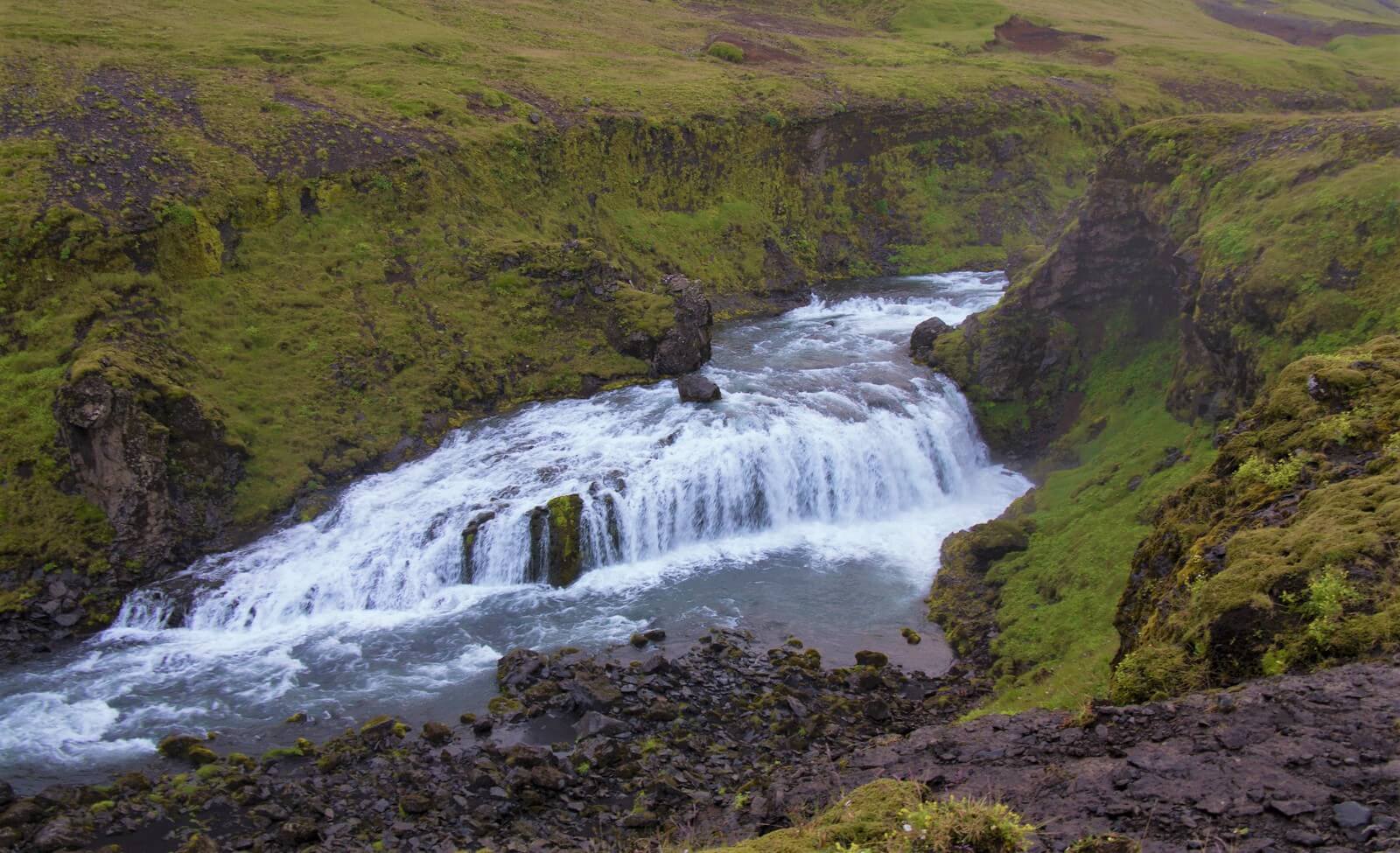
Brúarfoss
Brúarfoss waterfall (click to enlarge).
Location: West, see the map of Bruarfoss
Height: 5m (16ft)
Road accessible by: 2wd car
Hiking time: 40-60 minutes
Hiking distance: 3,5km (2,2mi)
Hiking difficulty: moderate
Trail in winter: snowy/icy but accessible
Trail link: Bruarfoss hiking trail
Búðarárfoss
Location: East, see the map of Budararfoss
Height: 12m (39ft)
Road accessible by: 2wd car in summer, 4wd car in winter*
Hiking time: next to the road/parking
Hiking distance: 50m* (60yd*)
Hiking difficulty: easy
Trail in winter: snowy/icy but accessible
Trail link: –
Búðareyrarfoss

Búðareyrarfoss waterfall (click to enlarge). Photo by Joe deSousa, CCM license. Source link.
Location: East, see the map of Budareyrarfoss
Height: 60m (197ft)
Road accessible by: 2wd car in summer, better 4wd car in winter
Hiking time: 5-10 minutes
Hiking distance: 300m (330yd)
Hiking difficulty: easy
Trail in winter: snowy/icy but accessible
Trail link: –
Búðarhálsfoss (Dynkur)
Búðarhálsfoss (Dynkur) waterfall (click to enlarge). Source link.
Location: Central Highlands, see the map of Budarhalsfoss dynkur
Height: 50m (164ft)
Road accessible by: 4wd car in summer, super jeep/inaccessible in winter
Hiking time: 20-30 minutes
Hiking distance: 1,5km (0,9mi)
Hiking difficulty: moderate
Trail in winter: hardly/inaccessible
Trail link: –
Bunárfoss
Bunárfoss waterfall (click to enlarge).
Location: Westfjords, see the map of Bunarfoss
Height: 80m (262ft)
Road accessible by: 2wd car in summer, 4wd car in winter
Hiking time: 15 minutes
Hiking distance: 400m (440yd)
Hiking difficulty: easy
Trail in winter: snowy/icy but accessible
Trail link: Bunarfoss hiking trail
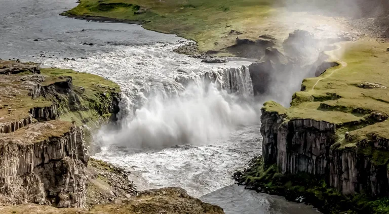
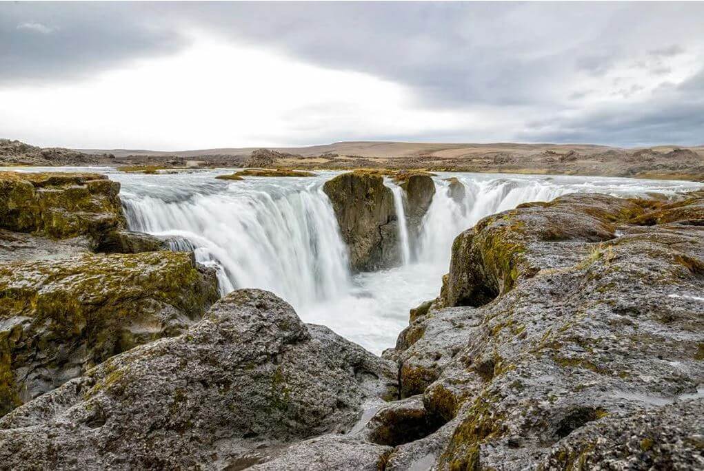
Dettifoss
Dettifoss waterfall (click to enlarge).
Location: Northeast, see the map of Dettifoss
Height: 44m (144ft)
Road accessible by: 2wd car in summer, 4wd car/super jeep winter*
Hiking time: 15 minutes
Hiking distance: 600m (0,4mi)
Hiking difficulty: moderate
Trail in winter: snowy/icy but accessible
Trail link: Dettifoss hiking trail
Our experience: Dettifoss visit
Djúpagilsfoss
Djúpagilsfoss waterfall (click to enlarge).
Location: Southwest, see the map of Djupagilsfoss
Height: 40m (131ft)
Road accessible by: 2wd car
Hiking time: 1,5-2 hours
Hiking distance: 5km (3,1mi)
Hiking difficulty: moderate
Trail in winter: snowy/icy but accessible
Trail link: Djupagilsfoss hiking trail
Djúpavíkurfoss
Djúpavíkurfoss waterfall (click to enlarge).
Location: Westfjords, see the map of Djupavikurfoss
Height: 160m (525ft)
Road accessible by: better 4wd car in summer, super jeep/inaccessible in winter
Hiking time: next to the road/parking*
Hiking distance: 50m* (60yd*)
Hiking difficulty: easy*
Trail in winter: easily accessible*
Trail link: Djupavikurfoss hiking trail
Drifandi
Drifandi waterfall (click to enlarge). Photo by Alexander Grebenkov, CCM license. Source link.
Location: Southwest, see the map of Drifandi
Height: 70m (230ft)
Road accessible by: 2wd car
Hiking time: next to the road/parking
Hiking distance: 50m (60yd)
Hiking difficulty: easy
Trail in winter: easily accessible
Trail link: Drifandi hiking trail
Drifandisfoss
Drifandisfoss waterfall (click to enlarge).
Location: Hornstrandir, see the map of Drifandisfoss
Height: 60m (197ft)
Road accessible by: no road, only ferry and hiking
Hiking time: 7 hours*
Hiking distance: 25km* (15,5mi*)
Hiking difficulty: difficult
Trail in winter: inaccessible
Trail link: Drifandisfoss hiking trail
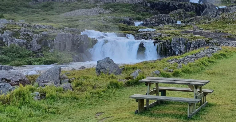
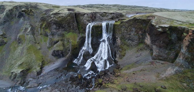
Dynjandi
Dynjandi waterfall (click to enlarge).
Location: Westfjords, see the map of Dynjandi
Height: 100m (328ft)
Road accessible by: 2wd car in summer, 4wd car in winter
Hiking time: 15 minutes
Hiking distance: 800m (0,5mi)
Hiking difficulty: easy
Trail in winter: snowy/icy but accessible
Trail link: Dynjandi hiking trail
Our experience: Dynjandi visit
Fagrifoss
Fagrifoss waterfall (click to enlarge).
Location: South Highlands, see the map of Fagrifoss
Height: 80m (262ft)
Road accessible by: 4wd car in summer (F-road), super jeep/inaccessible in winter
Hiking time: 5 minutes
Hiking distance: 200m (220yd)
Hiking difficulty: easy
Trail in winter: snowy/icy but accessible
Trail link: –
Our experience: Fagrifoss visit
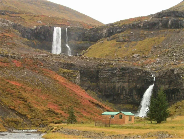
Fardagafoss
Fardagafoss waterfall (click to enlarge).
Location: East, see the map of Fardagafoss
Height: 20m (66ft)
Road accessible by: 2wd car
Hiking time: 15-20 minutes
Hiking distance: 1km (0,6mi)
Hiking difficulty: moderate
Trail in winter: snowy/icy but accessible
Trail link: Fardagafoss hiking trail
Faxafoss
Faxafoss waterfall (click to enlarge).
Location: Southwest, see the map of Faxafoss
Height: 10m (33ft)
Road accessible by: 2wd car
Hiking time: next to the road/parking
Hiking distance: 50m (60yd)
Hiking difficulty: easy
Trail in winter: easily accessible
Trail link: –
Faxi
Faxi waterfall (click to enlarge). Photo by Peter Stobbart, CCM license.
Location: East Highlands, see the map of Faxi
Height: 20m (66ft)
Road accessible by: 2wd car in summer, super jeep/inaccessible in winter
Hiking time: 40 minutes
Hiking distance: 2500m (1,6mi)
Hiking difficulty: moderate
Trail in winter: hardly/inaccessible
Trail link: Faxi hiking trail
Femri-Fellsfoss and Inri-Fellsfoss
Femri-Fellsfoss and Inri-Fellsfoss waterfall (click to enlarge).
Location: South, see the map of Femri-fellsfoss and innri-fellsfoss
Height: 15m (49ft)
Road accessible by: 2wd car
Hiking time: 40 minutes
Hiking distance: 2,2km (1,4mi)
Hiking difficulty: moderate
Trail in winter: snowy/icy but accessible
Trail link: Femri-fellsfoss and Innri-fellsfoss hiking trail
Our experience: Femri and Innri Fellsfoss visit
Flögufoss
Flögufoss waterfall (click to enlarge).
Location: East, see the map of Flogufoss
Height: 60m (197ft)
Road accessible by: 2wd car
Hiking time: 20 minutes
Hiking distance: 1500m (0,9mi)
Hiking difficulty: moderate
Trail in winter: snowy/icy but accessible
Trail link: Flogufoss hiking trail
Folaldafoss
Folaldafoss waterfall (click to enlarge).
Location: East, see the map of Folaldafoss
Height: 20m (66ft)
Road accessible by: 2wd car in summer, super jeep/inaccessible in winter
Hiking time: 5 minutes
Hiking distance: 300m (330yd)
Hiking difficulty: easy
Trail in winter: snowy/icy but accessible
Trail link: –
Our experience: Folaldafoss visit
Foss
Foss waterfall (click to enlarge).
Location: North, see the map of Foss
Height: 10m (33ft)
Road accessible by: 2wd car
Hiking time: 5 minutes
Hiking distance: 50m (60yd)
Hiking difficulty: easy
Trail in winter: snowy/icy but accessible
Trail link: –
Foss á Síðu
Foss á Síðu waterfall (click to enlarge). Photo by Christian Bickel fingalo, CCM license. Source link.
Location: South, see the map of Foss a sidu
Height: 30m (98ft)
Road accessible by: 2wd car
Hiking time: 5 minutes
Hiking distance: 100m (110yd)
Hiking difficulty: easy
Trail in winter: easily accessible
Trail link: –
Fossálar
Fossálar waterfall (click to enlarge).
Location: South, see the map of Fossalar
Height: 5m (16ft)
Road accessible by: 2wd car
Hiking time: next to the road/parking
Hiking distance: 50m (60yd)
Hiking difficulty: easy
Trail in winter: easily accessible
Trail link: –
Fosstorfufoss
Fosstorfufoss waterfall (click to enlarge).
Location: South, see the map of Fosstorfufoss
Height: 10m (33ft)
Road accessible by: 2wd car
Hiking time: 20 minutes
Hiking distance: 1,1km (0,7mi)
Hiking difficulty: moderate
Trail in winter: snowy/icy but accessible
Trail link: Fosstorfufoss hiking trail
Our experience: Fosstorfufoss visit
Gilsárfoss
Gilsárfoss waterfall (click to enlarge). Photo by El_Gulio, CCM license.
Location: East, see the map of Gilsarfoss
Height: 7m (23ft)
Road accessible by: 2wd car in summer, 4wd car/super jeep in winter
Hiking time: 15 minutes
Hiking distance: 1km (0,6mi)
Hiking difficulty: easy
Trail in winter: snowy/icy but accessible
Trail link: Gilsarfoss hiking trail
Gjárfoss
Gjárfoss waterfall (click to enlarge).
Location: South Highlands, see the map of Gjarfoss
Height: 15m (49ft)
Road accessible by: better 4wd car in summer, super jeep/inaccessible in winter
Hiking time: 10 minutes
Hiking distance: 500m (0,3mi)
Hiking difficulty: easy
Trail in winter: hardly/inaccessible
Trail link: Gjarfoss hiking trail
Our experience: Gjarfoss visit
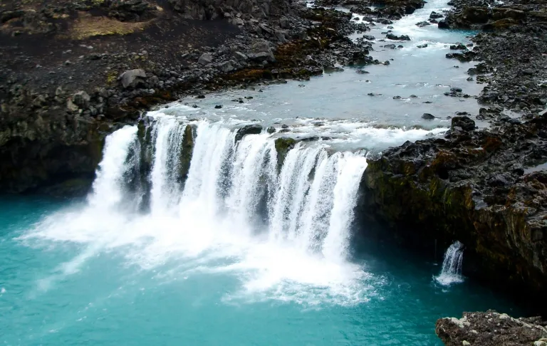
Glanni
Glanni waterfall (click to enlarge). Photo by Izsonzo, CCM license. Source link.
Location: West, see the map of Glanni
Height: 10m (33ft)
Road accessible by: 2wd car in summer, better 4wd car in winter
Hiking time: 5 minutes
Hiking distance: 300m (330yd)
Hiking difficulty: easy
Trail in winter: snowy/icy but accessible
Trail link: –
Gljúfrabúi
Gljúfrabúi waterfall (click to enlarge).
Location: Southwest, see the map of Gljufrabui
Height: 40m (131ft)
Road accessible by: 2wd car
Hiking time: 10 minutes
Hiking distance: 600m (0,4mi)
Hiking difficulty: moderate
Trail in winter: easily accessible
Trail link: –
Gljúfurárfoss
Gljúfurárfoss waterfall (click to enlarge). Photo by Bromr, CCM license. Source link.
Location: Westfjords, see the map of Gljufurarfoss
Height: 8m (26ft)
Road accessible by: 2wd car in summer, super jeep/inaccessible in winter
Hiking time: next to the road/parking
Hiking distance: 50m (60yd)
Hiking difficulty: easy
Trail in winter: easily accessible
Trail link: –
Gljúfursárfoss
Gljúfursárfoss waterfall (click to enlarge). Photo by Bromr, CCM license. Source link.
Location: East, see the map of Gljufursarfoss
Height: 45m (148ft)
Road accessible by: 2wd car in summer, 4wd car/super jeep in winter
Hiking time: next to the road/parking
Hiking distance: 50m (60yd)
Hiking difficulty: easy
Trail in winter: easily accessible
Trail link: –
Gluggafoss

Gluggafoss waterfall (click to enlarge). Photo by Hornstrandir1, CCM license. Source link.
Location: South, see the map of Gluggafoss
Height: 120m (394ft)
Road accessible by: 2wd car in summer, 4wd car in winter
Hiking time: 5 minutes
Hiking distance: 300m (330yd)
Hiking difficulty: easy
Trail in winter: snowy/icy but accessible
Trail link: –
Glymur
Glymur waterfall (click to enlarge). Photo by Andreas Tille, CCM license. Source link.
Location: West, see the map of Glymur
Height: 198m (649ft)
Road accessible by: 2wd car in summer, inaccessible in winter
Hiking time: 1 hour
Hiking distance: 3,5km (2,2mi)
Hiking difficulty: moderate
Trail in winter: inaccessible
Trail link: first Glymur hiking trail, second Glymur hiking trail
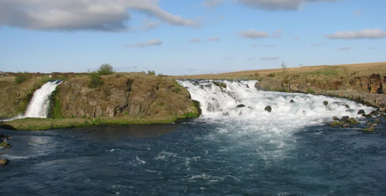
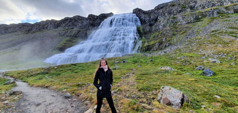
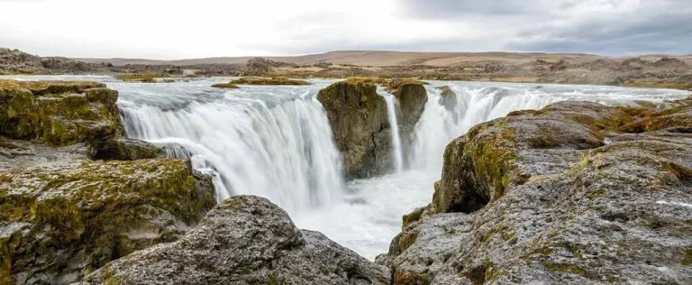
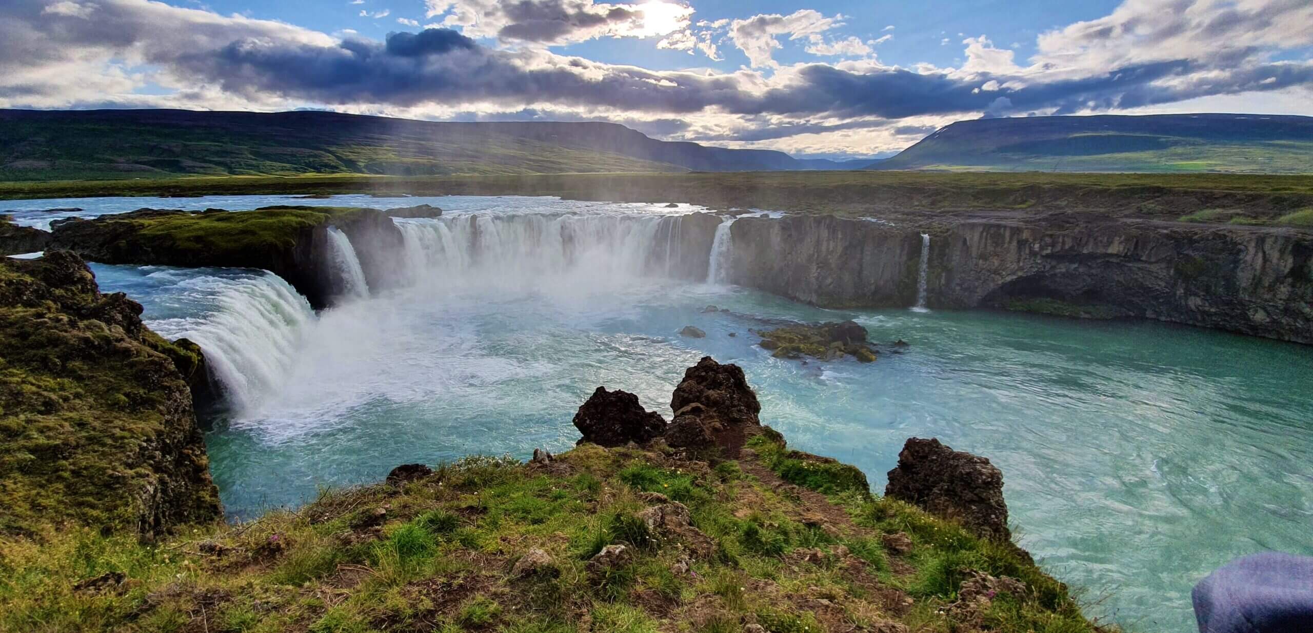
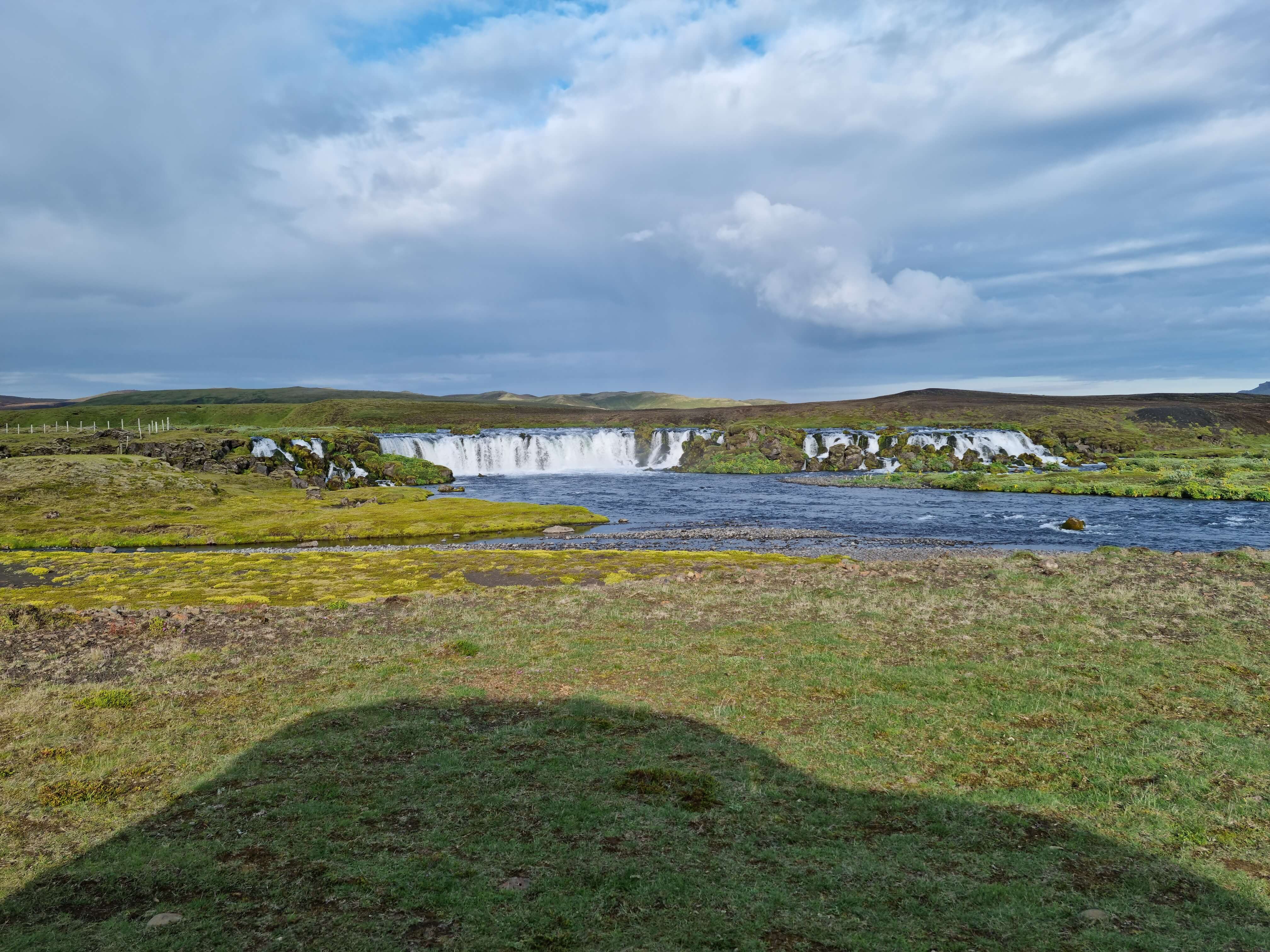
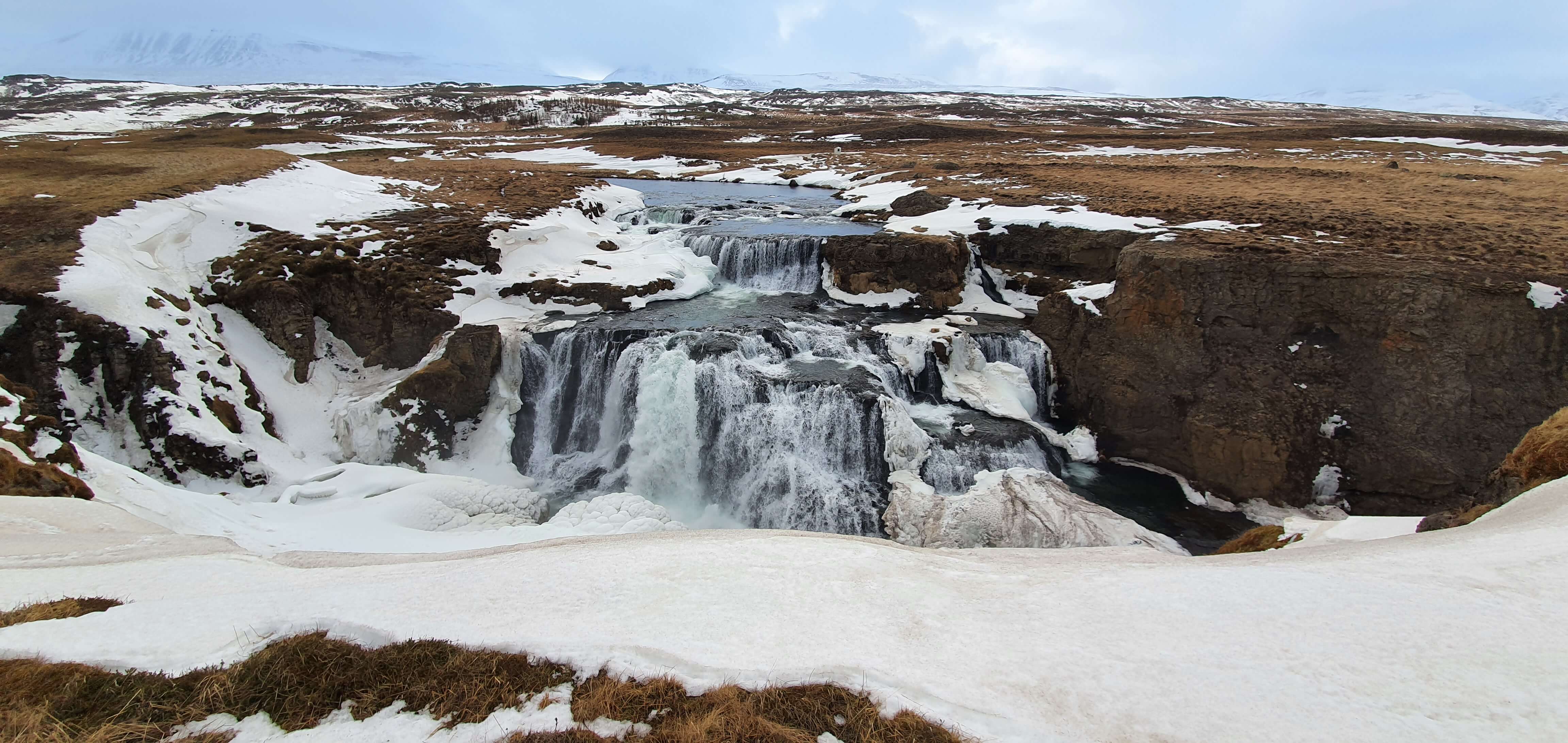
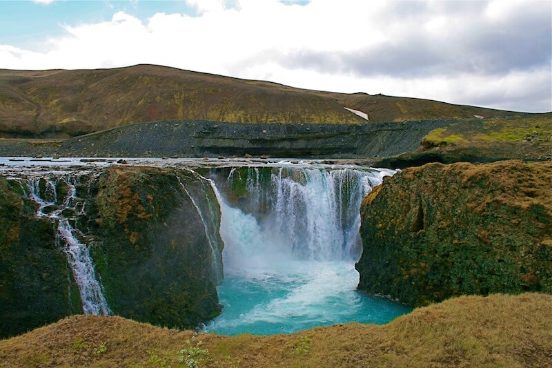
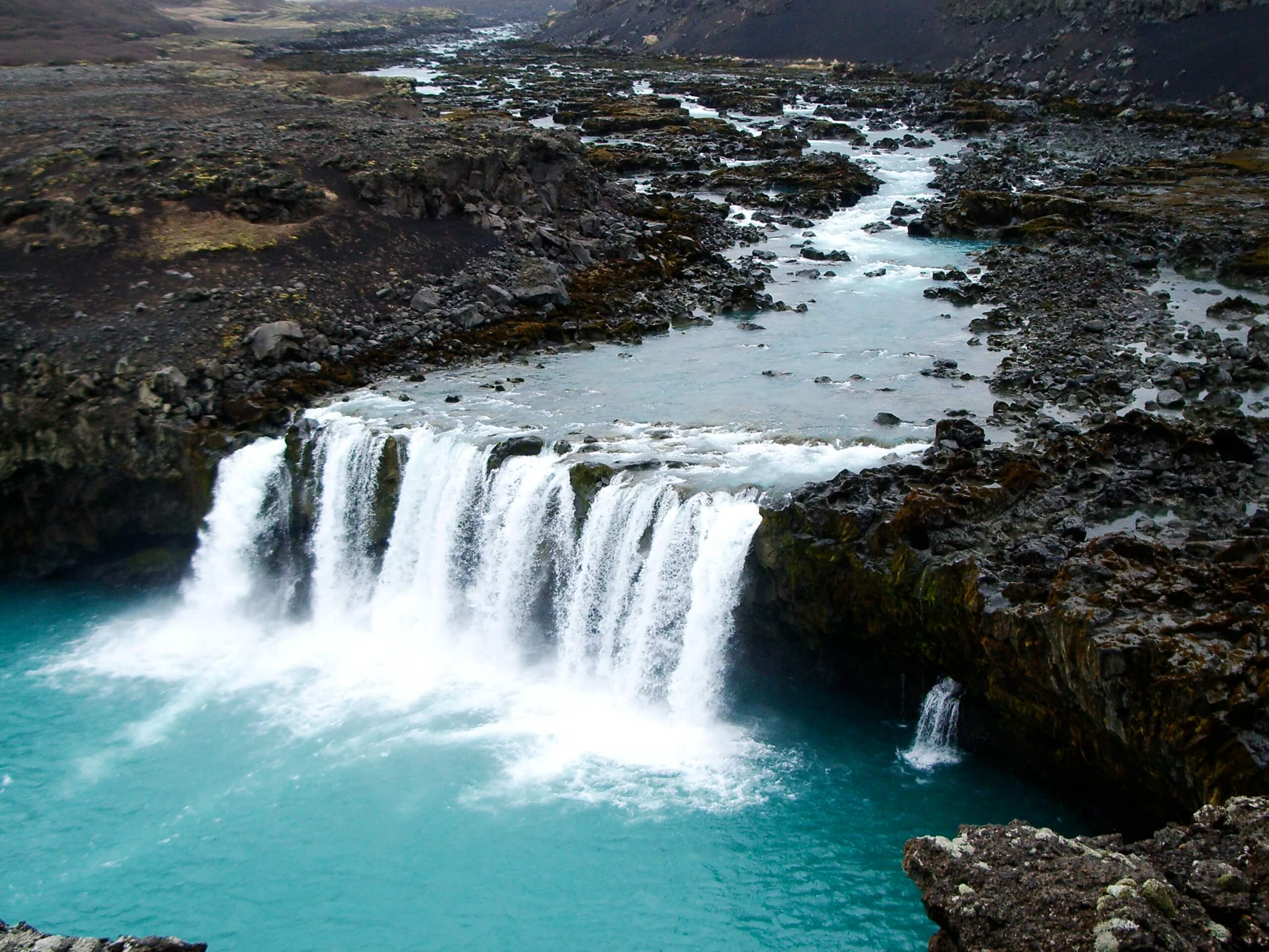
Goðafoss

Goðafoss waterfall (click to enlarge).
Location: North, see the map of Godafoss
Height: 12m (39ft)
Road accessible by: 2wd car
Hiking time: 10 minutes
Hiking distance: 500m (0,3mi)
Hiking difficulty: easy
Trail in winter: easily accessible
Trail link: –
Our experience: Godafoss summer visit, Godafoss winter visit
Göngumannafoss
Göngumannafoss waterfall (click to enlarge). Photo by Bromr, CCM license. Source link.
Location: Westfjords, see the map of Gongumannafoss
Height: 4m (13ft)
Road accessible by: 2wd car in summer, 4wd car in winter
Hiking time: 7 minutes
Hiking distance: 400m (440yd)
Hiking difficulty: easy
Trail in winter: snowy/icy but accessible
Trail link: Gongumannafoss hiking trail
Granni
Granni waterfall (click to enlarge).
Location: South Highlands, see the map of Granni
Height: 100m (328ft)
Road accessible by: better 4wd car in summer, super jeep in winter
Hiking time: next to the road/parking
Hiking distance: 50m (60yd)
Hiking difficulty: easy
Trail in winter: snowy/icy but accessible
Trail link: –
Our experience: Granni visit
Grundarfoss
Grundarfoss waterfall (click to enlarge).
Location: Snaefellsnes, see the map of Grundarfoss
Height: 70m (230ft)
Road accessible by: 2wd car in summer, 4wd car in winter
Hiking time: 20 minutes
Hiking distance: 1,5km (0,9mi)
Hiking difficulty: moderate
Trail in winter: snowy/icy but accessible
Trail link: Grundarfoss hiking trail
Gufufoss
Gufufoss waterfall (click to enlarge).
Location: East, see the map of Gufufoss
Height: 12m (39ft)
Road accessible by: 2wd car in summer, better 4wd car in winter
Hiking time: next to the road/parking
Hiking distance: 100m (110yd)
Hiking difficulty: easy
Trail in winter: snowy/icy but accessible
Trail link: –
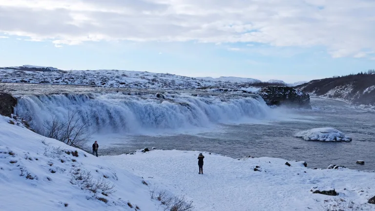
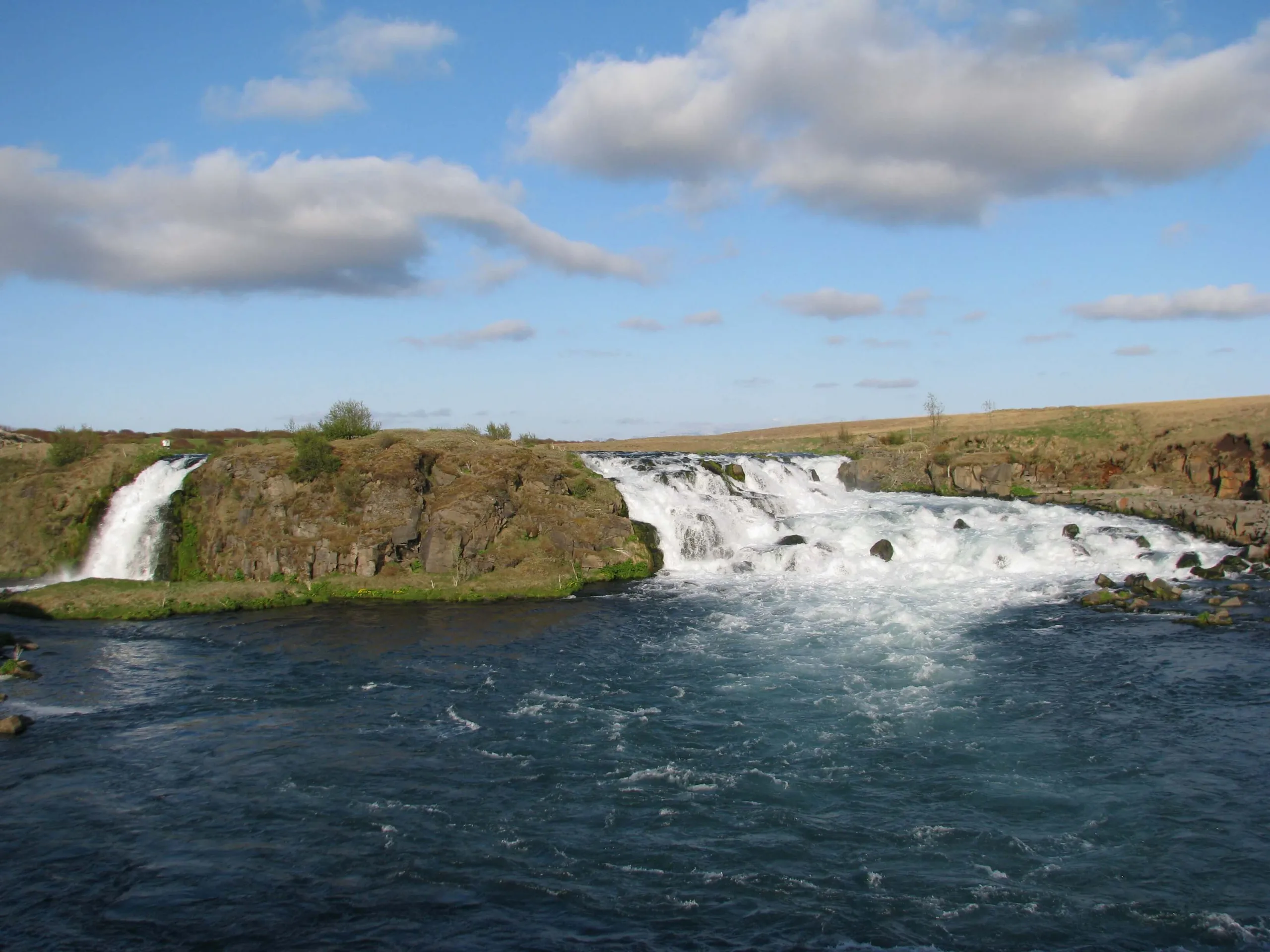
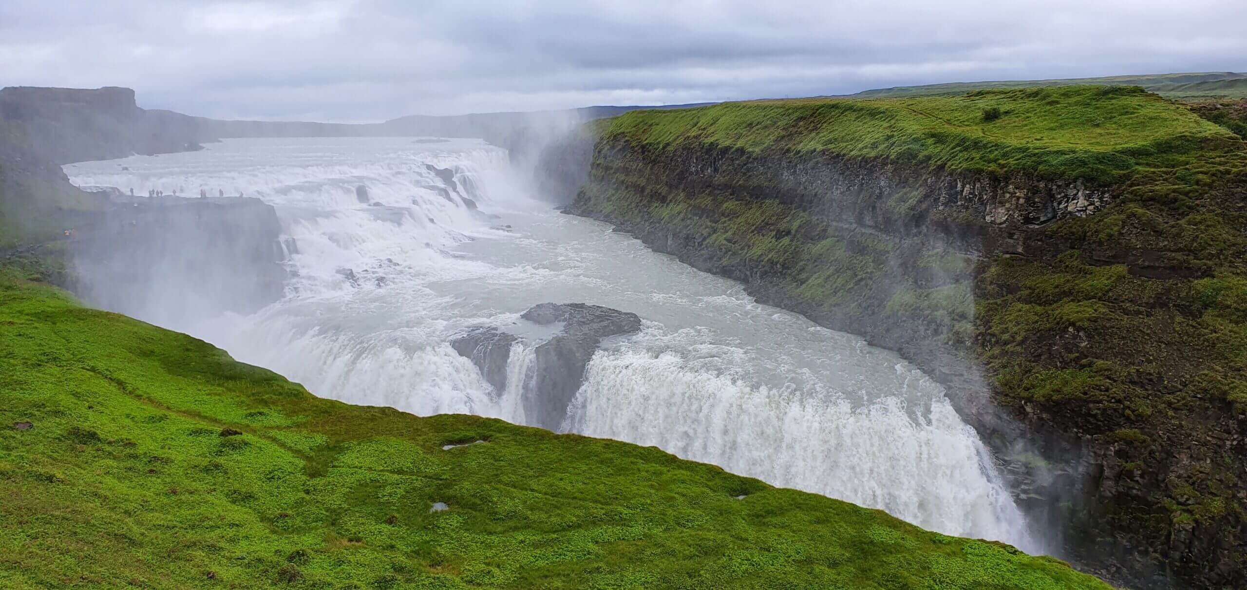
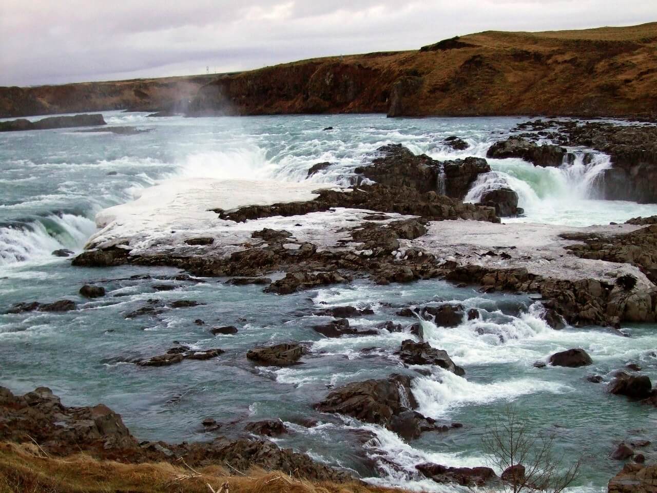
Gullfoss
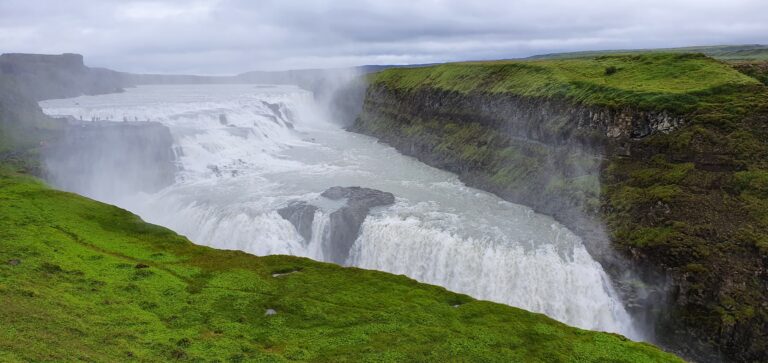
Gullfoss waterfall (click to enlarge).
Location: Southwest, see the map of Gullfoss
Height: 32m (105ft)
Road accessible by: 2wd car
Hiking time: 5-10 minutes
Hiking distance: 400m (440yd)
Hiking difficulty: easy
Trail in winter: easily accessible
Trail link: –
Our experience: Gullfoss visit
Gýgjarfoss

Gýgjarfoss waterfall (click to enlarge).
Location: Central Highlands, see the map of Gygjarfoss
Height: 5m (16ft)
Road accessible by: 4wd car in summer (F-road), super jeep/inaccessible in winter
Hiking time: next to the road/parking
Hiking distance: 50m (60yd)
Hiking difficulty: easy
Trail in winter: easily accessible
Trail link: –
Hænubrekkufoss
Hænubrekkufoss waterfall (click to enlarge).
Location: East, see the map of Haenubrekkufoss
Height: 53m (174ft)
Road accessible by: 2wd car in summer, super jeep/inaccessible in winter
Hiking time: 10 minutes
Hiking distance: 500m (0,3mi)
Hiking difficulty: moderate
Trail in winter: snowy/icy but accessible
Trail link: –
Hæstahjallafoss
Hæstahjallafoss waterfall (click to enlarge). Photo by Jennifer Boyer, CCM license. Source link.
Location: Westfjords, see the map of Haestahjallafoss
Height: 5m (16ft)
Road accessible by: 2wd car in summer, 4wd car in winter
Hiking time: 12 minutes
Hiking distance: 700m (0,4mi)
Hiking difficulty: easy
Trail in winter: snowy/icy but accessible
Trail link: Haestahjallafoss hiking trail
Hafragilsfoss
Hafragilsfoss waterfall (click to enlarge). Photo by Bernd Thaller, CCM license. Source link.
Location: Northeast, see the map of Hafragilsfoss
Height: 27m (89ft)
Road accessible by: 2wd car in summer, 4wd car/super jeep winter*
Hiking time: next to the road/parking
Hiking distance: 50m (60yd)
Hiking difficulty: easy
Trail in winter: snowy/icy but accessible
Trail link: –
Háifoss
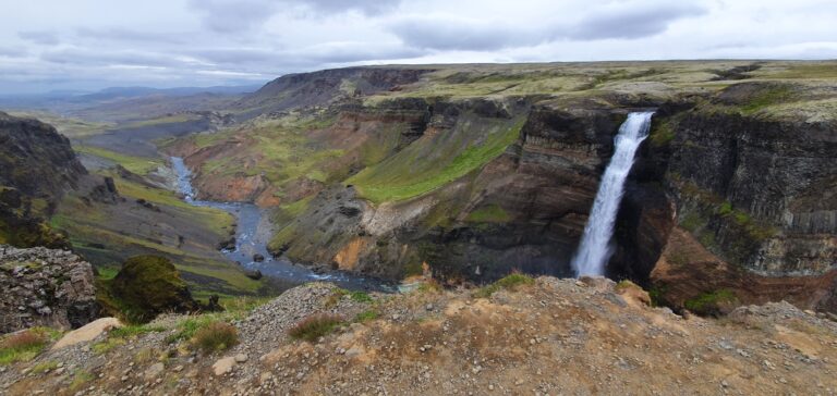
Háifoss waterfall (click to enlarge).
Location: South Highlands, see the map of Haifoss
Height: 122m (400ft)
Road accessible by: better 4wd car in summer, super jeep in winter
Hiking time: next to the road/parking
Hiking distance: 50m (60yd)
Hiking difficulty: easy
Trail in winter: snowy/icy but accessible
Trail link: –
Our experience: Haifoss visit
Hangandifoss
Hangandifoss waterfall (click to enlarge).
Location: Southeast, see the map of Hangandifoss
Height: 110m (361ft)
Road accessible by: 2wd car in summer, super jeep/inaccessible in winter
Hiking time: 30-45 minutes
Hiking distance: 1500m (0,9mi)
Hiking difficulty: moderate
Trail in winter: hardly/inaccessible
Trail link: Hangandifoss hiking trail
Helgufoss
Helgufoss waterfall (click to enlarge).
Location: West, see the map of Helgufoss
Height: 12m (39ft)
Road accessible by: 2wd car in summer, 4wd car/super jeep in winter
Hiking time: 10*
Hiking distance: 500m* (0,3mi*)
Hiking difficulty: easy
Trail in winter: snowy/icy but accessible
Trail link: –
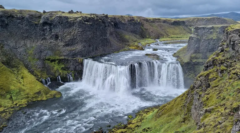
Hengifoss
Hengifoss waterfall (click to enlarge).
Location: East, see the map of Hengifoss
Height: 128m (420ft)
Road accessible by: 2wd car in summer, better 4wd car in winter
Hiking time: 30-40 minutes
Hiking distance: 2km (1,2mi)
Hiking difficulty: easy
Trail in winter: snowy/icy but accessible
Trail link: Hengifoss hiking trail
Hestavaðsfoss
Hestavaðsfoss waterfall (click to enlarge).
Location: South, see the map of Hestavadsfoss
Height: 9m (30ft)
Road accessible by: 2wd car
Hiking time: 15 minutes
Hiking distance: 800m (0,5mi)
Hiking difficulty: moderate
Trail in winter: snowy/icy but accessible
Trail link: Hestavadsfoss hiking trail
Our experience: Hestavadsfoss visit
Hjálparfoss
Hjálparfoss waterfall (click to enlarge).
Location: Southwest, see the map of Hjalparfoss
Height: 13m (43ft)
Road accessible by: 2wd car in summer, better 4wd car in winter
Hiking time: next to the road/parking
Hiking distance: 100m (110yd)
Hiking difficulty: easy
Trail in winter: snowy/icy but accessible
Trail link: –
Hlauptungufoss
Hlauptungufoss waterfall (click to enlarge). Photo by G.Mannaerts, CCM license. Source link.
Location: West, see the map of Hlauptungufoss
Height: 2m (7ft)
Road accessible by: 2wd car
Hiking time: 30-40 minutes
Hiking distance: 2km (1,2mi)
Hiking difficulty: easy
Trail in winter: snowy/icy but accessible
Trail link: Hlauptungufoss hiking trail
Hólmsárfoss
Hólmsárfoss waterfall (click to enlarge).
Location: South Highlands, see the map of Holmsarfoss
Height: 3m (10ft)
Road accessible by: 4wd car in summer (F-road), super jeep/inaccessible in winter
Hiking time: next to the road/parking
Hiking distance: 50m (60yd)
Hiking difficulty: easy
Trail in winter: snowy/icy but accessible
Trail link: –
Hólmsárfossár
Hólmsárfossár waterfall (click to enlarge).
Location: South Highlands, see the map of Holmsarfossar
Height: 10m (33ft)
Road accessible by: 4wd car in summer (F-road), inaccessible in winter
Hiking time: 40 minutes
Hiking distance: 2km (1,2mi)
Hiking difficulty: moderate
Trail in winter: inaccessible
Trail link: Holmsarfossar hiking trail
Our experience: Holmsarfossar visit
Hrafnabjargafoss
Hrafnabjargafoss waterfall (click to enlarge). Source link.
Location: North Highlands, see the map of Hrafnabjargafoss
Height: 8m (26ft)
Road accessible by: 4wd car in summer (F-road), super jeep/inaccessible in winter
Hiking time: 5 minutes
Hiking distance: 300m (0,2mi)
Hiking difficulty: easy
Trail in winter: hardly/inaccessible
Trail link: Hrafnabjargafoss hiking trail
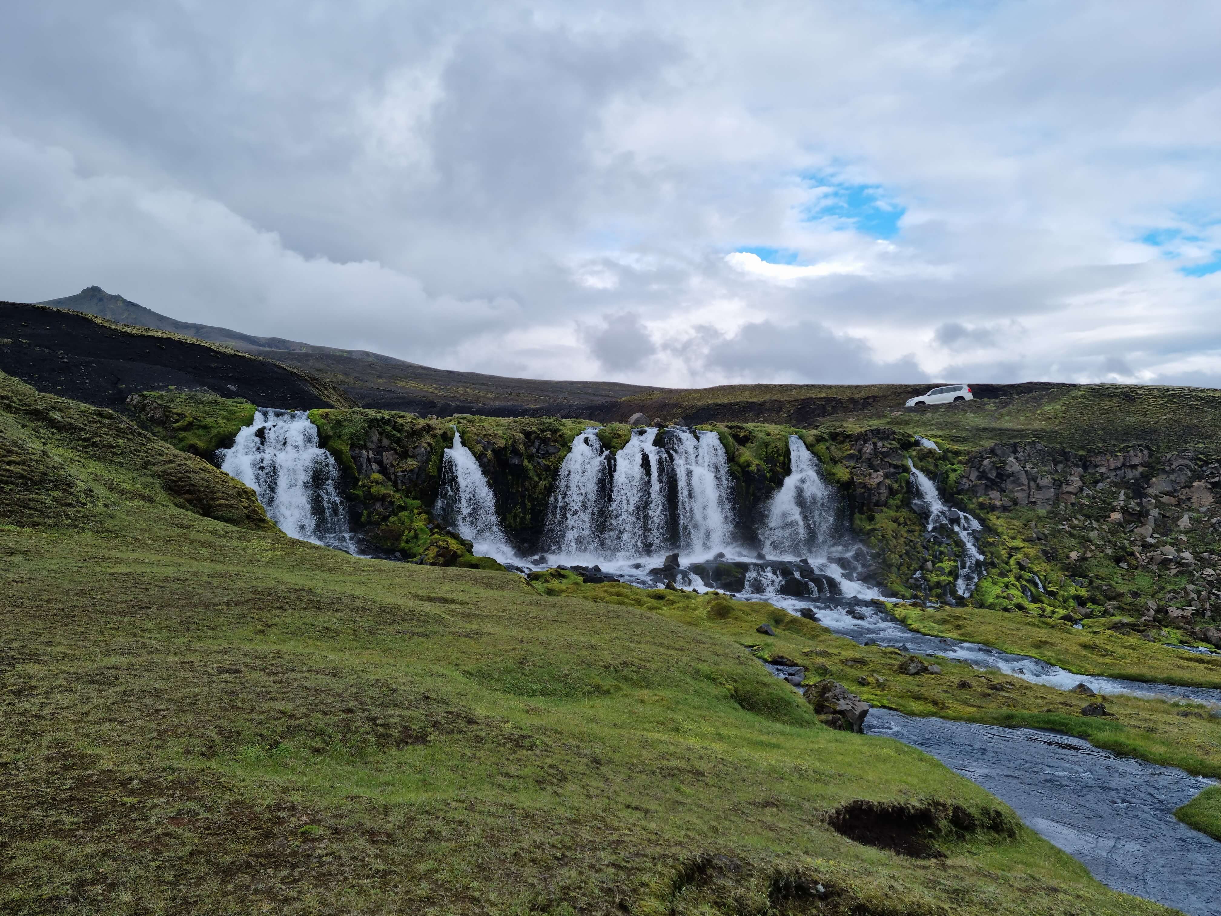
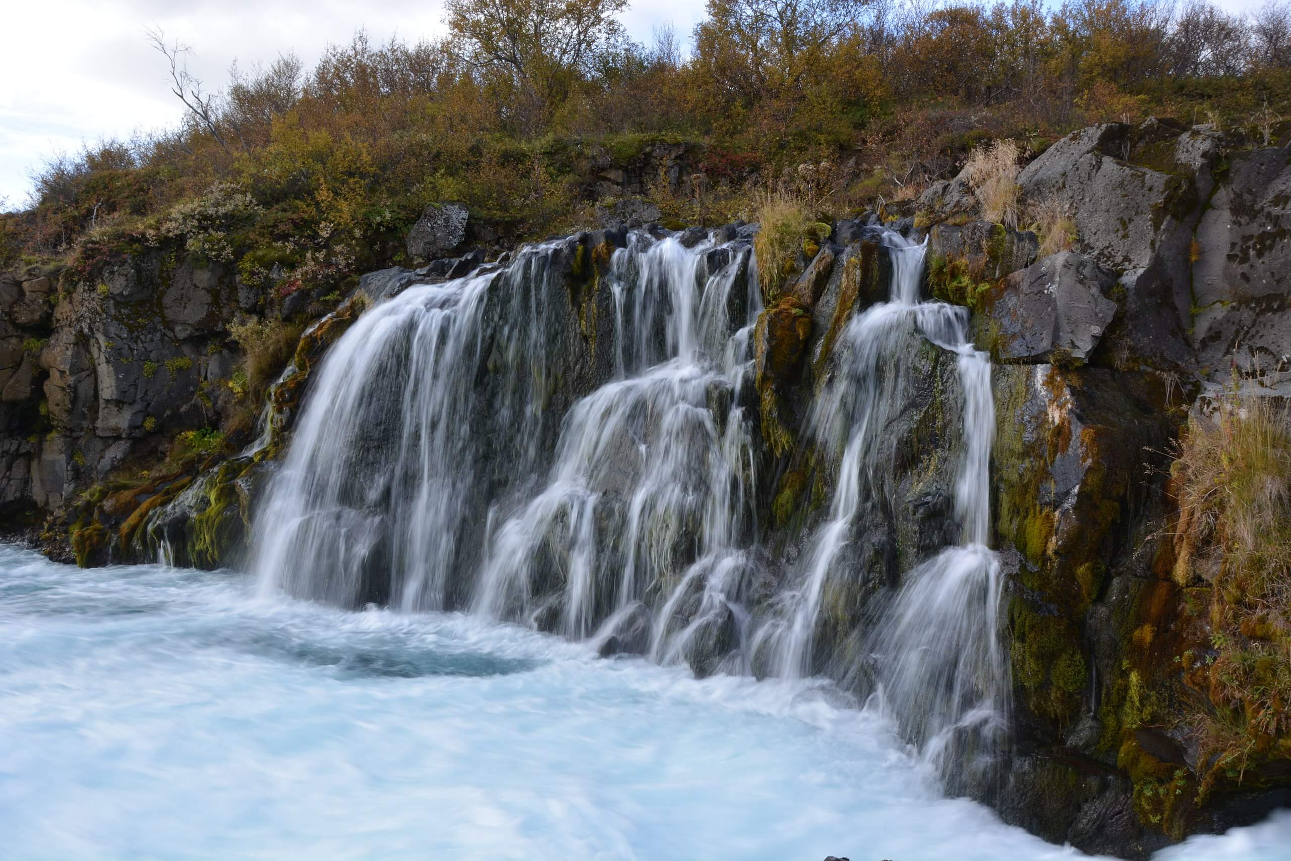
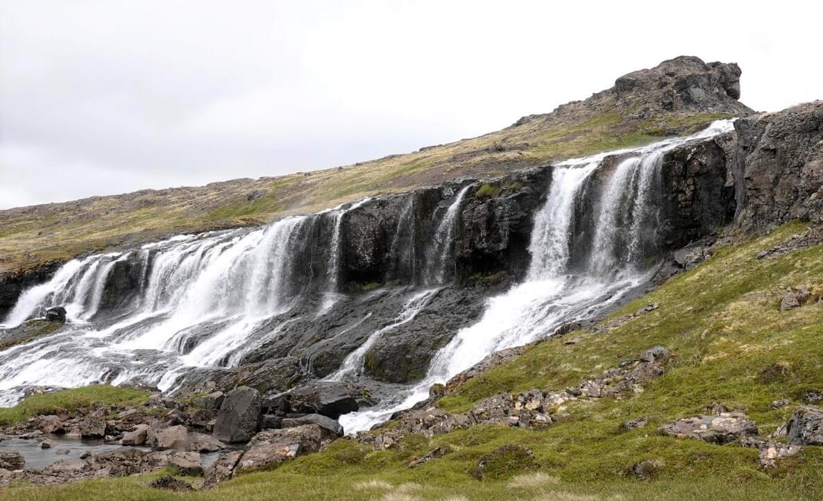
Hraunfossar
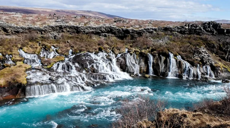
Hraunfossar waterfall (click to enlarge).
Location: West, see the map of Hraunfossar
Height: 10m (33ft)
Road accessible by: 2wd car in summer, better 4wd car in winter
Hiking time: 5 minutes
Hiking distance: 300m (330yd)
Hiking difficulty: easy
Trail in winter: easily accessible
Trail link: Hraunfossar hiking trail
Hrísvaðsfoss
Hrísvaðsfoss waterfall (click to enlarge).
Location: Westfjords, see the map of Hrisvadsfoss
Height: 3m (10ft)
Road accessible by: 2wd car in summer, 4wd car in winter
Hiking time: 5 minutes
Hiking distance: 300m (330yd)
Hiking difficulty: easy
Trail in winter: snowy/icy but accessible
Trail link: Hrisvadsfoss hiking trail
Hundafoss (Westfjords)
Hundafoss waterfall (click to enlarge).
Location: Westfjords, see the map of Hundafoss dynjandi
Height: 2m (7ft)
Road accessible by: 2wd car in summer, 4wd car in winter
Hiking time: 3 minutes
Hiking distance: 100m (110yd)
Hiking difficulty: easy
Trail in winter: snowy/icy but accessible
Trail link: Hundafoss dynjandi hiking trail
Our experience: Hundafoss visit
Hundafoss (Skaftafell)
Hundafoss waterfall (click to enlarge).
Location: Southeast, see the map of Hundafoss skaftafell
Height: 25m (82ft)
Road accessible by: 2wd car
Hiking time: 15 minutes
Hiking distance: 800m (0,5mi)
Hiking difficulty: easy
Trail in winter: snowy/icy but accessible
Trail link: Hundafoss skaftafell hiking trail
Húsárfoss

Husarfoss waterfall (click to enlarge)
Location: Westfjords, see the map of Husarfoss
Height: 25m (80ft)
Road accessible by: 4wd car in summer (F-road), super jeep/inaccessible in winter
Hiking time: 20-30 minutes
Hiking distance: 1,5km (1mi)
Hiking difficulty: easy
Trail in winter: hardly/inaccessible
Trail link: Husarfoss hiking trail
Hvitárfoss

Hvitárfoss waterfall (click to enlarge). Photo by Snorri Thor Trygvasson, CCM license. Source link.
Location: South, see the map of Hvitarfoss
Height: 30m (98ft)
Road accessible by: super jeep and only in summer
Hiking time: 1-4 hours
Hiking distance: 3-14 km (2-9mi)
Hiking difficulty: difficult
Trail in winter: inaccessible
Trail link: Hvitarfoss hiking trail
Írárfoss
Location: South, see the map of Irarfoss
Height: 60m (197ft)
Road accessible by: 2wd car
Hiking time: next to the road/parking
Hiking distance: 50m (60yd)
Hiking difficulty: easy
Trail in winter: snowy/icy but accessible
Trail link: –
Kæfufoss

Kæfufoss waterfall (click to enlarge).
Location: South, see the map of Kaefufoss
Height: 8m (26ft)
Road accessible by: 2wd car
Hiking time: 1 hour
Hiking distance: 3,2km (2mi)
Hiking difficulty: moderate
Trail in winter: snowy/icy but accessible
Trail link: Kaefufoss hiking trail
Kerlingarfoss
Kerlingarfoss waterfall (click to enlarge). Photo by Bromr, CCM license. Source link.
Location: Snaefellsnes, see the map of Kerlingarfoss
Height: 60m (197ft)
Road accessible by: 2wd car in summer, 4wd car/super jeep in winter
Hiking time: 5 minutes
Hiking distance: 250m (270yd)
Hiking difficulty: easy
Trail in winter: snowy/icy but accessible
Trail link: Kerlingarfoss hiking trail
Kermóafoss
Kermóafoss waterfall (click to enlarge).
Location: Reykjavik, see the map of Kermoafoss
Height: 7m (23ft)
Road accessible by: 2wd car
Hiking time: 3 minutes
Hiking distance: 150m (160yd)
Hiking difficulty: easy
Trail in winter: easily accessible
Trail link: –
Ketubjörg
Ketubjörg waterfall (click to enlarge).
Location: North, see the map of Ketubjorg
Height: 120m (394ft)
Road accessible by: 2wd car in summer, 4wd car/super jeep in winter
Hiking time: 5-10 minutes
Hiking distance: 200m-500m, depends on from where you go (0,1-0,3mi)
Hiking difficulty: easy
Trail in winter: snowy/icy but accessible
Trail link: –
Kirkjufellsfoss
Kirkjufellsfoss waterfall (click to enlarge).
Location: Snaefellsnes, see the map of Kirkjufellsfoss
Height: 20m (66ft)
Road accessible by: 2wd car in summer, better 4wd car in winter
Hiking time: 3 minutes
Hiking distance: 150m (160yd)
Hiking difficulty: easy
Trail in winter: easily accessible
Trail link: –
Our experience: Kirkjufellsfoss visit
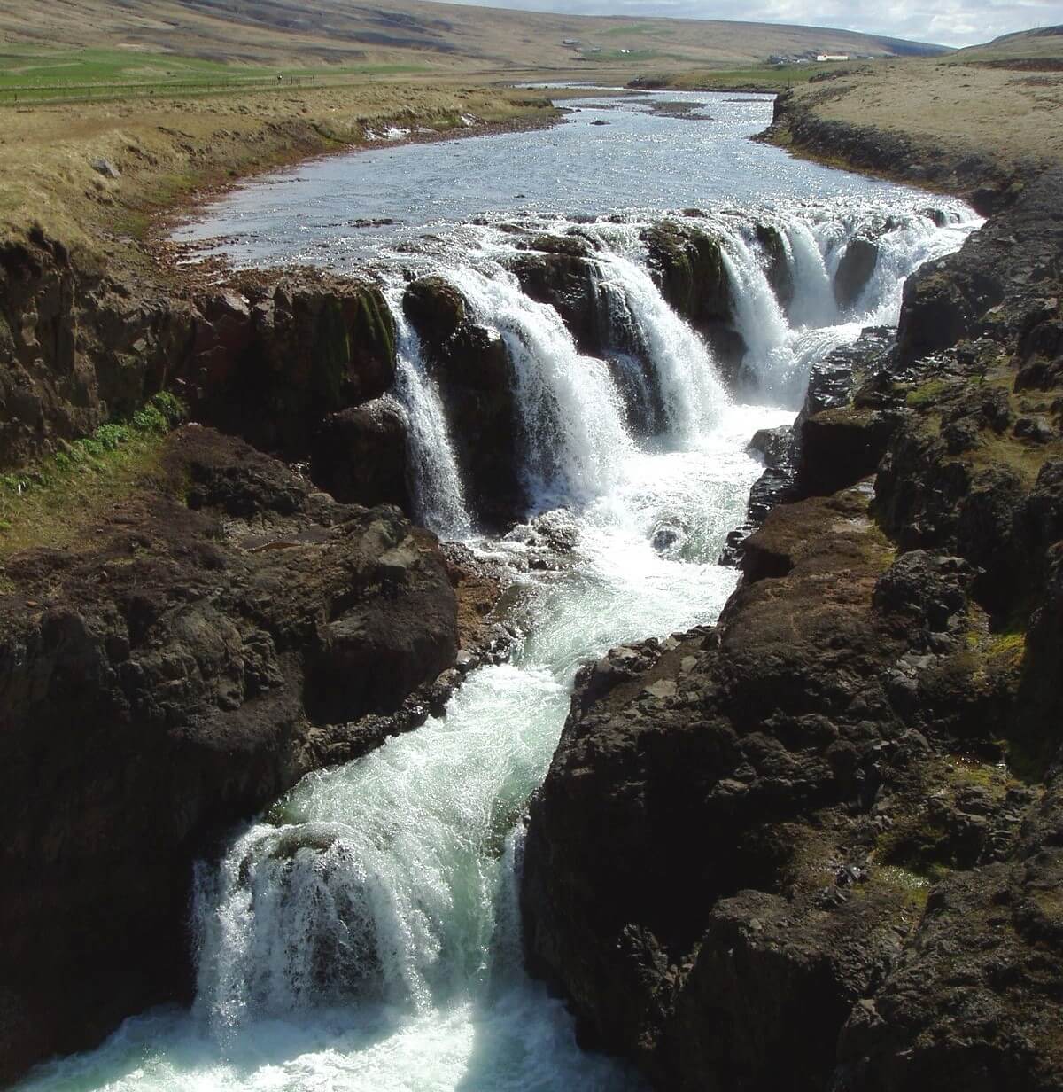
Kirkjufoss
Kirkjufoss waterfall (click to enlarge).
Location: East Highlands, see the map of Kirkjufoss
Height: 40m (131ft)
Road accessible by: 2wd car in summer, super jeep/inaccessible in winter
Hiking time: 30 minutes
Hiking distance: 2000m (1,2mi)
Hiking difficulty: moderate
Trail in winter: hardly/inaccessible
Trail link: Kirkjufoss hiking trail
Klifbrekkufoss
Klifbrekkufoss waterfall (click to enlarge).
Location: East, see the map of Klifbrekkufoss
Height: 90m (295ft)
Road accessible by: 2wd car in summer, super jeep in winter
Hiking time: 5-15 minutes
Hiking distance: 100-250m (100-300yd)
Hiking difficulty: easy*
Trail in winter: snowy/icy but accessible
Trail link: Klifbrekkufoss hiking trail
Klukkufoss
Klukkufoss waterfall (click to enlarge). Photo by Bromr, CCM license. Source link.
Location: Snaefellsnes, see the map of Klukkufoss
Height: 25m (82ft)
Road accessible by: 4wd car in summer (F-road), inaccessible in winter
Hiking time: 15 minutes
Hiking distance: 500m (0,3mi)
Hiking difficulty: easy
Trail in winter: hardly/inaccessible
Trail link: Klukkufoss hiking trail
Kolufossar
Kolufossar waterfall (click to enlarge). Photo by DasPumm, CCM license. Source link.
Location: Northwest, see the map of Kolufossar
Height: 8m (26ft)
Road accessible by: 2wd car in summer, better 4wd car in winter
Hiking time: next to the road/parking
Hiking distance: 50m (60yd)
Hiking difficulty: easy
Trail in winter: easily accessible
Trail link: –
Króksfoss (Skógar)
Location: South, see the map of Kroksfoss fimmvorduhals
Height: 14m (46ft)
Road accessible by: 2wd car
Hiking time: 2 hours
Hiking distance: 6,5km (4mi)
Hiking difficulty: moderate
Trail in winter: snowy/icy but accessible
Trail link: Kroksfoss fimmvorduhals hiking trail
Króksfoss (Norðurárdalur)
Location: West, see the map of Kroksfoss
Height: 5m (16ft)
Road accessible by: 2wd car
Hiking time: 5 minutes
Hiking distance: 100m (110yd)
Hiking difficulty: easy
Trail in winter: easily accessible
Trail link: –
Kvernufoss

Kvernufoss waterfall (click to enlarge).
Location: South, see the map of Kvernufoss
Height: 40m (131ft)
Road accessible by: 2wd car
Hiking time: 10-15 minutes
Hiking distance: 700m (0,4mi)
Hiking difficulty: easy
Trail in winter: easily accessible
Trail link: Kvernufoss hiking trail
Our experience: Kvernufoss visit
Laugavallalaug

Laugavallalaug waterfall (click to enlarge).
Location: East Highlands, see the map of Laugavallalaug
Height: 6m (20ft)
Road accessible by: 4wd car in summer, super jeep/inaccessible in winter
Hiking time: 5 minutes
Hiking distance: 300m (330yd)
Hiking difficulty: easy
Trail in winter: hardly/inaccessible
Trail link: –
Our experience: Laugavallalaug visit
Litlanesfoss
Litlanesfoss waterfall (click to enlarge).
Location: East, see the map of Litlanesfoss
Height: 35m (115ft)
Road accessible by: 2wd car in summer, better 4wd car in winter
Hiking time: 15-20 minutes
Hiking distance: 1200m (0,7mi)
Hiking difficulty: easy
Trail in winter: snowy/icy but accessible
Trail link: Litlanesfoss hiking trail
Mígandifoss
Mígandifoss waterfall (click to enlarge). Photo by Markus Trienke, CCM license. Source link.
Location: North, see the map of Migandi
Height: 45m (148ft)
Road accessible by: 2wd car
Hiking time: 5-20 minutes
Hiking distance: 100-1000m (100yd-0,6mi)
Hiking difficulty: easy
Trail in winter: snowy/icy but accessible
Trail link: –
Mögáfoss
Mögáfoss waterfall (click to enlarge).
Location: South, see the map of Mogafoss
Height: 40m (131ft)
Road accessible by: 2wd car
Hiking time: 10-15 minutes
Hiking distance: 600m (0,4mi)
Hiking difficulty: easy
Trail in winter: easily accessible
Trail link: Mogafoss hiking trail
Our experience: Mogafoss visit
Möngufoss
Möngufoss waterfall (click to enlarge).
Location: Westfjords, see the map of Mongufoss
Height: 60m (197ft)
Road accessible by: 2wd car in summer, super jeep in winter
Hiking time: 1 hour
Hiking distance: 4km (2,5mi)
Hiking difficulty: moderate
Trail in winter: hardly/inaccessible
Trail link: –
Morsárfoss
Morsárfoss waterfall (click to enlarge).
Location: Southeast, see the map of Morsarfoss
Height: 228m (748ft)
Road accessible by: 2wd car
Hiking time: 4 hours
Hiking distance: 11km (7mi)
Hiking difficulty: difficult
Trail in winter: inaccessible
Trail link: Morsarfoss hiking trail
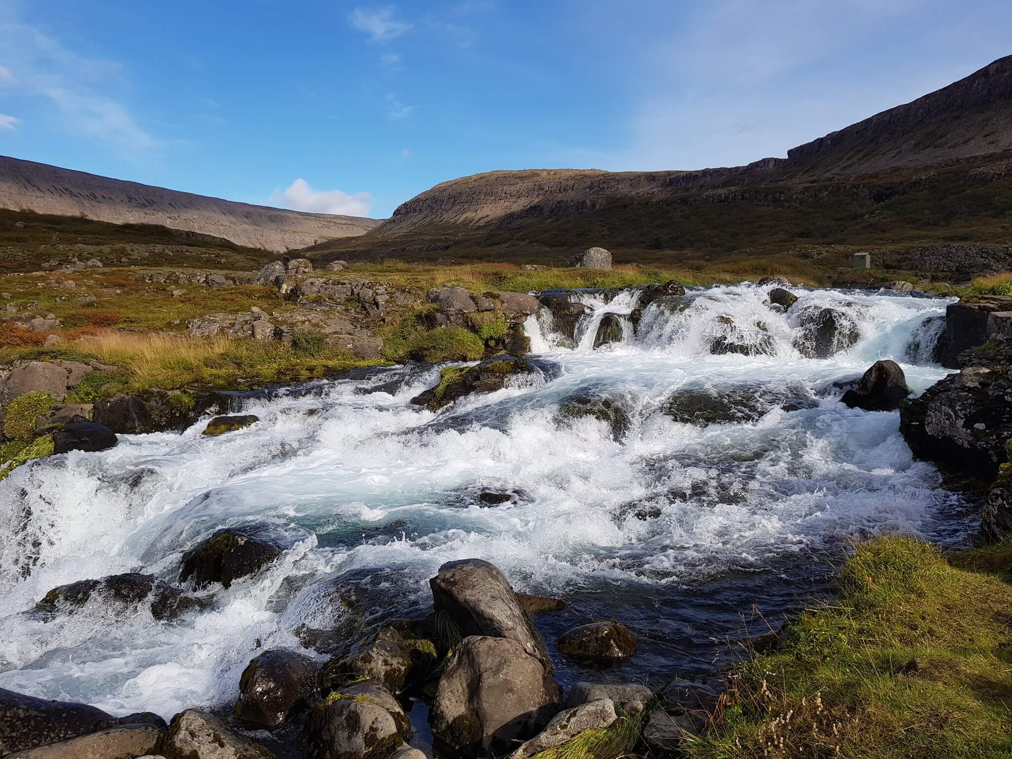
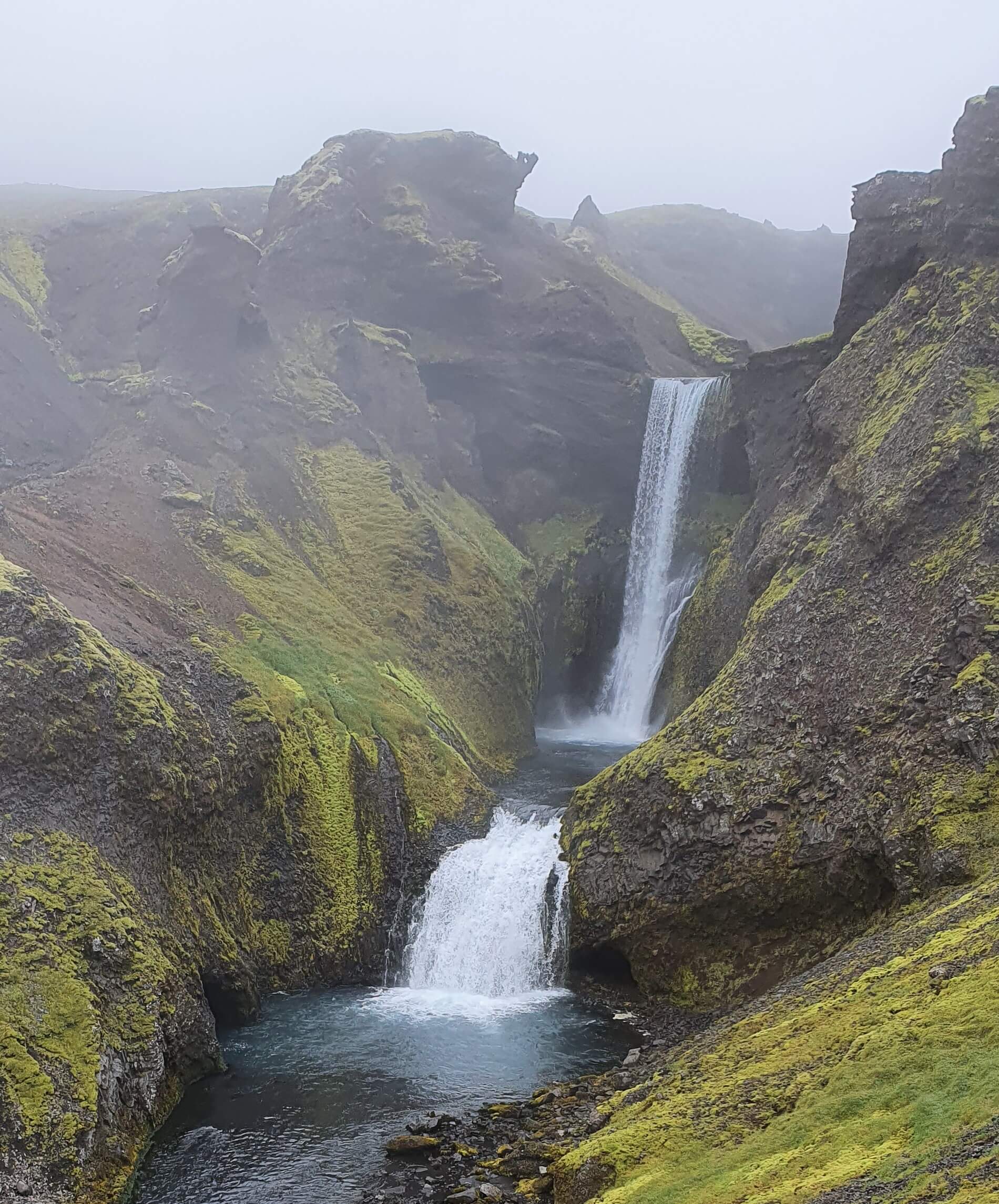
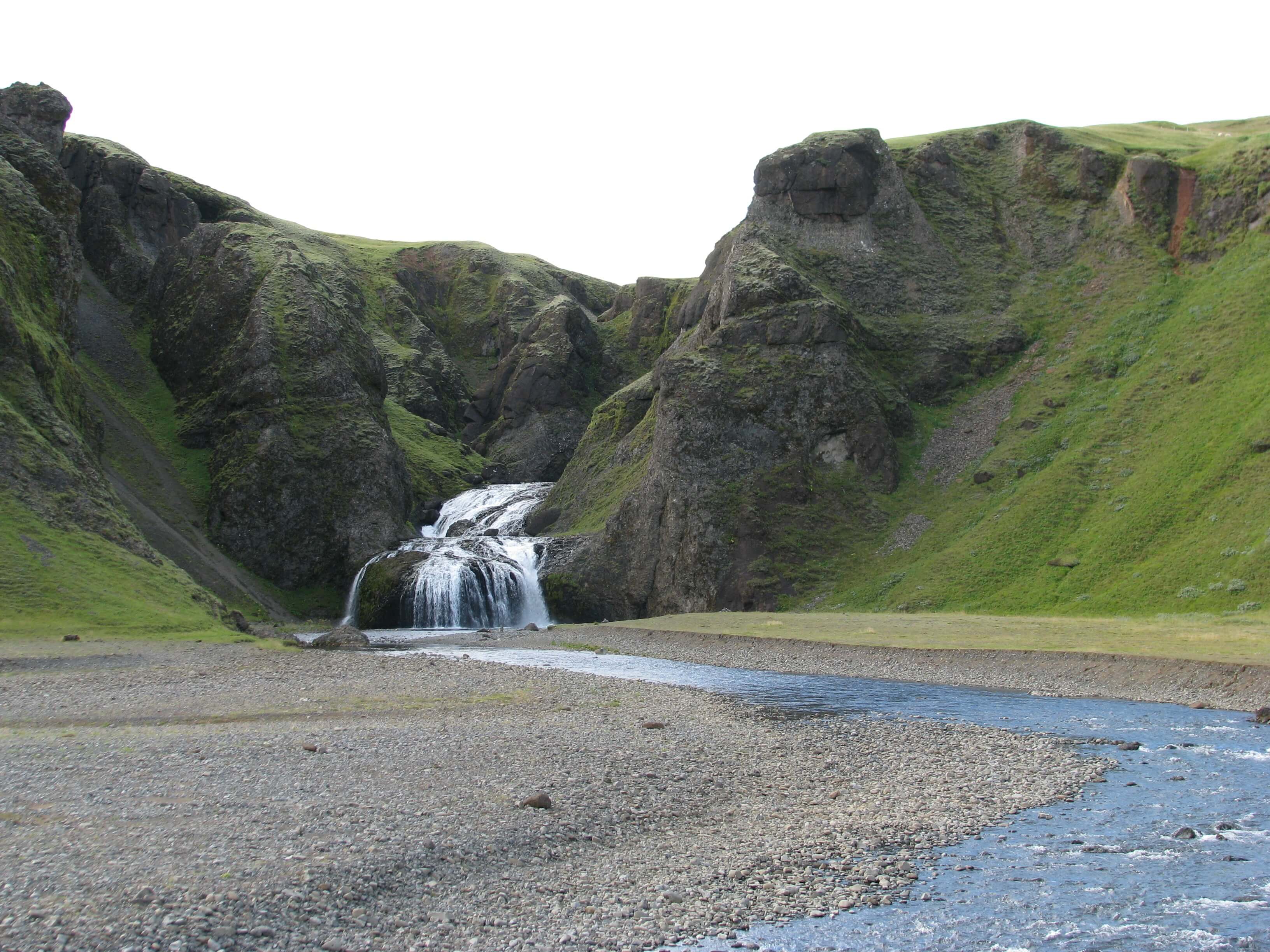
Múlafoss
Múlafoss waterfall (click to enlarge).
Location: Southeast, see the map of Mulafoss
Height: 50m (164ft)
Road accessible by: 2wd car in summer, super jeep/inaccessible in winter
Hiking time: 1-1,5 hour
Hiking distance: 3km (1,9mi)
Hiking difficulty: moderate*
Trail in winter: hardly/inaccessible
Trail link: Mulafoss hiking trail
Nauthusáfoss
Nauthusáfoss waterfall (click to enlarge).
Location: South, see the map of Nauthusafoss
Height: 20m (66ft)
Road accessible by: 2wd car in summer, better 4wd car in winter
Hiking time: 20 minutes
Hiking distance: 800m (0,5mi)
Hiking difficulty: moderate
Trail in winter: inaccessible
Trail link: Nauthusafoss hiking trail
Our experience: Nauthusafoss visit
Neðstifoss and Miðfoss
Neðstifoss and Miðfoss waterfall (click to enlarge).
Location: South, see the map of Nedstifoss and Midfoss
Height: 15m (49ft)
Road accessible by: 2wd car
Hiking time: 2,5 hours
Hiking distance: 8km (5mi)
Hiking difficulty: moderate
Trail in winter: snowy/icy but accessible
Trail link: Nedstifoss and Midfoss hiking trail
Our experience: Nedstifoss and Midfoss visit
Núpsárfoss
Núpsárfoss waterfall (click to enlarge). Photo by Snorri Thor Trygvasson, CCM license. Source link.
Location: South, see the map of Nupsarfoss
Height: 25m (82ft)
Road accessible by: super jeep and only in summer
Hiking time: 1-4 hours
Hiking distance: 3-14 km (2-9mi)
Hiking difficulty: difficult
Trail in winter: inaccessible
Trail link: Nupsarfoss hiking trail
Nýifoss

Nýifoss waterfall (click to enlarge). Photo by Polarlys, CCM license, Source link.
Location: West, see the map of Nyifoss
Height: 40m (130ft)
Road accessible by: 4wd car in summer (F-road), super jeep/inaccessible in winter
Hiking time: 30-40 minutes
Hiking distance: 2km (1,3mi)
Hiking difficulty: moderate
Trail in winter: hardly/inaccessible
Trail link: Nyifoss hiking trail
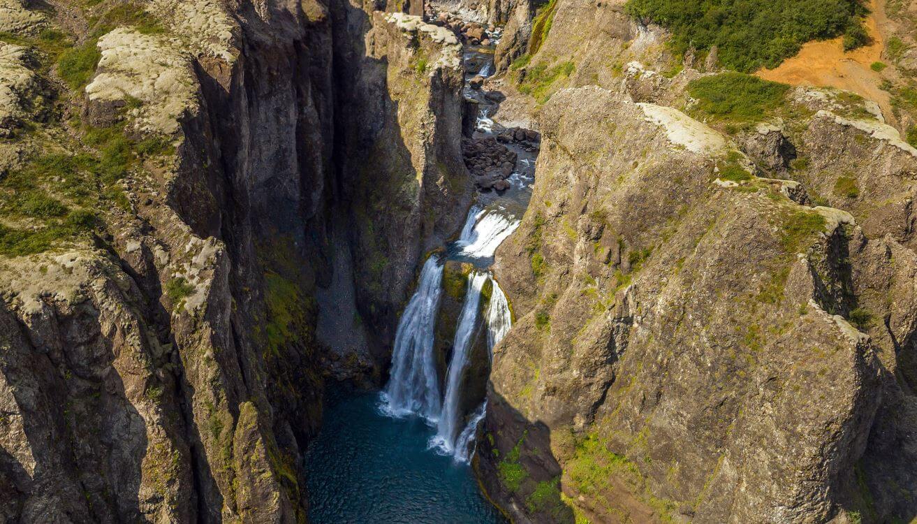
Ófærufoss
Ófærufoss waterfall (click to enlarge).
Location: South Highlands, see the map of Ofaerufoss
Height: 40m (131ft)
Road accessible by: 4wd car in summer (F-road), super jeep/inaccessible in winter
Hiking time: 40 minutes
Hiking distance: 2,5km (1,6mi)
Hiking difficulty: easy
Trail in winter: hardly/inaccessible
Trail link: Ofaerufoss hiking trail
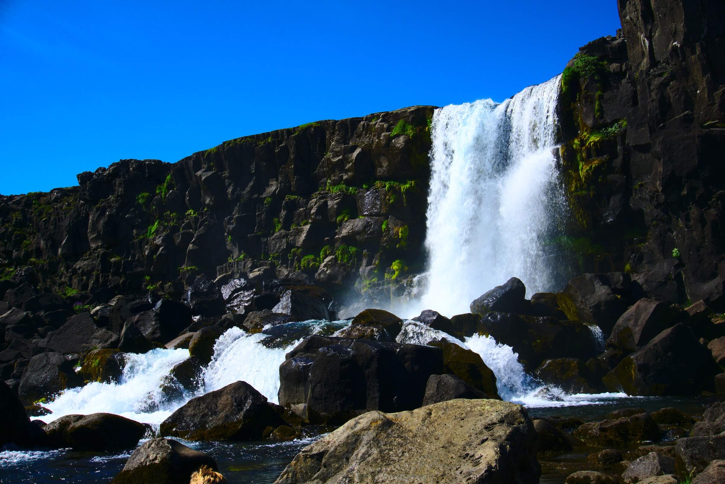
Öxarárfoss
Öxarárfoss waterfall (click to enlarge).
Location: West, see the map of Oxararfoss
Height: 7m (23ft)
Road accessible by: 2wd car
Hiking time: 10 minutes
Hiking distance: 400m (440yd)
Hiking difficulty: easy
Trail in winter: easily accessible
Trail link: Oxararfoss hiking trail
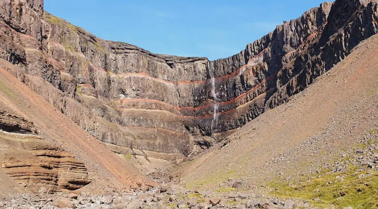
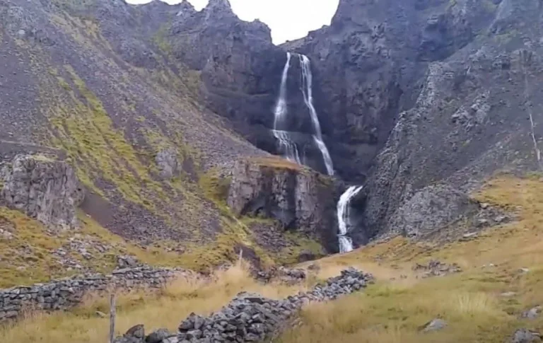
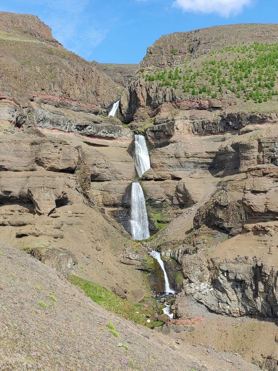
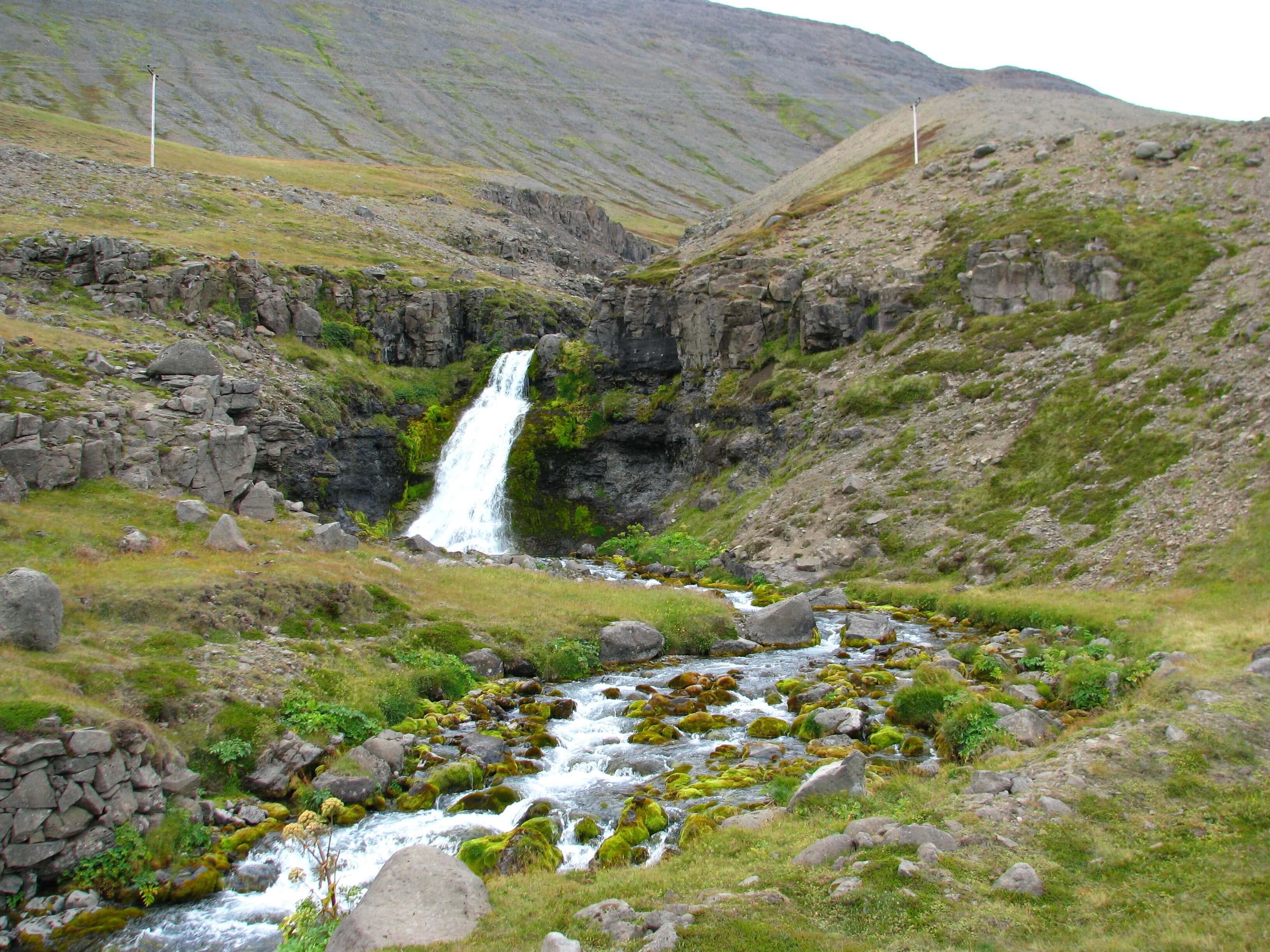
Prestagilsfoss
Location: East, see the map of Prestagilsfoss
Height: 160m (520ft)
Road accessible by: 2wd car in summer, super jeep in winter
Hiking time: 10 minutes
Hiking distance: 600m (0,4mi)
Hiking difficulty: moderate/difficult
Trail in winter: hardly/inaccessible
Trail link: –
Rauðárfoss

Rauðárfoss waterfall (click to enlarge).
Location: South, see the map of Raudarfoss
Height: 20m (66ft)
Road accessible by: 2wd car in summer, better 4wd car in winter*
Hiking time: 10*
Hiking distance: 300m* (330yd*)
Hiking difficulty: easy
Trail in winter: tougher, but accessible
Trail link: Raudarfoss hiking trail
Raudufossar

Raudufossar waterfall (click to enlarge).
Location: South Highlands, see the map of Raudufossar
Height: 60m (197ft)
Road accessible by: 4wd car in summer (F-road), super jeep/inaccessible in winter
Hiking time: 20-30 minutes
Hiking distance: 1500m (0,9mi)
Hiking difficulty: moderate
Trail in winter: hardly/inaccessible
Trail link: Raudufossar hiking trail
Our experience: Raudufossar visit
Raudufossafjol

Raudufossafjol waterfall (click to enlarge).
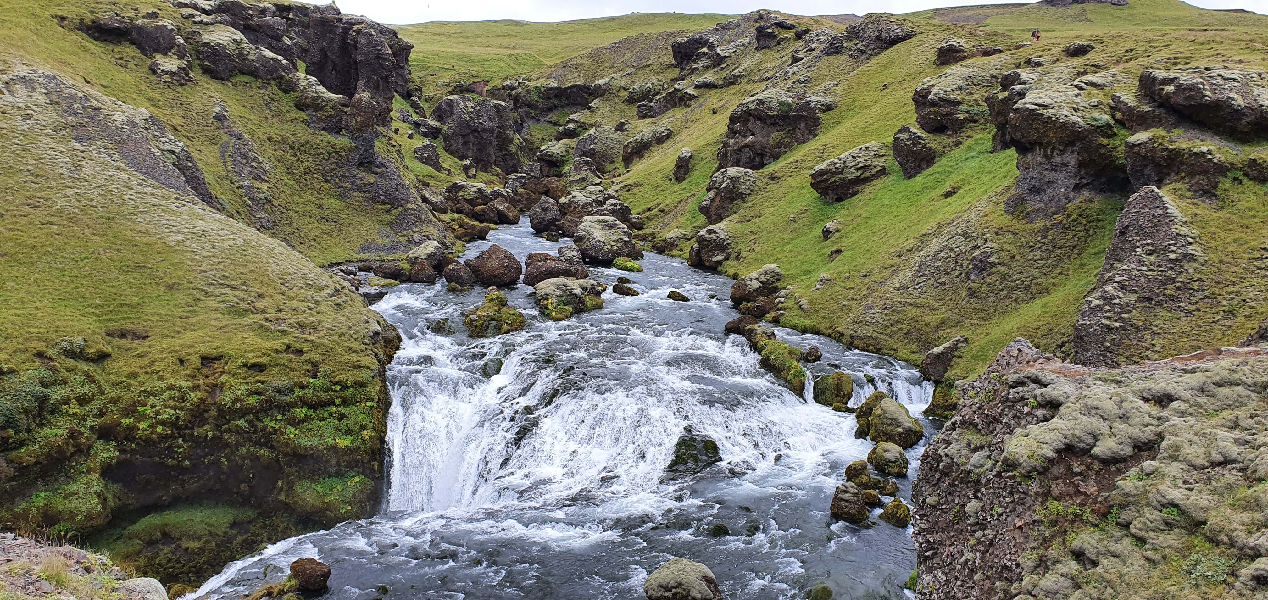
Location: South Highlands, see the map of Raudufossafjol
Height: 5m (16ft)
Road accessible by: 4wd car in summer (F-road), super jeep/inaccessible in winter
Hiking time: 1,5 hour
Hiking distance: 4,5km (2,8mi)
Hiking difficulty: moderate
Trail in winter: inaccessible
Trail link: Raudufossafjol hiking trail
Our experience: Raudufossafjol visit
Reykjafoss
Reykjafoss waterfall (click to enlarge).
Location: North, see the map of Reykjafoss
Height: 20m (66ft)
Road accessible by: 2wd car in summer, better 4wd car in winter
Hiking time: 10 minutes
Hiking distance: 400m (440yd)
Hiking difficulty: easy
Trail in winter: muddy/snowy/icy but accessible
Trail link: –
Our experience: Reykjafoss visit
Rjúkandi
Rjúkandi waterfall (click to enlarge).
Location: East, see the map of Rjukandafoss
Height: 139m (456ft)
Road accessible by: 2wd car
Hiking time: 5-10 minutes
Hiking distance: 300m (330yd)
Hiking difficulty: easy
Trail in winter: icy but accessible
Trail link: –
Rollutorfufoss

Rollutorfufoss waterfall (click to enlarge).
Location: South, see the map of Rollutorfufoss
Height: 5m (16ft)
Road accessible by: 2wd car
Hiking time: 45 minutes
Hiking distance: 2,5km (1,6mi)
Hiking difficulty: moderate
Trail in winter: snowy/icy but accessible
Trail link: Rollutorfufoss hiking trail
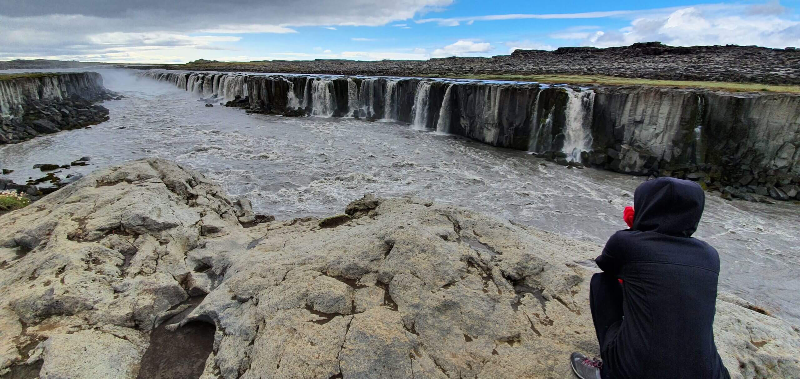
Selfoss

Selfoss waterfall (click to enlarge).
Location: Northeast, see the map of Selfoss
Height: 10m (33ft)
Road accessible by: 2wd car in summer, super jeep in winter
Hiking time: 30 minutes
Hiking distance: 2km (1,2mi)
Hiking difficulty: moderate
Trail in winter: snowy/icy but accessible
Trail link: Selfoss hiking trail
Our experience: Selfoss visit
Seljalandsfoss
Seljalandsfoss waterfall (click to enlarge).
Location: South, see the map of Seljalandsfoss
Height: 65m (213ft)
Road accessible by: 2wd car
Hiking time: 3 minutes
Hiking distance: 150m (160yd)
Hiking difficulty: easy
Trail in winter: easily accessible
Trail link: –
Our experience: Seljalandsfoss in summer, Seljalandsfoss in winter
Selvallafoss

Selvallafoss waterfall (click to enlarge).
Location: Snaefellsnes, see the map of Selvallafoss
Height: 10m (33ft)
Road accessible by: 2wd car in summer, better 4wd car in winter
Hiking time: 5 minutes
Hiking distance: 200m (220yd)
Hiking difficulty: easy
Trail in winter: muddy/snowy/icy but accessible
Trail link: –
Sigöldufoss

Sigöldufoss waterfall (click to enlarge). Photo by Mickaël Delcey (Silverkey), CCM license. Source link.
Location: South Highlands, see the map of Sigoldufoss
Height: 10m (33ft)
Road accessible by: 2wd car in summer, super jeep in winter
Hiking time: next to the road/parking
Hiking distance: 50m (60yd)
Hiking difficulty: easy
Trail in winter: easily accessible
Trail link: –
Skalabrekkufoss
Skalabrekkufoss waterfall (click to enlarge).
Location: South, see the map of Skalabrekkufoss
Height: 43m (141ft)
Road accessible by: 2wd car
Hiking time: 1 hour
Hiking distance: 3,5km (2,2mi)
Hiking difficulty: moderate
Trail in winter: snowy/icy but accessible
Trail link: Skalabrekkufoss hiking trail
Our experience: Skalabrekkufoss visit
Skiptárfoss
Skiptárfoss waterfall (click to enlarge). Photo by Bromr, CCM license. Source link.
Location: Westfjords, see the map of Skiptarfoss
Height: 80m (262ft)
Road accessible by: 2wd car in summer, 4wd car in winter*
Hiking time: 2*
Hiking distance: 50m* (60yd*)
Hiking difficulty: easy
Trail in winter: muddy/snowy/icy but accessible
Trail link: –
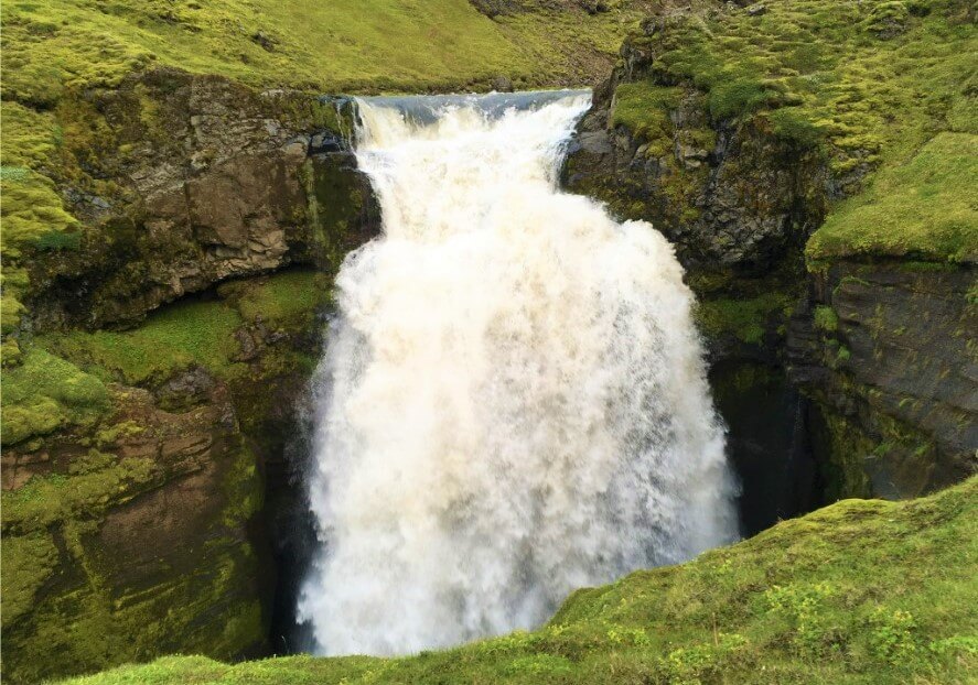
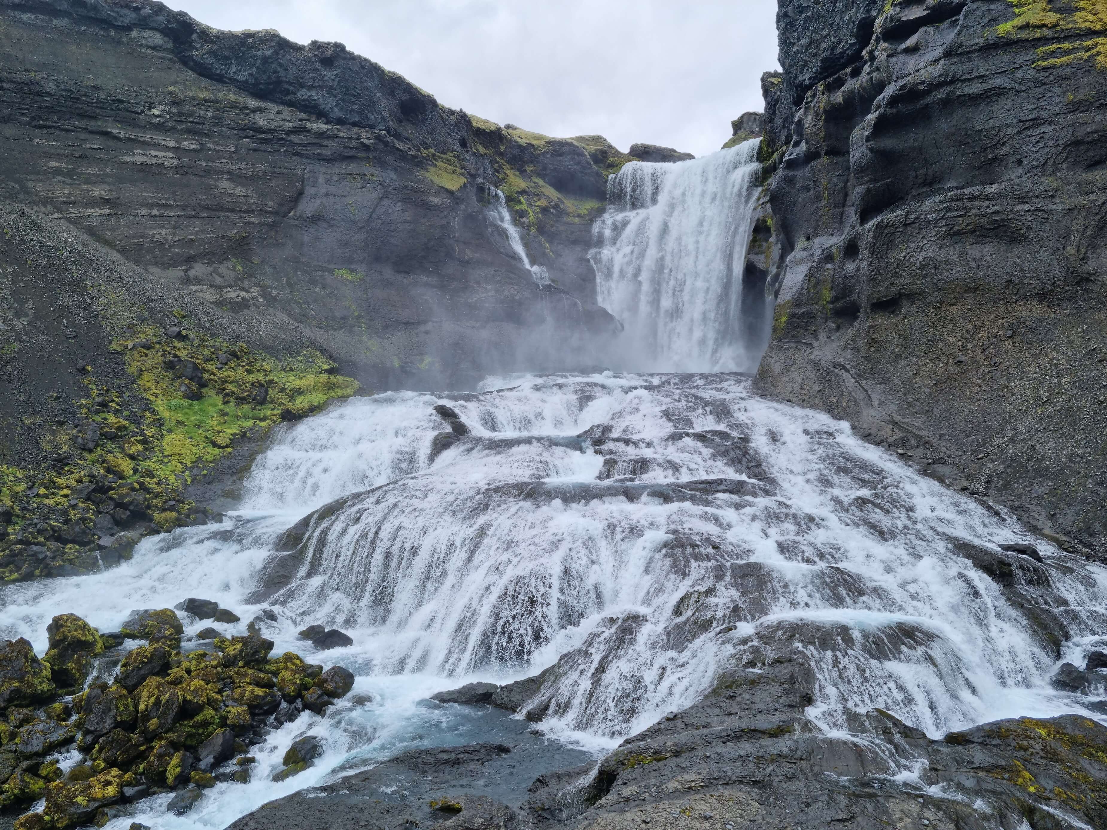
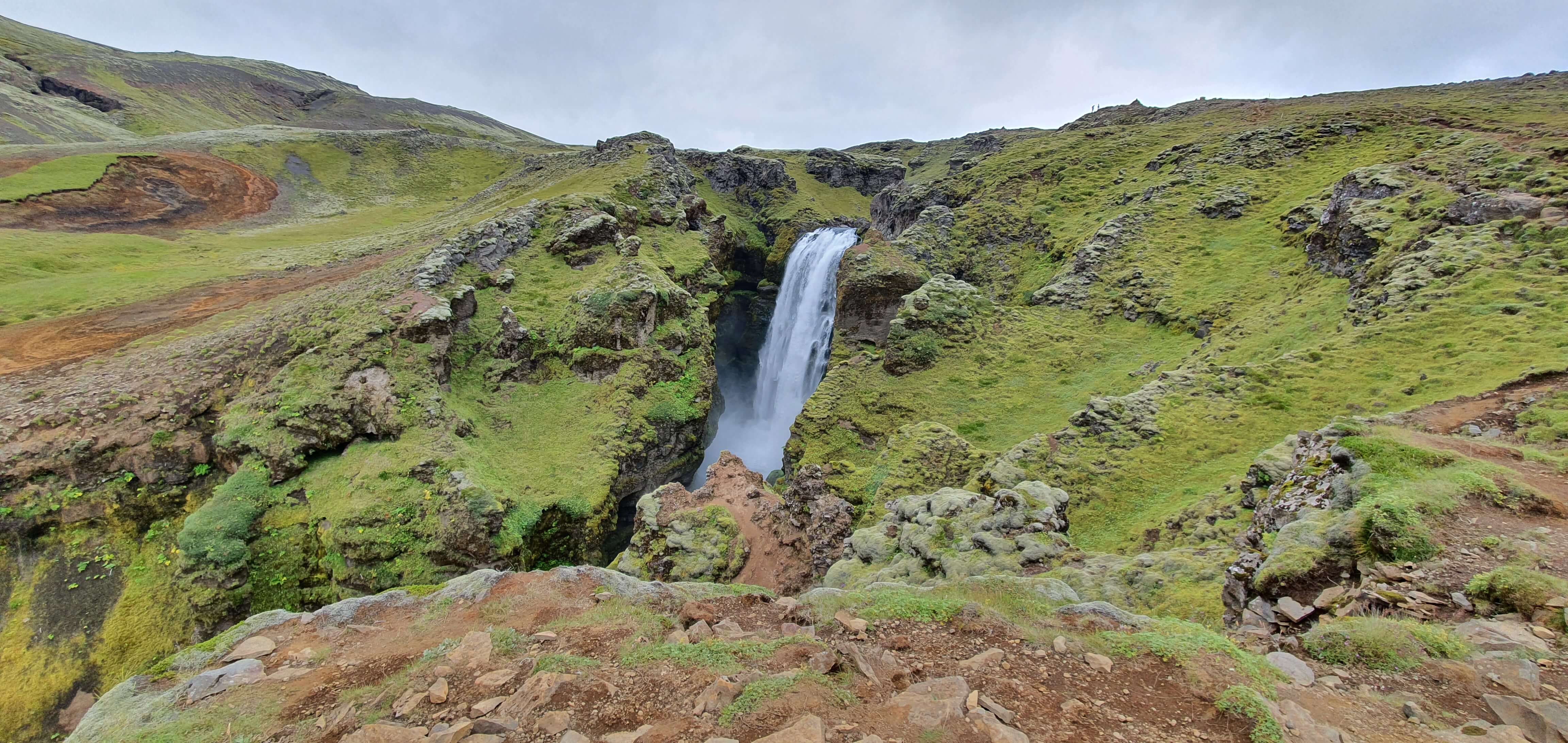
Skógafoss
Skógafoss waterfall (click to enlarge).
Location: South, see the map of Skogafoss
Height: 62m (203ft)
Road accessible by: 2wd car
Hiking time: 2-10 minutes
Hiking distance: 100-300m (100-330yd)
Hiking difficulty: easy
Trail in winter: easily accessible*
Trail link: –
Our experience: Skógafoss in summer, Skógafoss in winter
Skorhagafoss

Skorhagafoss waterfall (click to enlarge). Photo by Bromr, CCM license. Source link.
Location: West, see the map of Skorhagafoss
Height: 8m (26ft)
Road accessible by: 2wd
Hiking time: 2 minutes
Hiking distance: 50m (60yd)
Hiking difficulty: easy
Trail in winter: easily accessible
Trail link: –
Skútafoss
Skútafoss waterfall (click to enlarge).
Location: Southeast, see the map of Skutafoss
Height: 6m (20ft)
Road accessible by: 2wd car
Hiking time: 15 minutes
Hiking distance: 700m (0,4mi)
Hiking difficulty: easy
Trail in winter: muddy/snowy/icy but accessible
Trail link: Skutafoss hiking trail
Our experience: Skútafoss visit
Snædalsfoss
Snædalsfoss waterfall (click to enlarge).
Location: Southeast, see the map of Snaedalsfoss
Height: 37m (121ft)
Road accessible by: 2wd car
Hiking time: 20-25 minutes
Hiking distance: 1km (0,7mi)
Hiking difficulty: moderate/difficult
Trail in winter: muddy/snowy/icy but accessible
Trail link: Snaedalsfoss hiking trail
Staðarfoss
Staðarfoss waterfall (click to enlarge).
Location: Westfjords, see the map of Stadarfoss
Height: 30m (98ft)
Road accessible by: 2wd car in summer, 4wd car in winter
Hiking time: 10-15 minutes
Hiking distance: 500m (0,3mi)
Hiking difficulty: easy
Trail in winter: muddy/snowy/icy but accessible
Trail link: –
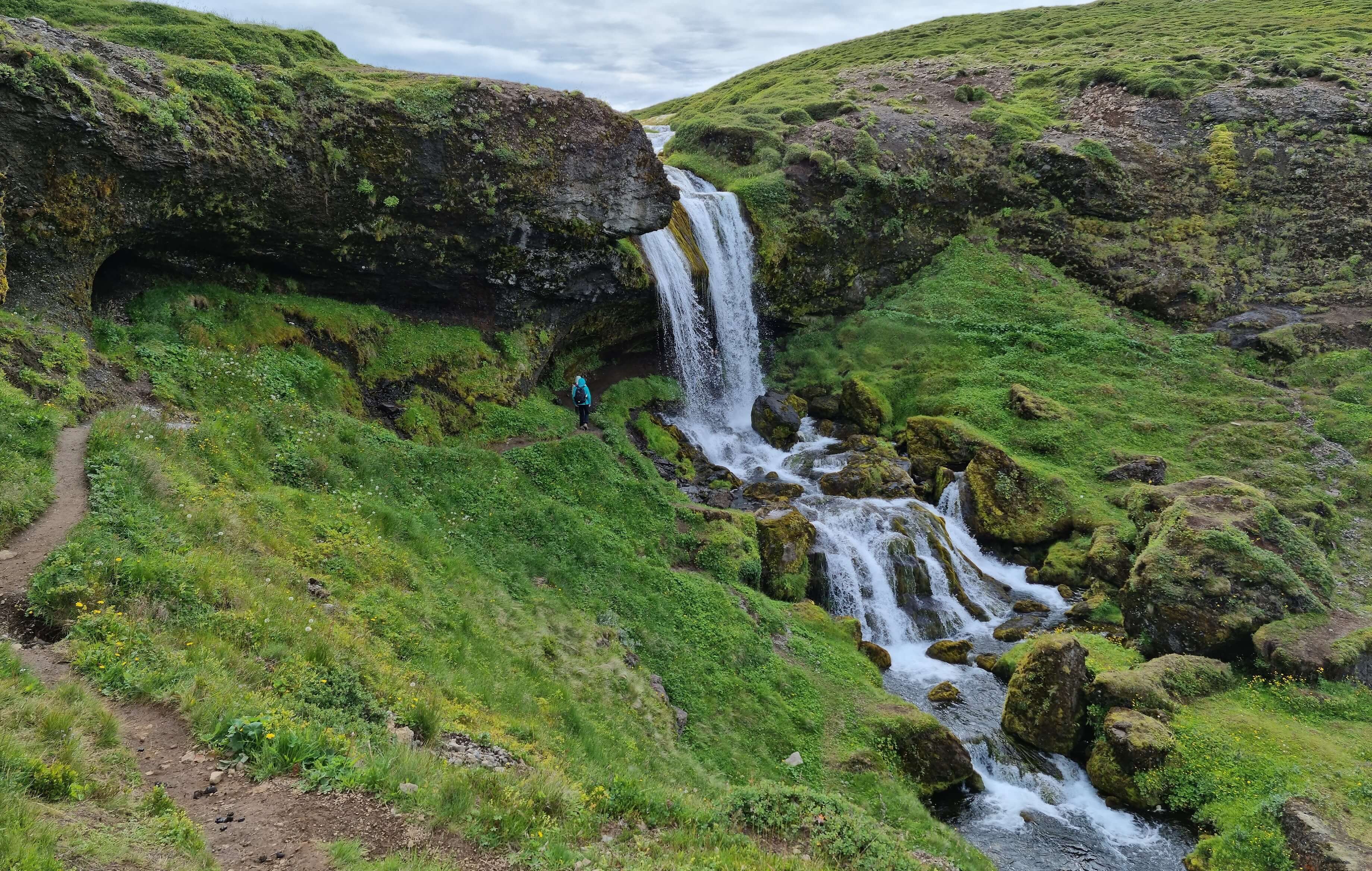
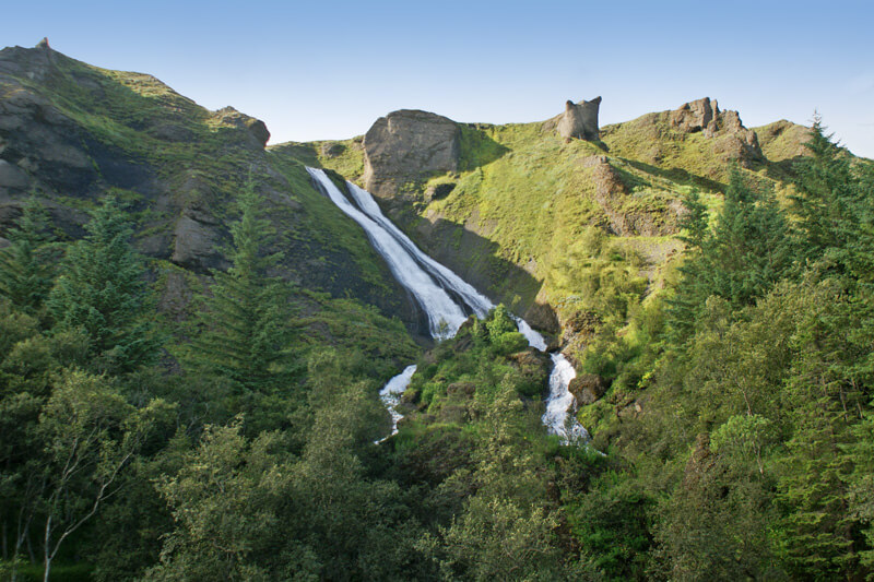
Stakkholtsgjáfoss
Stakkholtsgjáfoss waterfall (click to enlarge).
Location: South Highlands, see the map of Stakkholtsgjafoss
Height: 30m (98ft)
Road accessible by: large 4wd car in summer (F-road), super jeep in winter
Hiking time: 30-40 minutes
Hiking distance: 1,5km (0,9mi)
Hiking difficulty: difficult
Trail in winter: hardly/inaccessible
Trail link: Stakkholtsgjafoss hiking trail
Our experience: Stakkholtsgjafoss visit
Steinbogafoss
Steinbogafoss waterfall (click to enlarge).
Location: South, see the map of Steinbogafoss
Height: 8m (26ft)
Road accessible by: 2wd car
Hiking time: 30 minutes
Hiking distance: 1,5km (0,9mi)
Hiking difficulty: moderate
Trail in winter: snowy/icy but accessible
Trail link: Steinbogafoss hiking trail
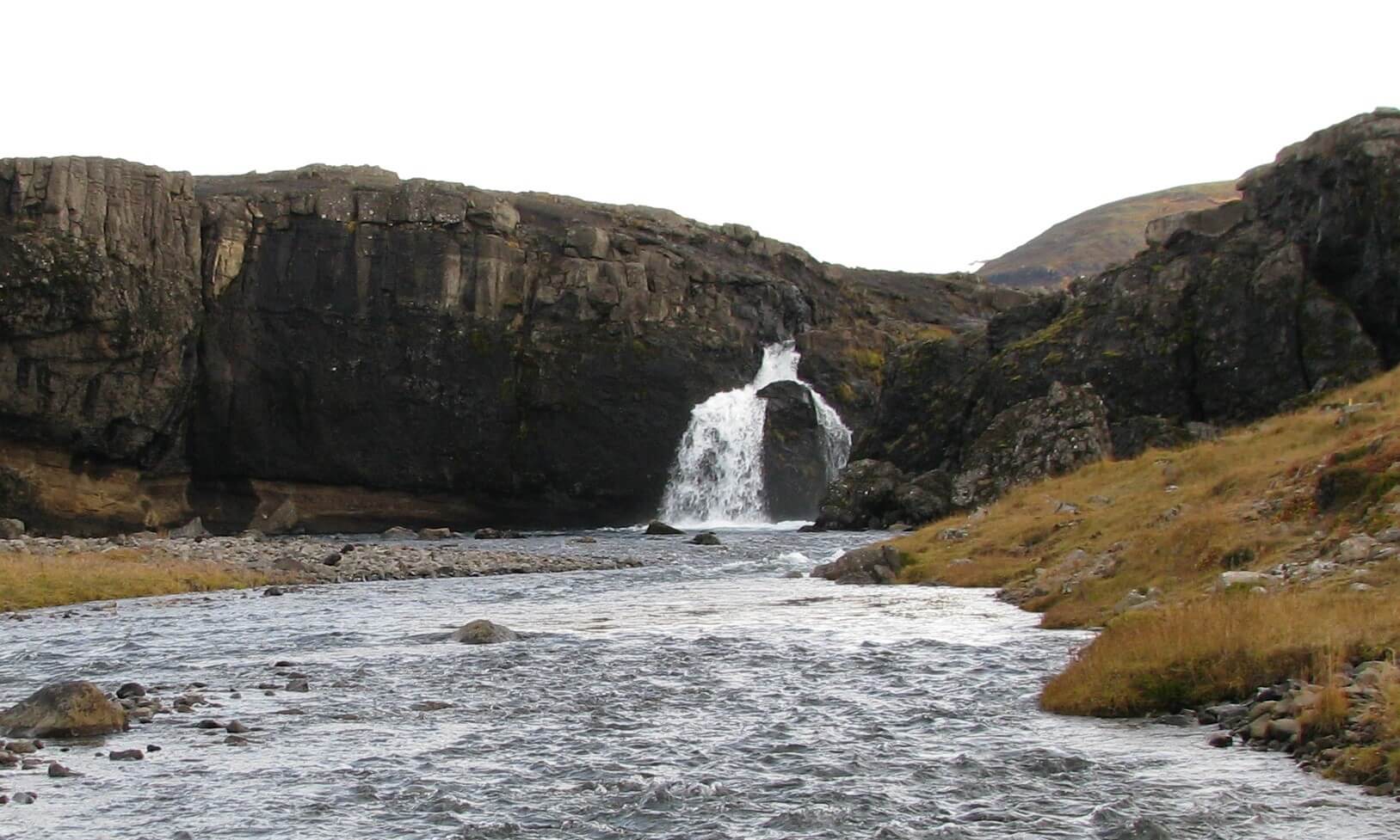
Stigafoss
Stigafoss waterfall (click to enlarge). Photo by Bromr, CCM license. Source link.
Location: South Highlands, see the map of Stigafoss
Height: 138m (453ft)
Road accessible by: large 4wd car in summer (F-road), super jeep in winter
Hiking time: 15-20 minutes
Hiking distance: 1km (0,6mi)
Hiking difficulty: moderate
Trail in winter: hardly/inaccessible
Trail link: –
Stjórnarfoss
Stjórnarfoss waterfall (click to enlarge). Photo by Bromr, CCM license. Source link.
Location: South, see the map of Stjornafoss
Height: 6m (20ft)
Road accessible by: 2wd car
Hiking time: 5 minutes
Hiking distance: 200m (220yd)
Hiking difficulty: easy
Trail in winter: easily accessible
Trail link: –
Strompgljúfrafoss
Strompgljúfrafoss waterfall (click to enlarge).
Location: Westfjords, see the map of Strompgljufrafoss
Height: 20m (66ft)
Road accessible by: 2wd car in summer, 4wd car in winter
Hiking time: 10 minutes
Hiking distance: 550m (0,3mi)
Hiking difficulty: easy
Trail in winter: snowy/icy but accessible
Trail link: Strompgljufrafoss hiking trail
Our experience: Strompgljufrafoss visit
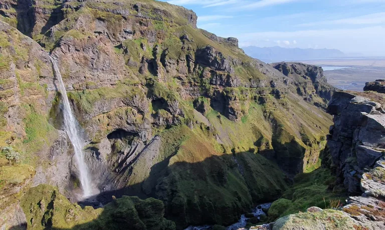
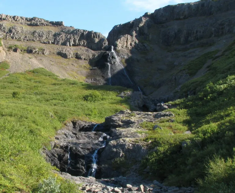
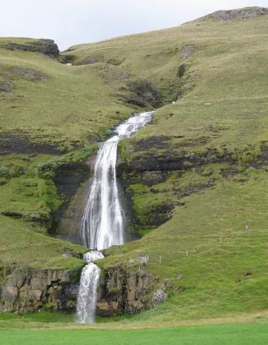
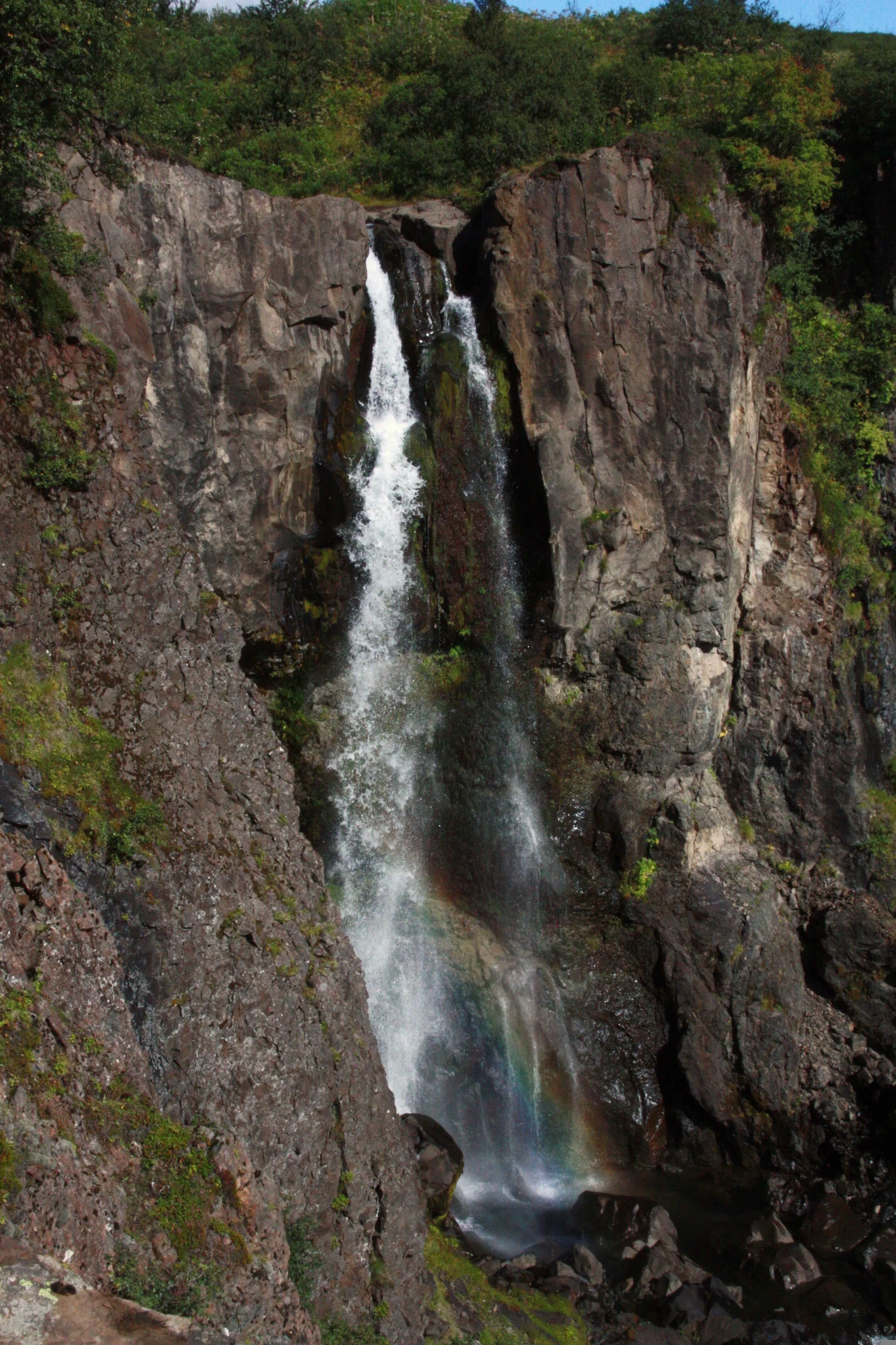
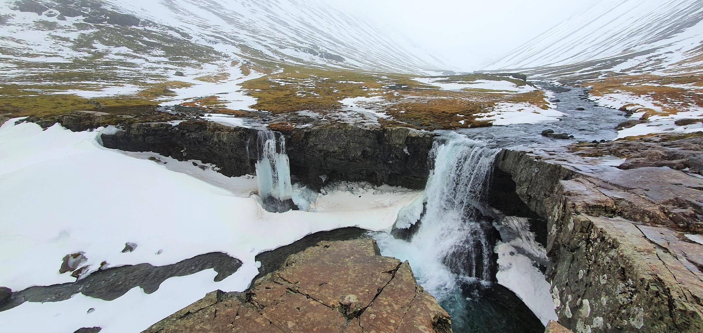
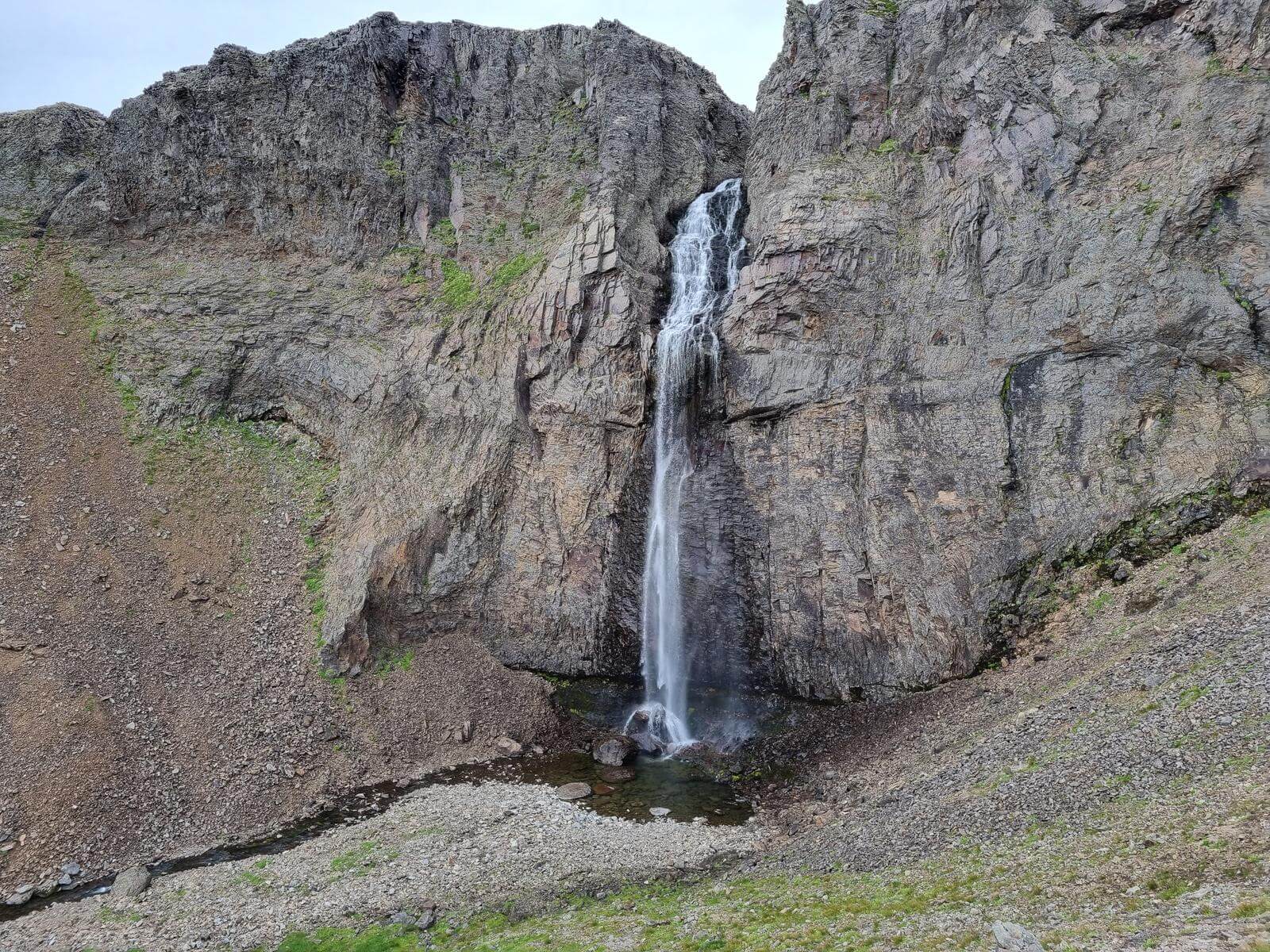
Strútsfoss
Strútsfoss waterfall (click to enlarge).
Location: East, see the map of Strutsfoss
Height: 120m (394ft)
Road accessible by: 2wd car in summer, 4wd car/super jeep in winter
Hiking time: 1 hour
Hiking distance: 4km (2,5mi)
Hiking difficulty: easy
Trail in winter: hardly/inaccessible
Trail link: Strutsfoss hiking trail
Stuðlafoss
Stuðlafoss waterfall (click to enlarge).
Location: East, see the map of Studlafoss
Height: 15m (49ft)
Road accessible by: 2wd car in summer, super jeep in winter
Hiking time: 40 minutes
Hiking distance: 2,5km (1,6mi)
Hiking difficulty: moderate
Trail in winter: hardly/inaccessible
Trail link: Studlafoss hiking trail
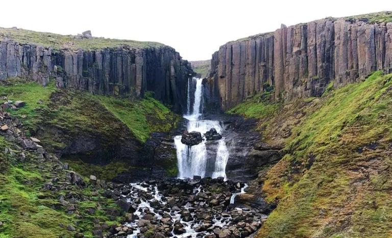
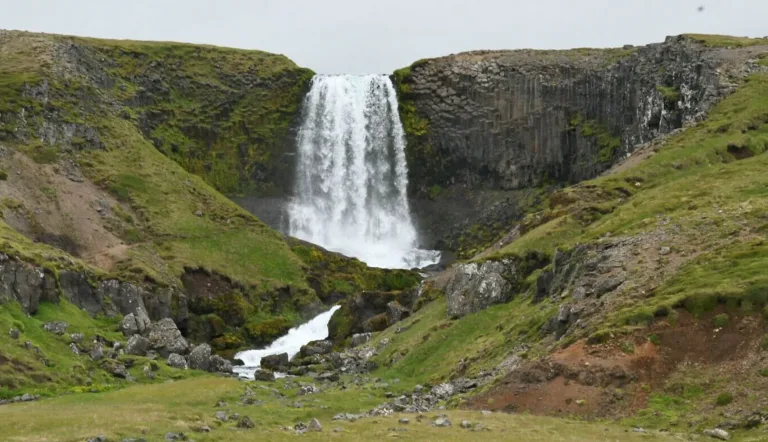
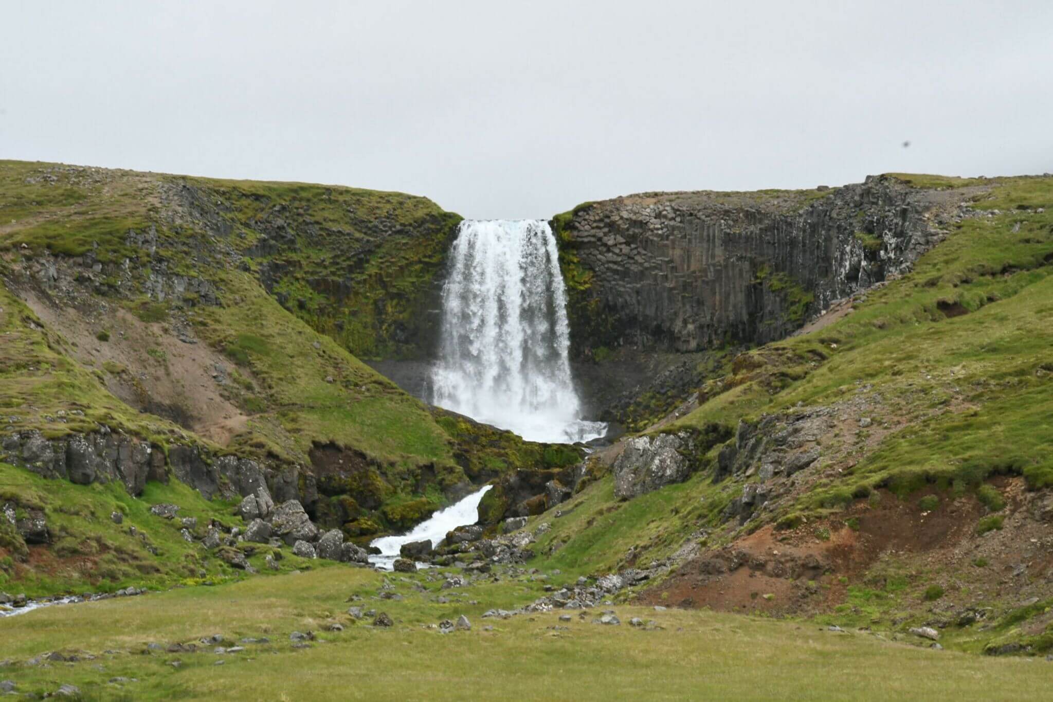
Svartifoss
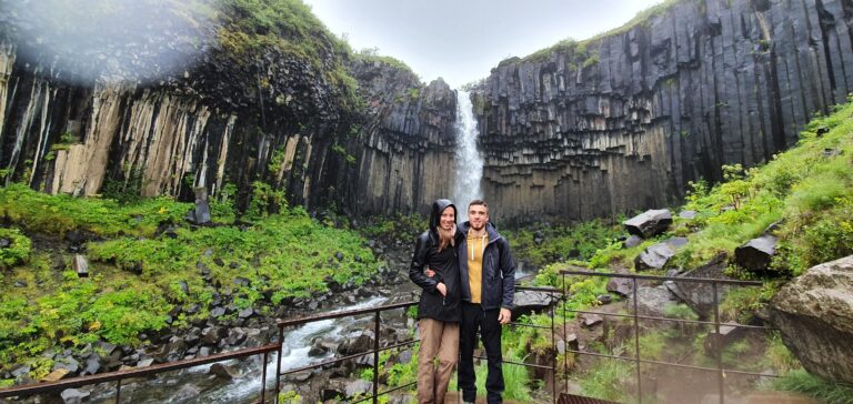
Svartifoss waterfall (click to enlarge).
Location: Southeast, see the map of Svartifoss
Height: 20m (66ft)
Road accessible by: 2wd car
Hiking time: 30 minutes
Hiking distance: 2km (1,2mi)
Hiking difficulty: easy
Trail in winter: snowy/icy but accessible
Trail link: Svartifoss hiking trail
Our experience: Svartifoss visit
Svöðufoss
Svöðufoss waterfall (click to enlarge). Photo by Veronique Lopez, CCM license.
Location: Snaefellsnes, see the map of Svodufoss
Height: 40m (131ft)
Road accessible by: 2wd car in summer, better 4wd car in winter
Hiking time: 15 minutes
Hiking distance: 800m (0,5mi)
Hiking difficulty: moderate
Trail in winter: snowy/icy but accessible
Trail link: Svodufoss hiking trail
Systrafoss
Location: South, see the map of Systrafoss
Height: 80m (262ft)
Road accessible by: 2wd car
Hiking time: next to the road/parking
Hiking distance: 50m (60yd)
Hiking difficulty: easy
Trail in winter: easily accessible
Trail link: –
Þjófafoss
Þjófafoss waterfall (click to enlarge). Photo by Grunkhead, CCM license. Source link.
Location: South Highlands, see the map of Thjofafoss
Height: 15m (49ft)
Road accessible by: better 4wd car in summer, super jeep in winter
Hiking time: next to the road/parking
Hiking distance: 100m (110yd)
Hiking difficulty: easy
Trail in winter: snowy/icy but accessible
Trail link: –
Þórðarfoss
Þórðarfoss waterfall (click to enlarge). Photo by Bromr, CCM license. Source link.
Location: South, see the map of Thordarfoss
Height: 80m (262ft)
Road accessible by: 2wd car in summer, 4wd car in winter
Hiking time: 5-10 minutes
Hiking distance: 300m (330yd)
Hiking difficulty: easy
Trail in winter: snowy/icy but accessible
Trail link: –
Tófufoss
Tófufoss waterfall (click to enlarge).
Location: East, see the map of Tofufoss
Height: 8m (26ft)
Road accessible by: 2wd car in summer, 4wd car in winter
Hiking time: 3 minutes
Hiking distance: 100m (110yd)
Hiking difficulty: easy
Trail in winter: easily accessible
Trail link: –
Tröllafoss
Tröllafoss waterfall (click to enlarge). Photo by Bromr, CCM license. Source link.
Location: West, see the map of Trollafoss
Height: 10m (33ft)
Road accessible by: 2wd car in summer, 4wd car/super jeep in winter
Hiking time: next to the road/parking
Hiking distance: 50m (60yd)
Hiking difficulty: easy
Trail in winter: muddy/snowy/icy but accessible
Trail link: –
Tungnaárfellsfoss
Tungnaárfellsfoss waterfall (click to enlarge). Photo by John Inrik, CCM license. Source link.
Location: South Highlands, see the map of Tungnaarfellsfoss
Height: 5m (16ft)
Road accessible by: 2wd car in summer, super jeep in winter
Hiking time: 10 minutes
Hiking distance: 500m (0,3mi)
Hiking difficulty: easy
Trail in winter: hardly/inaccessible
Trail link: –
Urriðafoss
Urriðafoss waterfall (click to enlarge). Photo by Ulrich Hess, CCM license. Source link.
Location: Southwest, see the map of Urridafoss
Height: 4m (13ft)
Road accessible by: 2wd car
Hiking time: next to the road/parking
Hiking distance: 50m (60yd)
Hiking difficulty: easy
Trail in winter: easily accessible
Trail link: –
Valafoss

Valafoss waterfall (click to enlarge). Photo by nonnio, CCM license.
Location: Snaefellsnes, see the map of Valafoss
Height: 60m (197ft)
Road accessible by: 2wd car in summer, better 4wd car in winter
Hiking time: 3-4 hours
Hiking distance: 8-10km (5-6mi)
Hiking difficulty: difficult
Trail in winter: inaccessible
Trail link: Valafoss hiking trail
Valagil

Valagil waterfall (click to enlarge). Photo by Werner, CCM license. Source link.
Location: Westfjords, see the map of Valagil
Height: 80m (262ft)
Road accessible by: 2wd car in summer, 4wd car in winter
Hiking time: 30-40 minutes
Hiking distance: 2km (1,2mi)
Hiking difficulty: moderate
Trail in winter: hardly/inaccessible
Trail link: Valagil hiking trail
Vestdalsfossar
Vestdalsfossar waterfall (click to enlarge).
Location: East, see the map of Vestdalsfossar
Height: 14m (46ft)
Road accessible by: 2wd car in summer, better 4wd car in winter
Hiking time: 10 minutes
Hiking distance: 600m (0,4mi)
Hiking difficulty: moderate
Trail in winter: muddy/snowy/icy but accessible
Trail link: Vestdalsfossar hiking trail
Our experience: Vestdalsfoss visit
 ask questions or get inspired in our community


![Westman Islands – Full Guide + Top Things to Do [our experience]](https://epiciceland.net/wp-content/uploads/2022/12/westman-islands-guide.jpg)