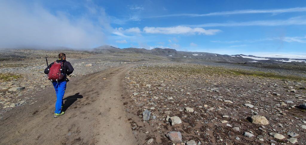
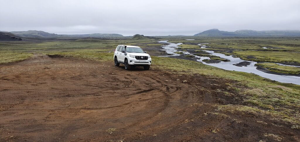
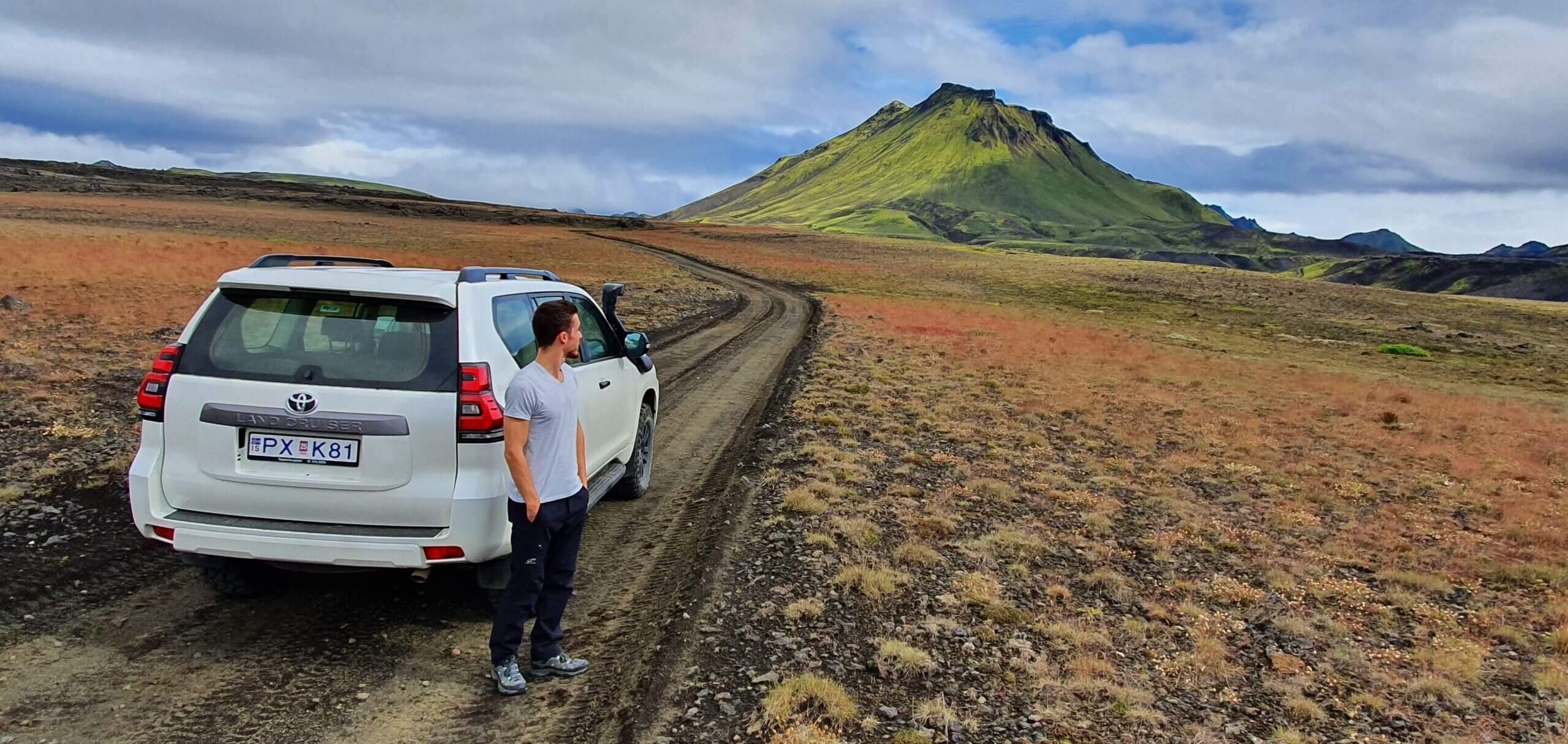
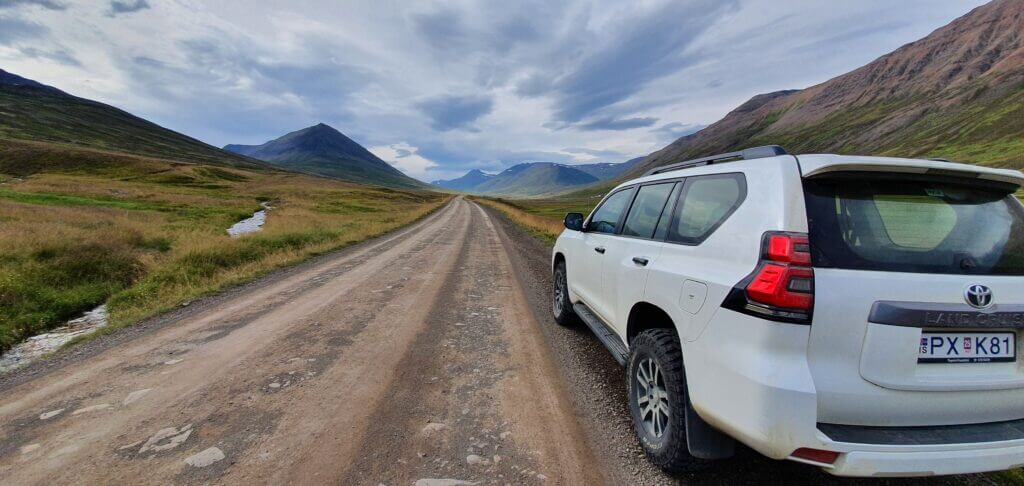
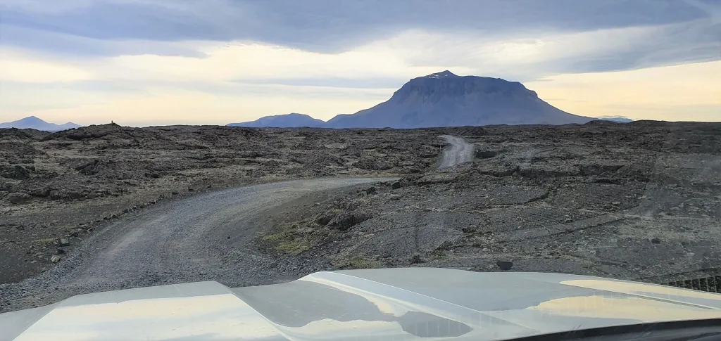
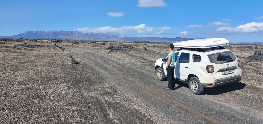
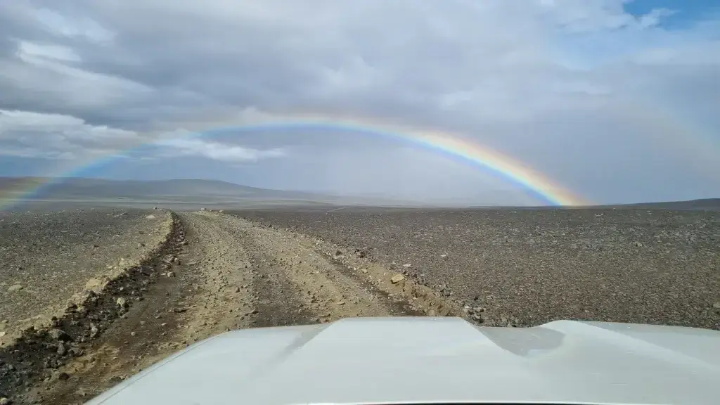
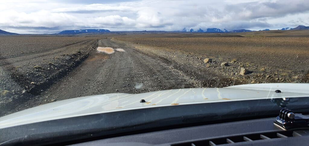
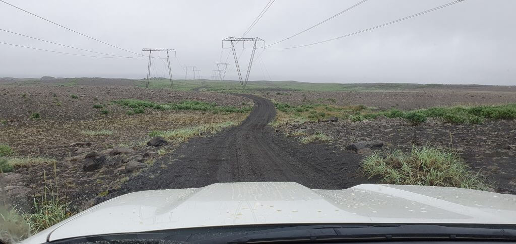
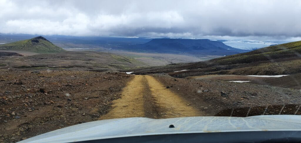
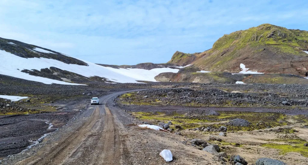
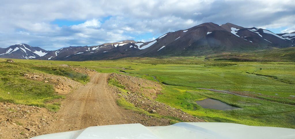
F-roads are rough, unpaved gravel roads leading to the inner part of Iceland – the highlands. They are sometimes also called highland roads or mountain roads and often involve river crossings.
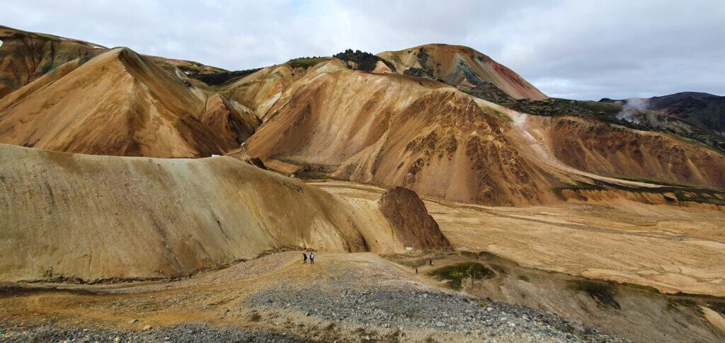
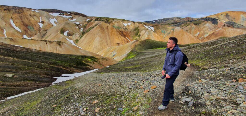
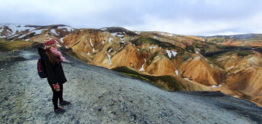
Good preparation and a proper car are necessary. Driving the F-roads is totally worth it, though, because the Icelandic highlands surrounding them are the most beautiful uncrowded parts of Iceland.
We’ve compiled for you a comprehensive list of all Icelandic F-roads. It’s based upon both personal experiences with driving the roads and extensive studying of other travelers’ experiences.
We’ve spent months driving F-roads in Iceland during several different trips in different cars and under various road conditions. We learned A LOT and have lots of valuable tips, which we share in this guide.
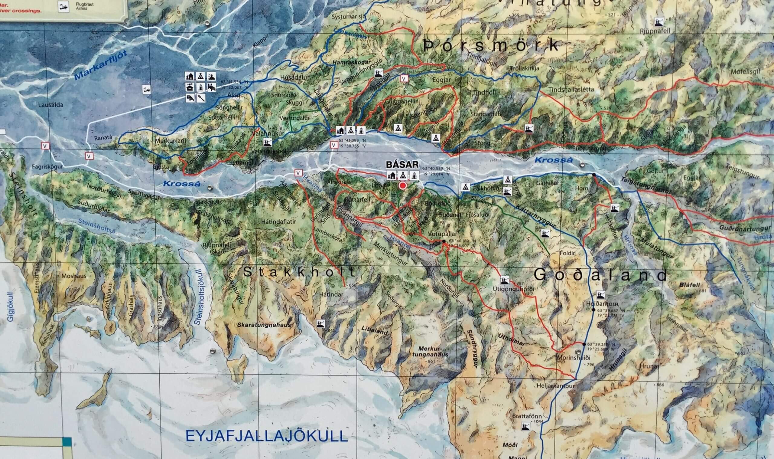
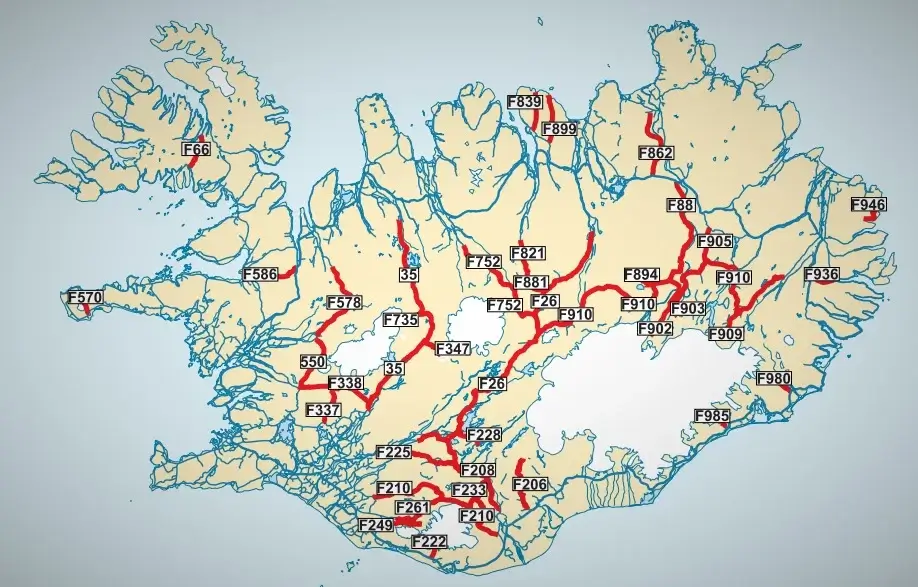
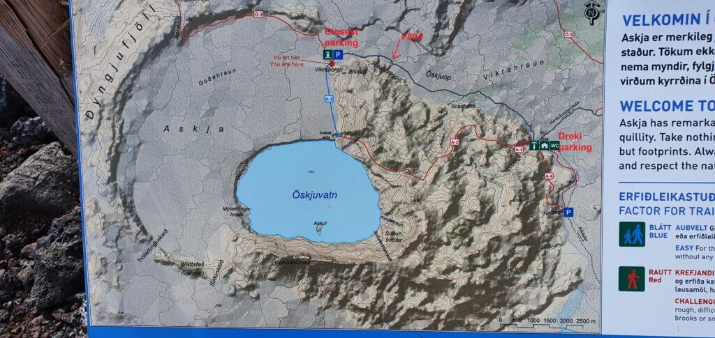
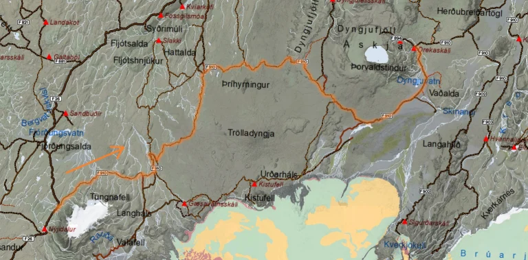
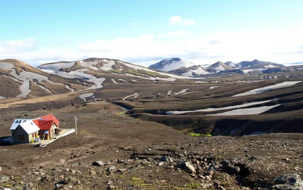
F-road Map
F-road difficulties and car suitabilities. Once the road is open (green). This is an approximate classification during average conditions.
All the GPS points on this map are under strict copyright and are being tracked for an illegal use. You can’t copy any content without our consent.
Most Popular F-roads
This is a shortened version of our unique database of all Icelandic F-roads. See our full F-road database below.
The table below is based on average summer conditions when roads are passable. It’s an estimate, conditions can change quickly, never rely on this info only. Please read important notes and legend below our master F-roads table.
|
F-Road |
Road Name |
Location |
Difficulty Class (Our Score) |
Steepness / Roughness |
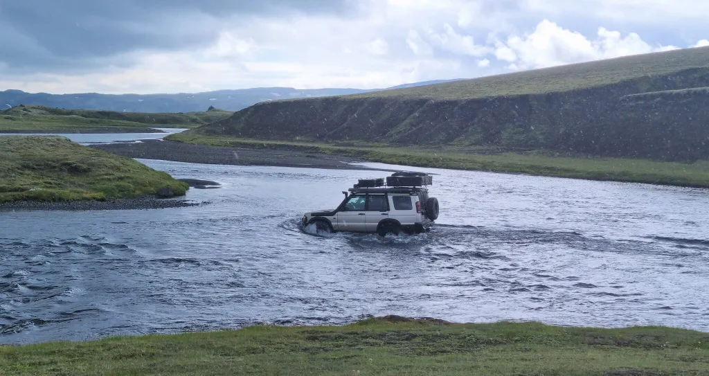
Unbridged River Crossings? |
Min. Car Requirement |
Recommended Car |
Our Advice |
|
F26 |
Sprengisandsleið |
connects north & south via central highlands |
7/10 - Moderate to Difficult |
flat, long rough gravel |
one medium to big (Hagakvísl, unpredictable) |
Medium 4x4 (Hilux) |
Jeep (33"+, snorkel) |
easy south of Nýidalur; unpredictable Hagakvísl river north of it; ask rangers in Nýidalur |
|
(F)35 |
Kjalvegur |
connects north & south via central highlands |
4/10 - Easy |
flat, potholed gravel |
no |
Any Car (even 2wd) |
Small 4x4 (Duster) |
easiest highland crossing, no rivers, reclassified to 35 (no F) |
|
(F)208 - north |
Fjallabaksleið Nyrðri |
northern route to Landmannalaugar |
4/10 - Easy |
flat, bumpy, potholes |
no |
Any Car (even 2wd) |
Small 4x4 (Duster) |
easiest way to Landmannalaugar, reclassified to 208 (no F) |
|
F208 - south |
Fjallabaksleið Nyrðri |
southern route to Landmannalaugar |
5/10 - Easy to Moderate |
some rough, narrow parts |
several small to medium |
Small 4x4 (Duster) |
Medium 4x4 (Hilux), if watery |
5-6/10, depends, beautiful road |
|
F210 |
Fjallabaksleið syðri |
Fjallabak, southern Highlands |
8/10 - Difficult |
steep parts, huge boulders, etc |
Holmsá (big), Kaldaklof. (medium to big) |
Medium 4x4 (Hilux) |
Jeep (33"+, snorkel), for Holmsá |
two difficult river crossings; only for experienced |
|
F225 |
Landmannaleið |
west route to Landmannalaugar |
5/10 - Easy to Moderate |
flat, slightly rough |
one small to medium |
Small 4x4 (Duster) |
Medium 4x4 (Hilux), if watery |
river can swell early in summer, becoming 6-7/10 |
|
F235 |
Langisjór |
to Langisjór lake |
5/10 - Easy to Moderate |
flat, relatively smooth |
several small |
Small 4x4 (Duster) |
Jeep (33"+, snorkel) |
great and beautiful practice road |
|
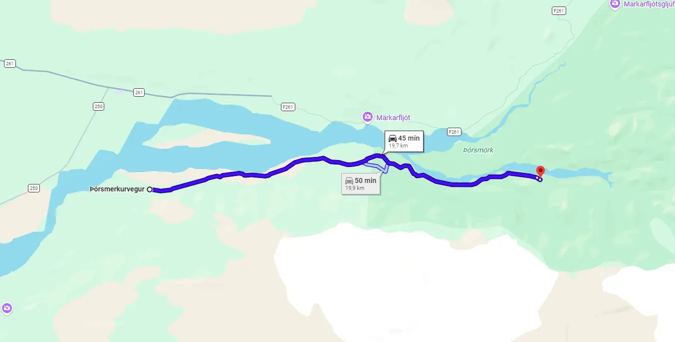
F249 |
Þórsmerkurvegur |
to Thórsmörk valley |
9/10 - Very Difficult |
flat, bumpy gravel |
several big ones |
Jeep (33"+, snorkel), NOT for Krossá! |
Super Jeep (38"+, snorkel), Krossá only locals! |
8/10 up to Krossá, 10/10 via Krossá, never do Krossá yourself |
|
F261 |
Emstruleið |
Fjallabak, southern Highlands |
7/10 - Moderate to Difficult |
pretty rough and narrow |
one medium (Bláfjallakvísl) |
Medium 4x4 (Hilux) |
Jeep (33"+, snorkel) |
easier than F210 but river can swell after rain or glacial melt |
|
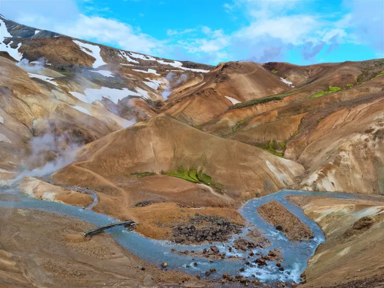
F347 |
Kerlingafjallavegur |
to Kerlingarfjöll |
4/10 - Easy |
a bit steep before Hveradalir |
no |
Any Car |
Small 4x4 (Duster) |
easy, last stretch to Hveradalir is a bit steep |
|
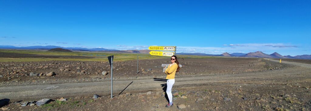
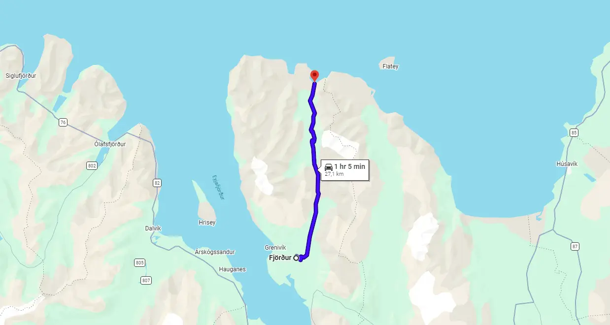
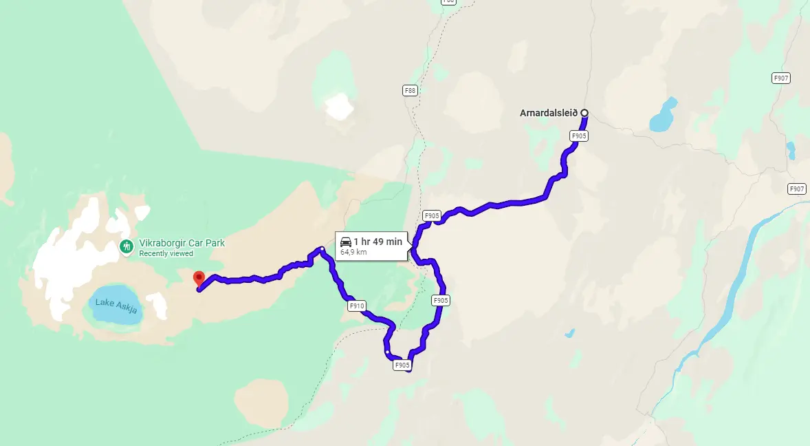
F905 |
Arnardalsleið |
east access to Askja |
4/10 - Easy |
relatively smooth and flat |
no |
Small 4x4 (Duster) |
Medium 4x4 (Hilux) |
the easier one compared to following F910 |
|
F910 - east |
Austurleið |
Askja east approach (F905 to Askja) |
6/10 - Moderate |
some huge boulders and sand |
two medium-sized |
Small 4x4 (Duster) |
Medium 4x4 (Hilux) |
if you want to reach Askja and are less experienced, this is a safer choice |
F-roads Checklist
Read our guide on how to choose the best car rental for Iceland.
Before taking an F-road, remember to ALWAYS check the following:
We also wrote a detailed article about Icelandic roads, their types, and passability, which we recommend reading too.
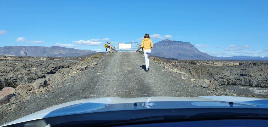
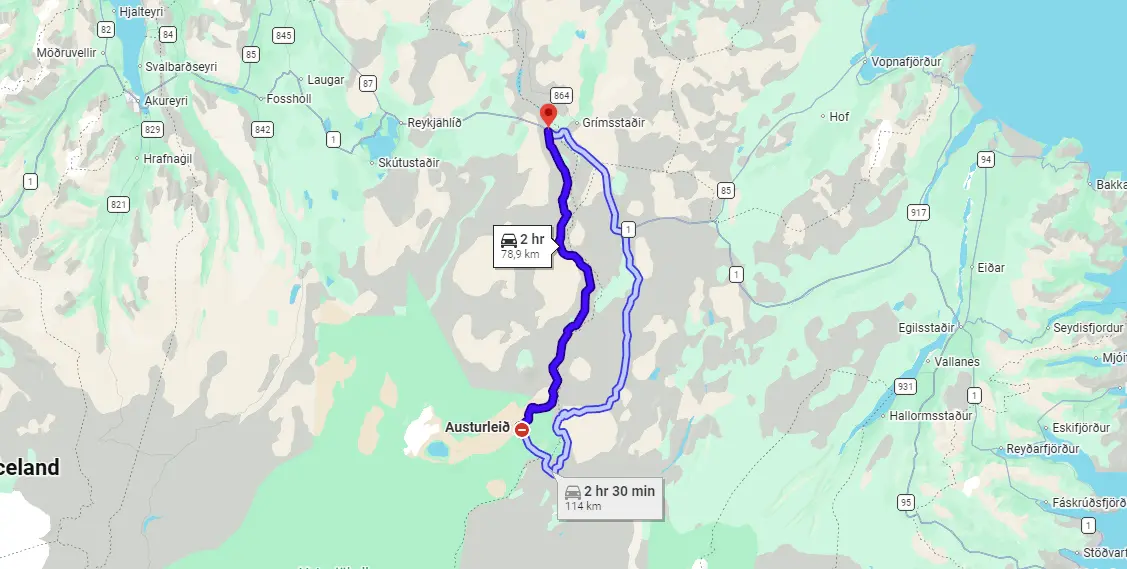
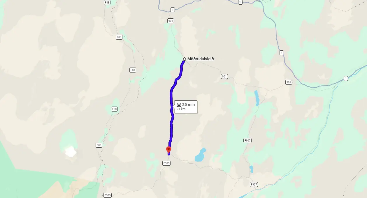
Crossroads between Möðrudalsleið road and F905
What Car do I need for F-roads
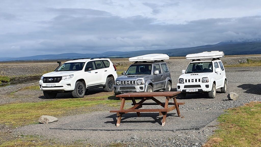
A 4×4 car is compulsory on all F-roads. There are many types of 4×4 cars and also many types of F-roads, though. Driving with a small 4wd car on a difficult F-road is dangerous and, on the other hand, driving with a huge 4×4 car on an easy F-road may be expensive. It’s important to choose your car properly based on which F-roads you plan to drive:
|
Difficulty |
River Crossings |
Terrain |
Car Needed |
Car Models Examples |
|
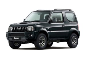
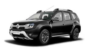
Easy F-roads |
small |
slightly rough |
any 4wd car |
Duster, Vitara, Jimny, Sorento |
|
Medium F-roads |
medium |
a lot rougher |
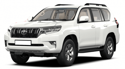
bigger 4x4 car |
Hilux, Land Cruiser, Wrangler, Defender |
|
Harder F-roads |
bigger |
rough, steep, narrow |
4x4 jeep with 33" tires and snorkel |
Modified Land Cruiser, Defender with snorkel |
|
Hardest F-roads and Tracks |
big, possibly treacherous |
very rough, high ground clearance |
super jeep with 38"+ tires and snorkel |
38"+ modified Cruisers, Defenders, Wranglers, etc |
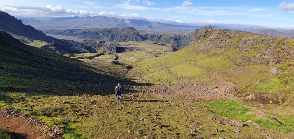
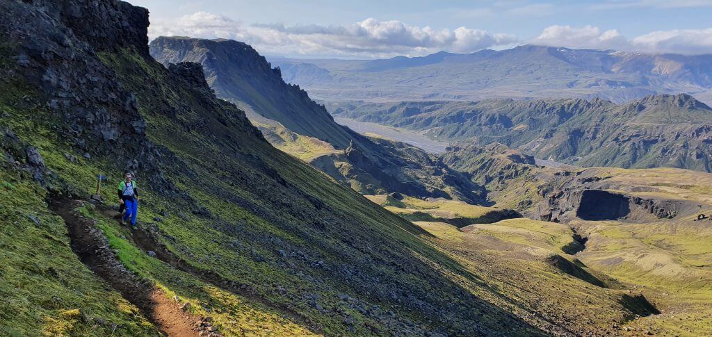
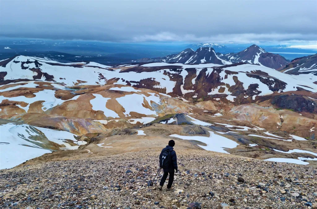
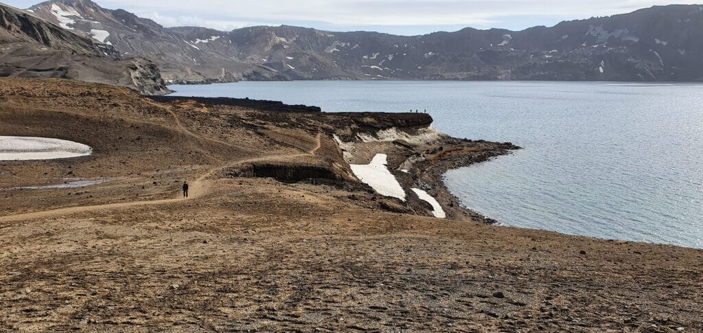
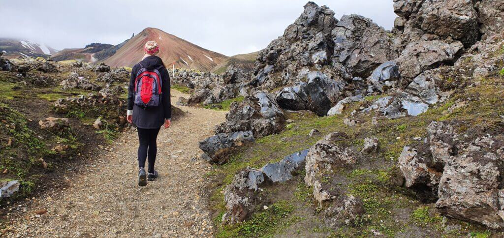
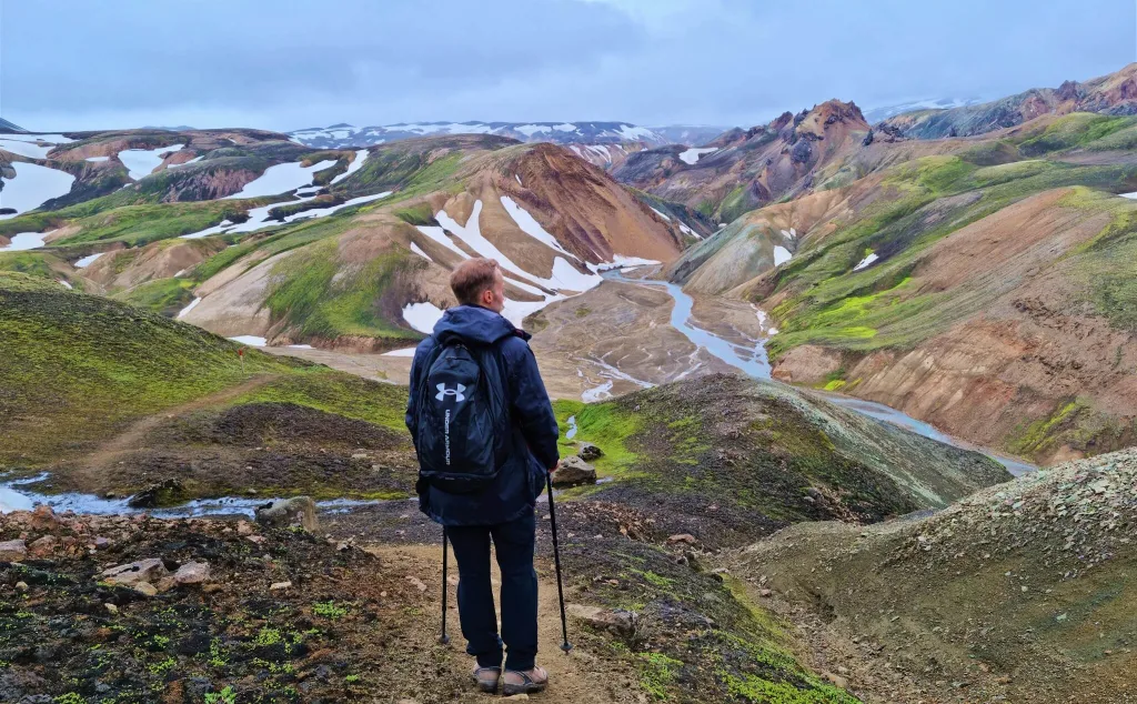
F-roads are worth driving because they often lead to amazing spots in Icelandic Highlands.
And how are you supposed to know which F-road is easy and which is difficult? We wrote a List of the 10 easiest F-roads, and also a detailed description of every F-road just below in this article.
The above classification is just in a nutshell. For details, please read How to choose the best car for Iceland. Please, take also special care about river crossings. We wrote an entire guide on How to cross rivers in Iceland.
Crossing the (often) treacherous Syðri-Ófæra river on F233 with a big 4wd car with snorkel
F-roads Status and Conditions
Always check the current status of the road on the Official Icelandic Road Administration (Vegagerðin) website dedicated to road conditions – www.road.is, www.trafficinfo.is, www.umferdin.is – these are all linking to the same source.
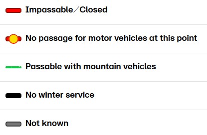
What can the status and conditions of F-roads be?
- Easily Passable – SOLID GREEN LINE – summer only; typically passable for any vehicles; typically only roads like (F)35 or (F)208 North, i.e. those that are not F-roads anymore are denoted by this sign
- Mountain Vehicles – DASHED GREEN LINE – summer only; typically passable for 4×4 cars, depending on the particular road, see this entire article 🙂
- Large 4×4 and Modified Vehicles – RED or DASHED GREEN LINE – summer only; roads sometimes receive this status if rivers get too big for ordinary tourists to pass, but still passable for experienced locals; typically forbidden by rental companies
- Impassable – RED LINE – in winter, this means the road is under deep snow, and only locals with super jeeps can pass on their own risk; in summer this usually means the road is in bad conditions, typically with swollen rivers, and only experienced locals can pass with super jeeps; forbidden by rental companies
- Closed or Driving Prohibited – RED CLOSED SIGN – no driving under any circumstances, not even by locals; the road is either too dangerous or too fragile
- Not Known – GREY LINE – typically used for gravel three-digit roads, or easier F-roads; the status means a road is not monitored and might be under snow or even damaged; it’s not prohibited to drive it, but you are on your own risk; typically forbidden by rental companies
- No Winter Service – BLACK/GREY LINE – this seems to have been replaced by “Not Known”; it was often used in the past and means the same as the above bullet
F-roads status and conditions
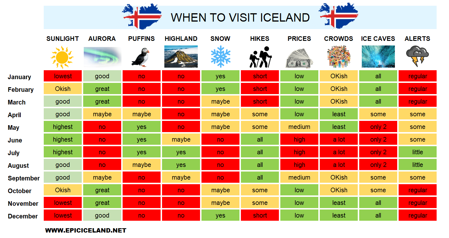
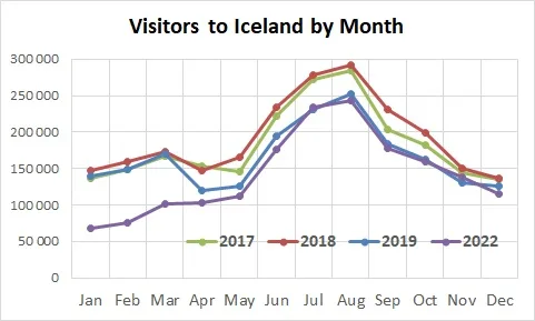
F-roads Opening dates 2026
F-roads in Iceland usually open once all the snow on the roads melts. This typically happens anywhere between the beginning of June and the end of July. Most of the F-roads tend to open before the main summer season begins, i.e. at the beginning of July. Of course, there are other factors, like river levels, road reconstructions, etc., but the main one is snow. It’s also important to understand the difference between “impassable road”, “closed road” and “no winter service” roads, which we cover in our Icelandic Roads article.
Openings depend on weather and location. The colder the weather, the later the opening. The more snow in the preceding winter, the later the opening. The warmer the spring the sooner the opening. The more the road is located to the center of Iceland (the coldest part of Iceland), the later it opens. Below are the statistics for the past few years. Here are the latest available statistics. For example, in 2022 several roads opened even later than the latest date in the table below (2017-2021 table at that time), due to an extraordinarily strong winter.
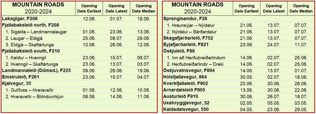
F-roads opening dates
When do F-roads close? Once a road becomes too difficult to pass, for whatever reason – snow, rain, storm. Seasonally, this typically happens sometime between the end of August and mid-October, most frequently in the second half of September, once the first heavy snow arrives in the highlands. No statistics, like the ones above, exist on these.
Be sure to check out our unique interactive Map of 2000+ Best Places in Iceland.
F-roads Driving times
I will answer this question for all of the roads at once. Google Maps is pretty much quite precise in time estimates, even when it comes to F-roads. That means if you are planning your trip, you may more or less rely on Google time estimates. There are a few caveats though.
Google Maps estimate is an estimate under standard conditions. This usually assumes, for example, normal weather, crossing the rivers immediately, etc. So what are the other things you need to account for other than standard conditions?
- Worse weather. This means anything from heavy rain, through a huge fog, to strong wind. Incorporate these into your estimates.
- Proper car. You need to drive a 4×4 car on all F-roads. However, 2 different 4×4 cars may be as different as night and day.
- Your driving skills. I’ve seen many much slower drivers when driving in Iceland. But I’ve also seen some much quicker. I would say I’m somewhere in the middle then, and I aligned with Google times quite well.
- River crossings. If you don’t know the river you are crossing, or if you are just inexperienced, you should take enough time to examine the river.
- Tourists. Yes, in high season there may even be a traffic jam on some F-roads. This may slow you down. Or maybe you will be the cause of the traffic jam? 🙂
- Pauses. You’re gonna make MANY of them. To eat, to take a picture, to go use the toilet, etc. Calculate with these as well.
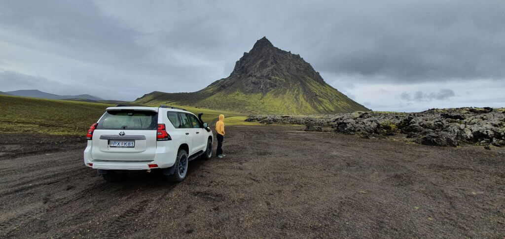
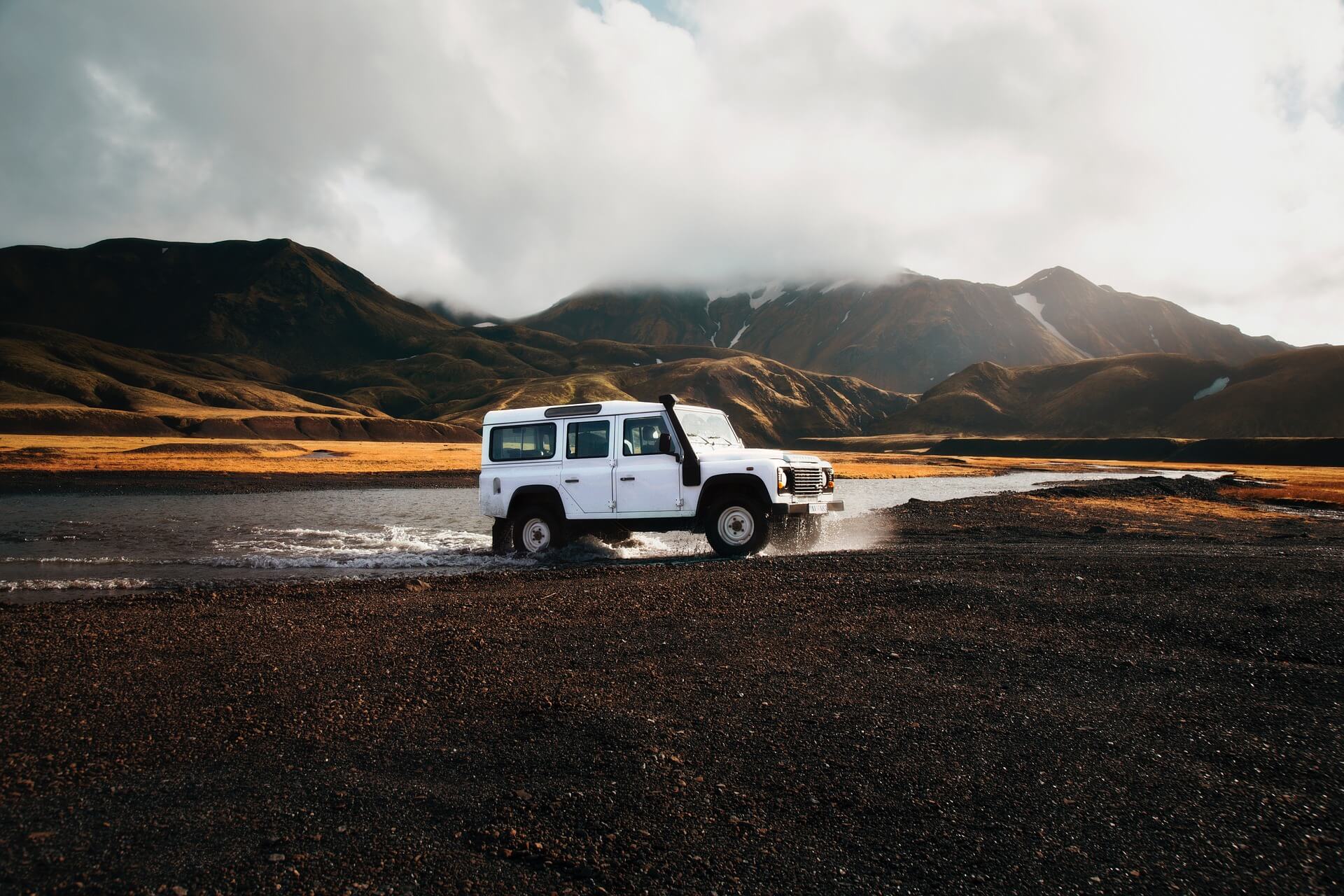
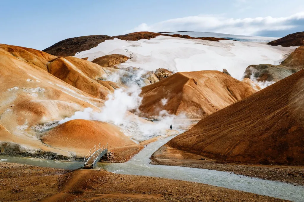
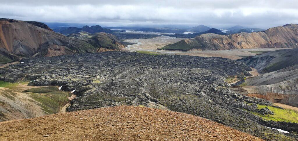
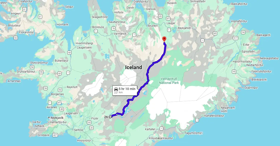
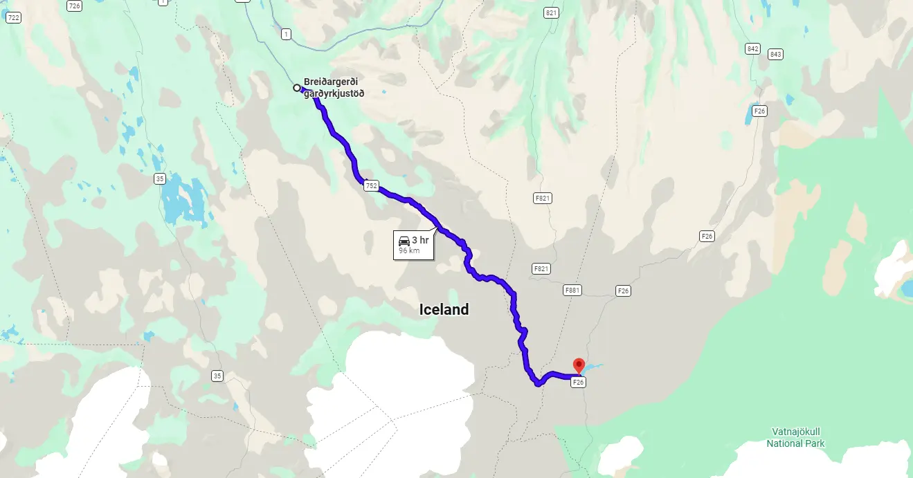
F26 – Sprengisandsleið
View Interactive Map
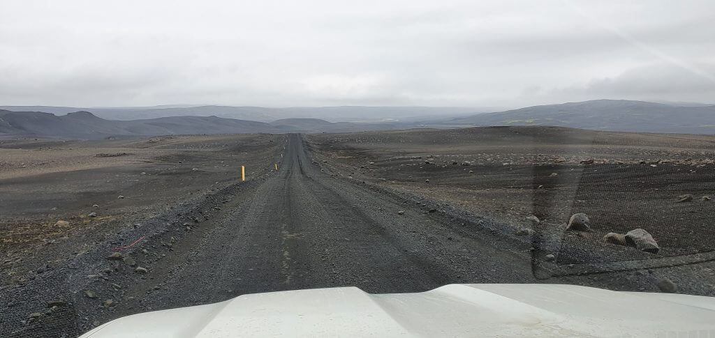
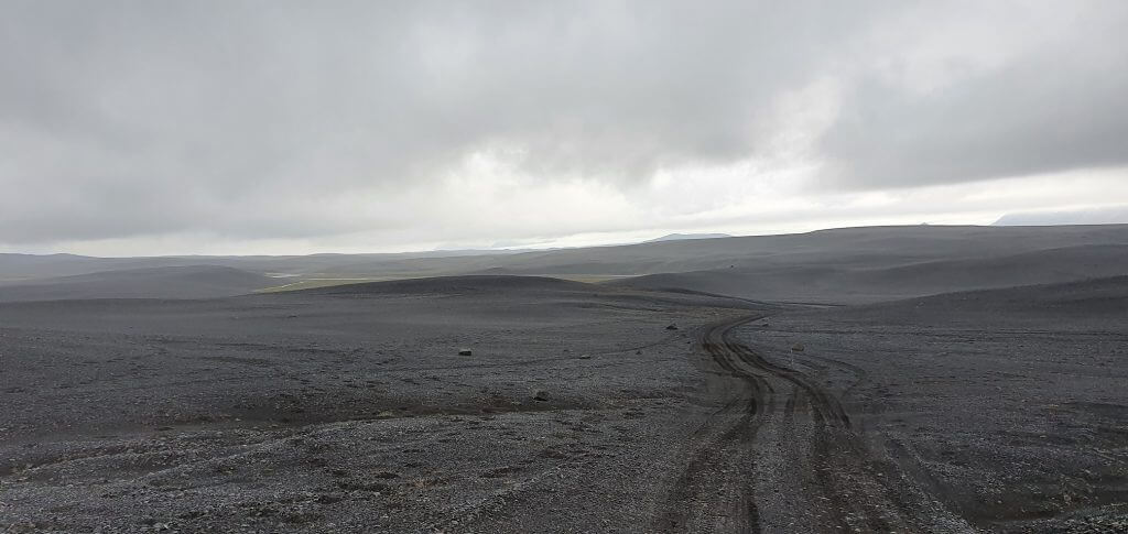
F26, Sprengisandur, or Sprengisandsleið, are all names of the same road. F26 is one of the longest Icelandic F-roads. It’s one of the only 2 roads which connect southern and northern Iceland directly. The first one is F35, which is much easier to drive compared to the rougher F26. The road is deserted, without any campsites, guesthouses, supermarkets, or even gas stations along the road.
You have to drive 250 kilometers with no possibility to refuel, mostly no cell phone coverage, nor any internet network. That being said, driving F26 is a huge adventure, just better be properly prepared for it. Bring enough water, food, and warm clothes, in case you needed to stop unexpectedly and wait for someone else to pass by and help you.
We also wrote a detailed guide on driving F26, be sure to check it out. When driving an F-road, always check the weather and road conditions thoroughly before departure and follow precautionary safety issues on the Icelandic Safe Travel website.
F26 – Sprengisandsleið, or Sprengisandur
Is there a river crossing on F26?
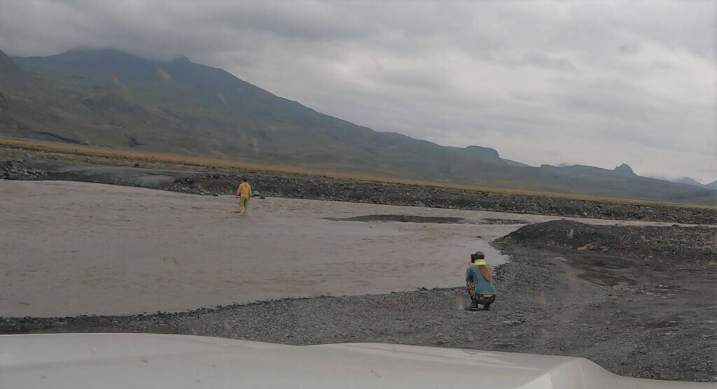
Yes, there’s one main river crossing on F26, roughly in the middle of the road, right next to Nýidalur hut. The river is called Hagakvisla and it’s pretty unpredictable. Usually, it’s a medium-sized river crossing, but it can get bigger with strong rain and especially the current can get stronger.
We write in detail about the river crossing in our separate article about F26.
What car do I need for F26?
It’s best to drive a large 4×4 like Land Cruiser for F26 due to the unpredictable Hagakvislar river crossing near Nyidalur. In very good conditions, a minimum requirement is a medium-sized 4×4 SUV like Dacia Duster. However, the bigger the car, the better. You will make no mistake when opting for a super-jeep.
Feel free to read how to choose a proper car here or how to pick the best Icelandic car rental insurance. We also collaborate with Icelandic car rental companies to give you a discount and us a small commission at no extra cost to you.
F26 video drive-through
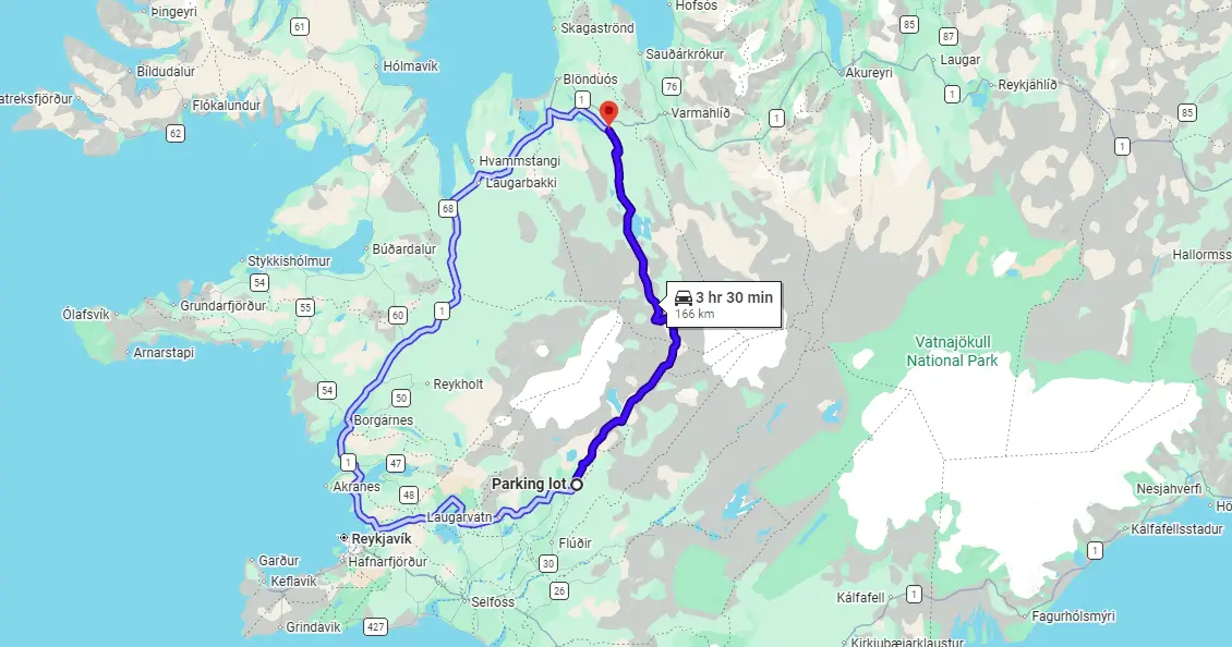
F35 – Kjalvegur
View Interactive Map
F35 has been reclassified to just “35” in recent years, due to road improvements. Still, Google Maps mark it as F35. Another name used for Kjalvegur is Kjölur. These are the synonyms. Icelanders use Kjölur more frequently.
F35 is the second-longest Icelandic F-road. It’s one of the only 2 roads which connect southern and northern Iceland directly. The first one is F26, which is much tougher to drive compared to the easier F35. The road F35 is long and remote, without any campsites, guesthouses, supermarkets, or even gas stations directly along the road.
BUT. You’re gonna meet many fellow travelers along the road. We met many of them even during Covid times. The reason is, there are two main points of interest near F35 – Kerlingarfjoll and Hveravellir. Both of them provide small guesthouses/hotels and restaurants. Just tank enough fuel to complete this approx. 180km route.
Is there a river crossing on F35?
There are no river crossings on F35. That’s one of the reasons why you will meet a lot more traffic on this road compared to F26. It’s also the reason why this road is much easier to drive than F26 or many other F-roads.
F35, aka Kjalvegur, near Hveravellir
What car do I need for F35?
You will be fine with any 4wd car. There are many potholes and small ponds with some water, but otherwise, F35 is easy to drive. It’s just long. I would say road 35/F35 is doable also by a 2wd car in good weather conditions. However, we better recommend taking a smaller/cheaper 4wd car.
Feel free to read how to choose a proper car here or how to pick the best Icelandic car rental insurance. We also collaborate with Icelandic car rental companies to give you a discount and us a small commission at no extra cost to you.
F35 video drive-through
F66 – Kollafjarðarheiði
View Interactive Map
F66 is the only road that leads across the central Westfjords and directly connects the northern part of Westfjords with the southern part.
Is there a river crossing on F66?
Yes, there are some small river crossings (more like streams than rivers). Nothing serious though.
What car do I need for F66?
This depends on weather conditions. In normal weather, you will be fine with any 4wd car, even a small SUV. In rainy and windy weather, however, F66 may get really challenging with the muddy ground and wind blowing.
With F66, the main challenge lies not in the river crossings, but in its steepness and terrain. It’s one of the most mountainous roads in Iceland.
Feel free to read how to choose a proper car or how to pick the best Icelandic car rental insurance. We also collaborate with Icelandic car rental companies to give you a discount and us a small commission at no extra cost to you.
F66 video drive-through
F88 – Öskjuleið
View Interactive Map
F88 is the shortest (and during low water levels the quickest) road to reach Askja, and also a controversial one 🙂 It connects the ring road in the north to F910. Why controversial? Most of the “bloggers” will advise you that F88 is much more dangerous and harder to drive than F905 and F910 combination. But did they actually drive F88? No.
The truth is when water levels of Lindaá river on F88 are high, then yes, F88 is more difficult due to this one particular spot. Otherwise the opposite is the case.
If you are a first-time visitor with little experience in Icelandic river crossings, better take F905 and F910 to avoid assessing whether water levels on F88 are high or not.
Is there a river crossing on F88?
Yes, there is one main river crossing, closer to an intersection with F910 – the Lindaá River. This river is the source of controversion about F88. Usually, this river crossing is medium-sized, but when it rains a lot, it can get bigger and problematic. But under normal summer conditions, the crossing is pretty much the same as those on F905 and F910.
F88 – Öskjuleið to Askja from north
What car do I need for F88?
You will definitely need at least a medium-sized 4×4 car. If you want to be 100% sure to make it through Lindaá river crossing, then better go for a large 4×4 or a super jeep with big ground clearance and a snorkel. It’s also better to gain experience with river crossings on different, less challenging, F-roads and then come back to drive this one. All river crossing rules apply strictly here.
Feel free to read how to choose a proper car or how to pick the best Icelandic car rental insurance. We also collaborate with Icelandic car rental companies to give you a discount and us a small commission at no extra cost to you.
F88 video drive-through
F206 – Lakavegur

View Interactive Map
F206 is a rough F-road leading to Laki craters. No, you won’t find this road at its full length on Google Maps. You need to look at more local maps.
Is there a river crossing on F206?
Yes, there are unbridged rivers along F206 and one of them is considered a medium-sized river crossing.
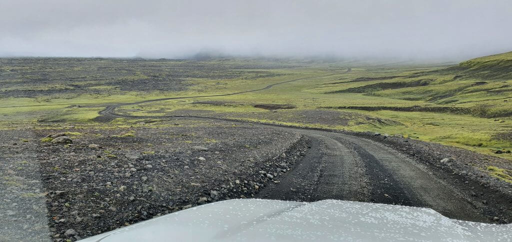
F206 to Laki craters in rain and fog
What car do I need for F206?
There are medium-sized river crossings on F206, hence you need preferably at least a medium-sized 4wd car. “Can we do it in a Suzuki Jimny?”, yes you can try and you may succeed, but you may also not. Jimny is considered to be a small-sized SUV, which, when driven in the right way and in good weather may be enough. It may also not be enough if the opposite is the case.
Feel free to read how to choose a proper car or how to pick the best Icelandic car rental insurance. We also collaborate with Icelandic car rental companies to give you a discount and us a small commission at no extra cost to you.
F206 video drive-through
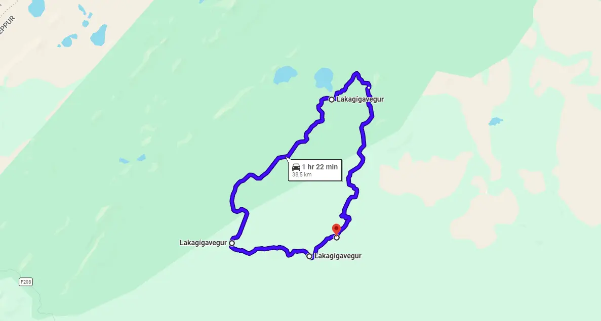
F207 – Lakagigavegur
View Interactive Map
Lakagigavegur is a rough and bumpy loop road leading around Laki craters. The road is completely isolated, and you need to drive F206 to get there.
Is there a river crossing on F207?
Yes, there are unbridged rivers along F207 and one of them is considered at least a medium-sized river crossing. There are videos over the internet of how tourists drown their cars in F207 (luckily without injuries) so take special care, please.
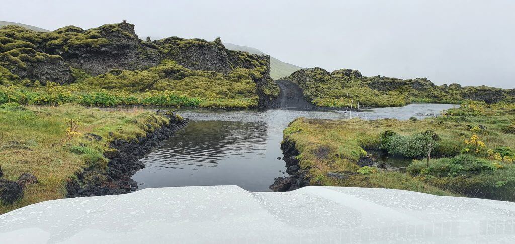
F207 river crossing (road to Laki craters)
What car do I need for F207?
You need preferably at least a medium-sized 4wd car. The road is very bumpy, and moreover, you have to overcome a medium-sized river crossing at F206 if you want to reach F207.
F207 video drive-through
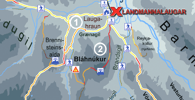
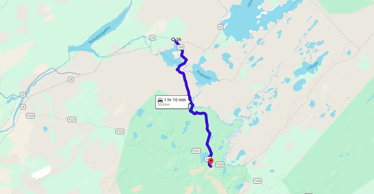
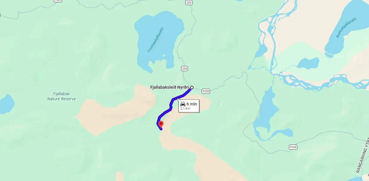
F208 – Fjallabaksleið Nyrðri – north
View Interactive Map
F208 North has been reclassified to just “208” in recent years, due to road improvements. Still, Google Maps mark it as F208.
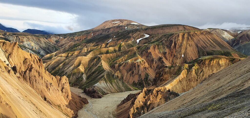
F208 is a long F-road that connects the southern ring road next to Vik with the southern end of F26. I call “north” the part north of Landmannalaugar and “south” the part south of Landmannalaugar. With F208 North vs F208 South, it’s a tale of two roads, which are significantly different from each other. Long story short – F208 North is easier to drive. But, this comes with a cost. Views and landscapes around F208 South are one of the most beautiful sights you may see in Iceland.
F208 is also one of the most sought F-roads because it leads to the most popular Icelandic highlands area – Landmannalaugar. Most of the guides would tell you to better take F208 north because it’s easier to drive. I will tell you the opposite – take F208 South because it’s amazing. Or even better – take both the southern and the northern ones and admire them. But, choose a proper car and study river crossing guidelines.
We also wrote a detailed guide on driving F208 (both south and north), be sure to check it out.
Is there a river crossing on F208 North?
There’s no river crossing on F208 north, not even small ponds.
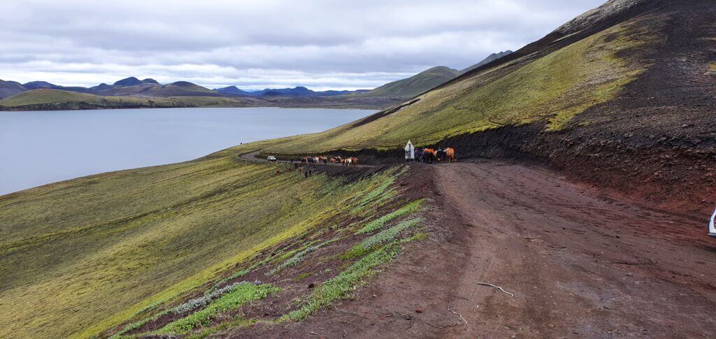
Horses or “Icelandic ponies” blocking the F208 road Fjallabaksleið Nyrðri north of Landmannalaugar
What car do I need for F208 North?
F208 North is a gravel road with many potholes and your car will probably shake a bit while you drive on it. Nonetheless, there’s nothing else exciting about F208 North.
Due to the road re-classification F208/208 from the north is now doable also by a better 2wd car. That being said, we better recommend taking any 4wd car, even a small-sized SUV, that would be fine for this part of F208 even in worse weather.
Feel free to read how to choose a proper car or how to pick the best Icelandic car rental insurance. We also collaborate with Icelandic car rental companies to give you a discount and us a small commission at no extra cost to you.
F208 North video drive-through
F208 – Fjallabaksleið Nyrðri – south

View Interactive Map
F208 is a long F-road that connects the southern ring road next to Vik with the southern end of F26. I call “north” the part north of Landmannalaugar and “south” the part south of Landmannalaugar. With F208 North vs F208 South, it’s a tale of two roads, which are significantly different from each other. Long story short – F208 North is easier to drive. But, this comes with a cost. Views and landscapes around F208 South are one of the most beautiful sights you may see in Iceland.
I particularly chose to drive F208 south, because I’d read that it’s a once-in-a-lifetime experience. And I can only confirm that. On top of that, you can make a detour to Langisjor lake from this part of F208 (and you should do that). Just choose a proper car and study river crossing guidelines.
We also wrote a detailed guide on driving F208 (both south and north), be sure to check it out.
Is there a river crossing on F208 South?
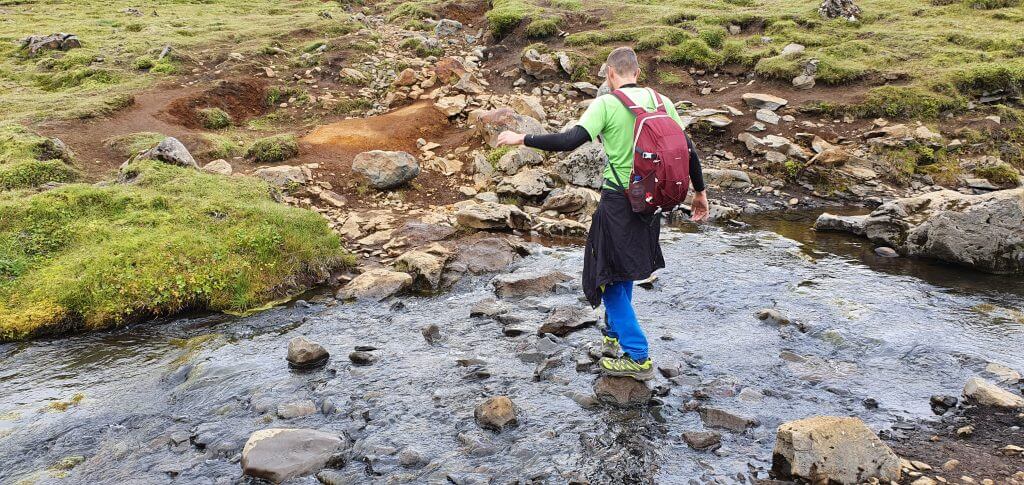
Yes, there are several river crossings from small to medium-sized ones. River crossings on F208 south were among the 3 biggest river crossings we’d encountered during our Icelandic trip (we chose to do medium-sized river crossings at maximum).
River crossings on F208 South are doable, though. Even if you are not highly experienced in driving through water. At least in the summer. The deepest ones had a depth of around 40-60cm during our trip in August. If you are interested in specific details about each river crossing on F208 South, reach out for our Day 3 journey blog post.
Road F208, or Fjallabaksleið Nyrðri, after crossing with F235 towards Landmannalaugar
What car do I need for F208 South?
You need to have at least a medium-sized 4wd car with decent ground clearance to ford the rivers. We’ve done well with our Dacia Duster. However, I wouldn’t go for a smaller car. See our guide below for more details.
“Can we do it in a Suzuki Jimny?”, yes you can try and you may succeed, but you may also not. Jimny is considered to be a small-sized SUV, which, when driven in the right way and in good weather may be enough. It may also not be enough if the opposite is the case.
Choose your car and insurance wisely when driving F-roads with bigger river crossings. Feel free to read how to choose a proper car or how to pick the best Icelandic car rental insurance. We also collaborate with Icelandic car rental companies to give you a discount and us a small commission at no extra cost to you.
F208 South video drive-through
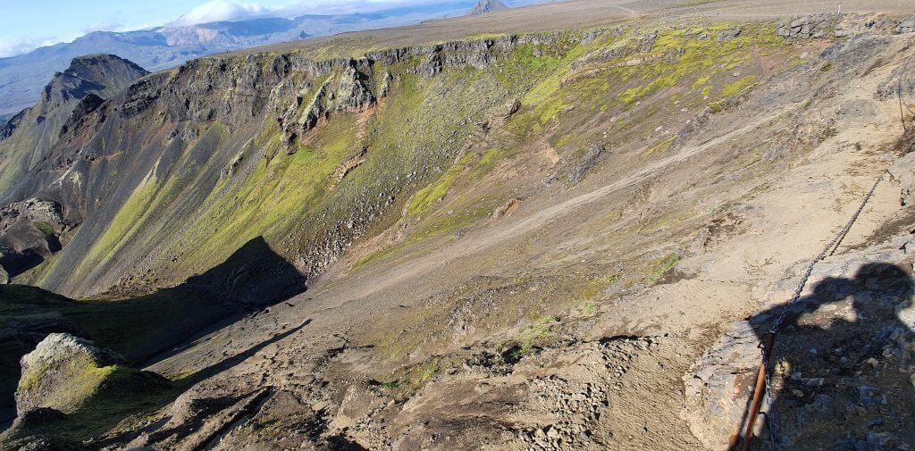
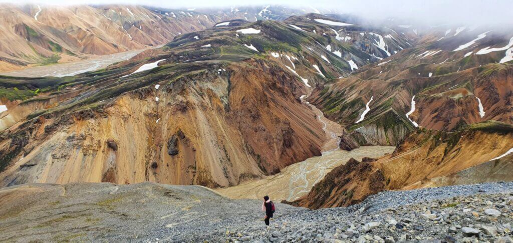
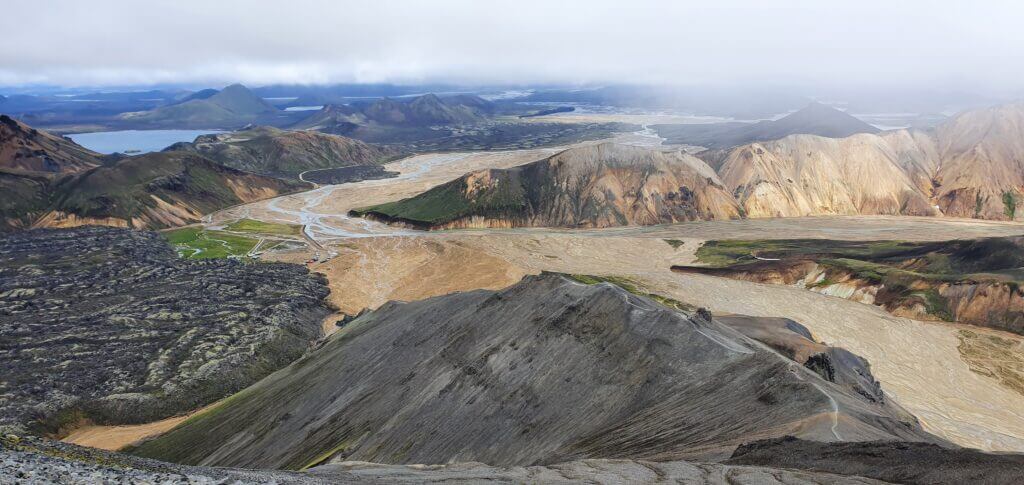
F210 – Fjallabaksleið syðri
View Interactive Map
This is one of the most moon-like F-roads in Iceland. F210 spans the area between Thorsmork and Landmannalaugar from the west to the east. F210 is only minimally maintained and very remote as only very few cars decide to take the route.
One of the main reasons travelers take the route is the legendary Maelifell mountain along the road. F210 is subject to Icelandic crazy highlands weather (like a total fog or heavy rain out of the blue). Be prepared for that with sufficient equipment, driving skills, and a proper car.
Fjallabaksleið syðri is pretty long and can be divided into Western and Eastern parts (intersected by F261, Emstruleið, in the middle). More about Fjallabaksleið syðri in our detailed article about F210.
We also wrote a detailed guide on driving F210, be sure to check it out.
Is there a river crossing on F210?
Yes, there are several river crossings, with many of them being small and medium ones and some of them even bigger ones subject to weather conditions. There’s even a part where you’re gonna be driving virtually IN THE RIVER along the river stream. We wrote in about our first-time driving experience on F210, Fjallabaksleið syðri, in our article about Fjallabak Highlands.
The biggest threats are the rivers Kaldaklofskvísl in the western part of F210 and the river Holmsá in the eastern part of F210. Kaldaklofskvísl has a bit difficult riverbed and Holmsá can sometimes get pretty nasty in terms of depth. Here’s also a short piece of advice from the local:
“River by Mælifell has a rocky bottom and a small steep bank right after you cross the river from the east and the sand can be wet and there is a risk of getting stuck also people tend to hurry across the river because of the steep bank not knowing that the riverbed has quite a lot of rocks that could cause you problems… “
F210 – Fjallabaksleið syðri west – near Álftavatn lake
What car do I need for F210?
For F210 you’re gonna need at least a medium-sized 4wd car, preferably a super-jeep with snorkel and good driving skills. Better practice with less difficult F-roads first and then go for F210.
And definitely choose your car wisely when driving F-roads with bigger river crossings. Feel free to read how to choose a proper car or how to pick the best Icelandic car rental insurance. We also collaborate with Icelandic car rental companies to give you a discount and us a small commission at no extra cost to you.
F210 video drive-through
F223 – Eldgjárvegur
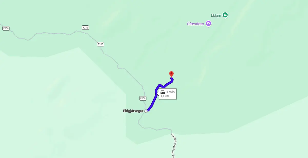
View Interactive Map
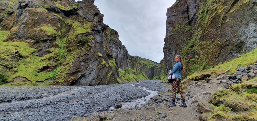
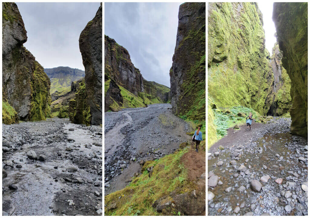
F223 is a short F-road that connects southern F208 with the Eldgjá hiking area. It is one of the easiest F-roads in Iceland and leads through a canyon surrounded by lush green hills.
Is there a river crossing on F223?
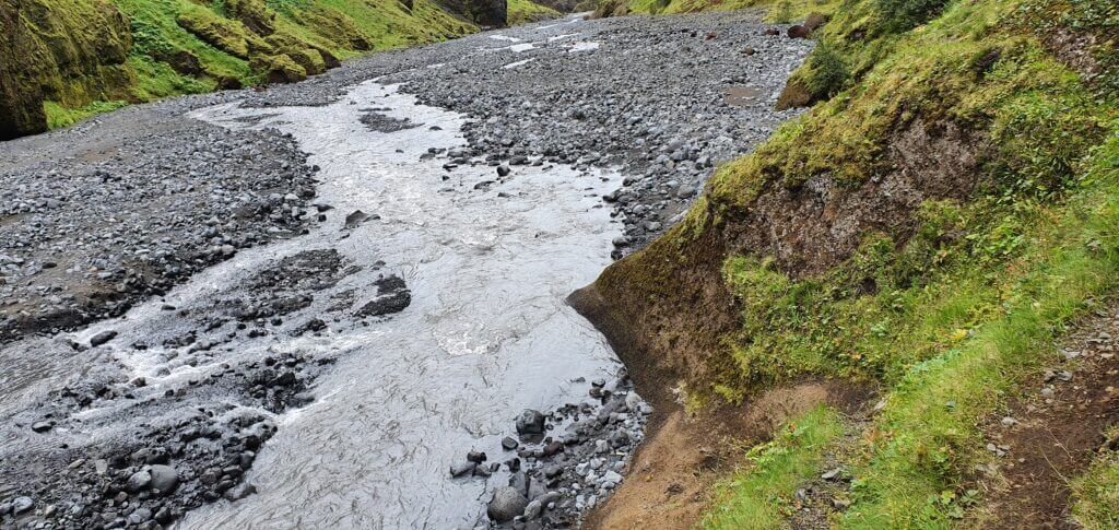
No, there’s no river crossing on Eldgjárvegur. There are, however, river crossings on the only connecting road F208 and in both directions – to the south (one) and to the north (several).
What car do I need for F223?
There’s no need for any special car for F223, but bear in mind that to reach it, you need to drive via F208 South. This means you need at least a medium-sized 4×4 car to get to F223.
F223 video drive-through
F224 – Landmannalaugavegur
View Interactive Map
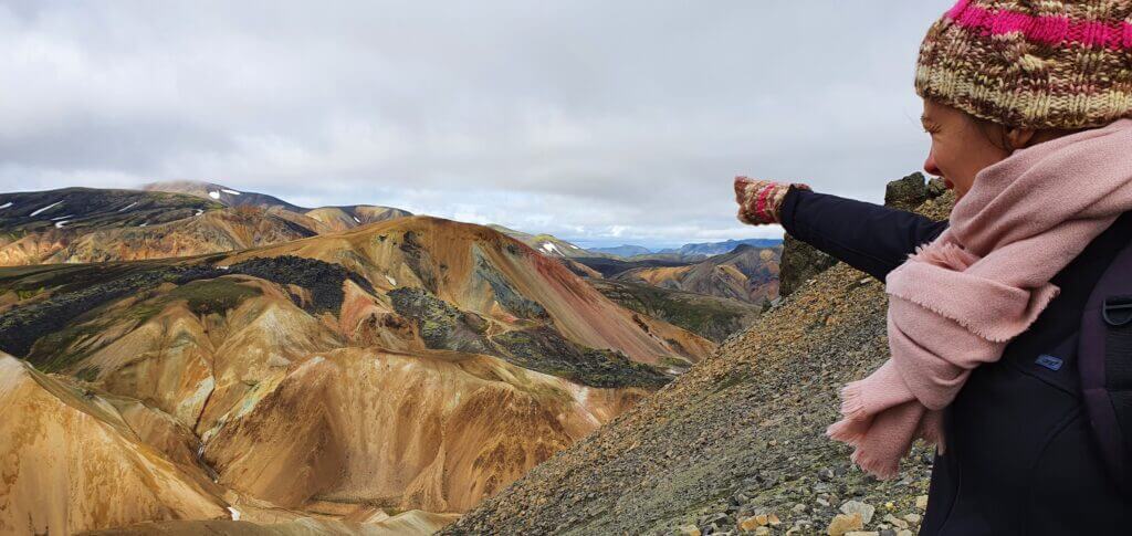
F224 is a short final detour to reach the main Landmannalaugar area. It’s scenic of course because you’re near Landmannalaugar, which is one of the most picturesque Icelandic places.
F224 is a very bumpy road with some epic potholes. You will also meet MANY fellow travelers at F224 because everybody wants to see Landmannalaugar 🙂
Is there a river crossing on F224?
Yes, there are 2 non-trivial, medium-sized river crossings at the end of F224, right next to the Brennisteinsalda campsite. That’s why many visitors opt for leaving their cars at the parking lot just before the river crossings. This is not very convenient though, because you have to walk the distance from the car to the campsite (around 10 minutes) each time you need something from your car (and this will happen often, trust me). Also, in case you have a rooftop tent, you will not want to camp that far from the campsite facilities.
We decided to cross the rivers, although these were one of the deepest ones throughout our trip. Feel free to read about our experience with crossing these rivers.
What car do I need for F224?
If you don’t want to do the final 2 river crossings, basically any small 4wd car will serve you well. Just drive slowly.
In case you want to park directly at Brennisteinsalda campsite, i.e. cross the rivers, you will need a medium-sized 4wd SUV. We’ve seen multiple travelers successfully crossing even with small 4wd cars, but they were struggling a bit and didn’t look very sure about their crossing. It’s already an adventure crossing with a medium-sized SUV so to save you some nerves better go for a bigger car.
Feel free to read how to choose a proper car or how to pick the best Icelandic car rental insurance. We also collaborate with Icelandic car rental companies to give you a discount and us a small commission at no extra cost to you.
F224 video drive-through
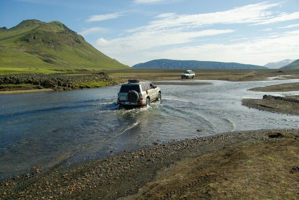
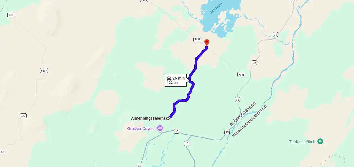
F225 – Landmannaleið
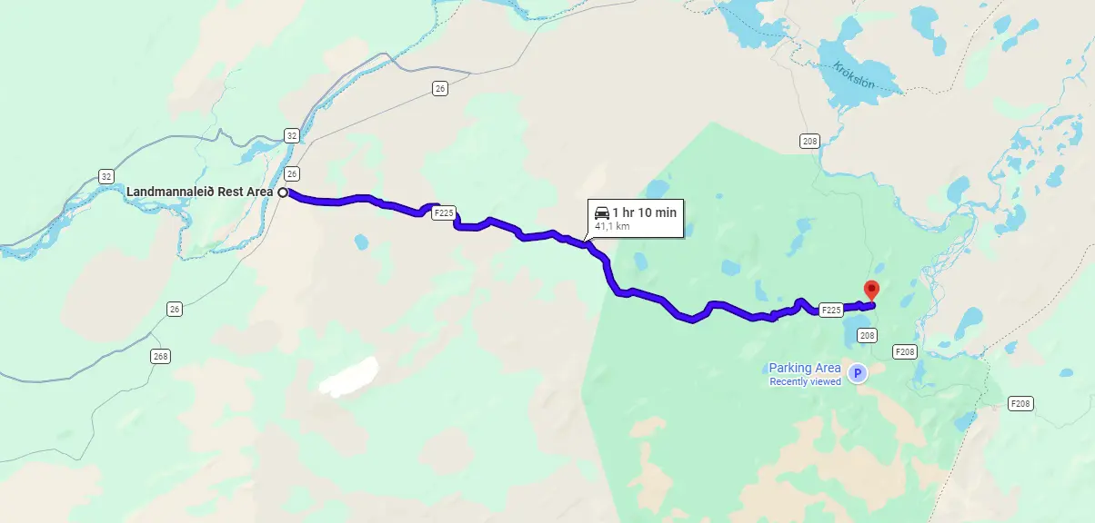
View Interactive Map
F225 is a shortcut from Road 26 in the west to Landmannalaugar in the east. Well, at least it’s supposed to be a shortcut 🙂 It’s 20km shorter than driving north via F26 and F208, but for someone, it may be more difficult to drive. It’s definitely a much nicer drive compared to F208/208 from the north, however.
Is there a river crossing on F225?
Yes, there are some small river crossings on F225, Landmannaleið. Under normal weather conditions and if the road is of course open, they should be doable with any 4wd car. That being said, you still have to adhere to river crossing guidelines and better have some experience with river crossings already. That’s why many travelers avoid this shortcut and go for the rather boring F208/208 North. If you want to start trying river crossings, though, we recommend starting with Landmannaleid 🙂
Beware of the early season, though! The river crossing on F225 can get pretty watery and dangerous to pass in June, or generally early in the season when glaciers thaw. During this time, at least a Hilux / Land Cruiser is recommended.
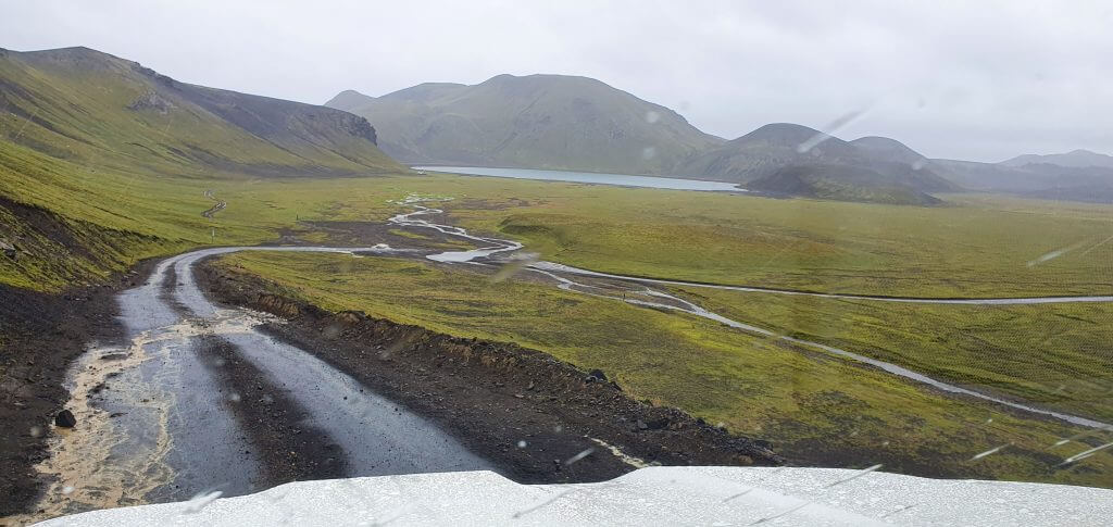
F225 Landmannaleið in rain
What car do I need for F225?
A medium-sized 4wd SUV should be sufficient for F225. Maybe even a small SUV, according to weather and road conditions.
Feel free to read how to choose a proper car or how to pick the best Icelandic car rental insurance. We also collaborate with Icelandic car rental companies to give you a discount and us a small commission at no extra cost to you.
F225 video drive-through
F228 – Veiðivatnaleið
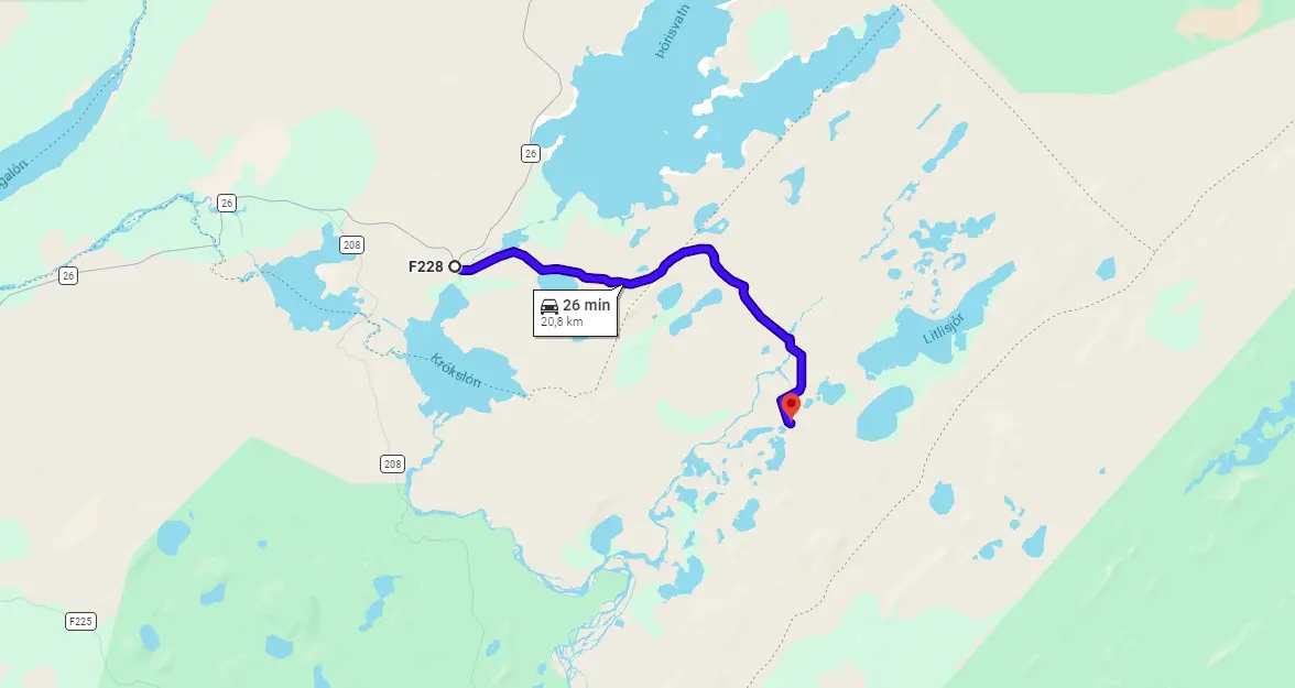
View Interactive Map
F228 advice from the local
“Sandy road with two clear water rivers to cross. One of the crossings is in a curve of the river, so can be quite deep. Veiðivotn (fish lakes) is mostly visited by fishermen It is a beautiful area with lots of colorful crater lakes. A great area to do shorter hikes.”
F228 video drive-through
F229 – Jökulheimaleið
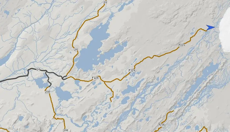
View Interactive Map
F229 leads to the Jökulheimar area, just west of the Tungnaájökul glacier. There are many connecting tracks to F229 (dirt tracks, not F-roads), which are much more dangerous than F229. In our opinion, this road is not particularly interesting. The more interesting are the neighboring tracks, but they are much more dangerous.
Is there a river crossing on F229?
According to scarce sources, there are no river crossings on the road.
What car do I need for F229?
There are some parts with sand and rough, unmaintained terrain, plus it’s an F-road, so definitely at least a small 4wd car. Other than that, the road should not be dangerous, it’s just remote and not often driven.
Feel free to read how to choose a proper car or how to pick the best Icelandic car rental insurance. We also collaborate with Icelandic car rental companies to give you a discount and us a small commission at no extra cost to you.
F232 – Öldufellsleið
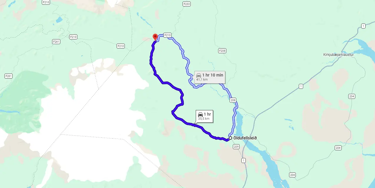
View Interactive Map
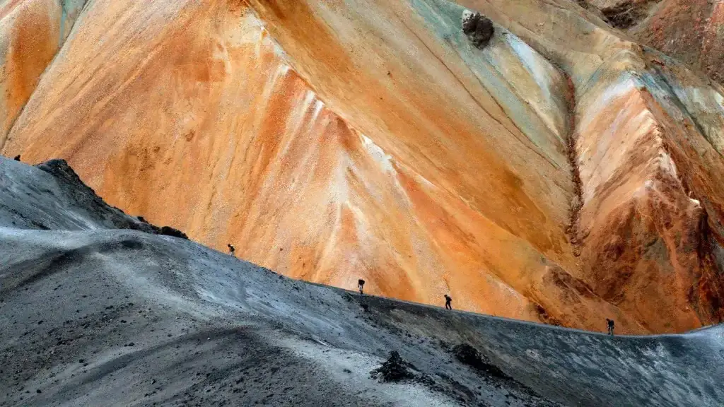
F232, or Öldufell, or Öldufellsleið is the legendary road depicted in all of these pictures where you see a car driving virtually over the waterfall. This waterfall is called Bláfjallafoss (after Bláfjallakvisl river). F232 is a beautiful road connecting F210 in the north almost with a ring road in the south. On a nice day, views over Öldufellsjökull glacier (the eastern part of Mýrdalsjökull) are amazing.
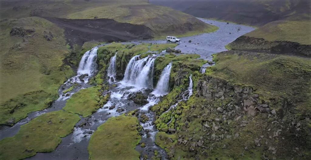
F232 Bláfjallafoss waterfall
Is there a river crossing on F232?
Yes, there is one medium-sized river crossing – the famous one over the waterfall. This ford is a bit bumpy but very scenic, especially when shot from the drone perspective. Other than this one river crossing there are only small puddles not worth mentioning.
What car do I need for F232?
A medium-sized 4wd SUV should do the job in good weather conditions. Don’t forget to consider also connecting roads (F210 requires a big 4×4 car but F233 is even more challenging and a super jeep is recommended).
Feel free to read how to choose a proper car or how to pick the best Icelandic car rental insurance. We also collaborate with Icelandic car rental companies to give you a discount and us a small commission at no extra cost to you.
F232 video drive-through
F233 – Álftavatnskrókur
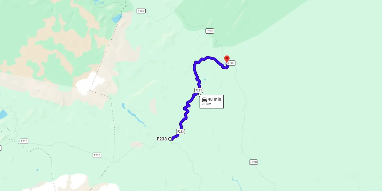
View Interactive Map
F233 is a shortcut from F210 to the northern part of “F208 south” road. Travelers who want to see Maelifell first and then continue towards Landmannalaugar usually look at this road. Beware though! F233 has one pretty difficult river crossing. This means that you either better avoid this road, or be very well prepared and gain enough experience with river crossings elsewhere first.
Is there a river crossing on F233?
Yes, there are several river crossings with one of them, Syðri-Ófæra river, easily being classified as a big river crossing. F233 opens every year among the last F-roads and that happens for a reason. Sydri Ofaera river with some powerful streams crosses the road and the snow usually holds longer in this area, which means Álftavatnskrókur is passable only for a limited time of a year.
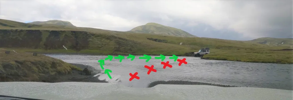
Correct river crossing of Sydri Ofaera river on F233 (click to enlarge).
What car do I need for F233?
With some luck, you may be able to pass with a medium-sized 4wd SUV. In case you don’t want to rely on luck, better go for a super-jeep option. Even with super-jeep, it’s very important to not do something stupid and strictly adhere to river crossing guidelines. Check the road conditions beforehand. Cross the main Sydri Ofaera river as depicted above. Don’t go straight! There are big boulders in the way.
Choose your car and insurance wisely when driving F-roads with bigger river crossings. Feel free to read how to choose a proper car or how to pick the best Icelandic car rental insurance. We also collaborate with Icelandic car rental companies to give you a discount and us a small commission at no extra cost to you.
F233 video drive-through
F235 – Langisjór
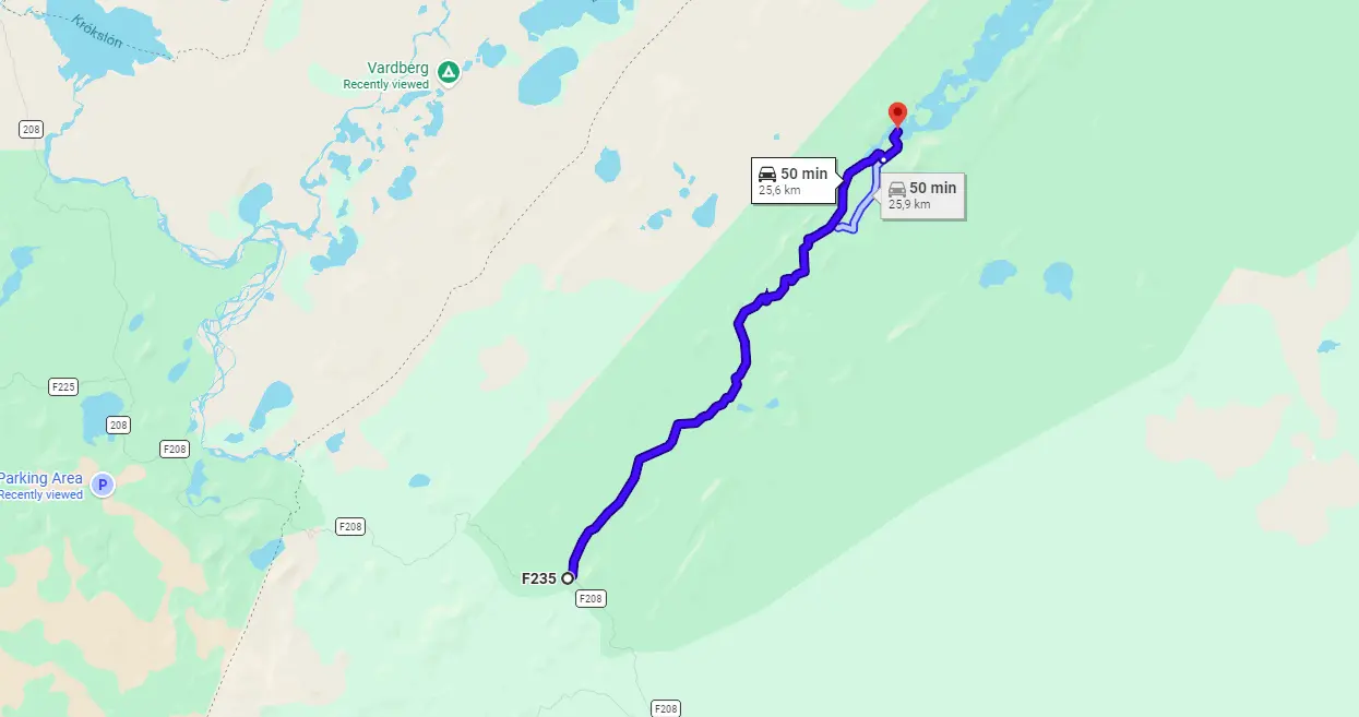
View Interactive Map
F235 is a one-way detour from F208 south towards out-of-this-world Langisjor lake and Sveinstindur mountain. I highly recommend you take F235 if you want to gain experience in driving Icelandic F-roads and enjoy the moon-like landscapes. It’s once in a lifetime experience.
Is there a river crossing on F235?
Yes, there are several river crossings. None of them was dangerous at the time of our journey, though. They are mostly small to medium-sized river crossings doable even if you are not highly experienced. You still have to adhere to river crossing rules of course.
If you are interested in specific details about river crossings on F235, feel free to read about them in detail here.
Surreal landscapes on road F235 towards Langisjór lake
What car do I need for F235?
You should do well with any 4wd SUV. The medium-sized 4wd car would be the safest, though, as some of the rivers may gain volume when it rains a lot. More importantly, to reach F235, you will have to cross several medium-sized rivers on F208 and for that, you definitely need a medium-sized 4wd SUV.
Feel free to read how to choose a proper car or how to pick the best Icelandic car rental insurance. We also collaborate with Icelandic car rental companies to give you a discount and us a small commission at no extra cost to you.
F235 video drive-through
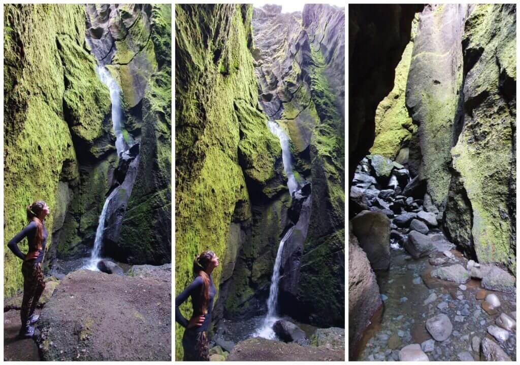
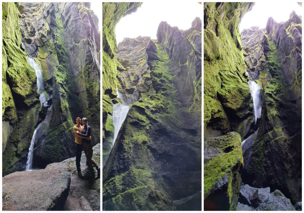
F249 – Þórsmerkurvegur
View Interactive Map
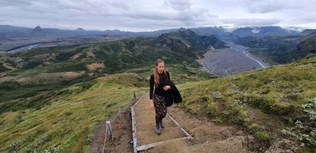
F249 is probably the most notoriously known for tourists getting their rental cars drowned here. Except for that, it’s a beautiful moon-like road and one of the only 2 roads that will get you to Thorsmork, which is a beautiful mountainous area. We wrote a detailed guide on getting to Thórsmörk.
The road is better to be avoided if you don’t have all it takes – a proper car, enough experience, and perfect knowledge of river crossing rules. If you don’t gave a big car and enough experience, we suggest taking a guided tour to Thórsmörk.
We also wrote a detailed guide on driving F249. Be sure to check it out!
Is there a river crossing on F249?
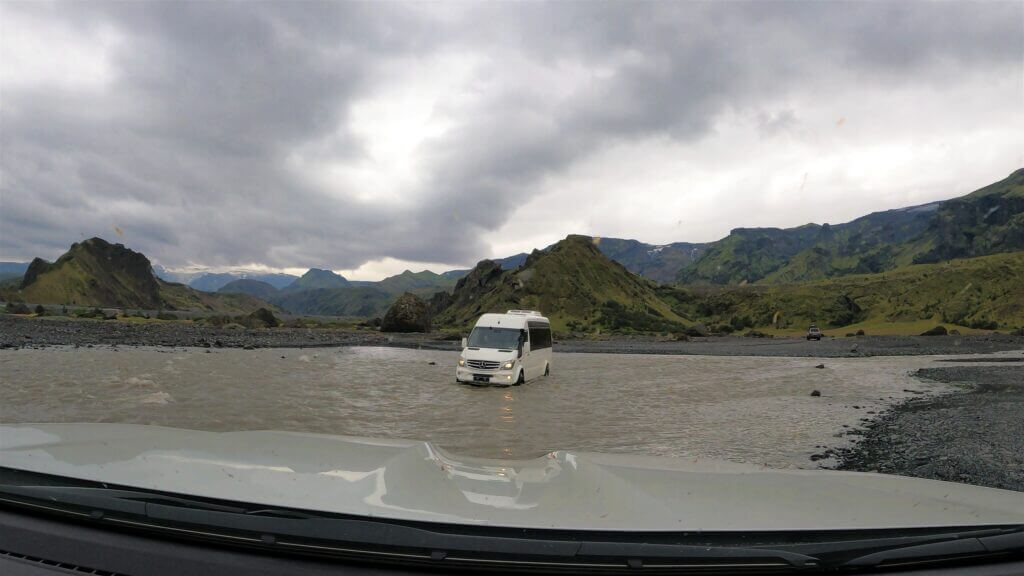
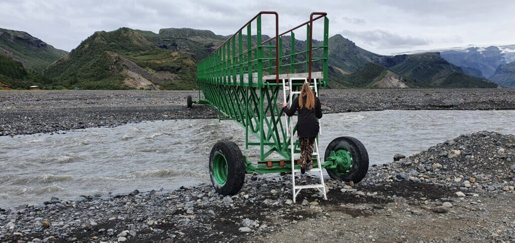
Sure, there are many river crossings on F249. They start as small ponds, soon evolve into small rivers, then medium-sized rivers, and end with big ones. The final river crossing (Krossá river) is probably the biggest river crossing you may encounter on marked F-roads in Iceland.
We drove to Thorsmork in a smaller super jeep. This is what I suggest to everyone to stay safe. We also drove only up to the Krossá river – you don’t want to cross this one, trust me. Read more details about our trip to Thorsmork here.
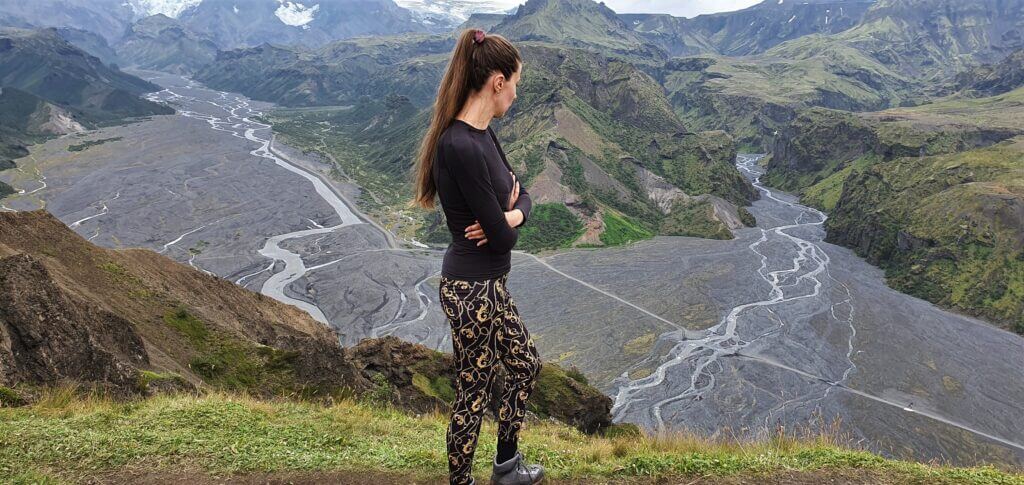
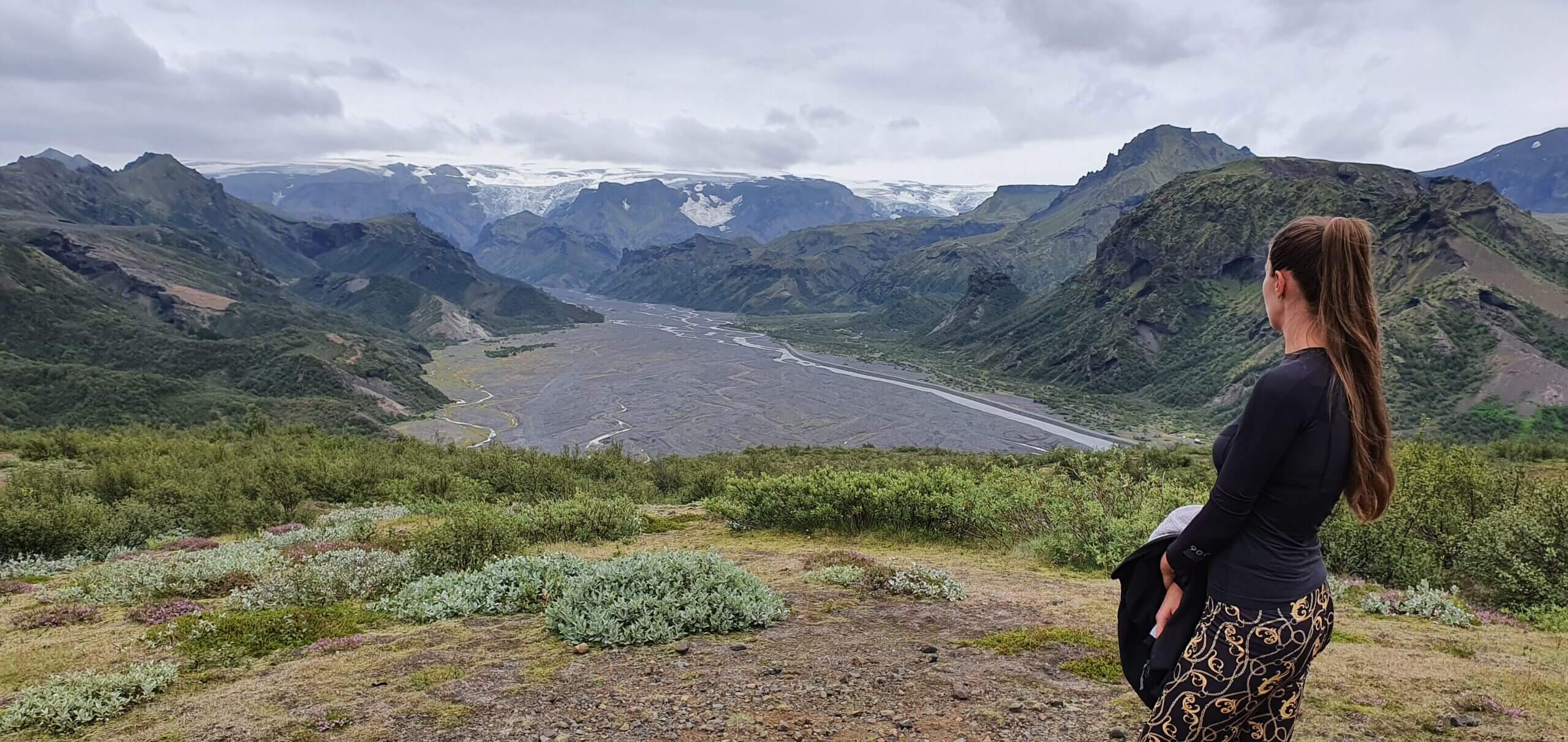
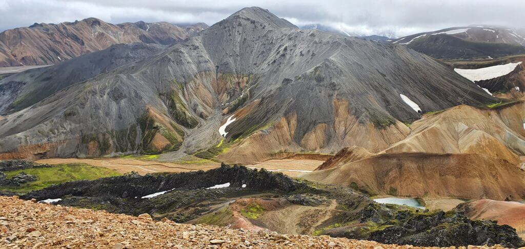
A spectacular view from the top of Valahnjukur
What car do I need for F249?
Without any doubt, you’re gonna need a super-jeep. And the bigger the better. The last river crossing is one of the most treacherous and challenging moments you will encounter on Icelandic roads. Even with a super-jeep, it’s not guaranteed you’re gonna pass. You have to ford a river precisely in the way it needs to be forded, to not drown your car.
Choose your car and insurance wisely when driving F-roads with bigger river crossings. Feel free to read how to choose a proper car or how to pick the best Icelandic car rental insurance. We also collaborate with Icelandic car rental companies to give you a discount and us a small commission at no extra cost to you.
F249 video drive-through
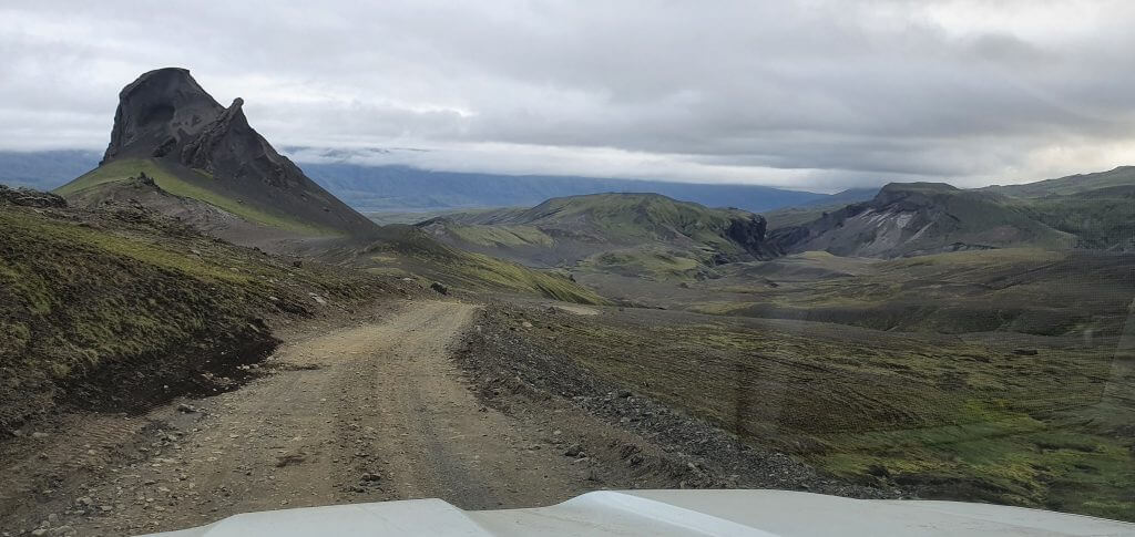
F261 – Emstruleið
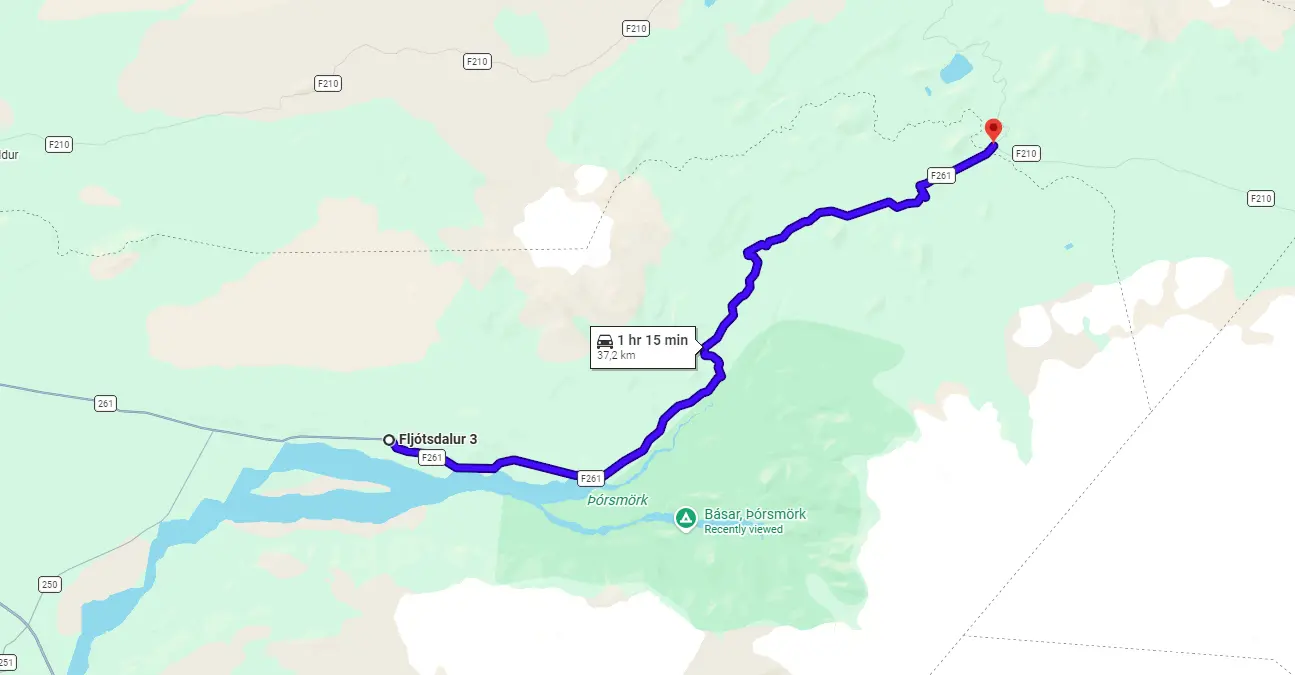
View Interactive Map
F261 leads along the northern side of Thorsmork valley and connects it with the eastern part of F210.
Is there a river crossing on F261?
Yes, there is one main river crossing, through the Bláfjallakvisl river. It’s considered at least a medium-sized river crossing and can become a bigger one when it rains a lot. There are no other notable river crossings. We crossed Blafjallakvisl on F261 several times in August in dry weather. The crossing was OK at that time and generally should be easier than Kaldaklofskvisl on F210. We wrote in detail about our F261 driving experience here.
F261 Emstruleið
What car do I need for F261?
A medium-sized 4wd SUV should do the job in good (dry) weather conditions. Don’t forget to consider also connecting roads (F210 should be similar but F233 is one of the most challenging F-roads in Iceland when it comes to river crossings). A large 4wd SUV always makes it safer to drive F261, however.
Feel free to read how to choose a proper car or how to pick the best Icelandic car rental insurance. We also collaborate with Icelandic car rental companies to give you a discount and us a small commission at no extra cost to you.
F261 video drive-through
F333 – Haukadalsvegur
View Interactive Map
F333 – advice from the local
“The track starts next to Geysir thermal area. It first goes through an Icelandic wood, then through fields of lupines, and ends at the F338. There is one small river crossing, but it shouldn’t be a problem.”
Another: “F333 is an unpaved and rough road. It doesn’t have any unbridged rivers, but the section beginning from the F338 route is very bumpy, filled with potholes and big rocks on the road. After that section, the F333 becomes a forest road, which is a pretty unusual experience in Iceland due to the lack of trees. 🙂 “
F333 video drive-through
F335 – Hagavatnsvegur
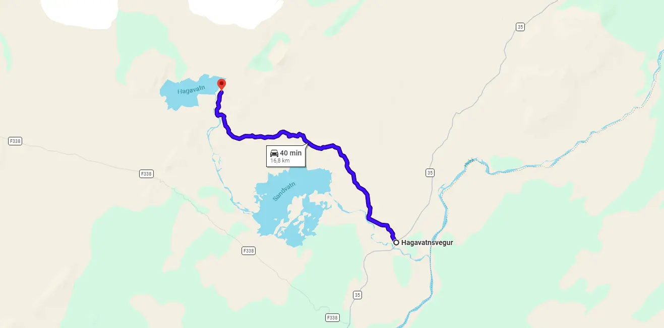
View Interactive Map
F335 advice from the local
“Track that goes to the glacier lake Hagavatn. The first part is easy, with only one tiny stream to cross. Nice views at Lake Sandvatn. Near the end is a small cabin from Ferðafélag Íslands. In 2015, staying there for one night cost ISK 4000. Very short bunk beds, and no drinking water near the cabin. After the cabin, the track continues for another kilometer to Hagavatn. But you have to cross a glacial river, about 4m wide. At the end of the road lake, Hagavatn overflows into a river with a 30-meter (my guess) high waterfall named Leynifoss. According to a message in the cabins gestabók (guest book), it should be possible to hike from there to the nearby glacier, but I haven’t tried that.”
Feel free to read how to choose a proper car or how to pick the best Icelandic car rental insurance. We also collaborate with Icelandic car rental companies to give you a discount and us a small commission at no extra cost to you.
F337 – Hlöðuvallavegur

View Interactive Map
F337 video drive-through
F337 advice from the local
“Starting from F338, going south, you first get a decent track around Mount Hlödufell. There are actually tracks on both sides of the mountain, I took the right branch. The area is flat but scattered with huge boulders which probably fell from the mountain. There is a cabin on the south side of the mountain, often used by horse groups. One km after the cabin there is an unnumbered sidetrack on your right, that goes to Thingvellir. I think its name is Eyvindarleið…
…The F337 continues in sand and lava to a mountain range. Just before reaching it, there is a sign pointing back to the north to an unnumbered track that goes around this mountain range. Close nearby the river Brúará runs in a small but pretty canyon Bruarárskörð, worth a visit. The same river later forms a few km downstream of the Brúarfoss waterfall. After the mentioned sign, the road goes steeply up the mountain. The track is mostly fair, but there is one section where it crosses a dry riverbed with big round stones for a few hundred meters. At the top of the mountain, you have a great view of Lake Apavatn (weather permitting, I only saw mist and rain), before descending on a steep and curvy road. There are no rivers to cross on F337.”
“2025 update… older comments underestimate the roughness and the steepness of the road. Compared to movies made 8-10 years ago the road is much rougher now. Starting from North to South, right after the river bed it starts going up quite to very steep, and the path is very damaged. Very intense with a heavy adventure bike. The descent at the end is very steep also, and very loose so it’s easy to lose control of the bike.”
“second 2025 update… When we drove this, the portion in the middle with the sand had covered the tracks so a gps/atlas became critical. The rocks on the ascent were the most demanding terrain out of all of the routes. Personally we would not do this in a Duster. Additionally, Google Maps has an incorrect route for the northern part of F-337 between 64.38594102018679, -20.55699728542681 and 64.44691709288622, -20.64165697588641. It’s literally going through a lava field: 64.42853675266463, -20.63375528189838. Kortabok and the Land Rover GPS both had the actual route.”
F338 – Skjaldbreiðarvegur

View Interactive Map
F338 advice from the local
One: “This is a Linuvegir, a track along powerlines. It runs on the slopes of the shield volcano Skjaldbreiður. Starting from the west the track first crosses a small stream. The track is mostly fine with only a few sandy stretches. But it runs in a lava field, with lots of short curves and bends. And several stretches where you drive under the powerlines. Nice views of the Thórisjökull and Langjökull glaciers. A few km before the track ends near Gullfoss, there is a river crossing. I don’t know how difficult this one is (I took the turn to F333), but you cross the same river on a bridge near Geysir, and it looks doable there.”
F338 Skjaldbreidarvegur
Another: “The river crossings on this road are very wide (3:55) and rather wide (7:00) (the only optimal place for a crossing is where the river turns wide and hopefully shallow). One needs to plan the crossing correctly because one is able to find submerged and surfaced boulders to place the car on top of, and also deep vistas within the crossing. This crossing changes every single year so any route or tracks may lead one astray and the route shown in the video is *not* to be taken for granted.”
F338 video drive-through
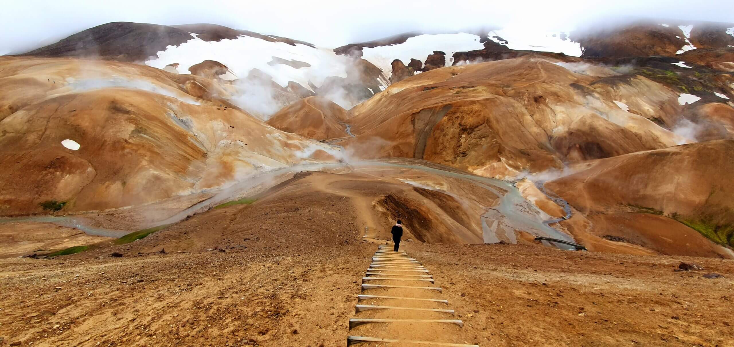
F347 – Kerlingafjallavegur
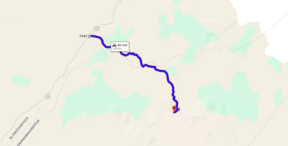
View Interactive Map
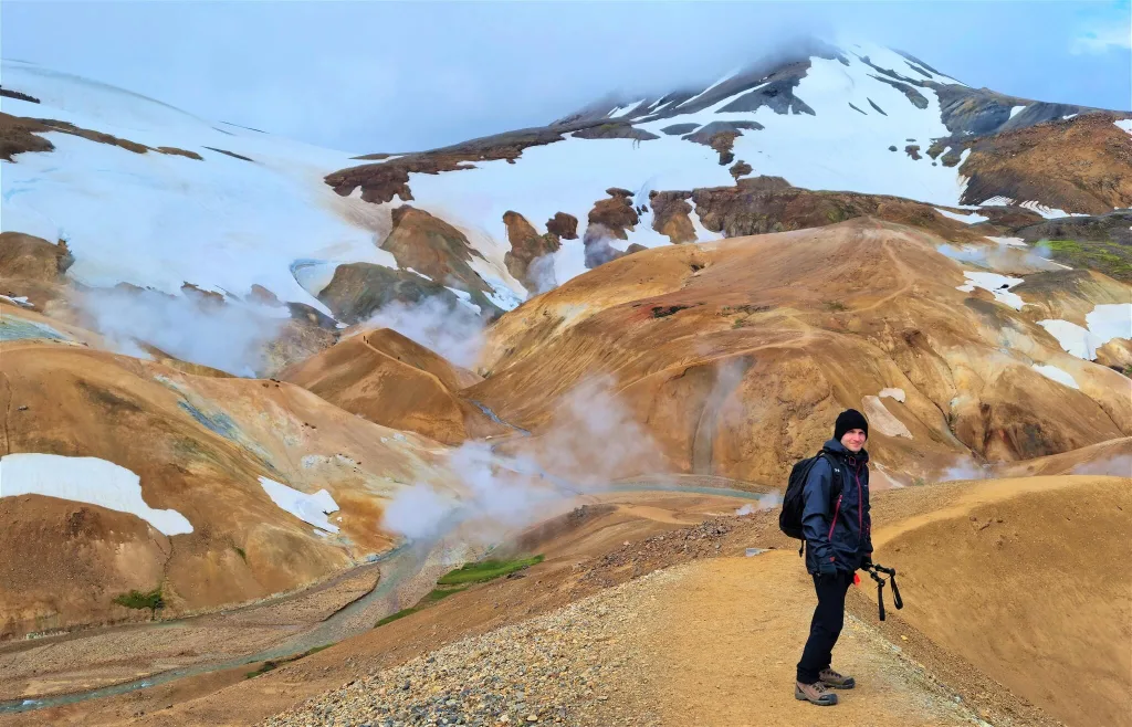
F347 is the only road leading directly to the picturesque Kerlingarfjoll area. It’s a detour from F35 and it’s definitely worth taking. In terms of difficulty, I would divide F347 into two parts – up to a Kerlingarfjoll mountain resort and afterward, towards Hveradalir.
Up to the Kerlingarfjoll mountain resort, F347 is just a gravel road with potholes doable even by a 2wd car. To Hveradalir, however, it becomes more challenging. This time the challenge exceptionally doesn’t lie in river crossings (as there are no unbridged ones) but in the steepness and rugged terrain of the final section.
Is there a river crossing on F347?
Contrary to the wrong statements of some other guides – there is NO unbridged river crossing on F347. This means you may get to Kerlingarfjoll without fording any river.
F347 road next to Hveradalir hot spring area in Kerlingarfjoll
What car do I need for F347?
For the part up to Kerlingarfjoll mountain resort, any 4wd car would be sufficient. For the final part leading to Hveradalir, I recommend at least a medium-sized SUV with enough ground clearance. Dacia Duster is a minimum. We’ve done it in it and it was a bit scary.
“Can we do it in a Suzuki Jimny?”, yes you can try and you may succeed, but you may also not. Jimny is considered to be a small-sized SUV, which, when driven in the right way and in good weather may be enough. It may also not be enough if the opposite is the case.
Not sure what type of car to choose? Feel free to read how to choose a proper car or how to pick the best Icelandic car rental insurance. We also collaborate with Icelandic car rental companies to give you a discount and us a small commission at no extra cost to you.
F347 video drive-through
F349 – Kerlingarfjöll old
View Interactive Map
F349 is an old, remote, and really long F-road serving as an alternative road to Kerlingarfjöll. F349 is not well-known, nor often driven. You will hardly meet here anyone, which is also both the biggest danger and biggest beauty of the road – its remoteness. Rough highlands and wild landscapes will be surrounding you on every kilometer of this track.
Is there a river crossing on F349?
According to very scarce resources, there are some small to medium-sized river crossings on F349. Rivers are not the main obstacle on this road.
What car do I need for F349?
As already mentioned, the main danger of this road are not river crossings, but rather its remoteness and some really rough sections. This means narrow roads and steep ascents and descents. It’s safer and easier to drive the road from south to north, not the opposite, because this way the steepest parts will be descents and not ascents.
Theoretically, under good weather conditions, a medium 4wd SUV should be able to drive through F349. However, bear in mind the road is really remote, with steep and rough sections. To be on the safe side I would definitely recommend at least a large 4×4 car and ideally a super jeep.
F349 advice from the local
“Definitely nothing less than a super jeep is capable. One section we could have gotten buried in mud, and another deep and loose black sand hill took us 4 attempts and various 4WD setting adjustments + speed variations to get up. It was absolutely exhilarating but also felt like we were on the edge.”
“…the road is in such bad condition that the drive is slow almost all the time (around 25 kph tops). You’ll either get stones or potholes at all times; sometimes they even look like fissures on the ground. There are some streches where the field becomes more clear as the road runs through some red grass camps and you can go up to around 45 kph, albeit with caution as potholes galore, but you’ll mostly alternate between bad and worse sections the whole way.
There are some medium-sized rivers to cross along the way. At the time of our drive, none of them were deep. The biggest one was right before the Svínarnes hut, a clear water river that could get bigger in bad weather. Still, it shouldn’t be a problem of you’re in a proper car to drive this road, but I also don’t know why you would take this road in bad weather. There’s one other tricky crossing that could get scary in bad conditions, located some 15-20 minutes after the hut. The crossing follows along the current and again wasn’t really deep, but there’s only one viable path to avoid the huge stones in the way, and the bottom of it is insanely rocky and with some holes in which the car will likely fall.
There’s likely a reason no one drives it: besides being really challenging, there isn’t that much around to see and, if you’re planning to go to Kerlingarfjöll, you’ll probably want to spend your time exploring the mountains rather than suffering for long hours in a drive that seems to never end. If you don’t have a big car, spare hours and a lot of patience, it might be better to just take F35.”
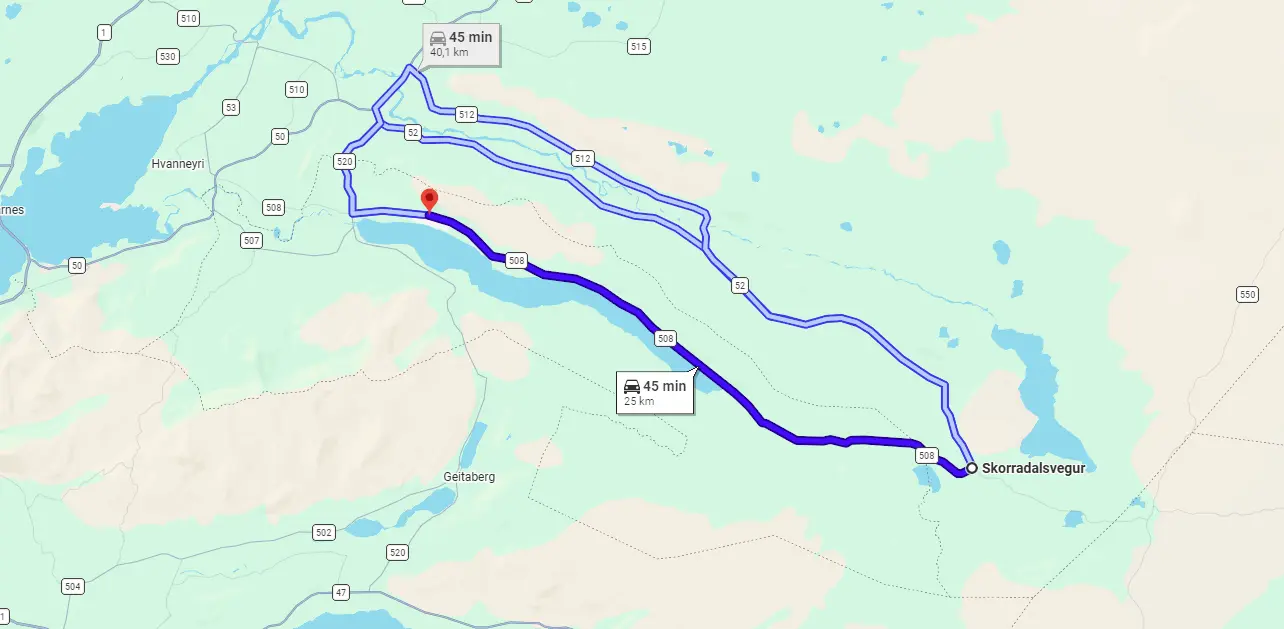
F508 – Skorradalsvegur
View Interactive Map
F508 advice from the local
“I’ve driven F508 Skorradalsvegur in a 4×4 truck. It’s bumpy and rocky. There is only one really steep hill to climb if one drives east (descend if one drives west). No rivers to cross that I can recall, but as mentioned – this follows the power lines like F338, not so much “under” the lines but they’re always nearby. Very little to see apart from one small waterfall next to the steep section mentioned – a second one isn’t far away but to see it one needs to hike to it. Both are pictured here and are about 12-14 meters high each (39-46 ft): https://gonguleidir.is/listing/eiriksfell-i-skorradal/ Those who visit these waterfalls tend to drive back out of Skorradalur rather than heading onwards.”
Not sure what type of car to choose? Feel free to read how to choose a proper car or how to pick the best Icelandic car rental insurance. We also collaborate with Icelandic car rental companies to give you a discount and us a small commission at no extra cost to you.
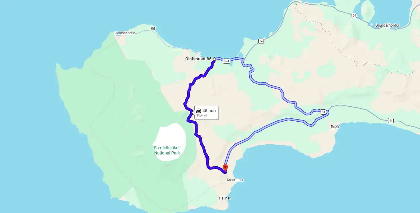
F570 – Jökulshálsvegur
View Interactive Map
F570 has been reclassified to just “570” in recent years, due to road improvements. Still, Google Maps mark it as F570.
F570 is an old mountain road connecting Ólafsvik with Arnastapi. The road is steep and narrow at several spots, but beautiful! It is also the closest road to Snæfellsjökull glacier. Super jeep tours use it for reaching the glacier and also for bringing the snowmobiles up towards the glacier.
We drove Road 570 in mid-July just 2 hours after the official opening. There was still a lot of snow around the road and we even had to pass several 3-meters (10-feet) high snow tunnels! We loved the drive and it was a once-in-a-lifetime experience.
Is there a river crossing on F570?
There are no river crossings on F570 – Jökulshálsvegur. There may be snow, though. Especially earlier in the season (May, June, July).
Road 570 Snæfellsness near Snæfellsjökull
What car do I need for F570?
Although technically a 2wd car is allowed in good conditions, we definitely do recommend driving Jökulshálsvegur with a 4×4 car. The road gets steep from time to time and you may get stuck with a small car. A small 4wd car is a must and should be enough under good weather conditions. We would better take there at least a medium-sized 4×4, though, as we mentioned above, because snow may often be present on the road.
Not sure what type of car to choose? Feel free to read how to choose a proper car or how to pick the best Icelandic car rental insurance. We also collaborate with Icelandic car rental companies to give you a discount and us a small commission at no extra cost to you.
F570 video drive-through
F575 – Eysteinsdalsleið
View Interactive Map
F575 is the only F-road that has remained in place in Snæfellsnes. It connects the western part of Road 547 (near Saxhóll crater) to the middle part of Road 570 (former F570). In some spots, it is steep, narrow, and with rough terrain and rocks. Nevertheless, F575 is definitely one of the easier F-roads.
We drove F575 on a sunny day in mid-July and it was a magnificent drive. Views on a nice day are picturesque and the road on a such day is a quick and quite easy drive.
Is there a river crossing on F575?
There’s no river crossing on F575 – Eysteinsdalsleið. The road is just steep, and rough, and there may be snow early in the season (anytime before August).
F575 Eysteinsdalsleið, Snæfellsnes in mid-July
What car do I need for F575?
F575 is a bit rougher and steeper than F570. You should drive the road with a 4×4 car or ideally in a larger 4×4 vehicle. However, under good weather conditions and when the snow is already melted it’s more or less an easy 4wd drive.
Not sure what type of car to choose? Feel free to read how to choose a proper car or how to pick the best Icelandic car rental insurance. We also collaborate with Icelandic car rental companies to give you a discount and us a small commission at no extra cost to you.
F575 video drive-through
F578 – Arnarvatnsvegur
View Interactive Map
F578 advice from the local
One: “Starting in Húsafell the first part is a bumpy ride in an old lava field. After about 6 km there are signs of two lava caves, Súrtshellir and Íshellir. The track continues bumpy and bendy, but with a good view of Langjökull and EiríksJökull, until the river Nórðingafljót. This is a clear-water river but can be a major obstacle. Wide, fast streaming, and big rocks on the river bed. Not an easy crossing… [2025 update: this river has been bridged]
…The F578 continues as a fair track to a mountain cabin Alftakrókurskáli and onwards. After a (signposted) turn to the left, the track goes along Arnarvatn stóra and to the fishing lodges at the north side. The Landscape is mostly lakes and small hills covered with stones. From Arnarvatn the road is going north as a straight black line in flat green moorland back to inhabited areas. But the “F” is then already dropped from the road number. There are quite a few unnumbered tracks in the area, and I was surprised to see how well signposted and marked they were, like this one, south of Arnarvatn.”
Another: “F578 from the south is quite rough. So rough that anglers going to the lodges generally drive the RR1 to the north and then take the F578 from there. I have twice had to help wrecked vehicles out of the river (Norðlingafljót). It’s a road I wouldn’t do except on a good truck… [2025 update: this river has been bridged]”
F586 – Haukadalsskarðsvegur
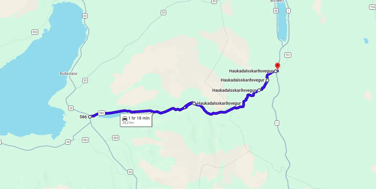
View Interactive Map
F586 advice from the local
“A normal track going over a hill. Steep on both sides. On the east side, you have to cross the same river two or three times, but this shouldn’t be a problem. More upstream the river runs in a nice but not too impressive canyon. Near the top of the hill, the river is dammed, creating a small reservoir. On the west side of the hill, you only have to cross one small river. There is an impressive rock face near the end of F586. The biggest attraction of Haukadalur is Eiriksstaðir, a replica of a Viking house, where a guy in a Viking costume will show you around.”
Not sure what type of car to choose? Feel free to read how to choose a proper car or how to pick the best Icelandic car rental insurance. We also collaborate with Icelandic car rental companies to give you a discount and us a small commission at no extra cost to you.
F586 video drive-through
F649 – Ófeigsfjarðarvegur
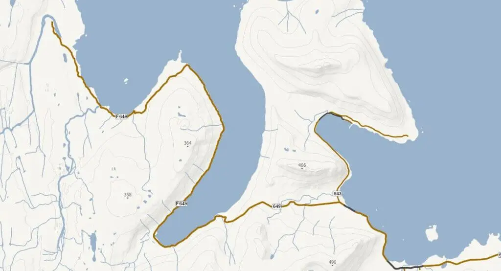
View Interactive Map
F649 advice from the local
“649 starts at Strandavegur (643) and goes over a mountain towards a fjord named Ingólfsfjörður. After descending the mountain, the road passes through Eyri, a small village that has a huge deserted herring factory and some houses used as summer homes. It’s after the factory when 649 becomes F649 and the road conditions get much more rougher and bumpier. Driving along the coastline we passed through a farm and eventually arrived next to the Húsá river. It’s worth mentioning that it is possible to ford Húsá river and carry on for a few more km and end up at Hvalárfoss waterfall, which marks the end of F649. But since we had problems with our car’s 4WD system, I decided not to risk it this time with the river crossing. So, we just turned around and drove all the way back to Strandavegur.
I’d say F649 is a very special road since it’s so isolated and far away from everything. As mentioned earlier, it creates a feeling that you are driving towards some kind of an end. And in a way, you also experience a sense of ending when you pass the abandoned factory, which has been like that since 1952. That being said, there was actually surprisingly much traffic on that day. :)”
F649 video drive-through
F734 – Svörtutungur / old Kjölur
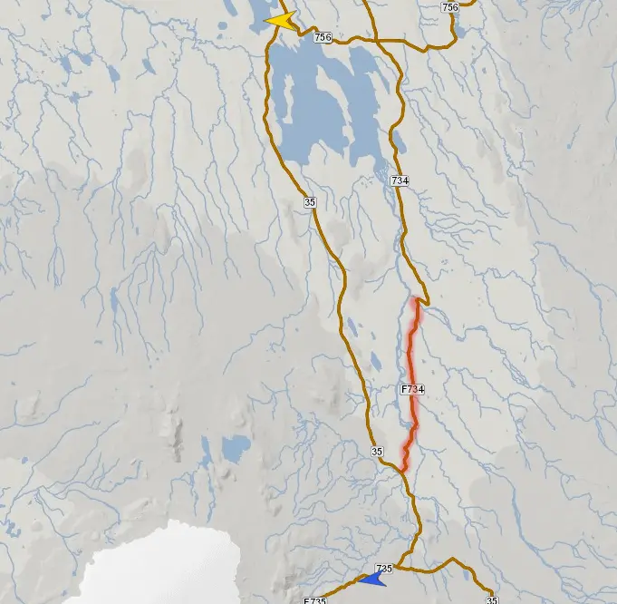
View Interactive Map
F734 is a dangerous alternative to normal Kjölur (road 35). An area around F734 is completely uninhabited and the road is a very scarcely driven one. That means rough and unmaintained.
Is there a river crossing on F734?
There are two big river crossings – the rivers of Svartakvisl and Blandá. We are talking about 80cm and more in terms of the depth of the ford. Can be easily more than 1 meter. On top of that – strong current and big rocks. Don’t go alone! And very carefully check the conditions!
What car do I need for F734?
Only and only a super jeep can survive here.
Not sure what type of car to choose? Feel free to read how to choose a proper car or how to pick the best Icelandic car rental insurance. We also collaborate with Icelandic car rental companies to give you a discount and us a small commission at no extra cost to you.
F735 – Þjófadalavegur
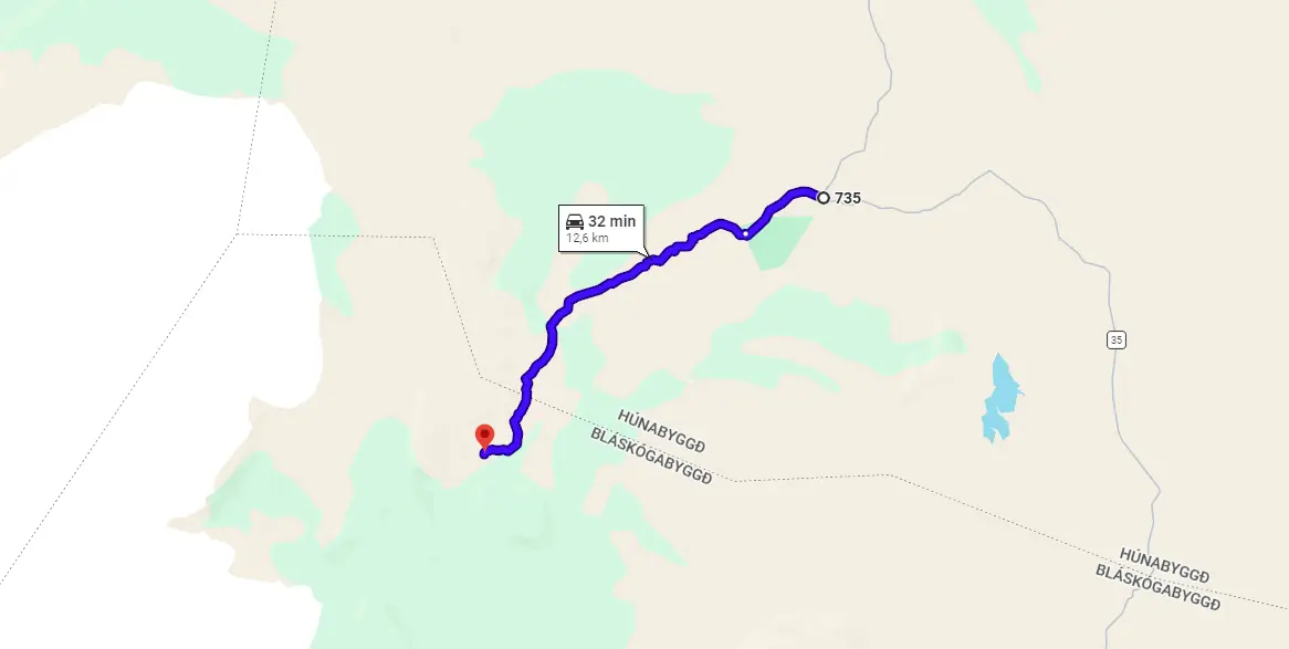
View Interactive Map
F735 advice from the local
“This is the road to Hveravellir, which is a must-go when you travel the Kjölur route. The track continues to the cabin at þjófadalir. I did this track but returned halfway because the scenery was not interesting enough. There is a track going up the mountain on the right (Oddnýjarhnúkur) which may give a good view of the Langjökull glacier which is behind it. No streams to cross on this track.”
F752 – Skagafjarðarleið
View Interactive Map
F752 advice from the local
“One of the three roads from the north to the Sprengisandur. And IMO the second most interesting after the F881 (from Akureyri) but before the F26. It has one major obstacle, near Laugafell you have to cross a big glacial river, the Hnjúkskvísl. There are also several freshwater rivers to cross, but these should be minor problems. Not many highlights on this road. Of course, Laugafell has an excellent thermal pool. The east part of F752 is rather desolate but sometimes has a good view of the Hofsjökull glacier. After a steep descent with sharp curves, you are in a green river valley between mountains, where it continues as road 752.”
F752 Skagafjardarleid south of Laugafell
Another: “As usual, it’s a lonely unpaved road, offering beautiful views and lunar landscapes. It also has some streams and two pretty wide unbridged rivers, that need fording. They weren’t too deep when were crossing them, but they can be depending on the weather conditions.”
Not sure what type of car to choose? Feel free to read how to choose a proper car or how to pick the best Icelandic car rental insurance. We also collaborate with Icelandic car rental companies to give you a discount and us a small commission at no extra cost to you.
F752 video drive-through
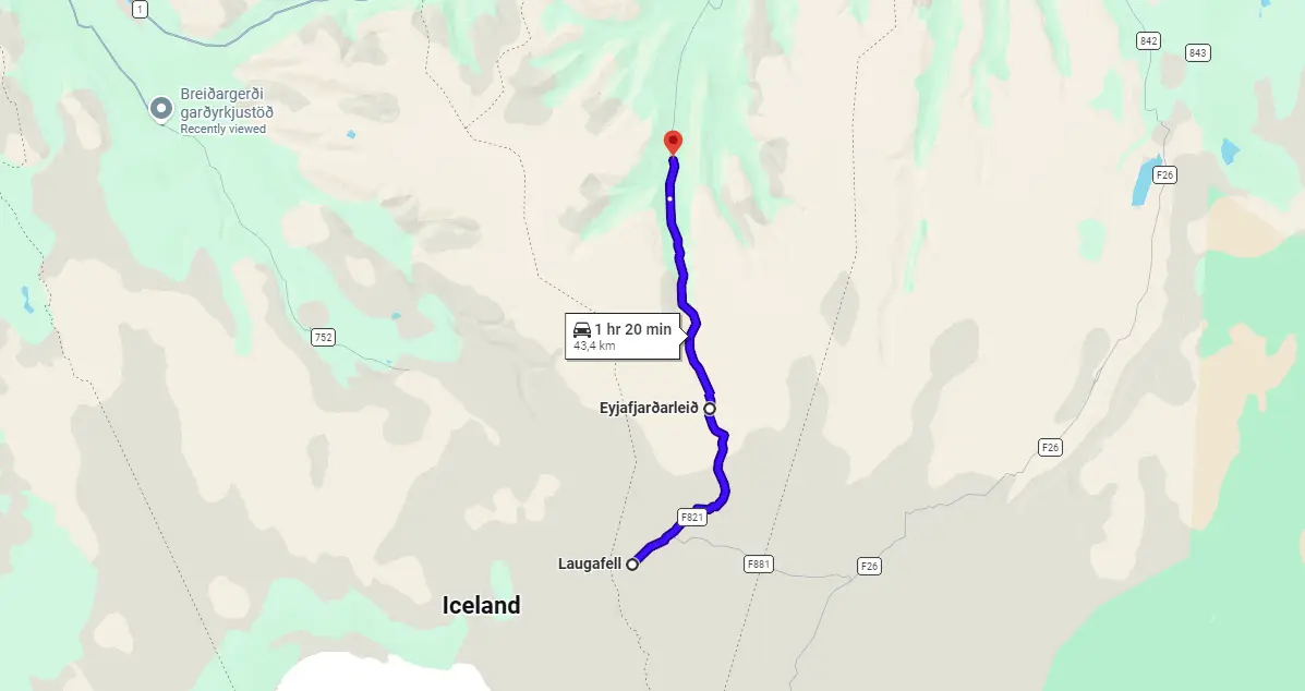
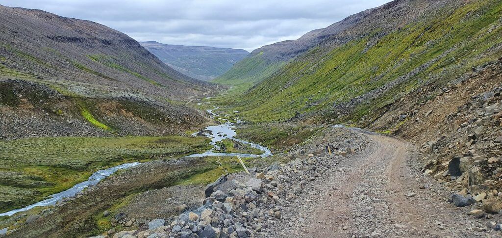
F821 – Eyjafjarðarleið
View Interactive Map
F821 is another spectacular Icelandic F-road located in the north of Iceland. It starts from Hólsgerði farm and heads south until it reaches Laugafell mountain hut. It’s pretty rough, having big potholes and rocks on the road.
Is there a river crossing on F821?
Yes, there are some small river crossings on F821, Eyjafjarðarleið. No serious or big river crossing, though.
What car do I need for F821?
F821 is theoretically passable by any 4wd car. We were more than happy, however, to have our big Land Cruiser with enough ground clearance and enough horsepower in case of the car got stuck or in case of meeting another car.
Rivers are not a big issue with Eyjafjarðarleið, the steep terrain is, however. There were some scary spots where a bigger car with high-enough undercarriage came in very handy. I would recommend renting a Land Cruiser-like vehicle for peace of mind.
Choose your car wisely when driving steep and rough F-roads. Feel free to read how to choose a proper car or how to pick the best Icelandic car rental insurance. We also collaborate with Icelandic car rental companies to give you a discount and us a small commission at no extra cost to you.
F821 Eyjafjardarleid
F821 advice from the local
“It doesn’t have any huge unbridged rivers, just a couple of streams. F821 runs through a valley and then climbs from sea level up to 926 meters (3037 ft). The twisty and narrow section climbing up was very exciting and memorable. The trail ends with Laugafell mountain hut, which has a natural geothermal hot spring.
We took this road on the 5th of September 2020 and a day before that there had been an unexpected spontaneous snowstorm in that area, especially more in the center part of Iceland. Luckily, the following day was clear and warm and the sun had been melting a lot of snow by the time we got there. That’s the reason why the trail was quite wet in the beginning and after the elevation, there was quite a bit of snow still on the road. A good example of how Icelandic weather can be unpredictable and change the conditions very quickly.”
F821 video drive-through
F839 – Leirdalsheiðarvegur
View Interactive Map
F839, in Icelandic Leirdalsheiðarvegur, is one of the two roads in the Northern Highlands leading to the sea, next to Flatey island and close to Akureyri’s fjord – Eyjafjörður. It’s a beautiful valley drive with sea views in the distance. We wrote in detail about driving F839 (Leirdalsheiðarvegur) in our article.
Is there a river crossing on F839?
Yes, there are some small to medium-sized river crossings on F839, Leirdalsheiðarvegur. No serious or big river crossing, though.
What car do I need for F839?
We recommend taking at least a medium-sized 4wd/SUV. There are river crossings on the road that require some ground clearance. If weather conditions are really good, also a small 4wd car should be sufficient. To be sure, we would use a bigger one though. We drove the road in Land Cruiser.
Not sure what type of car to choose? Feel free to read how to choose a proper car or how to pick the best Icelandic car rental insurance. We also collaborate with Icelandic car rental companies to give you a discount and us a small commission at no extra cost to you.
F839 – Leirdalsheiðarvegur
F839 advice from the local
“F839 is interesting… It often doesn’t open until late July or early August. It’s only about a 45-minute drive to the sea where you have an exceptional view and a legal but extremely primitive camping site. Great fishing at the mouth of the lake for a reasonable fee (ISK 6000). This road can be done in any reasonable SUV with +20cm clearance loaded.”
Another: “F839 is a bit shorter than F899, being 27 km (16,7 miles) long (while the F899 is 34 km / 21 miles long). It has a few unbridged rivers (or streams) that need crossing, but for me, the highlight of F839 is in the middle where there is a steep descent following a tight bridge and then ascent back up. Maybe it’s also worth mentioning that near the end of the road, we encountered some trail damage, and driving through that small section needed more caution. We did this trail at the end of September, so we were rewarded with beautiful autumn-coloured scenery. “
F839 video drive-through
F843 – Dyngjufjöll
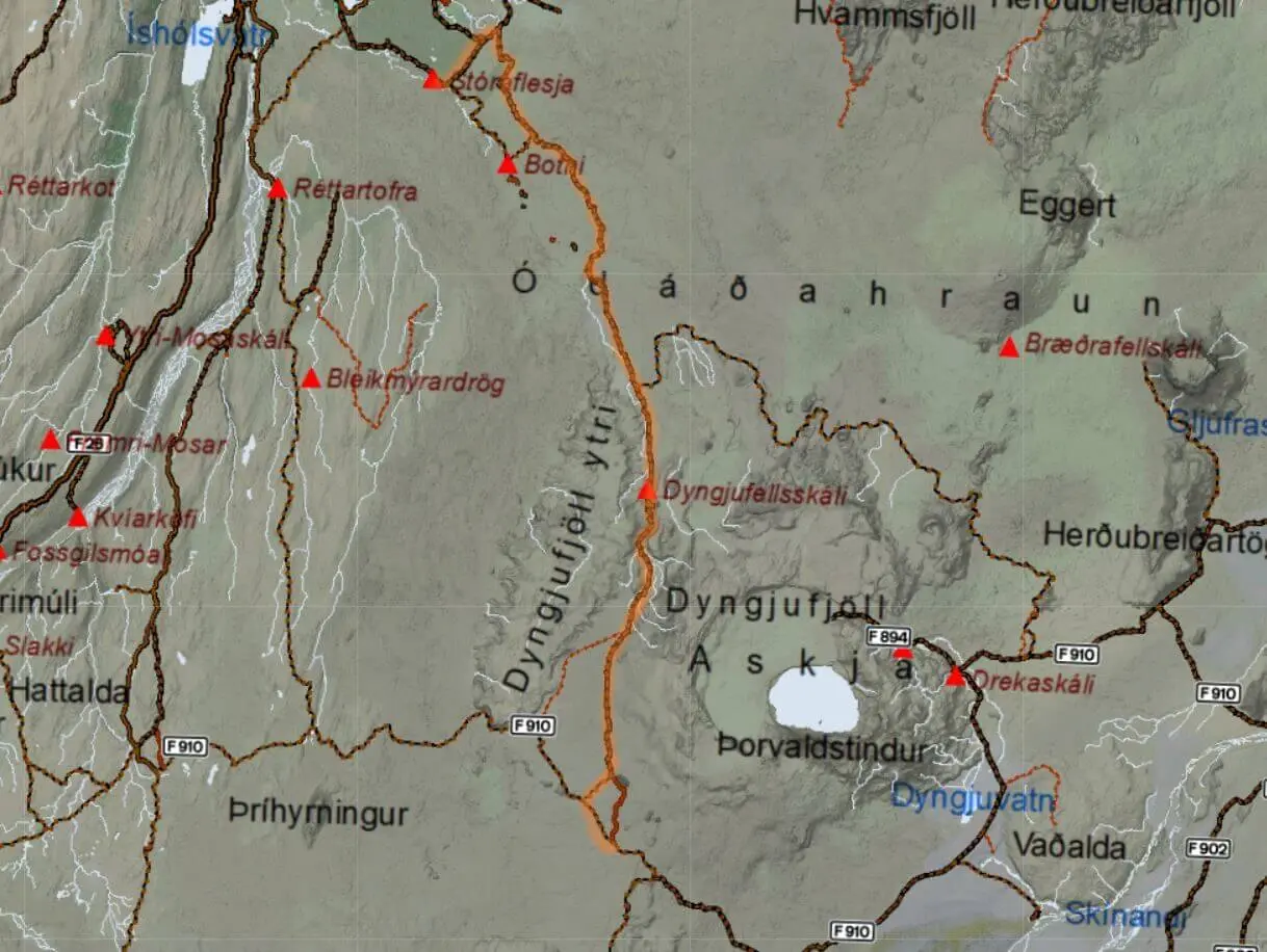
View Interactive Map
F843 is a totally deserted, rough, and unmaintained F-road. You won’t even find it on many maps. F843 leads west of the Dyngjufjöll mountains, hence its name. F843 is an old road connecting the Mývatn area in the north with the Askja area and with F910 in the central highlands of Iceland. The terrain is rocky and full of lava formations. The main challenge of F843 is the rough terrain and some steep sections, but mostly its remoteness.
Is there a river crossing on F843?
According to very scarce resources, there are some small to medium-sized river crossings. Rivers are not the main obstacle on this road.
What car do I need for F843?
You need a high ground clearance for crossing the lava field after Botni (thanks Volker Jungmann for pointing that out). Also, bear in mind the road connects to the central F910 which is even harder to drive on. For central F910 you definitely need a large 4×4 car and ideally a super jeep. Anything else is theoretically possible, but simply irresponsible and you may end up getting yourself stuck or injured.
We collaborate with Icelandic car rental companies to give you a discount and us a small commission at no extra cost to you.
F881 – Dragaleið

View Interactive Map
F881 is a road in the Icelandic Highlands connecting F26 and F821, located in the very heart of Iceland. It’s 18 km / 11 miles long and driving it offers a true sense of wilderness. At times it almost really feels as if you are on another planet.
Is there a river crossing on F881?
There is no river crossing on F881, Dragaleið. It’s just a rough and remote road.
What car do I need for F881?
While F881 itself is not difficult to drive and would require basically any 4wd car, don’t forget about connecting roads! All three of them – F752, F821, and F26 are much more difficult to drive, so you should choose your car according to where you will be driving next.
For roads, F821 and F26 to the north a medium-sized 4×4 car like Dacia Duster is a minimum. On the other hand, for roads F752 and F26 to the south we recommend a big 4wd car like Land Cruiser or any Icelandic super jeep to be able to pass safely in most conditions.
F881 video drive-through
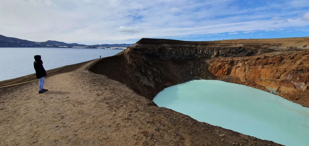
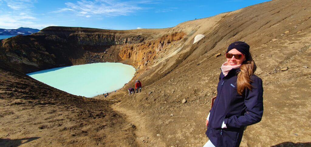
F894 – Öskjuvatnsvegur
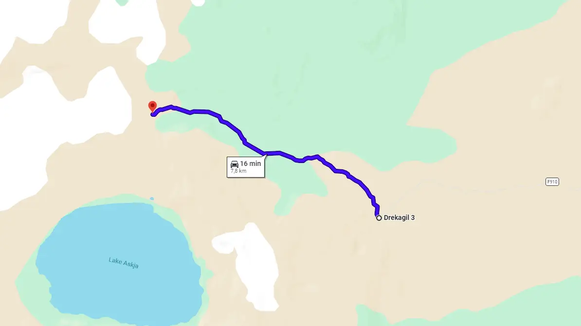
View Interactive Map
F894 is a climax of all moon-like roads leading to the amazing Askja area. It is the final section (after F905 and F910) which ends closest to the famous Viti crater. F894 is a very rough unpaved road that will shake the hell out of you but otherwise isn’t dangerous at all.
Some travelers decide to leave their car at Dreki huts and hike toward Askja afterward. Feel free to read about the details here. If you are interested in how we’ve done it, we wrote a blog about it here.
Is there a river crossing on F894?
There is no river crossing on F894. There are 2 medium-sized ones on the F910 preceding it, though, and several bigger ones also on the alternative route of the F88.
Vikraborgir car park, the closest point available on your route towards Askja/Víti crater
What car do I need for F894?
You need an SUV with sufficient ground clearance because the road is very bumpy with many big boulders being part of the terrain. By sufficient I mean at least that of a medium-sized SUV like the Dacia Duster. Alternatively, you may just drive very slowly to take care and not damage the undercarriage of your car.
Don’t forget to consider connecting roads. There are 2 medium-sized river crossings on F910 and even bigger river crossings on F88. Plan for that carefully.
Not sure what type of car to choose? Feel free to read how to choose a proper car or how to pick the best Icelandic car rental insurance. We also collaborate with Icelandic car rental companies to give you a discount and us a small commission at no extra cost to you.
F894 video drive-through
F899 – Flateyjardalsvegur

View Interactive Map
F899 or Flateyjardalsvegur, is one of the two roads in the Northern Highlands leading to the sea, next to Flatey island and close to Akureyri’s fjord – Eyjafjörður. It’s a beautiful valley drive with sea views in the distance. We wrote in detail about driving F899 (Flateyjardalsvegur) in our article.
Is there a river crossing on F899?
Yes, you have to cross several unbridged streams of small to medium sizes. There’s also one bigger river towards the end of the road, near the sea, that can be considered at a minimum a medium-sized river crossing. It can sometimes get bigger when it rains a lot.
What car do I need for F899?
We recommend taking a large 4wd/SUV, like Land Cruiser. There are river crossings on the road that require some ground clearance, especially the last one. If weather conditions are really good, also a medium-sized 4wd car should be sufficient. To be sure, we would use a bigger one though. We drove the road in Land Cruiser.
Not sure what type of car to choose? Feel free to read how to choose a proper car or how to pick the best Icelandic car rental insurance. We also collaborate with Icelandic car rental companies to give you a discount and us a small commission at no extra cost to you.
F899 Flateyjardalsvegur
F899 advice from the local
“You would say this track would be comparable with F839. But there is no steep climb in the beginning, and no summer houses, and it looked more deserted. But like F839 it is a river valley between beautiful mountains. Along the track were several signs pointing to deserted or disappeared farms. Halfway through the track is a mountain cabin, and near the end, another was under construction. Near the beach, there was a toilet house. There are numerous rivers to cross, but I don’t remember any that would be a problem with a decent SUV.”
Another: “F899 isn’t as rugged as some other F-roads, however, it still has numerous streams and unbridged rivers that need to be crossed, even though none of the rivers were super deep when we did this trip. Nature was very beautiful and green, offering stunning views. At the end of the trail, there is a sandy beach section that might be problematic for some vehicles. A small island, called Flatey, is also seen from the end of the trail. There is also a campsite (just before the sandy part) that has a flush toilet and running fresh water.”
F899 video drive-through
F902 – Kverkfjallaleið
View Interactive Map
F902 advice from the local
“Did this with a tour group, and only remember that the track was quite sandy. Kverkfjöll is an impressive hot spring area on top of the glacier. But very difficult to reach, because it requires a few hundred meters of steep climbing on the glacier. A hike from the cabin at the foot of the glacier to the spring area and back will take a full day. There are guided tours that start at the cabin.”
F902 video drive-through
F903 – Hvannalindavegur
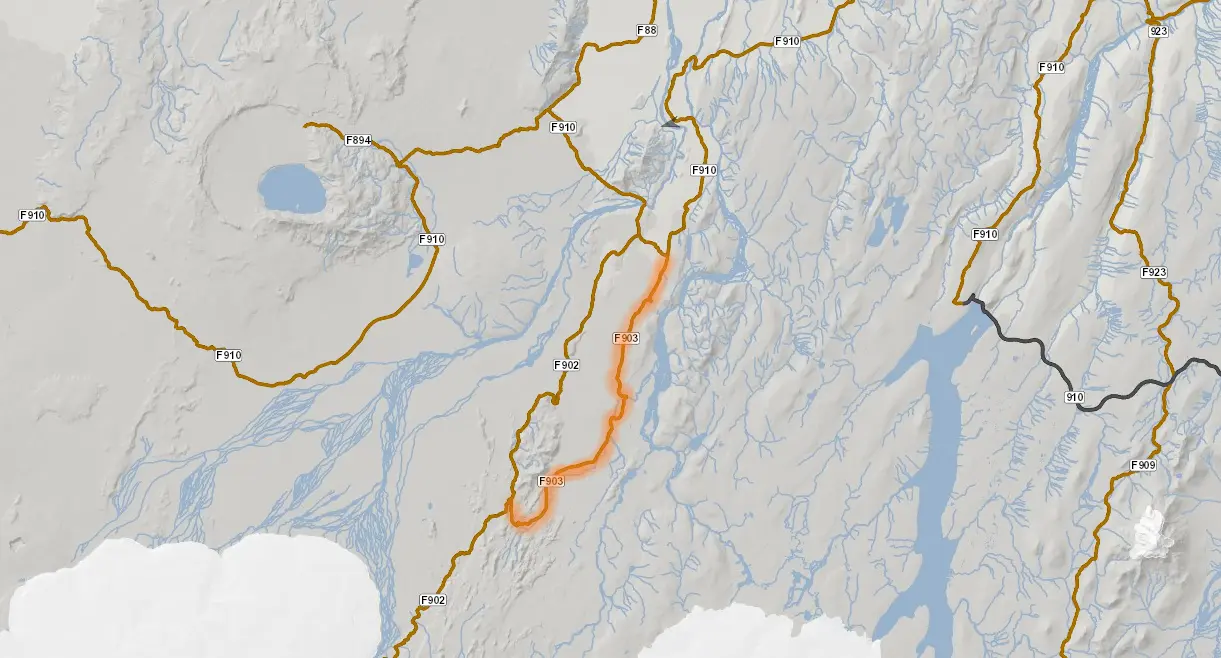
View Interactive Map
No, you won’t find this road at its full length on Google Maps. You need to look at more local maps.
F903 advice from the local
“Compared to some other Icelandic Highland roads, F903 is pretty sandy. I personally loved the rocky section of the trail, which is just before the first river crossing. F903 has two unbridged river crossings, both over the Lindaá river. In the middle of the trail after the second river crossing is a small oasis, called Hvannalindir.”
F903 video drive-through
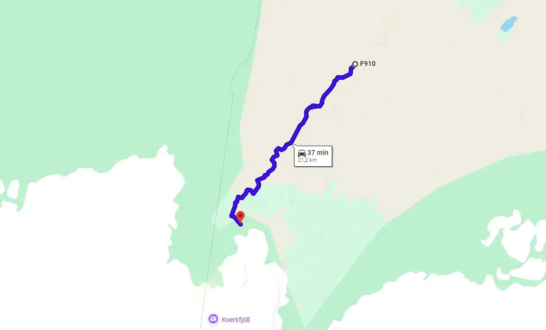
F905 – Arnardalsleið
View Interactive Map
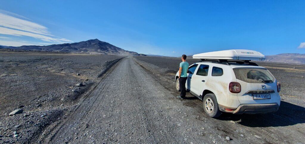
F905 is the first in the series of F-roads leading to the amazing Askja area. Compared to the main alternative – F88 – the road F905 (and F910) to Askja is longer, more versatile and I would say more beautiful. F905 stretches through the most beautiful and out-of-this-world Icelandic landscapes and I more than just recommend you take it. It’s once in a lifetime experience. The terrain is rough (see more below), but it’s worth the drive.
Gravel, clay, rocks, sand, sulfur – anything you can imagine, all of this surrounded by unforgettable views of the volcanic hills around. This is F905.
Should you take F88 from the north or F905 from the east to reach Askja? Long story short, If you are a river crossing beginner and if you want to take the more scenic route, then F905 is a better choice. On the other hand, if you are well experienced in Icelandic river crossings, then F88 will be quicker and with easier terrain.
You need a proper car for both alternatives, though. We wrote in detail here about our Askja experience with driving on the moon-like F-roads leading to Askja.
Is there a river crossing on F905?
There are no major river crossings on F905, only ponds, and small rivers. There are 2 significant medium-sized river crossings on the following F910, though. Follow the river crossing principles to succeed.
F905 coming from Möðrudalsleið, towards Askja
What car do I need for F905?
Specifically for F905, you would be fine with any 4wd car. BUT, don’t forget about the connecting roads, especially F910. As I mentioned, it contains medium-sized river crossings which require you to drive at least a medium-sized SUV to be more sure to cross.
F905 is a versatile F-road with all kinds of terrain you can imagine. It’s also bumpy and possesses many potholes so take care when driving it.
Not sure what type of car to choose? Feel free to read how to choose a proper car or how to pick the best Icelandic car rental insurance. We also collaborate with Icelandic car rental companies to give you a discount and us a small commission at no extra cost to you.
F905 video drive-through
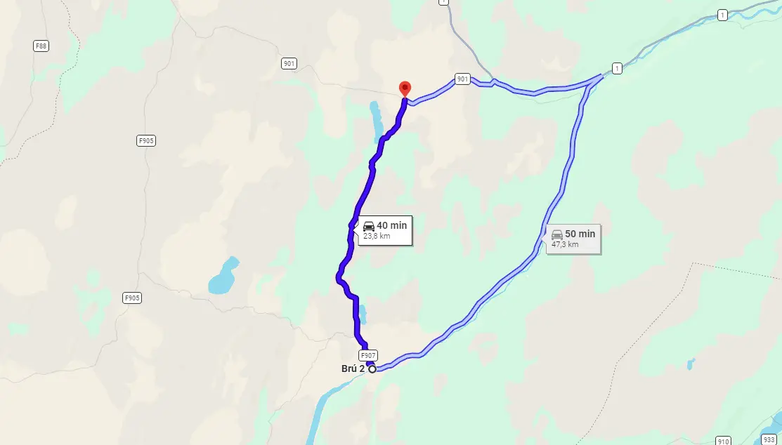
F907
View Interactive Map
F907 has been reclassified to just “907” in recent years, due to road improvements. Still, Google Maps mark it as F907.
F907 connects Modrudalsleid in the north with Austurleid and Jokuldalsvegur in the south. We used F907 to traverse from Askja towards Studlagil canyon.
Is there a river crossing on F907?
We drove only a short section of F907 from the crossroads with Austurleid in the west to Jokuldalsvegur in the south. This section had only some small ponds to cross. I’ll write a detailed guide once I drive the entire F907.
What car do I need for F907?
For the short section we drove, any 4wd car would be sufficient. Bear in mind though, you’re gonna be probably continuing on the more difficult roads like F910 where medium-sized river crossings are present. For those, you need a medium-sized SUV.
F909 – Snæfellsleið
View Interactive Map
F909 advice from the local
“Coming from the north you first get three smaller glacial rivers. Before you get to the mountain cabin, there is another, much wider one. The road itself was easy to ride, at least on my bike. From the cabin, I did a day hike following the valley west and later south of Mount Snæfell and was rewarded with a great view of the valley east of the mountain. Another popular hike is to go to the top of Snæfell. You can ask the warden at the cabin for directions. After the cabin, the road continues as a bumpy track to the Brúarjökull glacier. At that point, the glacier is not very steep, and you can easily set some foot on it.”
F909 video drive-through
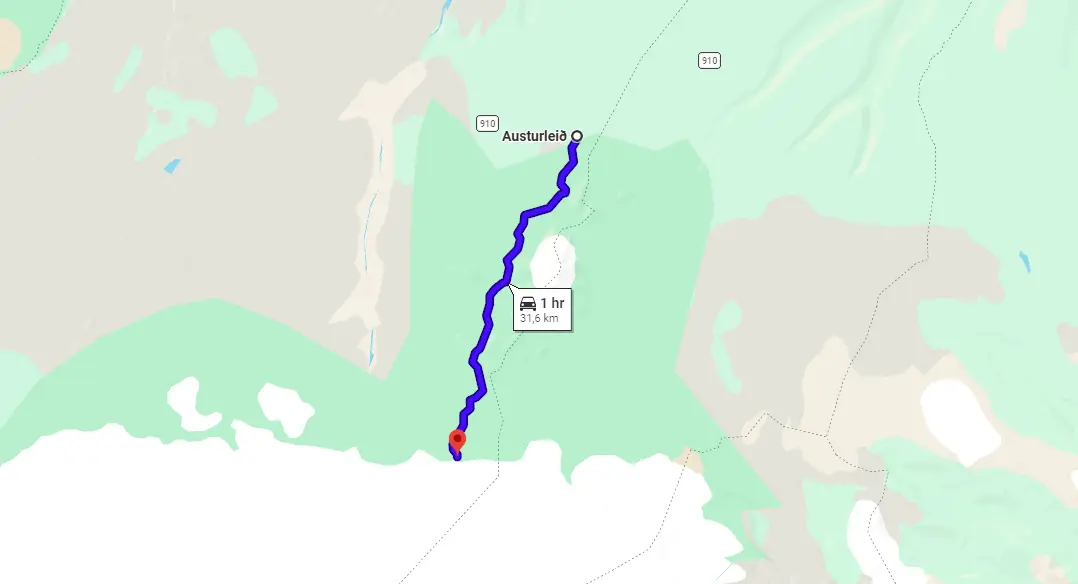
F910 – Austurleið – east
View Interactive Map
F910 is the road you cannot avoid when visiting Askja. F910 connects both F905 and F88 with the main Askja area. It’s a breathtaking F-road with magnificent landscapes along the road. Driving on F910 is an integral part of the entire Askja adventure.
One important fact – 99% of visitors drive only a small part of Austurleið – the part leading to Askja. However, F910 also continues a long way through central highlands all the way to F26 and Nyidalur in the west:
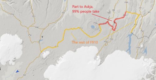
F910 Austurleið full length
This is a very deserted part of Iceland, we cover it below as F910 – Dyngjufjallaleið – west. In this paragraph, we cover only the part of the F910 leading to Askja from the east.
So – if heading to Askja – be prepared for your Askja venture responsibly. It’s neither an easy drive nor the short one. Bring enough food and water, tank enough fuel, and plan your journey in advance. Study guidelines for driving F-roads and crossing rivers carefully.
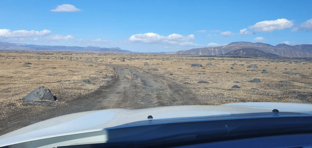
F910 towards Askja
Is there a river crossing on F910?
Yes, there are 2 major medium-sized river crossings on F910. They are manageable, just check the weather and road conditions thoroughly before departure and follow precautionary safety guidelines on the Icelandic Safe Travel website.
We’ve also put together a detailed guide on how to succeed with river crossings on your own.
If you are interested in specific details about river crossings to be found on F910, we wrote about them in detail here.
What car do I need for F910?
There are medium-sized river crossings on F910, hence you need preferably at least a medium-sized 4wd car. “Can we do it in a Suzuki Jimny?”, yes you can try and you may succeed, but you may also not. Jimny is considered to be a small-sized SUV, which, when driven in the right way and in good weather may be enough. It may also not be enough if the opposite is the case.
If you want to be sure, better opt for a larger car. Not sure what type of car to choose? Feel free to read how to choose a proper car or how to pick the best Icelandic car rental insurance. We also collaborate with Icelandic car rental companies to give you a discount and us a small commission at no extra cost to you.
F910 video drive-through
F910 – Dyngjufjallaleið – west

View Interactive Map
Fascinating, remote, moon-like F-road. That’s F910 between Nyidalur and Askja. A typical Icelandic visitor will never drive this road, nor hear about this road, central F910 is simply too far off. Everybody knows about F910 East leading to Askja only.
Remoteness is the main reason why someone decides to take the road, but also the main danger. The terrain of Dyngjufjallaleið is very rough and any help is very far away. Prepare well and choose your car wisely, or don’t drive this road.
Is there a river crossing on F910 West?
Yes, there are several medium river crossings on central F910 connecting Dreki (Askja) and Nyidalur (F26). The biggest river crossing is located about 30 minutes of drive from Nyidalur and can be considered a medium-to-big river crossing. You need to come equipped with a large enough car, with some river crossing experience, and ideally after a dry period.
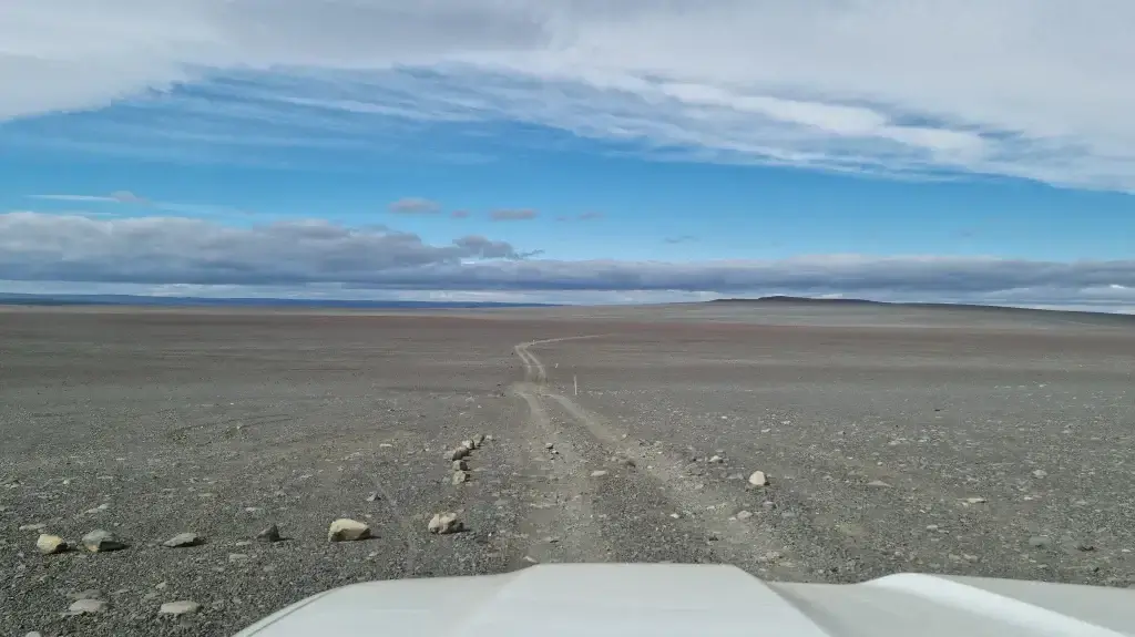
A drive through F910 from Nyidalur to Askja
You can read about our river crossing experience of central F910 in our article about Central Highlands (upcoming). For a video of all river crossings, see below. Just a word of caution, the video was shot at the end of July, over a very dry period.
What car do I need for F910 West?
You need a big 4×4 car, such as Land Cruiser, at minimum. We, however, better recommend driving a super jeep with high ground clearance.
Beware, there are medium-to-big river crossings, very rough terrain requiring high ground clearance (Land Cruiser minimum), and any help will be very far away in each direction. Don’t risk it with a smaller car, you may end up crying alone being stuck in the center of Iceland.
Not sure what type of car to choose? Feel free to read how to choose a proper car or how to pick the best Icelandic car rental insurance. We also collaborate with Icelandic car rental companies to give you a discount and us a small commission at no extra cost to you.
F910 West video drive-through
F923 – Jökuldalsvegur
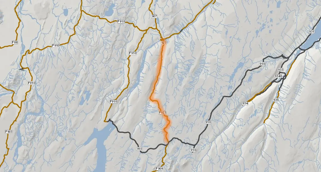
View Interactive Map
No, you won’t find this road at its full length on Google Maps. You need to look at more local maps.
F923 advice from the local
“It turns into an F-road after the last farm and straight away there is quite a wide unbridged river that needs to be forded in order to carry on. There is a second river crossing also, but that one is located a little bit before the end of the road. Eventually, F923 ends with merging into road 910. We did this trip at the end of September and some parts of the road were already covered by quite a bit of snow.”
F923 video drive-through
F936 – Þórdalsheiðarvegur
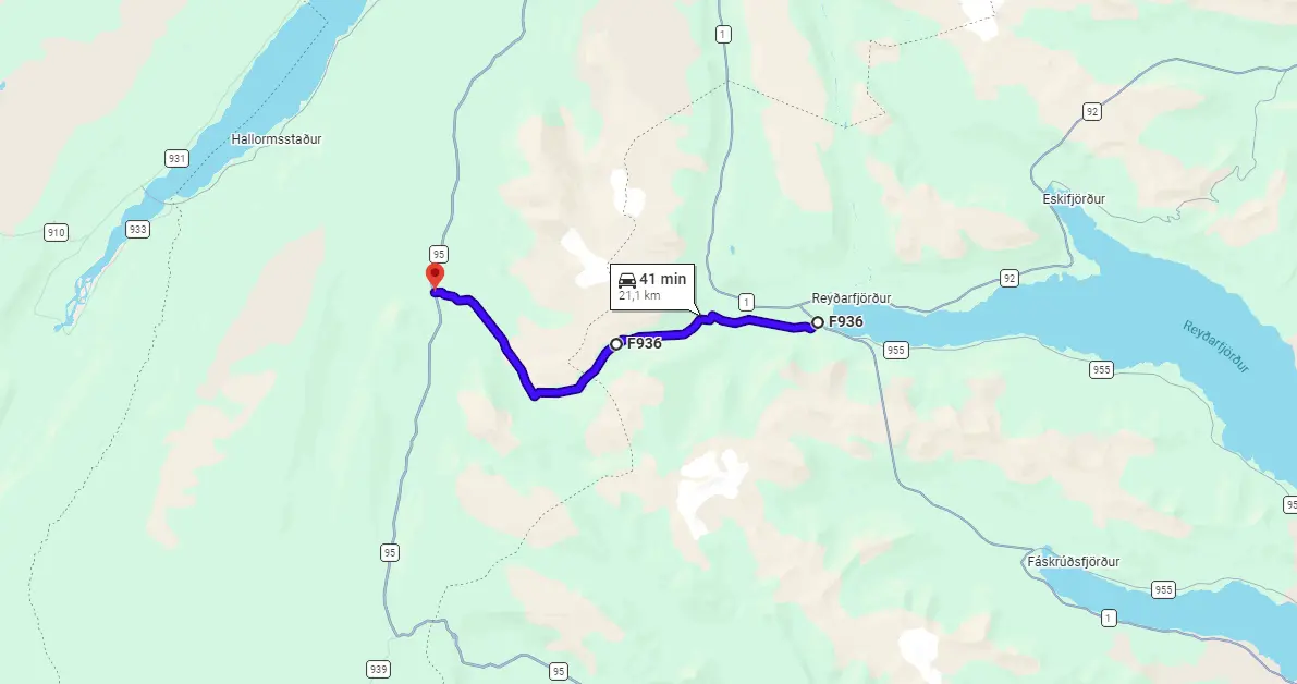
View Interactive Map
Road F936 (in some maps already marked as only 936), Þórdalsheiðarvegur, is an F-road leading along the power lines through a green and stony mountainous valley. Technically, F936 is kind of a “shortcut” from Fjarðabyggð in the east to Road 95 in the west. F936 is pretty rough, however, so it’s doubtful whether it’s really a shortcut. For F-road lovers, Þórdalsheiðarvegur is a nice route to take, though.
We wrote in detail about our drive via F936 in our article about the southeastern Icelandic Highlands.
Fun fact from our reader: “All those power lines go from Kárahnjúkar dam to Alcoa Fjardáal aluminum smelting company that consumes five times more power per day than capital city Reykjavik. And this road is basically just a service road for them”.
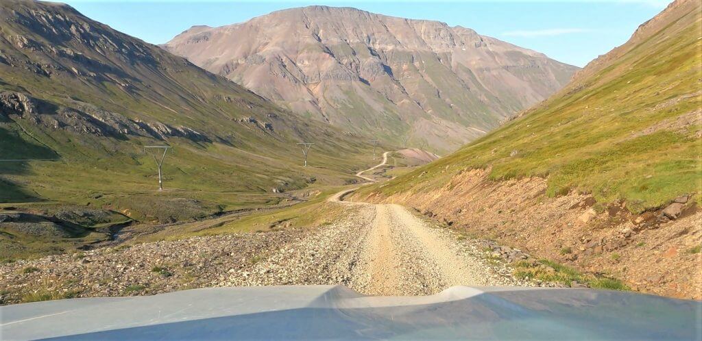
F936 (or 936 already) – Thordalsheidarvegur
Is there a river crossing on road F936?
There’s no river crossing on F936. However, be prepared for steep, rough, and narrow roads leading through a mountainous area.
What car do I need for road F936?
Although it’s possible to drive F936 in good weather in any 4×4 vehicle, we do recommend taking at least a medium 4×4 car. There are some really steep parts at F936. In case you meet a vehicle going in the other direction, or if you meet Mr. snow on the road, it’s much safer to have a bigger car.
We drove F936 in a super jeep and utilized our discounts for Icelandic super jeeps and large 4×4 cars.
F936 video drive-through
F946 – Loðmundarfjarðarvegur

View Interactive Map
F946, or Loðmundarfjarðarvegur, is one of the most remote roads in Eastfjord of Iceland. It leads via mountainous terrain to the hut in Loðmundarfjörður which is inhabited only seldom. The road has picturesque surroundings and is definitely worth a drive in nice weather and proper car.
The map above depicts both road 946 and F946 from Borgarfjordur Eystri up to Loðmundarfjörður hut. F946 starts roughly in the half.
Is there a river crossing on road F946?
There’s no river crossing on F946. However, be prepared for a steep, rough, and narrow road leading through a highly mountainous area.
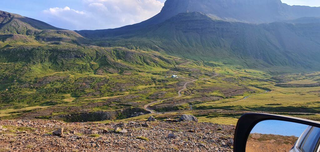
F946 Loðmundarfjarðarvegur Borgarfjörður Eystri
What car do I need for road F946?
Although it’s possible to drive the road in good weather in a medium-sized 4×4 vehicle, we do recommend taking a large 4×4 car. There are some really steep parts at F946. In case you meet a vehicle going in the other direction, or if you find snow on the road, it’s much safer to have a bigger car.
We drove F946 in a super jeep and utilized our discounts for Icelandic super jeeps and large 4×4 cars.
F946 video drive-through
F959 – Viðfjarðarvegur
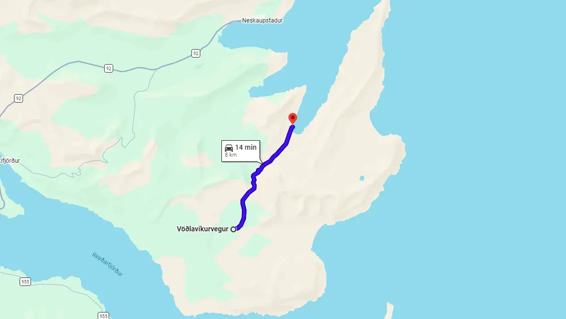
View Interactive Map
F959 or Viðfjarðarvegur is an F-road quietly hidden in Eastfjords leading to very remote Viðfjörður fjord. F959 is very scarcely driven, we drove it in a high season at the end of July and we were the only foreign car on the road. Viðfjarðarvegur is worth the drive if you enjoy remote mountain roads and lonely places where you will be completely alone surrounded just by Icelandic countryside.
Is there a river crossing on road F959?
There’s no river crossing on F959, only some small puddles and streams. The main obstacle of Viðfjarðarvegur is not rivers, but its steep, narrow, and bumpy parts. The major, the most exciting, and also the most dangerous part of the road is a drive via a narrow mountain pass with steep falls on your right and steep mountain slopes on your left (coming from the south).
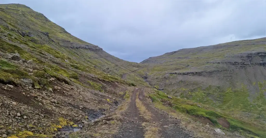
F959, Viðfjarðarvegur, leading (surprisingly) to Viðfjörður
The road is wide just enough for one car. If you meet another car, you have to think a lot to find a spot where you can both pass. This of course involves even more dangerous maneuvers of driving uphill or downhill in reverse or similar.
What car do I need for road F959?
F959 is technically passable by any 4wd car. We were more than happy, however, to have our big Land Cruiser with enough ground clearance and enough horsepower in case of a car got stuck or in case of meeting another car.
Choose your car wisely when driving steep and rough F-roads. Feel free to read how to choose a proper car or how to pick the best Icelandic car rental insurance. We also collaborate with Icelandic car rental companies to give you a discount and us a small commission at no extra cost to you.
F959 video drive-through
F980 – Kollumúlavegur
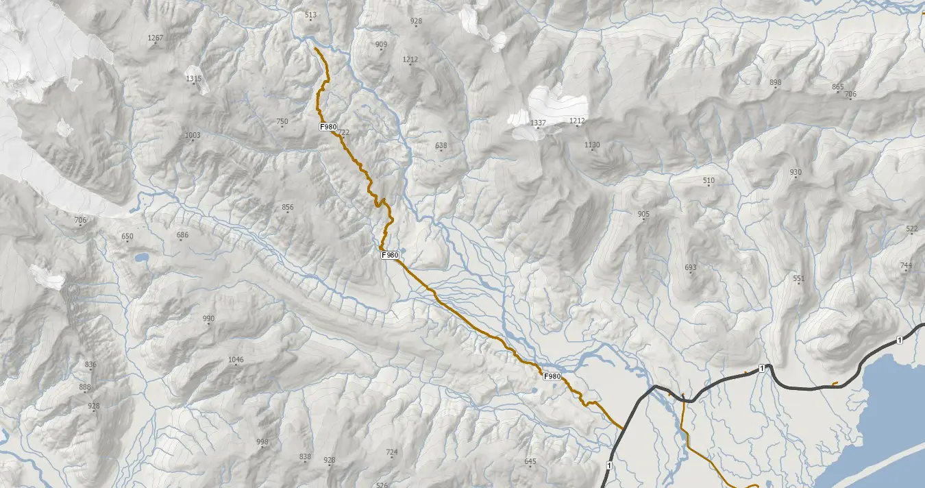
View Interactive Map
F980 is called Kollumúlavegur because it leads to Kollumúli mountain cabin in the Lónsöræfi highlands. F980 is beautiful and so are the surrounding landscapes. But the road is really dangerous due to its river crossing of the Skyndidalsá river. You may try to drive up to the river and then turn back. Never drive alone through the river. You may end up like this.
Is there a river crossing on road F980?
Yes, there are some medium-sized river crossings at all parts of F980. The major river crossing is located roughly in the middle – this is the Skyndidalsá river. This river crossing is one of the biggest in Iceland, together with Krossá on F249. Never go alone, never attempt in anything else than a super jeep, and better go with a guide.
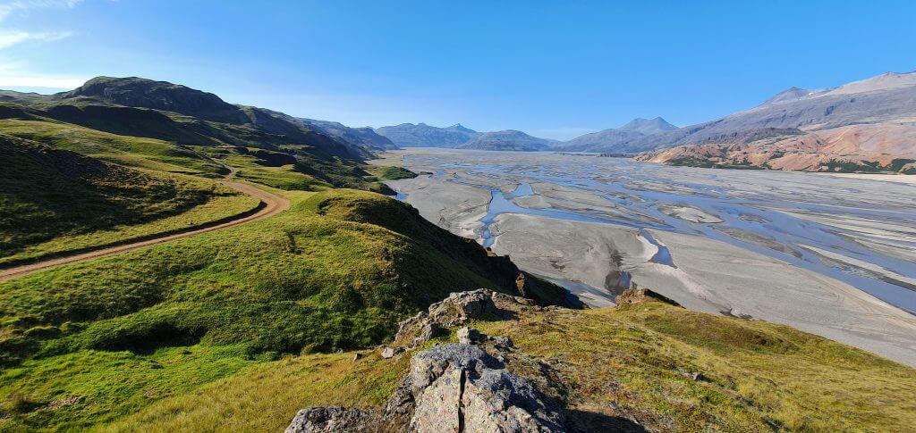
F980 Kollúmulavegur to Lónsöræfi
What car do I need for road F980?
Up to the Skyndidalsá river (roughly in the middle of F980) you should be fine with a large 4×4. If you want to cross the river, your option is only and only a super jeep + someone else crossing with you.
Not sure what type of car to choose? Feel free to read how to choose a proper car or how to pick the best Icelandic car rental insurance. We also collaborate with Icelandic car rental companies to give you a discount and us a small commission at no extra cost to you.
F980 advice from the local
“I tried to do it once by almost the end of October. No snow in low lands yet. The river was not big, doable with my Jeep Grand Cherokee 3.0 CRD, 32 inches, and snorkel. But up in the mountains, after about 20km it became more and more difficult: foggy and some snow. I could probably do it to the end but since I have never been there I did not know what to expect. The road is sometimes very narrow and on the edge of the mountain. I was thinking if somewhere I could no longer continue, it would have been difficult to even turn around. Thus, I decided to turn back.
I assume in summer I cannot cross the river because there are so many river beds with deep trenches…if full of water, difficult to get oriented and where to drive. In summer you definitely need a super jeep and someone knowing the river with close eyes. But even then, you should expect for unexpected. I heard that even very experienced local drivers in their super Jeeps ended up by being rescued. Indeed, such river is no joke at all.”
F980 video drive-through
F985 – Jökulvegur

View Interactive Map
Jökulvegur is an F-road leading to Skálafellsjökull glacier, a branch of the biggest Icelandic glacier – Vatnajökull. F985 mostly serves as an access road to the glacier. Tour companies take their jeeps with snowmobiles and transport tourists together with snowmobiles directly to the glacier via this road.
F985 has probably the biggest number of zig-zag bends out of all roads I’ve driven in Iceland. Jökulvegur will lead you to a pretty high altitude through a steep gravel road. F985 seems to be short on the map, but in reality, it felt to be quite a long drive. And the drive is not for those afraid of heights  Several parts of the road will test your guts.
We wrote in detail about our drive of F985 in our article about South-Eastern Highlands.
Is there a river crossing on road F985?
No, there are no river crossings on F985. But – the road is steep, narrow, with some pretty dangerous parts. Thus, the main threat of this road is mountain passes, not rivers.
What car do I need for road F985?
I drove F985 in our modified Land Cruiser and had no problems at all. It may be dangerous to drive all these steep ascents and rough gravel with Dacia Duster or anything smaller. Yes, it may be possible, but irresponsible. I better recommend taking a Land Cruiser or anything bigger, no shame for a super jeep.
F985 advice from the local
“We just went up F985 a couple of weeks ago on a super jeep tour. The road takes you all the way up to the station for snowmobile tours on Vatnajökull, where it ends. I saw smaller vehicles driving on the road, so it would appear that you can drive it under ‘normal’ conditions in summer, but be advised that it is narrow and windy and there is always the possibility of a HUGE truck coming around the corner at you.
The views are amazing on this road, especially as you get further up. Our super jeep guide kept going even when the road didn’t, bringing us through the snow and up onto the glacier for views across the top of Iceland. “
F985 video drive-through
214 – Kerlingardalvegur
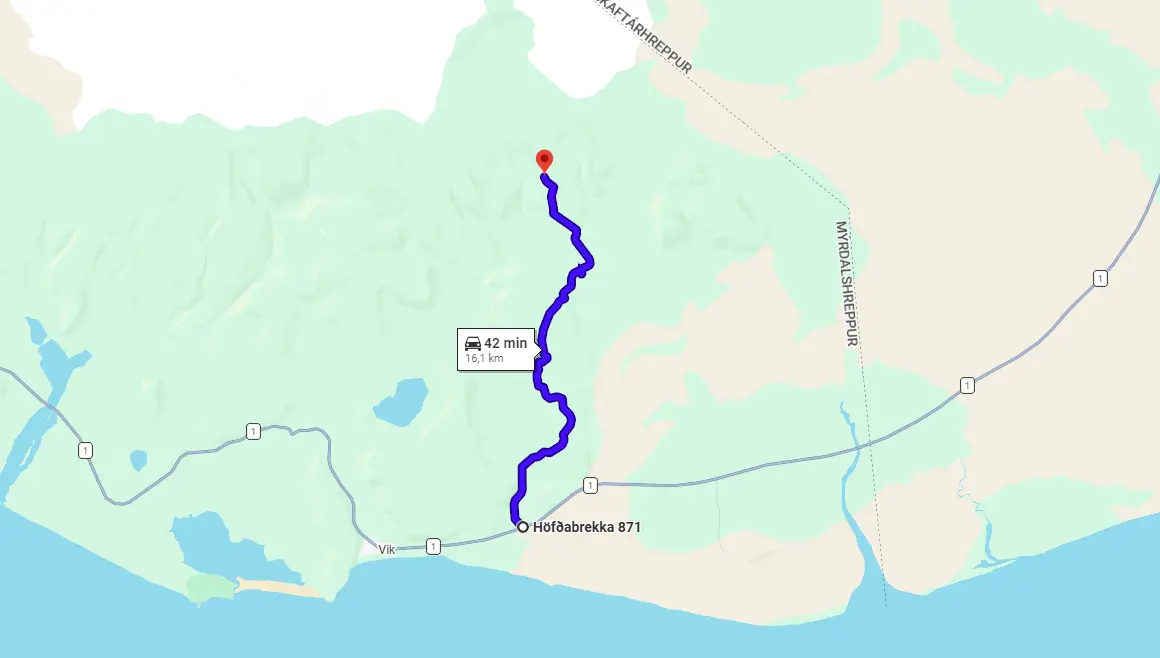
View Interactive Map
Road 214 leads to one of the most beautiful hiking areas in Iceland called Þakgil, or Thakgil. The road to Thakgil is adventurous and beautiful and would be worth driving even if you decide not to hike in the area. The surrounding landscapes form a scenic combination of lush green hills and volcanic black ash.
Is there a river crossing on Road 214?
There’s no river crossing on road 214 to Þakgil campsite. The road is just very bumpy and full of big holes.
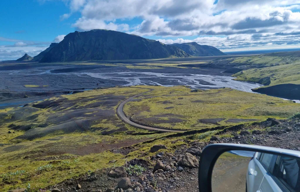
Road 214 Kerlingardalvegur to Þakgil on a beautiful sunny day.
What car do I need for Road 214?
When Road 214 is open in summer, you officially do not need any special car to drive it, any 2wd car should be sufficient. That being said, the road is so bumpy, we better recommend a car with high enough ground clearance, i.e. Dacia Duster and bigger. Small cars may struggle and need to be very careful not to scrape their bottoms.
Not sure what type of car to choose? Feel free to read how to choose a proper car or how to pick the best Icelandic car rental insurance. We also collaborate with Icelandic car rental companies to give you a discount and us a small commission at no extra cost to you.
Road 214 video drive-through
558 – Berserkjahraunsvegur

View Interactive Map
558 advice from the local
“Berserkjahraun is located on the Snæfellsnes peninsula in Western Iceland. It’s a 4000-year-old lava field and the twisty unpaved road going through it is called Berserkjahraunsvegur (558). It’s only 10.6 kilometers (6,5 miles) long but offers breathtakingly beautiful views and landscape. 558 is doable with a passenger car, even though there are some bumpy sections. “
558 video drive-through
612 – Örlygshafnarvegur
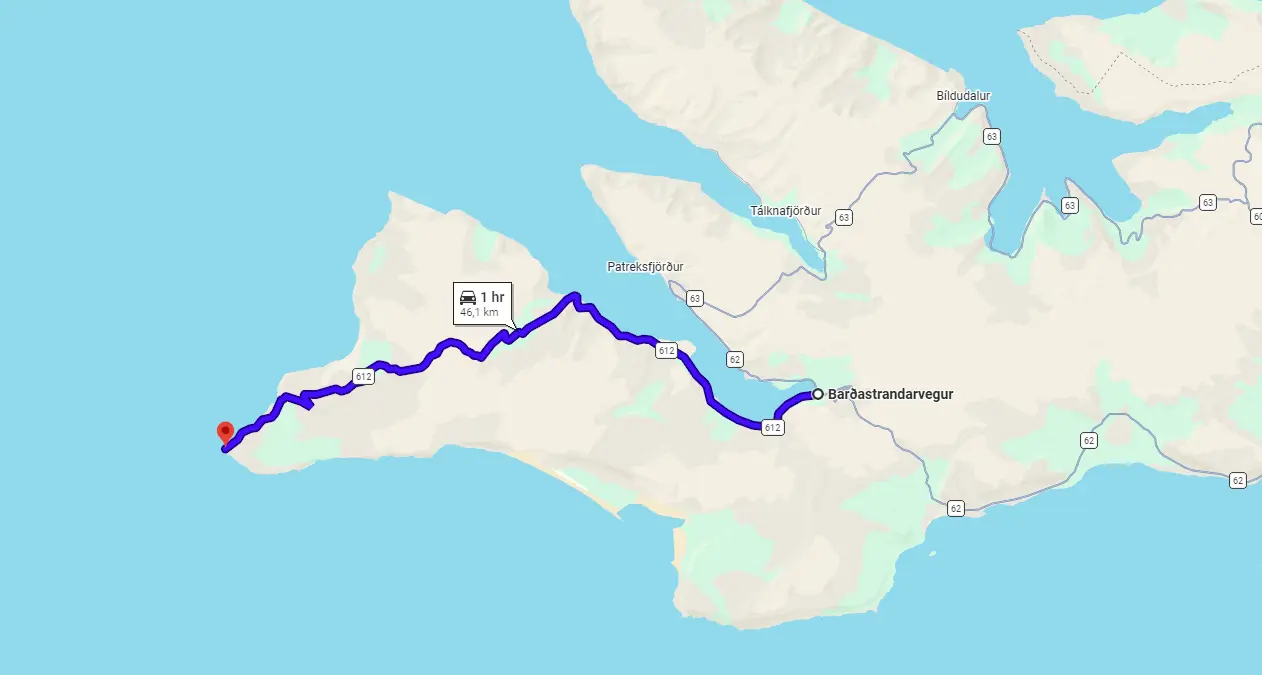
View Interactive Map
Road 612 is the scenic road that leads to the westernmost part of the entire Iceland – Látrabjarg cliffs. Road 612 is one of the most interesting roads around Iceland, find out in our Best Icelandic Landscapes article, where we write about Latrabjarg.
Is there a river crossing on road 612?
Since road 612 is officially not an F-road, it also doesn’t contain any river crossings. Other challenges are present, though.
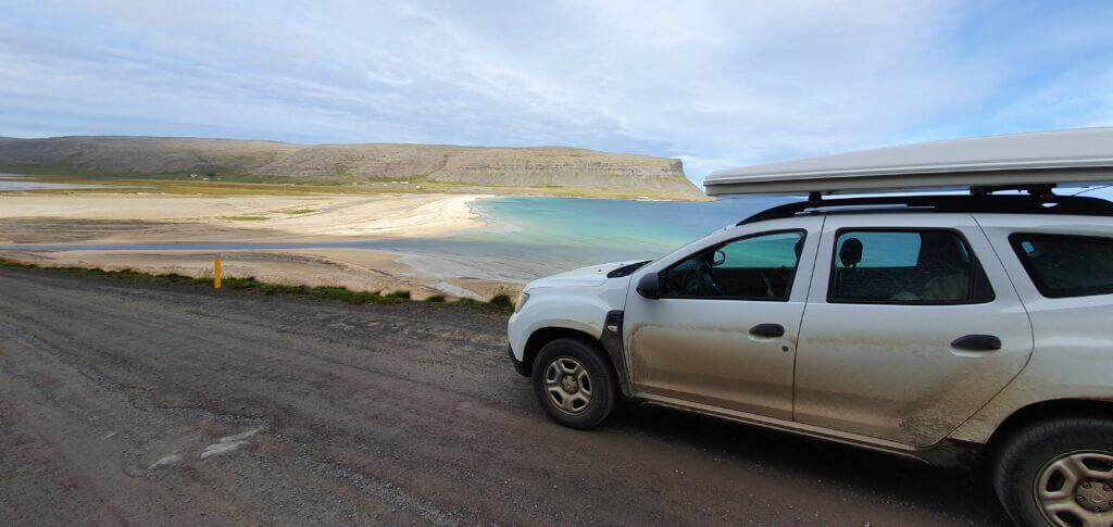
Breiðavík beach next to road 612
What car do I need for Road 612?
Officially, 612 is accessible by any 2wd car. I do recommend a 4wd though, at least a smaller one. The road eventually gets rough and you may damage the undercarriage of your car if its ground clearance isn’t big enough.
Read about our detailed experience with 612 in our South Westfjords article.
The last part of Örlygshafnarvegur is a rough, narrow gravel road with many potholes, leading across the mountainous area and sometimes even next to the coastal edge simultaneously. It’s definitely doable by any 4wd (not sure how it looks in rough weather, though). We also met several 2wd cars, but they were struggling at least. Sure, in good weather you can make the last part even with 2wd, it will just take you much longer than in 4wd and you will be probably blocking many 4wds waiting behind you.
Not sure what type of car to choose? Feel free to read how to choose a proper car or how to pick the best Icelandic car rental insurance. We also collaborate with Icelandic car rental companies to give you a discount and us a small commission at no extra cost to you.
622 – Svalvogavegur
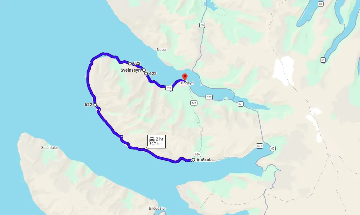
View Interactive Map
622 definitely is one of the most thrilling driving experiences that Iceland has to offer. Shelf roads through cliffs, beautiful views, and then of course the bit below the sea level. A smaller 4×4 will NOT be a good option here
622 advice from the local
“First bit of 622 is paved and in good shape, it is after a “4×4 vehicles only” warning sign when things start to get interesting. The road gets super tight and narrow, as it’s carved inside a cliff. Drive this part slowly and carefully, as it’s wide enough only for one car – having a cliff on the left and a steep drop down on the right. There is also a danger of falling rocks.
And now to the exciting part of the main attraction of the road – the sketchy bit down at sea level. First, there is a quite steep descent and the road starts to go between the sea and the cliffs. But soon it gets very narrow and sometimes we were basically kind of driving beneath the cliff, exposed to the waves crashing against the road. With a high tide, this part of the road can easily be underwater.
So, it is super important to be informed about the weather conditions while being on that road, as there is no help near and mobile connection is very limited. During our drive, the weather wasn’t the calmest and there were waves partly crashing onto the road, but we got through there in one piece. Also, this section is super rocky and bumpy and needs to be driven with extra care.”
622 video drive-through
624 – Ingjaldssandsvegur

View Interactive Map
624 advice from the local
“624 (Ingjaldssandsvegur) is a mountain road located in the northwestern part of the Westfjords region in Iceland. It starts from Highway 60 (Vestfjarðavegur), runs over a mountain, and ends up at Ingjaldssandur valley. The highest elevation of the road is 508 meters (1667 feet) and it’s passable only during the summer months.
The mountain pass is quite steep at some places, but the road is generally in good condition and shouldn’t be a problem for a simple crossover for example.”
624 video drive-through
630 – Skálavíkurvegur
View Interactive Map
630 advice from the local
“There is no winter service for 630, so the road is accessible only during the summer months. But despite being unpaved and opened only for some time during the year, the road itself is in good condition and easily accessible for simple passenger vehicles without 4WD.
A really exciting place near this route is Bolafjall Mountain, which is 635 meters (2086 ft) high. But it’s worth mentioning that weather can often be very foggy and cloudy up there and we were waiting three days for our shot, always rescheduling and aiming for the sunshine and clear sky. It’s definitely not pointless to go there when cloudy, you can still check out the Latrar Air Station and experience the tight mountain road (in that case with very poor visibility). But I’d say the views over the area are at least 60% of the experience up there.”
630 video drive-through
635 – Snæfjallastrandarvegur
View Interactive Map
635 advice from the local
“635 is unpaved, but it’s easily passable for a simple passenger vehicle (at least during the summer months!). I highly recommend stopping for a coffee break or lunch at Steinshús if you happen to be on this road. However, it’s worth mentioning that the cafe it’s not open all year round.
A track going towards Drangjökull glacier is also located in the middle of 635. You can drive on the trail until a parking spot and from there on it’s possible to hike all the way to the glacier.
A tiny cute church called Udalaskirkja is at the very end of the road. In my opinion, 635 isn’t as exciting a driving experience as road 643 for example, but it’s still a nice drive if you have some spare time to spend in Westfjords.“
635 video drive-through
643 – Strandavegur
View Interactive Map
Road 643 or Strandavegur is the only road leading to the legendary Krossneslaug hot spring. It is the terminal road of the area.
643 is a very scenic coastal drive and not an easy one. I highly recommend taking it, though because it’s a great experience. Feel free to read about our detailed experience with 643 here and in our journey diary.
Is there a river crossing on road 643?
Since road 643 is officially not an F-road, it also doesn’t contain any river crossings. Other challenges are present, though.
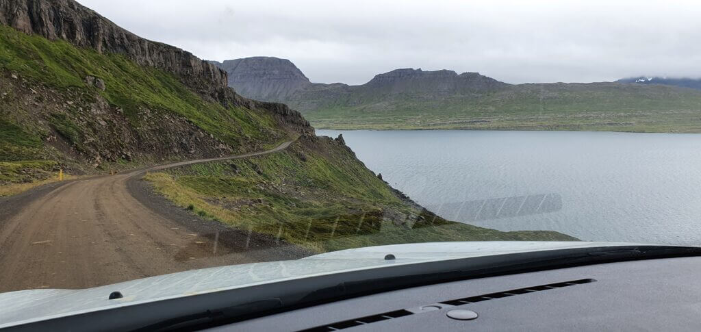
Overview of Strandavegur, a.k.a. Road 643
What car do I need for Road 643?
Road 643 heading towards Krossneslaug is definitely doable by any SUV in summer and definitely was doable by our Dacia Duster. Officially, you’re allowed to drive the road even with a normal 2wd car. However, this is one of the very few “normal” roads in Iceland, where I don’t recommend using a 2wd car. There are just too many potholes for it. Yes, you can do it also with 2wd, but take a lot of additional time. We’ve done it in about 2 hours (one way) and I would say with 2wd it’s additional 1-2 hours.
Not sure what type of car to choose? Feel free to read how to choose a proper car or how to pick the best Icelandic car rental insurance. We also collaborate with Icelandic car rental companies to give you a discount and us a small commission at no extra cost to you.
832 – Vaðlaheiðarvegur
View Interactive Map
832 advice from the local
“Vaðlaheiðarvegur is an old mountain pass over Vaðlaheiði mountain in North Iceland. There are three ways to get from Akureyri to North-East Iceland. The first one is a paid tunnel on the ring road, the second one is a combination of roads 84 and 83 and the third one is road 832.
Road 832 goes on top of the tunnel. It’s quite a fun alternative to the other options and shouldn’t be a problem to get through during the summer months. If you are afraid of mountain driving, don’t recommend it, though 🙂 It even has a small unbridged stream.”
832 video drive-through
939 – Öxi
View Interactive Map
Road 939 is a shortcut from Djupivogur towards Egilsstaðir and it’s passable only in summer.
Öxi is a quite steep mountain road with lots of turns, potholes, and beautiful scenery alongside it. Feel free to read about our detailed experience with 939 here and in our journey diary.
Is there a river crossing on road 939?
Since road 939 is officially not an F-road, it also doesn’t contain any river crossings. Other challenges are present, though.
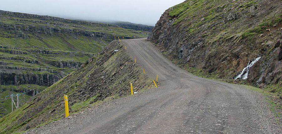
Source: https://www.dangerousroads.org/europe/iceland/6361-%C3%B6xi-pass.html
What car do I need for Road 939?
In summer, road 939 is accessible by any 2wd car. For the more comforting feeling, I would drive it with at least a small 4wd SUV, though. The road is mountainous and steep and the weather may get ugly around the area.
Not sure what type of car to choose? Feel free to read how to choose a proper car or how to pick the best Icelandic car rental insurance. We also collaborate with Icelandic car rental companies to give you a discount and us a small commission at no extra cost to you.
939 video drive-through
Austurleið next to Þríhyrningsvatn
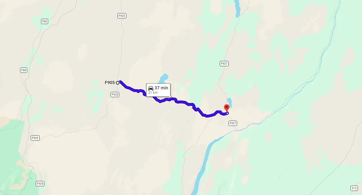
View Interactive Map
Austurleid is also the name of an entire F910 road. Here, however, I talk about the 20km long section between roads F905 and F907. We used Austurleid to traverse from Askja towards Studlagil canyon.
Is there a river crossing on Austurleið?
Austurleið by lake Þríhyrningsvatn didn’t contain any serious river crossings, just small rivers and small ponds of depth 20-30cm at max.
What car do I need for Austurleið?
Austurleid is a secluded F-road with all of the characteristics of any other general F-road – not well paved, not well maintained, potholes, gravel, but no serious river crossings. This makes Austurleid easy to pass.
Basically, any 4wd is sufficient for Austurleid. Just consider the connecting roads. If you are e.g. planning to visit Askja before or after, you will need at least a medium-sized SUV.
Feel free to read how to choose a proper car or how to pick the best Icelandic car rental insurance. We also collaborate with Icelandic car rental companies to give you a discount and us a small commission at no extra cost to you.
Bjólfur track
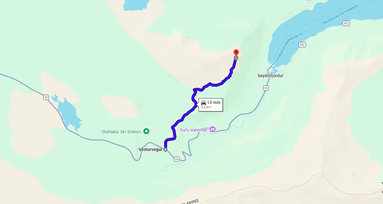
View Interactive Map
Bjólfur mountain track is a road leading close to the peak of the Bjólfur mountain with amazingly beautiful views over Seydisfjordur. The spot where Bjólfur track leads is marked on Google Maps as “Bjólfur avalanche barriers”, surprisingly, because there are avalanche barriers.
Bjólfur road is very steep and open strictly only when all the snow has melted. Bjólfur track is nothing for those with a fear of heights or small cars.
Is there a river crossing on Bjólfur track?
There’s no river crossing on Bjólfur road. However, be prepared for a steep, rough, and narrow road leading virtually directly to the top of a mountain.
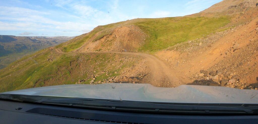
Bjolfur mountain road
What car do I need for the Bjólfur track?
Although it’s possible to drive Bjólfur track in good weather in a medium-sized 4×4 car, we do recommend taking at least a large 4×4 car. There are some really steep parts at Bjólfur track. In case you meet a vehicle going in the other direction, or if you meet mr. snow on the road, it’s much safer to have a bigger car.
We drove the track leading to Bjólfur avalanche barriers viewpoint in a super jeep and utilized our discounts for Icelandic super jeeps and large 4×4 cars.
A warning – Bjólfur track is not even an F-road, it’s just a track! You can read more about what “track” means in Iceland. In short, this means the track is even more difficult than F-roads and most car insurance packages do not cover it. Always check with your car rental company if it’s covered, otherwise, you are going at your own risk! Secondly, drive the track only if you already have experience with F-roads!
Bjólfur track video drive
Botnlangalón track
View Interactive Map
Botnlangalón track is one of the worst roads in Iceland. It’s undoubtedly the worst track we’ve driven in Iceland. The track is one of the three access roads leading to lake Langisjór. And, as the name suggests, it will first get you to the remote lake of Botnlangalón. Then, you can either turn back and drive back via the neighboring Faxasund track or finish your journey towards Langisjór in the eastern direction.
So why would anyone even bother driving this crazy track? Well, except for a guarantee to be alone in moon-like surroundings, there’s a surprise near the end of the road. A scenic drive in a river bank directly through canyon made of broken stones.
Is there a river crossing on the Botnlangalón track?
Yes, there are many river crossings throughout the track. None of them is huge, though. The biggest typically qualify as medium-sized river crossings. Beware – there’s no guarantee some crossing may become much bigger in a particular year or season!
What car do I need for the Botnlangalón track?
River crossings are not the main problem of the Botnlangalón track. Road quality is! The track is barely maintained, with huge holes, steep and uneven parts. A typical scenario involves a steep ascent combined with a hole slalom followed by “I-cannot-see-in-front-of-me” steep descent of similar quality. Take nothing less than a super jeep in here. Even our modified Land Cruiser struggled here and almost didn’t make it!
A warning – Botnlangalón track is not even an F-road, it’s just a track! You can read more about what “track” means in Iceland. In short, this means the track is even more difficult than F-roads and most car insurance packages do not cover it. Always check with your car rental company if it’s covered, otherwise, you are going at your own risk! Secondly, this track is only for very experienced drivers aware of all risks!
Botnlangalón track video drive
Emstrur track
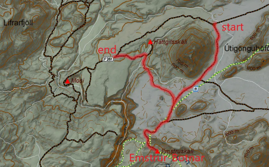
View Interactive Map
Emstrur track leads to one of the popular huts along the Laugavegur trail called Emstrur-Botnár hut (or Emstruskáli in Icelandic). Emstrur track also leads to the best (eastern) viewpoint of an amazingly beautiful Markarfljótsgljúfur Canyon. There are three branches of the track – the eastern one, the northern one, and the western one.
Here is the article where we write in detail about how we drove the Emstrur track. We drove the northern branch on our way there and a western branch on our way back. The western branch was a nightmare 🙂
Is there a river crossing on the Emstrur track?
There is no river crossing on Emstrur track. There are several other challenges, though. See below.
What car do I need for the Emstrur track?
You need a big 4×4 car, such as Land Cruiser, at minimum. We, however, better recommend driving a super jeep with high clearance. Although the Emstrur track doesn’t have any river crossings, it is steep and very uneven, with big sharp boulders every now and then. There are also pretty big holes in the road, even our modified Land Cruiser struggled at times when we drove the road.
A big warning – the Emstrur track is not even an F-road, it’s just a track! You can read more about what “track” means in Iceland. In short, this means the track is even more difficult than F-roads and most car insurance packages do not cover it. Always check with your car rental company if it’s covered, otherwise, you are going at your own risk! Secondly, drive the track only if you already have experience with F-roads!
Emstrur track video drive
Faxasund track
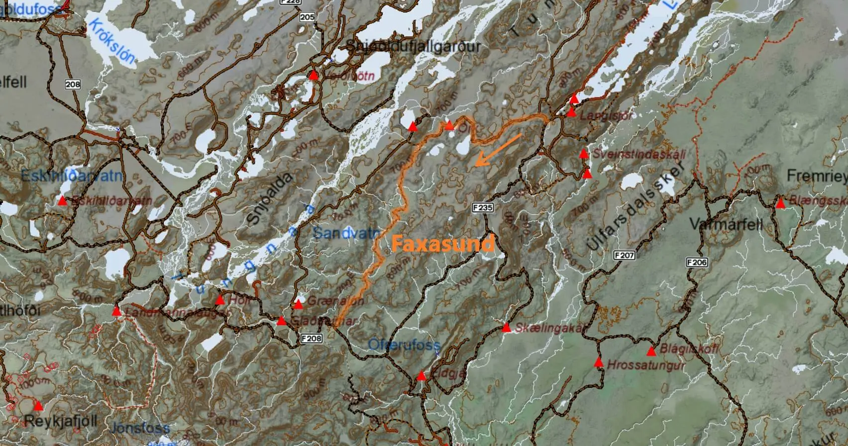
View Interactive Map
Faxasund track is the second most difficult access road leading to lake Langisjór. The main attraction of the track is its remoteness and harsh, yet fascinating, surroundings.
Is there a river crossing on the Faxasund track?
Yes, there are several river crossings along Faxasund. They typically don’t get bigger than just medium-sized river crossings, but there’s never a guarantee for this.
What car do I need for the Faxasund track?
We recommend a super jeep. A skilled driver may be able to pass with a large 4×4 like Land Cruiser or Hilux, but only in ideal conditions.
Similarly to Botnlangalón track, the main obstacle of this road is not river fords. The track terrain is the issue. The worst part of Faxasund is located near the junction with F208. It consists of thousands of sharp stones, some of them being too big to just drive on. Big ground clearance and slalom skills are required.
A warning – Faxasund track is not even an F-road, it’s just a track! You can read more about what “track” means in Iceland. In short, this means the track is even more difficult than F-roads and most car insurance packages do not cover it. Always check with your car rental company if it’s covered, otherwise, you are going at your own risk! Secondly, drive the track only if you already have experience with F-roads!
Faxasund track video drive
Gígjökull track
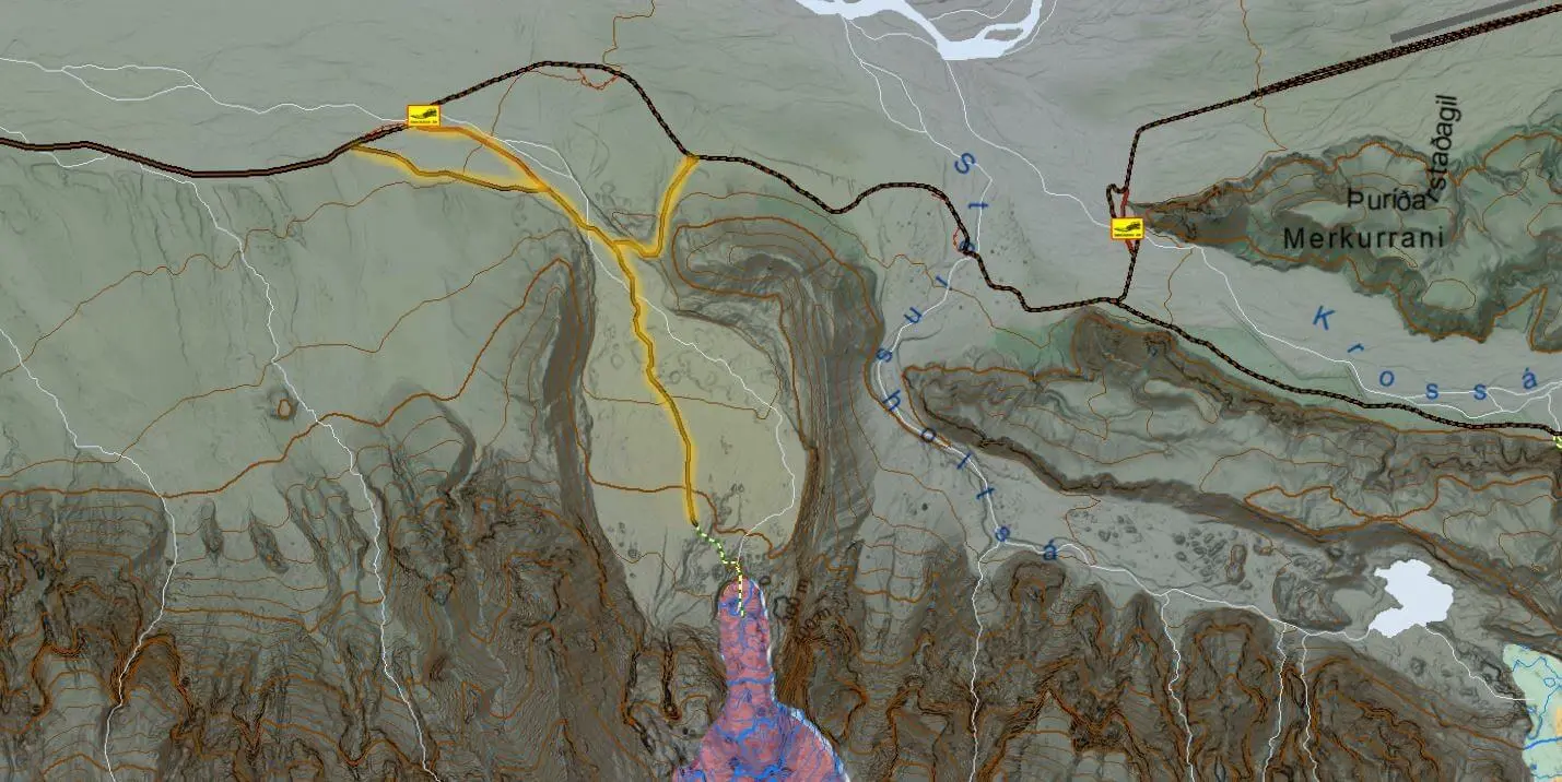
View Interactive Map
Gígjökull track is a detour from the road F249 (Þórsmerkurvegur) leading to Thórsmörk. Gígjökull track will (as its name suggests) take you to one of the glacier tongues – Gígjökull glacier tongue. Many guided tours make a stop here. Here is the article where we write in detail about how we drove the Gígjökull track.
Is there a river crossing on the Gígjökull track?
Yes, there are 1-3 fast-flowing medium-sized rivers (depending on whether you go from the west or from the east, there are 2 branches of the Gigjokull track).
What car do I need for the Gígjökull track?
You need a big 4×4 car, such as Land Cruiser, at minimum. We, however, better recommend driving a super jeep with high clearance.
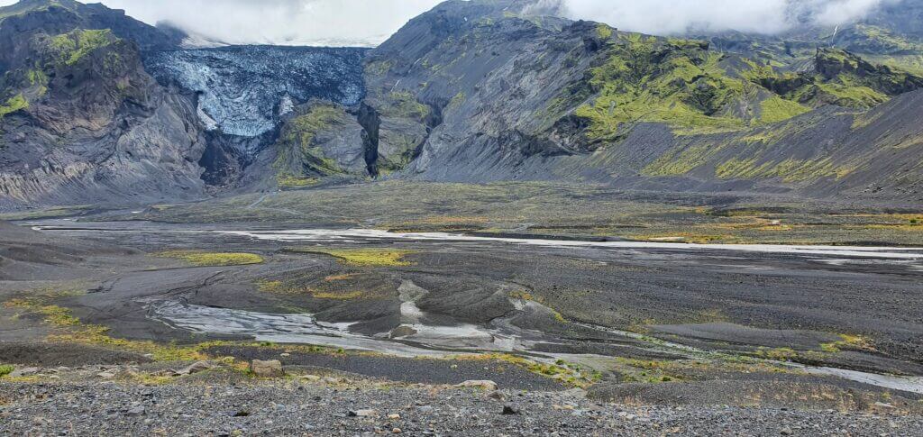
Gígjökull glacier and river crossings
A big warning – Gígjökull track is not even an F-road, it’s just a track! You can read more about what “track” means in Iceland. In short, this means the track is even more difficult than F-roads and most car insurance packages do not cover it. Always check with your car rental company if it’s covered, otherwise, you are going at your own risk! Secondly, drive the track only if you already have experience with F-roads!
Feel free to read how to choose a proper car or how to pick the best Icelandic car rental insurance. We also collaborate with Icelandic car rental companies to give you a discount and us a small commission at no extra cost to you.
Gígjökull track video drive
Hekla track
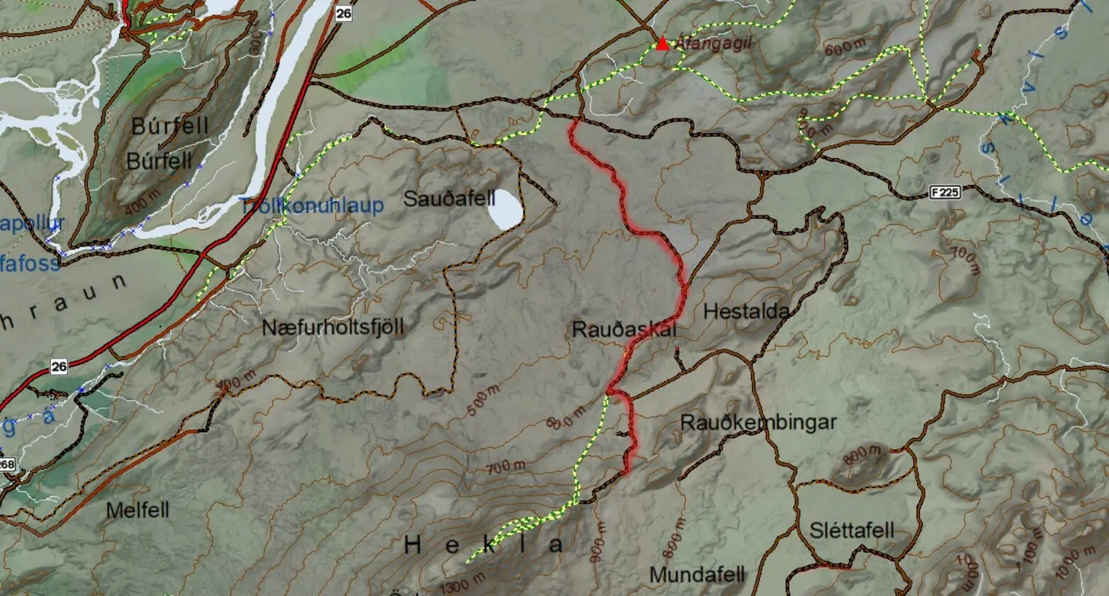
View Interactive Map
Hekla track is a detour south from F225 (Landmannaleið), directly towards the legendary Hekla volcano. Here is the article where we write in detail about how we drove the Hekla track.
Is there a river crossing on the Hekla track?
There is no river crossing on the Hekla track. There are several other challenges, though. See below.
What car do I need for the Hekla track?
Although there are no river crossings, expect very steep and uneven terrain to drive on. The most difficult part is the last kilometer, which makes for a very steep final ascent toward the Hekla volcano. This part of the Hekla track is one of the steepest roads you can find in Iceland. It can be very dangerous when driven improperly.
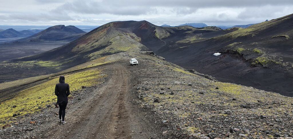
You need a big 4×4 car, such as Land Cruiser, at minimum. We, however, better recommend driving a super jeep with high ground clearance for the whole area. Is it possible to drive the Hekla F-road in Dacia Duster? Well, everything is possible – at least once. But it is simply irresponsible because there’s a high chance you’re gonna damage the car and nobody could come to rescue you.
A big warning – Hekla track is not even an F-road, it’s just a track! You can read more about what “track” means in Iceland. In short, this means the track is even more difficult than F-roads and most car insurance packages do not cover it. Always check with your car rental company if it’s covered, otherwise, you are going at your own risk! Secondly, drive the track only if you already have experience with F-roads!
Feel free to read how to choose a proper car or how to pick the best Icelandic car rental insurance. We also collaborate with Icelandic car rental companies to give you a discount and us a small commission at no extra cost to you.
Hekla track video drive
Hungurfit track
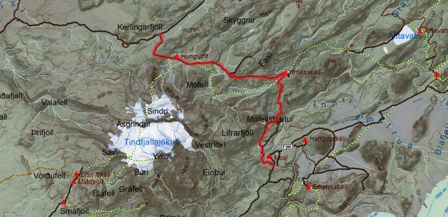
View Interactive Map
Hungurfit track is probably the most amazing, remote, versatile, and challenging track (yes all four at the same time) we’ve driven in Iceland. It is a “shortcut” from F261 to F210 through the inner Fjallabak highlands and there’s a Hungurfit hut and Króksskáli hut on the way.
Here is the article where we write in detail about how we drove the Hungurfit track.
Is there a river crossing on the Hungurfit track?
Yes, there are many small to medium-sized river streams along the Hungurfit track. There’s also one pretty fast-flowing medium-to-big-sized river in the second half, closer to Hungurfit hut. This river crossing scared us a bit, but under good conditions, with proper experience and a big enough car, it’s doable.
What car do I need for the Hungurfit track?
You need a big 4×4 car, such as Land Cruiser, at minimum. We, however, better recommend driving a super jeep with high ground clearance.
Hungurfit road is versatile and challenging with probably all the challenges you can expect. There are steep parts, narrow parts, big potholes, river crossings, and sharp boulders and the road is totally remote and not serviced.
A big warning – the Hungurfit track is not even an F-road, it’s just a track! You can read more about what “track” means in Iceland. In short, this means the track is even more difficult than F-roads and most car insurance packages do not cover it. Always check with your car rental company if it’s covered, otherwise, you are going at your own risk! Secondly, drive the track only if you already have experience with F-roads!
Hungurfit track video drive
Hvannagil track

View Interactive Map
Hvannagil track is a more or less average gravel road leading along Hvannagil valley, close to the Lónsöræfi area and along the huge and picturesque riverbed of river Jökulsá í Lóni. Most visitors use the Hvannagil road to get to hiking trails in the beautiful Hvannagil golden valley.
We wrote in detail about our drive via the Hvannagil track in our article about the southeastern Icelandic Highlands.
Is there a river crossing on the Hvannagil track?
There is no river crossing on the Hvannagil track, at least not in the first two-thirds we drove.
Feel free to read how to choose a proper car or how to pick the best Icelandic car rental insurance. We also collaborate with Icelandic car rental companies to give you a discount and us a small commission at no extra cost to you.
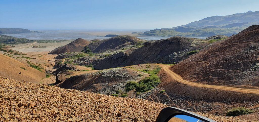
Hvannagil dirt track
What car do I need for the Hvannagil track?
You may get to the first half of the Hvannagil road – the start of the Hvannagil hike trail – by any car in the summer. The road leading to Hvannagil valley is semi-paved and narrow but without any river crossings. There’s no designated car park, but you can safely park your car in the huge gravel area. This is a good starting point for the hikes in the area.
After reaching Hvannagil valley car park, it’s possible to continue further following the dirt road, or better said a dirt track, along the river, deeper into the highlands. We drove the track for a few more kilometers with our Land Cruiser and you definitely need a 4wd car for this first part of the track. Maybe even a super jeep for the latter parts (which we haven’t driven yet).
A warning – the Hvannagil track is not even an F-road, it’s just a track! You can read more about what “track” means in Iceland. In short, this means the track is even more difficult than F-roads and most car insurance packages do not cover it. Always check with your car rental company if it’s covered, otherwise, you are going at your own risk! Secondly, drive the track only if you already have experience with F-roads!
Hvannagil track video drive
Jökuldalsvegur
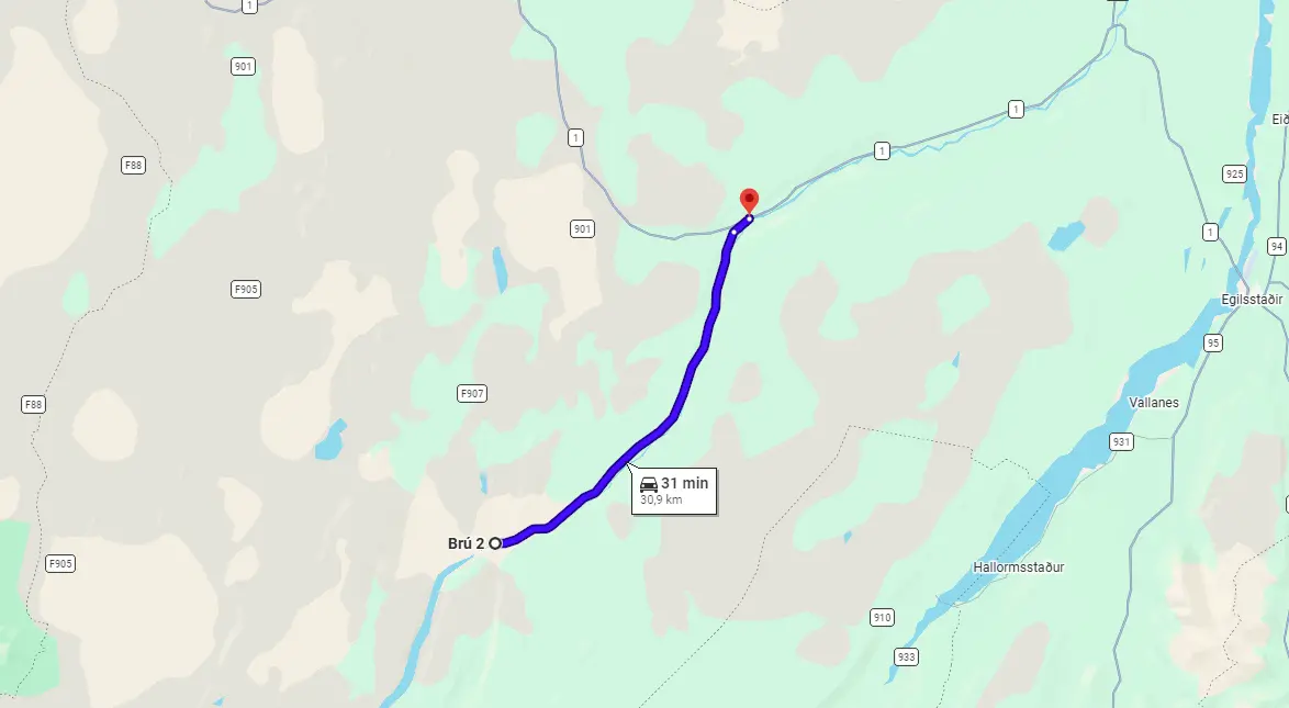
View Interactive Map
Jokuldalsvegur connects road 923 with F907 and stretches along the entire length of Studlagil canyon. It’s a semi-paved non-F-road, so you may basically treat it as a normal, but old road of worse quality.
Is there a river crossing on Jökuldalsvegur?
Since Jokuldalsvegur is not an F-road, it also doesn’t contain any river crossings. Other challenges are present, though.
What car do I need for Jökuldalsvegur?
If you aim only for Jokuldalsvegur (e.g. you want to visit Studlagil canyon), any car would be fine. Jokuldalsvegur is a bit rough compared to normal roads, but definitely doable also with a 2wd car.
If you, however, aim to combine your trip with visiting Askja, go for at least a medium-sized 4wd car.
Feel also free to read how to choose a proper car or how to pick the best Icelandic car rental insurance. We also collaborate with Icelandic car rental companies to give you a discount and us a small commission at no extra cost to you.
Krakatindur track
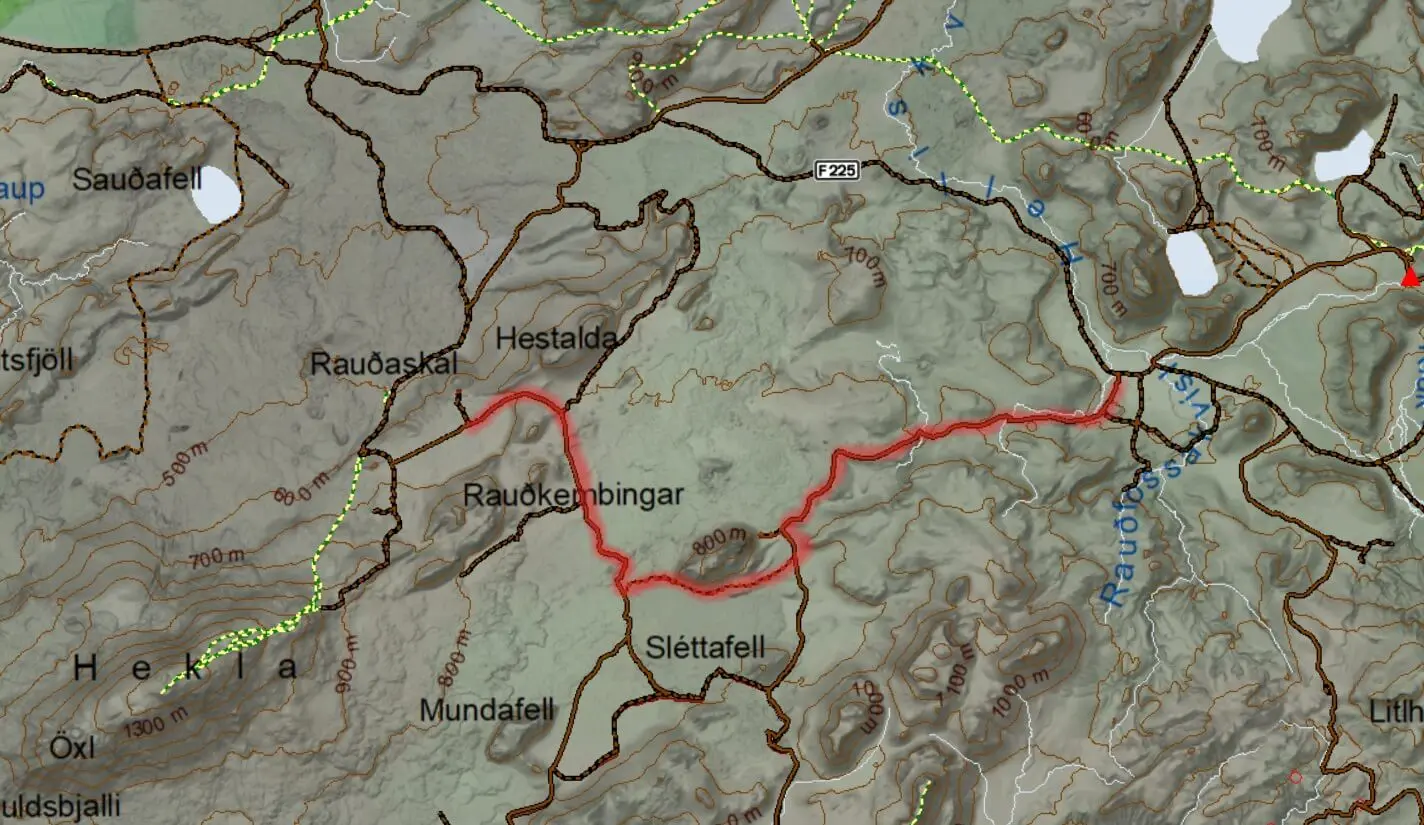
View Interactive Map
Krakatindur track is a rough dirt track that leads through the inner highlands of the northern Fjallabak reserve, in between Hekla and Rauðufossar waterfall. Krakatindur track leads to the dark and remote mountain called Krakatindur (that’s why its name is surprisingly the same).
Here is the article where we write in detail about how we drove the Krakatindur track.
Is there a river crossing on the Krakatindur track?
There is no river crossing on the Krakatindur track. There are several other challenges, though. See below.
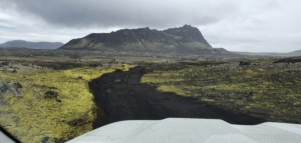
Krakatindur track near Hekla. Watch out for your car’s ground clearance!
What car do I need for the Krakatindur track?
Although there is no river crossing on the Krakatindur track, it is very rough, and uneven, with huge potholes, narrow passages, no road service at all, and totally remote. Even our modified Land Cruiser was struggling at times with some parts of the road, so please don’t go in here with cars like Subaru Forester or Suzuki Jimny…
You need a big 4×4 car, such as Land Cruiser, at minimum. We, however, better recommend driving a super jeep with high ground clearance for the whole area. Is it possible to drive the road in Dacia Duster? Well, everything is possible – at least once. But it is simply irresponsible because there’s a high chance you’re gonna damage the car and nobody could come to rescue you.
A big warning – Krakatindur track is not even an F-road, it’s just a track! You can read more about what “track” means in Iceland. In short, this means the track is even more difficult than F-roads and most car insurance packages do not cover it. Always check with your car rental company if it’s covered, otherwise, you are going at your own risk! Secondly, drive the track only if you already have experience with F-roads!
Krakatindur track video drive
Möðrudalsleið
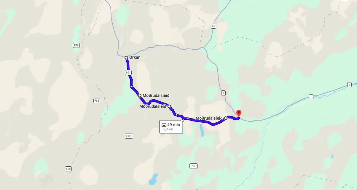
View Interactive Map
Modrudalsleid is a rough, semi-paved road that serves as a gate towards F-roads to Askja – F905 and F907.
We found out that the more the name of the road resembles some killing machine the rougher the actual road is, but that’s just what we’d observed. Möðrudalsleið is a quite good gravel road (compared to many other F-roads) so it’s possible to drive really fast.
Is there a river crossing on Möðrudalsleið?
Since Möðrudalsleið is officially not an F-road, it also doesn’t contain any river crossings. Other challenges are present, though.
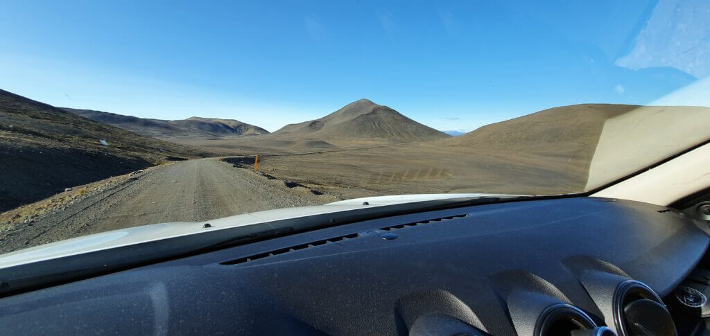
Möðrudalsleið road, the first gravel road you’re gonna encounter when coming from Egilsstaðir direction
What car do I need for Möðrudalsleið?
You may drive Modrudalsleid with basically any car. There are only small potholes, so even a 2wd car would be suitable. You will just have to drive slower because gravel may damage your car more easily if it has a very low ground clearance.
If you are planning to continue towards Askja, you will need a medium-sized 4wd car, though. Read more about that in the section where I write about F905 and F910.
Feel free to read how to choose a proper car or how to pick the best Icelandic car rental insurance. We also collaborate with Icelandic car rental companies to give you a discount and us a small commission at no extra cost to you.
Skælingar Blautulón track
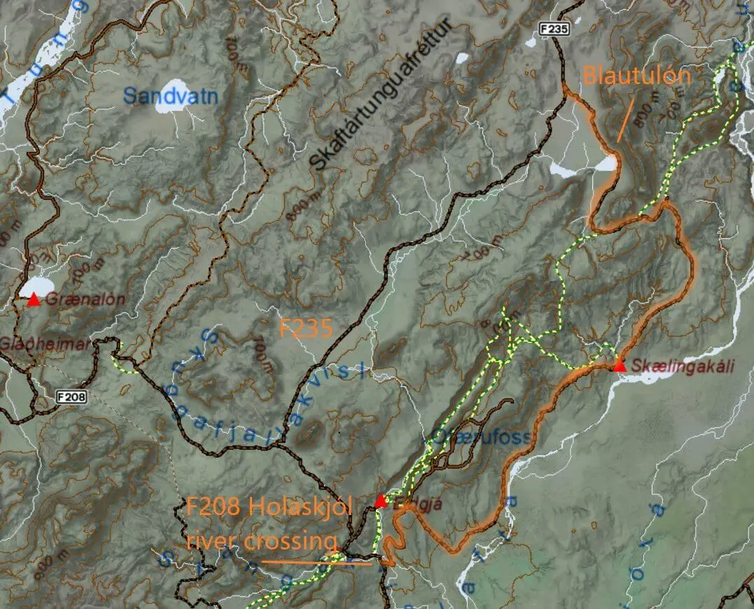
View Interactive Map
Skaelingar track is an amazing alternative to road F235 leading to Langisjór lake. The track first takes you to the Skælingar hut (Skælingaskáli). Then the track turns into the Blautulón track, which leads along the edge of the picturesque lake Blautulón and then connects to the official Langisjór F-road F235.
Is there a river crossing on the Skælingar Blautulón track?
Yes, there is one medium-to-big river crossing, right in the beginning when you turn from F208 south (Fjallabaksleið Nyrðri), close to Eldgjá, to Skaelingar track. You will be driving a few tens of meters through the actual riverbed. Since the crossing is right in the beginning, you may just look at the crossing and if feeling unsure, better turn back and drive the regular F235 to Langisjór.
Besides this river crossing, there is also a legendary lake crossing! Yes, you hear it well, a lake crossing. You’re gonna be driving a few hundred meters via the edge of lake Blautulón. You need to be sure to drive not too far from the edge and at the same time not too close to it to damage your car with the nearby cliffs. This can be both fun and dangerous, so be sure to have proper experience and a car before trying it.
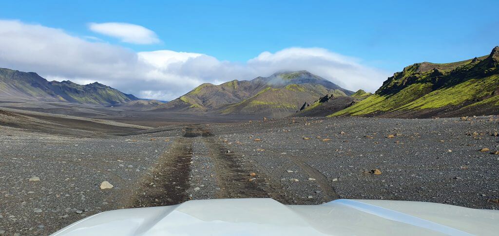
Between the Skælingar track and Blautulón track to Langisjór
What car do I need for Skælingar Blautulón track?
You need a big 4×4 car, such as Land Cruiser, at minimum. To be sure to drive the Skaelingar track even in bad weather, we better recommend driving a super jeep with high ground clearance for the whole area. Is it possible to drive the track in Dacia Duster? Well, everything is possible – at least once. But it is simply irresponsible because there’s a high chance you’re gonna damage the car and nobody could come to rescue you.
A big warning – Skælingar track is not even an F-road, it’s just a track! You can read more about what “track” means in Iceland. In short, this means the track is even more difficult than F-roads and most car insurance packages do not cover it. Always check with your car rental company if it’s covered, otherwise, you are going at your own risk! Secondly, drive the track only if you already have experience with F-roads!
Feel free to read how to choose a proper car or how to pick the best Icelandic car rental insurance. We also collaborate with Icelandic car rental companies to give you a discount and us a small commission at no extra cost to you.
Skælingar Blautulón track video drive
Strútur track
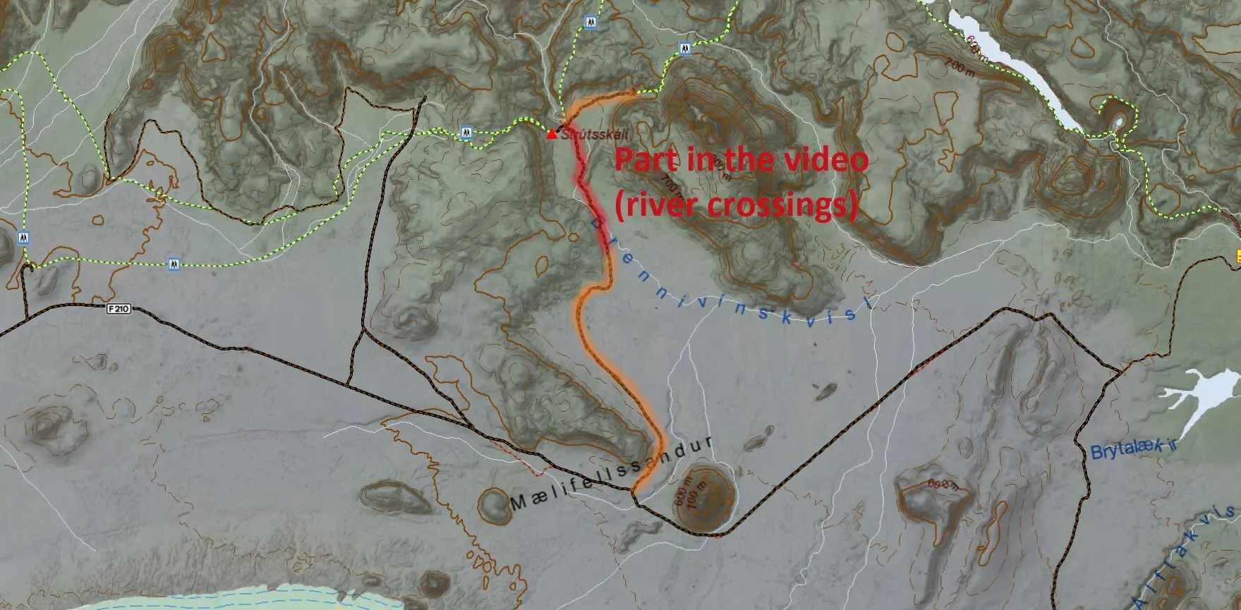
View Interactive Map
Strútur track starts just west of Maelifell, the legendary picturesque mountain. It leads to Strútsskáli hut and also to many amazing hiking trails. There are trails to Rauðibotn crater lake, the trail to Hólmsárbotnar, or a beautiful trek to a wild hot spring in the highlands called Strútslaug.
Here is the article where we write in detail about how we drove the Strútur track.
Is there a river crossing on the Strútur track?
Yes, you will have to cross several streams and one medium-to-big-sized calm river. You’re actually gonna drive roughly a hundred meters in the river itself, not just crossing it. This can be both fun and dangerous, so be sure to have proper experience and a car before trying it. And definitely read our river crossing guide.
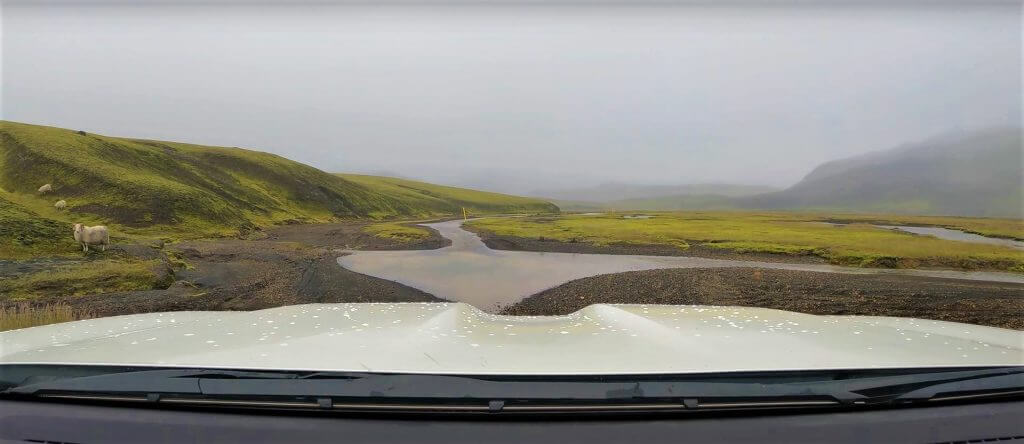
Strutur track to Strutslaug in a foggy weather
What car do I need for the Strútur track?
You need a big 4×4 car, such as Land Cruiser, at minimum. We, however, better recommend driving a super jeep with high ground clearance for the whole area.
A big warning – Strútur track is not even an F-road, it’s just a track! You can read more about what “track” means in Iceland. In short, this means the track is even more difficult than F-roads and most car insurance packages do not cover it. Always check with your car rental company if it’s covered, otherwise, you are going at your own risk! Secondly, drive the track only if you already have experience with F-roads!
Strútur track video drive
Master F-Road Database
This is our unique database of all Icelandic F-roads and their average summer conditions based on our most recent info. See important notes and legend below the table.
|
F-Road |
Road Name |
Location |
Difficulty Class (Our Score) |
Steepness / Roughness |
Unbridged River Crossings? |
Min. Car Requirement |
Recommended Car |
Our Advice |
|
F26 |
Sprengisandsleið |
connects north & south via central highlands |
7/10 - Moderate to Difficult |
flat, long rough gravel |
one medium to big (Hagakvísl, unpredictable) |
Medium 4x4 (Hilux) |
Jeep (33"+, snorkel) |
easy south of Nýidalur; unpredictable Hagakvísl river north of it; ask rangers in Nýidalur |
|
F35 |
Kjalvegur |
connects north & south via central highlands |
4/10 - Easy |
flat, potholed gravel |
no |
Any Car (even 2wd) |
Small 4x4 (Duster) |
easiest highland crossing, no rivers, reclassified to 35 (no F) |
|
F66 |
Kollafjarðarheiði |
connects north & south Westfjords |
6/10 - Moderate |
steep, rough mountain pass |
small streams |
Small 4x4 (Duster) |
Medium 4x4 (Hilux) |
remote "shortcut", scenic but rough |
|
F88 |
Öskjuleið |
northern access to Askja |
7/10 - Moderate to Difficult |
smooth, flat gravel |
one medium to big (Lindaá) |
Small 4x4 (Duster) |
Jeep (33"+, snorkel), if watery |
Lindaá river varies a lot, Duster only in ideal conditions! |
|
F206 |
Lakavegur |
to Laki craters |
6/10 - Moderate |
flat, narrow, rocky, winding |
one medium |
Small 4x4 (Duster) |
Medium 4x4 (Hilux) |
drive slow, blind corners |
|
F207 |
Lakagigavegur |
loop road around Laki craters |
6/10 - Moderate |
narrow lava track |
one medium |
Small 4x4 (Duster) |
Medium 4x4 (Hilux) |
river might vary in depth |
|
F208 - north |
Fjallabaksleið Nyrðri |
northern route to Landmannalaugar |
4/10 - Easy |
flat, bumpy, potholes |
no |
Any Car (even 2wd) |
Small 4x4 (Duster) |
easiest way to Landmannalaugar, reclassified to 208 (no F) |
|
F208 - south |
Fjallabaksleið Nyrðri |
southern route to Landmannalaugar |
5/10 - Easy to Moderate |
some rough, narrow parts |
several small to medium |
Small 4x4 (Duster) |
Medium 4x4 (Hilux), if watery |
5-6/10, depends, beautiful road |
|
F210 |
Fjallabaksleið syðri |
Fjallabak, southern Highlands |
8/10 - Difficult |
steep parts, huge boulders, etc |
Holmsá (big), Kaldaklof. (medium to big) |
Medium 4x4 (Hilux) |
Jeep (33"+, snorkel), for Holmsá |
two difficult river crossings; only for experienced |
|
F223 |
Eldgjárvegur |
to Eldgjá canyon |
4/10 - Easy |
flat, smooth |
no |
Any Car |
Small 4x4 (Duster) |
easy Eldgja parking access |
|
F224 |
Landmannalaugavegur |
to Landmannalaugar campsite |
6/10 - Moderate |
flat, potholed gravel |
medium at campsite |
Small 4x4 (Duster) |
Medium 4x4 (Hilux), if watery |
river before campsite varies a lot; there's a footbridge |
|
F225 |
Landmannaleið |
west route to Landmannalaugar |
5/10 - Easy to Moderate |
flat, slightly rough |
one small to medium |
Small 4x4 (Duster) |
Medium 4x4 (Hilux), if watery |
river can swell early in summer, becoming 6-7/10 |
|
F228 |
Veiðivatnaleið |
to Veiðivötn crater lakes |
6/10 - Moderate |
sandy, uneven |
two medium |
Small 4x4 (Duster) |
Medium 4x4 (Hilux) |
river at bend/curve might be deeper at times |
|
F229 |
Jökulheimaleið |
to Jökulheimar (by Tungnaárjökull) |
6/10 - Moderate |
little recent info |
little recent info |
Small 4x4 (Duster) |
Medium 4x4 (Hilux) |
many connecting dangerous tracks |
|
F232 |
Öldufellsleið |
southern access to Maelifell area |
6/10 - Moderate |
flat and rough |
one medium (Bláfjallakvísl) |
Medium 4x4 (Hilux) |
Medium 4x4 (Hilux) |
bumpy river crossing with a slope to climb; Duster in ideal conditions |
|
F233 |
Álftavatnskrókur |
connects F210 with F208 |
8/10 - Difficult |
few slopes, not too bad |
one big (Syðri-Ófæra) |
Jeep (33"+, snorkel) |
Jeep (33"+, snorkel) |
the river is a dealbreaker, huge caution |
|
F235 |
Langisjór |
to Langisjór lake |
5/10 - Easy to Moderate |
flat, relatively smooth |
several small |
Small 4x4 (Duster) |
Jeep (33"+, snorkel) |
great and beautiful practice road |
|
F249 |
Þórsmerkurvegur |
to Thórsmörk valley |
9/10 - Very Difficult |
flat, bumpy gravel |
several big ones |
Jeep (33"+, snorkel), NOT for Krossá! |
Super Jeep (38"+, snorkel), Krossá only locals! |
8/10 up to Krossá, 10/10 via Krossá, never do Krossá yourself |
|
F261 |
Emstruleið |
Fjallabak, southern Highlands |
7/10 - Moderate to Difficult |
pretty rough and narrow |
one medium (Bláfjallakvísl) |
Medium 4x4 (Hilux) |
Jeep (33"+, snorkel) |
easier than F210 but river can swell after rain or glacial melt |
|
F333 |
Haukadalsvegur |
near Geysir (connects to F338) |
4/10 - Easy |
one bumpy part |
small streams possible |
Small 4x4 (Duster) |
Medium 4x4 (Hilux) |
easy, one of the very few forests in Iceland |
|
F335 |
Hagavatnsvegur |
to Hagavatn glacier lake |
5/10 - Easy to Moderate |
little recent info |
one bigger at the end |
Small 4x4 (Duster), up to cabin |
Super Jeep (38"+, snorkel), for final river |
5/10 until last river, then possibly 7-8/10; no recent info |
|
F337 |
Hlöðuvallavegur |
around Mt. Hlöðufell (Þingvellir area) |
6/10 - Moderate |
very steep and rough |
no |
Medium 4x4 (Hilux) |
Jeep (33"+) |
road quality worsened considerably in recent years |
|
F338 |
Skjaldbreiðarvegur |
slopes of Skjaldbreiður (powerline road) |
6/10 - Moderate |
few sandy stretches |
two medium |
Medium 4x4 (Hilux) |
Jeep (33"+, snorkel) |
5/10 without river crossings on the eastern end, 7/10 with them |
|
F347 |
Kerlingafjallavegur |
to Kerlingarfjöll |
4/10 - Easy |
a bit steep before Hveradalir |
no |
Any Car |
Small 4x4 (Duster) |
easy, last stretch to Hveradalir is a bit steep |
|
F349 |
Kerlingarfjöll old |
old remote track to Kerlingarfjöll |
8/10 - Difficult |
mud, sand, very steep |
several medium-sized |
Jeep (33"+) |
Super Jeep (38"+) |
very slow and rought alternative to comfortable (F)35 |
|
F508 |
Skorradalsvegur |
Skorradalur valley (West Iceland) |
5/10 - Easy to Moderate |
bumpy, rocky, one steep hill |
no |
Small 4x4 (Duster) |
Medium 4x4 (Hilux) |
rough and a bit uneventful |
|
F570 |
Jökulshálsvegur |
connects south & north Snæfellsnes |
5/10 - Easy to Moderate |
yes, hillside drive |
no |
Any Car (even 2wd) |
Medium 4x4 (Hilux) |
4/10 if dry, 6/10 with snow in early summer 4x4 needed; reclassified to 570 |
|
F575 |
Eysteinsdalsleið |
goes under Snæfellsjökull |
5/10 - Easy to Moderate |
yes, hillside drive |
no |
Small 4x4 (Duster) |
Medium 4x4 (Hilux) |
5/10 if dry, 6-7/10 with snow in early summer 4x4 needed |
|
F578 |
Arnarvatnsvegur |
Arnarvatn highlands (West Iceland) |
6/10 - Moderate |
rough track |
not anymore |
Medium 4x4 (Hilux) |
Medium 4x4 (Hilux) |
bridge over Norðlingafljót was built recently, making it much easier |
|
F586 |
Haukadalsskarðsvegur |
Haukadalur pass (Dalir, West Iceland) |
5/10 - Easy to Moderate |
hillside drive |
several small ones |
Small 4x4 (Duster) |
Medium 4x4 (Hilux) |
nice hillside driving practice road |
|
F649 |
Ófeigsfjarðarvegur |
Strandir coast (to Ófeigsfjörður) |
6/10 - Moderate |
narrow coastal road |
medium-sized Húsá |
Small 4x4 (Duster), until Húsá river |
Jeep (33"+), possibly for Húsá |
Húsá ford might be tricky, be careful; no recent info |
|
F734 |
Svörtutungur / old Kjölur |
central highlands (alternative to Kjölur) |
10/10 - Very Dangerous |
very rough |
yes, big rivers |
Super Jeep (38"+, snorkel), locals only |
Super Jeep (38"+, snorkel), locals only |
possibly deadly fords; only with locals |
|
F735 |
Þjófadalavegur |
to Hveravellir area |
6/10 - Moderate |
steeper after Hveravellir |
looks like none |
Any Car for Hveravellir |
Small/Medium 4x4 after |
4/10 through 735 part, then 6/10 with little info |
|
F752 |
Skagafjarðarleið |
north highlands near Laugafell |
7/10 - Moderate to Difficult |
gradual hills and not too rough |
one medium to big, Hnjúkskvísl |
Medium 4x4 (Hilux) |
Jeep (33"+, snorkel) |
rivers can be pretty easy when dry (Duster-like), but deceptive when wet |
|
F821 |
Eyjafjarðarleið |
northern access to Laugafell |
5/10 - Easy to Moderate |
steep and rough |
small streams |
Small 4x4 (Duster) |
Medium 4x4 (Hilux) |
narrow and steep road; 6/10 if you don't like such roads |
|
F839 |
Leirdalsheiðarvegur |
to northern coast near Flatey |
6/10 - Moderate |
steep, rough and narrow sections |
small to medium ones |
Small 4x4 (Duster) |
Medium 4x4 (Hilux) |
nice mountain pass practice road |
|
F843 |
Dyngjufjöll |
central highlands, old track |
8/10 - Difficult |
very rough and unmaintained |
little recent info |
Medium 4x4 (Hilux) |
Jeep (33"+) |
7-8/10 based on how you handle super rough roads; no help nearby |
|
F881 |
Dragaleið |
central highlands (connects F26 and F821) |
4/10 - Easy |
short, flat, smooth |
no |
Small 4x4 (Duster), but plan for next roads |
Small 4x4 (Duster), but plan for next roads |
easy ash field pass, but connecting to harder roads |
|
F894 |
Öskjuvatnsvegur |
final track to Askja |
5/10 - Easy to Moderate |
a bit bumpy, not too bad |
no |
Small 4x4 (Duster) |
Small 4x4 (Duster) |
road quality improved recently, used to be much bumpier |
|
F899 |
Flateyjardalsvegur |
to northern coast near Flatey |
6/10 - Moderate |
some steep and sandy parts |
one medium-sized |
Medium 4x4 (Hilux) |
Jeep (33"+) |
last river might swell with water; easy when dry |
|
F902 |
Kverkfjallaleið |
to Kverkfjöll (north Vatnajökull) |
6/10 - Moderate |
some steep and rough parts |
no |
Medium 4x4 (Hilux) |
Medium 4x4 (Hilux) |
rough, remote drive, connecting to likewise roads |
|
F903 |
Hvannalindavegur |
eastern highlands to Hvannalindir |
7/10 - Moderate to Difficult |
rocky, sandy, not too steep |
two medium-sized, Lindaá |
Medium 4x4 (Hilux) |
Jeep (33"+) |
check the river crossings, may vary a lot |
|
F905 |
Arnardalsleið |
east access to Askja |
4/10 - Easy |
relatively smooth and flat |
no |
Small 4x4 (Duster) |
Medium 4x4 (Hilux) |
the easier one compared to following F910 |
|
F907 |
Saudalshafnarvegur |
Connects F905 to Jökuldalur |
5/10 - Easy to Moderate |
slightly rough |
small streams |
Small 4x4 (Duster) |
Small 4x4 (Duster) |
reclassified to 907, uneventful road |
|
F909 |
Snæfellsleið |
To Snæfell (East) |
6/10 - Moderate |
rough, not too steep |
several medium-sized |
Medium 4x4 (Hilux) |
Jeep (33"+) |
scarcely driven road, little recent info |
|
F910 - east |
Austurleið |
Askja east approach (F905 to Askja) |
6/10 - Moderate |
some huge boulders and sand |
two medium-sized |
Small 4x4 (Duster) |
Medium 4x4 (Hilux) |
if you want to reach Askja and are less experienced, this is a safer choice |
|
F910 - west |
Dyngjufjallaleið |
Askja to Nýidalur (central highlands) |
8/10 - Difficult |
very rough, uneven, not steep |
two medium to big ones |
Jeep (33"+) |
Jeep (33"+) |
long, slow, remote and not really eventful |
|
F923 |
Jökuldalsvegur |
east highlands (Jökuldalur to F910) |
7/10 - Moderate to Difficult |
only slightly steep/rough |
one medium-sized |
Medium 4x4 (Hilux) |
Jeep (33"+) |
the river crossing can be deeper when wet |
|
F936 |
Þórdalsheiðarvegur |
Eastfjords (Reyðarfjörður bypass) |
5/10 - Easy to Moderate |
yes, steep and rough |
no |
Small 4x4 (Duster) |
Medium 4x4 (Hilux) |
steeper power lines mountain pass |
|
F946 |
Loðmundarfjarðarvegur |
to Loðmundarfjordur |
5/10 - Easy to Moderate |
yes, hill drive |
no |
Small 4x4 (Duster) |
Medium 4x4 (Hilux) |
steep, rough and narrow, often no turning points |
|
F959 |
Viðfjarðarvegur |
To Viðfjörður |
6/10 - Moderate |
steep drops, very rough sections |
no |
Medium 4x4 (Hilux) |
Jeep (33"+) |
the main narrow pass is not for the faint of heart |
|
F980 |
Kollumúlavegur |
To Lónsöræfi |
10/10 - Very Dangerous |
steeper after river crossing |
yes, one huge (Lindaá) |
Small 4x4 (Duster), ONLY until Lindaá! |
Super Jeep (38"+, snorkel), Lindaá locals only |
5/10 until Lindaá river crossing, then 10/10 with super dangerous river |
|
F985 |
Jökulvegur |
to Skálafellsjökull glacier |
6/10 - Moderate |
pretty steep, not too rough |
no |
Medium 4x4 (Hilux) |
Jeep (33"+) |
steep climb towards glacier, not for those who fear heights |
Legend:
- 1/10 – “Florida” road (highway-like)
- 2/10 – Ring road (paved, narrow)
- 3/10 – Rougher road (3-digit road)
- 4/10 – Easy F-road
- 5/10 – Easy to Moderate F-road
- 6/10 – Moderate F-road
- 7/10 – Moderate to Difficult F-road
- 8/10 – Difficult F-road
- 9/10 – Very Difficult F-road
- 10/10 – Very Dangerous F-road
Important Database Notes:
- Conditions can change quickly for many of these roads, never rely on this info only!
- These are AVERAGE, summer-only conditions when the roads are OPEN and PASSABLE; all F-roads can be impassable or closed!
- Always check www.road.is, ask locals, and/or wait for someone else in front of you if possible
- Info is based on our, our friends, and our sources’ experience over the past years; some info may be old
- No information gives you a guarantee of the current status! Nor does ours.
- If you are unsure, better turn back; safety is the most important thing; roads can wait
- If you have any more recent info, please let us know!
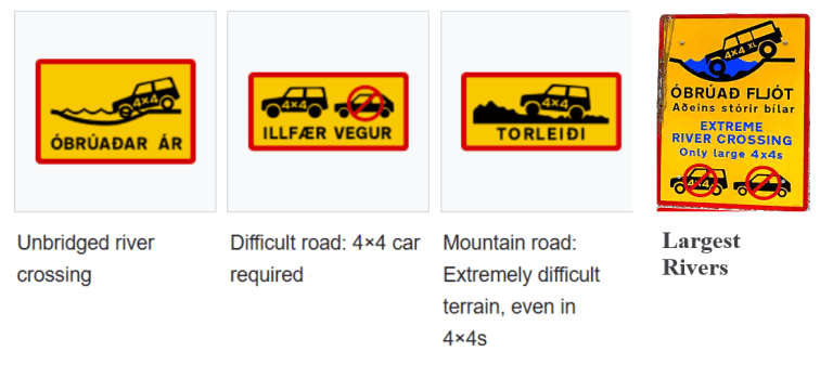
Road signs related to F-roads in Iceland
Frequently Asked Questions about F-roads
What are F-roads in Iceland?
F-roads are rough, unpaved summer-only roads leading to the Icelandic Highlands that often involve unbridged river crossings and require a 4×4 vehicle. You should prepare well in advance by studying the particular road details.
How to tell if a road is an F road in Iceland?
F-roads are marked with an “F” in front of their name on all Icelandic maps. When driving, there’s always a sign like “4×4 only” or “XXL vehicles only” or “unbridged rivers”. This indicates an F-road.
Do I need to drive on F-roads in Iceland?
No, you don’t have to drive on F-roads in Iceland. You can see most of the typical Icelandic highlights by following paved, well-maintained roads like the Ring Road. You have to drive on F-roads if you want to venture into the remote highlands of Iceland.
What are the Best F-roads in Iceland?
If by best F-roads you mean the easiest F-roads, then the easiest F-roads are considered road F35 (Kjalvegur) and northern F208 (Fjallabaksleið Nyrðri), which have been reclassified to non-F-roads recently. Other easier F-roads include F347 to Kerlingarfjöll or F235 to Langisjór.
If by best F-roads you mean the most beautiful F-roads, then the roads like southern F208 (Fjallabaksleið Nyrðri), F210 (Fjallabaksleið syðri), or F235 (Langisjór) are often considered to be the most scenic ones.
What is the Most Beautiful F-road in Iceland?
The roads in southern Icelandic highlands like F208 (Fjallabaksleið Nyrðri), F210 (Fjallabaksleið syðri), or F235 (Langisjór) are by many considered the most beautiful F-roads in Iceland. However, there are many F-roads in Iceland; one must find their own favorite.
What is the Easiest F-road in Iceland?
The easiest F-roads in Iceland are F35 (Kjalvegur) and northern F208 (Fjallabaksleið Nyrðri), which are no longer marked as F-roads. Other easier F-roads are F347 (Kerlingafjallavegur) and F575 (Eysteinsdalsleið) with no river crossing, or F235 (Langisjór) and F225 (Landmannaleið) with typically only shallow river crossings.
When do F-roads open in Iceland?
F-roads in Iceland typically open in early summer, i.e., between mid-June and mid-July. F-roads opening dates vary based on road conditions, such as the presence of snow and mud. The Icelandic Road Administration decides on the opening date to protect the fragile Icelandic nature.
When do F-roads close in Iceland?
F-roads in Iceland typically close in early autumn, i.e., in September. Some F-roads might close as early as late August, and some may close as late as early October. It depends on several factors such as river depths, snow, and nature protection.
Can I drive on F-roads in Winter?
If you are a sporadic visitor, you shouldn’t drive on F-roads in winter because it’s dangerous. You can join a local super jeep tour, though. Most of the F-roads are marked “impassable” in winter, which often means the presence of deep snow. Only locals equipped with modified super jeeps can drive on such roads.
Is it legal to drive in a 2WD car on F-roads?
All rental companies require that you drive a 4×4 on F-roads in Iceland. It’s legal to drive with your own 2WD car on F-roads, but it’s not recommended. Only experienced locals do it sporadically.
What vehicle types are recommended for F-roads in Iceland?
You need to drive a 4×4 car on F-roads. The particular car model needed depends on the specific F-roads you plan to drive. In short, the harder the F-road, the bigger the car you need.
For F-roads without river crossings, typically any 4×4 car is suitable. For F-roads with small river crossings, SUVs like the Dacia Duster or the Subaru Forester should be sufficient. For F-roads with medium river crossings, larger 4×4 cars like the Toyota Hilux or Land Cruiser are recommended. For F-roads with bigger river crossings, jeeps with snorkels, like the Land Rover Defender, and modified super jeeps are necessary.
Where to rent 4×4 cars suitable for Iceland F-roads?
There are many great, reliable local rental companies that are consistently rated highly. Examples include Lotus, MyCar, Lava Car, or Blue Car. Lotus is the only car rental in Iceland offering a special river crossing insurance.
Is the Dacia Duster good for F-roads in Iceland?
Yes, the Dacia Duster is a good vehicle for most of the easier to medium F-roads. However, for F-roads with bigger river crossings, you need a larger vehicle like a Toyota Land Cruiser or a modified jeep with a snorkel.
What guided tour companies explore Iceland’s F-roads?
There are many great local tour companies offering super jeep tours to F-roads. Epic Iceland is known to specialize in super jeep tours on F-roads. Other great companies include Midgard Adventure or Gravel Travel.
 ask questions or get inspired in our community